

Irrigation in Australia
Encyclopedia
Irrigation in Australia is a widespread practice to supplement low rainfall levels in Australia
with water from other sources to assist in the production of crop
s or pasture
. As the driest inhabited continent, irrigation
is required in many areas for production of crops for domestic and export use. However, overuse or poor management of irrigation is held responsible by some for environmental problems
such as soil salinity and loss of habitat for native flora and fauna.
Irrigation differs from dryland farming
(farming relying on rainfall) in Australia in its level of intensity
and production
. Common crops produced using irrigation include rice, cotton, canola, sugar, various fruits and other tree crops and pasture, hay and grain for use in beef and dairy production. Surface irrigation is the most common irrigation method in Australia with drip and center pivot also utilised. In Australia, all rights to use and control water are vested in the state which issue conditional entitlements for water use.
The first large scale irrigation schemes in Australia were introduced during the 1880s, partially in response to drought. In 1915, the River Murray Waters Agreement was signed. It set out basic conditions for the river's water use, which remain in force today. Towards the end of the 20th century, environmental problems in the basin became serious as diversions for irrigation approached or exceeded the capacity of natural flows. Following negotiations beginning in 1985, the Murray–Darling Basin Agreement was signed in 1987. The more comprehensive National Water Initiative was adopted in 2004.
systems and underground aquifer
s. Major river systems used for irrigation in Australia include the Murray-Darling
system, the Ord River
in the Kimberley region of Western Australia
and many rivers along the east coast of Australia. This includes the the Burdekin River
Irrigation Area in North Queensland
where irrigation is used during the dry season for double-cropping. A major source of ground water in Australia is the Great Artesian Basin
.
Although the Murray-Darling Basin
receives only 6% of Australia's annual rainfall, over 70% of Australia's irrigation resources are concentrated there, which makes up around 90% of the resources in the basin. It contains 42% of the nation's farmland and produces 40% of the nation's food. It can be seen that, in Australia as a whole, over 70% of water is devoted to irrigation.
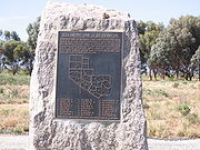 The first schemes for irrigation commenced in the latter half of the nineteenth century. Goulburn Weir
, constructed from 1887 to 1891, was the first major diversion structure built for irrigation development in Australia.
A major drought
in Victoria from 1877 to 1884 prompted Alfred Deakin
, then a minister in the State Government
and chairman of a Royal Commission
on water supply to visit the irrigation areas of California. There he met the Canadian brothers George
and William Chaffey
who had worked on irrigation schemes in California. In 1886 the Chaffey brothers came to Australia and selected a derelict sheep station covering 250000 acres (1,011.7 km²) at Mildura
as the site for their first irrigation settlement. They signed an agreement with the Victorian government to spend at least £300,000 on permanent improvements at Mildura in the next twenty years. Also in 1886/87, the Chaffey brothers were invited by John Downer
, the Premier of South Australia
, to commence a settlement at Renmark, South Australia
.
The Dethridge wheel
, used for measuring flow of water delivered to individual farms was developed in 1910.
Irrigation in the Murrumbidgee valley began in with the irrigation experiments of agricultural pioneer, Samuel McCaughey
at North Yanco station in 1900. This private scheme involved the construction of around 320 kilometres of channels to irrigate about 162 square kilometres of land. McCaughey's success appeared to have encouraged the New South Wales government to commence large scale irrigation. This process began in 1906 with the proclamation of the Barren Jack and Murrumbidgee Canals Construction Act 1906. Burrinjuck Dam
on the Murrumbidgee River near Tumut was commenced in 1907, work commenced on the channels and the first farms were established soon after.
In Western Australia the state's first controlled irrigation scheme, the Harvey
Irrigation Scheme, was officially started in 1916. It was further developed during the latter part of the 1930s depression to take unemployed workers to dig and build the extensive irrigation channels in the district.
The upstream states, Victoria and New South Wales, favoured the riparian doctrine
, under which landowners are free to take water from streams flowing through their property. As the ‘Premier State’, New South Wales, claimed riparian rights not only over its own rivers, but over the entire main stream of the Murray. South Australia relied on provisions of the newly-enacted Constitution
under which the Commonwealth government had authority over navigation along the Murray River and an implied obligation to preserve flows in the South Australian section of the river.
Negotiations were finally concluded in 1915. The River Murray Waters Agreement, to which the Commonwealth and the states of New South Wales, Victoria and South Australia were parties, set out the basic conditions which remain in force today:
The agreement also provided for construction of dams, weirs and locks on the main stream of the Murray to be managed by the River Murray Commission, which was established in 1917.
Although it was an important example of cooperative federalism, the River Murray Waters Agreement was limited to the management of water for irrigation and navigation.
The stated purpose of the Murray–Darling Basin Agreement was ‘to promote and coordinate effective planning and management for the equitable, efficient and sustainable use of the water, land and other environmental resources of the Murray–Darling Basin’
To achieve this, the Agreement established new institutions at the political, bureaucratic and community levels. These were:
was 12,191 gigalitres (GL) in 2004-05, accounting for 65% of total water consumption in Australia during that period. Irrigation/rural water providers were the main suppliers of distributed water in 2004-05 accounting for 6,637 GL or 59% of Australia's total distributed water supply. Since 2005 climatic conditions and reduced allocations have caused the total water consumed to decine by 30% from the 2004-2005 figure down to 8,521 GL in 2006-2007
and further to 7,286 GL in 2008-2009.
The total gross value of irrigated agricultural production in 2004-05 was A$
9,076 million compared to A$ 9,618 million in 2000-01. The gross value of irrigated agricultural production represents around a quarter (23%) of the gross value of agricultural commodities produced in Australia in 2004-05, on less than 1% of agricultural land.
Common crops produced using irrigation include rice
, cotton
, canola
, sugar
, various fruits and other tree crops and pasture, hay and grain for use in beef and dairy production.
In 2001/02 crop size was 420,170 hectares producing 3,041,000 bales . Estimates for 2006/07 were for 142,032 hectares producing cotton, a 66% reduction, producing a forecast crop of 1,171,765 bales, a 61% reduction. The total gross value of irrigated agricultural production in the cotton industry in 2004-05 was A$
908 million compared to A$ 1,222 million in 2000-01. While demand skyrocketed, actual water use by the cotton industry fell by 37% between 2000/01 and 2004/05, due mainly to drought. The cotton industry used 2,896 GL in 2000/01, 1,822 GL in 2004/05 and 793 GL in 2008/09.
(MIA), but also the Murray Irrigation Area
around Finley
, Coleambally
and Deniliquin areas.
Today, more than one million tonnes of Australian rice is produced each year and exported to over 70 countries, generating A$
500 million in export income and supporting 63 towns in the Riverina and northern Victoria. Major rice mills are located in Leeton, Coleambally and the largest rice mill in the southern hemisphere in Deniliquin.
The total gross value of irrigated agricultural production in the rice industry in 2004-05 was A$
102 million compared to A$ 350 million in 2000-01. Water use by the rice industry fell between 2000/01 and 2004/05, due mainly to smaller planted areas during the drought; the rice industry used 2,223 GL in 2000/01, 631 GL in 2004/05 and 101 GL in 2008/09.
A comparison with other grape producing countries throughout the world shows that Australia was the fourteenth largest producer of grapes in 1997.
Towards sustaining that production much of Australia’s viticulture is located in irrigable areas where water supply is reliable and well managed, with many new vineyards relying upon the availability of water pumped from rivers and streams.
The Australian grape industry used a total of 439 GL in 2006/07, equating to approximately 4.3 ML/ha.
Major grape growing areas of Australia are:
Entitlements vary state by state and according to the use, source, legal form, level of devolution, security and transferability among others. There has been a move across all states in recent years to move from older forms of water entitlement to more secure and transferable entitlements. Key parts of this move has been the separation of water entitlements from ties to particular parcels of land and the specification of entitlements with specific volumes and reliability.
Where an entitlement is able to be traded, the transaction may take several forms including temporary transfer of a seasonal water assignment, a permanent transfer of all or part of a water entitlement or a lease over a set period of years. All transfers require approval from the various regulatory bodies to ensure it complies with trading rules designed to meet environmental and in some cases socio-economic objectives. Such rules may include approving trades only within a set zone or the exchange rate of trades between zones to reflect water losses in delivery or differences in reliability.
, butterfly sprinklers, drip
and surface irrigation
. Surface irrigation remains the most common irrigation technique accounting for 50.6% of the total area irrigated in 2006/07 compared to 13.4% for drip, 12.7% for centre pivot and lateral move machines and 4.5% for microspray systems. These values may change from season to season due to water availability and commodity prices.
Centre pivot irrigation is often used for grass and fodder crops where the water can be distributed over a considerable period of time. In other crops where moisture stress is a complex concern, for example during the growing of cauliflower, water is required to be distributed quickly two or three specific times per day at a rate of about 140% the evaporation replacement rate and for this impact sprinklers set every 12 square metres or butterfly sprinklers set every 6 square metres are required. Drip sprinklers can be used on many spaced planting locations but typically will be found as gravity fed systems on vineyards.
Earthworks such as laser levelling are often employed to improve water use efficiency and even distribution of water.
 Overuse and poor irrigation practices have led to increased salt content in the soil
, reducing the productivity of the land. Irrigation salinity is caused by water soaking through the soil level adding to the ground water below. This causes the water table
to rise, bringing dissolved salts to the surface. As the irrigated area dries, the salt remains. At Wakool
in the Riverina
region of New South Wales
, irrigation salinity is mitigated through a salt interception scheme that pumps saline ground water into evaporation
basins, protecting approximately 50,000 hectare
s of farmland in the area from high water tables and salinity. The subsequent salt has various uses including as an animal feed supplement. The program has returned to production over 2,000 hectares of previously barren farmland and encouraged the regeneration of native eucalypt
s.
Australia
Australia , officially the Commonwealth of Australia, is a country in the Southern Hemisphere comprising the mainland of the Australian continent, the island of Tasmania, and numerous smaller islands in the Indian and Pacific Oceans. It is the world's sixth-largest country by total area...
with water from other sources to assist in the production of crop
Crop (agriculture)
A crop is a non-animal species or variety that is grown to be harvested as food, livestock fodder, fuel or for any other economic purpose. Major world crops include maize , wheat, rice, soybeans, hay, potatoes and cotton. While the term "crop" most commonly refers to plants, it can also include...
s or pasture
Pasture
Pasture is land used for grazing. Pasture lands in the narrow sense are enclosed tracts of farmland, grazed by domesticated livestock, such as horses, cattle, sheep or swine. The vegetation of tended pasture, forage, consists mainly of grasses, with an interspersion of legumes and other forbs...
. As the driest inhabited continent, irrigation
Irrigation
Irrigation may be defined as the science of artificial application of water to the land or soil. It is used to assist in the growing of agricultural crops, maintenance of landscapes, and revegetation of disturbed soils in dry areas and during periods of inadequate rainfall...
is required in many areas for production of crops for domestic and export use. However, overuse or poor management of irrigation is held responsible by some for environmental problems
Environment of Australia
The Australian environment ranges from virtually pristine Antarctic territory and rainforests to degraded industrial areas of major cities.- Issues :...
such as soil salinity and loss of habitat for native flora and fauna.
Irrigation differs from dryland farming
Dryland farming
Dryland farming is an agricultural technique for non-irrigated cultivation of drylands.-Locations:Dryland farming is used in the Great Plains, the Palouse plateau of Eastern Washington, and other arid regions of North America, the Middle East and in other grain growing regions such as the steppes...
(farming relying on rainfall) in Australia in its level of intensity
Intensive farming
Intensive farming or intensive agriculture is an agricultural production system characterized by the high inputs of capital, labour, or heavy usage of technologies such as pesticides and chemical fertilizers relative to land area....
and production
Agricultural productivity
Agricultural productivity is measured as the ratio of agricultural outputs to agricultural inputs. While individual products are usually measured by weight, their varying densities make measuring overall agricultural output difficult...
. Common crops produced using irrigation include rice, cotton, canola, sugar, various fruits and other tree crops and pasture, hay and grain for use in beef and dairy production. Surface irrigation is the most common irrigation method in Australia with drip and center pivot also utilised. In Australia, all rights to use and control water are vested in the state which issue conditional entitlements for water use.
The first large scale irrigation schemes in Australia were introduced during the 1880s, partially in response to drought. In 1915, the River Murray Waters Agreement was signed. It set out basic conditions for the river's water use, which remain in force today. Towards the end of the 20th century, environmental problems in the basin became serious as diversions for irrigation approached or exceeded the capacity of natural flows. Following negotiations beginning in 1985, the Murray–Darling Basin Agreement was signed in 1987. The more comprehensive National Water Initiative was adopted in 2004.
Water sources
In general, water for irrigation comes from two main sources, riverRiver
A river is a natural watercourse, usually freshwater, flowing towards an ocean, a lake, a sea, or another river. In a few cases, a river simply flows into the ground or dries up completely before reaching another body of water. Small rivers may also be called by several other names, including...
systems and underground aquifer
Aquifer
An aquifer is a wet underground layer of water-bearing permeable rock or unconsolidated materials from which groundwater can be usefully extracted using a water well. The study of water flow in aquifers and the characterization of aquifers is called hydrogeology...
s. Major river systems used for irrigation in Australia include the Murray-Darling
Murray-Darling Basin
The Murray-Darling basin is a large geographical area in the interior of southeastern Australia, whose name is derived from its two major rivers, the Murray River and the Darling River. It drains one-seventh of the Australian land mass, and is currently by far the most significant agricultural...
system, the Ord River
Ord River
The Ord River is a 320-kilometre-long river in the Kimberley region of Western Australia. It was named in honour of Harry Ord, Governor of Western Australia from 1877 to 1880....
in the Kimberley region of Western Australia
Kimberley region of Western Australia
The Kimberley is one of the nine regions of Western Australia. It is located in the northern part of Western Australia, bordered on the west by the Indian Ocean, on the north by the Timor Sea, on the south by the Great Sandy and Tanami Deserts, and on the east by the Northern Territory.The region...
and many rivers along the east coast of Australia. This includes the the Burdekin River
Burdekin River
The Burdekin River in Queensland, Australia rises on the western slope of the Seaview Range and flows into the Pacific Ocean at Upstart Bay over 200 km to the southeast of the source. The river was first encountered by Europeans during the expedition led by Ludwig Leichhardt in 1845 and named...
Irrigation Area in North Queensland
North Queensland
North Queensland or the Northern Region is the northern part of the state of Queensland in Australia. Queensland is a massive state, larger than most countries, and the tropical northern part of it has been historically remote and undeveloped, resulting in a distinctive regional character and...
where irrigation is used during the dry season for double-cropping. A major source of ground water in Australia is the Great Artesian Basin
Great Artesian Basin
The Great Artesian Basin provides the only reliable source of freshwater through much of inland Australia. The basin is the largest and deepest artesian basin in the world, stretching over a total of , with temperatures measured ranging from 30°C to 100°C...
.
Although the Murray-Darling Basin
Murray-Darling Basin
The Murray-Darling basin is a large geographical area in the interior of southeastern Australia, whose name is derived from its two major rivers, the Murray River and the Darling River. It drains one-seventh of the Australian land mass, and is currently by far the most significant agricultural...
receives only 6% of Australia's annual rainfall, over 70% of Australia's irrigation resources are concentrated there, which makes up around 90% of the resources in the basin. It contains 42% of the nation's farmland and produces 40% of the nation's food. It can be seen that, in Australia as a whole, over 70% of water is devoted to irrigation.
History
Goulburn Weir
Goulburn Weir is a weir built between 1887 and early 1891 across the Goulburn River near Nagambie, Victoria, Australia. It was the first major diversion structure built for irrigation development in Australia. The weir also forms Lake Nagambie where rowing regattas and waterskiing tournaments are...
, constructed from 1887 to 1891, was the first major diversion structure built for irrigation development in Australia.
A major drought
Drought in Australia
Drought in Australia is defined as rainfall over a three month period being in the lowest decile of what has been recorded for that region in the past. This definition takes into account that drought is a relative term and rainfall deficiencies need to be compared to typical rainfall patterns...
in Victoria from 1877 to 1884 prompted Alfred Deakin
Alfred Deakin
Alfred Deakin , Australian politician, was a leader of the movement for Australian federation and later the second Prime Minister of Australia. In the last quarter of the 19th century, Deakin was a major contributor to the establishment of liberal reforms in the colony of Victoria, including the...
, then a minister in the State Government
Parliament of Victoria
The Parliament of Victoria is the bicameral legislature of the Australian state of Victoria. It follows a Westminster-derived parliamentary system and consists of The Queen, represented by the Governor of Victoria; the Legislative Council ; and the Legislative Assembly...
and chairman of a Royal Commission
Royal Commission
In Commonwealth realms and other monarchies a Royal Commission is a major ad-hoc formal public inquiry into a defined issue. They have been held in various countries such as the United Kingdom, Australia, Canada, New Zealand, and Saudi Arabia...
on water supply to visit the irrigation areas of California. There he met the Canadian brothers George
George Chaffey
George Chaffey was a Canadian–born engineer who with his brother William developed large parts of Southern California, including what became the community of Etiwanda and cities of Ontario, and Upland...
and William Chaffey
William Chaffey
William Benjamin Chaffey was a Canadian engineer and irrigation planner who with his older brother George Chaffey developed what became the cities of Etiwanda, Ontario, and Upland in California, United States of America; and the city of Mildura, Victoria, Australia, as well as the town of Renmark,...
who had worked on irrigation schemes in California. In 1886 the Chaffey brothers came to Australia and selected a derelict sheep station covering 250000 acres (1,011.7 km²) at Mildura
Mildura, Victoria
Mildura is a regional city in northwestern Victoria, Australia and seat of the Rural City of Mildura local government area. It is located in the Sunraysia region, and is on the banks of the Murray River. The current population is estimated at just over 30,000.Mildura is a major agricultural centre...
as the site for their first irrigation settlement. They signed an agreement with the Victorian government to spend at least £300,000 on permanent improvements at Mildura in the next twenty years. Also in 1886/87, the Chaffey brothers were invited by John Downer
John Downer
Sir John William Downer, KCMG was the Premier of South Australia from 16 June 1885 until 11 June 1887 and again from 1892 to 1893. He was the first of three Australian politicians from the Downer family dynasty.-Early life:...
, the Premier of South Australia
Premiers of South Australia
Before the 1890s when there was no formal party system in South Australia, MPs tended to have historical liberal or conservative beliefs. The liberals dominated government from 1893 to 1905 with Labor support, with the conservatives mostly in opposition. Labor took government with the support of...
, to commence a settlement at Renmark, South Australia
Renmark, South Australia
Renmark is a town in South Australia's rural Riverland area, and is located 254 km northeast of Adelaide, on the banks of the River Murray. The Sturt Highway between Adelaide and Sydney runs through the town; Renmark is the last major town encountered in South Australia when driving this route. It...
.
The Dethridge wheel
Dethridge wheel
The Dethridge wheel is used throughout Australia and in many other countries, including the United States, Israel and in Africa, to measure the flow of water delivered to farms for irrigation....
, used for measuring flow of water delivered to individual farms was developed in 1910.
Irrigation in the Murrumbidgee valley began in with the irrigation experiments of agricultural pioneer, Samuel McCaughey
Samuel McCaughey
Sir Samuel McCaughey was an Irish-born pastoralist, politician and philanthropist in Australia.-Early life:McCaughey was born at Tullyneuh, near Ballymena, Ireland, the son of Francis McCaughey, farmer and merchant, and his wife Eliza, née Wilson.McCaughey came to Australia with an uncle, Charles...
at North Yanco station in 1900. This private scheme involved the construction of around 320 kilometres of channels to irrigate about 162 square kilometres of land. McCaughey's success appeared to have encouraged the New South Wales government to commence large scale irrigation. This process began in 1906 with the proclamation of the Barren Jack and Murrumbidgee Canals Construction Act 1906. Burrinjuck Dam
Burrinjuck Dam
Burrinjuck Dam is a high, concrete gravity dam on the Murrumbidgee River approximately 60 km from Yass, New South Wales, Australia. The Yass and Goodradigbee Rivers flow into the dam. The dam divides the upper and lower catchment of the Murrumbidgee and is the headwater storage for the...
on the Murrumbidgee River near Tumut was commenced in 1907, work commenced on the channels and the first farms were established soon after.
In Western Australia the state's first controlled irrigation scheme, the Harvey
Harvey, Western Australia
Harvey is a town located in the South West of Western Australia along the South Western Highway, 140 km south of Perth, between Pinjarra and Bunbury...
Irrigation Scheme, was officially started in 1916. It was further developed during the latter part of the 1930s depression to take unemployed workers to dig and build the extensive irrigation channels in the district.
Policy
The management of irrigation, particularly with relation to the problems of the Murray-Darling Basin has long been a politically contentious issue in Australia.The River Murray Waters Agreement
Regulation of the Murray River system was one of the first issues addressed after Federation. A period of drought beginning in 1895 culminated in the ‘Federation drought’ of 1901–2. One result was a non-government conference held in Corowa in 1902, which called for government action to manage the waters of the Murray River. A prolonged period of negotiation followed, during which the states claimed property rights over the waters of the Murray and its tributaries.The upstream states, Victoria and New South Wales, favoured the riparian doctrine
Riparian water rights
Riparian water rights are system for allocating water among those who possess land about its source. It has its origins in English common law...
, under which landowners are free to take water from streams flowing through their property. As the ‘Premier State’, New South Wales, claimed riparian rights not only over its own rivers, but over the entire main stream of the Murray. South Australia relied on provisions of the newly-enacted Constitution
Constitution of Australia
The Constitution of Australia is the supreme law under which the Australian Commonwealth Government operates. It consists of several documents. The most important is the Constitution of the Commonwealth of Australia...
under which the Commonwealth government had authority over navigation along the Murray River and an implied obligation to preserve flows in the South Australian section of the river.
Negotiations were finally concluded in 1915. The River Murray Waters Agreement, to which the Commonwealth and the states of New South Wales, Victoria and South Australia were parties, set out the basic conditions which remain in force today:
- flow at AlburyAlbury-Places:*Albury, New South Wales, Australia** Electoral district of Albury is an electoral district in the New South Wales Legislative Assembly, based around the area.*Albury, Hertfordshire, England*Albury, Oxfordshire, England*Albury, Surrey, England...
is shared equally between New South Wales and Victoria - Victoria and New South Wales retain control of their tributaries below Albury
- Victoria and New South Wales supply South Australia with a guaranteed minimum quantity of water or "entitlement".
The agreement also provided for construction of dams, weirs and locks on the main stream of the Murray to be managed by the River Murray Commission, which was established in 1917.
Although it was an important example of cooperative federalism, the River Murray Waters Agreement was limited to the management of water for irrigation and navigation.
The Murray–Darling Basin Agreement
As diversions for irrigation approached or exceeded the capacity of the Murray–Darling river system, and environmental problems became more serious, the need for a coordinated approach to management of the Basin as a whole became more evident. Following negotiations beginning in 1985 the Murray–Darling Basin Agreement was signed in 1987. In its initial form, it was as an amendment to the River Murray Waters Agreement. Five years later, in 1992, a totally new Murray–Darling Basin Agreement was signed, replacing the River Murray Waters Agreement. The Agreement was given full legal status by the Murray–Darling Basin Act 1993 which was passed by all the contracting governments. Queensland and the Australian Capital Territory later joined the agreement.The stated purpose of the Murray–Darling Basin Agreement was ‘to promote and coordinate effective planning and management for the equitable, efficient and sustainable use of the water, land and other environmental resources of the Murray–Darling Basin’
To achieve this, the Agreement established new institutions at the political, bureaucratic and community levels. These were:
- the Murray–Darling Basin Ministerial Council (MDBMC);
- the Murray–Darling Basin Commission (MDBC); and
- the Community Advisory Committee (CAC).
The National Water Initiative
The lack of satisfactory progress under the Murray–Darling Basin Agreement and the emergence of a variety of water policy problems elsewhere in Australia led to the adoption of the National Water Initiative in 2004. Key elements of the Initiative included promotion of water trading and a commitment to restore at least 500 gigalitres of environmental flows to the Murray Darling BasinProduction
Water consumption by the agriculture industryAgriculture in Australia
Australia is a major agricultural producer and exporter. Agriculture and its closely related sectors earn $155 billion-a-year for a 12% share of GDP. Australian farmers and graziers own 135,996 farms, covering 61% of Australia’s landmass. There is a mix of irrigation and dry-land farming...
was 12,191 gigalitres (GL) in 2004-05, accounting for 65% of total water consumption in Australia during that period. Irrigation/rural water providers were the main suppliers of distributed water in 2004-05 accounting for 6,637 GL or 59% of Australia's total distributed water supply. Since 2005 climatic conditions and reduced allocations have caused the total water consumed to decine by 30% from the 2004-2005 figure down to 8,521 GL in 2006-2007
and further to 7,286 GL in 2008-2009.
The total gross value of irrigated agricultural production in 2004-05 was A$
Australian dollar
The Australian dollar is the currency of the Commonwealth of Australia, including Christmas Island, Cocos Islands, and Norfolk Island, as well as the independent Pacific Island states of Kiribati, Nauru and Tuvalu...
9,076 million compared to A$ 9,618 million in 2000-01. The gross value of irrigated agricultural production represents around a quarter (23%) of the gross value of agricultural commodities produced in Australia in 2004-05, on less than 1% of agricultural land.
Common crops produced using irrigation include rice
Rice
Rice is the seed of the monocot plants Oryza sativa or Oryza glaberrima . As a cereal grain, it is the most important staple food for a large part of the world's human population, especially in East Asia, Southeast Asia, South Asia, the Middle East, and the West Indies...
, cotton
Cotton
Cotton is a soft, fluffy staple fiber that grows in a boll, or protective capsule, around the seeds of cotton plants of the genus Gossypium. The fiber is almost pure cellulose. The botanical purpose of cotton fiber is to aid in seed dispersal....
, canola
Canola
Canola refers to a cultivar of either Rapeseed or Field Mustard . Its seeds are used to produce edible oil suitable for consumption by humans and livestock. The oil is also suitable for use as biodiesel.Originally, Canola was bred naturally from rapeseed in Canada by Keith Downey and Baldur R...
, sugar
Sugar
Sugar is a class of edible crystalline carbohydrates, mainly sucrose, lactose, and fructose, characterized by a sweet flavor.Sucrose in its refined form primarily comes from sugar cane and sugar beet...
, various fruits and other tree crops and pasture, hay and grain for use in beef and dairy production.
| Gross value of irrigated agricultural production in A$M |
2000-01 | 2004-05 |
|---|---|---|
| Dairy farming | 1 499 | 1 632 |
| Vegetables | 1 817 | 1 761 |
| Sugar | 284 | 477 |
| Fruit | 1 590 | 1 777 |
| Grapes | 1 355 | 1 314 |
| Cotton | 1 222 | 908 |
| Rice | 350 | 102 |
| Nurseries, cut flowers & turf | 763 | 737 |
| Livestock, pasture, grains & other | 737 | 367 |
| Total | 9 618 | 9 076 |
Cotton
Major cotton growing areas in Australia are:- New South Wales - MungindiMungindi, New South WalesMungindi is a town on the border of New South Wales and Queensland in Moree Plains Shire. It possesses a New South Wales postcode. Mungindi sits on the Carnarvon Highway and straddles the Barwon River which is the border between New South Wales and Queensland...
, Gwydir RiverGwydir RiverThe Gwydir River is a large inland river in the northern part of the Australian state of New South Wales which is part of the Murray-Darling Basin. The river has two main tributaries—the Horton River and the Rocky River...
, WalgettWalgett, New South WalesWalgett is a town in North-West New South Wales, Australia and the seat of Walgett Shire. It is at the junction of the Barwon and Namoi rivers and near the junction of the Kamilaroi and Castlereagh Highways...
, BourkeBourke, New South Wales-Transportation:Bourke can be reached by the Mitchell Highway, with additional sealed roads from town to the north , east and south . The town is also served by Bourke Airport and has Countrylink bus service to other regional centres, like Dubbo...
, the Lower and Upper Namoi RiverNamoi RiverThe Namoi River is a major tributary of the Darling River in inland New South Wales, Australia.- Course :The headwaters of the Namoi, including the Macdonald River, the Peel River, the Cockburn River and the Manilla River, rise on the western slopes of the Great Dividing Range on the Northern...
, Macquarie River, MenindeeMenindee, New South WalesMenindee is a small town in the far west of New South Wales, Australia, in Central Darling Shire, on the banks of the Darling River, with a sign-posted population of 980.-History:...
, Lachlan RiverLachlan River- Course :The river rises in the central highland of New South Wales, part of the Great Dividing Range, 13 km east of Gunning. Its major headwaters, the Carcoar River, the Belubula River and the Abercrombie River converge near the town of Cowra. Minor tributaries include the Morongla Creek...
and Murrumbidgee RiverMurrumbidgee RiverThe Murrumbidgee River is a major river in the state of New South Wales, Australia, and the Australian Capital Territory . A major tributary of the Murray River, the Murrumbidgee flows in a west-northwesterly direction from the foot of Peppercorn Hill in the Fiery Range of the Snowy Mountains,... - Queensland - Central HighlandsCentral QueenslandCentral Queensland is an ambiguous geographical division of Queensland that centres on the eastern coast, around the Tropic of Capricorn. Its major regional centre is Rockhampton and the Capricorn Coast and the area extends west to the Central Highlands at Emerald, north to the Mackay Regional...
, Dawson Valley, BiloelaBiloela, QueenslandBiloela is a rural town in Central Queensland, Australia. It is situated inland from the port city of Gladstone at the junction of the Burnett and Dawson highways...
, Darling Downs, DirranbandiDirranbandi, QueenslandDirranbandi is a town in south-western Queensland, Australia, located in the Shire of Balonne. It sits on the Castlereagh Highway and the Balonne River. It is notable for the population increase each year as seasonal workers come to work on the extensive cotton fields. Due to the low annual...
, St GeorgeSt George, QueenslandSt George is a town of approximately 2400 people in south-western Queensland, Australia. It is the administrative centre for the Shire of Balonne. It was named by Major Thomas Mitchell who crossed the Balonne River on St George's Day, 23 April 1846. At the 2006 census, St George had a population of...
, Macintyre ValleyMacIntyre RiverThe Macintyre River is a river in northern New South Wales, Australia, part of which forms the border with Queensland.The headwaters of the Macintyre River rise west of Guyra and south of Glen Innes on the Northern Tablelands...
In 2001/02 crop size was 420,170 hectares producing 3,041,000 bales . Estimates for 2006/07 were for 142,032 hectares producing cotton, a 66% reduction, producing a forecast crop of 1,171,765 bales, a 61% reduction. The total gross value of irrigated agricultural production in the cotton industry in 2004-05 was A$
Australian dollar
The Australian dollar is the currency of the Commonwealth of Australia, including Christmas Island, Cocos Islands, and Norfolk Island, as well as the independent Pacific Island states of Kiribati, Nauru and Tuvalu...
908 million compared to A$ 1,222 million in 2000-01. While demand skyrocketed, actual water use by the cotton industry fell by 37% between 2000/01 and 2004/05, due mainly to drought. The cotton industry used 2,896 GL in 2000/01, 1,822 GL in 2004/05 and 793 GL in 2008/09.
Rice
Irrigated areas in the Riverina produces the vast majority of rice grown in Australia, particularly in the Murrumbidgee Irrigation AreaMurrumbidgee Irrigation Area
The Murrumbidgee Irrigation Area is geographically located within the Riverina area of New South Wales was created to control and divert the flow of local river and creek systems for the purpose of food production...
(MIA), but also the Murray Irrigation Area
Murray Irrigation Area
The Murray Irrigation Area is geographically located within the Riverina area of New South Wales, between Mulwala and Moulamein. It was created to control and divert the flow of local river and creek systems for the purpose of food production...
around Finley
Finley, New South Wales
Finley is a town in the Riverina region of New South Wales, Australia. It is the largest town in the Berrigan Shire Local Government Area. At the 2006 census, Finley had a population of 2,054 people....
, Coleambally
Coleambally, New South Wales
Coleambally is a small town in the Riverina of New South Wales, Australia, in Murrumbidgee Shire.Coleambally is one of the newest towns in the state of New South Wales, officially opened in June 1968, with the Post Office opening on 1 April 1970...
and Deniliquin areas.
Today, more than one million tonnes of Australian rice is produced each year and exported to over 70 countries, generating A$
Australian dollar
The Australian dollar is the currency of the Commonwealth of Australia, including Christmas Island, Cocos Islands, and Norfolk Island, as well as the independent Pacific Island states of Kiribati, Nauru and Tuvalu...
500 million in export income and supporting 63 towns in the Riverina and northern Victoria. Major rice mills are located in Leeton, Coleambally and the largest rice mill in the southern hemisphere in Deniliquin.
The total gross value of irrigated agricultural production in the rice industry in 2004-05 was A$
Australian dollar
The Australian dollar is the currency of the Commonwealth of Australia, including Christmas Island, Cocos Islands, and Norfolk Island, as well as the independent Pacific Island states of Kiribati, Nauru and Tuvalu...
102 million compared to A$ 350 million in 2000-01. Water use by the rice industry fell between 2000/01 and 2004/05, due mainly to smaller planted areas during the drought; the rice industry used 2,223 GL in 2000/01, 631 GL in 2004/05 and 101 GL in 2008/09.
Grapes
Wine, dried and table grapes are grown commercially in all States and Territories. Grape production is the fifth largest fruit industry in Australia. Of that production wine grape production at over 1 million tonnes per annum is almost 9 times the production of dried grapes and 14 times the production of table grapes.A comparison with other grape producing countries throughout the world shows that Australia was the fourteenth largest producer of grapes in 1997.
Towards sustaining that production much of Australia’s viticulture is located in irrigable areas where water supply is reliable and well managed, with many new vineyards relying upon the availability of water pumped from rivers and streams.
The Australian grape industry used a total of 439 GL in 2006/07, equating to approximately 4.3 ML/ha.
Major grape growing areas of Australia are:
- Western Australia – CarnarvonCarnarvon, Western AustraliaCarnarvon is a coastal town situated approximately 900 kilometres north of Perth, Western Australia. It lies at the mouth of the Gascoyne River on the Indian Ocean. The popular Shark Bay world heritage area lies to the south of the town and the Ningaloo Reef lies to the north...
, Swan Valley, and Margaret River, Western AustraliaMargaret River, Western AustraliaMargaret River is a town in the South West of Western Australia, located in the valley of the eponymous Margaret River, south of Perth, the state capital. Its Local Government Area is the Shire of Augusta-Margaret River.... - Northern Territory – Ti TreeTi Tree, Northern TerritoryTi Tree is a small town in the Northern Territory along the Stuart Highway 193 km north of Alice Springs, 311 km south of Tennant Creek and 1289 km south of Darwin in Australia. It is the closest town to Alice Springs. The area around Ti Tree has a population of...
- South Australia – Clare ValleyClare ValleyThe Clare Valley is one of Australia's oldest wine regions, best known for Riesling wines. It lies in the Mid North of South Australia, approximately 120 km north of Adelaide. The valley runs north-south, with Main North Road as the main thoroughfare....
, Barossa ValleyBarossa ValleyThe Barossa Valley is a major wine-producing region and tourist destination of South Australia, located 60 km northeast of Adelaide. It is the valley formed by the North Para River, and the Barossa Valley Way is the main road through the valley, connecting the main towns on the valley floor of...
, the RiverlandRiverlandThe Riverland, is a region of South Australia. It covers the area near the Murray River from where it flows into South Australia downstream to Blanchetown.The major town centres are Renmark, Berri, Loxton, Waikerie and Barmera...
, the Adelaide HillsAdelaide HillsThe Adelaide Hills are part of the Mount Lofty Ranges, east of the city of Adelaide in the state of South Australia. It is unofficially centred on the largest town in the area, Mount Barker, which has a population of around 29,000 and is also one of Australia's fastest growing towns.- History :The...
and the South East area of the State - Queensland – MareebaMareeba, QueenslandMareeba is a town on the Atherton Tableland in Far North Queensland, Australia. The town is above sea level on the confluence of the Barron River, Granite Creek and Emerald Creek. The town's name is derived from an Aboriginal word meaning meeting of the waters...
, MareebaRockhampton, QueenslandRockhampton is a city and local government area in Queensland, Australia. The city lies on the Fitzroy River, approximately from the river mouth, and some north of the state capital, Brisbane....
, Charters TowersCharters Towers, QueenslandCharters Towers is a city in northern Queensland, Australia. It is located 137 kilometres inland from Townsville on the Flinders Highway. In 2006 the population was 7,979 people, some 450 fewer than in the 2001 census. During the last quarter of the 19th century the town boomed as the rich gold...
, MundubberaMundubbera, QueenslandMundubbera is a town in the Wide Bay-Burnett region of Queensland, Australia. The town is located on the Burnett Highway, north west of the state capital, Brisbane and west of the regional centre, Bundaberg. Mundubbera is built on the bank on the Burnett River...
, StanthorpeStanthorpe, QueenslandStanthorpe is a town situated in south east Queensland, Australia. The town lies on the New England Highway near the New South Wales border 223 km from Brisbane via Warwick, 56 km north of Tenterfield and 811 m above sea level. The area surrounding the town is known as the Granite Belt...
, EmeraldEmerald, QueenslandEmerald is a town located in the Central Highlands district of Central Queensland, Australia. At the 2006 census, Emerald had a population of 10,999. The town is the business centre for the Central Highlands Regional Council....
, and St GeorgeSt George, QueenslandSt George is a town of approximately 2400 people in south-western Queensland, Australia. It is the administrative centre for the Shire of Balonne. It was named by Major Thomas Mitchell who crossed the Balonne River on St George's Day, 23 April 1846. At the 2006 census, St George had a population of... - New South Wales – Hunter Valley, New South Wales and RiverinaRiverinaThe Riverina is an agricultural region of south-western New South Wales , Australia. The Riverina is distinguished from other Australian regions by the combination of flat plains, warm to hot climate and an ample supply of water for irrigation. This combination has allowed the Riverina to develop...
- Victoria – SunraysiaSunraysiaSunraysia is an area of northwestern Victoria and southwestern New South Wales in Australia, known for its sunshine, grapes and oranges. Its main centre is Mildura....
, Swan HillSwan Hill, VictoriaSwan Hill is a city in the northwest of Victoria, Australia. It is located on the Murray Valley Highway, on the south bank of the Murray River, downstream from the junction of the Loddon River. At the 2006 census, Swan Hill had a population of 9,684.-History:...
and Yarra ValleyYarra ValleyThe Yarra Valley is the name given to the region surrounding the Yarra River in Victoria, Australia. The river originates approximately 90 kilometres east of the City of Melbourne and flows towards it and out into Port Phillip Bay... - Tasmania – LauncestonLaunceston, TasmaniaLaunceston is a city in the north of the state of Tasmania, Australia at the junction of the North Esk and South Esk rivers where they become the Tamar River. Launceston is the second largest city in Tasmania after the state capital Hobart...
Water trading
In Australia, all rights to use and control water are vested in the state. Users are then issued various conditional entitlements to use water and some of these entitlements can, in limited circumstances, be traded.Entitlements vary state by state and according to the use, source, legal form, level of devolution, security and transferability among others. There has been a move across all states in recent years to move from older forms of water entitlement to more secure and transferable entitlements. Key parts of this move has been the separation of water entitlements from ties to particular parcels of land and the specification of entitlements with specific volumes and reliability.
Where an entitlement is able to be traded, the transaction may take several forms including temporary transfer of a seasonal water assignment, a permanent transfer of all or part of a water entitlement or a lease over a set period of years. All transfers require approval from the various regulatory bodies to ensure it complies with trading rules designed to meet environmental and in some cases socio-economic objectives. Such rules may include approving trades only within a set zone or the exchange rate of trades between zones to reflect water losses in delivery or differences in reliability.
Methods
Irrigation methods in Australia have improved over many years allowing for more efficient production per megalitre of water used. Current methods include systems such as centre pivot irrigation, impact (knocker) sprinklersImpact sprinkler
An Impact sprinkler is a type of Irrigation sprinkler.-Development:The original horizontal action impact drive sprinkler was invented by Los Angeles citrus farmer Orton Englehardt in 1933 and patented in 1935...
, butterfly sprinklers, drip
Drip irrigation
Drip irrigation, also known as trickle irrigation or microirrigation or localized irrigation , is an irrigation method which saves water and fertilizer by allowing water to drip slowly to the roots of plants, either onto the soil surface or directly onto the root zone, through a network of valves,...
and surface irrigation
Surface irrigation
Surface irrigation is defined as the group of application techniques where water is applied and distributed over the soil surface by gravity. It is by far the most common form of irrigation throughout the world and has been practiced in many areas virtually unchanged for thousands of years.Surface...
. Surface irrigation remains the most common irrigation technique accounting for 50.6% of the total area irrigated in 2006/07 compared to 13.4% for drip, 12.7% for centre pivot and lateral move machines and 4.5% for microspray systems. These values may change from season to season due to water availability and commodity prices.
Centre pivot irrigation is often used for grass and fodder crops where the water can be distributed over a considerable period of time. In other crops where moisture stress is a complex concern, for example during the growing of cauliflower, water is required to be distributed quickly two or three specific times per day at a rate of about 140% the evaporation replacement rate and for this impact sprinklers set every 12 square metres or butterfly sprinklers set every 6 square metres are required. Drip sprinklers can be used on many spaced planting locations but typically will be found as gravity fed systems on vineyards.
Earthworks such as laser levelling are often employed to improve water use efficiency and even distribution of water.
Environment
Salinity in Australia
Soil salinity and dryland salinity are two problems degrading the environment of Australia. Salinity is a concern in most states, but especially in the south-west of Western Australia....
, reducing the productivity of the land. Irrigation salinity is caused by water soaking through the soil level adding to the ground water below. This causes the water table
Water table
The water table is the level at which the submarine pressure is far from atmospheric pressure. It may be conveniently visualized as the 'surface' of the subsurface materials that are saturated with groundwater in a given vicinity. However, saturated conditions may extend above the water table as...
to rise, bringing dissolved salts to the surface. As the irrigated area dries, the salt remains. At Wakool
Wakool, New South Wales
Wakool is a town in the western Riverina region of New South Wales, Australia. Wakool is located in the Wakool Shire Local Government Area, south west of the state capital, Sydney and north-west of Melbourne. At the 2006 census, Wakool had a population of 213.Wakool Post Office opened on 1...
in the Riverina
Riverina
The Riverina is an agricultural region of south-western New South Wales , Australia. The Riverina is distinguished from other Australian regions by the combination of flat plains, warm to hot climate and an ample supply of water for irrigation. This combination has allowed the Riverina to develop...
region of New South Wales
New South Wales
New South Wales is a state of :Australia, located in the east of the country. It is bordered by Queensland, Victoria and South Australia to the north, south and west respectively. To the east, the state is bordered by the Tasman Sea, which forms part of the Pacific Ocean. New South Wales...
, irrigation salinity is mitigated through a salt interception scheme that pumps saline ground water into evaporation
Evaporation
Evaporation is a type of vaporization of a liquid that occurs only on the surface of a liquid. The other type of vaporization is boiling, which, instead, occurs on the entire mass of the liquid....
basins, protecting approximately 50,000 hectare
Hectare
The hectare is a metric unit of area defined as 10,000 square metres , and primarily used in the measurement of land. In 1795, when the metric system was introduced, the are was defined as being 100 square metres and the hectare was thus 100 ares or 1/100 km2...
s of farmland in the area from high water tables and salinity. The subsequent salt has various uses including as an animal feed supplement. The program has returned to production over 2,000 hectares of previously barren farmland and encouraged the regeneration of native eucalypt
Eucalypt
Eucalypts are woody plants belonging to three closely related genera:Eucalyptus, Corymbia and Angophora.In 1995 new evidence, largely genetic, indicated that some prominent Eucalyptus species were actually more closely related to Angophora than to the other eucalypts; they were split off into the...
s.
See also
- List of dams and reservoirs in Australia
- Water security in AustraliaWater security in AustraliaWater security in Australia has become a major concern over the course of the late 20th and early 21st century as a result of population growth, severe drought, fears of the effects of global warming on Australia, environmental degradation from reduced environmental flows, competition between...
- Water supply and sanitation in AustraliaWater supply and sanitation in AustraliaWater supply and sanitation in Australia is universal and of good quality. As the country's supply of freshwater is increasingly vulnerable to droughts, possibly as a result of climate change, there is an emphasis on water conservation and various regions have imposed restrictions on the use of...
- Irrigation in viticultureIrrigation in viticultureThe role of irrigation in viticulture is considered both controversial and essential to wine production. In the physiology of the grapevine, water is a vital component to function of the vine with its presence or lack impacting photosynthesis, new plant shoot growth, as well as the development of...