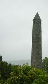
. Though there is no certain agreement as to their purpose, it is thought they were principally bell towers, places of refuge, or a combination of these.
, the door of the tower faces the west doorway of the church. In this way it has been possible to determine without excavation the approximate site of lost churches, where the tower still exists.
Surviving towers range in height from 18 metres (59.1 ft) to 40 metres (131.2 ft), and 12 metres (39.4 ft) to 18 metres (59.1 ft) in circumference; that at
being the highest surviving in Ireland (and leaning 1.7 metres (5.6 ft) out of perpendicular). The masonry differs according to date, the earliest examples being uncut rubble, while the later ones are of neatly joined stone work. The lower portion is solid
with a single door raised two to three metres above, often accessible only by a ladder. Within, in some, are two or more floors (or signs of where such floors existed), usually of wood, and it is thought that there were ladders in between. The windows, which are high up, are slits in the stone. The cap (roof), is of stone, usually conical in shape, although some of the towers are now crowned by a later circle of
The towers were probably built between the 9th and 12th centuries. In Ireland about 120 examples are thought once to have existed; most are in ruins, while eighteen to twenty are almost perfect. There are four examples outside Ireland. Two are in north-eastern
is the only Round Tower in Ireland to still retain its original cap.
. The only known round tower with a hexagonal base is at
The purpose of the towers has been somewhat unclear until recent times. A popular hypothesis in the past was that the towers were originally a redoubt against raiders such as
s. If a lookout posted in the tower spotted a Viking force, the local population (or at least the clerics) would enter, using a ladder which could be raised from within. The towers would be used to store religious
However, there are many problems with this hypothesis. Many towers are built in positions which are not ideal to survey the surrounding countryside and would not work efficiently as watch towers for incoming attacks.
The doors to these towers would have been wooden and therefore easily burned down. Due to the almost chimney-like design of the towers, the smoke from the burning door would have been carried upwards inside the tower causing any occupants to suffocate. Indeed, the round towers at Dysert O'Dea and Aghagower show evidence of fire damage around the doorway. There are also records of people being burned to death in round towers.
The main reason for the entrance-way being built above ground level was to maintain the structural integrity of the building rather than for defence. The towers were generally built with very little foundation. The tower at
has an underground foundation of only sixty centimetres. Building the door at ground level would weaken the tower. The buildings still stand today because their round shape is
-resistant and the section of the tower underneath the entrance is packed with soil and stones.
The distance from the ground to the raised doorway is somewhat greater than that from the first floor to the second; thus large, rigid steps would be too large for the door. Excavations in the 1990s, revealing
s, confirm that wooden steps were built. However, the use of ladders prior to the construction of such steps cannot be ruled out.
Therefore, according to the arguments immediately above, the primary reason for the round tower was to act as a
imitating the continental European style of bell tower which was popular at the time. The
However, the Irish language has greatly evolved over the last millennium. Dinneen notes the alternate pronunciations,
. The closely pronounced
means stone-house or stone-building,. The round tower seems to be the only significant stone building in Ireland before the advent of the Normans in 1167 AD. Although the physical evidence pointing towards a bell tower is strong, we must await confirmation from original sources such as glyphs on medieval manuscripts.
in the late 19th century as a memorial to central Massachusetts' Irish immigrants, of whom thousands are buried there.
. The 110 feet (33.5 m) tower is in the traditional design of an Irish round tower and is partially built with stone from a former army barracks in
The following is a list of surviving Irish round towers, excluding modern reconstructions.
| Picture |
Location |
County |
Province |
Condition |
Height |
Notes |
|
Aghadoe Aghadoe is a large townland overlooking the town and lakes of Killarney in Ireland. Officially it is also a parish, although the parish is larger than the area normally associated with the name. The area is famous for its views of the lakes and islands, including Innisfallen Island...
|
KerryKerry means the "people of Ciar" which was the name of the pre-Gaelic tribe who lived in part of the present county. The legendary founder of the tribe was Ciar, son of Fergus mac Róich. In Old Irish "Ciar" meant black or dark brown, and the word continues in use in modern Irish as an adjective...
|
Munster Munster is one of the Provinces of Ireland situated in the south of Ireland. In Ancient Ireland, it was one of the fifths ruled by a "king of over-kings" . Following the Norman invasion of Ireland, the ancient kingdoms were shired into a number of counties for administrative and judicial purposes...
|
Incomplete |
05.4mThe metre , symbol m, is the base unit of length in the International System of Units . Originally intended to be one ten-millionth of the distance from the Earth's equator to the North Pole , its definition has been periodically refined to reflect growing knowledge of metrology...
|
|
|
Aghagower |
MayoCounty Mayo is a county in Ireland. It is located in the West Region and is also part of the province of Connacht. It is named after the village of Mayo, which is now generally known as Mayo Abbey. Mayo County Council is the local authority for the county. The population of the county is 130,552...
|
Connacht Connacht , formerly anglicised as Connaught, is one of the Provinces of Ireland situated in the west of Ireland. In Ancient Ireland, it was one of the fifths ruled by a "king of over-kings" . Following the Norman invasion of Ireland, the ancient kingdoms were shired into a number of counties for...
|
Incomplete |
16m |
|
|
Aghaviller Aghaviller National Monument, is a church and round tower in County Kilkenny, Ireland.Aghaviller gives its name to the wider townland, civil parish, and electoral district....
|
KilkennyCounty Kilkenny is a county in Ireland. It is part of the South-East Region and is also located in the province of Leinster. It is named after the city of Kilkenny. The territory of the county was the core part of the ancient Irish Kingdom of Osraige which in turn was the core of the Diocese of...
|
LeinsterLeinster is one of the Provinces of Ireland situated in the east of Ireland. It comprises the ancient Kingdoms of Mide, Osraige and Leinster. Following the Norman invasion of Ireland, the historic fifths of Leinster and Mide gradually merged, mainly due to the impact of the Pale, which straddled...
|
Incomplete |
09.6m |
|
|
Ardmore Ardmore is a fishing village in County Waterford, Ireland, not far from Youghal on the south coast of Ireland, with a population of around 330, although this varies with the tourist season. It is believed to be the oldest Christian settlement in Ireland...
|
Waterford *Abbeyside, Affane, Aglish, Annestown, An Rinn, Ardmore*Ballinacourty, Ballinameela, Ballinamult, Ballinroad, Ballybeg, Ballybricken, Ballyduff Lower, Ballyduff Upper, Ballydurn, Ballygunner, Ballylaneen, Ballymacarbry, Ballymacart, Ballynaneashagh, Ballysaggart, Ballytruckle, Bilberry, Bunmahon,...
|
Munster Munster is one of the Provinces of Ireland situated in the south of Ireland. In Ancient Ireland, it was one of the fifths ruled by a "king of over-kings" . Following the Norman invasion of Ireland, the ancient kingdoms were shired into a number of counties for administrative and judicial purposes...
|
Complete |
30.0m |
has three string courses and a noticeable lean |
|
ArdrahanArdrahan is a village in County Galway, Ireland.-History:Richard de Brugo conquered Galway in 1236, and granted the land to Maurice Fitzgerald who built the castle whose ruins still stand today...
|
GalwayCounty Galway is a county in Ireland. It is located in the West Region and is also part of the province of Connacht. It is named after the city of Galway. Galway County Council is the local authority for the county. There are several strongly Irish-speaking areas in the west of the county...
|
Connacht Connacht , formerly anglicised as Connaught, is one of the Provinces of Ireland situated in the west of Ireland. In Ancient Ireland, it was one of the fifths ruled by a "king of over-kings" . Following the Norman invasion of Ireland, the ancient kingdoms were shired into a number of counties for...
|
Incomplete |
03m |
|
|
BallaBalla is a village in County Mayo, Ireland on the N60 National secondary road, the main road between Castlebar and Claremorris. The economy of the village survives mainly on passing trade, from the busy N60 which carries over 7,000 vehicles through the village every day. The village is to be...
|
MayoCounty Mayo is a county in Ireland. It is located in the West Region and is also part of the province of Connacht. It is named after the village of Mayo, which is now generally known as Mayo Abbey. Mayo County Council is the local authority for the county. The population of the county is 130,552...
|
Connacht Connacht , formerly anglicised as Connaught, is one of the Provinces of Ireland situated in the west of Ireland. In Ancient Ireland, it was one of the fifths ruled by a "king of over-kings" . Following the Norman invasion of Ireland, the ancient kingdoms were shired into a number of counties for...
|
Incomplete |
10.0m |
|
|
CastledermotCastledermot is an inland village in the south-east of Ireland in County Kildare, about from Dublin, and from the town of Carlow. The N9 road from Dublin to Waterford passes through the village but completion of a bypass is due during 2010.-Demographics:...
|
KildareCounty Kildare is a county in Ireland. It is part of the Mid-East Region and is also located in the province of Leinster. It is named after the town of Kildare. Kildare County Council is the local authority for the county...
|
LeinsterLeinster is one of the Provinces of Ireland situated in the east of Ireland. It comprises the ancient Kingdoms of Mide, Osraige and Leinster. Following the Norman invasion of Ireland, the historic fifths of Leinster and Mide gradually merged, mainly due to the impact of the Pale, which straddled...
|
Complete to cornice |
20.0m |
the conical cap has been replaced with battlements and the tower has been attached to a church (which was built later) |
|
Clondalkin-Today:Modern Clondalkin is a busy satellite town of Dublin, with a population of 43,929 in 2006. Retail facilities include Tesco Ireland- and Dunnes Stores-led shopping centres, and Aldi and Lidl stores on the Fonthill Road and New Nangor Road respectively, and the village centre is a base for...
|
DublinCounty Dublin is a county in Ireland. It is part of the Dublin Region and is also located in the province of Leinster. It is named after the city of Dublin which is the capital of Ireland. County Dublin was one of the first of the parts of Ireland to be shired by King John of England following the...
|
LeinsterLeinster is one of the Provinces of Ireland situated in the east of Ireland. It comprises the ancient Kingdoms of Mide, Osraige and Leinster. Following the Norman invasion of Ireland, the historic fifths of Leinster and Mide gradually merged, mainly due to the impact of the Pale, which straddled...
|
Complete |
27.5m |
strengthened by a stone buttress |
|
Clonmacnoise The monastery of Clonmacnoise is situated in County Offaly, Ireland on the River Shannon south of Athlone....
O’Rourke’s Tower McCarthy’s Tower |
OffalyCounty Offaly is a county in Ireland. It is part of the Midlands Region and is also located in the province of Leinster. It is named after the ancient Kingdom of Uí Failghe and was formerly known as King's County until the establishment of the Irish Free State in 1922. Offaly County Council is...
|
LeinsterLeinster is one of the Provinces of Ireland situated in the east of Ireland. It comprises the ancient Kingdoms of Mide, Osraige and Leinster. Following the Norman invasion of Ireland, the historic fifths of Leinster and Mide gradually merged, mainly due to the impact of the Pale, which straddled...
|
Incomplete Complete |
19.3m 17.7m |
two towers a short distance from each-other O'Rourke: full height but capless; has 8 windows at top McCarthy: attached to a church |
|
CloyneSt. Coleman's Cathedral, Cloyne is a cathedral of the Church of Ireland in Cloyne, County Cork in Ireland. It is in the ecclesiastical province of Dublin....
|
Cork County Cork is a county in Ireland. It is located in the South-West Region and is also part of the province of Munster. It is named after the city of Cork . Cork County Council is the local authority for the county...
|
Munster Munster is one of the Provinces of Ireland situated in the south of Ireland. In Ancient Ireland, it was one of the fifths ruled by a "king of over-kings" . Following the Norman invasion of Ireland, the ancient kingdoms were shired into a number of counties for administrative and judicial purposes...
|
Complete to cornice |
30.5m |
the conical cap has been replaced with battlements |
|
Devinish Devenish or Devinish is an island in Lower Lough Erne, County Fermanagh, Northern Ireland. Aligned roughly north–south, it is about one and a quarter miles long and two-thirds of a mile wide. The main place to get a ferry to the island is at Trory Point, just outside Enniskillen.- Features...
|
Fermanagh Fermanagh District Council is the only one of the 26 district councils in Northern Ireland that contains all of the county it is named after. The district council also contains a small section of County Tyrone in the Dromore and Kilskeery road areas....
|
UlsterUlster is one of the four provinces of Ireland, located in the north of the island. In ancient Ireland, it was one of the fifths ruled by a "king of over-kings" . Following the Norman invasion of Ireland, the ancient kingdoms were shired into a number of counties for administrative and judicial...
|
Complete |
25.0m |
climbable |
|
Donaghmore |
MeathCounty Meath is a county in Ireland. It is part of the Mid-East Region and is also located in the province of Leinster. It is named after the ancient Kingdom of Mide . Meath County Council is the local authority for the county...
|
LeinsterLeinster is one of the Provinces of Ireland situated in the east of Ireland. It comprises the ancient Kingdoms of Mide, Osraige and Leinster. Following the Norman invasion of Ireland, the historic fifths of Leinster and Mide gradually merged, mainly due to the impact of the Pale, which straddled...
|
Complete to cornice |
26.6m |
full height but without cap |
|
Dromiskin Dromiskin is a village and townland in County Louth, Ireland. It is situated 10 km south of Dundalk, about 1 km inland from the Irish Sea coast, and is located in one of Louth's most historical areas.-History:...
|
LouthCounty Louth is a county of Ireland. It is part of the Border Region and is also located in the province of Leinster. It is named after the town of Louth. Louth County Council is the local authority for the county...
|
LeinsterLeinster is one of the Provinces of Ireland situated in the east of Ireland. It comprises the ancient Kingdoms of Mide, Osraige and Leinster. Following the Norman invasion of Ireland, the historic fifths of Leinster and Mide gradually merged, mainly due to the impact of the Pale, which straddled...
|
Incomplete |
15.2m |
a conical cap was added to what remains of the tower |
|
Drumbo Drumbo is a small village and townland in County Antrim, Northern Ireland. It lies about south of Belfast city centre, east of Lisburn and west of Carryduff. The 2001 Census recorded the village's population as being 408....
|
Down-Cities:*Belfast *Newry -Large towns:*Dundonald*Newtownards*Bangor-Medium towns:...
|
UlsterUlster is one of the four provinces of Ireland, located in the north of the island. In ancient Ireland, it was one of the fifths ruled by a "king of over-kings" . Following the Norman invasion of Ireland, the ancient kingdoms were shired into a number of counties for administrative and judicial...
|
Incomplete |
10.25m |
|
| |
Drumcliff (near EnnisEnnis is the county town of Clare in Ireland. Situated on the River Fergus, it lies north of Limerick and south of Galway. Its name is a shortening of the original .... ) |
Clare-History:There was a Neolithic civilisation in the Clare area — the name of the peoples is unknown, but the Prehistoric peoples left evidence behind in the form of ancient dolmen; single-chamber megalithic tombs, usually consisting of three or more upright stones...
|
Munster Munster is one of the Provinces of Ireland situated in the south of Ireland. In Ancient Ireland, it was one of the fifths ruled by a "king of over-kings" . Following the Norman invasion of Ireland, the ancient kingdoms were shired into a number of counties for administrative and judicial purposes...
|
Incomplete |
11.0m |
|
|
DrumcliffDrumcliffe, officially Drumcliff , is a village in County Sligo, Ireland. It is 8 km north of Sligo town on the N15 road between Ben Bulben and the sea.-History:... (near SligoSligo is the county town of County Sligo in Ireland. The town is a borough and has a charter and a town mayor. It is sometimes referred to as a city, and sometimes as a town, and is the second largest urban area in Connacht... ) |
Sligo |
Connacht Connacht , formerly anglicised as Connaught, is one of the Provinces of Ireland situated in the west of Ireland. In Ancient Ireland, it was one of the fifths ruled by a "king of over-kings" . Following the Norman invasion of Ireland, the ancient kingdoms were shired into a number of counties for...
|
Incomplete |
09.0m |
|
 |
Glebe (near Armoy Armoy is a small village in County Antrim, Northern Ireland. It is 9 km southwest of Ballycastle and 13 km northeast of Ballymoney. In the 2001 Census it had a population of 414 people. The village is on the River Bush between two of the nine Glens of Antrim; Glenshesk and Glentaisie... ) |
AntrimCounty Antrim is one of six counties that form Northern Ireland, situated in the north-east of the island of Ireland. Adjoined to the north-east shore of Lough Neagh, the county covers an area of 2,844 km², with a population of approximately 616,000...
|
UlsterUlster is one of the four provinces of Ireland, located in the north of the island. In ancient Ireland, it was one of the fifths ruled by a "king of over-kings" . Following the Norman invasion of Ireland, the ancient kingdoms were shired into a number of counties for administrative and judicial...
|
Incomplete |
10.8m |
|
|
GlendaloughGlendalough or Glendaloch is a glacial valley in County Wicklow, Ireland. It is renowned for its Early Medieval monastic settlement founded in the 6th century by St Kevin, a hermit priest, and partly destroyed in 1398 by English troops....
|
Wicklow County Wicklow is a county in Ireland. It is part of the Mid-East Region and is also located in the province of Leinster. It is named after the town of Wicklow, which derives from the Old Norse name Víkingalág or Wykynlo. Wicklow County Council is the local authority for the county...
|
LeinsterLeinster is one of the Provinces of Ireland situated in the east of Ireland. It comprises the ancient Kingdoms of Mide, Osraige and Leinster. Following the Norman invasion of Ireland, the historic fifths of Leinster and Mide gradually merged, mainly due to the impact of the Pale, which straddled...
|
Complete |
30.5m |
nearby Saint Kevin’s Church includes a miniature round tower |
| |
Grangefertagh |
KilkennyCounty Kilkenny is a county in Ireland. It is part of the South-East Region and is also located in the province of Leinster. It is named after the city of Kilkenny. The territory of the county was the core part of the ancient Irish Kingdom of Osraige which in turn was the core of the Diocese of...
|
LeinsterLeinster is one of the Provinces of Ireland situated in the east of Ireland. It comprises the ancient Kingdoms of Mide, Osraige and Leinster. Following the Norman invasion of Ireland, the historic fifths of Leinster and Mide gradually merged, mainly due to the impact of the Pale, which straddled...
|
Complete to cornice |
30.0m |
full height but without cap |
| |
Inishcaltra (in Lough Derg Lough Derg is the name of two lakes in Ireland:* Lough Derg a large lake on the River Shannon, bordering counties Clare, Galway and Tipperary.* Lough Derg a small lake, a place of Christian pilgrimage.... ) |
Clare-History:There was a Neolithic civilisation in the Clare area — the name of the peoples is unknown, but the Prehistoric peoples left evidence behind in the form of ancient dolmen; single-chamber megalithic tombs, usually consisting of three or more upright stones...
|
Munster Munster is one of the Provinces of Ireland situated in the south of Ireland. In Ancient Ireland, it was one of the fifths ruled by a "king of over-kings" . Following the Norman invasion of Ireland, the ancient kingdoms were shired into a number of counties for administrative and judicial purposes...
|
Incomplete |
22.3m |
|
|
Inishkeen Inniskeen, officially Inishkeen , is a small village and parish in County Monaghan, Ireland, close to the County Louth and County Armagh borders. It is located about 17 km from Dundalk and 12 km from Carrickmacross and 5 km from Crossmaglen...
|
MonaghanCounty Monaghan is a county in Ireland. It is part of the Border Region and is also located in the province of Ulster. It is named after the town of Monaghan. Monaghan County Council is the local authority for the county...
|
UlsterUlster is one of the four provinces of Ireland, located in the north of the island. In ancient Ireland, it was one of the fifths ruled by a "king of over-kings" . Following the Norman invasion of Ireland, the ancient kingdoms were shired into a number of counties for administrative and judicial...
|
Incomplete |
12.6m |
the top has been sealed with brick and cement |
|
Kells The Abbey of Kells is a former monastery located in Kells, County Meath, Ireland, 40 miles north of Dublin. It was founded in the early ninth century, and the Book of Kells was kept there during the later medieval and early modern periods before finally leaving the Abbey in the 1650s...
|
MeathCounty Meath is a county in Ireland. It is part of the Mid-East Region and is also located in the province of Leinster. It is named after the ancient Kingdom of Mide . Meath County Council is the local authority for the county...
|
LeinsterLeinster is one of the Provinces of Ireland situated in the east of Ireland. It comprises the ancient Kingdoms of Mide, Osraige and Leinster. Following the Norman invasion of Ireland, the historic fifths of Leinster and Mide gradually merged, mainly due to the impact of the Pale, which straddled...
|
Complete to cornice |
26.0m |
full height but without cap |
|
Kilbennan |
GalwayCounty Galway is a county in Ireland. It is located in the West Region and is also part of the province of Connacht. It is named after the city of Galway. Galway County Council is the local authority for the county. There are several strongly Irish-speaking areas in the west of the county...
|
Connacht Connacht , formerly anglicised as Connaught, is one of the Provinces of Ireland situated in the west of Ireland. In Ancient Ireland, it was one of the fifths ruled by a "king of over-kings" . Following the Norman invasion of Ireland, the ancient kingdoms were shired into a number of counties for...
|
Incomplete |
16.5m |
|
 |
KildareThe Cathedral Church of St. Brigid, Kildare is a cathedral of the Church of Ireland in Kildare, County Kildare in Ireland. It is in the ecclesiastical province of Dublin.-History:...
|
KildareCounty Kildare is a county in Ireland. It is part of the Mid-East Region and is also located in the province of Leinster. It is named after the town of Kildare. Kildare County Council is the local authority for the county...
|
LeinsterLeinster is one of the Provinces of Ireland situated in the east of Ireland. It comprises the ancient Kingdoms of Mide, Osraige and Leinster. Following the Norman invasion of Ireland, the historic fifths of Leinster and Mide gradually merged, mainly due to the impact of the Pale, which straddled...
|
Complete to cornice |
32.0m |
climable; the conical cap has been replaced with battlements |
|
KilkennySt Canice's Cathedral , is a cathedral of the Church of Ireland in Kilkenny city, Ireland. It is in the ecclesiastical province of Dublin....
|
KildareCounty Kilkenny is a county in Ireland. It is part of the South-East Region and is also located in the province of Leinster. It is named after the city of Kilkenny. The territory of the county was the core part of the ancient Irish Kingdom of Osraige which in turn was the core of the Diocese of...
|
LeinsterLeinster is one of the Provinces of Ireland situated in the east of Ireland. It comprises the ancient Kingdoms of Mide, Osraige and Leinster. Following the Norman invasion of Ireland, the historic fifths of Leinster and Mide gradually merged, mainly due to the impact of the Pale, which straddled...
|
Complete to cornice |
30.0m |
climable; the conical cap has been replaced with battlements |
|
KillalaKillala is a village in County Mayo in Ireland, north of Ballina. The railway line from Dublin to Ballina once extended to Killala. To the west of Killala is a Townsplots West , which contains numerous ancient forts.- History :...
|
MayoCounty Mayo is a county in Ireland. It is located in the West Region and is also part of the province of Connacht. It is named after the village of Mayo, which is now generally known as Mayo Abbey. Mayo County Council is the local authority for the county. The population of the county is 130,552...
|
Connacht Connacht , formerly anglicised as Connaught, is one of the Provinces of Ireland situated in the west of Ireland. In Ancient Ireland, it was one of the fifths ruled by a "king of over-kings" . Following the Norman invasion of Ireland, the ancient kingdoms were shired into a number of counties for...
|
Complete |
25.5m |
there is a noticeable bulge about halfway up the tower |
| |
Killinaboy Kilnaboy or Killinaboy is the name of a small village, townland and parish in County Clare, Ireland. It is situated in The Burren, an area rich in heritage and natural beauty and Mullaghmore mountain is close by...
|
Clare-History:There was a Neolithic civilisation in the Clare area — the name of the peoples is unknown, but the Prehistoric peoples left evidence behind in the form of ancient dolmen; single-chamber megalithic tombs, usually consisting of three or more upright stones...
|
Munster Munster is one of the Provinces of Ireland situated in the south of Ireland. In Ancient Ireland, it was one of the fifths ruled by a "king of over-kings" . Following the Norman invasion of Ireland, the ancient kingdoms were shired into a number of counties for administrative and judicial purposes...
|
Incomplete |
03.5m |
|
|
KilmacduaghKilmacduagh Monastery is found 5 km from the town of Gort in County Galway, Ireland. It was the birthplace of the Diocese of Kilmacduagh, whose name means "church of Duagh's son"...
|
GalwayCounty Galway is a county in Ireland. It is located in the West Region and is also part of the province of Connacht. It is named after the city of Galway. Galway County Council is the local authority for the county. There are several strongly Irish-speaking areas in the west of the county...
|
Connacht Connacht , formerly anglicised as Connaught, is one of the Provinces of Ireland situated in the west of Ireland. In Ancient Ireland, it was one of the fifths ruled by a "king of over-kings" . Following the Norman invasion of Ireland, the ancient kingdoms were shired into a number of counties for...
|
Complete |
34.5m |
has 11 windows (more than any other tower) and the door is 8m from the ground (higher than any other tower) |
|
Kilree |
KilkennyCounty Kilkenny is a county in Ireland. It is part of the South-East Region and is also located in the province of Leinster. It is named after the city of Kilkenny. The territory of the county was the core part of the ancient Irish Kingdom of Osraige which in turn was the core of the Diocese of...
|
LeinsterLeinster is one of the Provinces of Ireland situated in the east of Ireland. It comprises the ancient Kingdoms of Mide, Osraige and Leinster. Following the Norman invasion of Ireland, the historic fifths of Leinster and Mide gradually merged, mainly due to the impact of the Pale, which straddled...
|
Complete to cornice |
27.0m |
the conical cap has been replaced with battlements |
|
Kinneigh |
Cork County Cork is a county in Ireland. It is located in the South-West Region and is also part of the province of Munster. It is named after the city of Cork . Cork County Council is the local authority for the county...
|
Munster Munster is one of the Provinces of Ireland situated in the south of Ireland. In Ancient Ireland, it was one of the fifths ruled by a "king of over-kings" . Following the Norman invasion of Ireland, the ancient kingdoms were shired into a number of counties for administrative and judicial purposes...
|
Complete to cornice |
24.5m |
has a hexagonal base and a sealed top |
|
Lusk |
DublinCounty Dublin is a county in Ireland. It is part of the Dublin Region and is also located in the province of Leinster. It is named after the city of Dublin which is the capital of Ireland. County Dublin was one of the first of the parts of Ireland to be shired by King John of England following the...
|
LeinsterLeinster is one of the Provinces of Ireland situated in the east of Ireland. It comprises the ancient Kingdoms of Mide, Osraige and Leinster. Following the Norman invasion of Ireland, the historic fifths of Leinster and Mide gradually merged, mainly due to the impact of the Pale, which straddled...
|
Complete to cornice |
26.6m |
full height but without cap; is attached to a church (which was built later) |
|
Maghera |
Down-Cities:*Belfast *Newry -Large towns:*Dundonald*Newtownards*Bangor-Medium towns:...
|
UlsterUlster is one of the four provinces of Ireland, located in the north of the island. In ancient Ireland, it was one of the fifths ruled by a "king of over-kings" . Following the Norman invasion of Ireland, the ancient kingdoms were shired into a number of counties for administrative and judicial...
|
Incomplete |
05.4m |
stump with a large hole in the side |
|
Meelick |
MayoCounty Mayo is a county in Ireland. It is located in the West Region and is also part of the province of Connacht. It is named after the village of Mayo, which is now generally known as Mayo Abbey. Mayo County Council is the local authority for the county. The population of the county is 130,552...
|
Connacht Connacht , formerly anglicised as Connaught, is one of the Provinces of Ireland situated in the west of Ireland. In Ancient Ireland, it was one of the fifths ruled by a "king of over-kings" . Following the Norman invasion of Ireland, the ancient kingdoms were shired into a number of counties for...
|
Incomplete |
21.0m |
|
|
Mollaneen (Dysert O'Dea Monastery) |
Clare-History:There was a Neolithic civilisation in the Clare area — the name of the peoples is unknown, but the Prehistoric peoples left evidence behind in the form of ancient dolmen; single-chamber megalithic tombs, usually consisting of three or more upright stones...
|
Munster Munster is one of the Provinces of Ireland situated in the south of Ireland. In Ancient Ireland, it was one of the fifths ruled by a "king of over-kings" . Following the Norman invasion of Ireland, the ancient kingdoms were shired into a number of counties for administrative and judicial purposes...
|
Incomplete |
15.0m |
|
|
Monasterboice The historic ruins of Monasterboice are of an early Christian settlement in County Louth in Ireland, north of Drogheda. It was founded in the late 5th century by Saint Buithe who died around 521, and was an important centre of religion and learning until the founding of nearby Mellifont Abbey in...
|
LouthCounty Louth is a county of Ireland. It is part of the Border Region and is also located in the province of Leinster. It is named after the town of Louth. Louth County Council is the local authority for the county...
|
LeinsterLeinster is one of the Provinces of Ireland situated in the east of Ireland. It comprises the ancient Kingdoms of Mide, Osraige and Leinster. Following the Norman invasion of Ireland, the historic fifths of Leinster and Mide gradually merged, mainly due to the impact of the Pale, which straddled...
|
Incomplete |
28.0m |
|
| |
Old Kilcullen Old Kilcullen, formerly Kilcullen , is a townland in County Kildare, Ireland, which includes a noted religious archaeological site within its boundary. It was formerly the site of a walled town, and before that of an ecclesiastical settlement dating from the 5th century...
|
KildareCounty Kildare is a county in Ireland. It is part of the Mid-East Region and is also located in the province of Leinster. It is named after the town of Kildare. Kildare County Council is the local authority for the county...
|
LeinsterLeinster is one of the Provinces of Ireland situated in the east of Ireland. It comprises the ancient Kingdoms of Mide, Osraige and Leinster. Following the Norman invasion of Ireland, the historic fifths of Leinster and Mide gradually merged, mainly due to the impact of the Pale, which straddled...
|
Incomplete |
11.0m |
|
| |
Oughter Ard-Arthur Guinness and Other Notable Burials:Until the construction of the turnpike road in the adjoining valley in 1729, Oughterard was situated on the main road from Dublin to Limerick and Cork...
|
KildareCounty Kildare is a county in Ireland. It is part of the Mid-East Region and is also located in the province of Leinster. It is named after the town of Kildare. Kildare County Council is the local authority for the county...
|
LeinsterLeinster is one of the Provinces of Ireland situated in the east of Ireland. It comprises the ancient Kingdoms of Mide, Osraige and Leinster. Following the Norman invasion of Ireland, the historic fifths of Leinster and Mide gradually merged, mainly due to the impact of the Pale, which straddled...
|
Incomplete |
09.5m |
|
|
Rattoo |
KerryKerry means the "people of Ciar" which was the name of the pre-Gaelic tribe who lived in part of the present county. The legendary founder of the tribe was Ciar, son of Fergus mac Róich. In Old Irish "Ciar" meant black or dark brown, and the word continues in use in modern Irish as an adjective...
|
Munster Munster is one of the Provinces of Ireland situated in the south of Ireland. In Ancient Ireland, it was one of the fifths ruled by a "king of over-kings" . Following the Norman invasion of Ireland, the ancient kingdoms were shired into a number of counties for administrative and judicial purposes...
|
Complete |
27.4m |
includes a Sheela na Gig Sheela na gigs are figurative carvings of naked women displaying an exaggerated vulva. They are found on churches, castles and other buildings, particularly in Ireland and Britain, sometimes together with male figures. One of the best examples may be found in the Round Tower at Rattoo, in County...
|
|
Roscrea Roscrea is a small heritage town in North Tipperary, Ireland. The town has a population of 4,910. Its main industries include meat processing and pharmaceuticals. It is a civil parish in the historical barony of Ikerrin...
|
Tipperary County Tipperary is a county of Ireland. It is located in the province of Munster and is named after the town of Tipperary. The area of the county does not have a single local authority; local government is split between two authorities. In North Tipperary, part of the Mid-West Region, local...
|
Munster Munster is one of the Provinces of Ireland situated in the south of Ireland. In Ancient Ireland, it was one of the fifths ruled by a "king of over-kings" . Following the Norman invasion of Ireland, the ancient kingdoms were shired into a number of counties for administrative and judicial purposes...
|
Incomplete |
20m |
|
|
Seir Kieran |
OffalyCounty Offaly is a county in Ireland. It is part of the Midlands Region and is also located in the province of Leinster. It is named after the ancient Kingdom of Uí Failghe and was formerly known as King's County until the establishment of the Irish Free State in 1922. Offaly County Council is...
|
LeinsterLeinster is one of the Provinces of Ireland situated in the east of Ireland. It comprises the ancient Kingdoms of Mide, Osraige and Leinster. Following the Norman invasion of Ireland, the historic fifths of Leinster and Mide gradually merged, mainly due to the impact of the Pale, which straddled...
|
Incomplete |
02.6m |
|
| |
St Mullin'sSt Mullin's is a village situated in the south of County Carlow on the eastern bank of the River Barrow in Ireland. It is located less than 2 km off the R729 regional road.-History:...
|
Carlow County Carlow is a county in Ireland. It is part of the South-East Region and is also located in the province of Leinster. It is named after the town of Carlow, which lies on the River Barrow. Carlow County Council is the local authority for the county...
|
LeinsterLeinster is one of the Provinces of Ireland situated in the east of Ireland. It comprises the ancient Kingdoms of Mide, Osraige and Leinster. Following the Norman invasion of Ireland, the historic fifths of Leinster and Mide gradually merged, mainly due to the impact of the Pale, which straddled...
|
Incomplete |
01m |
|
|
St Patrick’s Rock The Rock of Cashel , also known as Cashel of the Kings and St. Patrick's Rock, is a historic site in Ireland's province of Munster, located at Cashel, South Tipperary.-History:... (near CashelCashel is an Anglicised form of the Irish language word Caiseal, meaning "stone ringfort". Cashels were typically built on rocky outcrops.It has given its name to the following places:In Ireland:*Cashel, County Tipperary... ) |
Tipperary County Tipperary is a county of Ireland. It is located in the province of Munster and is named after the town of Tipperary. The area of the county does not have a single local authority; local government is split between two authorities. In North Tipperary, part of the Mid-West Region, local...
|
Munster Munster is one of the Provinces of Ireland situated in the south of Ireland. In Ancient Ireland, it was one of the fifths ruled by a "king of over-kings" . Following the Norman invasion of Ireland, the ancient kingdoms were shired into a number of counties for administrative and judicial purposes...
|
Complete |
28.0m |
attached to a church (which was built later) |
 |
Steeple (near Antrim - Northern Ireland :* County Antrim, one of the counties of Northern Ireland* Antrim, County Antrim, the town* Antrim railway station, serving the town of Antrim* Antrim , an administrative division... ) |
AntrimCounty Antrim is one of six counties that form Northern Ireland, situated in the north-east of the island of Ireland. Adjoined to the north-east shore of Lough Neagh, the county covers an area of 2,844 km², with a population of approximately 616,000...
|
UlsterUlster is one of the four provinces of Ireland, located in the north of the island. In ancient Ireland, it was one of the fifths ruled by a "king of over-kings" . Following the Norman invasion of Ireland, the ancient kingdoms were shired into a number of counties for administrative and judicial...
|
Complete |
28.0m |
|
|
Swords Swords is the county town of Fingal in Ireland. It is about 13 km north of Dublin city centre and is part of its commuter belt.- History :...
|
DublinCounty Dublin is a county in Ireland. It is part of the Dublin Region and is also located in the province of Leinster. It is named after the city of Dublin which is the capital of Ireland. County Dublin was one of the first of the parts of Ireland to be shired by King John of England following the...
|
LeinsterLeinster is one of the Provinces of Ireland situated in the east of Ireland. It comprises the ancient Kingdoms of Mide, Osraige and Leinster. Following the Norman invasion of Ireland, the historic fifths of Leinster and Mide gradually merged, mainly due to the impact of the Pale, which straddled...
|
Complete |
26.0m |
has a deformed top floor, which is topped by a stone cross |
| |
Taghadoe |
KildareCounty Kildare is a county in Ireland. It is part of the Mid-East Region and is also located in the province of Leinster. It is named after the town of Kildare. Kildare County Council is the local authority for the county...
|
LeinsterLeinster is one of the Provinces of Ireland situated in the east of Ireland. It comprises the ancient Kingdoms of Mide, Osraige and Leinster. Following the Norman invasion of Ireland, the historic fifths of Leinster and Mide gradually merged, mainly due to the impact of the Pale, which straddled...
|
Incomplete |
19.8m |
|
|
Timahoe Timahoe is a village in County Laois, Ireland, 12 km south of Portlaoise on the R426 regional road.-Features:The village of Timahoe is situated in a broad and fertile valley. The houses are built around a large central green, known as the Goosegreen...
|
Laois County Laois is a county in Ireland. It is part of the Midlands Region and is also located in the province of Leinster. It was formerly known as Queen's County until the establishment of the Irish Free State in 1922. The county's name was formerly spelt as Laoighis and Leix. Laois County Council...
|
LeinsterLeinster is one of the Provinces of Ireland situated in the east of Ireland. It comprises the ancient Kingdoms of Mide, Osraige and Leinster. Following the Norman invasion of Ireland, the historic fifths of Leinster and Mide gradually merged, mainly due to the impact of the Pale, which straddled...
|
Complete |
29m |
|
|
Tullaherin Tullaherin is a townland and parish in County Kilkenny, Ireland.It is the site of a 9th century round tower, an 11th-13th century ruined church and two ogham stones.The present church at Tullaherin was built about 1840....
|
KilkennyCounty Kilkenny is a county in Ireland. It is part of the South-East Region and is also located in the province of Leinster. It is named after the city of Kilkenny. The territory of the county was the core part of the ancient Irish Kingdom of Osraige which in turn was the core of the Diocese of...
|
LeinsterLeinster is one of the Provinces of Ireland situated in the east of Ireland. It comprises the ancient Kingdoms of Mide, Osraige and Leinster. Following the Norman invasion of Ireland, the historic fifths of Leinster and Mide gradually merged, mainly due to the impact of the Pale, which straddled...
|
Incomplete |
22.5m |
|
|
Turlough Turlough, |a seasonal lake]]) is a village in County Mayo, Ireland, 6 km northeast of Castlebar. It is known for the presence of the Museum of Country Life , and for its well-preserved and unusually squat round tower, built between 900 and 1200.Turlough is also the name of the surrounding 241...
|
MayoCounty Mayo is a county in Ireland. It is located in the West Region and is also part of the province of Connacht. It is named after the village of Mayo, which is now generally known as Mayo Abbey. Mayo County Council is the local authority for the county. The population of the county is 130,552...
|
Connacht Connacht , formerly anglicised as Connaught, is one of the Provinces of Ireland situated in the west of Ireland. In Ancient Ireland, it was one of the fifths ruled by a "king of over-kings" . Following the Norman invasion of Ireland, the ancient kingdoms were shired into a number of counties for...
|
Complete |
22.9m |
|