

Ipiaçu
Encyclopedia
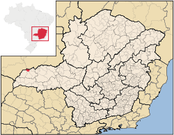
Minas Gerais
Minas Gerais is one of the 26 states of Brazil, of which it is the second most populous, the third richest, and the fourth largest in area. Minas Gerais is the Brazilian state with the largest number of Presidents of Brazil, the current one, Dilma Rousseff, being one of them. The capital is the...
. As of 2007 the population was 4,191 in a total area of 470 km². It became a municipality in 1962.
Location
Ipiaçu is located at an elevation of 437 meters just south of the Paranaíba RiverParanaíba River
The Paranaíba River is a Brazilian river whose source lies in the state of Minas Gerais in the Mata da Corda mountains, municipality of Rio Paranaíba, at an altitude of 1,148 meters; on the other face of this mountain chain are the sources of the Abaeté river, tributary of the São Francisco River...
in the Triângulo Mineiro
Triângulo Mineiro
The Triangle Mineiro Portuguese pronunciation: [tɾiɐɡulu minejru] is an officer in the region west of the state of Minas Gerais, Brazil. The area is 93.500 km ² and is limited by the Serra da Canastra and Marcela, east, south of Sao Paulo, Goias in the north and west of the junction of the rivers...
. It belongs to the statistical microregion of Ituiutaba
Ituiutaba
Ituiutaba is a city and municipality in the western part of Minas Gerais state, Brazil. Elevated to city status in 1901, it had a population in 2007 of 100,316 and a total area in the municipality of 2,694 km²...
. Neighboring municipalities are Santa Vitória
Santa Vitória, Minas Gerais
Santa Vitória is a municipality in the west of the Brazilian state of Minas Gerais. , the population was 18,157. It became a municipality in 1948....
, Capinópolis
Capinópolis
Capinópolis is a municipality in the west of the Brazilian state of Minas Gerais. As of 2007 the population was 15,302 in a total area of 621 km². It became a municipality in 1953. The name means "city of grass".-Location:...
and the state of Goiás
Goiás
Goiás is a state of Brazil, located in the central part of the country. The name Goiás comes from the name of an indigenous community...
.
Distances
- Belo HorizonteBelo HorizonteBelo Horizonte is the capital of and largest city in the state of Minas Gerais, located in the southeastern region of Brazil. It is the third largest metropolitan area in the country...
: 759 km. - Santa VitóriaSanta Vitória, Minas GeraisSanta Vitória is a municipality in the west of the Brazilian state of Minas Gerais. , the population was 18,157. It became a municipality in 1948....
: 28 km. - UberlândiaUberlândiaUberlândia is the main town in the Triangle region, west of the state of Minas Gerais, Brazil. With a population of 604,013 inhabitants, according to 2010 estimates, the city is the second largest in the state second only to Belo Horizonte...
: 210 km. - ItuiutabaItuiutabaItuiutaba is a city and municipality in the western part of Minas Gerais state, Brazil. Elevated to city status in 1901, it had a population in 2007 of 100,316 and a total area in the municipality of 2,694 km²...
: 77 km. - ItumbiaraItumbiaraItumbiara is a small city and municipality in the extreme south of the state of Goiás, Brazil. The population was 100,000 in a total area of 2,461,3 km²...
: 101
Economic activities
The most important economic activities are cattle raising, commerce, and agriculture. The GDP in 2005 was R$ 40,025,000. Ipiaçu is in the top tier of municipalities in the state with regard to economic and social development. It is in a region of good soils, adequate rainfall, and abundance of surface water. As of 2007 there was 01 banking agency in the town. There was a small retail commerce serving the surrounding area of cattle and agricultural lands. In the rural area there were 157 establishments employing about 1,800 workers. 72 of the farms had tractors. There were 278 automobiles in all of the municipality. There were 32,000 head of cattle in 2006. The crops with a planted area of more than 100 hectares were rice, sugarcane (6,379 ha.), soybeans (4,123 ha.), sorghum (803 ha.), and corn (1,540 ha.).Health and education
In the health sector there were 03 clinics and one hospital with 14 beds. In the educational sector there were 02 primary schools and 01 middle school.- Municipal Human Development IndexHuman Development IndexThe Human Development Index is a composite statistic used to rank countries by level of "human development" and separate "very high human development", "high human development", "medium human development", and "low human development" countries...
: 0.764 (2000) - State ranking: 196 out of 853 municipalities as of 2000
- National ranking: 1,491 out of 5,138 municipalities as of 2000
The highest ranking municipality in Minas Gerais in 2000 was Poços de Caldas
Poços de Caldas
Poços de Caldas is a city and municipality in south-western Minas Gerais state, Brazil, in the microregion of the same name. Its estimated population in 2009 was 151,449 inhabitants...
with 0.841, while the lowest was Setubinha
Setubinha
Setubinha is a municipality in the northeast of the Brazilian state of Minas Gerais. As of 2007 the population was 10,834 in a total area of 536 km². The elevation is 729 metres. It is part of the IBGE statistical microregion of Teófilo Otoni...
with 0.568. Nationally the highest was São Caetano do Sul
São Caetano do Sul
São Caetano do Sul is a city in São Paulo state in Brazil, located in the Greater São Paulo Metropolitan Area. It is the city with the highest per capita income in Brazil and it also has the highest Human Development Index .-Geography:São Caetano do Sul is located on a plateau that is part of the...
in São Paulo with 0.919, while the lowest was Setubinha. In more recent statistics (considering 5,507 municipalities) Manari in the state of Pernambuco
Pernambuco
Pernambuco is a state of Brazil, located in the Northeast region of the country. To the north are the states of Paraíba and Ceará, to the west is Piauí, to the south are Alagoas and Bahia, and to the east is the Atlantic Ocean. There are about of beaches, some of the most beautiful in the...
has the lowest rating in the country—0,467—putting it in last place.
See also
- List of municipalities in Minas Gerais