

Iperó
Encyclopedia
| Coat of arms | |
|---|---|
 |
|
| Statistics | |
| State: | São Paulo São Paulo (state) São Paulo is a state in Brazil. It is the major industrial and economic powerhouse of the Brazilian economy. Named after Saint Paul, São Paulo has the largest population, industrial complex, and economic production in the country. It is the richest state in Brazil... |
| Meso-region: | Paulista Macro-Metropolitan Meso-Region |
| Microrregions: | Sorocaba Sorocaba (micro-region) The Microregion of Sorocaba is a microregion in the central part of São Paulo State, Brazil.- Municipalities:* Alumínio* Araçariguama* Araçoiaba da Serra* Cabreúva* Capela do Alto* Iperó* Itu* Mairinque* Porto Feliz* Salto* Salto de Pirapora... |
| Founded: | March 21, 1964 |
| Location Location (geography) The terms location and place in geography are used to identify a point or an area on the Earth's surface or elsewhere. The term 'location' generally implies a higher degree of can certainty than "place" which often has an ambiguous boundary relying more on human/social attributes of place identity... : |
23.35/23°28'14" S, 47.69/47°44'5" W |
| Area Area Area is a quantity that expresses the extent of a two-dimensional surface or shape in the plane. Area can be understood as the amount of material with a given thickness that would be necessary to fashion a model of the shape, or the amount of paint necessary to cover the surface with a single coat... : |
171.44 km² |
| Population Population A population is all the organisms that both belong to the same group or species and live in the same geographical area. The area that is used to define a sexual population is such that inter-breeding is possible between any pair within the area and more probable than cross-breeding with individuals... : |
22,390 (2004) Ranked 273rd |
| Population density Population density Population density is a measurement of population per unit area or unit volume. It is frequently applied to living organisms, and particularly to humans... : |
130.6/km² |
| Elevation Elevation The elevation of a geographic location is its height above a fixed reference point, most commonly a reference geoid, a mathematical model of the Earth's sea level as an equipotential gravitational surface .... : |
590 m |
| Postal code: | 18560-xxx |
| Area/distance code: | (00)55-15 |
| Climate Climate Climate encompasses the statistics of temperature, humidity, atmospheric pressure, wind, rainfall, atmospheric particle count and other meteorological elemental measurements in a given region over long periods... : |
Subtropical |
| Name of inhabitants or denomym: | Iperoense |
| Website: | www.ipero.sp.gov.br |
| Population Statistics | |
| Urban: | 12,649 |
| Rural: | 5,735 |
| Other | |
| Literacy rate: | 91.8% |
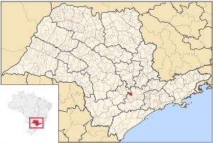
Iperó is a municipality in the state of São Paulo
São Paulo (state)
São Paulo is a state in Brazil. It is the major industrial and economic powerhouse of the Brazilian economy. Named after Saint Paul, São Paulo has the largest population, industrial complex, and economic production in the country. It is the richest state in Brazil...
in Brazil
Brazil
Brazil , officially the Federative Republic of Brazil , is the largest country in South America. It is the world's fifth largest country, both by geographical area and by population with over 192 million people...
. Its latitude is 23.35/23°28'14" S and the longitude is 46.69/47°44'05" W. The population in 2004 was 22,390 and the area is 171.44 km². The elevation is 590 m. The Rio Sorocaba flows near Iperó and is accessed with the highway known as the SP-280.
Population history
| Year | Population | Change | Density |
|---|---|---|---|
| 2001 | 18,384 | - | 107.57/km² |
| 2004 | 16,030 | 2,354 or 12.8% | 130.6/km² |
Demographics
According to the 2000 IBGEIBGE
The Brazilian Institute of Geography and Statistics or IBGE , is the agency responsible for statistical, geographic, cartographic, geodetic and environmental information in Brazil...
Census, the population was 18,384, of which 12,649 are urban and 5,735 are rural. Its life expectancy for the city was 72.42 years. The literacy rate was at 91.8%.