

Interstate 44
Encyclopedia
Interstate 44 is a major highway in the central United States
. Its western terminus is in Wichita Falls, Texas
at a concurrency with US 277, US 281 and US 287; its eastern terminus is at the Illinois
state line on the Poplar Street Bridge
over the Mississippi River
in St. Louis, Missouri
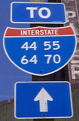
at a concurrency with Interstate 55
, Interstate 64
, Interstate 70
, and US 40 (as per the Federal Highway Administration http://www.fhwa.dot.gov/reports/routefinder/table3.cfm ). I-44 is one of five interstates built to bypass U.S. Route 66
; this highway covers the section between St. Louis and Oklahoma City
.
Virtually the entire length of the I-44 east of Springfield, Missouri was once US 66, which was upgraded from two to four lanes from 1949 to 1955. The section of I-44 west of Springfield was built farther south than US 66 in order to connect Missouri's section with the already completed Will Rogers Turnpike
, which Oklahoma wished to carry their part of I-44.
I-44 is referenced in the song "Convoy
" by C.W. McCall.
|TX
|15
|24
|-
|OK
|329
|530
|-
|MO
|290
|467
|-
|Total
|634
|1021
|}
and runs almost due north to the Texas-Oklahoma border at the Red River
. Texas' segment of I-44, only about 15 miles (24.1 km), is far shorter than the highway's mileage in Oklahoma and Missouri. In Wichita Falls, I-44 runs concurrent with , , and , and is known locally as the "Central Freeway".
s; it is parallel
ed by former US 66
from Oklahoma City to the Missouri line. In southwestern Oklahoma, I-44 is the H.E. Bailey Turnpike and is mainly north–south. In the Oklahoma City area, I-44 is either six or eight lanes; it runs concurrent with I-35 for about four miles in Oklahoma City. From Oklahoma City I-44 becomes northeast–southwest as the Turner Turnpike
towards Tulsa. After I-44 leaves Tulsa it becomes the Will Rogers Turnpike
to the Missouri border.
 I-44 enters Missouri southwest of Joplin near the corner of Oklahoma, Missouri, and Kansas. It misses the Kansas border by less than 200 yards (182.9 m). The first exit in Missouri is for US-166. I-44 continues through the southern part of Joplin, then continues east on the former US-166 to Mount Vernon
. At the northeast part of Mount Vernon, I-44 heads northeast, while old US-166 continued east on Missouri Route 174. The section of road to Halltown
is a completely new road, not bypassing any previous highways. At Halltown, the road follows the general pathway of US-66 all the way to downtown St. Louis.
I-44 passes through Springfield
on the north side of the city and continues northeast. At Waynesville, I-44 enters a very hilly curvy area until it passes Rolla
. Although the road still passes through some hilly areas, none are as steep as that particular stretch.
At Pacific
, I-44 begins to widen to six lanes, later to eight lanes. The interstate continues into the suburbs of St. Louis, finally ending near the Mississippi River
at the intersection with I-55. Plans for the New Mississippi River Bridge
will result in a planned extension by MoDOT of I-44 northward, multiplexing with I-55 briefly until I-55 crosses the Poplar Street Bridge
, and then taking over the former route of I-70 to where it meets the new bridge.
At some places, an "Alternate I-44" is posted. One such ran between Rolla and Springfield via US-60 and US-63 and another ran via US-63 and US-50 between Rolla and Union
. These were done to provide traffic relief during road work. The latter of these alternate routes detoured traffic around three hour delays due to road work near Cuba
.
linking Oklahoma City and Tulsa and the Will Rogers Turnpike
linking Tulsa and the Missouri state line southwest of Joplin
, along with the US 66 bypass in Tulsa that linked that city with the two turnpikes and the continued four-lane highway from the Missouri border to an interchange with US 71 south of Joplin previously designated as US 166.
As U.S. 66 was being bypassed by I-44, the Route 66 Association
requested the designation Interstate 66
for I-44 from St. Louis to Oklahoma City. AASHTO
rejected the request.
At the time the I-44 designation was assigned in Oklahoma in the 1950s, Oklahoma signed the milemarkers west to east starting at Turner Turnpike's Oklahoma City terminus at the I-44/I-35 interchange (near Edmond
). I-44 was extended in 1982 southwest of Oklahoma City along the existing H.E. Bailey Turnpike, thus raising the milemarkers by about 100. The addition of the new section was unusual in that it is a more north/south segment, and didn't directly connect to the previous western end at Interstate 35
. It now extends south of Interstate 40
, thus going beyond the usual Interstate numbering conventions.
What was once I-244 around St. Louis
is currently part of that city's I-270/I-255 beltway.
During the historic 1999 Oklahoma tornado outbreak, an F5 tornado
crossed Interstate 44. This particular tornado had the fastest tornado wind
speeds on record. The interstate was severely damaged where the tornado crossed it. In the end, this tornado was blamed for 36 deaths.
A section of I-44 was moved slightly north between Powellville, Missouri
and Doolittle
. The old road is highly visible for eastbound traffic near Powellville. , the rocks carved away for the new roadbed have virtually no lichen
, reflecting that this construction occurred rather recently.
.
All business loops of Interstate 44 are located in Missouri. They serve Joplin
, Sarcoxie
, Mount Vernon
, Springfield
, Lebanon
, Waynesville
-St. Robert
, Rolla
, and Pacific
. A business spur links I-44 with Fort Leonard Wood
.
United States
The United States of America is a federal constitutional republic comprising fifty states and a federal district...
. Its western terminus is in Wichita Falls, Texas
Wichita Falls, Texas
Wichita Falls is a city in and the county seat of Wichita County, Texas, United States, United States. Wichita Falls is the principal city of the Wichita Falls Metropolitan Statistical Area, which encompasses all of Archer, Clay and Wichita counties. According to the U.S. Census estimate of 2010,...
at a concurrency with US 277, US 281 and US 287; its eastern terminus is at the Illinois
Illinois
Illinois is the fifth-most populous state of the United States of America, and is often noted for being a microcosm of the entire country. With Chicago in the northeast, small industrial cities and great agricultural productivity in central and northern Illinois, and natural resources like coal,...
state line on the Poplar Street Bridge
Poplar Street Bridge
The Poplar Street Bridge, officially the Bernard F. Dickmann Bridge, completed in 1967, is a long deck girder bridge across the Mississippi River between St. Louis, Missouri and East St. Louis, Illinois...
over the Mississippi River
Mississippi River
The Mississippi River is the largest river system in North America. Flowing entirely in the United States, this river rises in western Minnesota and meanders slowly southwards for to the Mississippi River Delta at the Gulf of Mexico. With its many tributaries, the Mississippi's watershed drains...
in St. Louis, Missouri
St. Louis, Missouri
St. Louis is an independent city on the eastern border of Missouri, United States. With a population of 319,294, it was the 58th-largest U.S. city at the 2010 U.S. Census. The Greater St...
at a concurrency with Interstate 55
Interstate 55
Interstate 55 is an Interstate Highway in the central United States. Its odd number indicates that it is a north–south Interstate Highway. I-55 goes from LaPlace, Louisiana at Interstate 10 to Chicago at U.S. Route 41 , at McCormick Place. A common nickname for the highway is "double...
, Interstate 64
Interstate 64
Interstate 64 is an Interstate Highway in the Midwestern and Southeastern United States. Its western terminus is at I-70, U.S. 40, and U.S. 61 in Wentzville, Missouri. Its eastern terminus is at an interchange with I-264 and I-664 at Bowers Hill in Chesapeake, Virginia. As I-64 is concurrent with...
, Interstate 70
Interstate 70
Interstate 70 is an Interstate Highway in the United States that runs from Interstate 15 near Cove Fort, Utah, to a Park and Ride near Baltimore, Maryland. It was the first Interstate Highway project in the United States. I-70 approximately traces the path of U.S. Route 40 east of the Rocky...
, and US 40 (as per the Federal Highway Administration http://www.fhwa.dot.gov/reports/routefinder/table3.cfm ). I-44 is one of five interstates built to bypass U.S. Route 66
U.S. Route 66
U.S. Route 66 was a highway within the U.S. Highway System. One of the original U.S. highways, Route 66 was established on November 11, 1926 -- with road signs erected the following year...
; this highway covers the section between St. Louis and Oklahoma City
Oklahoma city
Oklahoma City is the capital and largest city of the U.S. state of Oklahoma.Oklahoma City may also refer to:*Oklahoma City metropolitan area*Downtown Oklahoma City*Uptown Oklahoma City*Oklahoma City bombing*Oklahoma City National Memorial...
.
Virtually the entire length of the I-44 east of Springfield, Missouri was once US 66, which was upgraded from two to four lanes from 1949 to 1955. The section of I-44 west of Springfield was built farther south than US 66 in order to connect Missouri's section with the already completed Will Rogers Turnpike
Will Rogers Turnpike
The Will Rogers Turnpike is a toll road in northeast Oklahoma that runs from Tulsa, Oklahoma to the Missouri state line. It is long and costs $4.00 to drive one way...
, which Oklahoma wished to carry their part of I-44.
I-44 is referenced in the song "Convoy
Convoy (song)
"Convoy" is a 1975 novelty song performed by C. W. McCall that became a number-one song on both the country and pop charts in the US. Written by McCall and Chip Davis, the song spent six weeks at number one on the country charts and one week at number one on the pop charts...
" by C.W. McCall.
Route description
|-|TX
Interstate 44 in Texas
In the U.S. state of Texas, Interstate 44 has a short but regionally important stretch, connecting Wichita Falls with Oklahoma. Its entire length is concurrent with U.S. Highway 277 and U.S. Highway 281. I-44 provides access to downtown Wichita Falls and Sheppard Air Force Base. The Interstate...
|15
|24
|-
|OK
Interstate 44 in Oklahoma
Interstate 44 runs diagonally through the U.S. state of Oklahoma, spanning from the Texas state line near Wichita Falls to the Missouri border near Joplin. It connects three of Oklahoma's largest cities, Oklahoma City, Tulsa, and Lawton. Most of I-44 in Oklahoma is a toll road. In southwestern...
|329
|530
|-
|MO
Interstate 44 in Missouri
In the U.S. state of Missouri, Interstate 44 runs northeast from the Oklahoma state line near Joplin to Interstate 55 in downtown St. Louis. It runs for a total of 290 miles in Missouri.-Route description:...
|290
|467
|-
|Total
|634
|1021
|}
Texas
I-44 begins in Wichita FallsWichita Falls, Texas
Wichita Falls is a city in and the county seat of Wichita County, Texas, United States, United States. Wichita Falls is the principal city of the Wichita Falls Metropolitan Statistical Area, which encompasses all of Archer, Clay and Wichita counties. According to the U.S. Census estimate of 2010,...
and runs almost due north to the Texas-Oklahoma border at the Red River
Red River (Mississippi watershed)
The Red River, or sometimes the Red River of the South, is a major tributary of the Mississippi and Atchafalaya Rivers in the southern United States of America. The river gains its name from the red-bed country of its watershed. It is one of several rivers with that name...
. Texas' segment of I-44, only about 15 miles (24.1 km), is far shorter than the highway's mileage in Oklahoma and Missouri. In Wichita Falls, I-44 runs concurrent with , , and , and is known locally as the "Central Freeway".
Oklahoma
I-44 in Oklahoma is mostly three separate toll roadToll road
A toll road is a privately or publicly built road for which a driver pays a toll for use. Structures for which tolls are charged include toll bridges and toll tunnels. Non-toll roads are financed using other sources of revenue, most typically fuel tax or general tax funds...
s; it is parallel
Parallel (geometry)
Parallelism is a term in geometry and in everyday life that refers to a property in Euclidean space of two or more lines or planes, or a combination of these. The assumed existence and properties of parallel lines are the basis of Euclid's parallel postulate. Two lines in a plane that do not...
ed by former US 66
U.S. Route 66
U.S. Route 66 was a highway within the U.S. Highway System. One of the original U.S. highways, Route 66 was established on November 11, 1926 -- with road signs erected the following year...
from Oklahoma City to the Missouri line. In southwestern Oklahoma, I-44 is the H.E. Bailey Turnpike and is mainly north–south. In the Oklahoma City area, I-44 is either six or eight lanes; it runs concurrent with I-35 for about four miles in Oklahoma City. From Oklahoma City I-44 becomes northeast–southwest as the Turner Turnpike
Turner Turnpike
The Governor Roy J. Turner Turnpike is a toll road in central Oklahoma, connecting its two largest cities, Oklahoma City and Tulsa. It was authorized by the Oklahoma Legislature in 1947 and opened in May, 1953, it is the oldest of the state's ten turnpikes. The route is signed as Interstate 44 for...
towards Tulsa. After I-44 leaves Tulsa it becomes the Will Rogers Turnpike
Will Rogers Turnpike
The Will Rogers Turnpike is a toll road in northeast Oklahoma that runs from Tulsa, Oklahoma to the Missouri state line. It is long and costs $4.00 to drive one way...
to the Missouri border.
Missouri
Mount Vernon, Missouri
Mount Vernon is a city in Lawrence County, Missouri, United States. The population was 4,017 at the 2000 census. It is the county seat of Lawrence County. It is regionally known for its annual Apple butter Makin' Days festival in October. The high school's athletic teams are known as the...
. At the northeast part of Mount Vernon, I-44 heads northeast, while old US-166 continued east on Missouri Route 174. The section of road to Halltown
Halltown, Missouri
Halltown is a village in Lawrence County, Missouri, United States. The population was 189 at the 2000 census.-Geography:Halltown is located at ....
is a completely new road, not bypassing any previous highways. At Halltown, the road follows the general pathway of US-66 all the way to downtown St. Louis.
I-44 passes through Springfield
Springfield, Missouri
Springfield is the third largest city in the U.S. state of Missouri and the county seat of Greene County. According to the 2010 census data, the population was 159,498, an increase of 5.2% since the 2000 census. The Springfield Metropolitan Area, population 436,712, includes the counties of...
on the north side of the city and continues northeast. At Waynesville, I-44 enters a very hilly curvy area until it passes Rolla
Rolla, Missouri
Rolla is a city in Phelps County, Missouri, United States, midway between the larger cities of St. Louis and Springfield along I-44. The population in the 2010 United States Census was 19,559.It is the county seat of Phelps County...
. Although the road still passes through some hilly areas, none are as steep as that particular stretch.
At Pacific
Pacific, Missouri
Pacific is a city in Franklin and St. Louis counties in the U.S. state of Missouri. The population was 7,002 at the 2010 census.-Geography:Pacific is located at . The city straddles the Franklin County/St. Louis County line, which lies halfway on the blocks between Elm and Neosho streets. St...
, I-44 begins to widen to six lanes, later to eight lanes. The interstate continues into the suburbs of St. Louis, finally ending near the Mississippi River
Mississippi River
The Mississippi River is the largest river system in North America. Flowing entirely in the United States, this river rises in western Minnesota and meanders slowly southwards for to the Mississippi River Delta at the Gulf of Mexico. With its many tributaries, the Mississippi's watershed drains...
at the intersection with I-55. Plans for the New Mississippi River Bridge
New Mississippi River Bridge
The New Mississippi River Bridge is a bridge, currently under construction, which will eventually cross the Mississippi River, connecting St. Clair County, Illinois to the city of St. Louis, Missouri...
will result in a planned extension by MoDOT of I-44 northward, multiplexing with I-55 briefly until I-55 crosses the Poplar Street Bridge
Poplar Street Bridge
The Poplar Street Bridge, officially the Bernard F. Dickmann Bridge, completed in 1967, is a long deck girder bridge across the Mississippi River between St. Louis, Missouri and East St. Louis, Illinois...
, and then taking over the former route of I-70 to where it meets the new bridge.
At some places, an "Alternate I-44" is posted. One such ran between Rolla and Springfield via US-60 and US-63 and another ran via US-63 and US-50 between Rolla and Union
Union, Missouri
Union is a city in and the county seat of Franklin County, Missouri, United States. The population was 10,204 at the 2010 census making Union the fastest growing community in Franklin County, Missouri. It is located on the Bourbeuse River. The city was founded in 1827 and is named after the...
. These were done to provide traffic relief during road work. The latter of these alternate routes detoured traffic around three hour delays due to road work near Cuba
Cuba, Missouri
Cuba is a city in Crawford County, Missouri, United States, and it is known as "Route 66 Mural City,"in recognition of Viva Cuba's . The population was 3,230 at the 2000 census.Cuba was once visited by Harry Truman during a tour of U.S. Route 66...
.
History
I-44 was originally signed in 1958 as an Interstate designation of the Turner TurnpikeTurner Turnpike
The Governor Roy J. Turner Turnpike is a toll road in central Oklahoma, connecting its two largest cities, Oklahoma City and Tulsa. It was authorized by the Oklahoma Legislature in 1947 and opened in May, 1953, it is the oldest of the state's ten turnpikes. The route is signed as Interstate 44 for...
linking Oklahoma City and Tulsa and the Will Rogers Turnpike
Will Rogers Turnpike
The Will Rogers Turnpike is a toll road in northeast Oklahoma that runs from Tulsa, Oklahoma to the Missouri state line. It is long and costs $4.00 to drive one way...
linking Tulsa and the Missouri state line southwest of Joplin
Joplin, Missouri
Joplin is a city in southern Jasper County and northern Newton County in the southwestern corner of the US state of Missouri. Joplin is the largest city in Jasper County, though it is not the county seat. As of the 2010 census, the city population was 50,150...
, along with the US 66 bypass in Tulsa that linked that city with the two turnpikes and the continued four-lane highway from the Missouri border to an interchange with US 71 south of Joplin previously designated as US 166.
As U.S. 66 was being bypassed by I-44, the Route 66 Association
Route 66 Association
Route 66 Association is the generic name of the non-profit associations established for preservation, restoration and promotion of the historic U.S. Route 66...
requested the designation Interstate 66
Interstate 66
Interstate 66 is an Interstate Highway in the eastern United States. As indicated by its even route number, it runs in an east–west direction. Its western terminus is at Middletown, Virginia, at an intersection with Interstate 81; its eastern terminus is in Washington, D.C., at an...
for I-44 from St. Louis to Oklahoma City. AASHTO
American Association of State Highway and Transportation Officials
AASHTO, the American Association of State Highway and Transportation Officials, is a standards setting body which publishes specifications, test protocols and guidelines which are used in highway design and construction throughout the United States...
rejected the request.
At the time the I-44 designation was assigned in Oklahoma in the 1950s, Oklahoma signed the milemarkers west to east starting at Turner Turnpike's Oklahoma City terminus at the I-44/I-35 interchange (near Edmond
Edmond, Oklahoma
Edmond is a city in Oklahoma County, Oklahoma, United States, and a part of the Oklahoma City metropolitan area in the central part of the state. As of the 2010 census, the population was 81,405, making it the sixth largest city in the state of Oklahoma....
). I-44 was extended in 1982 southwest of Oklahoma City along the existing H.E. Bailey Turnpike, thus raising the milemarkers by about 100. The addition of the new section was unusual in that it is a more north/south segment, and didn't directly connect to the previous western end at Interstate 35
Interstate 35
Interstate 35 is a north–south Interstate Highway in the central United States. I-35 stretches from Laredo, Texas, on the U.S.-Mexico border to Duluth, Minnesota, at Minnesota Highway 61 and 26th Avenue East. Many interstates used to have splits or spurs indicated with suffixed letters , but I-35...
. It now extends south of Interstate 40
Interstate 40
Interstate 40 is the third-longest major east–west Interstate Highway in the United States, after I-90 and I-80. Its western end is at Interstate 15 in Barstow, California; its eastern end is at a concurrency of U.S. Route 117 and North Carolina Highway 132 in Wilmington, North Carolina...
, thus going beyond the usual Interstate numbering conventions.
What was once I-244 around St. Louis
St. Louis, Missouri
St. Louis is an independent city on the eastern border of Missouri, United States. With a population of 319,294, it was the 58th-largest U.S. city at the 2010 U.S. Census. The Greater St...
is currently part of that city's I-270/I-255 beltway.
During the historic 1999 Oklahoma tornado outbreak, an F5 tornado
Tornado
A tornado is a violent, dangerous, rotating column of air that is in contact with both the surface of the earth and a cumulonimbus cloud or, in rare cases, the base of a cumulus cloud. They are often referred to as a twister or a cyclone, although the word cyclone is used in meteorology in a wider...
crossed Interstate 44. This particular tornado had the fastest tornado wind
Wind
Wind is the flow of gases on a large scale. On Earth, wind consists of the bulk movement of air. In outer space, solar wind is the movement of gases or charged particles from the sun through space, while planetary wind is the outgassing of light chemical elements from a planet's atmosphere into space...
speeds on record. The interstate was severely damaged where the tornado crossed it. In the end, this tornado was blamed for 36 deaths.
A section of I-44 was moved slightly north between Powellville, Missouri
Powellville, Missouri
Powellville is a former town on U.S. Highway 66, now an outer road of Interstate 44 in Phelps County, Missouri, United States. It is located about twelve miles west of Rolla. Nothing remains of the town....
and Doolittle
Doolittle, Missouri
Doolittle is a city in Phelps County, Missouri, United States. The population was 644 at the 2000 census.-Geography:Doolittle is located at .According to the United States Census Bureau, the city has a total area of , all of it land.-Demographics:...
. The old road is highly visible for eastbound traffic near Powellville. , the rocks carved away for the new roadbed have virtually no lichen
Lichen
Lichens are composite organisms consisting of a symbiotic organism composed of a fungus with a photosynthetic partner , usually either a green alga or cyanobacterium...
, reflecting that this construction occurred rather recently.
Auxiliary routes
- Tulsa, OklahomaTulsa, OklahomaTulsa is the second-largest city in the state of Oklahoma and 46th-largest city in the United States. With a population of 391,906 as of the 2010 census, it is the principal municipality of the Tulsa Metropolitan Area, a region with 937,478 residents in the MSA and 988,454 in the CSA. Tulsa's...
- I-244Interstate 244Interstate 244 , also known as the Martin Luther King Jr. Memorial Expressway , the Crosstown Expressway, and the Red Fork Expressway, is a 15.8-mile-long east–west Interstate Highway bypass route of Interstate 44 in Tulsa, Oklahoma, USA.At both I-244's western and eastern terminus, the...
, I-444Interstate 444Interstate 444 is an unsigned auxiliary route of the Interstate Highway System, with both ends at Interstate 244 in downtown Tulsa, Oklahoma. It makes up the eastern and southern sections on the square-shaped Inner Dispersal Loop....
(unsigned) - St. Louis, MissouriSt. Louis, MissouriSt. Louis is an independent city on the eastern border of Missouri, United States. With a population of 319,294, it was the 58th-largest U.S. city at the 2010 U.S. Census. The Greater St...
- I-244 decommissioned in 1974, today signed as I-270Interstate 270 (Illinois-Missouri)Interstate 270 makes up a large portion of the outer belt freeway in the St. Louis, Missouri metropolitan area. The counterclockwise terminus of I-270 is at the junction with Interstate 55 in Mehlville, Missouri; the clockwise terminus of the freeway is at the junction with I-55 and I-70 north of...
.
Business routes
Main article: Business routes of Interstate 44Business routes of Interstate 44
Nine business routes of Interstate 44 exist, all of them within the state of Missouri.-Joplin business loop:Business Loop 44 in Joplin runs north from I-44 along Main Street until it reaches Route 66 , where it turns east. It then runs through Duquesne and Duenweg...
.
All business loops of Interstate 44 are located in Missouri. They serve Joplin
Joplin, Missouri
Joplin is a city in southern Jasper County and northern Newton County in the southwestern corner of the US state of Missouri. Joplin is the largest city in Jasper County, though it is not the county seat. As of the 2010 census, the city population was 50,150...
, Sarcoxie
Sarcoxie, Missouri
Sarcoxie is a city in Jasper County, Missouri, United States. The population was 1,330 at the 2010 census. It is part of the Joplin, Missouri Metropolitan Statistical Area.- History :...
, Mount Vernon
Mount Vernon, Missouri
Mount Vernon is a city in Lawrence County, Missouri, United States. The population was 4,017 at the 2000 census. It is the county seat of Lawrence County. It is regionally known for its annual Apple butter Makin' Days festival in October. The high school's athletic teams are known as the...
, Springfield
Springfield, Missouri
Springfield is the third largest city in the U.S. state of Missouri and the county seat of Greene County. According to the 2010 census data, the population was 159,498, an increase of 5.2% since the 2000 census. The Springfield Metropolitan Area, population 436,712, includes the counties of...
, Lebanon
Lebanon, Missouri
Lebanon is a city in Laclede County, Missouri, United States. The estimated population in July 2009 was 14,292. The population was 12,155 at the 2000 census. It is the county seat of Laclede County. The Lebanon Micropolitan Statistical Area consists of Laclede County.-Geography:Lebanon is located at...
, Waynesville
Waynesville, Missouri
-Registered historic places:* Old Stagecoach Stop * Pulaski County Courthouse-Transportation:Waynesville Regional Airport at Forney Field serves the community with air service; even though it's on Fort Leonard Wood, it is jointly run by the cities of Waynesville and St...
-St. Robert
St. Robert, Missouri
St. Robert is a city in Pulaski County, Missouri, United States. The population was 2,760 at the 2000 census. It is a gateway community to the United States Army Maneuver Support Center of Excellence Fort Leonard Wood. It is named after the local Catholic parish, whose patron saint was an...
, Rolla
Rolla, Missouri
Rolla is a city in Phelps County, Missouri, United States, midway between the larger cities of St. Louis and Springfield along I-44. The population in the 2010 United States Census was 19,559.It is the county seat of Phelps County...
, and Pacific
Pacific, Missouri
Pacific is a city in Franklin and St. Louis counties in the U.S. state of Missouri. The population was 7,002 at the 2010 census.-Geography:Pacific is located at . The city straddles the Franklin County/St. Louis County line, which lies halfway on the blocks between Elm and Neosho streets. St...
. A business spur links I-44 with Fort Leonard Wood
Fort Leonard Wood (military base)
Fort Leonard Wood is a United States Army installation located in the Missouri Ozarks. The main gate is located on the southern boundary of St. Robert. The post was created in December 1940 and named in honor of General Leonard Wood, former Chief of Staff, in January 1941...
.