
.gif)
Interstate 280 (New Jersey)
Encyclopedia
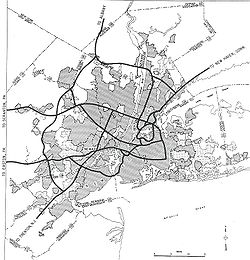
Interstate 280 is a 17.85 miles (28.73 km) Interstate Highway in the U.S. state
of New Jersey
. It provides a spur from I-80
in Parsippany-Troy Hills
, Morris County
to Newark
, and I-95
(the New Jersey Turnpike
in Kearny
, Hudson County
. In Kearny, access is provided toward the Holland Tunnel
and Lincoln Tunnel
to New York City
. The western part of the route runs through suburban areas of Morris and Essex
counties, crossing the Watchung Mountains
. Upon reaching The Oranges, the setting becomes more urbanized and I-280 runs along a depressed alignment before ascending again in Newark. I-280 includes a lift bridge
, the William A. Stickel Memorial Bridge
over the Passaic River
between Newark and Harrison
. The highway is sometimes called the Essex Freeway. I-280 interchanges with several roads, including the Garden State Parkway
in East Orange
and Route 21 in Newark.
A part of present-day I-280 in Newark west of the Stickel Bridge was legislated as Route 25A in 1939, a spur of Route 25 (U.S. Route 1/9
) that was to run from Jersey City
west to Newark. This portion of road would become Route 58
in 1953 (the Route 58 designation was removed in the 1990s). When the Interstate Highway System was being planned, the Route 3 freeway was planned to become an Interstate. The New Jersey State Highway Department favored the Essex Freeway instead between I-80 in Parsippany-Troy Hills to I-95 in Kearny instead. The latter would become the Interstate and be designated I-280. This road was built in the 1960s and be completed west from Newark in 1973. The portion east of Newark to the New Jersey Turnpike opened in 1980. I-280 was once planned to continue east to I-78
near the Holland Tunnel but never was extended east of the New Jersey Turnpike. In the 2000s, the Stickel Bridge was reconstructed after the original structure was determined to be structurally deficient.
and US 46
in Parsippany-Troy Hills
, Morris County
and heads southeast into wooded surroundings as a four-lane highway. The road comes to its first interchange with New Road before crossing the Whippany River
into East Hanover
. The freeway runs near some fields before heading back into woods and entering Roseland
, Essex County
at the crossing of the Passaic River
. Shortly after the Passaic River, I-280 has a cloverleaf interchange
with the Eisenhower Parkway
(CR 609). At this point, the roadway widens to six lanes and runs near wooded suburban areas before reaching CR 527
at another cloverleaf interchange. Past CR 527, I-280 makes a turn to the east before heading southeast into Livingston
and intersecting CR 634. Following this exit, the road enters West Orange
and passes through Second Watchung Mountain
in a cut. Past the mountain, the road heads back into suburban areas and comes to the exit for CR 636, where the highway widens to eight lanes here and heads east to an interchange with CR 577
. After CR 577, I-280 makes a sharp turn to the south and goes through First Watchung Mountain
in another cut, resuming into suburbs again and heading south-southeast as it comes interchanges at CR 660 and CR 508 Spur.
The terrain becomes urban soon after exit 10, when it enters Orange
. Here, I-280 narrows back to six lanes and heads onto a depressed alignment with frequent overpasses, running a short distance to the south of New Jersey Transit
’s Morristown Line
. Along this portion, the roadway has ramps to Essex Avenue, Day Street, and Center Street. Continuing into East Orange
, the freeway passes under more streets as it runs next to the Morristown Line, interchanging with Harrison Street and Clinton Street. At a full interchange with the Garden State Parkway
, I-280 also has access to CR 509
and Oraton Parkway. Following this junction, the highway widens to eight lanes before becoming ten lanes at the border with Newark
.
After crossing under more city streets, the roadway comes to exit 13, a left-side exit and entrance to and from the west accessing 1st Street and a ramp from the east to Orange Street. At this point, the total amount of lanes on the road decreases from ten to four and I-280 eastbound heads up and over the exit 13 ramps, rejoining the westbound lanes on a bridge over First Street, Orange Street and the Newark City Subway. As the road returns to surface level and begins to parallel the Morris & Essex Lines
and Montclair-Boonton Line
to the north, an unused bridge carries the western end of the 1954 section of freeway over the railroad to Orange Street east of Duryea Street. After this, I-280 passes under Clifton Avenue, which it has access to, and Nesbitt Street. It rises again to pass over Martin Luther King Boulevard, which is also has access to, Broad Street and Route 21. Just after a large interchange with Route 21, I-280 crosses the Passaic River again on the six-lane William A. Stickel Memorial Bridge
, a 125 feet (38.1 m) vertical lift bridge
, into Harrison
, Hudson County
.
I-280 continues to run just north of the railroad as a six-lane freeway through Harrison, reaching an interchange with CR 508
. The road continues southeast through urban surroundings before turning east and passing to the north of a railroad yard, splitting from the railroad line as it runs into Kearny
and enters the New Jersey Meadowlands
. At the final interchange with CR 508, I-280 has access to the Holland Tunnel
via Route 7, US 1/9 Truck and Route 139. Past CR 508, the freeway narrows to four lanes and comes to the toll plaza for the New Jersey Turnpike
(I-95
) at exit 15W, at which point I-280 ends. Full access is provided with the Western Spur of the New Jersey Turnpike, which carries through I-95 traffic; ramps to and from the north on the Eastern Spur of the New Jersey Turnpike allow for access to the Lincoln Tunnel
via Route 495.
 What is now the easternmost part of I-280 was legislated as Route 25A in 1939. This route was a branch of Route 25 (US 1/9
) that ran from Jersey City
west through Kearny and Harrison across the Passaic River and into Newark, connecting with Route 21 and Clifton Avenue. The William A. Stickel Memorial Bridge
opened in 1949, with approaches stretching east to Harrison Avenue (now CR 508) in Harrison (crossing Cleveland Avenue and Hamilton Street at-grade) and west beyond Route 21 to Broad Street. Route 25A was redesignated as Route 58
in the 1953 New Jersey state highway renumbering
, and the next year an extension opened west beyond Clifton Avenue to Orange Street east of Duryea Street.
Around the time the Stickel Bridge opened, the Essex Freeway was planned to connect US 46 in Morris County east to the New Jersey Turnpike in Hudson County, with the intention of alleviating traffic along Route 10. During planning for the Interstate Highway System
in the 1950s, the Bureau of Public Roads proposed an Interstate Highway along Route 3, to the north of Newark. The New Jersey State Highway Department countered with the proposed Essex Freeway, which would run from I-80 to the New Jersey Turnpike (I-95) via the existing Route 58, saying that the Route 3 corridor "does not meet Interstate standards, and cannot be economically converted to such standards." The Essex Freeway was selected as the interstate corridor, which was called FAI Corridor 105 before being designated I-280 in 1958.
Construction progressed slowly, starting in 1960 near Orange. There were many obstacles that had to be overcome when constructing I-280. The first was whether to build the highway on an elevated or depressed alignment through urbanized areas of East Orange and Newark. Following opposition to the elevated option, it was decided to build I-280 on a depressed alignment through the area. In addition, there was an issue of building the road across First Watchung Mountain in West Orange. A tunnel
had initially been considered, although the expense of such a project caused this alternative to be rejected. Instead, a rock cut along a longer route was built through the mountain. Much of the material that was excavated from this section of I-280 and east was removed via a temporary rail line that was built in the center of the right-of-way west to I-80. I-280 fully opened west from Newark to I-80 in Parsippany-Troy Hills in 1973. The portion of I-280 east of Newark was planned onto an alignment that would disrupt the fewest homes and would utilize existing railroad and utility right-of-way. The road east from Newark to the New Jersey Turnpike was completed in the 1980s. In the 1966 plans, I-280 was to continue east to I-78
in Jersey City near the Holland Tunnel, following the CR 508 and Route 7 corridors; this was planned again in the 1970s but never built.
In the 1990s, the Route 58 designation was officially removed from I-280 through Newark. In 2001, the state determined the Stickel Bridge over the Passaic River and its approaches were structurally deficient and was going to need to be replaced after sections of it were falling apart. Instead of replacing the bridge, in 2007 the NJDOT decided to rehabilitate it at a lower cost. Reconstruction of the bridge was completed in April 2009 at a cost of $33 million.
I-280, like many other highways in New Jersey, once had solar powered emergency call boxes every 1 miles (1.6 km), however with the advent of cell phones the usage of these call boxes became extremely limited. To save on maintenance costs, the NJDOT removed these call boxes in 2005.
!County
!Location
!Mile
!Exit
!Destinations
!Notes
|-
|rowspan=3|Morris
|rowspan=3|Parsippany-Troy Hills Township
|rowspan=2|0.00
|
|
|Westbound exit and eastbound entrance
|-
|
|
|Westbound exit and eastbound entrance
|-
|1.55
|1
|
|
|-
|rowspan=15|Essex
|rowspan=2|Boro of Roseland
|3.87
|4
|
|Signed as exits 4A (south) and 4B (north)
|-
|4.95
|5
|
|Signed as exits 5A (south) and 5B (north)
|-
|Livingston Township
|6.22
|6
|
|Signed as exits 6A (south) and 6B (north) westbound
|-
|rowspan=4|West Orange Township
|7.49
|7
|
|
|-
|8.23
|8
|
|Signed as exits 8A (south) and 8B (north)
|-
|9.64
|9
|
|Eastbound exit and westbound entrance
|-
|9.91
|10
|
|Westbound exit and eastbound entrance
|-
|City of Orange
|10.61-10.80
|11
|Center Street, Day Street, Essex Avenue - Orange
|Signed as exit 11B westbound
|-
|rowspan=2|East Orange
|11.48
|12A
|Harrison Street, Clinton Street - City of East Orange
|
|-
|12.32
|12B
|
|Toll station at ramp
|-
|rowspan=5|City of Newark
|13.18-13.40
|13
|1st Street, Orange Street, 6th Street - Branch Brook Park
, UMDNJ, NJIT
|
|-
|13.74
|14A
|Clifton Avenue
|No eastbound exit
|-
|14.11
|14B
|Martin Luther King Boulevard - Broad Street Station
, Rutgers University
, NJIT, Essex County College
|Signed as exit 14 eastbound; no westbound entrance
|-
|14.42-14.70
|15A
|
|Signed as exit 15 eastbound; no westbound entrance
|-
|14.70
|15B
|
|Westbound exit and eastbound entrance
|-
|rowspan=5|Hudson
|Town of Harrison
|14.92
|16
|
|
|-
|rowspan=4|Town of Kearny
|16.86
|17
|
|split into 17A and 17B
|-
|17.05
|colspan=3 align="center"|New Jersey Turnpike
Toll Plaza (Exit 15W)
|-
|17.25
|rowspan=2|18
|
|Eastbound exit and westbound entrance
|-
|17.85
|
|Eastbound exit and westbound entrance
U.S. state
A U.S. state is any one of the 50 federated states of the United States of America that share sovereignty with the federal government. Because of this shared sovereignty, an American is a citizen both of the federal entity and of his or her state of domicile. Four states use the official title of...
of New Jersey
New Jersey
New Jersey is a state in the Northeastern and Middle Atlantic regions of the United States. , its population was 8,791,894. It is bordered on the north and east by the state of New York, on the southeast and south by the Atlantic Ocean, on the west by Pennsylvania and on the southwest by Delaware...
. It provides a spur from I-80
Interstate 80 in New Jersey
Interstate 80 is a major Interstate Highway in the United States, running from the New York City Metropolitan Area westward to San Francisco, California...
in Parsippany-Troy Hills
Parsippany-Troy Hills, New Jersey
Parsippany-Troy Hills Township, commonly called Parsippany, is a township in Morris County, New Jersey, United States. As of the 2000 United States Census, the township population was 50,649. The name Parsippany comes from the Lenape Native American word parsipanong, which means "the place where...
, Morris County
Morris County, New Jersey
Morris County is a county located in the U.S. state of New Jersey, about west of New York City. According to the United States 2010 Census, the population was 492,276. It is part of the New York Metropolitan Area. Its county seat is Morristown....
to Newark
Newark, New Jersey
Newark is the largest city in the American state of New Jersey, and the seat of Essex County. As of the 2010 United States Census, Newark had a population of 277,140, maintaining its status as the largest municipality in New Jersey. It is the 68th largest city in the U.S...
, and I-95
Interstate 95 in New Jersey
Interstate 95 is a major Interstate Highway that traverses the full extent of the East Coast of the United States, from Florida to Maine...
(the New Jersey Turnpike
New Jersey Turnpike
The New Jersey Turnpike is a toll road in New Jersey, maintained by the New Jersey Turnpike Authority. According to the International Bridge, Tunnel and Turnpike Association, the Turnpike is the nation's sixth-busiest toll road and is among one of the most heavily traveled highways in the United...
in Kearny
Kearny, New Jersey
Kearny is a town in Hudson County, New Jersey, United States. It was named after Civil War general Philip Kearny. As of the United States 2010 Census, the town population was 40,684. The town is a suburb of the nearby city of Newark....
, Hudson County
Hudson County, New Jersey
Hudson County is the smallest county in New Jersey and one of the most densely populated in United States. It takes its name from the Hudson River, which creates part of its eastern border. Part of the New York metropolitan area, its county seat and largest city is Jersey City.- Municipalities...
. In Kearny, access is provided toward the Holland Tunnel
Holland Tunnel
The Holland Tunnel is a highway tunnel under the Hudson River connecting the island of Manhattan in New York City with Jersey City, New Jersey at Interstate 78 on the mainland. Unusual for an American public works project, it is not named for a government official, politician, or local hero or...
and Lincoln Tunnel
Lincoln Tunnel
The Lincoln Tunnel is a long tunnel under the Hudson River, connecting Weehawken, New Jersey and the borough of Manhattan in New York City.-History:...
to New York City
New York City
New York is the most populous city in the United States and the center of the New York Metropolitan Area, one of the most populous metropolitan areas in the world. New York exerts a significant impact upon global commerce, finance, media, art, fashion, research, technology, education, and...
. The western part of the route runs through suburban areas of Morris and Essex
Essex County, New Jersey
Essex County is a county located in the northeastern part of the U.S. state of New Jersey. As of the United States 2010 Census, the population was 783,969, ranking it third in the state after Bergen County and Middlesex County; Essex County's population has declined from 786,147 as of the bureau's...
counties, crossing the Watchung Mountains
Watchung Mountains
The Watchung Mountains are a group of three long low ridges of volcanic origin, between 400 ft. and 500 ft. high, lying parallel to each other in northern New Jersey in the United States...
. Upon reaching The Oranges, the setting becomes more urbanized and I-280 runs along a depressed alignment before ascending again in Newark. I-280 includes a lift bridge
Lift bridge
A vertical-lift bridge or lift bridge is a type of movable bridge in which a span rises vertically while remaining parallel with the deck....
, the William A. Stickel Memorial Bridge
William A. Stickel Memorial Bridge
The William A. Stickel Memorial Bridge is a vertical-lift bridge in New Jersey that crosses the Passaic River, connecting Newark and Harrison as part of Interstate 280....
over the Passaic River
Passaic River
The Passaic River is a mature surface river, approximately 80 mi long, in northern New Jersey in the United States. The river in its upper course flows in a highly circuitous route, meandering through the swamp lowlands between the ridge hills of rural and suburban northern New Jersey,...
between Newark and Harrison
Harrison, New Jersey
Harrison is a town in Hudson County, New Jersey, United States. As of the 2010 United States Census, the town's population was 13,620. The town is a suburb of the nearby city of Newark, New Jersey.-Geography:Harrison is located at ....
. The highway is sometimes called the Essex Freeway. I-280 interchanges with several roads, including the Garden State Parkway
Garden State Parkway
The Garden State Parkway is a 172.4-mile limited-access toll parkway that stretches the length of New Jersey from the New York line at Montvale, New Jersey, to Cape May at New Jersey's southernmost tip. Its name refers to New Jersey's nickname, the "Garden State." Most New Jersey residents refer...
in East Orange
East Orange, New Jersey
East Orange is a city in Essex County, New Jersey, United States. As of the 2010 United States Census the city's population 64,270, making it the state's 20th largest municipality, having dropped 5,554 residents from its population of 69,824 in the 2000 Census, when it was the state's 14th most...
and Route 21 in Newark.
A part of present-day I-280 in Newark west of the Stickel Bridge was legislated as Route 25A in 1939, a spur of Route 25 (U.S. Route 1/9
U.S. Route 1/9
U.S. Route 9 is a U.S. highway in the northeast United States, running from Laurel, Delaware north to the Canadian border near Champlain, New York...
) that was to run from Jersey City
Jersey City, New Jersey
Jersey City is the seat of Hudson County, New Jersey, United States.Part of the New York metropolitan area, Jersey City lies between the Hudson River and Upper New York Bay across from Lower Manhattan and the Hackensack River and Newark Bay...
west to Newark. This portion of road would become Route 58
New Jersey Route 58
Route 58 is a former state highway in the city of Newark, New Jersey and nearby borough of Harrison, New Jersey. The highway ran from Orange and Hecker Streets in Newark, eastbound as a four-lane freeway across the William A. Stickel Memorial Bridge to Harrison, where it terminated at an...
in 1953 (the Route 58 designation was removed in the 1990s). When the Interstate Highway System was being planned, the Route 3 freeway was planned to become an Interstate. The New Jersey State Highway Department favored the Essex Freeway instead between I-80 in Parsippany-Troy Hills to I-95 in Kearny instead. The latter would become the Interstate and be designated I-280. This road was built in the 1960s and be completed west from Newark in 1973. The portion east of Newark to the New Jersey Turnpike opened in 1980. I-280 was once planned to continue east to I-78
Interstate 78 in New Jersey
Interstate 78 is an east–west route stretching from Union Township, Lebanon County, Pennsylvania to New York City. In New Jersey, I-78 is called the Phillipsburg–Newark Expressway and the Newark Bay Extension of the New Jersey Turnpike...
near the Holland Tunnel but never was extended east of the New Jersey Turnpike. In the 2000s, the Stickel Bridge was reconstructed after the original structure was determined to be structurally deficient.
Route description
I-280 begins at I-80Interstate 80 in New Jersey
Interstate 80 is a major Interstate Highway in the United States, running from the New York City Metropolitan Area westward to San Francisco, California...
and US 46
U.S. Route 46
U.S. Route 46 is an east–west U.S. Highway, running for , completely within the state of New Jersey. The west end is at an interchange with Interstate 80 and Route 94 in Columbia, Warren County on the Delaware River...
in Parsippany-Troy Hills
Parsippany-Troy Hills, New Jersey
Parsippany-Troy Hills Township, commonly called Parsippany, is a township in Morris County, New Jersey, United States. As of the 2000 United States Census, the township population was 50,649. The name Parsippany comes from the Lenape Native American word parsipanong, which means "the place where...
, Morris County
Morris County, New Jersey
Morris County is a county located in the U.S. state of New Jersey, about west of New York City. According to the United States 2010 Census, the population was 492,276. It is part of the New York Metropolitan Area. Its county seat is Morristown....
and heads southeast into wooded surroundings as a four-lane highway. The road comes to its first interchange with New Road before crossing the Whippany River
Whippany River
The Whippany River is a tributary of the Rockaway River, approximately 20 mi long, in northern New Jersey in the United States....
into East Hanover
East Hanover, New Jersey
East Hanover Township is a township in Morris County, New Jersey, United States. As of the United States 2000 Census, the township population was 11,393. The town was incorporated in 1928. The headquarters of the Nabisco company and the pharmaceutical company Novartis are located in East...
. The freeway runs near some fields before heading back into woods and entering Roseland
Roseland, New Jersey
Roseland is a borough in western Essex County, New Jersey, United States. As of the 2010 United States Census, the borough population was 5,819...
, Essex County
Essex County, New Jersey
Essex County is a county located in the northeastern part of the U.S. state of New Jersey. As of the United States 2010 Census, the population was 783,969, ranking it third in the state after Bergen County and Middlesex County; Essex County's population has declined from 786,147 as of the bureau's...
at the crossing of the Passaic River
Passaic River
The Passaic River is a mature surface river, approximately 80 mi long, in northern New Jersey in the United States. The river in its upper course flows in a highly circuitous route, meandering through the swamp lowlands between the ridge hills of rural and suburban northern New Jersey,...
. Shortly after the Passaic River, I-280 has a cloverleaf interchange
Cloverleaf interchange
A cloverleaf interchange is a two-level interchange in which left turns, reverse direction in left-driving regions, are handled by ramp roads...
with the Eisenhower Parkway
Eisenhower Parkway
Eisenhower Parkway, also known as County Route 609, is a highway in Essex County, New Jersey, located in the municipalities of Roseland and Livingston...
(CR 609). At this point, the roadway widens to six lanes and runs near wooded suburban areas before reaching CR 527
County Route 527 (New Jersey)
County Route 527 is a county highway in the U.S. state of New Jersey. The highway extends from Main Street in Toms River Township to Pompton Avenue in Cedar Grove. It is the second longest county highway in New Jersey after Route 519. It was first given the number 527 in 1954...
at another cloverleaf interchange. Past CR 527, I-280 makes a turn to the east before heading southeast into Livingston
Livingston, New Jersey
Livingston is a township in Essex County, New Jersey, United States. As of the United States 2000 Census, the township population was 29,366.Livingston was incorporated as a township by an Act of the New Jersey Legislature on February 5, 1813, from portions of Caldwell Township and Springfield...
and intersecting CR 634. Following this exit, the road enters West Orange
West Orange, New Jersey
West Orange is a township in central Essex County, New Jersey, United States. As of the 2010 United States Census, the township population was 46,207...
and passes through Second Watchung Mountain
Watchung Mountains
The Watchung Mountains are a group of three long low ridges of volcanic origin, between 400 ft. and 500 ft. high, lying parallel to each other in northern New Jersey in the United States...
in a cut. Past the mountain, the road heads back into suburban areas and comes to the exit for CR 636, where the highway widens to eight lanes here and heads east to an interchange with CR 577
County Route 577 (New Jersey)
County Route 577, abbreviated CR 577, is a county highway in the U.S. state of New Jersey. The highway extends from Springfield Avenue in Springfield Township to Bloomfield Avenue in Verona.-Route description:...
. After CR 577, I-280 makes a sharp turn to the south and goes through First Watchung Mountain
Watchung Mountains
The Watchung Mountains are a group of three long low ridges of volcanic origin, between 400 ft. and 500 ft. high, lying parallel to each other in northern New Jersey in the United States...
in another cut, resuming into suburbs again and heading south-southeast as it comes interchanges at CR 660 and CR 508 Spur.
The terrain becomes urban soon after exit 10, when it enters Orange
Orange, New Jersey
The City of Orange is a city and township in Essex County, New Jersey, United States. As of the 2010 United States Census, the township population was 30,134...
. Here, I-280 narrows back to six lanes and heads onto a depressed alignment with frequent overpasses, running a short distance to the south of New Jersey Transit
New Jersey Transit
The New Jersey Transit Corporation is a statewide public transportation system serving the United States state of New Jersey, and New York, Orange, and Rockland counties in New York State...
’s Morristown Line
Morristown Line
The Morristown Line is one of New Jersey Transit's commuter lines and is one of two branches that run along the Morris and Essex Lines. Out of 60 inbound and 58 outbound daily weekday trains, 28 inbound and 26 outbound trains use the Kearny Connection to Secaucus Junction and New York Penn...
. Along this portion, the roadway has ramps to Essex Avenue, Day Street, and Center Street. Continuing into East Orange
East Orange, New Jersey
East Orange is a city in Essex County, New Jersey, United States. As of the 2010 United States Census the city's population 64,270, making it the state's 20th largest municipality, having dropped 5,554 residents from its population of 69,824 in the 2000 Census, when it was the state's 14th most...
, the freeway passes under more streets as it runs next to the Morristown Line, interchanging with Harrison Street and Clinton Street. At a full interchange with the Garden State Parkway
Garden State Parkway
The Garden State Parkway is a 172.4-mile limited-access toll parkway that stretches the length of New Jersey from the New York line at Montvale, New Jersey, to Cape May at New Jersey's southernmost tip. Its name refers to New Jersey's nickname, the "Garden State." Most New Jersey residents refer...
, I-280 also has access to CR 509
County Route 509 (New Jersey)
County Route 509 is a county highway in the U.S. state of New Jersey. The highway extends 25.78 miles from North Avenue in Westfield to Straight Street in Paterson....
and Oraton Parkway. Following this junction, the highway widens to eight lanes before becoming ten lanes at the border with Newark
Newark, New Jersey
Newark is the largest city in the American state of New Jersey, and the seat of Essex County. As of the 2010 United States Census, Newark had a population of 277,140, maintaining its status as the largest municipality in New Jersey. It is the 68th largest city in the U.S...
.
After crossing under more city streets, the roadway comes to exit 13, a left-side exit and entrance to and from the west accessing 1st Street and a ramp from the east to Orange Street. At this point, the total amount of lanes on the road decreases from ten to four and I-280 eastbound heads up and over the exit 13 ramps, rejoining the westbound lanes on a bridge over First Street, Orange Street and the Newark City Subway. As the road returns to surface level and begins to parallel the Morris & Essex Lines
Morris & Essex Lines
The Morris & Essex Lines are a group of former Delaware, Lackawanna and Western Railroad railroad lines in New Jersey now owned and operated by New Jersey Transit...
and Montclair-Boonton Line
Montclair-Boonton Line
The Montclair-Boonton Line is a commuter rail line of New Jersey Transit Rail Operations. It is part of the Hoboken Division. The line is a consolidation of three individual lines: the former Delaware, Lackawanna & Western Railroad's Montclair Branch, which ran from Hoboken Terminal to Bay Street,...
to the north, an unused bridge carries the western end of the 1954 section of freeway over the railroad to Orange Street east of Duryea Street. After this, I-280 passes under Clifton Avenue, which it has access to, and Nesbitt Street. It rises again to pass over Martin Luther King Boulevard, which is also has access to, Broad Street and Route 21. Just after a large interchange with Route 21, I-280 crosses the Passaic River again on the six-lane William A. Stickel Memorial Bridge
William A. Stickel Memorial Bridge
The William A. Stickel Memorial Bridge is a vertical-lift bridge in New Jersey that crosses the Passaic River, connecting Newark and Harrison as part of Interstate 280....
, a 125 feet (38.1 m) vertical lift bridge
Lift bridge
A vertical-lift bridge or lift bridge is a type of movable bridge in which a span rises vertically while remaining parallel with the deck....
, into Harrison
Harrison, New Jersey
Harrison is a town in Hudson County, New Jersey, United States. As of the 2010 United States Census, the town's population was 13,620. The town is a suburb of the nearby city of Newark, New Jersey.-Geography:Harrison is located at ....
, Hudson County
Hudson County, New Jersey
Hudson County is the smallest county in New Jersey and one of the most densely populated in United States. It takes its name from the Hudson River, which creates part of its eastern border. Part of the New York metropolitan area, its county seat and largest city is Jersey City.- Municipalities...
.
I-280 continues to run just north of the railroad as a six-lane freeway through Harrison, reaching an interchange with CR 508
County Route 508 (New Jersey)
County Route 508 is a county highway in the U.S. state of New Jersey. The highway extends 16.14 miles from Mount Pleasant Avenue in Livingston to Belleville Turnpike in Kearny.-Essex County:...
. The road continues southeast through urban surroundings before turning east and passing to the north of a railroad yard, splitting from the railroad line as it runs into Kearny
Kearny, New Jersey
Kearny is a town in Hudson County, New Jersey, United States. It was named after Civil War general Philip Kearny. As of the United States 2010 Census, the town population was 40,684. The town is a suburb of the nearby city of Newark....
and enters the New Jersey Meadowlands
New Jersey Meadowlands
New Jersey Meadowlands, also known as the Hackensack Meadowlands after the primary river flowing through it, is a general name for the large ecosystem of wetlands in northeast New Jersey in the United States. The Meadowlands are known for being the site of large landfills and decades of...
. At the final interchange with CR 508, I-280 has access to the Holland Tunnel
Holland Tunnel
The Holland Tunnel is a highway tunnel under the Hudson River connecting the island of Manhattan in New York City with Jersey City, New Jersey at Interstate 78 on the mainland. Unusual for an American public works project, it is not named for a government official, politician, or local hero or...
via Route 7, US 1/9 Truck and Route 139. Past CR 508, the freeway narrows to four lanes and comes to the toll plaza for the New Jersey Turnpike
New Jersey Turnpike
The New Jersey Turnpike is a toll road in New Jersey, maintained by the New Jersey Turnpike Authority. According to the International Bridge, Tunnel and Turnpike Association, the Turnpike is the nation's sixth-busiest toll road and is among one of the most heavily traveled highways in the United...
(I-95
Interstate 95 in New Jersey
Interstate 95 is a major Interstate Highway that traverses the full extent of the East Coast of the United States, from Florida to Maine...
) at exit 15W, at which point I-280 ends. Full access is provided with the Western Spur of the New Jersey Turnpike, which carries through I-95 traffic; ramps to and from the north on the Eastern Spur of the New Jersey Turnpike allow for access to the Lincoln Tunnel
Lincoln Tunnel
The Lincoln Tunnel is a long tunnel under the Hudson River, connecting Weehawken, New Jersey and the borough of Manhattan in New York City.-History:...
via Route 495.
History
U.S. Route 1/9
U.S. Route 9 is a U.S. highway in the northeast United States, running from Laurel, Delaware north to the Canadian border near Champlain, New York...
) that ran from Jersey City
Jersey City, New Jersey
Jersey City is the seat of Hudson County, New Jersey, United States.Part of the New York metropolitan area, Jersey City lies between the Hudson River and Upper New York Bay across from Lower Manhattan and the Hackensack River and Newark Bay...
west through Kearny and Harrison across the Passaic River and into Newark, connecting with Route 21 and Clifton Avenue. The William A. Stickel Memorial Bridge
William A. Stickel Memorial Bridge
The William A. Stickel Memorial Bridge is a vertical-lift bridge in New Jersey that crosses the Passaic River, connecting Newark and Harrison as part of Interstate 280....
opened in 1949, with approaches stretching east to Harrison Avenue (now CR 508) in Harrison (crossing Cleveland Avenue and Hamilton Street at-grade) and west beyond Route 21 to Broad Street. Route 25A was redesignated as Route 58
New Jersey Route 58
Route 58 is a former state highway in the city of Newark, New Jersey and nearby borough of Harrison, New Jersey. The highway ran from Orange and Hecker Streets in Newark, eastbound as a four-lane freeway across the William A. Stickel Memorial Bridge to Harrison, where it terminated at an...
in the 1953 New Jersey state highway renumbering
1953 New Jersey state highway renumbering
On January 1, 1953, the New Jersey Department of Transportation renumbered many of the State Routes. A few rules were followed in deciding what to renumber:...
, and the next year an extension opened west beyond Clifton Avenue to Orange Street east of Duryea Street.
Around the time the Stickel Bridge opened, the Essex Freeway was planned to connect US 46 in Morris County east to the New Jersey Turnpike in Hudson County, with the intention of alleviating traffic along Route 10. During planning for the Interstate Highway System
Interstate Highway System
The Dwight D. Eisenhower National System of Interstate and Defense Highways, , is a network of limited-access roads including freeways, highways, and expressways forming part of the National Highway System of the United States of America...
in the 1950s, the Bureau of Public Roads proposed an Interstate Highway along Route 3, to the north of Newark. The New Jersey State Highway Department countered with the proposed Essex Freeway, which would run from I-80 to the New Jersey Turnpike (I-95) via the existing Route 58, saying that the Route 3 corridor "does not meet Interstate standards, and cannot be economically converted to such standards." The Essex Freeway was selected as the interstate corridor, which was called FAI Corridor 105 before being designated I-280 in 1958.
Construction progressed slowly, starting in 1960 near Orange. There were many obstacles that had to be overcome when constructing I-280. The first was whether to build the highway on an elevated or depressed alignment through urbanized areas of East Orange and Newark. Following opposition to the elevated option, it was decided to build I-280 on a depressed alignment through the area. In addition, there was an issue of building the road across First Watchung Mountain in West Orange. A tunnel
Tunnel
A tunnel is an underground passageway, completely enclosed except for openings for egress, commonly at each end.A tunnel may be for foot or vehicular road traffic, for rail traffic, or for a canal. Some tunnels are aqueducts to supply water for consumption or for hydroelectric stations or are sewers...
had initially been considered, although the expense of such a project caused this alternative to be rejected. Instead, a rock cut along a longer route was built through the mountain. Much of the material that was excavated from this section of I-280 and east was removed via a temporary rail line that was built in the center of the right-of-way west to I-80. I-280 fully opened west from Newark to I-80 in Parsippany-Troy Hills in 1973. The portion of I-280 east of Newark was planned onto an alignment that would disrupt the fewest homes and would utilize existing railroad and utility right-of-way. The road east from Newark to the New Jersey Turnpike was completed in the 1980s. In the 1966 plans, I-280 was to continue east to I-78
Interstate 78 in New Jersey
Interstate 78 is an east–west route stretching from Union Township, Lebanon County, Pennsylvania to New York City. In New Jersey, I-78 is called the Phillipsburg–Newark Expressway and the Newark Bay Extension of the New Jersey Turnpike...
in Jersey City near the Holland Tunnel, following the CR 508 and Route 7 corridors; this was planned again in the 1970s but never built.
In the 1990s, the Route 58 designation was officially removed from I-280 through Newark. In 2001, the state determined the Stickel Bridge over the Passaic River and its approaches were structurally deficient and was going to need to be replaced after sections of it were falling apart. Instead of replacing the bridge, in 2007 the NJDOT decided to rehabilitate it at a lower cost. Reconstruction of the bridge was completed in April 2009 at a cost of $33 million.
I-280, like many other highways in New Jersey, once had solar powered emergency call boxes every 1 miles (1.6 km), however with the advent of cell phones the usage of these call boxes became extremely limited. To save on maintenance costs, the NJDOT removed these call boxes in 2005.
Exit list
{| class=wikitable!County
!Location
!Mile
!Exit
Exit number
An exit number is a number assigned to a road junction, usually an exit from a freeway. It is usually marked on the same sign as the destinations of the exit, as well as a sign in the gore....
!Destinations
!Notes
|-
|rowspan=3|Morris
Morris County, New Jersey
Morris County is a county located in the U.S. state of New Jersey, about west of New York City. According to the United States 2010 Census, the population was 492,276. It is part of the New York Metropolitan Area. Its county seat is Morristown....
|rowspan=3|Parsippany-Troy Hills Township
Parsippany-Troy Hills, New Jersey
Parsippany-Troy Hills Township, commonly called Parsippany, is a township in Morris County, New Jersey, United States. As of the 2000 United States Census, the township population was 50,649. The name Parsippany comes from the Lenape Native American word parsipanong, which means "the place where...
|rowspan=2|0.00
|
|
|Westbound exit and eastbound entrance
|-
|
|
|Westbound exit and eastbound entrance
|-
|1.55
|1
|
|
|-
|rowspan=15|Essex
Essex County, New Jersey
Essex County is a county located in the northeastern part of the U.S. state of New Jersey. As of the United States 2010 Census, the population was 783,969, ranking it third in the state after Bergen County and Middlesex County; Essex County's population has declined from 786,147 as of the bureau's...
|rowspan=2|Boro of Roseland
Roseland, New Jersey
Roseland is a borough in western Essex County, New Jersey, United States. As of the 2010 United States Census, the borough population was 5,819...
|3.87
|4
|
|Signed as exits 4A (south) and 4B (north)
|-
|4.95
|5
|
|Signed as exits 5A (south) and 5B (north)
|-
|Livingston Township
|6.22
|6
|
|Signed as exits 6A (south) and 6B (north) westbound
|-
|rowspan=4|West Orange Township
|7.49
|7
|
|
|-
|8.23
|8
|
|Signed as exits 8A (south) and 8B (north)
|-
|9.64
|9
|
|Eastbound exit and westbound entrance
|-
|9.91
|10
|
|Westbound exit and eastbound entrance
|-
|City of Orange
Orange, New Jersey
The City of Orange is a city and township in Essex County, New Jersey, United States. As of the 2010 United States Census, the township population was 30,134...
|10.61-10.80
|11
|Center Street, Day Street, Essex Avenue - Orange
Orange, New Jersey
The City of Orange is a city and township in Essex County, New Jersey, United States. As of the 2010 United States Census, the township population was 30,134...
|Signed as exit 11B westbound
|-
|rowspan=2|East Orange
East Orange, New Jersey
East Orange is a city in Essex County, New Jersey, United States. As of the 2010 United States Census the city's population 64,270, making it the state's 20th largest municipality, having dropped 5,554 residents from its population of 69,824 in the 2000 Census, when it was the state's 14th most...
|11.48
|12A
|Harrison Street, Clinton Street - City of East Orange
East Orange, New Jersey
East Orange is a city in Essex County, New Jersey, United States. As of the 2010 United States Census the city's population 64,270, making it the state's 20th largest municipality, having dropped 5,554 residents from its population of 69,824 in the 2000 Census, when it was the state's 14th most...
|
|-
|12.32
|12B
|
|Toll station at ramp
|-
|rowspan=5|City of Newark
Newark, New Jersey
Newark is the largest city in the American state of New Jersey, and the seat of Essex County. As of the 2010 United States Census, Newark had a population of 277,140, maintaining its status as the largest municipality in New Jersey. It is the 68th largest city in the U.S...
|13.18-13.40
|13
|1st Street, Orange Street, 6th Street - Branch Brook Park
Branch Brook Park
Branch Brook Park is a county park of Essex County, New Jersey in the United States, located in the North Ward of Newark, between the neighborhoods of Forest Hill and Roseville. At 360 acres , Branch Brook Park is the largest public park in the city of Newark...
, UMDNJ, NJIT
|
|-
|13.74
|14A
|Clifton Avenue
|No eastbound exit
|-
|14.11
|14B
|Martin Luther King Boulevard - Broad Street Station
Broad Street Station (Newark)
Newark Broad Street is a New Jersey Transit commuter rail station at 25 University Avenue in Newark, New Jersey. Built in 1901-03 on the Delaware, Lackawanna and Western Railroad main line from Hoboken to Denville, Scranton and Buffalo, the station's historic architecture includes an elegant clock...
, Rutgers University
Rutgers-Newark
Rutgers University in Newark is one of three campuses of Rutgers, The State University of New Jersey, the eighth oldest college in the United States and a member of the Association of American Universities...
, NJIT, Essex County College
Essex County College
Essex County College is an open-door, public two-year college located in Essex County, New Jersey, United States. It is committed to providing quality educational programs and life-long learning activities at the most affordable cost. The college is open to students with a wide variety of...
|Signed as exit 14 eastbound; no westbound entrance
|-
|14.42-14.70
|15A
|
|Signed as exit 15 eastbound; no westbound entrance
|-
|14.70
|15B
|
|Westbound exit and eastbound entrance
|-
|rowspan=5|Hudson
Hudson County, New Jersey
Hudson County is the smallest county in New Jersey and one of the most densely populated in United States. It takes its name from the Hudson River, which creates part of its eastern border. Part of the New York metropolitan area, its county seat and largest city is Jersey City.- Municipalities...
|Town of Harrison
Harrison, New Jersey
Harrison is a town in Hudson County, New Jersey, United States. As of the 2010 United States Census, the town's population was 13,620. The town is a suburb of the nearby city of Newark, New Jersey.-Geography:Harrison is located at ....
|14.92
|16
|
|
|-
|rowspan=4|Town of Kearny
Kearny, New Jersey
Kearny is a town in Hudson County, New Jersey, United States. It was named after Civil War general Philip Kearny. As of the United States 2010 Census, the town population was 40,684. The town is a suburb of the nearby city of Newark....
|16.86
|17
|
|split into 17A and 17B
|-
|17.05
|colspan=3 align="center"|New Jersey Turnpike
New Jersey Turnpike
The New Jersey Turnpike is a toll road in New Jersey, maintained by the New Jersey Turnpike Authority. According to the International Bridge, Tunnel and Turnpike Association, the Turnpike is the nation's sixth-busiest toll road and is among one of the most heavily traveled highways in the United...
Toll Plaza (Exit 15W)
|-
|17.25
|rowspan=2|18
|
|Eastbound exit and westbound entrance
|-
|17.85
|
|Eastbound exit and westbound entrance
See also
- Route 25Route 25 (New Jersey)Route 25 was a major state highway in New Jersey, United States prior to the 1953 renumbering, running from the Benjamin Franklin Bridge in Camden to the Holland Tunnel in Jersey City. The number was retired in the renumbering, as the whole road was followed by various U.S. Routes - U.S...
- Route 25AD