
.gif)
Interstate 275 (Ohio)
Encyclopedia
Interstate 275 is an 83.71 miles (134.7 km) loop in Ohio
, Indiana
, and Kentucky
that forms a complete beltway around the Cincinnati, Ohio
area. It is the only auxiliary interstate that enters three states, including one state that the parent route does not enter (Indiana). It is the longest loop interstate highway in the United States. For a short distance in northwest Hamilton County
it overlaps
with I-74
and US 52.
I-275 is signed as the "Cincinnati By-Pass" and officially known as the Donald H. Rolf Circle Freeway in Ohio, after a state senator, but locals rarely use these names, instead simply referring to it as "two-seventy-five." In 2011, Kentucky named their segment the Ronald Reagan Highway.
, with Kentucky Route 212
(KY 212) used as the service road to and from the airport. Then near Hebron
, west of the airport, I-275 has an interchange with Kentucky Route 237
(KY 237), before passing over the Ohio River
into Indiana.
(US 50)/State Road 1
(SR 1). I-275 heads northeast towards Ohio, at the Ohio state line I-275 passes over US 50.
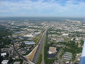 I-275 heads northeast towards Springdale
. I-275 has a short concurrency
with Interstate 74 (I-74). When the concurrency ends, I-275 has an intersection with Ohio State Route 126 (Ronald Reagan Cross County Highway). Then I-275 has an interchanges with U.S. Route 27 (US 27) and U.S. Route 127 (US 127). I-275 turns east having an interchange with State Route 4, State Route 747
, Interstate 75
, and U.S. Route 42. I-275 turns southeast having an interchange with Interstate 71 and U.S. Route 22. I-275 passes through over the Little Miami River
and I-275 turns due south toward Milford
. I-275 then has interchanges with State Route 450, State Route 32, and State Road 125
. I-275 turns due west towards Kentucky, passing through a short concurrency with U.S. Route 52 (US 52), before crossing over the Ohio River into Kentucky.
. I-275 has an interchange with Interstate 471
(I-471) near Highland Heights. I-275 turns due west towards Crestview Hills
, passing through an interchange with Kentucky Route 9 (KY 9), Kentucky Route 16
(KY 16), and Kentucky Route 17
(KY 17). In Crestview Hills I-275 has an interchange with U.S. Route 25/U.S. Route 42/U.S. Route 127. I-275 turns northeast towards Interstate 71/Interstate 75.
Ohio
Ohio is a Midwestern state in the United States. The 34th largest state by area in the U.S.,it is the 7th‑most populous with over 11.5 million residents, containing several major American cities and seven metropolitan areas with populations of 500,000 or more.The state's capital is Columbus...
, Indiana
Indiana
Indiana is a US state, admitted to the United States as the 19th on December 11, 1816. It is located in the Midwestern United States and Great Lakes Region. With 6,483,802 residents, the state is ranked 15th in population and 16th in population density. Indiana is ranked 38th in land area and is...
, and Kentucky
Kentucky
The Commonwealth of Kentucky is a state located in the East Central United States of America. As classified by the United States Census Bureau, Kentucky is a Southern state, more specifically in the East South Central region. Kentucky is one of four U.S. states constituted as a commonwealth...
that forms a complete beltway around the Cincinnati, Ohio
Cincinnati, Ohio
Cincinnati is a city in the U.S. state of Ohio. Cincinnati is the county seat of Hamilton County. Settled in 1788, the city is located to north of the Ohio River at the Ohio-Kentucky border, near Indiana. The population within city limits is 296,943 according to the 2010 census, making it Ohio's...
area. It is the only auxiliary interstate that enters three states, including one state that the parent route does not enter (Indiana). It is the longest loop interstate highway in the United States. For a short distance in northwest Hamilton County
Hamilton County, Ohio
As of 2000, there were 845,303 people, 346,790 households, and 212,582 families residing in the county. The population density was 2,075 people per square mile . There were 373,393 housing units at an average density of 917 per square mile...
it overlaps
Concurrency (road)
A concurrency, overlap, or coincidence in a road network is an instance of one physical road bearing two or more different highway, motorway, or other route numbers...
with I-74
Interstate 74
Interstate 74 is an Interstate Highway in the Midwestern and Southeastern United States. Its western end is at an intersection with Interstate 80 in Davenport, Iowa; the eastern end of its Midwest segment is at an intersection with Interstate 75 in Cincinnati, Ohio...
and US 52.
I-275 is signed as the "Cincinnati By-Pass" and officially known as the Donald H. Rolf Circle Freeway in Ohio, after a state senator, but locals rarely use these names, instead simply referring to it as "two-seventy-five." In 2011, Kentucky named their segment the Ronald Reagan Highway.
I-71/I-75 to Indiana
I-275 heads west toward Indiana passing by the Cincinnati/Northern Kentucky International AirportCincinnati/Northern Kentucky International Airport
Cincinnati/Northern Kentucky International Airport , sometimes called the Greater Cincinnati Airport is located in Hebron, unincorporated Boone County, Kentucky, United States and serves the Greater Cincinnati metropolitan area. Despite being located in Boone County, the airport operations are...
, with Kentucky Route 212
Kentucky Route 212
Kentucky Route 212 is a long north–south state highway linking Interstate 275 to the Cincinnati/Northern Kentucky International Airport in Boone County, Kentucky. It forms off KY 20 and immediately intersects with I-275...
(KY 212) used as the service road to and from the airport. Then near Hebron
Hebron, Kentucky
Hebron is an unincorporated community in Boone County, Kentucky, United States. It is the location of Cincinnati/Northern Kentucky International Airport, which serves Cincinnati and the tri-state area.- Growth :...
, west of the airport, I-275 has an interchange with Kentucky Route 237
Kentucky Route 237
Kentucky Route 237 is a long state highway in Boone County, Kentucky, connecting the Florence/Burlington area with Hebron. The southern terminus of the route is at KY 536 in Florence. The northern terminus is at KY 8 near Hebron...
(KY 237), before passing over the Ohio River
Ohio River
The Ohio River is the largest tributary, by volume, of the Mississippi River. At the confluence, the Ohio is even bigger than the Mississippi and, thus, is hydrologically the main stream of the whole river system, including the Allegheny River further upstream...
into Indiana.
Indiana
In Indiana I-275 passes through rural area with only one interchange and it is at U.S. Route 50U.S. Route 50 in Indiana
In the U.S. state of Indiana, U.S. Route 50 is a major east–west route. It enters Indiana from Illinois and leaves Indiana into Ohio.- Route description :...
(US 50)/State Road 1
Indiana State Road 1
State Road 1 is a north–south state highway in the eastern portion of the U.S. state of Indiana. Its southern terminus is at U.S. Highway 50 in east-central Dearborn County, just east of Lawrenceburg. Its northern terminus is at U.S...
(SR 1). I-275 heads northeast towards Ohio, at the Ohio state line I-275 passes over US 50.
Ohio
Springdale, Ohio
As of the census of 2000, there were 10,563 people, 4,421 households, and 2,816 families residing in the city. The population density was 2,131.0 people per square mile . There were 4,607 housing units at an average density of 929.4 per square mile...
. I-275 has a short concurrency
Concurrency (road)
A concurrency, overlap, or coincidence in a road network is an instance of one physical road bearing two or more different highway, motorway, or other route numbers...
with Interstate 74 (I-74). When the concurrency ends, I-275 has an intersection with Ohio State Route 126 (Ronald Reagan Cross County Highway). Then I-275 has an interchanges with U.S. Route 27 (US 27) and U.S. Route 127 (US 127). I-275 turns east having an interchange with State Route 4, State Route 747
Ohio State Route 747
State Route 747 is a north–south state highway in the southwestern portion of the U.S. state of Ohio. It connects with State Route 4 at both ends, from a signalized intersection in Glendale at the south end to a signalized intersection approximately west of State Route 63 near Monroe at...
, Interstate 75
Interstate 75 in Ohio
In the U.S. state of Ohio, Interstate 75 runs from Cincinnati to Toledo by way of Dayton. I-75 enters Ohio concurrent with I-71 from Kentucky on the Brent Spence Bridge over the Ohio River and into the Bluegrass region...
, and U.S. Route 42. I-275 turns southeast having an interchange with Interstate 71 and U.S. Route 22. I-275 passes through over the Little Miami River
Little Miami River
The Little Miami River is a Class I tributary of the Ohio River that flows through five counties in southwestern Ohio in the United States. The Little Miami joins the Ohio River east of Cincinnati. It forms parts of the borders between Hamilton and Clermont counties and between Hamilton and Warren...
and I-275 turns due south toward Milford
Milford, Ohio
Milford is a city in Clermont and Hamilton counties in the U.S. state of Ohio, along the Little Miami River in the southwestern part of the state. It is a part of Greater Cincinnati. Milford, an abbreviated form of mill ford, was so named because it was the first safe ford across the Little Miami...
. I-275 then has interchanges with State Route 450, State Route 32, and State Road 125
Ohio State Route 125
State Route 125 is an east–west state highway in the southwestern portion of the U.S. state of Ohio. Its western terminus is within the Cincinnati city limits, about east of downtown, at U.S. Route 50 – this is also the western terminus of State Route 32 and the southern terminus of State...
. I-275 turns due west towards Kentucky, passing through a short concurrency with U.S. Route 52 (US 52), before crossing over the Ohio River into Kentucky.
Ohio to I-71/I-75
From Ohio I-275 heads southwest towards Highland HeightsHighland Heights, Kentucky
Highland Heights is a city in Campbell County, Kentucky, United States. The population was 6,554 at the 2000 census.Highland Heights is home to Northern Kentucky University...
. I-275 has an interchange with Interstate 471
Interstate 471
Interstate 471 is a long United States Interstate Highway, linking Interstate 71 in downtown Cincinnati, Ohio to Interstate 275 in Highland Heights, Kentucky. South of I-275, the expressway continues south to U.S...
(I-471) near Highland Heights. I-275 turns due west towards Crestview Hills
Crestview Hills, Kentucky
Crestview Hills is a city in Kenton County, Kentucky, United States. The population was 2,889 at the 2000 census.-Geography:Crestview Hills is located at ....
, passing through an interchange with Kentucky Route 9 (KY 9), Kentucky Route 16
Kentucky Route 16
Kentucky Route 16 is a state highway in the U.S. state of Kentucky. It follows a southwest-northeast course, paralleling Interstate 71 from U.S. Highway 127 at Glencoe northeast to Walton and continuing northeast and north into Covington, where it ends at KY 17.- Route Names :Gallatin CountyU.S...
(KY 16), and Kentucky Route 17
Kentucky Route 17
Kentucky Route 17 is a state highway that runs from the small town of Catawba, in unincorporated Pendleton County to the Kentucky/Ohio border in Covington. The road begins by branching off U.S. 27 in Catawba, about four miles north of Falmouth. The road heads north with a slight bend west. The...
(KY 17). In Crestview Hills I-275 has an interchange with U.S. Route 25/U.S. Route 42/U.S. Route 127. I-275 turns northeast towards Interstate 71/Interstate 75.