

Ingenio, Las Palmas
Encyclopedia
| Municipality of Ingenio | |
| Map | |
|---|---|
 |
|
| Statistics | |
| Autonomous region: | Canary Islands Canary Islands The Canary Islands , also known as the Canaries , is a Spanish archipelago located just off the northwest coast of mainland Africa, 100 km west of the border between Morocco and the Western Sahara. The Canaries are a Spanish autonomous community and an outermost region of the European Union... |
| Province: | Las Palmas Las Palmas (province) The Province of Las Palmas is a province of Spain, consisting of the eastern part of the autonomous community of the Canary Islands.-Composition:... |
| Island: | Gran Canaria Gran Canaria Gran Canaria is the second most populous island of the Canary Islands, with a population of 838,397 which constitutes approximately 40% of the population of the archipelago... |
| Area Area Area is a quantity that expresses the extent of a two-dimensional surface or shape in the plane. Area can be understood as the amount of material with a given thickness that would be necessary to fashion a model of the shape, or the amount of paint necessary to cover the surface with a single coat... : |
38.15 km² some reads 38.83 km² |
| Population Population A population is all the organisms that both belong to the same group or species and live in the same geographical area. The area that is used to define a sexual population is such that inter-breeding is possible between any pair within the area and more probable than cross-breeding with individuals... : |
26,857 (2004) |
| Population density Population density Population density is a measurement of population per unit area or unit volume. It is frequently applied to living organisms, and particularly to humans... : |
691.66/km² |
| Elevation Elevation The elevation of a geographic location is its height above a fixed reference point, most commonly a reference geoid, a mathematical model of the Earth's sea level as an equipotential gravitational surface .... : Lowest: Centre: Highest: |
Atlantic Ocean Atlantic Ocean The Atlantic Ocean is the second-largest of the world's oceanic divisions. With a total area of about , it covers approximately 20% of the Earth's surface and about 26% of its water surface area... 558 m western part |
| Location Geographic coordinate system A geographic coordinate system is a coordinate system that enables every location on the Earth to be specified by a set of numbers. The coordinates are often chosen such that one of the numbers represent vertical position, and two or three of the numbers represent horizontal position... : |
27.91667/27°55' N lat. 15.41667/15°25' W long. |
| Municipal code: | E-35011 |
| Car designation: | GC until 2001 |
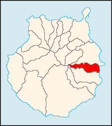
Ingenio is a Canarian municipality in the eastern portion of the island of Gran Canaria
Gran Canaria
Gran Canaria is the second most populous island of the Canary Islands, with a population of 838,397 which constitutes approximately 40% of the population of the archipelago...
in the Las Palmas
Las Palmas (province)
The Province of Las Palmas is a province of Spain, consisting of the eastern part of the autonomous community of the Canary Islands.-Composition:...
province in the Canary Islands
Canary Islands
The Canary Islands , also known as the Canaries , is a Spanish archipelago located just off the northwest coast of mainland Africa, 100 km west of the border between Morocco and the Western Sahara. The Canaries are a Spanish autonomous community and an outermost region of the European Union...
. The population is 26,857 (ISTAC, 2003), its density is 692.87/km² and the area is 38.15 km².
Ingenio is situated between the mountains and the Atlantic Ocean, south of Las Palmas de Gran Canaria and Telde and is accessed with the GC1
GC1 (Gran Canaria)
The GC1 is a superhighway on the island of Gran Canaria. It links the capital Las Palmas in the north with Puerto Rico in the south. It is the fastest route from the top of the island to the bottom and vice versa with a top speed limit of 120 km/h...
highway. The main industries are agriculture and tourism. Farmlands are situated in the valleys while the mountains covers west of the town centre. Residential developments have replaced part of the farmlands.
In agriculture, sugar cane is one of the dominant crops in Ingenio.
The municipality is home to the International Folklore Festival which has the participation of music groups worldwide including Mexico, Colombia, Romania, Russia and Uganda.
Geography
- Location:
- Latitude: 27.91667 (27°55') N
- Longitude: 15.41667 (15°25') W
- Altitude:
- Lowest: eastern part
- Centre: 558 m
- Highest: southwestern part
Historical population
| Year | Population | Density |
|---|---|---|
| 1991 | 21,807 | - |
| 1996 | 24,394 | - |
| 2001 | 24,439 | 643.13/km² |
| 2002 | 25,681 | - |
| 2003 | 26,433 | 692.87/km² |
| 2004 | 26,857 | 691.66/km² |
Other
Ingenio has schools, lyceums, a few gymnasia, churches, a post office and squares (plaza).External links
- Villa de Ingenio
- Map and aerial photos
- Street map from Mapquest, MapPoint, Google or Yahoo! Maps
- Google or Microsoft Virtual Earth - image now available
- Coordinates: 27°55′0"N 15°25′0"W
See also
| North: Telde Telde, Las Palmas Telde is a municipality in the eastern on the island of Gran Canaria, Canary Islands, Spain. The suburb of Las Palmas city. It is the second most populated municipality on the island, with a population of 100,015... |
||
| West: Valsequillo | Ingenio | East: Atlantic Ocean Atlantic Ocean The Atlantic Ocean is the second-largest of the world's oceanic divisions. With a total area of about , it covers approximately 20% of the Earth's surface and about 26% of its water surface area... |
| South: Agüimes Agüimes, Las Palmas Agüimes is a Canarian municipality in the eastern portion of the island of Gran Canaria in the Las Palmas province in the Canary Islands. The population is 23,572 , its density is 297.33/km² and the area is 79.28 km². The elevation is 275 m. Agüimes is situated between the mountains and the... |