
Indiana State Road 70
Encyclopedia
State Road 70 in the U.S. state
of Indiana
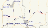
consists of two discontinuous east–west segments of two-lane rural roadway. State Road 70 passes through no cities or towns of significant size.
, from U.S. Route 231
at the west end through the unincorporated town of Newtonville
to State Road 66
at the east end.
, from State Road 37
at the west end to State Road 66 in the community of Derby
, on the banks of the Ohio River
, at the east end.
|colspan=5 align=center|Gap in route
U.S. state
A U.S. state is any one of the 50 federated states of the United States of America that share sovereignty with the federal government. Because of this shared sovereignty, an American is a citizen both of the federal entity and of his or her state of domicile. Four states use the official title of...
of Indiana
Indiana
Indiana is a US state, admitted to the United States as the 19th on December 11, 1816. It is located in the Midwestern United States and Great Lakes Region. With 6,483,802 residents, the state is ranked 15th in population and 16th in population density. Indiana is ranked 38th in land area and is...
consists of two discontinuous east–west segments of two-lane rural roadway. State Road 70 passes through no cities or towns of significant size.
Western segment
The western segment is about 10 miles (16.1 km) long and is relatively straight; it runs entirely within the boundaries of Spencer CountySpencer County, Indiana
As of the census of 2000, there were 20,391 people, 7,569 households, and 5,752 families residing in the county. The population density was 51 people per square mile . There were 8,333 housing units at an average density of 21 per square mile...
, from U.S. Route 231
U.S. Route 231
U.S. Route 231 is a parallel route of U.S. Route 31. It currently runs for 912 miles from St. John, Indiana, at U.S. Route 41 to south of U.S. Route 98 in Downtown Panama City, Florida.One of its most notable landmarks is the William H...
at the west end through the unincorporated town of Newtonville
Newtonville, Indiana
Newtonville is an unincorporated town in Hammond Township, Spencer County, Indiana, USA....
to State Road 66
Indiana State Road 66
State Road 66 is an east–west highway in six counties in the southernmost portion of the U.S. state of Indiana.-Route description:State Road 66 begins at the eastern end of a toll bridge over the Wabash River in New Harmony and ends at U.S. Route 150 east of Hardinsburg...
at the east end.
Eastern segment
The eastern segment about 6.2 miles (10 km) long and is a more winding road than the western segment; it runs entirely within Perry CountyPerry County, Indiana
Perry County is a county located in the southwestern part of the U.S. state of Indiana. As of 2010, the population was 19,338. The county seat is Tell City. It is the hilliest county as well as one of the most forested counties of in Indiana as it features more than of Hoosier National Forest...
, from State Road 37
Indiana State Road 37
State Road 37 in the U.S. State of Indiana is a major route in Indiana, running as a 4-lane divided highway for 110 miles of its course....
at the west end to State Road 66 in the community of Derby
Derby, Indiana
Derby is an unincorporated community along the Ohio River in far southern Union Township, Perry County, Indiana, United States. It lies at the intersection of State Roads 66 and 70 above the city of Tell City, the county seat of Perry County. Its elevation is 449 feet , and it is located at...
, on the banks of the Ohio River
Ohio River
The Ohio River is the largest tributary, by volume, of the Mississippi River. At the confluence, the Ohio is even bigger than the Mississippi and, thus, is hydrologically the main stream of the whole river system, including the Allegheny River further upstream...
, at the east end.
Major intersections
|-|colspan=5 align=center|Gap in route