

Index to Marine & Lacustrine Geological Samples
Encyclopedia
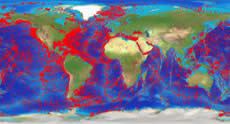
The Index to Marine & Lacustrine Geological Samples is a collaboration between twenty institutions and agencies that operate geological sample repositories. The purpose of the database is to help researchers locate sea floor and lakebed cores, grabs, dredges, and drill samples in their collections.
 Sample material is available from participating institutions.
Data include basic collection and storage information. Lithology
, texture
, age, principal investigator, province, weathering/metamorphism, glass remarks, and descriptive comments are included for some samples. Links are provided to related data and information at the institutions and at NGDC.
Data are coded by individual institutions, several of which receive funding from the US National Science Foundation. For more information see the NSF Division of Ocean Sciences Data and Sample Policy.
The Index is endorsed by the Intergovernmental Oceanographic Commission, Committee on International Oceanographic Data and Information Exchange (IODE-XIV.2).
The index is maintained by the National Geophysical Data Center
(NGDC) and collocated World Data Center for Marine Geology & Geophysics, Boulder, Colorado. NGDC is part of the National Environmental Satellite, Data and Information Service of the National Oceanic & Atmospheric Administration, U. S. Department of Commerce.
Searches and data downloads are available via a JSP and an ArcIMS interface. Data selections can be downloaded in tab-delimited or shapefile form, depending on the interface used. Both WMS and WFS interfaces are also available.
The Index was created in 1977 in response to a meeting of Curators of Marine Geological Samples, sponsored by the U.S. National Science Foundation
. The Curators' group continues to meet every 2-3 years.
Data include basic collection and storage information. Lithology
Lithology
The lithology of a rock unit is a description of its physical characteristics visible at outcrop, in hand or core samples or with low magnification microscopy, such as colour, texture, grain size, or composition. It may be either a detailed description of these characteristics or be a summary of...
, texture
Texture (geology)
Texture in geology refers to the physical appearance or character of a rock, such as grain size, shape, arrangement, and pattern at both the megascopic or microscopic surface feature level. This includes the geometric aspects and relations amongst the component particles or crystals which is called...
, age, principal investigator, province, weathering/metamorphism, glass remarks, and descriptive comments are included for some samples. Links are provided to related data and information at the institutions and at NGDC.
Data are coded by individual institutions, several of which receive funding from the US National Science Foundation. For more information see the NSF Division of Ocean Sciences Data and Sample Policy.
The Index is endorsed by the Intergovernmental Oceanographic Commission, Committee on International Oceanographic Data and Information Exchange (IODE-XIV.2).
The index is maintained by the National Geophysical Data Center
National Geophysical Data Center
The National Geophysical Data Center provides scientific stewardship, products and services for geophysical data describing the solid earth, marine, and solar-terrestrial environment, as well as earth observations from space....
(NGDC) and collocated World Data Center for Marine Geology & Geophysics, Boulder, Colorado. NGDC is part of the National Environmental Satellite, Data and Information Service of the National Oceanic & Atmospheric Administration, U. S. Department of Commerce.
Searches and data downloads are available via a JSP and an ArcIMS interface. Data selections can be downloaded in tab-delimited or shapefile form, depending on the interface used. Both WMS and WFS interfaces are also available.
The Index was created in 1977 in response to a meeting of Curators of Marine Geological Samples, sponsored by the U.S. National Science Foundation
National Science Foundation
The National Science Foundation is a United States government agency that supports fundamental research and education in all the non-medical fields of science and engineering. Its medical counterpart is the National Institutes of Health...
. The Curators' group continues to meet every 2-3 years.
Web site
Participating Institutions
- Antarctic Research Facility, Florida State University
- Bedford Institute of Oceanography, Canada
- Byrd Polar Research Center, Ohio State University
- Lamont-Doherty Earth Observatory, Columbia University
- National Lacustrine Core Repository, University of Minnesota
- Ocean Drilling Program/Deep Sea Drilling Project
- Oregon State University, College of Ocean and Atmospheric Sciences
- Scripps Institution of Oceanography
- University of Rhode Island, Graduate School of Oceanography
- USGS West Coast Repository
- USGS East Coast Repository
- Woods Hole Oceanographic Institution
- Complete list of Participants