
Hot Springs National Park
Encyclopedia
Established from Hot Springs Reservation, Hot Springs National Park is a United States
National Park
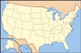
in central Arkansas
adjacent to the city of Hot Springs
. Hot Springs Reservation was initially created by an act of the United States Congress
on April 20, 1832, and the area was made a national park on March 4, 1921. It is the smallest national park by area in the United States. Since Hot Springs National Park is the oldest federal reserve, it was the first to receive its own US quarter
in April 2010 as part of the America the Beautiful Quarters series.
The hot springs flow from the western slope of Hot Springs Mountain, part of the Ouachita Mountain
range. In the park, the hot springs have not been preserved in their unaltered state as natural surface phenomena. They have instead been managed to conserve the production of uncontaminated hot water for public use. The mountains within the park are also managed within this conservation philosophy in order to preserve the hydrological system that feeds the springs.
People have used the hot spring water in therapeutic baths for more than two hundred years to treat rheumatism
and other ailments. While it was a reservation, the area developed into a well-known resort nicknamed The American Spa that attracted not only the wealthy but indigent health seekers from around the world as well.
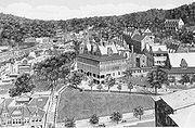
The park includes portions of downtown Hot Springs, making it one of the most easily visited national parks. There are numerous hiking trails and camping areas. Bathing in spring water is available in approved facilities at extra cost. The entire Bathhouse Row
area is a National Historic Landmark
District that contains the grandest collection of bathhouses of its kind in North America
, including many outstanding examples of Gilded Age
architecture
. The row's Fordyce Bathhouse serves as the park's visitor center; the Buckstaff and Quapaw are currently the only facilities still operating as bathhouses. Other buildings of the row are currently in various states of interior restoration or are used in other capacities.
The park has become increasingly popular in recent years, and recorded over 1.5 million visitors in 2003, as well as nearly 2.5 million non-recreational visitors.

 Spanish explorer Hernando de Soto
was the first European to see what Native Americans
referred to as the Valley of the Vapors when he and his men reached the area in 1541. Members of many Native American tribes had been gathering in the valley for over 8,000 years to enjoy the healing properties of the thermal springs. Around the 18th century the Caddo
settled in the area, followed by the Choctaw
, Cherokee
, and other tribes. There was agreement among the tribes that they would put aside their weapons and partake of the healing waters in peace while in the valley. The Quapaw
lived in the Arkansas River
delta area and visited the springs.
In 1673 Father Marquette and Jolliet
explored the area and claimed it for France
. The Treaty of Paris 1763 ceded the land back to Spain, however in 1800 control was returned to France until the Louisiana Purchase
of 1803.
In December 1804 George Hunter
and William Dunbar
made an expedition to the springs, finding a lone log cabin and a few rudimentary shelters used by people visiting the springs for their healing properties. In 1807 Jean Emmanual Prudhomme became the first settler of modern Hot Springs, although after he regained his health following two years of bathing in the hot water and eating local foods, he returned home to Louisiana. Not long afterward John Perciful and Isaac Cates arrived.
Having been placed in a reservation southeast of Hot Springs in the 19th century, on August 24, 1818, the Quapaw Indians ceded the land around the hot springs to the United States in a treaty. After Arkansas became its own territory in 1819, the Arkansas Territorial Legislature requested in 1820 that the springs and adjoining mountains be set aside as a federal reservation. Twelve years later, in 1832, the 22nd United States Congress
formed the national reservation, granting federal protection of the thermal waters and giving Hot Springs the honor of being the first “national park” to be designated for such government protection. The Hot Springs Reservation was set aside for public use as a park on June 16, 1880.
The springs are all grouped about the base of the Hot Springs Mountain, with a flow well over a half million gallons a day. The hot water is supplied to the various bathhouses with resulting income going to the U.S. Treasury. There are miles of roads and trails over the mountains. The park is open throughout the year.
 The first bathhouses were really little more than brush huts and log cabins placed over excavations cut in the rocks to receive hot water that flowed from the springs. More elaborate bathing facilities soon developed, with wooden troughs delivering water from hillside springs to bathhouses along the east bank of Hot Springs Creek. Some of the tufa covering the hillside was excavated to accommodate the bathhouses. The narrow street along the west side of the creek was connected to the bathhouses by narrow bridges.
After direct federal supervision was exercised in 1877, major improvements were made. The creek was covered with stone arches, and above a street a hundred feet wide was built. All the squatters were evicted, rubbish cleaned, and a centralized plumbing system was begun. This was completed around 1890. In 1950 central cooling towers limited the maximum temperature to a safe level, so individual bathhouses no longer needed their own cooling systems.
The park operates a public campground at Gulpha Gorge, about two miles (3 km) from downtown Hot Springs.
 The city of Hot Springs (incorporated 1851) is governed under State and municipal law. The National Park Service exercises no control or supervision over any matters connected with the city. The city's buildings are as close as across Central Avenue from Bathhouse Row, and has extended beyond the narrow valley in which the springs are located and spreads out over the open plain to the south and east. The climate is good throughout the year. The elevation of the city is 600 feet (182.9 m) above sea level, with surrounding hills rising another 600 feet (182.9 m). In earlier days the city was a summer resort, but hotels have now long stayed open during the winter due to many northerly patrons escaping the winter cold.
During the peak popularity of the hot springs, until the 1950s, the many patients staying for three weeks, six weeks, or longer were a large source of business for the numerous hotels, boarding houses, doctors, and drugstores. As the daily treatments required only an hour or two, the visitors' idle time created opportunities for other businesses in the town.
and lung diseases, and acute and inflammatory diseases, the use of the waters was considered injurious and in many cases very dangerous.
The earliest bathing procedure consisted of merely reclining in natural pools of hot springs and cool creek water for long periods of time. During the 1820s crude vapor baths stood over the springs, and bathers breathed in the vapors for extended periods of time. Wooden tubs were added to some bathhouses in the 1830s. Physicians began arriving in the 1850s, although many visitors did without their services; visitors remained from one week to two months. After the Civil War a tub bath of 15 to 20 minutes was common.
During the 1870s the bathing regimen became more diverse, and physicians prescribed various types of baths for patients. The period of time for tub baths became six to ten minutes and the time in the steam bath shortened to two minutes, with only one bath a day.
The treatment was by drinking and bathing in the waters, producing a profuse perspiration, which was considered an active agent in fighting disease. The advice of a physician who was familiar with the use of the waters was considered necessary to avoid injury. In many cases medicine was required before using the waters, although it had been observed that the amount of drugs given was "enough to sicken a well man."
The hot baths were usually taken once a day for three weeks, when a rest was necessary (often with a week at the sulphur springs near the Ouachita River). A second three weeks' course was then taken, followed again by an abstinence from bathing for several days. The usual stay at the springs was from one to three months, but many invalids stayed a year and longer.
The process described in 1878 was a hot bath of 90° to 95 °F (35 °C) for about 3 minutes (timed with a sand-glass). This was followed by another three minutes with all but the head in a steam box, or if milder treatment was prescribed, sitting atop the steam box covered with a blanket. During this the bather is also drinking hot water from their coffee-pot. After these eight to ten minutes of treatment, the bather is well rubbed down and thoroughly dried. The blanket-covered customer then would walk briskly back to their quarters to lie down for at least a half hour to let the body recover its normal temperature. Sleeping at this stage was considered dangerous.
The bathhouses began using vapor cabinets around 1884. The bather sat in the cabinet for 10–20 minutes with the lid closed tightly around the neck, with vapor from the hot water rising through the floor of the cabinet, with temperatures around 110-130 degrees. Toward the end of the 1880s Russian and Turkish baths were offered, and in the 1890s German needle baths and Scotch douches (concentrated stream of hot or cold water, often used on the back) were added.
Although details of services were left to bathhouse operators, the Park's superintendent set various rules. In the 1930s a tub bath could not take more than 20 minutes and shower no more than 90 seconds. During the next decade shower time was reduced to a minute, with maximum temperatures specified for several services. After a bath of about 98 degrees, the patient might spend 2–5 minutes in a vapor cabinet, get 15 minutes of packs (wet, hot or cold), followed by a tepid needle shower and light massage and alcohol rub.
By 1980 one reporter described getting a 20 minute bath, two minutes in a steam bath, 15 minutes wrapped with hot packs, and resting in a cooling room for 20–30 minutes.
The current modern facilities are oriented toward spa style or pool services.
In 1929, prices for single baths ranged from $1 to $1.40, while a course of 21 baths was $16 to $24. Baths were offered at the Arlington Hotel
, Fordyce, Buckstaff, Eastman Hotel, Maurice, La Mar, Majestic Hotel, Quapaw, Hale, Imperial, Moody Hotel, Ozark, St. Joseph's Infirmary, Superior, Ozark Sanatorium, Rockafellow, Alhambra, Pythian (colored), and Woodmen of Union (colored).
At present on Bathhouse Row only the Buckstaff and Quapaw are operating as bathhouses. The Fordyce is open as a visitors center giving tours of the facilities that have been renovated to appear as they originally did and The Ozark is currently housing the Museum of Contemporary Art and can be rented as reception hall. The Arlington Hotel, Austin Hotel and Convention Center, and The Springs Hotel & Spa also offer hot spring baths using the Park water.
 The Army and Navy General Hospital (now the Rehabilitation Center) was also supplied with water from the springs. It is located behind the south end of Bathhouse Row along the base of Hot Springs Mountain. It was administered by the War Department for the benefit of military members, officers of the Public Health Service, and honorably discharged veterans, who suffered from such diseases as the waters of the hot springs had an established reputation in benefiting. However, admission was not extended to mild and transient cases which should yield to ordinary treatment, but were reserved for those of a serious and obstinate character, which, though resisting ordinary methods of relief, were promised a rapid and permanent recovery from the use of the waters of the spring.
The facility now known as the Hot Springs Rehabilitation Center was built in 1933 as the second Army-Navy hospital. It has been used by the state for over 40 years.
 The Government free bathhouse for the indigent was established by Congress on December 16, 1878. The Ral Hole mudpit and pool were closed, and later the first Government Free Bathhouse operated at the site.
During the 1880s a few of the open springs gradually dried up. Corn Hole, a popular spring for people to soak their feet, dried up in 1882. Other open springs were either covered over by the government or the bathhouse owners to prevent their pollution.
Nearly 100,000 baths a year were given to the poor. Applicants for free baths were required to make an oath that they were without and unable to obtain means to pay for the baths, with violations being a misdemeanor subject to fine and/or imprisonment. Tickets were issued to those who, after examination, were found to be suffering from diseases which were reasonably expected to be benefited from the baths.
A new bathhouse was built in 1904, with separate facilities for black and white patrons. The materials used in construction were of poor quality. A new bathhouse was built off the reservation, and it opened in 1922.
The Government free bathhouse was a concrete building fully equipped for bathing large numbers of people under sanitary conditions. In 1878 the Army and Navy opened a free dispensary on the second floor, which remained open for two years. In 1916 the Public Health Service opened a clinic for the examination and treatment of indigents taking the free baths.
The Park Service reminded people that they had to provide their own board and lodging and to have return travel fare, due to many destitute invalids who arrived each year with the mistaken the belief that there was a public institution at which they would be cared for free of charge.
The free bathhouse closed in 1957, when it was much more economical to have the few indigent customers distributed among the commercial bathhouses. The poor applied at park headquarters and upon approval by a physician were sent to a participating bathhouse, which was reimbursed by the government.
forest dominated by oak
and hickory
. Pine
s predominate on the south sides of the ridges. There are 230 acres (93.1 ha) of unlogged pine and oak forests on North and Hot Springs Mountains, and 90 acres (36.4 ha) on Sugarloaf Mountain. These old-growth forests contain shortleaf pine, blackjack oak
, and white oak
; many of the trees over 130 years old, and a few over 200 years old.
Plains Bison
, Eastern Elk
, North American Cougar and Red Wolf
left the region after European settlement. Present day fauna include squirrel
, rabbit
, Virginia Opossum
, Gray Fox
, Coyote
, skunk
, Raccoon
, gopher
, Long-tailed Weasel
, American Mink
, rat
, frog
, and Nine-banded Armadillo
. Some migratory birds following the Mississippi Flyway
spend part of the year in the vicinity.
units which generally impede ground-water movement, while fractured chert
, novaculite
, and sandstone
units generally support ground-water movement.
 The water comes from rain which falls in mountains to the north and northeast. Flowing downward through cracked rock at about one foot a year, the meteoric water migrates to estimated minimum depths of 4,500 to 7500 ft (2,286 m) and achieves high temperatures in the deep section of the flow path before rising along fault and fracture conduits. Under artesian pressure, the thermal waters rise and emerge through the Hot Springs Sandstone between the traces of two thrust faults, along several northeast-trending lineaments. Some rainwater from near the springs mixes with the deep hot water before discharge. The trip down takes about 4,000 years while the hot water takes about a year to reach the surface.
The heat comes from the natural heating of rocks as depth increases. The composition of the water indicates it is heated rainwater which has not approached a magmatic source, so no volcanic action is involved in the formation of these hot springs. The result is the mildly alkaline, pleasant tasting solution with dissolved calcium carbonate.
 The exposed rock types in the vicinity of the thermal springs are sedimentary rock
s of Mississippian to Ordovician
age, with the exception of younger igneous rock
s (Cretaceous
age) exposed in two small areas about 6 and 11 miles (17.7 km) southeast of the thermal springs (Potash Sulphur Spring and Magnet Cove
, respectively), and in many small dikes
and sills
. Most dikes are less than 5 ft (1.5 m) wide. There have been 80 dikes noted about 4 miles (6.4 km) southeast of Hot Springs, on and near the Ouachita River
. There is no indication that igneous rock occurs where the thermal springs discharge.
The sedimentary rocks in the vicinity of the thermal springs consist of shale, chert, novaculite, sandstone, and conglomerate.
During most of the Paleozoic
Era, what became the Ouachita Mountains was the bottom of a shallow sea, where several sedimentary layers were created. About 500 million years ago a collision of the South American Plate
with the North American Plate
caused the shale and sandstone layers to fracture and fissure, creating mountains of the folded rocks. The thermal springs emerge from the plunging crest line of a large overturned anticline
in the Zigzag Mountains of the Ouachita anticlinorium. The overturned anticline plunges toward the southwest into the Mazarn Basin. There are two recognized major thrust fault
s trending nearly parallel to fold axes that define the northern and southern limits of the thermal springs discharge area. The northern fault extends nearly parallel to Fountain Street northeastward about 9200 ft (2,804.2 m) onto the southeast flank of North Mountain, and dips
about 26 degrees north. At the northern extent of the thermal springs, this fault is suggested to form along the bedding contact of the Hot Springs Sandstone and Stanley Shale, with the Stanley Shale forming the hanging wall of the fault. The southern fault extends northeastward about 9000 ft (2,743.2 m) roughly along the axis of the Hot Springs anticline, and dips about 44 degrees north. It has been proposed that a fault splits away from the southern fault, trends west and connects with the northern fault. A natural ravine trends along the location of this fault. Extensive cracks, joints, and fissures in the Bigfork Chert, Arkansas Novaculite, and the Hot Springs Sandstone allow the water to flow in the thermal springs area. Dissolved minerals in the water precipitate to form the white to tan travertine
or "tufa rock
" seen near the openings of the hot springs.
 The water all comes from the same deep source, but surface appearance of the springs differed. What was called Mud Spring had a tepid ooze where there was no danger of being scalded. Springs acquired names such as Magnesia, Big Iron, and Arsenic. Big Iron's water, with significant dissolved iron, would precipitate ocherous crusts and stains. Arsenic Spring, on the other hand, contains no detectable traces of that substance
. The water from many springs is now combined in one supply, with the total amount of water varying from 750,000 to 950,000 gallons a day. The temperature averages about 143 °F (61 °C). Maximum temperatures have declined about 5 °F (3 °C) since records have been kept.
In 1905 curative characteristics were being ascribed to radium
and Professor Bertram Boltwood
of Yale examined these waters. There is a measurable level of radioactivity primarily due to dissolved radon
gas, with some radium
. At the time collection and distribution equipment was designed to retain the radon gas, while now it is designed to allow it to escape. The level of exposure to radiation that results from bathing appears to be similar to the level that would result from sitting in the sun for the same period of time. The park water is considered well within safe limits and similar to other natural waters throughout the world.
Drinking water is dispensed from several hot water jug fountains. The hot water is naturally potable. Two cold water springs (Happy Hollow and Whittington Springs) are treated using ozone filtration. Regulations prohibit private individuals from selling the park's waters.

United States
The United States of America is a federal constitutional republic comprising fifty states and a federal district...
National Park
National park
A national park is a reserve of natural, semi-natural, or developed land that a sovereign state declares or owns. Although individual nations designate their own national parks differently A national park is a reserve of natural, semi-natural, or developed land that a sovereign state declares or...
in central Arkansas
Arkansas
Arkansas is a state located in the southern region of the United States. Its name is an Algonquian name of the Quapaw Indians. Arkansas shares borders with six states , and its eastern border is largely defined by the Mississippi River...
adjacent to the city of Hot Springs
Hot Springs, Arkansas
Hot Springs is the 10th most populous city in the U.S. state of Arkansas, the county seat of Garland County, and the principal city of the Hot Springs Metropolitan Statistical Area encompassing all of Garland County...
. Hot Springs Reservation was initially created by an act of the United States Congress
United States Congress
The United States Congress is the bicameral legislature of the federal government of the United States, consisting of the Senate and the House of Representatives. The Congress meets in the United States Capitol in Washington, D.C....
on April 20, 1832, and the area was made a national park on March 4, 1921. It is the smallest national park by area in the United States. Since Hot Springs National Park is the oldest federal reserve, it was the first to receive its own US quarter
Quarter (United States coin)
A quarter dollar, commonly shortened to quarter, is a coin worth ¼ of a United States dollar, or 25 cents. The quarter has been produced since 1796. The choice of 25¢ as a denomination, as opposed to 20¢ which is more common in other parts of the world, originated with the practice of dividing...
in April 2010 as part of the America the Beautiful Quarters series.
The hot springs flow from the western slope of Hot Springs Mountain, part of the Ouachita Mountain
Ouachita Mountains
The Ouachita Mountains are a mountain range in west central Arkansas and southeastern Oklahoma. The range's subterranean roots may extend as far as central Texas, or beyond it to the current location of the Marathon Uplift. Along with the Ozark Mountains, the Ouachita Mountains form the U.S...
range. In the park, the hot springs have not been preserved in their unaltered state as natural surface phenomena. They have instead been managed to conserve the production of uncontaminated hot water for public use. The mountains within the park are also managed within this conservation philosophy in order to preserve the hydrological system that feeds the springs.
People have used the hot spring water in therapeutic baths for more than two hundred years to treat rheumatism
Rheumatism
Rheumatism or rheumatic disorder is a non-specific term for medical problems affecting the joints and connective tissue. The study of, and therapeutic interventions in, such disorders is called rheumatology.-Terminology:...
and other ailments. While it was a reservation, the area developed into a well-known resort nicknamed The American Spa that attracted not only the wealthy but indigent health seekers from around the world as well.
The park includes portions of downtown Hot Springs, making it one of the most easily visited national parks. There are numerous hiking trails and camping areas. Bathing in spring water is available in approved facilities at extra cost. The entire Bathhouse Row
Bathhouse Row
Bathhouse Row is a collection of bathhouses, associated buildings, and gardens located at Hot Springs National Park in the city of Hot Springs, Arkansas...
area is a National Historic Landmark
National Historic Landmark
A National Historic Landmark is a building, site, structure, object, or district, that is officially recognized by the United States government for its historical significance...
District that contains the grandest collection of bathhouses of its kind in North America
North America
North America is a continent wholly within the Northern Hemisphere and almost wholly within the Western Hemisphere. It is also considered a northern subcontinent of the Americas...
, including many outstanding examples of Gilded Age
Gilded Age
In United States history, the Gilded Age refers to the era of rapid economic and population growth in the United States during the post–Civil War and post-Reconstruction eras of the late 19th century. The term "Gilded Age" was coined by Mark Twain and Charles Dudley Warner in their book The Gilded...
architecture
Architecture
Architecture is both the process and product of planning, designing and construction. Architectural works, in the material form of buildings, are often perceived as cultural and political symbols and as works of art...
. The row's Fordyce Bathhouse serves as the park's visitor center; the Buckstaff and Quapaw are currently the only facilities still operating as bathhouses. Other buildings of the row are currently in various states of interior restoration or are used in other capacities.
The park has become increasingly popular in recent years, and recorded over 1.5 million visitors in 2003, as well as nearly 2.5 million non-recreational visitors.
Discovery and protection
Hernando de Soto (explorer)
Hernando de Soto was a Spanish explorer and conquistador who, while leading the first European expedition deep into the territory of the modern-day United States, was the first European documented to have crossed the Mississippi River....
was the first European to see what Native Americans
Native Americans in the United States
Native Americans in the United States are the indigenous peoples in North America within the boundaries of the present-day continental United States, parts of Alaska, and the island state of Hawaii. They are composed of numerous, distinct tribes, states, and ethnic groups, many of which survive as...
referred to as the Valley of the Vapors when he and his men reached the area in 1541. Members of many Native American tribes had been gathering in the valley for over 8,000 years to enjoy the healing properties of the thermal springs. Around the 18th century the Caddo
Caddo
The Caddo Nation is a confederacy of several Southeastern Native American tribes, who traditionally inhabited much of what is now East Texas, northern Louisiana and portions of southern Arkansas and Oklahoma. Today the Caddo Nation of Oklahoma is a cohesive tribe with its capital at Binger, Oklahoma...
settled in the area, followed by the Choctaw
Choctaw
The Choctaw are a Native American people originally from the Southeastern United States...
, Cherokee
Cherokee
The Cherokee are a Native American people historically settled in the Southeastern United States . Linguistically, they are part of the Iroquoian language family...
, and other tribes. There was agreement among the tribes that they would put aside their weapons and partake of the healing waters in peace while in the valley. The Quapaw
Quapaw
The Quapaw people are a tribe of Native Americans who historically resided on the west side of the Mississippi River in what is now the state of Arkansas.They are federally recognized as the Quapaw Tribe of Indians.-Government:...
lived in the Arkansas River
Arkansas River
The Arkansas River is a major tributary of the Mississippi River. The Arkansas generally flows to the east and southeast as it traverses the U.S. states of Colorado, Kansas, Oklahoma, and Arkansas. The river's initial basin starts in the Western United States in Colorado, specifically the Arkansas...
delta area and visited the springs.
In 1673 Father Marquette and Jolliet
Louis Jolliet
Louis Jolliet , also known as Louis Joliet, was a French Canadian explorer known for his discoveries in North America...
explored the area and claimed it for France
France
The French Republic , The French Republic , The French Republic , (commonly known as France , is a unitary semi-presidential republic in Western Europe with several overseas territories and islands located on other continents and in the Indian, Pacific, and Atlantic oceans. Metropolitan France...
. The Treaty of Paris 1763 ceded the land back to Spain, however in 1800 control was returned to France until the Louisiana Purchase
Louisiana Purchase
The Louisiana Purchase was the acquisition by the United States of America of of France's claim to the territory of Louisiana in 1803. The U.S...
of 1803.
In December 1804 George Hunter
George Hunter
George Hunter may refer to:* George Hunter , Canadian journalistic photographer* George Hunter , businessman and philanthropist who made his fortune bottling Coca-Cola* George Hunter...
and William Dunbar
William Dunbar (explorer)
William Dunbar was a ScotsAmerican merchant, naturalist, astronomer and explorer.-Life:William Dunbar was born in Duffus House, Duffus Parish near Elgin, Scotland. His family's roots can be traced back to at least the tenth century...
made an expedition to the springs, finding a lone log cabin and a few rudimentary shelters used by people visiting the springs for their healing properties. In 1807 Jean Emmanual Prudhomme became the first settler of modern Hot Springs, although after he regained his health following two years of bathing in the hot water and eating local foods, he returned home to Louisiana. Not long afterward John Perciful and Isaac Cates arrived.
Having been placed in a reservation southeast of Hot Springs in the 19th century, on August 24, 1818, the Quapaw Indians ceded the land around the hot springs to the United States in a treaty. After Arkansas became its own territory in 1819, the Arkansas Territorial Legislature requested in 1820 that the springs and adjoining mountains be set aside as a federal reservation. Twelve years later, in 1832, the 22nd United States Congress
22nd United States Congress
-House of Representatives:-Leadership:- Senate :* President:** John C. Calhoun , resigned December 28, 1832, thereafter vacant.* President pro tempore:** Samuel Smith , first elected December 5, 1831** Littleton W...
formed the national reservation, granting federal protection of the thermal waters and giving Hot Springs the honor of being the first “national park” to be designated for such government protection. The Hot Springs Reservation was set aside for public use as a park on June 16, 1880.
National Park
In 1921, by act of Congress, the site's name was changed from the Hot Springs Reservation to the Hot Springs National Park. Growing to over 900 acres (3.6 km²), it included Hot Springs Mountain, North Mountain, West Mountain, Sugar-Loaf Mountain and Whittington Lake Park. It later was expanded to 5000 acres (20.2 km²).The springs are all grouped about the base of the Hot Springs Mountain, with a flow well over a half million gallons a day. The hot water is supplied to the various bathhouses with resulting income going to the U.S. Treasury. There are miles of roads and trails over the mountains. The park is open throughout the year.
After direct federal supervision was exercised in 1877, major improvements were made. The creek was covered with stone arches, and above a street a hundred feet wide was built. All the squatters were evicted, rubbish cleaned, and a centralized plumbing system was begun. This was completed around 1890. In 1950 central cooling towers limited the maximum temperature to a safe level, so individual bathhouses no longer needed their own cooling systems.
The park operates a public campground at Gulpha Gorge, about two miles (3 km) from downtown Hot Springs.
City of Hot Springs
During the peak popularity of the hot springs, until the 1950s, the many patients staying for three weeks, six weeks, or longer were a large source of business for the numerous hotels, boarding houses, doctors, and drugstores. As the daily treatments required only an hour or two, the visitors' idle time created opportunities for other businesses in the town.
Bathing customs
It was believed the waters benefited diseases of the skin and blood, nervous affections, rheumatism and kindred diseases, and the "various diseases of women". In the case of tuberculosisTuberculosis
Tuberculosis, MTB, or TB is a common, and in many cases lethal, infectious disease caused by various strains of mycobacteria, usually Mycobacterium tuberculosis. Tuberculosis usually attacks the lungs but can also affect other parts of the body...
and lung diseases, and acute and inflammatory diseases, the use of the waters was considered injurious and in many cases very dangerous.
The earliest bathing procedure consisted of merely reclining in natural pools of hot springs and cool creek water for long periods of time. During the 1820s crude vapor baths stood over the springs, and bathers breathed in the vapors for extended periods of time. Wooden tubs were added to some bathhouses in the 1830s. Physicians began arriving in the 1850s, although many visitors did without their services; visitors remained from one week to two months. After the Civil War a tub bath of 15 to 20 minutes was common.
During the 1870s the bathing regimen became more diverse, and physicians prescribed various types of baths for patients. The period of time for tub baths became six to ten minutes and the time in the steam bath shortened to two minutes, with only one bath a day.
The treatment was by drinking and bathing in the waters, producing a profuse perspiration, which was considered an active agent in fighting disease. The advice of a physician who was familiar with the use of the waters was considered necessary to avoid injury. In many cases medicine was required before using the waters, although it had been observed that the amount of drugs given was "enough to sicken a well man."
The hot baths were usually taken once a day for three weeks, when a rest was necessary (often with a week at the sulphur springs near the Ouachita River). A second three weeks' course was then taken, followed again by an abstinence from bathing for several days. The usual stay at the springs was from one to three months, but many invalids stayed a year and longer.
The process described in 1878 was a hot bath of 90° to 95 °F (35 °C) for about 3 minutes (timed with a sand-glass). This was followed by another three minutes with all but the head in a steam box, or if milder treatment was prescribed, sitting atop the steam box covered with a blanket. During this the bather is also drinking hot water from their coffee-pot. After these eight to ten minutes of treatment, the bather is well rubbed down and thoroughly dried. The blanket-covered customer then would walk briskly back to their quarters to lie down for at least a half hour to let the body recover its normal temperature. Sleeping at this stage was considered dangerous.
The bathhouses began using vapor cabinets around 1884. The bather sat in the cabinet for 10–20 minutes with the lid closed tightly around the neck, with vapor from the hot water rising through the floor of the cabinet, with temperatures around 110-130 degrees. Toward the end of the 1880s Russian and Turkish baths were offered, and in the 1890s German needle baths and Scotch douches (concentrated stream of hot or cold water, often used on the back) were added.
Although details of services were left to bathhouse operators, the Park's superintendent set various rules. In the 1930s a tub bath could not take more than 20 minutes and shower no more than 90 seconds. During the next decade shower time was reduced to a minute, with maximum temperatures specified for several services. After a bath of about 98 degrees, the patient might spend 2–5 minutes in a vapor cabinet, get 15 minutes of packs (wet, hot or cold), followed by a tepid needle shower and light massage and alcohol rub.
By 1980 one reporter described getting a 20 minute bath, two minutes in a steam bath, 15 minutes wrapped with hot packs, and resting in a cooling room for 20–30 minutes.
The current modern facilities are oriented toward spa style or pool services.
Pay bathhouses
There have been nearly two dozen pay bathhouses open at the same time, with about nine of those within the park's "Bathhouse Row" (these numbers have varied for reasons such as the Quapaw now using the space formerly occupied by two bathhouses). Nine of the bathhouses were associated with hotels, hospitals, or sanatoria. The water is the same for all, but the prices charged for the baths varied in accordance with the equipment and accommodations furnished by each facility. The charges for the services of the attendants are the same and include the necessities except towels, blankets, bathrobes, laundering, rubbing mercury, and handling of invalids.In 1929, prices for single baths ranged from $1 to $1.40, while a course of 21 baths was $16 to $24. Baths were offered at the Arlington Hotel
Arlington Hotel (Hot Springs National Park, Arkansas)
The Arlington Resort Hotel & Spa is a nearly 500 room resort in the Ouachita Mountains of Hot Springs National Park, Arkansas, home of Oaklawn Race Track and the Arkansas Derby. The Arlington's sister hotel was the Baker Hotel in Mineral Wells, Texas....
, Fordyce, Buckstaff, Eastman Hotel, Maurice, La Mar, Majestic Hotel, Quapaw, Hale, Imperial, Moody Hotel, Ozark, St. Joseph's Infirmary, Superior, Ozark Sanatorium, Rockafellow, Alhambra, Pythian (colored), and Woodmen of Union (colored).
At present on Bathhouse Row only the Buckstaff and Quapaw are operating as bathhouses. The Fordyce is open as a visitors center giving tours of the facilities that have been renovated to appear as they originally did and The Ozark is currently housing the Museum of Contemporary Art and can be rented as reception hall. The Arlington Hotel, Austin Hotel and Convention Center, and The Springs Hotel & Spa also offer hot spring baths using the Park water.
Army and Navy Hospital
The facility now known as the Hot Springs Rehabilitation Center was built in 1933 as the second Army-Navy hospital. It has been used by the state for over 40 years.
Disasters
In November of 1864, a large part of “the valley” (the central portion of the city along Hot Springs Creek) was burned down – presumably by Union troops. Just 14 years later -- on March 5, 1878 -- a large fire burned for eight hours, and claimed almost 150 buildings, including hotels, bath houses, and restaurants. On February 26, 1905, a fire started in the Grand Central Hotel on Chapel Street and burned 25 blocks of the southern section of Hot Springs. On September 6, 1913, a laundry worker had been ironing and accidentally started a fire on Church Street which spread rapidly due to strong winds and burned nearly 60 blocks of the south part of the city. On May 14, 1923, a severe storm hit the city. With mountains surrounding three sides of the city, water flooded down the slopes of the mountains, funneling to Central Avenue and reaching a depth of nine feet. To further complicate matters, a lightning strike during the storm caused a fire that destroyed several commercial businesses in downtown Hot Springs. On February 15, 1956, a severe flood filled Central Avenue with three feet of rushing water, causing significant property damage. And in May of 1990, a series of severe flash floods dropped 13+ inches of rain into the city. Again, the mountain slopes acted as funnels and a wave of water six feet high washed through downtown Hot Springs, causing extensive damage. During the flood, Carpenter Dam Bridge was washed away.Government free baths
During the 1880s a few of the open springs gradually dried up. Corn Hole, a popular spring for people to soak their feet, dried up in 1882. Other open springs were either covered over by the government or the bathhouse owners to prevent their pollution.
Nearly 100,000 baths a year were given to the poor. Applicants for free baths were required to make an oath that they were without and unable to obtain means to pay for the baths, with violations being a misdemeanor subject to fine and/or imprisonment. Tickets were issued to those who, after examination, were found to be suffering from diseases which were reasonably expected to be benefited from the baths.
A new bathhouse was built in 1904, with separate facilities for black and white patrons. The materials used in construction were of poor quality. A new bathhouse was built off the reservation, and it opened in 1922.
The Government free bathhouse was a concrete building fully equipped for bathing large numbers of people under sanitary conditions. In 1878 the Army and Navy opened a free dispensary on the second floor, which remained open for two years. In 1916 the Public Health Service opened a clinic for the examination and treatment of indigents taking the free baths.
The Park Service reminded people that they had to provide their own board and lodging and to have return travel fare, due to many destitute invalids who arrived each year with the mistaken the belief that there was a public institution at which they would be cared for free of charge.
The free bathhouse closed in 1957, when it was much more economical to have the few indigent customers distributed among the commercial bathhouses. The poor applied at park headquarters and upon approval by a physician were sent to a participating bathhouse, which was reimbursed by the government.
Flora and fauna
The area is primarily forest. The northern slopes of the ridges and basins provide a suitable habitat for deciduousDeciduous
Deciduous means "falling off at maturity" or "tending to fall off", and is typically used in reference to trees or shrubs that lose their leaves seasonally, and to the shedding of other plant structures such as petals after flowering or fruit when ripe...
forest dominated by oak
Oak
An oak is a tree or shrub in the genus Quercus , of which about 600 species exist. "Oak" may also appear in the names of species in related genera, notably Lithocarpus...
and hickory
Hickory
Trees in the genus Carya are commonly known as hickory, derived from the Powhatan language of Virginia. The genus includes 17–19 species of deciduous trees with pinnately compound leaves and big nuts...
. Pine
Pine
Pines are trees in the genus Pinus ,in the family Pinaceae. They make up the monotypic subfamily Pinoideae. There are about 115 species of pine, although different authorities accept between 105 and 125 species.-Etymology:...
s predominate on the south sides of the ridges. There are 230 acres (93.1 ha) of unlogged pine and oak forests on North and Hot Springs Mountains, and 90 acres (36.4 ha) on Sugarloaf Mountain. These old-growth forests contain shortleaf pine, blackjack oak
Blackjack oak
Quercus marilandica is a small oak, one of the red oak group Quercus sect. Lobatae, but fairly isolated from the others...
, and white oak
White oak
Quercus alba, the white oak, is one of the pre-eminent hardwoods of eastern North America. It is a long-lived oak of the Fagaceae family, native to eastern North America and found from southern Quebec west to eastern Minnesota and south to northern Florida and eastern Texas. Specimens have been...
; many of the trees over 130 years old, and a few over 200 years old.
Plains Bison
Plains Bison
The Plains Bison or Common bison is one of two subspecies/ecotypes of the American Bison, the other being the Wood Bison . Furthermore, it has been suggested that the Plains Bison consists of a northern and a southern subspecies, bringing the total to three...
, Eastern Elk
Eastern elk
The Eastern elk is one of six subspecies of elk that inhabited northern and eastern United States, and southern Canada. The last Eastern elk was shot in Pennsylvania on September 1, 1877. The subspecies was declared as extinct by the United States Fish and Wildlife Service in 1880...
, North American Cougar and Red Wolf
Red Wolf
The red wolf is a North American canid which once roamed throughout the Southeastern United States and is a glacial period survivor of the Late Pleistocene epoch...
left the region after European settlement. Present day fauna include squirrel
Squirrel
Squirrels belong to a large family of small or medium-sized rodents called the Sciuridae. The family includes tree squirrels, ground squirrels, chipmunks, marmots , flying squirrels, and prairie dogs. Squirrels are indigenous to the Americas, Eurasia, and Africa and have been introduced to Australia...
, rabbit
Rabbit
Rabbits are small mammals in the family Leporidae of the order Lagomorpha, found in several parts of the world...
, Virginia Opossum
Virginia Opossum
The Virginia opossum , commonly known as the North American opossum or tlacuache in Mexico, is the only marsupial found in North America north of Mexico. A solitary and nocturnal animal about the size of a domestic cat, and thus the largest opossum, it is a successful opportunist...
, Gray Fox
Gray Fox
The gray fox is a mammal of the order Carnivora ranging throughout most of the southern half of North America from southern Canada to the northern part of South America...
, Coyote
Coyote
The coyote , also known as the American jackal or the prairie wolf, is a species of canine found throughout North and Central America, ranging from Panama in the south, north through Mexico, the United States and Canada...
, skunk
Skunk
Skunks are mammals best known for their ability to secrete a liquid with a strong, foul odor. General appearance varies from species to species, from black-and-white to brown or cream colored. Skunks belong to the family Mephitidae and to the order Carnivora...
, Raccoon
Raccoon
Procyon is a genus of nocturnal mammals, comprising three species commonly known as raccoons, in the family Procyonidae. The most familiar species, the common raccoon , is often known simply as "the" raccoon, as the two other raccoon species in the genus are native only to the tropics and are...
, gopher
Gopher (animal)
The term gopher as it is commonly used does not relate to any one species, but is a generic term used to describe any of several small burrowing rodents endemic to North America, including the pocket gopher , also called true gophers, and the ground squirrel , including Richardson's ground squirrel...
, Long-tailed Weasel
Long-tailed Weasel
The long-tailed weasel , also known as the bridled weasel or big stoat is a species of mustelid distributed from southern Canada throughout all the United States and Mexico, southward through all of Central America and into northern South America.-Evolution:The long-tailed weasel is the product of...
, American Mink
American Mink
The American mink is a semi-aquatic species of Mustelid native to North America, though human intervention has expanded its range to many parts of Europe and South America. Because of this, it is classed as Least Concern by the IUCN. Since the extinction of the sea mink, the American mink is the...
, rat
Rat
Rats are various medium-sized, long-tailed rodents of the superfamily Muroidea. "True rats" are members of the genus Rattus, the most important of which to humans are the black rat, Rattus rattus, and the brown rat, Rattus norvegicus...
, frog
Frog
Frogs are amphibians in the order Anura , formerly referred to as Salientia . Most frogs are characterized by a short body, webbed digits , protruding eyes and the absence of a tail...
, and Nine-banded Armadillo
Nine-banded Armadillo
The nine-banded armadillo , or the nine-banded, long-nosed armadillo, is a species of armadillo found in North, Central, and South America, making it the most widespread of the armadillos...
. Some migratory birds following the Mississippi Flyway
Mississippi Flyway
The Mississippi Flyway is a bird migration route that generally follows the Mississippi River in the United States and the Mackenzie River in Canada. The main endpoints of the flyway include central Canada and the region surrounding the Gulf of Mexico...
spend part of the year in the vicinity.
Geology
The thermal springs are situated in the Ouachita Mountains of central Arkansas. The springs emerge in a gap between Hot Springs Mountain and West Mountain in an area about 1500 feet (457.2 m) long by 400 feet (121.9 m) wide at altitudes from 576 to 683 feet (208.2 m). The springs predominantly are composed of hot water from thousands of feet underground mixed with some shallow cold ground water. Currently, there are 43 thermal springs in the park that are presumed to be flowing. Thermal water from 33 of the thermal springs is collected and monitored at a central reservoir, which distributes the combined discharge for public use and consumption. Rock types in the area include shaleShale
Shale is a fine-grained, clastic sedimentary rock composed of mud that is a mix of flakes of clay minerals and tiny fragments of other minerals, especially quartz and calcite. The ratio of clay to other minerals is variable. Shale is characterized by breaks along thin laminae or parallel layering...
units which generally impede ground-water movement, while fractured chert
Chert
Chert is a fine-grained silica-rich microcrystalline, cryptocrystalline or microfibrous sedimentary rock that may contain small fossils. It varies greatly in color , but most often manifests as gray, brown, grayish brown and light green to rusty red; its color is an expression of trace elements...
, novaculite
Novaculite
Novaculite is a form of chert or flint found in the Ouachita Mountains of Arkansas and Oklahoma and in the Marathon Uplift of Texas. Novaculite is considered to be highly siliceous sediments and may be a product of the low-grade metamorphism of chert beds...
, and sandstone
Sandstone
Sandstone is a sedimentary rock composed mainly of sand-sized minerals or rock grains.Most sandstone is composed of quartz and/or feldspar because these are the most common minerals in the Earth's crust. Like sand, sandstone may be any colour, but the most common colours are tan, brown, yellow,...
units generally support ground-water movement.
The heat comes from the natural heating of rocks as depth increases. The composition of the water indicates it is heated rainwater which has not approached a magmatic source, so no volcanic action is involved in the formation of these hot springs. The result is the mildly alkaline, pleasant tasting solution with dissolved calcium carbonate.
Rock types
Sedimentary rock
Sedimentary rock are types of rock that are formed by the deposition of material at the Earth's surface and within bodies of water. Sedimentation is the collective name for processes that cause mineral and/or organic particles to settle and accumulate or minerals to precipitate from a solution....
s of Mississippian to Ordovician
Ordovician
The Ordovician is a geologic period and system, the second of six of the Paleozoic Era, and covers the time between 488.3±1.7 to 443.7±1.5 million years ago . It follows the Cambrian Period and is followed by the Silurian Period...
age, with the exception of younger igneous rock
Igneous rock
Igneous rock is one of the three main rock types, the others being sedimentary and metamorphic rock. Igneous rock is formed through the cooling and solidification of magma or lava...
s (Cretaceous
Cretaceous
The Cretaceous , derived from the Latin "creta" , usually abbreviated K for its German translation Kreide , is a geologic period and system from circa to million years ago. In the geologic timescale, the Cretaceous follows the Jurassic period and is followed by the Paleogene period of the...
age) exposed in two small areas about 6 and 11 miles (17.7 km) southeast of the thermal springs (Potash Sulphur Spring and Magnet Cove
Magnet Cove igneous complex
The Magnet Cove igneous complex is a small alkalic ring complex lying to the west of the town of Magnet Cove in Hot Spring County, Arkansas. It and the adjacent town are so named due to the existence of magnetite and the terrain being a cove, a basin-shaped valley.The complex is of Mesozoic age,...
, respectively), and in many small dikes
Dike (geology)
A dike or dyke in geology is a type of sheet intrusion referring to any geologic body that cuts discordantly across* planar wall rock structures, such as bedding or foliation...
and sills
Sill (geology)
In geology, a sill is a tabular sheet intrusion that has intruded between older layers of sedimentary rock, beds of volcanic lava or tuff, or even along the direction of foliation in metamorphic rock. The term sill is synonymous with concordant intrusive sheet...
. Most dikes are less than 5 ft (1.5 m) wide. There have been 80 dikes noted about 4 miles (6.4 km) southeast of Hot Springs, on and near the Ouachita River
Ouachita River
The Ouachita River is a river that runs south and east through the U.S. states of Arkansas and Louisiana, joining the Tensas River to form the Black River near Jonesville, Louisiana.-Course:...
. There is no indication that igneous rock occurs where the thermal springs discharge.
The sedimentary rocks in the vicinity of the thermal springs consist of shale, chert, novaculite, sandstone, and conglomerate.
- The Stanley Shale is predominantly a clayClayClay is a general term including many combinations of one or more clay minerals with traces of metal oxides and organic matter. Geologic clay deposits are mostly composed of phyllosilicate minerals containing variable amounts of water trapped in the mineral structure.- Formation :Clay minerals...
ey, thinly fissile, black to green shale, with large amounts of sandstone interbedded throughout the formation. The sandstone, when freshly exposed, is a hard, fine-grained, feldspathicFeldsparFeldspars are a group of rock-forming tectosilicate minerals which make up as much as 60% of the Earth's crust....
, siltSiltSilt is granular material of a size somewhere between sand and clay whose mineral origin is quartz and feldspar. Silt may occur as a soil or as suspended sediment in a surface water body...
y sandstone, but weathers easily to a soft, clayey porous material ranging from green to brown in color. Almost all of the low-lying areas in the city of Hot Springs are composed of the Stanley Shale, and it surrounds Hot Springs Mountain on the south, east, and west sides. - The Hot Springs Sandstone Member of the Stanley Shale, hereafter referred to as the Hot Springs Sandstone, consists of fine- to medium-grained sandstone with some shale and conglomerate. The sandstone is gray, hard and quartziticQuartziteQuartzite is a hard metamorphic rock which was originally sandstone. Sandstone is converted into quartzite through heating and pressure usually related to tectonic compression within orogenic belts. Pure quartzite is usually white to gray, though quartzites often occur in various shades of pink...
, reaching thicknesses up to 6 ft (1.8 m) The shale predominantly occurs at the top of the unit, and the principal bed of the conglomerate occurs at the bottom. - The Arkansas Novaculite consists of lower, middle, and upper members. The lower member is a massive fractured novaculite, and is the dominant member on Hot Springs Mountain, with a thickness of about 275 ft (83.8 m) The middle member is a black clay shale interbedded with novaculite, about 10 ft (3 m) thick on Hot Springs Mountain. The upper member is chiefly a massive, highly calcareous light gray to black novaculite. It reaches a maximum thickness of 180 ft (54.9 m) in the area.
- The Polk Creek Shale and Missouri Mountain Shale overlie the Bigfork Chert and generally consist of shale with minor thin layers of quartzitic sandstone. The Polk Creek Shale is a black, fissile, graphiticGraphiteThe mineral graphite is one of the allotropes of carbon. It was named by Abraham Gottlob Werner in 1789 from the Ancient Greek γράφω , "to draw/write", for its use in pencils, where it is commonly called lead . Unlike diamond , graphite is an electrical conductor, a semimetal...
shale. The Missouri Mountain Shale varies in color, and is soft and argillaceous. - The Bigfork Chert overlies the Womble Shale and consists almost entirely of chert and silty chert in layers 2 to 12 inches (304.8 mm) thick, separated by minor thin beds of black shale. The chert is very brittle and intensely fractured from folding.
- The Womble Shale is the oldest geologic unit that underlies all other exposed units. It is black, hard, and argillaceous shale.
During most of the Paleozoic
Paleozoic
The Paleozoic era is the earliest of three geologic eras of the Phanerozoic eon, spanning from roughly...
Era, what became the Ouachita Mountains was the bottom of a shallow sea, where several sedimentary layers were created. About 500 million years ago a collision of the South American Plate
South American Plate
The South American Plate is a continental tectonic plate which includes the continent of South America and also a sizeable region of the Atlantic Ocean seabed extending eastward to the Mid-Atlantic Ridge....
with the North American Plate
North American Plate
The North American Plate is a tectonic plate covering most of North America, Greenland, Cuba, Bahamas, and parts of Siberia, Japan and Iceland. It extends eastward to the Mid-Atlantic Ridge and westward to the Chersky Range in eastern Siberia. The plate includes both continental and oceanic crust...
caused the shale and sandstone layers to fracture and fissure, creating mountains of the folded rocks. The thermal springs emerge from the plunging crest line of a large overturned anticline
Anticline
In structural geology, an anticline is a fold that is convex up and has its oldest beds at its core. The term is not to be confused with antiform, which is a purely descriptive term for any fold that is convex up. Therefore if age relationships In structural geology, an anticline is a fold that is...
in the Zigzag Mountains of the Ouachita anticlinorium. The overturned anticline plunges toward the southwest into the Mazarn Basin. There are two recognized major thrust fault
Thrust fault
A thrust fault is a type of fault, or break in the Earth's crust across which there has been relative movement, in which rocks of lower stratigraphic position are pushed up and over higher strata. They are often recognized because they place older rocks above younger...
s trending nearly parallel to fold axes that define the northern and southern limits of the thermal springs discharge area. The northern fault extends nearly parallel to Fountain Street northeastward about 9200 ft (2,804.2 m) onto the southeast flank of North Mountain, and dips
Strike and dip
Strike and dip refer to the orientation or attitude of a geologic feature. The strike line of a bed, fault, or other planar feature is a line representing the intersection of that feature with a horizontal plane. On a geologic map, this is represented with a short straight line segment oriented...
about 26 degrees north. At the northern extent of the thermal springs, this fault is suggested to form along the bedding contact of the Hot Springs Sandstone and Stanley Shale, with the Stanley Shale forming the hanging wall of the fault. The southern fault extends northeastward about 9000 ft (2,743.2 m) roughly along the axis of the Hot Springs anticline, and dips about 44 degrees north. It has been proposed that a fault splits away from the southern fault, trends west and connects with the northern fault. A natural ravine trends along the location of this fault. Extensive cracks, joints, and fissures in the Bigfork Chert, Arkansas Novaculite, and the Hot Springs Sandstone allow the water to flow in the thermal springs area. Dissolved minerals in the water precipitate to form the white to tan travertine
Travertine
Travertine is a form of limestone deposited by mineral springs, especially hot springs. Travertine often has a fibrous or concentric appearance and exists in white, tan, and cream-colored varieties. It is formed by a process of rapid precipitation of calcium carbonate, often at the mouth of a hot...
or "tufa rock
Tufa
Tufa is a variety of limestone, formed by the precipitation of carbonate minerals from ambient temperature water bodies. Geothermally heated hot-springs sometimes produce similar carbonate deposits known as travertine...
" seen near the openings of the hot springs.
Composition of the water
Arsenic
Arsenic is a chemical element with the symbol As, atomic number 33 and relative atomic mass 74.92. Arsenic occurs in many minerals, usually in conjunction with sulfur and metals, and also as a pure elemental crystal. It was first documented by Albertus Magnus in 1250.Arsenic is a metalloid...
. The water from many springs is now combined in one supply, with the total amount of water varying from 750,000 to 950,000 gallons a day. The temperature averages about 143 °F (61 °C). Maximum temperatures have declined about 5 °F (3 °C) since records have been kept.
In 1905 curative characteristics were being ascribed to radium
Radium
Radium is a chemical element with atomic number 88, represented by the symbol Ra. Radium is an almost pure-white alkaline earth metal, but it readily oxidizes on exposure to air, becoming black in color. All isotopes of radium are highly radioactive, with the most stable isotope being radium-226,...
and Professor Bertram Boltwood
Bertram Boltwood
Bertram Borden Boltwood was an American pioneer of radiochemistry.He graduated from Yale University, and taught there 1897-1900...
of Yale examined these waters. There is a measurable level of radioactivity primarily due to dissolved radon
Radon
Radon is a chemical element with symbol Rn and atomic number 86. It is a radioactive, colorless, odorless, tasteless noble gas, occurring naturally as the decay product of uranium or thorium. Its most stable isotope, 222Rn, has a half-life of 3.8 days...
gas, with some radium
Radium
Radium is a chemical element with atomic number 88, represented by the symbol Ra. Radium is an almost pure-white alkaline earth metal, but it readily oxidizes on exposure to air, becoming black in color. All isotopes of radium are highly radioactive, with the most stable isotope being radium-226,...
. At the time collection and distribution equipment was designed to retain the radon gas, while now it is designed to allow it to escape. The level of exposure to radiation that results from bathing appears to be similar to the level that would result from sitting in the sun for the same period of time. The park water is considered well within safe limits and similar to other natural waters throughout the world.
Drinking water is dispensed from several hot water jug fountains. The hot water is naturally potable. Two cold water springs (Happy Hollow and Whittington Springs) are treated using ozone filtration. Regulations prohibit private individuals from selling the park's waters.
| Chemical | Parts per million |
|---|---|
| Bicarbonate (HCO3-) | 130.0 |
| Silica (SiO2) | 53.0 |
| Calcium (Ca2+) | 47.0 |
| Free carbon dioxide (CO2) | 9.7 |
| Sulfate (SO42-) | 7.8 |
| Oxygen (O2) | 4.5 |
| Magnesium (Mg2+) | 4.9 |
| Chloride (Cl-) | 2.2 |
| Sodium (Na+) | 4.0 |
| Potassium (K+) | 1.4 |
| Fluoride (F-) | 0.26 |
External links
- Official site: Hot Springs National Park
- A Native American Perspective