
Highest unclimbed mountain
Encyclopedia
The highest unclimbed mountain in a particular region or in the world is often a matter of controversy. In some parts of the world surveying and mapping are still not reliable, and there are not comprehensive records of the routes of explorers, mountaineers and local inhabitants.
However, a major problem relates to the definition of a mountain
. Any particular mountain, in addition to its highest point, will also have subsidiary "tops." Generally, a subjective view is taken of what is a mountain and what is a top. The horizontal distance between main peak and top, the difference in height, the topographic prominence
of the top, as well as the general topography, all come into consideration. Although objective criteria have been proposed for distinguishing "peaks" from "tops" (a prominence of 610 m, 2,000 feet is one definition), there is no widely agreed standard.
The Peakware World Mountain Encyclopedia has a list of unclimbed 7000 m Himalayan peaks which includes tops. The list is somewhat out-of-date: for example Lhotse Middle, 8430 m, was first climbed in spring 2001. Another list is provided on the Explorersweb website using a prominence cutoff of 500 m.
 The mountain most widely claimed to be the highest unclimbed mountain in the world in terms of elevation
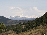
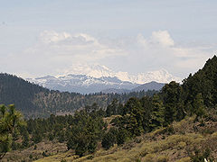
seems to be Gangkhar Puensum
, 7570 m (24,836 feet). It is in Bhutan
, on or near the border with China
. In Bhutan, climbing of high mountains has been prohibited since 1994. The rationale is based on a combination of (1) the Bhutanese government's respect for local customs that consider this and similar peaks to be the sacred homes of protective spirits and (2) the lack of high-altitude rescue resources from any locale closer than India.
It is also doubtful which is the highest unclimbed non-prohibited mountain. This depends greatly on the prominence cutoff. Saser Kangri
II East (7,513 m, Prom=1,450 m), until recenty considered the second highest unclimbed mountain, was climbed on August 24, 2011. Labuche Kang
III/East (7250 m?, Prom=570 m?), near Cho Oyu
, is reportedly unclimbed, but its status is hard to verify. It also lacks significant prominence.
It is similarly troublesome to determine the most prominent
unclimbed mountain. Finisterre Range
HP (Prom. = 3,675 m), Sauyr Zhotasy
(Prom. = 3,252 m) and Mount Siple
(Prom. = 3,110 m) all have no record of successful ascents, but the status of each of these peaks is difficult to confirm. Coincidentally, Gangkhar Puensum (Prom. = 2,995 m) is perhaps the most prominent unclimbed mountain that has any reasonable degree of certainty regarding its unclimbed status.
However, a major problem relates to the definition of a mountain
Mountain
Image:Himalaya_annotated.jpg|thumb|right|The Himalayan mountain range with Mount Everestrect 58 14 160 49 Chomo Lonzorect 200 28 335 52 Makalurect 378 24 566 45 Mount Everestrect 188 581 920 656 Tibetan Plateaurect 250 406 340 427 Rong River...
. Any particular mountain, in addition to its highest point, will also have subsidiary "tops." Generally, a subjective view is taken of what is a mountain and what is a top. The horizontal distance between main peak and top, the difference in height, the topographic prominence
Topographic prominence
In topography, prominence, also known as autonomous height, relative height, shoulder drop , or prime factor , categorizes the height of the mountain's or hill's summit by the elevation between it and the lowest contour line encircling it and no higher summit...
of the top, as well as the general topography, all come into consideration. Although objective criteria have been proposed for distinguishing "peaks" from "tops" (a prominence of 610 m, 2,000 feet is one definition), there is no widely agreed standard.
The Peakware World Mountain Encyclopedia has a list of unclimbed 7000 m Himalayan peaks which includes tops. The list is somewhat out-of-date: for example Lhotse Middle, 8430 m, was first climbed in spring 2001. Another list is provided on the Explorersweb website using a prominence cutoff of 500 m.
Elevation
The elevation of a geographic location is its height above a fixed reference point, most commonly a reference geoid, a mathematical model of the Earth's sea level as an equipotential gravitational surface ....
seems to be Gangkhar Puensum
Gangkhar Puensum
Gangkhar Puensum is the highest mountain in Bhutan and a strong candidate for the highest unclimbed mountain in the world with an elevation of 7,570 metres and a prominence of over 2990 metres. It lies on the border with China...
, 7570 m (24,836 feet). It is in Bhutan
Bhutan
Bhutan , officially the Kingdom of Bhutan, is a landlocked state in South Asia, located at the eastern end of the Himalayas and bordered to the south, east and west by the Republic of India and to the north by the People's Republic of China...
, on or near the border with China
People's Republic of China
China , officially the People's Republic of China , is the most populous country in the world, with over 1.3 billion citizens. Located in East Asia, the country covers approximately 9.6 million square kilometres...
. In Bhutan, climbing of high mountains has been prohibited since 1994. The rationale is based on a combination of (1) the Bhutanese government's respect for local customs that consider this and similar peaks to be the sacred homes of protective spirits and (2) the lack of high-altitude rescue resources from any locale closer than India.
It is also doubtful which is the highest unclimbed non-prohibited mountain. This depends greatly on the prominence cutoff. Saser Kangri
Saser Kangri
Saser Kangri is the highest peak in the Saser Muztagh, the easternmost subrange of the Karakoram range in India.The Saser Kangri massif consists of five named peaks:...
II East (7,513 m, Prom=1,450 m), until recenty considered the second highest unclimbed mountain, was climbed on August 24, 2011. Labuche Kang
Labuche Kang
Labuche Kang is a northern outlier of the Himalayas inside Tibet northwest of Cho Oyu and east of Shishapangma. The peak belongs to a little-known section of the Himalaya variously called Labuche Himal, Pamari Himal and Lapchi Kang. This section extends south into Nepal immediately east of Arniko...
III/East (7250 m?, Prom=570 m?), near Cho Oyu
Cho Oyu
Cho Oyu is the sixth highest mountain in the world at above sea level. Cho Oyu lies in the Himalayas and is 20 km west of Mount Everest, at the border between China and Nepal...
, is reportedly unclimbed, but its status is hard to verify. It also lacks significant prominence.
It is similarly troublesome to determine the most prominent
Topographic prominence
In topography, prominence, also known as autonomous height, relative height, shoulder drop , or prime factor , categorizes the height of the mountain's or hill's summit by the elevation between it and the lowest contour line encircling it and no higher summit...
unclimbed mountain. Finisterre Range
Finisterre Range
Finisterre Range is a mountain range in north-eastern Papua New Guinea, at . The unnamed highest point of the range , which is ranked 45th in the world by prominence, is usually quoted at 4,175 m, but SRTM data suggests that it is nearer to 4,120 m...
HP (Prom. = 3,675 m), Sauyr Zhotasy
Sauyr Zhotasy
Sauyr Zhotasy, also known as Muz Tau, is the highest point in the Saur Range, part of the Tien Shan, on the border between Kazakhstan and China. It lies southeast of Zaysan Lake. Despite its low elevation, it is well separated from higher ranges in its area, and is therefore ranked highly by...
(Prom. = 3,252 m) and Mount Siple
Mount Siple
Mount Siple is a potentially active shield volcano, rising to and dominating the northwest part of Siple Island, which is separated from the Bakutis Coast, Marie Byrd Land, by the Getz Ice Shelf. Its youthful appearance strongly suggests that it last erupted in Holocene. It is capped by a summit...
(Prom. = 3,110 m) all have no record of successful ascents, but the status of each of these peaks is difficult to confirm. Coincidentally, Gangkhar Puensum (Prom. = 2,995 m) is perhaps the most prominent unclimbed mountain that has any reasonable degree of certainty regarding its unclimbed status.