

Henry W. Coe State Park
Encyclopedia
Henry W. Coe State Park is a California
state park
located in Santa Clara
and Stanislaus
counties. It contains over 86,000 acres (34,800 ha), making it the largest state park in northern California, and the second-largest in the state (after Anza-Borrego Desert State Park
near the U.S.-Mexico
border). Managed within its boundaries is a designated wilderness area of about 22,000 acres (8,900 ha). This is officially known as Henry W. Coe State Wilderness, but locally as the Orestimba Wilderness.
Henry W. Coe State Park's land area is larger than that of the nearby Santa Clara Valley
. This is remarkable, considering that the park headquarters is less than one hour drive from San Jose, California
. Despite its vicinity to this large population, the park receives only about 40,000 visitors per year, and is not well known among San Francisco Bay Area
residents.
ranch
of 12,230 acres (4,950 ha). It was the home of Henry Willard Coe, Jr. and his family from 1905 until his death in 1943. Coe left the ranch to his son, Henry Sutcliffe Coe, who sold it to the Beach Land and Cattle Company of Fresno County in 1948.
The ranch's road network was greatly expanded during this time. Coe's daughter, Sada Coe Robinson, re-purchased the ranch in 1950 and donated it to Santa Clara County in 1953, when it became Henry Willard Coe County Park. It became a state park in 1958. Additional adjacent lands were added, and for many years, the park's size stood at 13,000 acres (5,300 ha). Indeed, many currently available state road maps still show the park in its 13,000 acre configuration. The park expanded considerably in the early 1980s with the purchase of adjacent properties to the east and south (the Gill-Mustang and Coit ranches, respectively), bringing the size to 67,000 acres (27,000 ha). In the early 1990s, the Redfern Ranch added some 11,000 acres (4,500 ha) in the south, and since 2000, lands to the west have been purchased for inclusion. The park is still growing.
The northern part of the park, including the Orestimba Wilderness, was swept by a massive wildfire starting on September 3, 2007. Named the Lick Fire after it was first spotted by nearby Lick Observatory
, the fire had grown to 27,000 acres (11,000 ha) by the evening of September 6, and ultimately burned 47,760 acres (19,330 ha) by the time it was contained on September 11. Fire officials blamed the fire on burning debris within a barrel at a hunting club adjacent to the park. The person responsible for the fire came forward, but was not charged criminally, as the fire was not intentionally set. This link contains a partial list of areas closed following the fire: http://bayareahiking.tribe.net/thread/d715e731-b394-4c40-a496-98d391aed61a. All areas affected by the fire were re-opened to unrestricted public access on February 16, 2008. The following link describes the aftermath of the Lick Fire and will chronicle the park's recovery over the next several years http://coefire2007.info.
The highest point in the park is on the northernmost boundary, at about 3560 ft (1090 m) elevation. This point may be considered to be on the slopes of Mt. Stakes, a mile north of the park's northern boundary. (Mt. Stakes, at 3804 ft (1159 m), is the highest point in Stanislaus County). The lowest point in the park is at the Bell Station
access point in the southeast; this is only a little above 300 ft (90 m) in elevation. Since this is a mere strip of land along a road right-of-way, it is often not thought of as an integral part of the state park. The lowest point in the main body of the park is the place where the North Fork of Pacheco Creek
flows out, at about 710 ft (220 m) elevation, also in the southeast corner.
Prominent ridges and peaks in the park, from west to east and north to south, include Pine Ridge, Middle Ridge, Blue Ridge (with Mount Sizer
the highest point), Rock House Ridge, Bear Mountain, Bear Mountain Peak, Robinson Mountain, Rooster Comb
, Palassou Ridge, Mahoney Ridge (and Mahoney Meadows), Willow Ridge, Pacheco Ridge, Mustang Peak, Walsh Peak, Willson Field Hill, Wasno Ridge, Burra Burra Peak, Willson Peak, Rock Springs Peak, and Phegley Ridge.
 The area encompasses parts of three major watersheds: Coyote Creek
, Orestimba Creek
, and Pacheco Creek
. Coyote Creek is fed by Grizzly Creek, the Little, Middle, and East Forks of Coyote Creek, Kelly Cabin Canyon, Grizzly Gulch (not be confused with Grizzly Creek), and Hunting Hollow. Coyote Creek flows into Coyote Lake and Anderson Lake, and then north through San Jose into the San Francisco Bay. The South Fork of Orestimba Creek originates in the park, and is fed by Red Creek, Pinto and Robinson creeks, and Lion Canyon. After joining the North Fork outside the park, it flows out to the San Joaquin Valley, where it joins the San Joaquin River. The latter runs more or less north and, if it were not diverted, would flow out to San Pablo Bay. The North Fork of Pacheco Creek also originates within the park, and it is fed by Mississippi Creek. Cañada de la Dormida independently reaches Pacheco Creek outside of the park boundaries. If not diverted, the waters of Pacheco Creek would eventually reach Monterey Bay via the Pajaro River. There is a fourth, minor watershed within the park: the small creeks of the Upper San Antonio Valley in the north flow into San Antonio Creek north of the park. This, in turn, joins Arroyo Valle, which flows into Alameda Creek, then flows into San Francisco Bay west of the city of Fremont.
The creeks are all seasonal; none of them flow year-round, though all have holes in which water may be found during all seasons. Depending on rainfall and temperatures, the creeks generally flow from November to May. After heavy rainfall, the creeks can become impassable, raging torrents, though usually they are not difficult to ford if one does not mind getting wet or (in winter and early spring) cold.
The park contains dozens of reservoirs created by the former ranch owners for watering cattle and for recreational fishing and hunting. The largest is Mississippi Lake, at about 32 acres (13 ha) and 3/4 mile (1.2 km) long. Other notables are Coit, Kelly, Jackrabbit, and Paradise lakes.
ecoregion
. Large parts of the park are covered in chaparral
and oak woodlands
.
Native trees which dominate the park include Valley Oak
(Quercus lobata), Blue Oak
(Q. douglasii), Coast live oak
(Q. agrifolia), Canyon Live Oak (Q. chrysolepis), Interior live oak
(Q. wislizenii), Digger Pine (Pinus sabiniana), Ponderosa Pine
(P. ponderosa), Pacific Madrone
(Arbutus menziesii), California laurel (Umbellularia californica), California Buckeye (Aesculus californica), White Alder
(Alnus rhombifolia), California Juniper (Juniperus californica), Blue Elderberry (Sambucus mexicana) and California Sycamore
(Platanus racemosa). Big-berry Manzanita (Arctostaphylos glauca) reach remarkable size within the park (over 20 feet (6 m) tall) and can grow as either small trees or large shrubs. Other prominent shrubs and wildflowers include Chamise (Adenostoma fasciculatum), Toyon
(Heteromeles arbutifolia), Coyote Brush (Baccharis pilularis), California Sagebrush (Artemisia californica), Eastwood Manzanita
(Arctostaphylos glandulosa), Yerba Santa
(Eriodictyon californicum), Buck Brush (Ceanothus cuneatus), California Gooseberry (Ribes californicum), Fuchsia-flowered Gooseberry (Ribes speciosum), Yellow Mariposa Lily (Calochortus luteus
) and Mountain Mahogany (Cercocarpus betuloides).
Of the trees, Blue Oak is the most common and widespread. It is most noticeable in the eastern side of the park, where it often forms pure stands. In other areas it may be dominated by other trees, but if the habitat will support trees, Blue Oak is usually there. Gray Pine is also almost ubiquitous throughout, but curiously, is absent in much of the far southwestern portion, perhaps because of the influence of summer fog, rare elsewhere.
 Ponderosa Pines dominate parts of three ridges in the west: Pine, Middle, and Blue, usually crowning the summits, but often extending down into cooler canyon slopes. They are rarely very dense, and visitors accustomed to seeing Ponderosa forests in the Sierra Nevada may come to two opposite, and fallacious, conclusions: 1) That the pines were logged, and all we see left is a small percentage of survivors; or 2) that they were all planted. In reality, there is no evidence (stumps, historical accounts) that any significant logging took place, nor does the relatively wide extent of the stands and the great variety of age groups support a tree-planting theory. Most likely, the pines are relicts of a broader distribution during cooler climates. When the climate warmed, the only places the trees could survive were up on the high cooler ridges and shady slopes where they grow today.
Chamise is undoubtedly the most abundant shrub in Coe Park, covering acres of hot, dry slopes and poor soils.
, Tule Elk
, non-native Wild Pig, Coyote
, Bobcat
, and Mountain Lion (aka Cougar, Puma). Smaller mammals include Raccoon
, Gray Fox
, Striped Skunk
, Beechey Ground Squirrel, Black-tailed Jackrabbit
, Badger
, and Brush Rabbit
. About 170 species of birds have been recorded in the park. Among these are: Red-tailed Hawk
, Golden Eagle
, Bald Eagle
, Turkey Vulture
, Raven
, Scrub Jay, Steller's Jay
, Great Horned Owl
, Acorn Woodpecker
, California Quail
, Western Bluebird
, and the non-native Wild Turkey
. Common reptiles include Western Pond Turtle
, western fence lizard
, Northern Alligator Lizard
, Western Skink
, Coast Horned Lizard
, Pacific Gopher Snake
, Western Kingsnake, Western Rattlesnake
, Ringneck Snake, and Western Aquatic Garter Snake. Amphibians most seen (or heard) include Pacific Tree Frog
, the non-native Bullfrog
, and California Newt
.
s and small recreational vehicle
s. There is a horse camp at Coe Headquarters, but is limited to a single parking space behind the old ranch house. Two paddocks are available for horses and water for horses can be obtained across the access road. About the only other structures at Coe Headquarters are water tanks and two employee residences. This area is at the end of East Dunne Avenue, about 14 miles (23 km) east of downtown Morgan Hill.
Another access point is the Hunting Hollow parking area just off Gilroy Hot Springs Road. This area is more primitive, with no piped water available and only a chemical toilet. The Hunting Hollow access is best for casual walkers and bikers, as the 3-mile (5-km) valley trail is level, without any steep hills to traverse. This is a good access for spring wildflower viewing. Parking is available for equestrian trailers and trucks.
The Coyote Creek entrance is about 2 miles (3 km) north on Gilroy Hot Springs Road. This entrance has no parking or facilities. Currently, it can only be used by arranging to be dropped off by car, or by parking at Hunting Hollow and walking up the road. A chemical toilet is available just beyond the locked gate and water is available at Timm Springs.
A fourth access area is the Dowdy Ranch Visitor's Center, opened 19 May 2007, with access via the unpaved Kaiser-Aetna Road from Bell Station on State Route 152
. This entrance is currently open only on weekends during the summer dry season. Bikers and backpackers can access the park via this road at any time, provided they are willing to hike or ride the seven steep miles to the park boundary. When open, the Dowdy Ranch will allow day use by automobile. No overnight parking will be allowed until staffing is increased. There is excellent parking for equestrians, however, again, only day use is allowed. During the annual Coe Backcountry Weekend event a limited number of vehicles are permitted to travel up this road as far as the Orestimba Wilderness.
A future entrance is to be located in San Antonio Valley
in the northernmost part of the park, though it will likely be many years before funds are available to do this.
Many sources of water are found within the park, including seasonal springs and watercourses and old ponds built by the cattle ranchers. The springs and water troughs have been maintained and improved by park volunteers. All surface water in the park should be filtered before drinking to remove harmful organisms.
The state has replaced the many crude pit toilets with clean well-maintained toilet structures known by the volunteers as "Taj MaPotties". They are wheelchair-friendly, but the trails to them are not.
or mountain bike
on the numerous trail
s within the park. There are about 200 miles (300 km) of dirt roads and trails in the park. Some of the dirt roads are wide and designed well, some are narrow and rutted, and some are so overgrown as to be easily missed. Recently constructed single-track trails are usually maintained, and, in general, the closer one is to Coe Headquarters, the more such trails there are. More remote trails are often just old jeep roads overgrown to a single-track width; others were created solely by repeated use, especially by equestrians. These were often made with insufficient forethought and often suffer moderate to severe erosion problems, or may be overgrown and difficult to follow much of the year.
Henry Coe also provides exceptional backpacking
opportunities. The park is so large and there are so many roads and trails, that one could plan a route covering ten miles per day, at a different campsite each night, and go two weeks without ever using the same trail or dirt road. Coe is the only park in the San Francisco Bay Area
where this is possible. Permits are required, but are usually easy to obtain, except on busy spring weekends.
The park is considered mountain bike friendly, since there are only a few miles of trails off limits to them (though this includes the whole of Orestimba Wilderness, but this is too far away for most bicyclists to reach on a day ride). It is not unusual for as much as half of park visitors on a given day to be mountain bicyclists, though this is normally closer to 30%. Equestrians also make use of the trails, though they account for less than 1% of all visitors. As in all state parks, hunting
is prohibited, but fishing
is allowed. Motorized vehicles are prohibited in the backcountry; exceptions are law enforcement or maintenance staff, and a few dirt roads are designated rights-of-way for neighboring property owners and their guests.
Spring is the most popular time to visit the park, with its moderate weather, green hillsides dotted with colorful wildflowers, and flowing creeks. Summer is usually too hot and dry for most people to enjoy the area, though the nighttime weather is pleasant and the sky usually clear for star-gazing. Fall
, from about mid-October through early November, is also a pleasant time to visit. There are also mild days between rainstorms in winter at Coe. Infrequent snowfall is light and usually persists for just a few days. On rare occasions, creeks can be frozen over in winter.
The most common danger faced by visitors is exhaustion from attempting to hike or ride too many steep trails in too little time, or with too little water or food. Additionally, there are many tick
s of several different species (though Lyme disease
is rare in the area), as well as a few venomous rattlesnake
s.
s commonly seen in the fall there when males are wandering about looking for the burrows of females in order to mate with them.
as part of a deficit reduction program. The proposal was dropped, at least temporarily, later in the year.
After the statewide special election of May 19, 2009
, in which voters turned down a package of propositions dealing with California's budget crisis, Schwarzenegger proposed the temporary closure (for at least 2 years) of 220 parks, including Henry W. Coe State Park. On June 4, 2009, Santa Clara County Supervisor Ken Yeager
announced that on June 9, 2009, he would propose that Santa Clara County take over the operation of the park at a reduced level of service, if the state's proposal to close the park should become final.
California
California is a state located on the West Coast of the United States. It is by far the most populous U.S. state, and the third-largest by land area...
state park
State park
State parks are parks or other protected areas managed at the federated state level within those nations which use "state" as a political subdivision. State parks are typically established by a state to preserve a location on account of its natural beauty, historic interest, or recreational...
located in Santa Clara
Santa Clara County, California
Santa Clara County is a county located at the southern end of the San Francisco Bay Area in the U.S. state of California. As of 2010 it had a population of 1,781,642. The county seat is San Jose. The highly urbanized Santa Clara Valley within Santa Clara County is also known as Silicon Valley...
and Stanislaus
Stanislaus County, California
Stanislaus County is a county located in the Central Valley of the U.S. state of California. As the price of housing has increased in the San Francisco Bay Area, many people who work in the southern reaches of the Bay Area have opted for the longer commute and moved to Stanislaus County for the...
counties. It contains over 86,000 acres (34,800 ha), making it the largest state park in northern California, and the second-largest in the state (after Anza-Borrego Desert State Park
Anza-Borrego Desert State Park
Anza-Borrego Desert State Park is a state park located within the Colorado Desert of Southern California. The park takes its name from 18th century, Spanish explorer Juan Bautista de Anza and borrego, the Spanish word for bighorn sheep...
near the U.S.-Mexico
Mexico
The United Mexican States , commonly known as Mexico , is a federal constitutional republic in North America. It is bordered on the north by the United States; on the south and west by the Pacific Ocean; on the southeast by Guatemala, Belize, and the Caribbean Sea; and on the east by the Gulf of...
border). Managed within its boundaries is a designated wilderness area of about 22,000 acres (8,900 ha). This is officially known as Henry W. Coe State Wilderness, but locally as the Orestimba Wilderness.
Henry W. Coe State Park's land area is larger than that of the nearby Santa Clara Valley
Santa Clara Valley
The Santa Clara Valley is a valley just south of the San Francisco Bay in Northern California in the United States. Much of Santa Clara County and its county seat, San José, are in the Santa Clara Valley. The valley was originally known as the Valley of Heart’s Delight for its high concentration...
. This is remarkable, considering that the park headquarters is less than one hour drive from San Jose, California
San Jose, California
San Jose is the third-largest city in California, the tenth-largest in the U.S., and the county seat of Santa Clara County which is located at the southern end of San Francisco Bay...
. Despite its vicinity to this large population, the park receives only about 40,000 visitors per year, and is not well known among San Francisco Bay Area
San Francisco Bay Area
The San Francisco Bay Area, commonly known as the Bay Area, is a populated region that surrounds the San Francisco and San Pablo estuaries in Northern California. The region encompasses metropolitan areas of San Francisco, Oakland, and San Jose, along with smaller urban and rural areas...
residents.
History
Henry W. Coe State Park (Coe Park) began as the Pine Ridge Ranch, a private cattleCattle
Cattle are the most common type of large domesticated ungulates. They are a prominent modern member of the subfamily Bovinae, are the most widespread species of the genus Bos, and are most commonly classified collectively as Bos primigenius...
ranch
Ranch
A ranch is an area of landscape, including various structures, given primarily to the practice of ranching, the practice of raising grazing livestock such as cattle or sheep for meat or wool. The word most often applies to livestock-raising operations in the western United States and Canada, though...
of 12,230 acres (4,950 ha). It was the home of Henry Willard Coe, Jr. and his family from 1905 until his death in 1943. Coe left the ranch to his son, Henry Sutcliffe Coe, who sold it to the Beach Land and Cattle Company of Fresno County in 1948.
The ranch's road network was greatly expanded during this time. Coe's daughter, Sada Coe Robinson, re-purchased the ranch in 1950 and donated it to Santa Clara County in 1953, when it became Henry Willard Coe County Park. It became a state park in 1958. Additional adjacent lands were added, and for many years, the park's size stood at 13,000 acres (5,300 ha). Indeed, many currently available state road maps still show the park in its 13,000 acre configuration. The park expanded considerably in the early 1980s with the purchase of adjacent properties to the east and south (the Gill-Mustang and Coit ranches, respectively), bringing the size to 67,000 acres (27,000 ha). In the early 1990s, the Redfern Ranch added some 11,000 acres (4,500 ha) in the south, and since 2000, lands to the west have been purchased for inclusion. The park is still growing.
The northern part of the park, including the Orestimba Wilderness, was swept by a massive wildfire starting on September 3, 2007. Named the Lick Fire after it was first spotted by nearby Lick Observatory
Lick Observatory
The Lick Observatory is an astronomical observatory, owned and operated by the University of California. It is situated on the summit of Mount Hamilton, in the Diablo Range just east of San Jose, California, USA...
, the fire had grown to 27,000 acres (11,000 ha) by the evening of September 6, and ultimately burned 47,760 acres (19,330 ha) by the time it was contained on September 11. Fire officials blamed the fire on burning debris within a barrel at a hunting club adjacent to the park. The person responsible for the fire came forward, but was not charged criminally, as the fire was not intentionally set. This link contains a partial list of areas closed following the fire: http://bayareahiking.tribe.net/thread/d715e731-b394-4c40-a496-98d391aed61a. All areas affected by the fire were re-opened to unrestricted public access on February 16, 2008. The following link describes the aftermath of the Lick Fire and will chronicle the park's recovery over the next several years http://coefire2007.info.
Geography
The park consists of a series of high ridges separated by steep canyons, with occasional level valley bottoms and distinct peaks. Most of the ridges run around 2000 to 3000 ft (600 to 900 m) in elevation, with canyon bottoms usually around 1000 to 1500 ft (300 to 450 m) above sea level.The highest point in the park is on the northernmost boundary, at about 3560 ft (1090 m) elevation. This point may be considered to be on the slopes of Mt. Stakes, a mile north of the park's northern boundary. (Mt. Stakes, at 3804 ft (1159 m), is the highest point in Stanislaus County). The lowest point in the park is at the Bell Station
Bell Station, California
Bell Station is an unincorporated area located along State Route 152 between Casa de Fruta and Pacheco Pass near the southeast extent of Santa Clara County, California....
access point in the southeast; this is only a little above 300 ft (90 m) in elevation. Since this is a mere strip of land along a road right-of-way, it is often not thought of as an integral part of the state park. The lowest point in the main body of the park is the place where the North Fork of Pacheco Creek
Pacheco Creek
Pacheco Creek is a waterway in central Contra Costa County, California.-See also:* List of watercourses in the San Francisco Bay Area...
flows out, at about 710 ft (220 m) elevation, also in the southeast corner.
Prominent ridges and peaks in the park, from west to east and north to south, include Pine Ridge, Middle Ridge, Blue Ridge (with Mount Sizer
Mount Sizer
Mount Sizer is a prominent peak located on Blue Ridge in Henry W. Coe State Park, just east of Morgan Hill, California. Because Mount Sizer is the highest point on Blue Ridge and under miles from the park's headquarters, it makes it an ideal destination for day hikers. There are two ways to reach...
the highest point), Rock House Ridge, Bear Mountain, Bear Mountain Peak, Robinson Mountain, Rooster Comb
Rooster Comb
Rooster Comb is a prominent ridge located within Henry W. Coe State Park, east of Morgan Hill, California. Rooster Comb is located within Stanislaus County. Its name refers to the large fleshy red skin atop a rooster's head. The resemblance to a rooster's comb is evident by the large rock...
, Palassou Ridge, Mahoney Ridge (and Mahoney Meadows), Willow Ridge, Pacheco Ridge, Mustang Peak, Walsh Peak, Willson Field Hill, Wasno Ridge, Burra Burra Peak, Willson Peak, Rock Springs Peak, and Phegley Ridge.
Coyote Creek
Coyote Creek is a river that flows through the Santa Clara Valley in California, United States.-History:Coyote Creek was originally named Arroyo del Coyote by Padre Pedro Font when the de Anza Expedition reached it on Sunday, March 31, 1776....
, Orestimba Creek
Orestimba Creek
Orestimba Creek, originally Arroyo Orestimba is a tributary of the San Joaquin River draining eastern slopes of part of the Diablo Range within the Central Valley of California, USA...
, and Pacheco Creek
Pacheco Creek
Pacheco Creek is a waterway in central Contra Costa County, California.-See also:* List of watercourses in the San Francisco Bay Area...
. Coyote Creek is fed by Grizzly Creek, the Little, Middle, and East Forks of Coyote Creek, Kelly Cabin Canyon, Grizzly Gulch (not be confused with Grizzly Creek), and Hunting Hollow. Coyote Creek flows into Coyote Lake and Anderson Lake, and then north through San Jose into the San Francisco Bay. The South Fork of Orestimba Creek originates in the park, and is fed by Red Creek, Pinto and Robinson creeks, and Lion Canyon. After joining the North Fork outside the park, it flows out to the San Joaquin Valley, where it joins the San Joaquin River. The latter runs more or less north and, if it were not diverted, would flow out to San Pablo Bay. The North Fork of Pacheco Creek also originates within the park, and it is fed by Mississippi Creek. Cañada de la Dormida independently reaches Pacheco Creek outside of the park boundaries. If not diverted, the waters of Pacheco Creek would eventually reach Monterey Bay via the Pajaro River. There is a fourth, minor watershed within the park: the small creeks of the Upper San Antonio Valley in the north flow into San Antonio Creek north of the park. This, in turn, joins Arroyo Valle, which flows into Alameda Creek, then flows into San Francisco Bay west of the city of Fremont.
The creeks are all seasonal; none of them flow year-round, though all have holes in which water may be found during all seasons. Depending on rainfall and temperatures, the creeks generally flow from November to May. After heavy rainfall, the creeks can become impassable, raging torrents, though usually they are not difficult to ford if one does not mind getting wet or (in winter and early spring) cold.
The park contains dozens of reservoirs created by the former ranch owners for watering cattle and for recreational fishing and hunting. The largest is Mississippi Lake, at about 32 acres (13 ha) and 3/4 mile (1.2 km) long. Other notables are Coit, Kelly, Jackrabbit, and Paradise lakes.
Ecology
The park protects part of the California interior chaparral and woodlandsCalifornia interior chaparral and woodlands
The California interior chaparral and woodlands ecoregion covers in an elliptical ring around the California Central Valley. It occurs on hills and mountains ranging from to . It is part of the Mediterranean forests, woodlands, and scrub biome, with cool, wet winters and hot, dry summers...
ecoregion
Ecoregion
An ecoregion , sometimes called a bioregion, is an ecologically and geographically defined area that is smaller than an ecozone and larger than an ecosystem. Ecoregions cover relatively large areas of land or water, and contain characteristic, geographically distinct assemblages of natural...
. Large parts of the park are covered in chaparral
Chaparral
Chaparral is a shrubland or heathland plant community found primarily in the U.S. state of California and in the northern portion of the Baja California peninsula, Mexico...
and oak woodlands
California oak woodland
California oak woodland is a plant community found throughout the California chaparral and woodlands ecoregion of California in the United States and northwestern Baja California in Mexico...
.
Plant life
Besides its size, the park is notable for a mostly intact flora. Unlike many other Bay Area parks, there are no large stands of non-native trees or shrubs. There are forested ridge-tops and slopes interspersed with chaparral and grasslands, with some creeks supporting distinct riparian vegetation.Native trees which dominate the park include Valley Oak
Valley Oak
Quercus lobata, commonly called the Valley oak, grows into the largest of North American oaks. It is endemic to California, growing in the interior valleys and foothills. Mature specimens may attain an age of up to 600 years. This deciduous oak requires year-round access to groundwater.Its thick,...
(Quercus lobata), Blue Oak
Blue Oak
Quercus douglasii, the Blue Oak, is an oak in the white oak section of the genus, Quercus sect. Quercus. It is endemic to California and is found in foothills surrounding the Central Valley of California and certain locations in the California Coast Ranges, USA...
(Q. douglasii), Coast live oak
Coast Live Oak
Quercus agrifolia, the Coast Live Oak, is an evergreen oak , native to the California Floristic Province. It grows west of the Sierra Nevada from Mendocino County, California, south to northern Baja California in Mexico. It is classified in the red oak section Quercus agrifolia, the Coast Live Oak,...
(Q. agrifolia), Canyon Live Oak (Q. chrysolepis), Interior live oak
Interior Live Oak
Quercus wislizeni, known by the common names Interior Live Oak, and Sierra Live Oak, is an evergeen oak, highly variable and often shrubby, found in areas of California in the United States. It also occurs south into northern Baja California in Mexico...
(Q. wislizenii), Digger Pine (Pinus sabiniana), Ponderosa Pine
Ponderosa Pine
Pinus ponderosa, commonly known as the Ponderosa Pine, Bull Pine, Blackjack Pine, or Western Yellow Pine, is a widespread and variable pine native to western North America. It was first described by David Douglas in 1826, from eastern Washington near present-day Spokane...
(P. ponderosa), Pacific Madrone
Pacific Madrone
Arbutus menziesii, commonly known as the Pacific Madrone, is a species of Arbutus found on the west coast of North America, from British Columbia to California...
(Arbutus menziesii), California laurel (Umbellularia californica), California Buckeye (Aesculus californica), White Alder
White Alder
White Alder may refer to:* USCGC White Alder , a United States Coast Guard ship* White Alder , a North American flowering plant...
(Alnus rhombifolia), California Juniper (Juniperus californica), Blue Elderberry (Sambucus mexicana) and California Sycamore
California Sycamore
Platanus racemosa is a species of sycamore tree known by several common names, including California sycamore, Western sycamore, California plane tree, and in Spanish Aliso...
(Platanus racemosa). Big-berry Manzanita (Arctostaphylos glauca) reach remarkable size within the park (over 20 feet (6 m) tall) and can grow as either small trees or large shrubs. Other prominent shrubs and wildflowers include Chamise (Adenostoma fasciculatum), Toyon
Toyon
Heteromeles arbutifolia , and commonly known as Toyon, is a common perennial shrub native to California down to Baja California....
(Heteromeles arbutifolia), Coyote Brush (Baccharis pilularis), California Sagebrush (Artemisia californica), Eastwood Manzanita
Arctostaphylos glandulosa
Arctostaphylos glandulosa, with the common name Eastwood's manzanita, is a species of manzanita.-Distribution:This shrub is native to the coastal slopes of western North America from Oregon through California to Baja California.-Description:...
(Arctostaphylos glandulosa), Yerba Santa
Yerba santa
Yerba santa or hierba santa , meaning mean "sacred herb" in Spanish, can refer to:*Hoja santa *Species of the genus Eriodictyon, including Eriodictyon californicum and Eriodictyon crassifolium...
(Eriodictyon californicum), Buck Brush (Ceanothus cuneatus), California Gooseberry (Ribes californicum), Fuchsia-flowered Gooseberry (Ribes speciosum), Yellow Mariposa Lily (Calochortus luteus
Calochortus luteus
Calochortus luteus, or Yellow mariposa lily, is a mariposa lily endemic to California.-Description:The primarily a bright deep yellow flower is 3-5cm across and perianth Bulb-shaped, lined red-brown inside, often also with central red-brown blotch and sparse hair inside.-Distribution:This species...
) and Mountain Mahogany (Cercocarpus betuloides).
Of the trees, Blue Oak is the most common and widespread. It is most noticeable in the eastern side of the park, where it often forms pure stands. In other areas it may be dominated by other trees, but if the habitat will support trees, Blue Oak is usually there. Gray Pine is also almost ubiquitous throughout, but curiously, is absent in much of the far southwestern portion, perhaps because of the influence of summer fog, rare elsewhere.
Chamise is undoubtedly the most abundant shrub in Coe Park, covering acres of hot, dry slopes and poor soils.
Animal life
Wildlife in the park is abundant. Large mammals making their home within Coe include Mule DeerMule Deer
The mule deer is a deer indigenous to western North America. The Mule Deer gets its name from its large mule-like ears. There are believed to be several subspecies, including the black-tailed deer...
, Tule Elk
Tule Elk
The tule elk is a subspecies of elk found only in California, ranging from the grasslands and marshlands of the Central Valley to the grassy hills on the coast. The subspecies name derives from the tule that it feeds off of, which grows in the marshlands...
, non-native Wild Pig, Coyote
Coyote
The coyote , also known as the American jackal or the prairie wolf, is a species of canine found throughout North and Central America, ranging from Panama in the south, north through Mexico, the United States and Canada...
, Bobcat
Bobcat
The bobcat is a North American mammal of the cat family Felidae, appearing during the Irvingtonian stage of around 1.8 million years ago . With twelve recognized subspecies, it ranges from southern Canada to northern Mexico, including most of the continental United States...
, and Mountain Lion (aka Cougar, Puma). Smaller mammals include Raccoon
Raccoon
Procyon is a genus of nocturnal mammals, comprising three species commonly known as raccoons, in the family Procyonidae. The most familiar species, the common raccoon , is often known simply as "the" raccoon, as the two other raccoon species in the genus are native only to the tropics and are...
, Gray Fox
Gray Fox
The gray fox is a mammal of the order Carnivora ranging throughout most of the southern half of North America from southern Canada to the northern part of South America...
, Striped Skunk
Striped Skunk
The striped skunk, Mephitis mephitis, is an omnivorous mammal of the skunk family Mephitidae. Found over most of the North American continent north of Mexico, it is one of the best-known mammals in Canada and the United States.-Description:...
, Beechey Ground Squirrel, Black-tailed Jackrabbit
Black-tailed Jackrabbit
The black-tailed jackrabbit , also known as the american desert hare, is a common hare of the western United States and Mexico, where it is found at elevations from sea level to up to...
, Badger
Badger
Badgers are short-legged omnivores in the weasel family, Mustelidae. There are nine species of badger, in three subfamilies : Melinae , Mellivorinae , and Taxideinae...
, and Brush Rabbit
Brush Rabbit
The Brush Rabbit , or Western Brush Rabbit, is a species of cottontail rabbit found in western coastal regions of North America, from the Columbia River in Oregon to the southern tip of the Baja California peninsula...
. About 170 species of birds have been recorded in the park. Among these are: Red-tailed Hawk
Red-tailed Hawk
The Red-tailed Hawk is a bird of prey, one of three species colloquially known in the United States as the "chickenhawk," though it rarely preys on standard sized chickens. It breeds throughout most of North America, from western Alaska and northern Canada to as far south as Panama and the West...
, Golden Eagle
Golden Eagle
The Golden Eagle is one of the best known birds of prey in the Northern Hemisphere. Like all eagles, it belongs to the family Accipitridae. Once widespread across the Holarctic, it has disappeared from many of the more heavily populated areas...
, Bald Eagle
Bald Eagle
The Bald Eagle is a bird of prey found in North America. It is the national bird and symbol of the United States of America. This sea eagle has two known sub-species and forms a species pair with the White-tailed Eagle...
, Turkey Vulture
Turkey Vulture
The Turkey Vulture is a bird found throughout most of the Americas. It is also known in some North American regions as the Turkey Buzzard , and in some areas of the Caribbean as the John Crow or Carrion Crow...
, Raven
Raven
Raven is the common name given to several larger-bodied members of the genus Corvus—but in Europe and North America the Common Raven is normally implied...
, Scrub Jay, Steller's Jay
Steller's Jay
The Steller's Jay is a jay native to western North America, closely related to the Blue Jay found in the rest of the continent, but with a black head and upper body. It is also known as the Long-crested Jay, Mountain Jay, and Pine Jay...
, Great Horned Owl
Great Horned Owl
The Great Horned Owl, , also known as the Tiger Owl, is a large owl native to the Americas. It is an adaptable bird with a vast range and is the most widely distributed true owl in the Americas.-Description:...
, Acorn Woodpecker
Acorn Woodpecker
The Acorn woodpecker is a medium-sized woodpecker, 21 cm long with an average weight of 85 g.-Description:...
, California Quail
California Quail
The California Quail, Callipepla californica, also known as the California Valley Quail or Valley Quail, is a small ground-dwelling bird in the New World quail family...
, Western Bluebird
Western Bluebird
The Western Bluebird is a small thrush, approximately to in length.Adult males are bright blue on top and on the throat with an orange breast and sides, a brownish patch on back, and a gray belly and undertail coverts. Adult females have a duller blue body, wings, and tail than the male, a gray...
, and the non-native Wild Turkey
Wild Turkey
The Wild Turkey is native to North America and is the heaviest member of the Galliformes. It is the same species as the domestic turkey, which derives from the South Mexican subspecies of wild turkey .Adult wild turkeys have long reddish-yellow to grayish-green...
. Common reptiles include Western Pond Turtle
Western pond turtle
The western pond turtle , or Pacific pond turtle is a small to medium-sized turtle growing to approximately 20 cm in carapace length. It is limited to the west coast of the United States of America and Mexico, ranging from western Washington state to northern Baja California...
, western fence lizard
Western fence lizard
The western fence lizard is a common lizard of California and the surrounding area. Because the ventral abdomen of an adult is characteristically blue, it is also known as the blue-belly...
, Northern Alligator Lizard
Northern Alligator Lizard
The Northern Alligator Lizard is a medium-sized lizard that occurs on the North American west coast.- Taxonomy :This lizard was formerly known under the scientific name of Gerrhonotus coeruleus , but is nowadays classed as Elgaria coerulea. There are four subspecies:* E.c...
, Western Skink
Western Skink
The Western Skink is a small, smooth-scaled lizard with relatively small limbs, measuring about 100 to 200 mm long. It is one of five species of lizards in Canada. Western skinks are very adaptable. They spend much of their day basking in the sun. Their diet ranges widely, including spiders...
, Coast Horned Lizard
Coast Horned Lizard
The coast horned lizard is a species of phrynosomatid lizard which can be found from Baja California north to California's Sacramento Valley. It is a widely divergent species with over 6 subspecies in their relatively small range...
, Pacific Gopher Snake
Pacific Gopher Snake
The Pacific Gopher Snake is a species of large colubrid snake native to the western coast of the United States.- Description :...
, Western Kingsnake, Western Rattlesnake
Crotalus viridis
Crotalus viridis is a venomous pitviper species native to the western United States, southwestern Canada, and northern Mexico. Currently, nine subspecies are recognized, including the nominate subspecies described here.-Description:...
, Ringneck Snake, and Western Aquatic Garter Snake. Amphibians most seen (or heard) include Pacific Tree Frog
Pacific Tree Frog
The Pacific Tree Frog has a range from the West Coast of the United States to British Columbia, in Canada. They live from sea level to more than 10,000 feet in many types of habitats, reproducing in aquatic settings. They are the only frogs that go "ribbit"...
, the non-native Bullfrog
Bullfrog
The American bullfrog , often simply known as the bullfrog in Canada and the United States, is an aquatic frog, a member of the family Ranidae, or “true frogs”, native to much of North America. This is a frog of larger, permanent water bodies, swamps, ponds, and lakes, where it is usually found...
, and California Newt
California Newt
The California newt is a newt. It is also referred to as the orange bellied newt. They can grow to be in length.- Physical description :T. torosa adult length can range from to...
.
Development and facilities
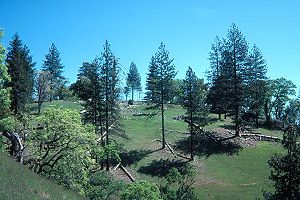
Coe Park has few facilities. The most developed area is at Coe Headquarters located at the historic Pine Ridge Ranch. Besides several historic ranch buildings, there is a visitor center that features exhibits about the old ranch life, a small bookstore, and a registration/information desk. A 20-unit campground on a nearby open area provides spaces for tentTent
A tent is a shelter consisting of sheets of fabric or other material draped over or attached to a frame of poles or attached to a supporting rope. While smaller tents may be free-standing or attached to the ground, large tents are usually anchored using guy ropes tied to stakes or tent pegs...
s and small recreational vehicle
Recreational vehicle
Recreational vehicle or RV is, in North America, the usual term for a Motor vehicle or trailer equipped with living space and amenities found in a home.-Features:...
s. There is a horse camp at Coe Headquarters, but is limited to a single parking space behind the old ranch house. Two paddocks are available for horses and water for horses can be obtained across the access road. About the only other structures at Coe Headquarters are water tanks and two employee residences. This area is at the end of East Dunne Avenue, about 14 miles (23 km) east of downtown Morgan Hill.
Another access point is the Hunting Hollow parking area just off Gilroy Hot Springs Road. This area is more primitive, with no piped water available and only a chemical toilet. The Hunting Hollow access is best for casual walkers and bikers, as the 3-mile (5-km) valley trail is level, without any steep hills to traverse. This is a good access for spring wildflower viewing. Parking is available for equestrian trailers and trucks.
The Coyote Creek entrance is about 2 miles (3 km) north on Gilroy Hot Springs Road. This entrance has no parking or facilities. Currently, it can only be used by arranging to be dropped off by car, or by parking at Hunting Hollow and walking up the road. A chemical toilet is available just beyond the locked gate and water is available at Timm Springs.
A fourth access area is the Dowdy Ranch Visitor's Center, opened 19 May 2007, with access via the unpaved Kaiser-Aetna Road from Bell Station on State Route 152
California State Route 152
State Route 152 is a state highway that runs near the latitudinal middle of the U.S. state of California from Watsonville to Route 99 southeast of Merced...
. This entrance is currently open only on weekends during the summer dry season. Bikers and backpackers can access the park via this road at any time, provided they are willing to hike or ride the seven steep miles to the park boundary. When open, the Dowdy Ranch will allow day use by automobile. No overnight parking will be allowed until staffing is increased. There is excellent parking for equestrians, however, again, only day use is allowed. During the annual Coe Backcountry Weekend event a limited number of vehicles are permitted to travel up this road as far as the Orestimba Wilderness.
A future entrance is to be located in San Antonio Valley
San Antonio Valley, California
The community of San Antonio Valley, also called San Antonio or San Antone, is located along the Diablo Range in eastern Santa Clara County, California. The locale is on the border of Alameda County and Stanislaus County. The sparsely-populated area is located at the junction of San Antonio Valley...
in the northernmost part of the park, though it will likely be many years before funds are available to do this.
Many sources of water are found within the park, including seasonal springs and watercourses and old ponds built by the cattle ranchers. The springs and water troughs have been maintained and improved by park volunteers. All surface water in the park should be filtered before drinking to remove harmful organisms.
The state has replaced the many crude pit toilets with clean well-maintained toilet structures known by the volunteers as "Taj MaPotties". They are wheelchair-friendly, but the trails to them are not.
Recreation
Most visitors at Coe Park hikeHiking
Hiking is an outdoor activity which consists of walking in natural environments, often in mountainous or other scenic terrain. People often hike on hiking trails. It is such a popular activity that there are numerous hiking organizations worldwide. The health benefits of different types of hiking...
or mountain bike
Mountain biking
Mountain biking is a sport which consists of riding bicycles off-road, often over rough terrain, using specially adapted mountain bikes. Mountain bikes share similarities with other bikes, but incorporate features designed to enhance durability and performance in rough terrain.Mountain biking can...
on the numerous trail
Trail
A trail is a path with a rough beaten or dirt/stone surface used for travel. Trails may be for use only by walkers and in some places are the main access route to remote settlements...
s within the park. There are about 200 miles (300 km) of dirt roads and trails in the park. Some of the dirt roads are wide and designed well, some are narrow and rutted, and some are so overgrown as to be easily missed. Recently constructed single-track trails are usually maintained, and, in general, the closer one is to Coe Headquarters, the more such trails there are. More remote trails are often just old jeep roads overgrown to a single-track width; others were created solely by repeated use, especially by equestrians. These were often made with insufficient forethought and often suffer moderate to severe erosion problems, or may be overgrown and difficult to follow much of the year.
Henry Coe also provides exceptional backpacking
Backpacking (wilderness)
Backpacking combines the activities of hiking and camping for an overnight stay in backcountry wilderness...
opportunities. The park is so large and there are so many roads and trails, that one could plan a route covering ten miles per day, at a different campsite each night, and go two weeks without ever using the same trail or dirt road. Coe is the only park in the San Francisco Bay Area
San Francisco Bay Area
The San Francisco Bay Area, commonly known as the Bay Area, is a populated region that surrounds the San Francisco and San Pablo estuaries in Northern California. The region encompasses metropolitan areas of San Francisco, Oakland, and San Jose, along with smaller urban and rural areas...
where this is possible. Permits are required, but are usually easy to obtain, except on busy spring weekends.
The park is considered mountain bike friendly, since there are only a few miles of trails off limits to them (though this includes the whole of Orestimba Wilderness, but this is too far away for most bicyclists to reach on a day ride). It is not unusual for as much as half of park visitors on a given day to be mountain bicyclists, though this is normally closer to 30%. Equestrians also make use of the trails, though they account for less than 1% of all visitors. As in all state parks, hunting
Hunting
Hunting is the practice of pursuing any living thing, usually wildlife, for food, recreation, or trade. In present-day use, the term refers to lawful hunting, as distinguished from poaching, which is the killing, trapping or capture of the hunted species contrary to applicable law...
is prohibited, but fishing
Fishing
Fishing is the activity of trying to catch wild fish. Fish are normally caught in the wild. Techniques for catching fish include hand gathering, spearing, netting, angling and trapping....
is allowed. Motorized vehicles are prohibited in the backcountry; exceptions are law enforcement or maintenance staff, and a few dirt roads are designated rights-of-way for neighboring property owners and their guests.
Spring is the most popular time to visit the park, with its moderate weather, green hillsides dotted with colorful wildflowers, and flowing creeks. Summer is usually too hot and dry for most people to enjoy the area, though the nighttime weather is pleasant and the sky usually clear for star-gazing. Fall
Autumn
Autumn is one of the four temperate seasons. Autumn marks the transition from summer into winter usually in September or March when the arrival of night becomes noticeably earlier....
, from about mid-October through early November, is also a pleasant time to visit. There are also mild days between rainstorms in winter at Coe. Infrequent snowfall is light and usually persists for just a few days. On rare occasions, creeks can be frozen over in winter.
The most common danger faced by visitors is exhaustion from attempting to hike or ride too many steep trails in too little time, or with too little water or food. Additionally, there are many tick
Tick
Ticks are small arachnids in the order Ixodida, along with mites, constitute the subclass Acarina. Ticks are ectoparasites , living by hematophagy on the blood of mammals, birds, and sometimes reptiles and amphibians...
s of several different species (though Lyme disease
Lyme disease
Lyme disease, or Lyme borreliosis, is an emerging infectious disease caused by at least three species of bacteria belonging to the genus Borrelia. Borrelia burgdorferi sensu stricto is the main cause of Lyme disease in the United States, whereas Borrelia afzelii and Borrelia garinii cause most...
is rare in the area), as well as a few venomous rattlesnake
Rattlesnake
Rattlesnakes are a group of venomous snakes of the genera Crotalus and Sistrurus of the subfamily Crotalinae . There are 32 known species of rattlesnake, with between 65-70 subspecies, all native to the Americas, ranging from southern Alberta and southern British Columbia in Canada to Central...
s.
Events
The park's non-profit support group, the Pine Ridge Association, sponsors two popular annual events, a Mothers' Day Breakfast and the fall TarantulaFest. The latter consists of a traditional outdoor barbecue with live music and a celebration of the hairy arachnids which inhabit the park, the gentle tarantulaTarantula
Tarantulas comprise a group of often hairy and often very large arachnids belonging to the family Theraphosidae, of which approximately 900 species have been identified. Some members of the same Suborder may also be called "tarantulas" in the common parlance. This article will restrict itself to...
s commonly seen in the fall there when males are wandering about looking for the burrows of females in order to mate with them.
Threats of closure
Henry W. Coe State Park was one of the 48 California state parks proposed for closure in January 2008 by former California Governor Arnold SchwarzeneggerArnold Schwarzenegger
Arnold Alois Schwarzenegger is an Austrian-American former professional bodybuilder, actor, businessman, investor, and politician. Schwarzenegger served as the 38th Governor of California from 2003 until 2011....
as part of a deficit reduction program. The proposal was dropped, at least temporarily, later in the year.
After the statewide special election of May 19, 2009
California state special elections, 2009
The California state special elections, 2009 were held on May 19, 2009 throughout the state of California. The elections were authorized by the State Legislature and Governor Arnold Schwarzenegger as a part of a budget signed into law on February 19, 2009...
, in which voters turned down a package of propositions dealing with California's budget crisis, Schwarzenegger proposed the temporary closure (for at least 2 years) of 220 parks, including Henry W. Coe State Park. On June 4, 2009, Santa Clara County Supervisor Ken Yeager
Ken Yeager
Ken Yeager is an American politician from California, currently serving on the Santa Clara County Board of Supervisors, representing District 4. First elected to the board in 2006, he represents the cities of Campbell and Santa Clara, as well as west San Jose and the Burbank and Cambrian...
announced that on June 9, 2009, he would propose that Santa Clara County take over the operation of the park at a reduced level of service, if the state's proposal to close the park should become final.
External links
- bayareahiking.tribe.net List of areas & trails closed due to the 2007 fire
- parks.ca.gov Official California State Parks site
- coepark.org Site sponsored by the Pine Ridge Association, includes current information on special events and fees, plus well-rounded information on most topics and numerous wildflower photos
- www.coestatepark.com Unofficial site with extensive photo tour, annotated illustrated plant list, detailed topographic maps of the park's more popular western area, and other information not found on the official sites
- www.wlevey.com Bill Levey's unofficial site, with topographic and GPS-generated trail maps
- Henry Coe State Park Map for your GPS An up-to-date map of Henry Coe State Park to upload to your GPS navigation deviceGPS navigation deviceA GPS navigation device is any device that receives Global Positioning System signals for the purpose of determining the device's current location on Earth...
- www.von-kaenel.com Vincent von Kaenel mountain biking resource with lots of pictures and maps