

Harrison County, Indiana
Encyclopedia
Harrison County is a county located in the far southern part of the U.S. state
of Indiana
along the Ohio River. It is divided into twelve townships, and the county seat
is Corydon
, the former capital of Indiana. The county is part of the larger Louisville/Jefferson County
, KY
–IN Metropolitan Statistical Area. As of the 2010 census
, the county's population was 39,364.
The county has a diverse economy with no sector employing more than 13% of the local workforce. Horseshoe Southern Indiana is the largest employer, followed by Tyson Foods
and the Harrison County Hospital. Tourism also plays a significant role in the economy centered around the county's many historic sites. Government of the county is divided between several bodies including the boards of the county's three school districts, three elected commissioner who exercise legislative and executive powers, an elected county council that controls the county budget, a circuit and superior court, and township trustees who oversee government function in the townships.
Migratory groups of Native Americans inhabited the area for thousands of years, but the first permanent settlements in what would become Harrison County were created by American settlers in the years after the American Revolutionary War
. The population grew rapidly during first decade of the nineteenth century. Corydon was officially platted in 1808 and became the capital of the Indiana Territory
in 1813. Many of the state's important historic events occurred in the county, including the writing of Indiana's first constitution. Corydon remained the state capital until 1825, but in the years afterward remained an important hub for southern Indiana. In 1859 there was a major meteorite
strike, then in 1863 the Battle of Corydon
was fought, the only battle of the American Civil War
to occur in Indiana.
. The region around Harrison County was of particular value to the early humans because of the abundance of flint
. There is evidence of flint mining in local caves as early as 2000 BCE; the stone was used to produce crude tools. Passing migratory tribes frequented the area which was influenced by succeeding groups of peoples including the Hopewells
and Mississippians
. One flint-working and camping location is known as the Swan's Landing Archeological Site
; it is among the most important Early Archaic archaeological sites anywhere in eastern North America. Permanent human settlements in the county began with the arrival of American settlers in the last decade of the eighteenth century.
The area became part of the United States following its conquest during the American Revolutionary War
. Veterans of the revolution received land grants in the eastern part of the county as part of Clark's Grant
. Daniel Boone
and his brother Squire Boone
were early explorers of the county, entering from Kentucky in the 1780s. Harvey Heth
, Spier Spencer
, and Edward Smith were among the first to settle in the county beginning in the 1790s. Smith built the first home in what later became the county seat of Corydon
.
Harrison County was originally part of Knox County
and Clark County
but was separated in 1808. It was the first Indiana
county formed by the Indiana territorial
legislature and not the Governor. The county originally contained land that is now parts of Crawford, Floyd, Washington, Jackson, Clark, Lawrence, Perry, Scott and Orange Counties. The county was named for William Henry Harrison
, the first governor of Indiana Territory
, and later a General in War of 1812
, hero of Tippecanoe
, and the 9th U.S. President. Harrison was the largest land holder in the county at the time and had a small estate at Harrison Spring
.
Squire Boone settled permanently in what is now Boone Township in 1806. He died in 1815 and is buried in a cave near his home, Squire Boone Caverns
. James, Isaiah, and Daniel (son of Squire) Boone settled in Heth Township during the first decade of the 1800s. The county's first church was built by Boone east of present day Laconia
. The church, which has been reconstructed, is known as Old Goshen. Jacob Kintner settled near Corydon in about 1810. He was one of the wealthiest settlers and amassed a 700 acres (2.8 km²) tract of land around Corydon, built a large home, and maintained an inn. Paul and Susanna Mitchem became Quakers and immigrated to Harrison County from North Carolina
in 1814, bringing with them 107 slaves they freed after arriving. Although some of the former slaves left, the group became one of the largest communities of free blacks in the state.
The first road was built in Harrison County in 1809 connecting Corydon with Mauckport
on the Ohio River
. A tow-and-ferry line was operated there by the Mauck family bringing settlers into the county from Kentucky
. This road and ferry greatly expanded the county's economic viability and ease of access to the outside world, leading to a rapid settlement of the area. The county's population more than doubled in the following decade.
 Dennis Pennington
, who lived near Lanesville
became one of the county's early leading citizens and speaker of the territory's legislature. Corydon began competing with other southern Indiana settlements to become to new capital of the territory after its reorganization in 1809. Hostilities broke out in 1811 with the Native American tribes on the frontier, the territorial capital was moved to Corydon on May 1, 1813 after Pennington suggested it would be safer than Vincennes. For the next twelve years, Corydon was the political center of the territory and subsequent state. A state constitution was drafted in Corydon during June 1816 and after statehood the town served as the state capital until 1825.
The first division of the county occurred in 1814 when the northern portion of the county was separated to become Washington County. The county was again divided in 1818 with the western part of the county being separated to become Crawford County. A third division occurred in 1819 when Floyd County was created out of the eastern part of the county. Harrison County's eastern border has had minor adjustments through land transactions with Floyd County; the last changed occurred in 1968.
The northern part of the county is known as the barrens, named by the early settlers for the lack timber there. For the first decades of settlement, settlers refused purchase the land in the barrens because they were considered too far from the timber needed to build homes, fires, fences, and other necessities. The barrens were swept by annual wildfires that prevented the growth of trees. The largest barren ran from the northern edge of Corydon northward to Palmyra, and from the Floyd Knobs in the east, westward to the Blue River. The Central Barren
covered most the upper middle part of the county. As settlement expanded and farming grew in the early nineteenth century, settlers began to discover that the barrens were among the most fertile farmlands in the state, and they quickly filled up with landholders. As settlement increased, the wildfires were stopped and by the start of the 20th century the uninhabited parts of the barrens became forested and have remained so until modern times.
A large Meteorite fell near Buena Vista on March 28, 1859 causing some panic in the area. The site of the impact and a part of the meteorite have been preserved.
 In 1860 the first Harrison County fair was held in Corydon. The county fair has been an annual event since then and is the longest continuously running fair in the state. The county fairgrounds were built in the southwest corner of Corydon where the home of Edward Smith formerly stood. The fair’s original grandstand burned in 1960 and the county purchased a new grandstands from the minor league baseball team at Parkway Field
in Louisville, Kentucky
.
The only civil war battle fought in Indiana occurred in Harrison County on July 9, 1863 between the Harrison County Legion and Brigadier General John Hunt Morgan
of the Confederate Army during Morgan's Raid
. Morgan crossed the Ohio River into Harrison county on the morning of July 9. His crossing was contested by the Legion with artillery on the Indiana shore and an armed river boat. After Morgan opened fire with his own batteries from the opposite shore the legion quickly retreated towards Corydon. The citizens of Mauckport fled the town with most of their valuables. Morgan landed on the east side of Mauckport with two thousand cavalry and marched north burning homes, farms, and mills. The county militia made a stand to block his advance on the county seat and the resulting conflict is known as the Battle of Corydon
. The battle was won by the Confederates and the town of Corydon was then sacked and stores were looted and ransomed. The battle left four dead, twelve wounded, 355 captured. After the battle Morgan continued into northern Harrison County where he looted New Salisbury area with the main body of troops. Crandall and Palmyra were robbed and sacked by detachments. His forced left the county on July 10; they were eventually defeated and captured by Union Army.
 The railroad reached Harrison County in 1869. A line was completed across the northern half of county in 1874 running from Floyd County connecting Crandall and then continuing west into Crawford County. A southward extension connecting Corydon to Crandall was completed in 1882. A train wreck killed three in 1902. The southern extension connecting Corydon was purchased by the Corydon Scenic Railroad Company in 1989 and operated as a tourist attraction until 2003 when it was closed because of financial difficulties, ending passenger service in the county.
In 1929 the new county courthouse (pictured above) was completed and occupied by the county government. The first state capitol building had been used as the county courthouse prior to that.
The Harrison-Crawford State Forest
was started in 1932 when the State of Indiana purchased land in western Harrison County. The 26000 acres (105.2 km²) park is the largest state forest in Indiana and surrounds the O'Bannon Woods State Park
and Wyandotte Caves, located in eastern Crawford County.
 The Matthew E. Welsh Bridge
was completed in 1966 in Mauckport. It connected Harrison County with neighboring Meade County
. This is the only bridge over the Ohio River between Tell City
and New Albany
. In 1969 Dr. Samuel P. Hays donated the 311 acres (1.3 km²) Hayswood Nature Reserve
to the county. It was developed in 1973 by the Harrison County Park Board by adding public facilities to the western part of the preserve. It is the second largest nature reserve in the county.
Caesars Indiana
opened a casino river boat, hotel complex, and golf course in 1998, boosting the county's tourism industry. The casino complex was purchased and became Horseshoe Southern Indiana on July 11, 2008.
and by the Indiana Code
. Executive and legislative power is vested in the Board of Commissioners, and fiscal power is vested in the County Council.
The seven member county council is the fiscal branch of the county government and controls all the spending and revenue collection in the county. Four representatives are elected from county districts and three are elected at-large. The council members serve four-year terms. They are responsible for setting salaries, the annual budget, and special spending. The council also has limited authority to impose local taxes in the form of an income tax, property tax, excise taxes, and service taxes. County income and property taxes are subject to state level approval. In 2011 the council members were Phil Smith, District 1 (R); Gary Davis, District 2 (R); Gordon Pendleton, District 3 (D); Ralph Sherman District 4 (R); Richard Gerdon, At-Large (D); Jim Heitkemper, At-Large (R); Chris Timberlake, At-Large (D).
The Board of Commissioners consists of three commissioners who are elected county-wide in staggered terms. Each serves a four-year term. One of the commissioners, typically the most senior, serves as president of the board. The commissioners manage the budget set forth by the council, the collection of revenue, enact and repeal ordinances, and managing the day-to-day functions of the county government. The commissioners hold public meetings twice each month to discuss issues affecting the public and receive community input. In 2010 the commissioners were James Goldman, District 1 (D); Carl L. "Buck" Mathes, District 2 (D); Terry L. Miller, District 3 (D).
Harrison County has a Circuit Court and a Superior Court. The Superior Court handles all adult criminal cases, small claims cases, traffic tickets, and infractions. The Circuit Court handles the rest of the cases in the county, including most of the divorce cases, juvenile matters, CHINS cases, civil proceedings, probate, estates, adoptions, civil commitments, and other civil cases. Judges in each court serve a six year term. The Judge of the Circuit Court appoints a referee to handle family law cases.
The county has several other elected offices, including sheriff
, coroner
, auditor, treasurer
, recorder
, surveyor
and circuit court clerk
. Each of these elected officers serves a term of four years and oversees a different part of county government. Members elected to county government positions are required to declare party
affiliations and to be residents of the county.
Most of Harrison County falls within State House District 70 and is represented in Indiana House of Representatives
by Democrat Paul J. Robertson. The northernmost part of the county including Palmyra, is part of State House District 73 and is represented by Democrat Dennie Oxley. The entire county is part of State Senate District 47 and is represented in the Indiana State Senate by Democrat Richard Young The county, along with most of southern Indiana, is part of Indiana's 9th congressional district
and is represented in the United States Congress
by Democrat Baron Hill
.
Harrison Spring is located west of Corydon; it is 60 feet (18.3 m) in diameter and is over 4000 feet (1,219.2 m) deep, making it the largest and deepest spring in Indiana. It rises from a solid rock in a level spot of land, and it outputs enough water to have turned flour mills in the past. Is the largest spring by volume in Indiana producing over 3 million gallons of water daily. The spring derives its name from William Henry Harrison who once owned the land surrounding it.
Harrison County's surface is covered by many hills and valleys. The Knobstone Escarpment
begins in the southeastern part of the county, rising sharply at the Ohio River, and following a course roughly along the eastern edge of the county. The "knobs" are the most significant series of hills in Indiana, with the highest knobs near the Ohio River towering 610 feet (185.9 m) over the surrounding valley. This is the greatest local relief difference in the state. The Ohio River borders the entire southeastern, southern, and southwestern part of the county. Blue River forms the western border with Indian Creek and Buck Creek as the primary internal drainage systems.
The western part of the county is preserved as the Harrison-Crawford State Forest
and the O'Bannon Woods State Park
. The county has extensive cave systems including Squire Boone Caverns
and the Binkley Cave System and smaller, highly decorated caves such as Jewel Box and Devil's Graveyard caves.
There are six counties adjacent to Harrison County; Washington County
to the north; Floyd County
to the east; Jefferson County
, Kentucky
, to the southeast; Hardin County
, Kentucky
to the southeast; Meade County
, Kentucky
south; Crawford County
to the west.
had a 2000 population of 932; the town sits on the western border of the county and a majority of its population lives in Crawford County. The county's other incorporated towns, Crandall
, Elizabeth
, Laconia
, Mauckport
, and New Middletown
all have populations under 150. New Amsterdam
is the smallest town in the county and state with an official 2000 population of 1.
There are several unincorporated and formerly-incorporated communities. These include Bradford
, Central
, Depauw
, New Salisbury
, Ramsey
, Rosewood, Sennville and White Cloud
.
The county is subdivided into twelve townships: Blue River
, Boone
, Franklin
, Harrison
, Heth
, Jackson
, Morgan
, Posey
, Spencer
, Taylor
, Washington
, and Webster
.
of 2000, there were 34,325 people, 12,917 households, and 9,713 families residing in the county. The population density
was 71 people per square mile (27/km²). There were 13,699 housing units at an average density of 28 per square mile (11/km²). The majority of the population was rural, with 13.4% living in towns and 76.6% living in unincorporated areas. The racial makeup of the county was 98.38% White
, 0.37% Black
or African American
, 0.28% Native American
, 0.21% Asian
, 0.01% Pacific Islander
, 0.18% from other races
, and 0.57% from two or more races. 0.96% of the population were Hispanic
or Latino
of any race. 33.3% were of German
, 23.9% American
, 11.3% Irish
and 9.5% English
ancestry according to Census 2000.
There were 12,917 households out of which 36.00% had children under the age of 18 living with them, 62.40% were married couples
living together, 8.80% had a female householder with no husband present, and 24.80% were non-families. 20.70% of all households were made up of individuals and 8.40% had someone living alone who was 65 years of age or older. The average household size was 2.63 and the average family size was 3.04.
In the county the population was spread out with 25.90% under the age of 18, 8.70% from 18 to 24, 30.20% from 25 to 44, 23.70% from 45 to 64, and 11.40% who were 65 years of age or older. The median age was 37 years. For every 100 females there were 99.30 males. For every 100 females age 18 and over, there were 97.20 males.
The median income for a household in the county was $43,423, and the median income for a family was $48,542. Males had a median income of $33,735 versus $24,897 for females. The per capita income
for the county was $19,643. About 4.90% of families and 6.40% of the population were below the poverty line, including 7.30% of those under age 18 and 9.80% of those age 65 or over.
 Harrison County has a diverse economy with manufacturing industry in the Corydon Industrial Park where automobile-related manufacturing is most prevalent. There is large scale farming throughout the rural areas of the county; corn
and soybean
s are the county's largest crops. A service and shopping district is centered in Corydon. There are several medical facilities in the county including the Harrison County Hospital, two nursing facilities operated by Kindred Healthcare
, and a number of private practices.
The county has a developed tourism industry. The main attractions are the historic sites of Corydon, the county's golf courses, the Horseshoe Riverboat Casino and Hotel, and the area's two famous caves: Squire Boone Caverns
near Mauckport and Wyandotte Caves
in adjoining Crawford County
. The casino is the county's single largest source of tax revenue and produced $23.5 million in tax revenue during 2007.
Multiple utility companies serve the county. Electricity is provided by the Harrison Rural Electric Membership Cooperative (REMC) and Duke Energy
. Natural gas is provided by the Indiana Utilities Corporation in Corydon and several small distributors provide rural service. Land-line telephone service is provided exclusively by Verizon. Cable television
is provided by Insight Communications
in some parts of the county. Water is pumped from a number of corporations, the largest being South Harrison Water Corporation and Ramsey Water Inc.
As of July 2009, the county's largest employer was the Horseshoe Southern Indiana casino with 1,600 employees. Other large employers are Tyson Foods
with 550 employees, Harrison County Hospital employs 504, South Harrison Community School Corporation employs 425, Blue River Services employs 405, Wal-Mart
employs 400, North Harrison Community School Corporation employs 311, ICON Metal Forming employs 200, Darmic Inc. employs 120, Kindred Healthcare employs 115, Smith Store Fixtures and Lucas Oil
Products each employs 80, Norstam Veneers employs 50, and Speed Flex employs 41. An additional 92 businesses employ 5 to 40 workers. In total, 13% of the workforce is in retail, 12% in government, 12% in manufacturing, 11% in services, 8% in accommodations and food services, 8% in agriculture, 7% in construction, 7% working for local utilities, 6% in finance, insurance, and real estate, and 6% in other trades. The Louisville, Jefferson County, KY-IN Metropolitan statistical area to which Harrison County belongs has an unemployment rate of 10.2% in December 2009.
. The highway has entrances and exits at Corydon and Lanesville. Indiana State Road 135
and Indiana State Road 62
are roughly perpendicular and cross each other at Corydon. U.S. Route 150
crosses the northern part of the county following the route of the Buffalo Trace
. Indiana State Road 64
is a east-west route through the north central part of the county, crossing Indiana 135 in New Salisbury. Indiana State Road 111
connects Elizabeth with New Albany
in neighboring Floyd County; the Horseshoe Riverboat Casino is located on the route. Indiana State Road 337
crosses the county from the northwest to the southeast, passing through Corydon in the center of the county.
Two railroads operate in the county; the Lucas Rail Lines and the much larger Norfolk Southern Railway
. Lucas Rail Lines is a 14 miles (22.5 km) long spur beginning in downtown Corydon, moving northward through the industrial park where Lucas Oil's bottling facilities are located, and thence northward to where it intersects with the Norfolk South line near New Salisbury. Norfolk Southern's line runs east-west across the northern half of the county passing through Crandall, Ramsey, and Depauw. It has a small depot in Ramsey.
, Corydon Central Junior High School
, South Central Junior & Senior High School
, Corydon Intermediate, Corydon Elementary, Heth-Washington Elementary
, and New Middletown Elementary. North Harrison Community School Corporation had 2,324 pupils in 2010 enrolled in North Harrison High School
, North Harrison Middle School
, North Harrison Elementary, and Morgan Elementary. Lanesville Community School Corporation is the smallest district serving only Franklin Township. It consists of Lanesville Junior Senior High School
and Lanesville Elementary. In 2010, teachers in the North Harrison district averaged $50,800 in annual salary; South Harrison teachers averaged $48,500; Lanesville teachers averaged $51,500. North Harrison had a 2010 graduation rate of 81.5%; South Harrison 84.6%; Lanesville 91.5%. Lanesville and North Harrison students performed above average on 2010 statewide ISTEP+ tests, while South Harrison students performed below average.
The county also has several prominent private schools supported by local churches. St. John's, a Lutheran school near Lanesville, has 77 pupils. St. Joseph's, a Catholic school
in Corydon, has 87 pupils. County high school students, including those in public, private, and homeschools, have access to attend the vocational school
C. A. Prosser school of Technology in neighboring Floyd County as part of their high school curriculum.
U.S. state
A U.S. state is any one of the 50 federated states of the United States of America that share sovereignty with the federal government. Because of this shared sovereignty, an American is a citizen both of the federal entity and of his or her state of domicile. Four states use the official title of...
of Indiana
Indiana
Indiana is a US state, admitted to the United States as the 19th on December 11, 1816. It is located in the Midwestern United States and Great Lakes Region. With 6,483,802 residents, the state is ranked 15th in population and 16th in population density. Indiana is ranked 38th in land area and is...
along the Ohio River. It is divided into twelve townships, and the county seat
County seat
A county seat is an administrative center, or seat of government, for a county or civil parish. The term is primarily used in the United States....
is Corydon
Corydon, Indiana
Corydon is a town in Harrison Township, Harrison County, Indiana, United States, founded in 1808, and is known as Indiana's First State Capital. After Vincennes, Corydon was the second capital of the Indiana Territory from May 1, 1813, until December 11, 1816. After statehood, the town was the...
, the former capital of Indiana. The county is part of the larger Louisville/Jefferson County
Louisville, Kentucky
Louisville is the largest city in the U.S. state of Kentucky, and the county seat of Jefferson County. Since 2003, the city's borders have been coterminous with those of the county because of a city-county merger. The city's population at the 2010 census was 741,096...
, KY
Kentucky
The Commonwealth of Kentucky is a state located in the East Central United States of America. As classified by the United States Census Bureau, Kentucky is a Southern state, more specifically in the East South Central region. Kentucky is one of four U.S. states constituted as a commonwealth...
–IN Metropolitan Statistical Area. As of the 2010 census
United States Census
The United States Census is a decennial census mandated by the United States Constitution. The population is enumerated every 10 years and the results are used to allocate Congressional seats , electoral votes, and government program funding. The United States Census Bureau The United States Census...
, the county's population was 39,364.
The county has a diverse economy with no sector employing more than 13% of the local workforce. Horseshoe Southern Indiana is the largest employer, followed by Tyson Foods
Tyson Foods
Tyson Foods, Inc. is a multinational corporation based in Springdale, Arkansas, that operates in the food industry. The company is the world's second largest processor and marketer of chicken, beef, and pork only behind Brazilian JBS S.A., and annually exports the largest percentage of beef out of...
and the Harrison County Hospital. Tourism also plays a significant role in the economy centered around the county's many historic sites. Government of the county is divided between several bodies including the boards of the county's three school districts, three elected commissioner who exercise legislative and executive powers, an elected county council that controls the county budget, a circuit and superior court, and township trustees who oversee government function in the townships.
Migratory groups of Native Americans inhabited the area for thousands of years, but the first permanent settlements in what would become Harrison County were created by American settlers in the years after the American Revolutionary War
American Revolutionary War
The American Revolutionary War , the American War of Independence, or simply the Revolutionary War, began as a war between the Kingdom of Great Britain and thirteen British colonies in North America, and ended in a global war between several European great powers.The war was the result of the...
. The population grew rapidly during first decade of the nineteenth century. Corydon was officially platted in 1808 and became the capital of the Indiana Territory
Indiana Territory
The Territory of Indiana was an organized incorporated territory of the United States that existed from July 4, 1800, until November 7, 1816, when the southern portion of the territory was admitted to the Union as the state of Indiana....
in 1813. Many of the state's important historic events occurred in the county, including the writing of Indiana's first constitution. Corydon remained the state capital until 1825, but in the years afterward remained an important hub for southern Indiana. In 1859 there was a major meteorite
Meteorite
A meteorite is a natural object originating in outer space that survives impact with the Earth's surface. Meteorites can be big or small. Most meteorites derive from small astronomical objects called meteoroids, but they are also sometimes produced by impacts of asteroids...
strike, then in 1863 the Battle of Corydon
Battle of Corydon
The Battle of Corydon was a minor engagement that took place July 9, 1863, just south of Corydon, which had been the original capital of Indiana until 1825, and was the county seat of Harrison County. The attack occurred during Morgan's Raid in the American Civil War as a force of 2,500 cavalry...
was fought, the only battle of the American Civil War
American Civil War
The American Civil War was a civil war fought in the United States of America. In response to the election of Abraham Lincoln as President of the United States, 11 southern slave states declared their secession from the United States and formed the Confederate States of America ; the other 25...
to occur in Indiana.
History
Humans first entered what would become Indiana near the end of the last ice ageIce age
An ice age or, more precisely, glacial age, is a generic geological period of long-term reduction in the temperature of the Earth's surface and atmosphere, resulting in the presence or expansion of continental ice sheets, polar ice sheets and alpine glaciers...
. The region around Harrison County was of particular value to the early humans because of the abundance of flint
Flint
Flint is a hard, sedimentary cryptocrystalline form of the mineral quartz, categorized as a variety of chert. It occurs chiefly as nodules and masses in sedimentary rocks, such as chalks and limestones. Inside the nodule, flint is usually dark grey, black, green, white, or brown in colour, and...
. There is evidence of flint mining in local caves as early as 2000 BCE; the stone was used to produce crude tools. Passing migratory tribes frequented the area which was influenced by succeeding groups of peoples including the Hopewells
Hopewell culture
The Hopewell tradition is the term used to describe common aspects of the Native American culture that flourished along rivers in the northeastern and midwestern United States from 200 BCE to 500 CE. The Hopewell tradition was not a single culture or society, but a widely dispersed set of related...
and Mississippians
Mississippian culture
The Mississippian culture was a mound-building Native American culture that flourished in what is now the Midwestern, Eastern, and Southeastern United States from approximately 800 CE to 1500 CE, varying regionally....
. One flint-working and camping location is known as the Swan's Landing Archeological Site
Swan's Landing Archeological Site
The Swan's Landing Archeological Site is an archaeological site from the Early Archaic period in Harrison County, Indiana, United States. Located along the Ohio River, it has been extensively damaged by modern activity, but it is still one of the most important sites for its time period in North...
; it is among the most important Early Archaic archaeological sites anywhere in eastern North America. Permanent human settlements in the county began with the arrival of American settlers in the last decade of the eighteenth century.
The area became part of the United States following its conquest during the American Revolutionary War
American Revolutionary War
The American Revolutionary War , the American War of Independence, or simply the Revolutionary War, began as a war between the Kingdom of Great Britain and thirteen British colonies in North America, and ended in a global war between several European great powers.The war was the result of the...
. Veterans of the revolution received land grants in the eastern part of the county as part of Clark's Grant
Clark's Grant
Clark's Grant was a tract of land granted to George Rogers Clark and the soldiers who fought with him during the American Revolutionary War by the state of Virginia in honor of their service...
. Daniel Boone
Daniel Boone
Daniel Boone was an American pioneer, explorer, and frontiersman whose frontier exploits mad']'e him one of the first folk heroes of the United States. Boone is most famous for his exploration and settlement of what is now the Commonwealth of Kentucky, which was then beyond the western borders of...
and his brother Squire Boone
Squire Boone
Squire Boone Jr. was an American pioneer and brother of Daniel Boone. In 1780, he founded the first settlement in Shelby County, Kentucky. The tenth of eleven children, Squire Boone was born to Nathan "Squire" Boone Sr. and his wife Sarah Boone in Berks County, Pennsylvania at the Daniel Boone...
were early explorers of the county, entering from Kentucky in the 1780s. Harvey Heth
Harvey Heth
Harvey Heth was born on April 28, 1770 in Virginia. He was the son of Phoebe Miller Heth and Captain Henry Heth a new Irish immigrant to the United States and a veteran of the American Revolutionary War.-Biography:...
, Spier Spencer
Spier Spencer
Captain Spier Spencer was an Indiana militia officer who commanded a company of mounted riflemen known as the Yellow Jackets at the Battle of Tippecanoe. Spencer County, Indiana was named in his honor....
, and Edward Smith were among the first to settle in the county beginning in the 1790s. Smith built the first home in what later became the county seat of Corydon
Corydon, Indiana
Corydon is a town in Harrison Township, Harrison County, Indiana, United States, founded in 1808, and is known as Indiana's First State Capital. After Vincennes, Corydon was the second capital of the Indiana Territory from May 1, 1813, until December 11, 1816. After statehood, the town was the...
.
Harrison County was originally part of Knox County
Knox County, Indiana
As of the census of 2000, there were 39,256 people, 15,552 households, and 10,139 families residing in the county. The population density was 76 people per square mile . There were 17,305 housing units at an average density of 34 per square mile...
and Clark County
Clark County, Indiana
Clark County is a county located in the U.S. state of Indiana, located directly across the Ohio River from Louisville, Kentucky. At the 2010 Census, the population was 110,232. The county seat is Jeffersonville. Clarksville is also a major city in the county...
but was separated in 1808. It was the first Indiana
Indiana
Indiana is a US state, admitted to the United States as the 19th on December 11, 1816. It is located in the Midwestern United States and Great Lakes Region. With 6,483,802 residents, the state is ranked 15th in population and 16th in population density. Indiana is ranked 38th in land area and is...
county formed by the Indiana territorial
Indiana Territory
The Territory of Indiana was an organized incorporated territory of the United States that existed from July 4, 1800, until November 7, 1816, when the southern portion of the territory was admitted to the Union as the state of Indiana....
legislature and not the Governor. The county originally contained land that is now parts of Crawford, Floyd, Washington, Jackson, Clark, Lawrence, Perry, Scott and Orange Counties. The county was named for William Henry Harrison
William Henry Harrison
William Henry Harrison was the ninth President of the United States , an American military officer and politician, and the first president to die in office. He was 68 years, 23 days old when elected, the oldest president elected until Ronald Reagan in 1980, and last President to be born before the...
, the first governor of Indiana Territory
Indiana Territory
The Territory of Indiana was an organized incorporated territory of the United States that existed from July 4, 1800, until November 7, 1816, when the southern portion of the territory was admitted to the Union as the state of Indiana....
, and later a General in War of 1812
War of 1812
The War of 1812 was a military conflict fought between the forces of the United States of America and those of the British Empire. The Americans declared war in 1812 for several reasons, including trade restrictions because of Britain's ongoing war with France, impressment of American merchant...
, hero of Tippecanoe
Battle of Tippecanoe
The Battle of Tippecanoe was fought on November 7, 1811, between United States forces led by Governor William Henry Harrison of the Indiana Territory and Native American warriors associated with the Shawnee leader Tecumseh. Tecumseh and his brother Tenskwatawa were leaders of a confederacy of...
, and the 9th U.S. President. Harrison was the largest land holder in the county at the time and had a small estate at Harrison Spring
Harrison Spring
Harrison Spring is the name of the largest spring in the state of Indiana. It is located in west-central Harrison County, near the Blue River and just north of White Cloud.-The Spring:...
.
Squire Boone settled permanently in what is now Boone Township in 1806. He died in 1815 and is buried in a cave near his home, Squire Boone Caverns
Squire Boone Caverns
Squire Boone Caverns and Village is a cavern exploration attraction in Mauckport, Indiana . The park consists of a one-hour walking tour into the caverns, as well as a working pioneer village and grist mill.-Park's History:...
. James, Isaiah, and Daniel (son of Squire) Boone settled in Heth Township during the first decade of the 1800s. The county's first church was built by Boone east of present day Laconia
Laconia, Indiana
Laconia is a town in Boone Township, Harrison County, Indiana, United States. The population was 29 at the 2000 census.-Geography:Laconia is located at ....
. The church, which has been reconstructed, is known as Old Goshen. Jacob Kintner settled near Corydon in about 1810. He was one of the wealthiest settlers and amassed a 700 acres (2.8 km²) tract of land around Corydon, built a large home, and maintained an inn. Paul and Susanna Mitchem became Quakers and immigrated to Harrison County from North Carolina
North Carolina
North Carolina is a state located in the southeastern United States. The state borders South Carolina and Georgia to the south, Tennessee to the west and Virginia to the north. North Carolina contains 100 counties. Its capital is Raleigh, and its largest city is Charlotte...
in 1814, bringing with them 107 slaves they freed after arriving. Although some of the former slaves left, the group became one of the largest communities of free blacks in the state.
The first road was built in Harrison County in 1809 connecting Corydon with Mauckport
Mauckport, Indiana
Mauckport is a town in Heth Township, Harrison County, Indiana, along the Ohio River. The population was 81 at the 2010 census.-History:In the earliest times Daniel Boone and his brothers, most notably Squire Boone, were regularly in the area of Mauckport. Squire Boone settled in the area in 1806...
on the Ohio River
Ohio River
The Ohio River is the largest tributary, by volume, of the Mississippi River. At the confluence, the Ohio is even bigger than the Mississippi and, thus, is hydrologically the main stream of the whole river system, including the Allegheny River further upstream...
. A tow-and-ferry line was operated there by the Mauck family bringing settlers into the county from Kentucky
Kentucky
The Commonwealth of Kentucky is a state located in the East Central United States of America. As classified by the United States Census Bureau, Kentucky is a Southern state, more specifically in the East South Central region. Kentucky is one of four U.S. states constituted as a commonwealth...
. This road and ferry greatly expanded the county's economic viability and ease of access to the outside world, leading to a rapid settlement of the area. The county's population more than doubled in the following decade.
Dennis Pennington
Dennis Pennington was an early legislator in Indiana and the Indiana Territory, speaker of the first Indiana State Senate, speaker of the territorial legislature, a member of the Whig Party serving over 37 years in public office, and one of the founders of Indiana. He was also a stonemason and...
, who lived near Lanesville
Lanesville, Indiana
Lanesville is a town in Franklin Township, Harrison County, Indiana, United States. The population was 564 at the 2010 census.-Geography:Lanesville is located at . Its elevation is 699 feet above sea level....
became one of the county's early leading citizens and speaker of the territory's legislature. Corydon began competing with other southern Indiana settlements to become to new capital of the territory after its reorganization in 1809. Hostilities broke out in 1811 with the Native American tribes on the frontier, the territorial capital was moved to Corydon on May 1, 1813 after Pennington suggested it would be safer than Vincennes. For the next twelve years, Corydon was the political center of the territory and subsequent state. A state constitution was drafted in Corydon during June 1816 and after statehood the town served as the state capital until 1825.
The first division of the county occurred in 1814 when the northern portion of the county was separated to become Washington County. The county was again divided in 1818 with the western part of the county being separated to become Crawford County. A third division occurred in 1819 when Floyd County was created out of the eastern part of the county. Harrison County's eastern border has had minor adjustments through land transactions with Floyd County; the last changed occurred in 1968.
The northern part of the county is known as the barrens, named by the early settlers for the lack timber there. For the first decades of settlement, settlers refused purchase the land in the barrens because they were considered too far from the timber needed to build homes, fires, fences, and other necessities. The barrens were swept by annual wildfires that prevented the growth of trees. The largest barren ran from the northern edge of Corydon northward to Palmyra, and from the Floyd Knobs in the east, westward to the Blue River. The Central Barren
Central Barren, Indiana
Central Barren is an unincorporated community in Morgan Township, Harrison County, Indiana.-History:The Harrison County barrens were so named by the early settlers for the lack timber on them. They were large tracts of prairie like land, with only grass and small bushes...
covered most the upper middle part of the county. As settlement expanded and farming grew in the early nineteenth century, settlers began to discover that the barrens were among the most fertile farmlands in the state, and they quickly filled up with landholders. As settlement increased, the wildfires were stopped and by the start of the 20th century the uninhabited parts of the barrens became forested and have remained so until modern times.
A large Meteorite fell near Buena Vista on March 28, 1859 causing some panic in the area. The site of the impact and a part of the meteorite have been preserved.
Parkway Field
Parkway Field is the name of a minor league baseball and college baseball park that stood in Louisville, Kentucky. It was home to the Louisville Colonels of the American Association from 1923 into the mid 1950s, and then of the University of Louisville team for several decades until they abandoned...
in Louisville, Kentucky
Louisville, Kentucky
Louisville is the largest city in the U.S. state of Kentucky, and the county seat of Jefferson County. Since 2003, the city's borders have been coterminous with those of the county because of a city-county merger. The city's population at the 2010 census was 741,096...
.
The only civil war battle fought in Indiana occurred in Harrison County on July 9, 1863 between the Harrison County Legion and Brigadier General John Hunt Morgan
John Hunt Morgan
John Hunt Morgan was a Confederate general and cavalry officer in the American Civil War.Morgan is best known for Morgan's Raid when, in 1863, he and his men rode over 1,000 miles covering a region from Tennessee, up through Kentucky, into Indiana and on to southern Ohio...
of the Confederate Army during Morgan's Raid
Morgan's Raid
Morgan's Raid was a highly publicized incursion by Confederate cavalry into the Northern states of Indiana and Ohio during the American Civil War. The raid took place from June 11–July 26, 1863, and is named for the commander of the Confederates, Brig. Gen...
. Morgan crossed the Ohio River into Harrison county on the morning of July 9. His crossing was contested by the Legion with artillery on the Indiana shore and an armed river boat. After Morgan opened fire with his own batteries from the opposite shore the legion quickly retreated towards Corydon. The citizens of Mauckport fled the town with most of their valuables. Morgan landed on the east side of Mauckport with two thousand cavalry and marched north burning homes, farms, and mills. The county militia made a stand to block his advance on the county seat and the resulting conflict is known as the Battle of Corydon
Battle of Corydon
The Battle of Corydon was a minor engagement that took place July 9, 1863, just south of Corydon, which had been the original capital of Indiana until 1825, and was the county seat of Harrison County. The attack occurred during Morgan's Raid in the American Civil War as a force of 2,500 cavalry...
. The battle was won by the Confederates and the town of Corydon was then sacked and stores were looted and ransomed. The battle left four dead, twelve wounded, 355 captured. After the battle Morgan continued into northern Harrison County where he looted New Salisbury area with the main body of troops. Crandall and Palmyra were robbed and sacked by detachments. His forced left the county on July 10; they were eventually defeated and captured by Union Army.
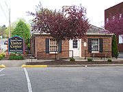
In 1929 the new county courthouse (pictured above) was completed and occupied by the county government. The first state capitol building had been used as the county courthouse prior to that.
The Harrison-Crawford State Forest
Harrison-Crawford State Forest
- Licensing :The Harrison-Crawford State Forest is a large tract of protected forests in south central Indiana along the borders of Harrison and Crawford County.-Creation of the State Forest:...
was started in 1932 when the State of Indiana purchased land in western Harrison County. The 26000 acres (105.2 km²) park is the largest state forest in Indiana and surrounds the O'Bannon Woods State Park
O'Bannon Woods State Park
O'Bannon Woods State Park is located near Leavenworth, Crawford County, Indiana, 32 miles west of Louisville, KY.O'Bannon Woods was originally known as the Wyandotte Woods State Recreation Area, which was part of the Harrison-Crawford State Forest...
and Wyandotte Caves, located in eastern Crawford County.
Matthew E. Welsh Bridge
Matthew E. Welsh Bridge is a two-lane, single-deck continuous truss bridge on the Ohio River. The bridge connects Kentucky Route 79 and Indiana State Road 135, as well as the communities of Brandenburg, Kentucky and Mauckport, Indiana....
was completed in 1966 in Mauckport. It connected Harrison County with neighboring Meade County
Meade County, Kentucky
As of the census of 2000, there were 26,349 people, 9,470 households, and 7,396 families residing in the county. The population density was . There were 10,293 housing units at an average density of...
. This is the only bridge over the Ohio River between Tell City
Tell City, Indiana
Tell City is a city in Troy Township, Perry County, Indiana, along the Ohio River, Indiana's southern border. The population was 7,272 at the 2010 census. The city is the county seat of Perry County.-History:...
and New Albany
New Albany, Indiana
New Albany is a city in Floyd County, Indiana, United States, situated along the Ohio River opposite Louisville, Kentucky. In 1900, 20,628 people lived in New Albany; in 1910, 20,629; in 1920, 22,992; and in 1940, 25,414. The population was 36,372 at the 2010 census. The city is the county seat of...
. In 1969 Dr. Samuel P. Hays donated the 311 acres (1.3 km²) Hayswood Nature Reserve
Hayswood Nature Reserve
The Hayswood Nature Preserve is a county park owned by the Harrison County Park and Recreation Board.-The Samuel P Hays Donation:The preserve was donated to the citizens of Harrison County in 1969 by Dr. Samuel P. Hays. The parks board developed a portion of the land in 1973 for public use, but...
to the county. It was developed in 1973 by the Harrison County Park Board by adding public facilities to the western part of the preserve. It is the second largest nature reserve in the county.
Caesars Indiana
Caesars Indiana
Horseshoe Southern Indiana, is a riverboat casino operated by Caesars Entertainment Corporation. Opened in 1998, it is located outside the community of Elizabeth, Indiana, across the Ohio River from Louisville, Kentucky. The complex is located at the Harrison County line...
opened a casino river boat, hotel complex, and golf course in 1998, boosting the county's tourism industry. The casino complex was purchased and became Horseshoe Southern Indiana on July 11, 2008.
Climate and weather
In recent years, average temperatures in Corydon have ranged from a low of 21 °F (-6.1 °C) in January to a high of 88 °F (31.1 °C) in July, although a record low of -31 °F was recorded in January 1977 and a record high of 104 °F (40 °C) was recorded in July 1983. Average monthly precipitation ranged from 3.13 inches (8 cm) in October to 5.06 inches (12.9 cm) in May.Government
The county government is a constitutional body and is granted specific powers by the Constitution of IndianaConstitution of Indiana
There have been two Constitutions of the State of Indiana. The first constitution was created when the Territory of Indiana sent forty-three delegates to a constitutional convention on June 10, 1816 to establish a constitution for the proposed State of Indiana after the United States Congress had...
and by the Indiana Code
Indiana Code
The Indiana Code is the code of laws for the US State of Indiana. The contents are the codification of the all the laws currently in effect within Indiana...
. Executive and legislative power is vested in the Board of Commissioners, and fiscal power is vested in the County Council.
The seven member county council is the fiscal branch of the county government and controls all the spending and revenue collection in the county. Four representatives are elected from county districts and three are elected at-large. The council members serve four-year terms. They are responsible for setting salaries, the annual budget, and special spending. The council also has limited authority to impose local taxes in the form of an income tax, property tax, excise taxes, and service taxes. County income and property taxes are subject to state level approval. In 2011 the council members were Phil Smith, District 1 (R); Gary Davis, District 2 (R); Gordon Pendleton, District 3 (D); Ralph Sherman District 4 (R); Richard Gerdon, At-Large (D); Jim Heitkemper, At-Large (R); Chris Timberlake, At-Large (D).
The Board of Commissioners consists of three commissioners who are elected county-wide in staggered terms. Each serves a four-year term. One of the commissioners, typically the most senior, serves as president of the board. The commissioners manage the budget set forth by the council, the collection of revenue, enact and repeal ordinances, and managing the day-to-day functions of the county government. The commissioners hold public meetings twice each month to discuss issues affecting the public and receive community input. In 2010 the commissioners were James Goldman, District 1 (D); Carl L. "Buck" Mathes, District 2 (D); Terry L. Miller, District 3 (D).
Harrison County has a Circuit Court and a Superior Court. The Superior Court handles all adult criminal cases, small claims cases, traffic tickets, and infractions. The Circuit Court handles the rest of the cases in the county, including most of the divorce cases, juvenile matters, CHINS cases, civil proceedings, probate, estates, adoptions, civil commitments, and other civil cases. Judges in each court serve a six year term. The Judge of the Circuit Court appoints a referee to handle family law cases.
The county has several other elected offices, including sheriff
Sheriff
A sheriff is in principle a legal official with responsibility for a county. In practice, the specific combination of legal, political, and ceremonial duties of a sheriff varies greatly from country to country....
, coroner
Coroner
A coroner is a government official who* Investigates human deaths* Determines cause of death* Issues death certificates* Maintains death records* Responds to deaths in mass disasters* Identifies unknown dead* Other functions depending on local laws...
, auditor, treasurer
Treasurer
A treasurer is the person responsible for running the treasury of an organization. The adjective for a treasurer is normally "tresorial". The adjective "treasurial" normally means pertaining to a treasury, rather than the treasurer.-Government:...
, recorder
Recorder of deeds
Recorder of deeds is a government office tasked with maintaining public records and documents, especially records relating to real estate ownership that provide persons other than the owner of a property with real rights over that property.-Background:...
, surveyor
Surveying
See Also: Public Land Survey SystemSurveying or land surveying is the technique, profession, and science of accurately determining the terrestrial or three-dimensional position of points and the distances and angles between them...
and circuit court clerk
Court clerk
A court clerk is an officer of the court whose responsibilities include maintaining the records of a court. Another duty is to administer oaths to witnesses, jurors, and grand jurors...
. Each of these elected officers serves a term of four years and oversees a different part of county government. Members elected to county government positions are required to declare party
Political party
A political party is a political organization that typically seeks to influence government policy, usually by nominating their own candidates and trying to seat them in political office. Parties participate in electoral campaigns, educational outreach or protest actions...
affiliations and to be residents of the county.
Most of Harrison County falls within State House District 70 and is represented in Indiana House of Representatives
Indiana House of Representatives
The Indiana House of Representatives is the lower house of the Indiana General Assembly, the state legislature of the U.S. state of Indiana. The House is composed of 100 members representing an equal number of constituent districts. House members serve two-year terms without term limits...
by Democrat Paul J. Robertson. The northernmost part of the county including Palmyra, is part of State House District 73 and is represented by Democrat Dennie Oxley. The entire county is part of State Senate District 47 and is represented in the Indiana State Senate by Democrat Richard Young The county, along with most of southern Indiana, is part of Indiana's 9th congressional district
Indiana's 9th congressional district
Indiana's 9th congressional district is a congressional district in the U.S. state of Indiana. Located in south-central and southeastern Indiana, the district is based in Bloomington....
and is represented in the United States Congress
United States Congress
The United States Congress is the bicameral legislature of the federal government of the United States, consisting of the Senate and the House of Representatives. The Congress meets in the United States Capitol in Washington, D.C....
by Democrat Baron Hill
Baron Hill
Baron Paul Hill is the former U.S. Representative for , serving from 1999 to 2005 and from 2007 to 2011. He is a member of the Democratic Party....
.
Geography
According to the 2010 census, the county has a total area of 486.52 square miles (1,260.1 km²), of which 484.52 square miles (1,254.9 km²) (or 99.59%) is land and 2 square miles (5.2 km²) (or 0.41%) is water.Harrison Spring is located west of Corydon; it is 60 feet (18.3 m) in diameter and is over 4000 feet (1,219.2 m) deep, making it the largest and deepest spring in Indiana. It rises from a solid rock in a level spot of land, and it outputs enough water to have turned flour mills in the past. Is the largest spring by volume in Indiana producing over 3 million gallons of water daily. The spring derives its name from William Henry Harrison who once owned the land surrounding it.
Harrison County's surface is covered by many hills and valleys. The Knobstone Escarpment
Knobstone Escarpment
The Knobstone Escarpment is a rugged geologic region in Southern Indiana. Physically, the Knobstone Escarpment is the most rugged terrain in Indiana. The highest hill in the area is Weed Patch Hill, with an elevation of 1,056 feet above sea level....
begins in the southeastern part of the county, rising sharply at the Ohio River, and following a course roughly along the eastern edge of the county. The "knobs" are the most significant series of hills in Indiana, with the highest knobs near the Ohio River towering 610 feet (185.9 m) over the surrounding valley. This is the greatest local relief difference in the state. The Ohio River borders the entire southeastern, southern, and southwestern part of the county. Blue River forms the western border with Indian Creek and Buck Creek as the primary internal drainage systems.
The western part of the county is preserved as the Harrison-Crawford State Forest
Harrison-Crawford State Forest
- Licensing :The Harrison-Crawford State Forest is a large tract of protected forests in south central Indiana along the borders of Harrison and Crawford County.-Creation of the State Forest:...
and the O'Bannon Woods State Park
O'Bannon Woods State Park
O'Bannon Woods State Park is located near Leavenworth, Crawford County, Indiana, 32 miles west of Louisville, KY.O'Bannon Woods was originally known as the Wyandotte Woods State Recreation Area, which was part of the Harrison-Crawford State Forest...
. The county has extensive cave systems including Squire Boone Caverns
Squire Boone Caverns
Squire Boone Caverns and Village is a cavern exploration attraction in Mauckport, Indiana . The park consists of a one-hour walking tour into the caverns, as well as a working pioneer village and grist mill.-Park's History:...
and the Binkley Cave System and smaller, highly decorated caves such as Jewel Box and Devil's Graveyard caves.
There are six counties adjacent to Harrison County; Washington County
Washington County, Indiana
Washington County is a county located in the U.S. state of Indiana. As of 2010, the population was 28,262. The county seat is Salem.Washington County is part of the Louisville/Jefferson County, KY–IN Metropolitan Statistical Area.-Early settlers:...
to the north; Floyd County
Floyd County, Indiana
Floyd County is a county located in the U.S. state of Indiana. As of 2010, the population was 74,578. The county seat is New Albany. Floyd County is the county with the second smallest land area in the entire state...
to the east; Jefferson County
Jefferson County, Kentucky
As of the census of 2000, there were 693,604 people, 287,012 households, and 183,113 families residing in the county. The population density was . There were 305,835 housing units at an average density of...
, Kentucky
Kentucky
The Commonwealth of Kentucky is a state located in the East Central United States of America. As classified by the United States Census Bureau, Kentucky is a Southern state, more specifically in the East South Central region. Kentucky is one of four U.S. states constituted as a commonwealth...
, to the southeast; Hardin County
Hardin County, Kentucky
As of the census of 2000, there were 94,174 people, 34,497 households, and 25,355 families residing in the county. The population density was . There were 37,673 housing units at an average density of...
, Kentucky
Kentucky
The Commonwealth of Kentucky is a state located in the East Central United States of America. As classified by the United States Census Bureau, Kentucky is a Southern state, more specifically in the East South Central region. Kentucky is one of four U.S. states constituted as a commonwealth...
to the southeast; Meade County
Meade County, Kentucky
As of the census of 2000, there were 26,349 people, 9,470 households, and 7,396 families residing in the county. The population density was . There were 10,293 housing units at an average density of...
, Kentucky
Kentucky
The Commonwealth of Kentucky is a state located in the East Central United States of America. As classified by the United States Census Bureau, Kentucky is a Southern state, more specifically in the East South Central region. Kentucky is one of four U.S. states constituted as a commonwealth...
south; Crawford County
Crawford County, Indiana
Crawford County is a county located in the U.S. state of Indiana. As of 2010, the population was 10,713. The county seat is English.-Geography:...
to the west.
Towns and communities
Corydon, with a 2000 population of 2,715, is the largest town in the county, the county seat, and center of economic activity. Palmyra, located on the northern edge of the county, is the second largest town and had a 2000 population of 644. Lanesville is the third largest town with a 2000 population of 615. MilltownMilltown, Indiana
Milltown is a town in Blue River and Spencer townships in Harrison County and Whiskey Run Township in Crawford County, Indiana, United States. The population was 818 at the 2010 census.-Geography:Milltown is located at ....
had a 2000 population of 932; the town sits on the western border of the county and a majority of its population lives in Crawford County. The county's other incorporated towns, Crandall
Crandall, Indiana
Crandall is a town in Jackson Township, Harrison County, Indiana, United States. The population was 152 at the 2010 census.-Geography:Crandall is located at .According to the United States Census Bureau, the town has a total area of , all of it land....
, Elizabeth
Elizabeth, Indiana
Elizabeth is a town in Posey Township, Harrison County, Indiana, United States. The population was 162 at the 2010 census. It was founded in 1812 and named for Elizabeth Veach, wife of the landowner who donated the land for the town.-History:...
, Laconia
Laconia, Indiana
Laconia is a town in Boone Township, Harrison County, Indiana, United States. The population was 29 at the 2000 census.-Geography:Laconia is located at ....
, Mauckport
Mauckport, Indiana
Mauckport is a town in Heth Township, Harrison County, Indiana, along the Ohio River. The population was 81 at the 2010 census.-History:In the earliest times Daniel Boone and his brothers, most notably Squire Boone, were regularly in the area of Mauckport. Squire Boone settled in the area in 1806...
, and New Middletown
New Middletown, Indiana
New Middletown is a town in Webster Township, Harrison County, Indiana, United States. The population was 93 at the 2010 census.-Geography:New Middletown is located at .According to the United States Census Bureau.-Demographics:...
all have populations under 150. New Amsterdam
New Amsterdam, Indiana
New Amsterdam is a town located in Washington Township, Harrison County, Indiana, USA,along the Ohio River. At the 2010 census, New Amsterdam had a population of 1....
is the smallest town in the county and state with an official 2000 population of 1.
There are several unincorporated and formerly-incorporated communities. These include Bradford
Bradford, Indiana
Bradford is an unincorporated town in Morgan Township, Harrison County, Indiana....
, Central
Central, Indiana
Central is an unincorporated town in Heth Township, Harrison County, Indiana.-History:The town of Central was plotted by William Smith in 1890. It originally contained fifteen lots, two parallel streets coving of land....
, Depauw
Depauw, Indiana
Depauw is an unincorporated town in Blue River Township, Harrison County, Indiana....
, New Salisbury
New Salisbury, Indiana
New Salisbury is an unincorporated community in Jackson Township, Harrison County, Indiana. The community is centered on the intersection of State Highway 135 and State Highway 64, about 8 miles north of Corydon.New Salisbury has many businesses and homes...
, Ramsey
Ramsey, Indiana
Ramsey is an unincorporated town in Jackson Township, Harrison County, Indiana. Originally platted on March 14, 1883, it was originally known as Jackson City. It was platted by Howard Ramsey alongside the Louisville, Evansville and St. Louis Railroad ....
, Rosewood, Sennville and White Cloud
White Cloud, Indiana
White Cloud is an unincorporated community in Harrison Township, Harrison County, Indiana....
.
The county is subdivided into twelve townships: Blue River
Blue River Township, Harrison County, Indiana
Blue River Township is one of twelve townships in Harrison County, Indiana, USA. As of the 2000 census, its population was 1,923.-Geography:Blue River Township covers an area of...
, Boone
Boone Township, Harrison County, Indiana
Boone Township is one of twelve townships in Harrison County, Indiana, USA. As of the 2000 census, its population was 1,217.-History:Boone Township is named after Squire Boone who settled in the township in 1806. He died there in 1813 and is buried in the nearby Squire Boone Caverns. Boone built...
, Franklin
Franklin Township, Harrison County, Indiana
Franklin Township is one of twelve townships in Harrison County, Indiana, USA. As of the 2000 census, its population was 3,642.-Geography:Franklin Township covers an area of ; of this, or 0.08 percent is water...
, Harrison
Harrison Township, Harrison County, Indiana
Harrison Township is one of twelve townships in Harrison County, Indiana, USA. As of the 2000 census, its population was 10,303. Corydon, the county seat of Harrison County, is in Harrison Township.-History:...
, Heth
Heth Township, Harrison County, Indiana
Heth Township is one of twelve townships in Harrison County, Indiana. As of the 2000 census, its population was 1,199.-History:The township was named for Harvey Heth, the man who surveyed much of Southern Indiana...
, Jackson
Jackson Township, Harrison County, Indiana
Jackson Township is one of twelve townships in Harrison County, Indiana. As of the 2000 census, its population was 5,213.-External links:* *...
, Morgan
Morgan Township, Harrison County, Indiana
Morgan Township is one of twelve townships in Harrison County, Indiana. As of the 2000 census, its population was 3,819.-External links:* *...
, Posey
Posey Township, Harrison County, Indiana
Posey Township is one of twelve townships in Harrison County, Indiana. As of the 2000 census, its population was 2,725.-History:Posey township was named for Territorial Governor Thomas Posey....
, Spencer
Spencer Township, Harrison County, Indiana
Spencer Township is one of twelve townships in Harrison County, Indiana. As of the 2000 census, its population was 1,694.-External links:* *...
, Taylor
Taylor Township, Harrison County, Indiana
Taylor Township is one of twelve townships in Harrison County, Indiana. As of the 2000 census, its population was 718.-External links:* * *...
, Washington
Washington Township, Harrison County, Indiana
Washington Township is the smallest of twelve townships in Harrison County, Indiana. At the 2000 census, its population was 256.-History:Washington Township's first settlers were Jacob and Henry Funk and their families who settled in the area in 1805...
, and Webster
Webster Township, Harrison County, Indiana
Webster Township is one of twelve townships in Harrison County, Indiana. As of the 2000 census, its population was 1,616.-External links:* *...
.
| Town | Township | Population | Founded |
|---|---|---|---|
| Corydon Corydon, Indiana Corydon is a town in Harrison Township, Harrison County, Indiana, United States, founded in 1808, and is known as Indiana's First State Capital. After Vincennes, Corydon was the second capital of the Indiana Territory from May 1, 1813, until December 11, 1816. After statehood, the town was the... |
Harrison Harrison Township, Harrison County, Indiana Harrison Township is one of twelve townships in Harrison County, Indiana, USA. As of the 2000 census, its population was 10,303. Corydon, the county seat of Harrison County, is in Harrison Township.-History:... |
2,715 | 1808 |
| Crandall Crandall, Indiana Crandall is a town in Jackson Township, Harrison County, Indiana, United States. The population was 152 at the 2010 census.-Geography:Crandall is located at .According to the United States Census Bureau, the town has a total area of , all of it land.... |
Jackson Jackson Township, Harrison County, Indiana Jackson Township is one of twelve townships in Harrison County, Indiana. As of the 2000 census, its population was 5,213.-External links:* *... |
131 | 1872 |
| Elizabeth Elizabeth, Indiana Elizabeth is a town in Posey Township, Harrison County, Indiana, United States. The population was 162 at the 2010 census. It was founded in 1812 and named for Elizabeth Veach, wife of the landowner who donated the land for the town.-History:... |
Posey Posey Township, Harrison County, Indiana Posey Township is one of twelve townships in Harrison County, Indiana. As of the 2000 census, its population was 2,725.-History:Posey township was named for Territorial Governor Thomas Posey.... |
137 | 1812 |
| Laconia Laconia, Indiana Laconia is a town in Boone Township, Harrison County, Indiana, United States. The population was 29 at the 2000 census.-Geography:Laconia is located at .... |
Boone Boone Township, Harrison County, Indiana Boone Township is one of twelve townships in Harrison County, Indiana, USA. As of the 2000 census, its population was 1,217.-History:Boone Township is named after Squire Boone who settled in the township in 1806. He died there in 1813 and is buried in the nearby Squire Boone Caverns. Boone built... |
29 | 1837 |
| Lanesville Lanesville, Indiana Lanesville is a town in Franklin Township, Harrison County, Indiana, United States. The population was 564 at the 2010 census.-Geography:Lanesville is located at . Its elevation is 699 feet above sea level.... |
Franklin Franklin Township, Harrison County, Indiana Franklin Township is one of twelve townships in Harrison County, Indiana, USA. As of the 2000 census, its population was 3,642.-Geography:Franklin Township covers an area of ; of this, or 0.08 percent is water... |
614 | 1821 |
| Mauckport Mauckport, Indiana Mauckport is a town in Heth Township, Harrison County, Indiana, along the Ohio River. The population was 81 at the 2010 census.-History:In the earliest times Daniel Boone and his brothers, most notably Squire Boone, were regularly in the area of Mauckport. Squire Boone settled in the area in 1806... |
Heth Heth Township, Harrison County, Indiana Heth Township is one of twelve townships in Harrison County, Indiana. As of the 2000 census, its population was 1,199.-History:The township was named for Harvey Heth, the man who surveyed much of Southern Indiana... |
83 | 1827 |
| Milltown Milltown, Indiana Milltown is a town in Blue River and Spencer townships in Harrison County and Whiskey Run Township in Crawford County, Indiana, United States. The population was 818 at the 2010 census.-Geography:Milltown is located at .... |
Blue River Blue River Township, Harrison County, Indiana Blue River Township is one of twelve townships in Harrison County, Indiana, USA. As of the 2000 census, its population was 1,923.-Geography:Blue River Township covers an area of... |
932* | 1827 |
| New Amsterdam New Amsterdam, Indiana New Amsterdam is a town located in Washington Township, Harrison County, Indiana, USA,along the Ohio River. At the 2010 census, New Amsterdam had a population of 1.... |
Washington Washington Township, Harrison County, Indiana Washington Township is the smallest of twelve townships in Harrison County, Indiana. At the 2000 census, its population was 256.-History:Washington Township's first settlers were Jacob and Henry Funk and their families who settled in the area in 1805... |
1 | 1815 |
| New Middletown New Middletown, Indiana New Middletown is a town in Webster Township, Harrison County, Indiana, United States. The population was 93 at the 2010 census.-Geography:New Middletown is located at .According to the United States Census Bureau.-Demographics:... |
Webster Webster Township, Harrison County, Indiana Webster Township is one of twelve townships in Harrison County, Indiana. As of the 2000 census, its population was 1,616.-External links:* *... |
77 |
Demographics
As of the censusCensus
A census is the procedure of systematically acquiring and recording information about the members of a given population. It is a regularly occurring and official count of a particular population. The term is used mostly in connection with national population and housing censuses; other common...
of 2000, there were 34,325 people, 12,917 households, and 9,713 families residing in the county. The population density
Population density
Population density is a measurement of population per unit area or unit volume. It is frequently applied to living organisms, and particularly to humans...
was 71 people per square mile (27/km²). There were 13,699 housing units at an average density of 28 per square mile (11/km²). The majority of the population was rural, with 13.4% living in towns and 76.6% living in unincorporated areas. The racial makeup of the county was 98.38% White
Race (United States Census)
Race and ethnicity in the United States Census, as defined by the Federal Office of Management and Budget and the United States Census Bureau, are self-identification data items in which residents choose the race or races with which they most closely identify, and indicate whether or not they are...
, 0.37% Black
Race (United States Census)
Race and ethnicity in the United States Census, as defined by the Federal Office of Management and Budget and the United States Census Bureau, are self-identification data items in which residents choose the race or races with which they most closely identify, and indicate whether or not they are...
or African American
Race (United States Census)
Race and ethnicity in the United States Census, as defined by the Federal Office of Management and Budget and the United States Census Bureau, are self-identification data items in which residents choose the race or races with which they most closely identify, and indicate whether or not they are...
, 0.28% Native American
Race (United States Census)
Race and ethnicity in the United States Census, as defined by the Federal Office of Management and Budget and the United States Census Bureau, are self-identification data items in which residents choose the race or races with which they most closely identify, and indicate whether or not they are...
, 0.21% Asian
Race (United States Census)
Race and ethnicity in the United States Census, as defined by the Federal Office of Management and Budget and the United States Census Bureau, are self-identification data items in which residents choose the race or races with which they most closely identify, and indicate whether or not they are...
, 0.01% Pacific Islander
Race (United States Census)
Race and ethnicity in the United States Census, as defined by the Federal Office of Management and Budget and the United States Census Bureau, are self-identification data items in which residents choose the race or races with which they most closely identify, and indicate whether or not they are...
, 0.18% from other races
Race (United States Census)
Race and ethnicity in the United States Census, as defined by the Federal Office of Management and Budget and the United States Census Bureau, are self-identification data items in which residents choose the race or races with which they most closely identify, and indicate whether or not they are...
, and 0.57% from two or more races. 0.96% of the population were Hispanic
Race (United States Census)
Race and ethnicity in the United States Census, as defined by the Federal Office of Management and Budget and the United States Census Bureau, are self-identification data items in which residents choose the race or races with which they most closely identify, and indicate whether or not they are...
or Latino
Race (United States Census)
Race and ethnicity in the United States Census, as defined by the Federal Office of Management and Budget and the United States Census Bureau, are self-identification data items in which residents choose the race or races with which they most closely identify, and indicate whether or not they are...
of any race. 33.3% were of German
Germans
The Germans are a Germanic ethnic group native to Central Europe. The English term Germans has referred to the German-speaking population of the Holy Roman Empire since the Late Middle Ages....
, 23.9% American
United States
The United States of America is a federal constitutional republic comprising fifty states and a federal district...
, 11.3% Irish
Irish people
The Irish people are an ethnic group who originate in Ireland, an island in northwestern Europe. Ireland has been populated for around 9,000 years , with the Irish people's earliest ancestors recorded having legends of being descended from groups such as the Nemedians, Fomorians, Fir Bolg, Tuatha...
and 9.5% English
English people
The English are a nation and ethnic group native to England, who speak English. The English identity is of early mediaeval origin, when they were known in Old English as the Anglecynn. England is now a country of the United Kingdom, and the majority of English people in England are British Citizens...
ancestry according to Census 2000.
There were 12,917 households out of which 36.00% had children under the age of 18 living with them, 62.40% were married couples
Marriage
Marriage is a social union or legal contract between people that creates kinship. It is an institution in which interpersonal relationships, usually intimate and sexual, are acknowledged in a variety of ways, depending on the culture or subculture in which it is found...
living together, 8.80% had a female householder with no husband present, and 24.80% were non-families. 20.70% of all households were made up of individuals and 8.40% had someone living alone who was 65 years of age or older. The average household size was 2.63 and the average family size was 3.04.
In the county the population was spread out with 25.90% under the age of 18, 8.70% from 18 to 24, 30.20% from 25 to 44, 23.70% from 45 to 64, and 11.40% who were 65 years of age or older. The median age was 37 years. For every 100 females there were 99.30 males. For every 100 females age 18 and over, there were 97.20 males.
The median income for a household in the county was $43,423, and the median income for a family was $48,542. Males had a median income of $33,735 versus $24,897 for females. The per capita income
Per capita income
Per capita income or income per person is a measure of mean income within an economic aggregate, such as a country or city. It is calculated by taking a measure of all sources of income in the aggregate and dividing it by the total population...
for the county was $19,643. About 4.90% of families and 6.40% of the population were below the poverty line, including 7.30% of those under age 18 and 9.80% of those age 65 or over.
Economy
Maize
Maize known in many English-speaking countries as corn or mielie/mealie, is a grain domesticated by indigenous peoples in Mesoamerica in prehistoric times. The leafy stalk produces ears which contain seeds called kernels. Though technically a grain, maize kernels are used in cooking as a vegetable...
and soybean
Soybean
The soybean or soya bean is a species of legume native to East Asia, widely grown for its edible bean which has numerous uses...
s are the county's largest crops. A service and shopping district is centered in Corydon. There are several medical facilities in the county including the Harrison County Hospital, two nursing facilities operated by Kindred Healthcare
Kindred Healthcare
Kindred Healthcare Incorporated is a healthcare services company that through its subsidiaries operates hospitals, nursing centers, and contract rehabilitation services across the United States...
, and a number of private practices.
The county has a developed tourism industry. The main attractions are the historic sites of Corydon, the county's golf courses, the Horseshoe Riverboat Casino and Hotel, and the area's two famous caves: Squire Boone Caverns
Squire Boone Caverns
Squire Boone Caverns and Village is a cavern exploration attraction in Mauckport, Indiana . The park consists of a one-hour walking tour into the caverns, as well as a working pioneer village and grist mill.-Park's History:...
near Mauckport and Wyandotte Caves
Wyandotte Caves
Wyandotte Caves, a pair of limestone caves located on the Ohio River in Harrison-Crawford State Forest in Crawford County, five miles north-east of Leavenworth and 12 miles from Corydon in southern Indiana, is a popular tourist attraction. Wyandotte Caves were designated a National Natural...
in adjoining Crawford County
Crawford County, Indiana
Crawford County is a county located in the U.S. state of Indiana. As of 2010, the population was 10,713. The county seat is English.-Geography:...
. The casino is the county's single largest source of tax revenue and produced $23.5 million in tax revenue during 2007.
Multiple utility companies serve the county. Electricity is provided by the Harrison Rural Electric Membership Cooperative (REMC) and Duke Energy
Duke Energy
Duke Energy , headquartered in Charlotte, North Carolina, is an energy company with assets in the United States, Canada and Latin America.-Overview:...
. Natural gas is provided by the Indiana Utilities Corporation in Corydon and several small distributors provide rural service. Land-line telephone service is provided exclusively by Verizon. Cable television
Cable television
Cable television is a system of providing television programs to consumers via radio frequency signals transmitted to televisions through coaxial cables or digital light pulses through fixed optical fibers located on the subscriber's property, much like the over-the-air method used in traditional...
is provided by Insight Communications
Insight Communications
Insight Communications is the 13th largest multiple system operator in the United States with approximately 692,000 customers in the three contiguous states of Kentucky, Indiana and Ohio...
in some parts of the county. Water is pumped from a number of corporations, the largest being South Harrison Water Corporation and Ramsey Water Inc.
As of July 2009, the county's largest employer was the Horseshoe Southern Indiana casino with 1,600 employees. Other large employers are Tyson Foods
Tyson Foods
Tyson Foods, Inc. is a multinational corporation based in Springdale, Arkansas, that operates in the food industry. The company is the world's second largest processor and marketer of chicken, beef, and pork only behind Brazilian JBS S.A., and annually exports the largest percentage of beef out of...
with 550 employees, Harrison County Hospital employs 504, South Harrison Community School Corporation employs 425, Blue River Services employs 405, Wal-Mart
Wal-Mart
Wal-Mart Stores, Inc. , branded as Walmart since 2008 and Wal-Mart before then, is an American public multinational corporation that runs chains of large discount department stores and warehouse stores. The company is the world's 18th largest public corporation, according to the Forbes Global 2000...
employs 400, North Harrison Community School Corporation employs 311, ICON Metal Forming employs 200, Darmic Inc. employs 120, Kindred Healthcare employs 115, Smith Store Fixtures and Lucas Oil
Lucas Oil
Lucas Oil Products is a manufacturer and distributor of automotive oil, additives, and lubricants. It was founded by trucker Forrest Lucas and his wife Charlotte in 1989....
Products each employs 80, Norstam Veneers employs 50, and Speed Flex employs 41. An additional 92 businesses employ 5 to 40 workers. In total, 13% of the workforce is in retail, 12% in government, 12% in manufacturing, 11% in services, 8% in accommodations and food services, 8% in agriculture, 7% in construction, 7% working for local utilities, 6% in finance, insurance, and real estate, and 6% in other trades. The Louisville, Jefferson County, KY-IN Metropolitan statistical area to which Harrison County belongs has an unemployment rate of 10.2% in December 2009.
Transportation
Harrison County is bisected by the major east-west Interstate 64Interstate 64
Interstate 64 is an Interstate Highway in the Midwestern and Southeastern United States. Its western terminus is at I-70, U.S. 40, and U.S. 61 in Wentzville, Missouri. Its eastern terminus is at an interchange with I-264 and I-664 at Bowers Hill in Chesapeake, Virginia. As I-64 is concurrent with...
. The highway has entrances and exits at Corydon and Lanesville. Indiana State Road 135
Indiana State Road 135
State Road 135 in the U.S. State of Indiana is a road that connects Indianapolis with the Ohio River; for the most part it is a two-lane road.-Route description:The southern terminus is the Matthew E. Welsh Bridge on the east side of Mauckport...
and Indiana State Road 62
Indiana State Road 62
State Road 62 in the U.S. State of Indiana is an east–west route that runs from the Illinois state line in the southwest corner of Indiana to the Louisville, Kentucky area, then northeast toward the Cincinnati, Ohio area.-Route description:...
are roughly perpendicular and cross each other at Corydon. U.S. Route 150
U.S. Route 150
U.S. Route 150 is a 571 mile long northwest-southeast United States highway, signed as east–west. It runs from U.S. Route 6 outside of Moline, Illinois to U.S. Route 25 in Mount Vernon, Kentucky .-Illinois:In the state of Illinois, U.S. 150 runs from the Quad City International Airport at U.S...
crosses the northern part of the county following the route of the Buffalo Trace
Buffalo Trace (road)
The Buffalo Trace was a trackway running through what are now the American states of Kentucky, Indiana, and Illinois. Originally formed by migrating bison, the trace crossed the Ohio River near the Falls of the Ohio and the Wabash River near Vincennes...
. Indiana State Road 64
Indiana State Road 64
State Road 64 in the U.S. State of Indiana is an east–west highway that crosses most of the southern portion of the state, covering a distance of about .-Route description:...
is a east-west route through the north central part of the county, crossing Indiana 135 in New Salisbury. Indiana State Road 111
Indiana State Road 111
State Road 111 in the U.S. State of Indiana is a rural two lane highway which passes though New Albany in the far southern portion of the state. It has existed since 1935.-Route description:...
connects Elizabeth with New Albany
New Albany, Indiana
New Albany is a city in Floyd County, Indiana, United States, situated along the Ohio River opposite Louisville, Kentucky. In 1900, 20,628 people lived in New Albany; in 1910, 20,629; in 1920, 22,992; and in 1940, 25,414. The population was 36,372 at the 2010 census. The city is the county seat of...
in neighboring Floyd County; the Horseshoe Riverboat Casino is located on the route. Indiana State Road 337
Indiana State Road 337
State Road 337 in the U.S. State of Indiana is divided into a northern section and a southern section.-Southern section:The southern section is about long. Starting at State Road 64 in Depauw it runs along rolling hills toward Corydon. The Harrison County Hospital is located on the stretch next to...
crosses the county from the northwest to the southeast, passing through Corydon in the center of the county.
Two railroads operate in the county; the Lucas Rail Lines and the much larger Norfolk Southern Railway
Norfolk Southern Railway
The Norfolk Southern Railway is a Class I railroad in the United States, owned by the Norfolk Southern Corporation. With headquarters in Norfolk, Virginia, the company operates 21,500 route miles in 22 eastern states, the District of Columbia and the province of Ontario, Canada...
. Lucas Rail Lines is a 14 miles (22.5 km) long spur beginning in downtown Corydon, moving northward through the industrial park where Lucas Oil's bottling facilities are located, and thence northward to where it intersects with the Norfolk South line near New Salisbury. Norfolk Southern's line runs east-west across the northern half of the county passing through Crandall, Ramsey, and Depauw. It has a small depot in Ramsey.
Education
The county has twenty-two school; fifteen public schools in three school districts, and seven private schools. South Harrison Community Schools is the largest district with 3,141 pupils in 2010. The district covers the southern half of the county and includes Corydon Central High SchoolCorydon Central High School
Corydon Central High School is a public high school located in Corydon, Indiana. The school is part of the South Harrison Community School System. The school serves high school age students of Harrison Township,...
, Corydon Central Junior High School
Corydon Central Junior High School
Corydon Central Junior High School is a middle school serving grades 7-8 located in Corydon, Indiana. The school is part of the South Harrison Community School System. The school is built adjacent the Corydon Central High School....
, South Central Junior & Senior High School
South Central Junior & Senior High School
South Central Junior and & Senior High School is a public school servings grades 7-12 located in south central Harrison County, Indiana. The school serves the students of Laconia and Elizabeth and their townships. The school is built adjacent to South Central Elementary School. The school had 432...
, Corydon Intermediate, Corydon Elementary, Heth-Washington Elementary
Heth-Washington Elementary
Heth Washington Elementary School is a kindergarten through 6th grade school located in south-western Harrison County, Indiana. It is part of the South Harrison Community School System. The school serves elementary school age children from Heth and Washington townships near Central.The school...
, and New Middletown Elementary. North Harrison Community School Corporation had 2,324 pupils in 2010 enrolled in North Harrison High School
North Harrison High School
North Harrison High School is a public high school located in Ramsey, Indiana. It is part of the North Harrison Community School System. It serves as the consolidated high school for Morgan Elementary and North Harrison Elementary schools....
, North Harrison Middle School
North Harrison Middle School
North Harrison Middle School is a part of North Harrison community schools.-External links:* *...
, North Harrison Elementary, and Morgan Elementary. Lanesville Community School Corporation is the smallest district serving only Franklin Township. It consists of Lanesville Junior Senior High School
Lanesville Junior Senior High School
Lanesville Junior Senior Highs School is a public school in Lanesville, Indiana that serves grade 7-12. It is part of the Lanseville Community School Corporation. It is attended by students from Lanesville and surrounding Franklin Township...
and Lanesville Elementary. In 2010, teachers in the North Harrison district averaged $50,800 in annual salary; South Harrison teachers averaged $48,500; Lanesville teachers averaged $51,500. North Harrison had a 2010 graduation rate of 81.5%; South Harrison 84.6%; Lanesville 91.5%. Lanesville and North Harrison students performed above average on 2010 statewide ISTEP+ tests, while South Harrison students performed below average.
The county also has several prominent private schools supported by local churches. St. John's, a Lutheran school near Lanesville, has 77 pupils. St. Joseph's, a Catholic school
Catholic school
Catholic schools are maintained parochial schools or education ministries of the Catholic Church. the Church operates the world's largest non-governmental school system...
in Corydon, has 87 pupils. County high school students, including those in public, private, and homeschools, have access to attend the vocational school
Vocational school
A vocational school , providing vocational education, is a school in which students are taught the skills needed to perform a particular job...
C. A. Prosser school of Technology in neighboring Floyd County as part of their high school curriculum.
See also
- Louisville-Jefferson County, KY-IN Metropolitan Statistical Area
- Louisville-Elizabethtown-Scottsburg, KY-IN Combined Statistical Area
- National Register of Historic Places listings in Harrison County, IndianaNational Register of Historic Places listings in Harrison County, IndianaThis is a list of the National Register of Historic Places listings in Harrison County, Indiana.This is intended to be a complete list of the properties and districts on the National Register of Historic Places in Harrison County, Indiana, United States...
- :Category:Harrison County, Indiana