
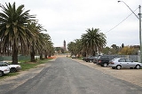
Harden, New South Wales
Encyclopedia


South West Slopes, New South Wales
The South West Slopes is a region predominantly in New South Wales, Australia. It covers the lower inland slopes of the Great Dividing Range extending from north of Cowra through southern NSW into western Victoria...
region of New South Wales
New South Wales
New South Wales is a state of :Australia, located in the east of the country. It is bordered by Queensland, Victoria and South Australia to the north, south and west respectively. To the east, the state is bordered by the Tasman Sea, which forms part of the Pacific Ocean. New South Wales...
in Australia
Australia
Australia , officially the Commonwealth of Australia, is a country in the Southern Hemisphere comprising the mainland of the Australian continent, the island of Tasmania, and numerous smaller islands in the Indian and Pacific Oceans. It is the world's sixth-largest country by total area...
and is adjacent to both the Canberra
Canberra
Canberra is the capital city of Australia. With a population of over 345,000, it is Australia's largest inland city and the eighth-largest city overall. The city is located at the northern end of the Australian Capital Territory , south-west of Sydney, and north-east of Melbourne...
region of the Australian Capital Territory
Australian Capital Territory
The Australian Capital Territory, often abbreviated ACT, is the capital territory of the Commonwealth of Australia and is the smallest self-governing internal territory...
and the Riverina
Riverina
The Riverina is an agricultural region of south-western New South Wales , Australia. The Riverina is distinguished from other Australian regions by the combination of flat plains, warm to hot climate and an ample supply of water for irrigation. This combination has allowed the Riverina to develop...
Region in the southwest area of NSW. The town is a twin town between Harden and Murrumburrah
Murrumburrah, New South Wales
Murrumburrah is a township in New South Wales, Australia in Harden Shire and forms a twin town with Harden. It is near both the Canberra region of the Australian Capital Territory, and the Riverina Region in the southwest area of NSW. It is on the Burley Griffin Way, the major link from the...
(which is noted as one of the earliest settlements in the southwest of New South Wales
New South Wales
New South Wales is a state of :Australia, located in the east of the country. It is bordered by Queensland, Victoria and South Australia to the north, south and west respectively. To the east, the state is bordered by the Tasman Sea, which forms part of the Pacific Ocean. New South Wales...
).
The shire is traversed by the Burley Griffin Way
Burley Griffin Way
Burley Griffin Way is a New South Wales state route, is located in south eastern Australia. Named after the American architect, Walter Burley Griffin, designer of the cities of Canberra and Griffith, the highway links the two cities via Yass and the Barton Highway.It provides a major link between...
, the major link from and between the extra supportive the Riverina to the Hume Highway near Yass
Yass, New South Wales
Yass is a town in the Southern Tablelands of New South Wales, Australia in Yass Valley Shire. The name appears to have been derived from an Aboriginal word, "Yarrh" , said to mean 'running water'....
, and ultimately Sydney
Sydney
Sydney is the most populous city in Australia and the state capital of New South Wales. Sydney is located on Australia's south-east coast of the Tasman Sea. As of June 2010, the greater metropolitan area had an approximate population of 4.6 million people...
, Canberra and the coast. Cunningham Creek
Cunningham Creek
Cunningham Creek is a creek located in the Cariboo region of British Columbia. The creek was discovered in 1861 by William Cunningham. The creek was mined for gold by European and Chinese Miners....
runs along the edge of the town.
The Olympic Highway traverses the western end of the shire and is the major link through the central west to the Blue Mountains and from there to the Sydney region.
Harden is 3.5 hours away by road from Sydney, and 1.5 hours from Canberra and Wagga Wagga
Wagga Wagga, New South Wales
Wagga Wagga is a city in New South Wales, Australia. Straddling the Murrumbidgee River, and with an urban population of 46,735 people, Wagga Wagga is the state's largest inland city, as well as an important agricultural, military, and transport hub of Australia...
. The shire is accessible via the XPT passenger rail service.
Beggan Beggan is a village community in the north east boundary of the Riverina
Riverina
The Riverina is an agricultural region of south-western New South Wales , Australia. The Riverina is distinguished from other Australian regions by the combination of flat plains, warm to hot climate and an ample supply of water for irrigation. This combination has allowed the Riverina to develop...
, located within Harden's boundaries. It is situated about 17 kilometres north from Jugiong
Jugiong, New South Wales
Jugiong is a village community on the banks of the Murrumbidgee River, in the central east part of the Riverina. It is situated just off the Hume Highway, by road, about 30 kilometres southwest from Bookham and 40 kilometres northeast from Gundagai...
and 20 kilometres south west from Harden.
History
Before European settlement the Harden area was inhabited by the WiradjuriWiradjuri
The Wiradjuri are an Indigenous Australian group of central New South Wales.In the 21st century, major Wiradjuri groups live in Condobolin, Peak Hill, Narrandera and Griffith...
people. Hume and Hovell passed nearby in 1824. In the late 1820s, the 'Murrumburra' was established. Its superintendent, James Kennedy, established an inn on the townsite in the late 1840s. Gold was found in the area in the 1850s. A railway station was opened one km east of Murrumburrah on the Main Southern line
Main Southern railway line, New South Wales
The Main Southern Railway is a major railway in New South Wales, Australia. It runs through the Southern Highlands, Southern Tablelands, South West Slopes and the Riverina regions.- Description of route :...
in 1877 as Murrumburrah Station, but changed its name to Harden Station a year after the opening of a new station in Murrumburrah in 1879. The first Australian Lighthorse was also founded in Harden-Murrumburrah, with the Lighthorse festival occurring annually. Jack Wilfred Granger was the youngest mayor of Harden, and died in June 2008. Harden has remained as the main station and, as a result, became the main town. Harden Post Office opened on 1 January 1870.
Transport
The Main Southern Railway passes through Harden which was once one of the great railway townRailway town
A railway town is a settlement that originated or was greatly developed because of a railway station or junction at its site.In Victorian Britain, the spread of railways greatly affected the fate of many small towns...
s. Countrylink
CountryLink
CountryLink is the operator of passenger rail services in country New South Wales, Australia and into Queensland and Victoria. It is an operating brand of the Rail Corporation New South Wales, a government-owned entity...
provide four XPT services passing through the town daily, two each way, an Xplorer service to Griffith on Saturday returning Sundays and a daily coach service between Cootamundra and Canberra.
Demography
Harden is situated in the south west slopes of New South WalesNew South Wales
New South Wales is a state of :Australia, located in the east of the country. It is bordered by Queensland, Victoria and South Australia to the north, south and west respectively. To the east, the state is bordered by the Tasman Sea, which forms part of the Pacific Ocean. New South Wales...
. Harden-Murrumburrah is situated in some of the best wheat growing land in Australia and forms part of what is referred to as the 'Golden Triangle' of the best wheat-growing land in Australia, having as it does an ideal average rainfall and ideal soil conditions for wheat farming.