
Gülnar
Encyclopedia
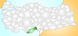
Gülnar is a district of Mersin Province
of Turkey
, 150 km (93 mi) south-west of the city of Mersin
.
, attractive countryside known for its vineyards and its green meadows used for summer grazing. Gülnar is a small town providing high schools and other basic amenities to the surrounding villages.(Town population. 8 357) The road from central Anatolia
to Anamur
on the Mediterranean coast passes through here, one of the windiest roads imaginable, making Gulnar a remote district indeed.
The land area of Gülnar is 1669 km² (644 sq mi) of which 351.1 km² (136 sq mi) is cultivated, 848.09 km² (327 sq mi) is forested hillside, 1.3 km² (0.501932806170296 sq mi) is high meadow, and 468.51 km² (181 sq mi) is rocky mountains. Much of the cultivated area is vineyards, other important crops are grains and chick peas. The high meadows are used for summer grazing.
, and was later settled by the Assyrians, Persians, Egyptians
and later the Ancient Romans. The people of Gülnar today are descendents of the Turkmen
tribes that came here from Central Asia
in the 13th century. (Among older generation of Turkmens Gülnar is usually named as Anaypazarı )
Mersin Province
The Mersin Province is a province in southern Turkey, on the Mediterranean coast between Antalya and Adana. The provincial capital is the city of Mersin and the other major town is Tarsus, birthplace of St Paul...
of Turkey
Turkey
Turkey , known officially as the Republic of Turkey , is a Eurasian country located in Western Asia and in East Thrace in Southeastern Europe...
, 150 km (93 mi) south-west of the city of Mersin
Mersin
-Mersin today:Today, Mersin is a large city spreading out along the coast, with Turkey's second tallest skyscraper , huge hotels, an opera house, expensive real estate near the sea or up in the hills, and many other modern urban...
.
Geography
The town of Gülnar is 32 km (20 mi) inland on a plain high in the Taurus MountainsTaurus Mountains
Taurus Mountains are a mountain complex in southern Turkey, dividing the Mediterranean coastal region of southern Turkey from the central Anatolian Plateau. The system extends along a curve from Lake Eğirdir in the west to the upper reaches of the Euphrates and Tigris rivers in the east...
, attractive countryside known for its vineyards and its green meadows used for summer grazing. Gülnar is a small town providing high schools and other basic amenities to the surrounding villages.(Town population. 8 357) The road from central Anatolia
Anatolia
Anatolia is a geographic and historical term denoting the westernmost protrusion of Asia, comprising the majority of the Republic of Turkey...
to Anamur
Anamur
Anamur is a town and district of the province of Mersin, on the Mediterranean coast of southern Turkey, between Antalya and the city of Mersin.Anamur is Turkey's southernmost point, a coastal resort famous for its bananas and peanuts.-Etymology:...
on the Mediterranean coast passes through here, one of the windiest roads imaginable, making Gulnar a remote district indeed.
The land area of Gülnar is 1669 km² (644 sq mi) of which 351.1 km² (136 sq mi) is cultivated, 848.09 km² (327 sq mi) is forested hillside, 1.3 km² (0.501932806170296 sq mi) is high meadow, and 468.51 km² (181 sq mi) is rocky mountains. Much of the cultivated area is vineyards, other important crops are grains and chick peas. The high meadows are used for summer grazing.
History
The area has been occupied since the time of the HittitesHittites
The Hittites were a Bronze Age people of Anatolia.They established a kingdom centered at Hattusa in north-central Anatolia c. the 18th century BC. The Hittite empire reached its height c...
, and was later settled by the Assyrians, Persians, Egyptians
Egyptians
Egyptians are nation an ethnic group made up of Mediterranean North Africans, the indigenous people of Egypt.Egyptian identity is closely tied to geography. The population of Egypt is concentrated in the lower Nile Valley, the small strip of cultivable land stretching from the First Cataract to...
and later the Ancient Romans. The people of Gülnar today are descendents of the Turkmen
Turkmen people
The Turkmen are a Turkic people located primarily in the Central Asian states of Turkmenistan, Afghanistan, and northeastern Iran. They speak the Turkmen language, which is classified as a part of the Western Oghuz branch of the Turkic languages family together with Turkish, Azerbaijani, Qashqai,...
tribes that came here from Central Asia
Central Asia
Central Asia is a core region of the Asian continent from the Caspian Sea in the west, China in the east, Afghanistan in the south, and Russia in the north...
in the 13th century. (Among older generation of Turkmens Gülnar is usually named as Anaypazarı )