

Guerrero
Encyclopedia
Guerrero officially Estado Libre y Soberano de Guerrero (Free and Sovereign State of Guerrero) is one of the 31 states which, with the Federal District
, comprise the 32 Federal Entities of Mexico
. It is divided in 81 municipalities
and its capital city is Chilpancingo
.
It is located in Southwestern Mexico
. It is bordered by the states of Michoacán
to the north and west, México and Morelos
to the north, Puebla
to the northeast and Oaxaca
to the east.
The state was named after Vicente Guerrero
, one of the most prominent leaders in the Mexican War of Independence
and the second President of Mexico
. It is the only Mexican state named after a president. The modern entity did not exist until 1849, when it was carved out of territories from the states of Mexico, Puebla
and Michoacán
.
In addition to the capital city, the state's largest cities include Acapulco
, Petatlan
, Ciudad Altamirano
, Taxco
, Iguala
, Ixtapa
, Zihuatanejo
, and Santo Domingo
. Today, it is home to a number of indigenous communities, including the Nahuas, Mixtec
s and Amuzgo
s. It is also home to communities of Afro-Mexican
s in the Costa Chica
region.
Geographically, the state is mountainous and rugged with flat areas limited to small mesa
s and the coast line. This coastline has been important economically for the area, first as the port of Acapulco in colonial and post-Independence area and today for the tourist destinations of Acapulco, Zihuatanejo and Ixtapa. Tourism is the single most important economic factor of the state and Acapulco’s tourism is important to the nation’s economy as a whole. However, other sources of employment are scarce in the state, which has caused its ranking as number one in the emigration of workers to the United States. In addition, the state of Guerrero is currently the most violent state in Mexico's Drug War
.
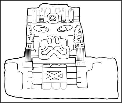
_.jpg) The first humans in the state’s territory were nomadic hunter-gatherers who left evidence of their existence in various caves starting about 20,000 years ago. Up until about 8,000 years ago, climatic conditions better favored human habitation than those today; however, sedimentary human habitation happened around this time in the mountainous areas with more moisture, and better soil for agriculture. After that, settlements appeared near the coast because of fishing. At these sites, evidence of weaving, ceramics, basketry and other crafts have been found. Around this time, a grain called teocintle, or the forerunner to corn, became the staple of the diet.
The first humans in the state’s territory were nomadic hunter-gatherers who left evidence of their existence in various caves starting about 20,000 years ago. Up until about 8,000 years ago, climatic conditions better favored human habitation than those today; however, sedimentary human habitation happened around this time in the mountainous areas with more moisture, and better soil for agriculture. After that, settlements appeared near the coast because of fishing. At these sites, evidence of weaving, ceramics, basketry and other crafts have been found. Around this time, a grain called teocintle, or the forerunner to corn, became the staple of the diet.
There is debate as to whether the earliest civilizations here were Olmec
s who migrated to this region or native peoples who were heavily influenced by the Olmecs, especially in the Mexcala River
area. Olmec influences can be seen in cave paintings such as those found in Juxtlahuaca
and well as stone tools and jade jewelry from the time period.
Eventually, the peoples of the Mexcala River area developed their own distinctive culture, called Mezcala or Mexcala. It is characterized by its own sculpture and ceramics, distinguished by its simplicity. Olmec influence remained with this culture, especially evident in the grouping of villages, construction of ceremonial centers and a government dominated by priests. Later, the culture assimilated aspects of the Teotihuacan
model, which included the Mesoamerican ball game .
Later migrations to the area brought ethnicities such as the P’urhépecha, the Mixtecs, the Maya
and the Zapotecs who left traces on the local cultures as they established commercial centers around the 7th century. In the 8th century, Toltec
influence was felt as they traveled the many trade routes through here in search of tropical bird plumage and amate paper
. From the 12th century to the 15th, the various peoples of the state were influence by the Chichimeca
s, culminating in Aztec domination by the 15th century.
In the 11th century, new migrations entered the area from the north, which included the Nahuas, who occupied what is now the center of the state and the P’urhépecha who took over the west. The Nahuas established themselves in Zacatula
, Atoyac
and Tlacotepec
, later conquering the areas occupied by the Chontal
s and Matlazincas.
By the 15th century, the territory of modern Guerrero state was inhabited by a number of peoples, none of whom had major cities or population centers. The most important of these peoples where the P’urhépecha, Cuitlatecas, Ocuitecas and Matlazincas in the Tierra Caliente
, the Chontales, Mazatlecos and Tlahuicas in the Sierra del Norte, the Coixcas and Tepoztecos in the Central Valleys, the Tlapanecos and Mixtecs in the La Montaña, the Jopis, Mixtecos and Amuzgos in Costa Chica and Tolimecas, Chubias, Pantecas and Cuitlecas in Costa Grande
. Most of these lived in smaller dominions with moderate social stratification. One distinctive feature of the peoples of this was the use of cotton garments.
The Aztecs began making incursions in the Guerrero area as early as 1414 under Chimalpopoca
as part of the conquest of the Toluca Valley
. Incursions into the Tierra Caliente came around 1433 under Itzcoatl
who attacked the Cuitlatecos settled between the Teloloapan and Cocula Rivers. By 1440, the Aztec Empire controlled the north of the state, or the La Montaña area. Attempts to take the Costa Chica area began in 1452 against the Yopis, which failed. Various battles would be fought between 1452 and 1511 before most of the rest of the state became Aztec tributary provinces. The modern state of Guerrero the comprised seven Aztec provinces.
(who was the son of a Chontal princess and Ahuizotl), came from Ixcateopan. After the fall of Tenochtitlan, there was little resistance by the peoples of the Guerrero area to the Spanish and a number of them, such as the Amuzgos, actively sided with the Europeans. In 1521, Rodrigo de Castañeda entered the Taxco area, while Gonzalo de Sandoval
marched on the Chontal region, the Sierra del Norte, the Iguala
valley and later the Costa Chica. Juan Rodriguz de Villafuerte took the Costa Grande area.
After the Spanish Conquest, the territory was part of the “audencia” called “Mexico,” which initially consisted of the lands of the former Aztec Empire, which was then diminished somewhat when it became a province of New Spain
. The Guerrero area was attractive to the Spanish mostly for its coast. The first Spanish Pacific port was at Zihuatanejo, used for trade, fishing and pearls. Another important area for the Spanish was Taxco for its minerals. The lands were divided into 76 encomienda
s given to the conquistador
s to exploit the mines, farmlands, forest and native peoples. Evangelization efforts were undertaken by the Augustinians in the Central Valleys, La Montaña and Tierra Caliente regions while the Franciscans took the northern areas, the Costa Grande and Acapulco.
Much of the population decline occurred in the first half of the 16th century when diseases brought by the Europeans, as well as brutal exploitation, killed many natives. This was particularly true in the Costa Chica region, which would lead to the importation of African slaves to the area. During this time indigenous political bodies called “pueblos” or “Indian Republics” arose, which were local entities that represented the Indians of that area before Spanish authorities. They are credited with being one of the forerunners of the current municipality system in the state. At their height, there were 213 such pueblos in the Guerrero territory.
During the colonial period, Acapulco became the main western port for New Spain, connecting this part of the Spanish empire to Asia. The Manila Galleon
came here each year, bringing silks and other merchandise from China, India and other Asian areas.
By the second half of the 18th century, few indigenous people survived and exploitation of those that were left took on more varied forms in indentured servitude. Acapulco became the most important city in the area, and its mayor governed much of Guerrero’s territory. This territory then belonged into three “intendencias” or “alcaldias”: Puebla, Mexico and Valladolid
and would remain so until the early Independence period.
, José María Morelos
fought on the side of Miguel Hidalgo in the southern part of Mexico, including the Acapulco area and the Costa Grande. However, the insurgents were never able to take the port. They were able to take control of territories in the center of the state. Morelos took Chilpancingo and set up the Congress of Anáhuac, which would publish the document “Sentimentos de la Nación” on 6 November 1813. The Congress of Anáhuac also approved the Act of Independence written by Carlos María Bustamante
. Later, the Mexican flag was designed and first sewn in Iguala
, after Agustín de Iturbide
and Vicente Guerrero joined forces under the Plan of Iguala
to end the war in 1821.
The first government of an independent Mexico divided the country into twelve departments. The territory of modern Guerrero state was divided among the departments of Mexico, Puebla, Michoacán and Oaxaca
. The 1824 Constitution
made these entities states.
In 1823, Nicolás Bravo
and Vicente Guerrero petitioned for the creation of a “South State” (Estado del Sur), encompassing the lands that Guerrero had military control over during the war, but without success. However, the federal government did recognize a military district centered on Chilpancingo which Guerrero headed until he became President of Mexico
in 1824.
Much of the country struggled between its liberal (federalist) and conservative (centralist) factions in the first half of the 19th century. In one of these battles, Vicente Guerrero was captured and executed in Oaxaca in 1831. With conservatives in charge, Nicolas Bravo proposed in 1836 a South Department with its capital in Chilpancingo, including the provinces of Acapulco, Chilapa, Tlapa and Taxco. In 1841, representatives from 42 communities in the area, called the “amigos del sur,” pushed to have a “Acapulco Department” created, but it was rejected by Antonio López de Santa Anna
.
There were other political and military reorganizations in the area during the 1840s. In 1847, Nicolas Bravo and Juan Álvarez
proposed creating a separate entity for the Acapulco, Chilapa and Taxco areas, but the Mexican-American War intervened. After the war, the states of Puebla, Mexico and Michoacán were persuaded to cede territory for a new entity and in 1849, President José Joaquín de Herrera decreed the establishment of the state of Guerrero, with Juan Alvarez as its first governor. Tixtla
was declared the first capital. The state was created from the districts of Acapulco, Chilapa and Taxco from the State of Mexico, Tlapa from Puebla and the municipality of Coyuca from the state of Michoacán. The capital would later be moved to Chilpancingo in 1870.
In this state, Juan Alvarez rebelled against the government of Ignacio Comonfort
and declared the Plan of Ayutla
in 1854. However, this rebellion was quelled by the federal government. More uprisings would ensue after the adoption of the 1857 Constitution. These uprisings were part of the ongoing struggle between liberals and conservatives in the country. Guerrero was a mostly conservative area of the country and it opposed both the 1857 Constitution and the 1859 Reform Laws
. Intense battle between liberal and conservative elements would continue through most of the rest of the 19th century.
For most of the Porfirio Díaz
period, the state was in relative peace, electing nine governors, although only two of these were Guerrero natives. The economy became concentrated in the hands of a few landholders, military people and others. While the era was relatively prosperous, very little of this benefit reached the common people. Laws were passed and infrastructure in the state was created to benefit the major players of the economy. In addition, indigenous people were forced from the north to the south to work, such as the Kikapos who were forced to work in the haciendas of the Costa Chica. Some of the first factories built in the state were constructed during this period. Acapulco was connected to Mexico City by rail in the 1890s. Despite the economic development, many people remained without work at the very end of the 19th century as mining and cotton farming waned.
A number of other rebellions broke out in the state against the Diaz government until the start of the Mexican Revolution
in 1910. From that point, many of the local rebels became affiliated with the Zapatistas
.
In 1911, after Díaz resigned, the last of his supporting troops in Guerrero surrendered in Acapulco. Rebels loyal to Francisco I. Madero
chose Francisco Figueroa as the governor and established Guerrero’s capital in Acapulco. While Madero was initially popular in Guerrero, he soon lost standing for failure to return lands which were claimed by various indigenous and rural farm groups. From this point, the Zapatistas turned on the Madero government with the next phase of the revolution breaking out in Guerrero and other states. The Zapatistas soon had control of the central valley and strategic positions in the north of the state. When Victoriano Huerta
took control of the country, the Zapatistas in Guerrero joined forces with those loyal to Venustiano Carranza
, eventually controlling almost all of the state by 1914. During this time lands were redistributed. However, after Huerta resigned and Carranza assumed the presidency, the Zapatistas in Guerrero opposed him as well. Carranza offered the position of governor of Guerrero to Julian Blanco in 1915 but he was killed in an ambush a year later. From this point, there were battles between the Zapatistas and forces loyal to Carranza. This ended in 1919, when Emiliano Zapata
died and his movement split.
Various battles among the factions of the Mexican Revolution had skirmishes in the state until the war was finally over in 1920. The Zapatistas, although fragmented, were recognized as a political force in Guerrero with many Zapatistas receiving political and military positions. This included Rodolfo Neri as governor, who initiated the Agrarian Reform in 1921, organized workers’ unions and made education mandatory.
Although the Revolution was over, there were still fractional struggles among unions, local strongmen, foreign interests and rural farm organizations over land, education and politics. These would flare up into localized armed rebellions such as the one led by Romulo Figueroa in 1923 and federal attempts to recuperate lands in 1927. In addition, battles related to the Cristero War
were fought in Guerrero as well. There were a number of strikes and other political actions by unions in the 1930s. Government intervention brought better agricultural production techniques as well as new crops such as coconut groves, sesame seed and coffee. Some industries were introduced as well, especially in Iguala and Chilpancingo. Most of these are related to food processing, mining and energy production.
Form the 1930s, to the present, the making of crafts and tourism have played a significant role in the economy. In Taxco, silver mining and silversmithing made a comeback due to the efforts of William Spratling
. Tourism is mostly centered on the coastal communities of Acapulco, Zihuatanejo and the tourist resort of Ixtapa. Acapulco became the first major tourist attraction for the state in the 1950s, when Hollywood stars such as Elizabeth Taylor
, Frank Sinatra
, Eddie Fisher
, Brigitte Bardot
and others made it fashionable. During the 1960s and 1970s, new hotel resorts were built, and accommodation and transport were made cheaper. It was no longer necessary to be a millionaire to spend a holiday in Acapulco; the foreign and Mexican middle class could now afford to travel there. Zihuatanejo, with the nearby resort area of Ixtapa, were developed by the federal government in the 1970s and 1980s to increase tourism to the area.
 The state is home about 390,000 indigenous ethnic groups , most of whom live in rugged, isolated mountain areas such as Ixcateopan, Santa María Oapan, Ameyaltepec, Chilapa de Álvarez
, Malinaltepec
, Tlapa de Comonfort
, Metlatonoc
, Zapotitlan Tablas
and Xochistlahuaca
and Xilitla
. Some of these groups include the Mixtecs, Nahuas, Amuzgos and Tlapanecos, and over 20 indigenous languages are spoken. The most common languages are Nahuatl (38.9%), Mixteco (27%), Tlapaneco (21.9%) and Amuszo 7.9%. Only 29% of those who speak an indigenous language also speak Spanish.
One distinctive group in the state is the Amuzgo people, who are concentrated in the south, near the Oaxacan border in municipalities such as Xochistlahuaca. This group is known for its handwoven textiles done on backstrap looms with many pieces recognized by the Consejo Nacional para la Cultura y las Artes. Cualac
is noted for its machetes which have blades decorated by etching miniature landscapes. Temalacacingo and Acapetlahuaya
produce gourd items, toys and small lacquered items. Olinalá
has been an important producer of lacquer since pre-Hispanic times.
Another important group is the “afromexicanos” or Afro-Mexican
s who are concentrated in the Costa Chica region. This group is found in Guerrero and the Costa Chica area of Oaxaca. This group has been relatively isolated from the rest of Mexico, with little modernization or formal education. To this day, there are many who have no birth certificates or know how to read or write. Much of the history of these people is preserved in oral tradition. Historically, afromexicanos have been discriminated against and marginalized. Even among these people today, the concept of being “negro” is considered bad and a number take to skin-lightening methods. The musical style associated with the group is “chilena ” which became popular outside of Guerrero and Oaxaca after the 1960s. One of these songs, “Soy negro de la Costa…,” has been preserved by CONACULTA and INAH as part of Mexico’s cultural heritage. A major change for this community came with the building of the highway connecting Acapulco with Pinotepa Nacional
and Puerto Escondido
, which opened it up to the outside world. This allowed the shipping of goods and influx of people. The increase in people and contacts led to the building of schools.
The literary arts have a longer tradition, at least as far back as the 17th century. The best-known writer from the state hailed from Taxco
, playwright Juan Ruiz de Alarcón
. He is considered to be one of the most notable writers from the Siglo de Oro of Spanish literature. Another notable writer from the state is Ignacio Manuel Altamirano
, although he is better known for his role in the defeat of Emperor Maximilian I
and as a politician than as a writer. Other writers from the state over the centuries include Celedonio Serrano, Herminio Chávez, Juan Sánchez Andraka and Andrés Acosta.
The state has a long history of folk music, which has been the basis of much of the state's modern compositions as well. Because of the different ethnicities, traditions and customs vary from region to region. In the coastal lowlands, music such as “son” is most often heard and dances such as jarabe
s. The culture of the Costa Chica region of Guerrero is centered on the municipality of Tixtla. Dances performed here include the Arranca Zacete, Jarabes, Palomo or Chilena and the Fandango. Most of these are accompanied by bands playing wind instruments. Another type of music which is endemic to the state is called "calentana", which comes from an area called the Tierra Caliente. Tixtleca music comes from the town of Tixtla in the center of the state. Guerrero's best known composer is Margarito Damián Vargas, who was active in the late 19th and early 20th centuries. He was only 37 years old when he died, but he had written more than 200 musical works including "Ondas del Pacífico," "Me delirio," "Adiós a Acapulco," and "Dolores," which have been performed by orchestras and popular singers. Other musicians include José Agustín Ramírez Altamirano, Zacarías Salmerón Daza and Joan Sebastian
. As well, another singer from Guerrero, Aida Pierce
, became better known as an actress and comedienne.
Some interesting regional customs in Guerrero include the burning of “malo” (evil) on 29 September made with dried flowers. Afterward, protective crosses of fresh flowers are placed on doors of homes. Other customs are the singing of “Papaquis” instead of “Las Mañanitas
” in Tixtla, the weddings of the Costa Grande where guests pay for their own food, the tiger fight dance in Zitlala and Tixtla and eating pozole
on Thursdays in Chilpancingo.
Cuisine in the state is most strongly influenced by the indigenous, the Spanish and, to some extent, the French. Corn, chili pepper, beans and meat are indigenous ingredients. Indigenous preparations include the various moles (red, green, yellow and others), chalupa
s, totopos, atole
, pozole
and many other dishes. Spanish contributions include wheat, leavened bread (including “chilpancingueñas") and dairy products. French influence comes from the French occupation of the country in the 19th century as well as French monks who had been in the area of Chilapa earlier. Regional dishes include mole de jumil
in Taxco, bean tamale
s in Tepecuacuilco
, quail dishes in Iguala and seafood “cuatete” in the Costa Chica area. A number of areas in the state produce mezcal
and wine is made in the Huitzuco
area. Ozole blanco is widely and traditionally consumed on Thursdays and Saturdays in the state.
The state's ethnic groups are known for their unique musical styles as well as regional dances. The best known dance is the Danza de los Tlacoloteros. This originated in the Central Valleys region, and its theme is agriculture. The owners of “tlacololes” (cornfields) are called “tlacololoeros.” The basic premise is that these tlacololoeros chase away malevolent spirits from the crops, which are represented by nagual
s or fierce tigers. The dance has 15 characters. It is most often performed in places such as Chichuihualco, Taxco, Chilpancingo, Iguala and Atlixtac
. Another dance that feature tigers is the Danza del Tecuano, where the animals stalk characters. This one is most often performed in Tuxpan, Ciudad Altamirano
and Huitzuco. Other dances performed in the state include the Danza de los Diablos, the Danza de los Manueles, the Danza de los Gachupines, the Danza de los Siete Vicios, the Danza de los Pescados, the Danza de los Machos, the Danza de los Moros, the Danza de los Maizos, the Danza de los Zopilotes, the Danza de los Tejoneros and the Danza del Palomo de Guerrero.
Acapulco is one of Mexico’s oldest and most well-known beach resorts, which came into prominence by the 1950s as a getaway for Hollywood stars and millionaires. Acapulco is still famous for its nightlife and still attracts many vacationers, although most are now from Mexico itself. Zihuatanejo is the fourth-largest city in the Mexican state of Guerrero. It is northwest of Acapulco. This town has been developed as a tourist attraction, paired along with the modern tourist resort of Ixtapa
, 5 km away. However, Zihuatanejo keeps its traditional town feel. Taxco was one of the primary mining areas during the colonial period. It has narrow winding streets with no sidewalks, due to being built in a narrow ridge on the side of a mountain. The town was declared a national monument by Mexico in 1990, with numerous historical buildings dating from the 17th to 19th centuries.
 Most of Guerrero’s pre-Hispanic history is known through archeology. The state has 1,705 registered archeological sites, with seven officially open to the public. These include La Organera-Xochipala
, Palma Sola, Teopantecuanitlán
and Cuetlajuchitlán
. La Organera-Xochipala is the best known of Guerrero’s archeological sites because of its monumental architecture. The site has seven states of development with six patios, and thirty two structures. The site covers 1600 m² (1,913.6 sq yd) and is located in the community of Xochilapa in the municipality of Eduardo Neri or Zumpango del Río, which is a mountains and semi-arid region of the state. It was occupied from 650 CE to 1000 CE The tombs are the most notable constructions here and feature a number of Mayan “false arches.” .
Palma Sola is a site on the south side of El Veladero in Acapulco. This site does not have any structure but rather it is important for 18 rocks with petrogylphs with images of humans, plants and animals. There are also figures which look to be calendar like and geographic in function.
Teopantecuanitlan is the most important Olmec era site in Guerrero. Its calculated to extend over 160 hectares (395.4 acre) but the most important buildings cover 50000 m² (59,799.5 sq yd). It was discovered in 1983 as it was being sacked. It is estimated to have been inhabited from between 1000 and 500 BCE. It is located in the Valley of Copalillo where the Amacuzas and Mezcala (Balsas) Rivers converge. Cuetlajuchitlan was discovered accidentally during the construction of the Cuernavaca, Acapulco highway. To preserve the site, the Los Querendes Tunnel was built underneath it. It is calculated to extend 35 hectares (86.5 acre) but only 2 hectares (4.9 acre) have been explored. It was principally occupied between 200 BCE and 200 CE. It is identified as being with the Mezcala culture. The site stands out as an early example of a planned city which extends from the intersection two main roads.
Other, smaller sites include Ixcateopan, Los Tepoltzis and Huamuxtitlan
. Pueblo Viejo is located on the side of the El Tamarindo mountain just west of the city of Iguala. This site has an extension of 901145 m² (1,077,760.5 sq yd) and is divided in two parts due to a ravine that runs through it. The exact number of structures here is not known because the site has not been fully explored. The site of Ixcateopan is located in the municipality of the same name. The explored site was a civic-religious center with a palace and an altar to Quetzalcoatl. Los Tepoltzis is located outside the community of Tixtla and consists of a number of small sites including a ceremonial center thirty meters long, three meters high with stairways and a plaza. Huamuxtitlán is in the municipality of the same name. While the site is covers significant territory only one pyramid has been uncovered. Most of the rest of the site consists of living quarters. Near this site are smaller sites along the Tlapaneco River.
ing, canoeing, river rafting, rock climbing, spelunking, paintball
, mountain climbing, parasailing
and more. Activities in other parts of the state include rafting on the Papagayo River, kayaking and canoeing in Ixtapa and Zihuatanejo, rock-climbing in Chilpancingo and Taxco, mountain climbing in Ixcateopan, rappelling in Zihuatanejo and bungee jumping
and parasailing in Iguala.
There are a number of caves to explore such as Grutas Dos Arroyos in Dos Arroyos, various small caves in Pueblo Bravo and some in Acapulco. The best known caves in the state are in the Grutas de Cacahuamilpa National Park
. This park is home to the Grutas de Cacahuamilpa Caverns and Grutas de Carlos Pacheco. The first is a live cave with many rock formations still in progress. This has infrastructure for tourists and guided tours. The second set of caves is a dry cave with less infrastructure. .
Laca is the making of wooden items which are then painted and coated with a high-gloss lacquer. The best pieces of this type are made of a wood called linalóe (Bursera aloexylon) which is aromatic. Cheaper ones are made of pine, treated to smell like linalóe. The making of lacquered items is centered in the municipality of Olinalá, but also can be found in Temalcalcingo, Ocotepec and Acapetlahuaya
. Olinalá’s lacquered items are traditional made with a wood called linaloe, with has a distinctive odor, but due to its relatively scarcity, pine is also being used. Items made include small boxes, chests, trays, masks, frames, jewelry boxes.
Pottery is a very traditional craft and is practices in many of the communities of the state, although most of the wares produced are basic and meant for local consumption. These items include cooking pots, water containers, pitchers, candle holders and some sculptured decorative items. Most of these items have been made the same way since the pre-Hispanic period. The best quality ware is considered to be made in the central valleys in municipalities such as Zacualpan, Nuitzalapa, Atzacualoya, and others. Some areas have become specialized for certain types of pieces. The San Juan neighborhood of Chilapa make figures of a cerarmic which is glassy after firing. Acatlán mades ceramic toys, and Ometepec specializes in the making of very large cántaro
jars, traditionally used for storage.
Clothing and textiles are mostly made by indigenous communities such as the Nahuas, Mixtecos and Amuzgos, who use weaving and embroidery patterns to distinguish themselves from one another. The most distinctive indigenous clothing item is the huipil although rebozos and other items are also made.. While much is made for local consumption, indigenous clothing can be found in tourist areas and other markets as well as tablecloths, napkins and other decorative pieces. Communities with reputation for their textiles include Tlacoachistlahuaca, Xochistlahuaca, Yoloxóchilt (San Luis Acatlán
) and Acatlán (Chilapa) .
Another craft, practiced mostly along the central and coastal areas, is that of palm frond weaving. With these fronds items like hats, bags, fans, mats, animal figures and more are made. A particular type of hat made in this fashion in Chilapa, Zitlala, Zapotitlán Tablas and Ahuacoutzingo is called a “costeño” hat.
Most handcrafted furniture is made in Taxco and Ixcatepoan, in which an aromatic cedar is found. Other furniture producing areas are Chilpancingo, Iguala, Teloloapan and Ciudad Altamirano. In addition to furniture, items such as masks and figures are carved from wood.
One craft which is specific to the state is painting using traditional amate or bark paper as a canvas. This craft began in the 1970s in Xalitla, located between Iguala and Chilpancingo. Since that time, these paintings or drawings have become known both inside and outside of Mexico. The best known works today come from the communities of Maxela, San Juan, Ahuelicán and Ahuehuepan. Most of the themes of these paintings are related to agriculture, everyday life and religion.
Leathercrafts is mostly limited to saddlemaking and other items relating to horseback riding. This is prominent in areas such as San Jerónimo, Chilpancingo, Tixtla, Quechultenango
and others. Other crafts include stone sculpting and the cutting of precious and semiprecious stones, buttons and other items for clothing and costume jewelry.
and seven political regions. The largest municipality is Coahuayutla at 3,511.5km2 and the most recently created one is Iliatenco
in the La Montaña region. The three best-known communities of the state are Acapulco, Zihuatanejo and Taxco. The current Governor of state is Angel Aguirre Rivero.
, Puebla, Michoacan, Oaxaca and with the Pacific Ocean
to the west. Geographically, the state is divided into three regions: La Montaña (mountains), Tierra Caliente
(hot lands) of the northeast and La Costa (coast) . La Montaña is mostly forested and is concentrated in the north and east of the state. Tierra Caliente and is situated in the lowlands along the Balsas River. This area also extends into Michoacán state and is called similarly. La Costa is divided into two subregions called Costa Chica and Costa Grande. The Costa Chica extends from Acapulco to the border with Oaxaca. Costa Grande extends west of Acapulco to the Balsas River. Much of the state’s current agriculture and livestock raising concentrated in La Costa as it is relatively flat.
Most of the state is covered in mountains of varying heights, with deep canyons with flat areas limited to small mesas and the coastline. Most of the mountains belong to the Sierra Madre del Sur
. The exception is the mountains of the Taxco area which belong to the Trans-Mexican Volcanic Belt
and include the small mountain ranges of the Sierra de Sultepec, Sierra de Zacualpan and the Sierra de Zultepec. These are connected to the same volcanic system as the Nevado de Toluca
.
The state’s climate is dominated by the rainy tropical areas and rainy temperate areas. The former has high temperatures above 18 °C (64.4 °F) year round and experiences most rain in the summer and early fall. Most of this is found near the coast under 2000 m (6,562 ft) asl
. In the higher elevations away from the coast in the Sierra Madre del Sur, the climate is temperate but also experiences the same pattern of rainfall. Most of the rain that falls in the state is produced from evaporation from the Pacific Ocean.
The coast extends for about 500 km (311 mi) and includes features such as the Balsas River delta, Mongles Point, Ixtapa Point, Zihuatanejo Bay, Ixtapa Island
, Acapulco Bay, Apies Island, Islas Blancas, San Gabriel Island, Islas Frailes Blancos or Rocas de Potosi, Punta Gorda, and others. There are a number of lagoons along the coast including the Laguna de Potosi in Morro de Petatlán, Lagunas de Mitla, the Laguna de Nusco and the Laguna de Coyuca.
The Balsas River enters Guerrero from Puebla state where it is formed. Prior to reaching the town of Balsas, the river is called Mexcala, then Balsas to the ocean. The Nexapa River is a tributary of the upper portion of the Balsas. The Amacuzac River enters the state from the State of Mexico. It passes under the Grutas de Cacahuamilco, then reemerges to form part of the border between Guerrero and Morelos. The Tepecoacuilco or Huitzuco River forms within the state and is a tributary of the Balsas. The Cocula or Iguala River forms in the Taxco area and is one of the major drainages of this region. Other rivers in the state include the Cuetzala, the Alohuixtla, the Cutzamala, the Tlapaneco Huamuxtitlan, the Milpilla or Zumpango, the Río del Oro, the Zayulapa, the Huautla and the Río Unión.
Flora of the state is determined by altitude and climate. The higher mountain areas have forests of pine and oyamel fir, with amate, and other tropical trees found in the lower elevations. Tropical hardwoods are mostly found in the lower elevations near the coast. The state has a wide variety of wildlife from deer, small mammals, large numbers of birds and reptiles and insects.
Five terrestrial ecoregion
s extend across the state. The Southern Pacific dry forests lie on the southern slopes of the Sierra Madre del Sur, extending from the coast up to 1400 meters elevation. The forests are predominantly deciduous
during the long dry season. The Sierra Madre del Sur pine-oak forests
occupy the higher slopes of the Sierra Madre del Sur. These forests harbor a great diversity of species, including many endemic orchids, butterflies, and birds. The Balsas dry forests
lie in the basin of the Balsas River, north of the Sierra Madre del Sur, and are notable for the diversity of mammal species, including jaguarundi
, coati
, ocelot
, and collared peccary
. The northernmost part of the state includes portions of the Trans-Mexican Volcanic Belt pine-oak forests
, which occupy the mountainous northern rim of the Balsas basin. The Mexican South Pacific mangroves are found in coastal lagoons along the coast of Michoacan
, Guerrero, and Oaxaca
.
The Parque Natural de Guerrero is a natural reserve located in the central valleys of the state, extending for about eighty kilometers squared. Most of the area is covered in pine and holm oak forests that covered the high altitude valleys of this region.
s, okra
, green chili peppers, chickpeas, soybeans, yams, and other vegetables. Commercial crops include coffee, hibiscus
, sugar cane, sesame seed, peanuts and sorghum
. A number of fruits are grown for both domestic consumption and market such as melons, papaya
, watermelon, mango
s, bananas, tamarind
and citrus.
The state has large forests with logging potential, although most are ejido
or other community property. Most of the loggable timber is pine.
Fishing is an important industry for the state with livestock raised is limited due to poor pastures due to overgrazing. They include cattle, pigs, goats and sheep as well as some domestic fowl. The long coast is important for fishing which support 55 fishing communities. The main fishing ports are Petacalco
, Zihuatanejo, Acapulco, Barra de Tecoanapa and Puna Maldonado. Commercial fishing brings in shark, sailfish, sierra, sea bass, mojarra
, lobster, shrimp, clams and many other species.
The mountains in the interior of the state have mineral deposits, such as gold and lead as well as iron. The latter is found mostly along the Balsas River.
Tourism is the most important sector of the state’s commerce. Tourism in Guerrero is important to the overall Mexican economy as well. It is the main source of the state’s economic development.
The main employment generators of the state are service industry (28.2% of workers), commerce, restaurants and hotels (25.1%), financial services and real estate (13.4) and manufacturing (12.2%).
However, due to the lack of employment and the general lack of education of many in Guerrero, the state ranks number one in the number of migrants that head to the United States to work. It is estimated that each year 73,000 head north to live permanently with another 128,000 who migrate each year during the dry season. It is also estimated what somewhere between one quarter and one third of Guerrero’s population lives in the United States, with about 300,000 in the Chicago area alone. The phenomenon has left many villages with no men and women taking up most of the work such as farming, crafts and petty commerce.
From pre-school through high school, the state has 9,559 schools, staffed by 44,239 teachers. The state university is the Universidad Autónoma de Guerrero, which was initially founded as the Instituto Literario de Álvarez in 1852 in Acapulco. It was transferred to Chilpancingo when that city was made the capital in 1870. The institution was reorganized a number of times with the most modern structure taking shape in 1960, when the institution was named the Universidad de Guerrero. The current name was granted in 1963 when it became autonomous from direct state control.
There is also education in the native Amuzgo Guerrero language.
and Zihuatanejo
as well as private airstrips.
Mexico City
Mexico City is the Federal District , capital of Mexico and seat of the federal powers of the Mexican Union. It is a federal entity within Mexico which is not part of any one of the 31 Mexican states but belongs to the federation as a whole...
, comprise the 32 Federal Entities of Mexico
Mexico
The United Mexican States , commonly known as Mexico , is a federal constitutional republic in North America. It is bordered on the north by the United States; on the south and west by the Pacific Ocean; on the southeast by Guatemala, Belize, and the Caribbean Sea; and on the east by the Gulf of...
. It is divided in 81 municipalities
Municipalities of Guerrero
The Mexican state of Guerrero is divided into 81 municipalities :...
and its capital city is Chilpancingo
Chilpancingo
Chilpancingo de los Bravo is the capital and second-largest city of the state of Guerrero, Mexico. It is located at . In the 2005 census the population of the city was 166,796. Its surrounding municipality, of which it is municipal seat, had a population of 214,219 persons...
.
It is located in Southwestern Mexico
Southwestern Mexico
Southwestern Mexico is a region of Mexico, formed by the states of Chiapas, Guerrero and Oaxaca.Because of its population is mostly indigenous people, these states are famous for the deep roots of their traditions, holidays, crafts and great food...
. It is bordered by the states of Michoacán
Michoacán
Michoacán officially Estado Libre y Soberano de Michoacán de Ocampo is one of the 31 states which, with the Federal District, comprise the 32 Federal Entities of Mexico. It is divided in 113 municipalities and its capital city is Morelia...
to the north and west, México and Morelos
Morelos
Morelos officially Estado Libre y Soberano de Morelos is one of the 31 states which, with the Federal District, comprise the 32 Federal Entities of Mexico. It is divided in 33 municipalities and its capital city is Cuernavaca....
to the north, Puebla
Puebla
Puebla officially Estado Libre y Soberano de Puebla is one of the 31 states which, with the Federal District, comprise the 32 Federal Entities of Mexico. It is divided in 217 municipalities and its capital city is Puebla....
to the northeast and Oaxaca
Oaxaca
Oaxaca , , officially Estado Libre y Soberano de Oaxaca is one of the 31 states which, along with the Federal District, comprise the 32 federative entities of Mexico. It is divided into 571 municipalities; of which 418 are governed by the system of customs and traditions...
to the east.
The state was named after Vicente Guerrero
Vicente Guerrero
Vicente Ramón Guerrero Saldaña was one of the leading revolutionary generals of the Mexican War of Independence, who fought against Spain for independence in the early 19th century, and served briefly as President of Mexico...
, one of the most prominent leaders in the Mexican War of Independence
Mexican War of Independence
The Mexican War of Independence was an armed conflict between the people of Mexico and the Spanish colonial authorities which started on 16 September 1810. The movement, which became known as the Mexican War of Independence, was led by Mexican-born Spaniards, Mestizos and Amerindians who sought...
and the second President of Mexico
President of Mexico
The President of the United Mexican States is the head of state and government of Mexico. Under the Constitution, the president is also the Supreme Commander of the Mexican armed forces...
. It is the only Mexican state named after a president. The modern entity did not exist until 1849, when it was carved out of territories from the states of Mexico, Puebla
Puebla
Puebla officially Estado Libre y Soberano de Puebla is one of the 31 states which, with the Federal District, comprise the 32 Federal Entities of Mexico. It is divided in 217 municipalities and its capital city is Puebla....
and Michoacán
Michoacán
Michoacán officially Estado Libre y Soberano de Michoacán de Ocampo is one of the 31 states which, with the Federal District, comprise the 32 Federal Entities of Mexico. It is divided in 113 municipalities and its capital city is Morelia...
.
In addition to the capital city, the state's largest cities include Acapulco
Acapulco
Acapulco is a city, municipality and major sea port in the state of Guerrero on the Pacific coast of Mexico, southwest from Mexico City. Acapulco is located on a deep, semi-circular bay and has been a port since the early colonial period of Mexico’s history...
, Petatlan
Petatlan
Petatlán is a city and municipality located along the Pacific Coast of the state of Guerrero in Mexico. It is part of the Costa Grande region between Zihuatanejo and Acapulco. The city is known for the Sanctuary of the Padre Jesús de Petatlán, a 17th century image of Christ that is claimed to...
, Ciudad Altamirano
Ciudad Altamirano
Ciudad Altamiro may refer to:* Ciudad Altamirano, Guerrero* Ciudad Altamirano, Michoacán...
, Taxco
Taxco
Taxco de Alarcón is a small city and municipality located in the Mexican state of Guerrero. The name Taxco is most likely derived from the Nahuatl word tlacheco, which means “place of the ballgame.” However, one interpretation has the name coming from the word tatzco which means “where the father...
, Iguala
Iguala
The historic city of Iguala de la Independencia is located from state capital Chilpancingo in the Mexican state of Guerrero. It stands on Federal Highway 95. Iguala is the municipal seat of the municipality of the same name, located in the north-central part of the state. The city had a 2005...
, Ixtapa
Ixtapa
Ixtapa is a beach resort in the municipality of Zihuatanejo de Azueta, in the Mexican state of Guerrero. It is located to the northwest of the municipal seat, Zihuatanejo, and some northwest of Acapulco....
, Zihuatanejo
Zihuatanejo
Zihuatanejo or Ixtapa-Zihuatanejo, is the fourth-largest city in the Mexican state of Guerrero. Politically the city belongs to the municipality of Zihuatanejo de Azueta in the western part of Guerrero, but both are commonly referred to as Zihuatanejo...
, and Santo Domingo
Santo Domingo
Santo Domingo, known officially as Santo Domingo de Guzmán, is the capital and largest city in the Dominican Republic. Its metropolitan population was 2,084,852 in 2003, and estimated at 3,294,385 in 2010. The city is located on the Caribbean Sea, at the mouth of the Ozama River...
. Today, it is home to a number of indigenous communities, including the Nahuas, Mixtec
Mixtec
The Mixtec are indigenous Mesoamerican peoples inhabiting the Mexican states of Oaxaca, Guerrero and Puebla in a region known as La Mixteca. The Mixtecan languages form an important branch of the Otomanguean language family....
s and Amuzgo
Amuzgo
Amuzgo is an Oto-Manguean language spoken in the Costa Chica region of the Mexican states of Guerrero and Oaxaca by about 44,000 speakers. Like other Oto-Manguean languages, Amuzgo is a tonal language. From syntactical point of view Amuzgo can be considered as an active language...
s. It is also home to communities of Afro-Mexican
Afro-Mexican
People of African descent in Mexico is a term mainly used outside of Mexico to identify Mexicans of predominantly African ancestry. Now largely assimilated into the general population, Afro Mexicans historically have been located in certain communities, most notably in two coastal areas of Guerrero...
s in the Costa Chica
Costa Chica of Guerrero
The Costa Chica is one of the seven regions into which the southern Mexican state of Guerrero is divided.It begins to the east of Acapulco and extends along the coast for as far as the border with Oaxaca, where the Costa Chica of Oaxaca begins.Similar to other parts of the southern Mexico, the...
region.
Geographically, the state is mountainous and rugged with flat areas limited to small mesa
Mesa
A mesa or table mountain is an elevated area of land with a flat top and sides that are usually steep cliffs. It takes its name from its characteristic table-top shape....
s and the coast line. This coastline has been important economically for the area, first as the port of Acapulco in colonial and post-Independence area and today for the tourist destinations of Acapulco, Zihuatanejo and Ixtapa. Tourism is the single most important economic factor of the state and Acapulco’s tourism is important to the nation’s economy as a whole. However, other sources of employment are scarce in the state, which has caused its ranking as number one in the emigration of workers to the United States. In addition, the state of Guerrero is currently the most violent state in Mexico's Drug War
Mexican Drug War
The Mexican Drug War is an ongoing armed conflict taking place among rival drug cartels who fight each other for regional control, and Mexican government forces who seek to combat drug trafficking. However, the government's principal goal has been to put down the drug-related violence that was...
.
Prehistoric and Pre-Columbian periods
There is debate as to whether the earliest civilizations here were Olmec
Olmec
The Olmec were the first major Pre-Columbian civilization in Mexico. They lived in the tropical lowlands of south-central Mexico, in the modern-day states of Veracruz and Tabasco....
s who migrated to this region or native peoples who were heavily influenced by the Olmecs, especially in the Mexcala River
Balsas River
The Balsas River is a major river of south-central Mexico. The basin flows through the states of Puebla, Morelos, Guerrero, and Mexico. The river empties into the Pacific Ocean at Mangrove Point, adjacent to the city of Lázaro Cárdenas, Michoacán...
area. Olmec influences can be seen in cave paintings such as those found in Juxtlahuaca
Juxtlahuaca
Juxtlahuaca is a cave and archaeological site in the Mexican state of Guerrero containing murals linked to the Olmec motifs and iconography. Along with the nearby Oxtotitlán cave, Juxtlahuaca walls contain the earliest sophisticated painted art known in Mesoamerica, and only known example of...
and well as stone tools and jade jewelry from the time period.
Eventually, the peoples of the Mexcala River area developed their own distinctive culture, called Mezcala or Mexcala. It is characterized by its own sculpture and ceramics, distinguished by its simplicity. Olmec influence remained with this culture, especially evident in the grouping of villages, construction of ceremonial centers and a government dominated by priests. Later, the culture assimilated aspects of the Teotihuacan
Teotihuacan
Teotihuacan – also written Teotihuacán, with a Spanish orthographic accent on the last syllable – is an enormous archaeological site in the Basin of Mexico, just 30 miles northeast of Mexico City, containing some of the largest pyramidal structures built in the pre-Columbian Americas...
model, which included the Mesoamerican ball game .
Later migrations to the area brought ethnicities such as the P’urhépecha, the Mixtecs, the Maya
Maya peoples
The Maya people constitute a diverse range of the Native American people of southern Mexico and northern Central America. The overarching term "Maya" is a collective designation to include the peoples of the region who share some degree of cultural and linguistic heritage; however, the term...
and the Zapotecs who left traces on the local cultures as they established commercial centers around the 7th century. In the 8th century, Toltec
Toltec
The Toltec culture is an archaeological Mesoamerican culture that dominated a state centered in Tula, Hidalgo in the early post-classic period of Mesoamerican chronology...
influence was felt as they traveled the many trade routes through here in search of tropical bird plumage and amate paper
Amatl
Amate is a form of paper that has been manufactured in Mexico since the pre Hispanic times. Amate paper was extensively produced and used for both communication, records and ritual during the Aztec Empire; however, after the Spanish conquest, its production was mostly banned and replaced by...
. From the 12th century to the 15th, the various peoples of the state were influence by the Chichimeca
Chichimeca
Chichimeca was the name that the Nahua peoples of Mexico generically applied to a wide range of semi-nomadic peoples who inhabited the north of modern-day Mexico and southwestern United States, and carried the same sense as the European term "barbarian"...
s, culminating in Aztec domination by the 15th century.
In the 11th century, new migrations entered the area from the north, which included the Nahuas, who occupied what is now the center of the state and the P’urhépecha who took over the west. The Nahuas established themselves in Zacatula
La Unión de Isidoro Montes de Oca
La Unión de Isidoro Montes de Oca is one of the 81 municipalities of Guerrero, in south-western Mexico. The municipal seat lies at La Unión. The municipality covers an area of 1,142 km².As of 2005, the municipality had a total population of 25,230....
, Atoyac
Atoyac de Álvarez
Atoyac de Álvarez is a city and seat of the municipality of Atoyac de Álvarez, in the state of Guerrero, south-western Mexico....
and Tlacotepec
Tlacotepec
Tlacotepec is a city and seat of the municipality of General Heliodoro Castillo, in the state of Guerrero, south-western Mexico. It is a town settled by the Aztecs, and it is where Doña Conchita was born....
, later conquering the areas occupied by the Chontal
Chontal
The Chontal Maya are an indigenous people of the Mexican state of Tabasco. "Chontal", from the Nahuatl word for chontalli, which means "foreigner", has been applied to various ethnic groups in Mexico...
s and Matlazincas.
By the 15th century, the territory of modern Guerrero state was inhabited by a number of peoples, none of whom had major cities or population centers. The most important of these peoples where the P’urhépecha, Cuitlatecas, Ocuitecas and Matlazincas in the Tierra Caliente
Tierra Caliente (Mexico)
Tierra Caliente is a term used to describe a cultural and geographical region in southern Mexico that stretches some areas of the states of Guerrero, Michoacán and Estado de Mexico.Municipios included:...
, the Chontales, Mazatlecos and Tlahuicas in the Sierra del Norte, the Coixcas and Tepoztecos in the Central Valleys, the Tlapanecos and Mixtecs in the La Montaña, the Jopis, Mixtecos and Amuzgos in Costa Chica and Tolimecas, Chubias, Pantecas and Cuitlecas in Costa Grande
Costa Grande of Guerrero
Costa Grande of Guerrero is a sociopolitical region located in the Mexican state of Guerrero, along the Pacific Coast. It makes up of Guerrero’s approximately coastline, extending from the Michoacán border to the Acapulco area, wedged between the Sierra Madre del Sur and the Pacific Ocean...
. Most of these lived in smaller dominions with moderate social stratification. One distinctive feature of the peoples of this was the use of cotton garments.
The Aztecs began making incursions in the Guerrero area as early as 1414 under Chimalpopoca
Chimalpopoca
Chimalpopoca was the third king of Tenochtitlan .-Rule:On the day of Chimalpopoca's coronation in 1417 , his brother Tlacaelel I was named high priest...
as part of the conquest of the Toluca Valley
Toluca Valley
Toluca Valley is a valley located approximately 75 km southwest Mexico City. The modern city of Toluca is located there. Other municipalities within valley and part of the Toluca metropolitan area include Metepec, Calimaya, Almoloya de Juárez, San Mateo Atenco, Lerma, Lago, Temoaya, Otzolotepec and...
. Incursions into the Tierra Caliente came around 1433 under Itzcoatl
Itzcóatl
Itzcoatl was the fourth emperor of the Aztecs, ruling from 1427 to 1440, the period when the Mexica threw off the domination of the Tepanecs and laid the foundations for the eventual Aztec Empire.- Biography :...
who attacked the Cuitlatecos settled between the Teloloapan and Cocula Rivers. By 1440, the Aztec Empire controlled the north of the state, or the La Montaña area. Attempts to take the Costa Chica area began in 1452 against the Yopis, which failed. Various battles would be fought between 1452 and 1511 before most of the rest of the state became Aztec tributary provinces. The modern state of Guerrero the comprised seven Aztec provinces.
Colonial period
During the Spanish conquest of the Aztec Empire, the last Aztec emperor, CuauhtémocCuauhtémoc
Cuauhtémoc was the Aztec ruler of Tenochtitlan from 1520 to 1521...
(who was the son of a Chontal princess and Ahuizotl), came from Ixcateopan. After the fall of Tenochtitlan, there was little resistance by the peoples of the Guerrero area to the Spanish and a number of them, such as the Amuzgos, actively sided with the Europeans. In 1521, Rodrigo de Castañeda entered the Taxco area, while Gonzalo de Sandoval
Gonzalo de Sandoval
Gonzalo de Sandoval was a Spanish conquistador in New Spain and briefly co-governor of the colony while Hernan Cortés was away from the capital .-Arrival in New Spain:Sandoval was the youngest of the lieutenants of Cortés. They arrived together in New Spain in 1519...
marched on the Chontal region, the Sierra del Norte, the Iguala
Iguala
The historic city of Iguala de la Independencia is located from state capital Chilpancingo in the Mexican state of Guerrero. It stands on Federal Highway 95. Iguala is the municipal seat of the municipality of the same name, located in the north-central part of the state. The city had a 2005...
valley and later the Costa Chica. Juan Rodriguz de Villafuerte took the Costa Grande area.
After the Spanish Conquest, the territory was part of the “audencia” called “Mexico,” which initially consisted of the lands of the former Aztec Empire, which was then diminished somewhat when it became a province of New Spain
New Spain
New Spain, formally called the Viceroyalty of New Spain , was a viceroyalty of the Spanish colonial empire, comprising primarily territories in what was known then as 'América Septentrional' or North America. Its capital was Mexico City, formerly Tenochtitlan, capital of the Aztec Empire...
. The Guerrero area was attractive to the Spanish mostly for its coast. The first Spanish Pacific port was at Zihuatanejo, used for trade, fishing and pearls. Another important area for the Spanish was Taxco for its minerals. The lands were divided into 76 encomienda
Encomienda
The encomienda was a system that was employed mainly by the Spanish crown during the colonization of the Americas to regulate Native American labor....
s given to the conquistador
Conquistador
Conquistadors were Spanish soldiers, explorers, and adventurers who brought much of the Americas under the control of Spain in the 15th to 16th centuries, following Europe's discovery of the New World by Christopher Columbus in 1492...
s to exploit the mines, farmlands, forest and native peoples. Evangelization efforts were undertaken by the Augustinians in the Central Valleys, La Montaña and Tierra Caliente regions while the Franciscans took the northern areas, the Costa Grande and Acapulco.
Much of the population decline occurred in the first half of the 16th century when diseases brought by the Europeans, as well as brutal exploitation, killed many natives. This was particularly true in the Costa Chica region, which would lead to the importation of African slaves to the area. During this time indigenous political bodies called “pueblos” or “Indian Republics” arose, which were local entities that represented the Indians of that area before Spanish authorities. They are credited with being one of the forerunners of the current municipality system in the state. At their height, there were 213 such pueblos in the Guerrero territory.
During the colonial period, Acapulco became the main western port for New Spain, connecting this part of the Spanish empire to Asia. The Manila Galleon
Manila Galleon
The Manila galleons or Manila-Acapulco galleons were Spanish trading ships that sailed once or twice per year across the Pacific Ocean between Manila in the Philippines, and Acapulco, New Spain . The name changed reflecting the city that the ship was sailing from...
came here each year, bringing silks and other merchandise from China, India and other Asian areas.
By the second half of the 18th century, few indigenous people survived and exploitation of those that were left took on more varied forms in indentured servitude. Acapulco became the most important city in the area, and its mayor governed much of Guerrero’s territory. This territory then belonged into three “intendencias” or “alcaldias”: Puebla, Mexico and Valladolid
Morelia
Morelia is a city and municipality in the north central part of the state of Michoacán in central Mexico. The city is in the Guayangareo Valley and is the capital of the state. The main pre-Hispanic cultures here were the P'urhépecha and the Matlatzinca, but no major cities were founded in the...
and would remain so until the early Independence period.
Independence period
Peoples of the territory of Guerrero immediately supported the cause of Miguel Hidalgo y Costilla which would culminate with the Independence of Mexico. During the first part of the Mexican War of IndependenceMexican War of Independence
The Mexican War of Independence was an armed conflict between the people of Mexico and the Spanish colonial authorities which started on 16 September 1810. The movement, which became known as the Mexican War of Independence, was led by Mexican-born Spaniards, Mestizos and Amerindians who sought...
, José María Morelos
José María Morelos
José María Teclo Morelos y Pavón was a Mexican Roman Catholic priest and revolutionary rebel leader who led the Mexican War of Independence movement, assuming its leadership after the execution of Miguel Hidalgo y Costilla in 1811...
fought on the side of Miguel Hidalgo in the southern part of Mexico, including the Acapulco area and the Costa Grande. However, the insurgents were never able to take the port. They were able to take control of territories in the center of the state. Morelos took Chilpancingo and set up the Congress of Anáhuac, which would publish the document “Sentimentos de la Nación” on 6 November 1813. The Congress of Anáhuac also approved the Act of Independence written by Carlos María Bustamante
Carlos María Bustamante
Carlos María de Bustamante was a Mexican statesman and historian.-Biography and works:Carlos María de Bustamante was born in the city of Oaxaca in 1774...
. Later, the Mexican flag was designed and first sewn in Iguala
Iguala
The historic city of Iguala de la Independencia is located from state capital Chilpancingo in the Mexican state of Guerrero. It stands on Federal Highway 95. Iguala is the municipal seat of the municipality of the same name, located in the north-central part of the state. The city had a 2005...
, after Agustín de Iturbide
Agustín de Iturbide
Agustín Cosme Damián de Iturbide y Aramburu , also known as Augustine I of Mexico, was a Mexican army general who built a successful political and military coalition that was able to march into Mexico City on 27 September 1821, decisively ending the Mexican War of Independence...
and Vicente Guerrero joined forces under the Plan of Iguala
Plan of Iguala
Plan of Iguala, also known as Plan of the Three Guarantees , was a peace treaty proclaimed on February 24, 1821, in the final stage of Mexican War of Independence from Spain. The plan attempted to establish a constitutional foundation upon which an independent Mexican Empire would be based...
to end the war in 1821.
The first government of an independent Mexico divided the country into twelve departments. The territory of modern Guerrero state was divided among the departments of Mexico, Puebla, Michoacán and Oaxaca
Oaxaca
Oaxaca , , officially Estado Libre y Soberano de Oaxaca is one of the 31 states which, along with the Federal District, comprise the 32 federative entities of Mexico. It is divided into 571 municipalities; of which 418 are governed by the system of customs and traditions...
. The 1824 Constitution
1824 Constitution of Mexico
The Federal Constitution of the United Mexican States of 1824 was enacted on October 4 of 1824, after the overthrow of the Mexican Empire of Agustin de Iturbide. In the new constitution, the republic took the name of United Mexican States, and was defined as a representative federal republic, with...
made these entities states.
In 1823, Nicolás Bravo
Nicolás Bravo
Nicolás Bravo was a Mexican politician and soldier. He distinguished himself in both offices during the 1846–1848 U.S. invasion of Mexico....
and Vicente Guerrero petitioned for the creation of a “South State” (Estado del Sur), encompassing the lands that Guerrero had military control over during the war, but without success. However, the federal government did recognize a military district centered on Chilpancingo which Guerrero headed until he became President of Mexico
President of Mexico
The President of the United Mexican States is the head of state and government of Mexico. Under the Constitution, the president is also the Supreme Commander of the Mexican armed forces...
in 1824.
Much of the country struggled between its liberal (federalist) and conservative (centralist) factions in the first half of the 19th century. In one of these battles, Vicente Guerrero was captured and executed in Oaxaca in 1831. With conservatives in charge, Nicolas Bravo proposed in 1836 a South Department with its capital in Chilpancingo, including the provinces of Acapulco, Chilapa, Tlapa and Taxco. In 1841, representatives from 42 communities in the area, called the “amigos del sur,” pushed to have a “Acapulco Department” created, but it was rejected by Antonio López de Santa Anna
Antonio López de Santa Anna
Antonio de Padua María Severino López de Santa Anna y Pérez de Lebrón , often known as Santa Anna or López de Santa Anna, known as "the Napoleon of the West," was a Mexican political leader, general, and president who greatly influenced early Mexican and Spanish politics and government...
.
There were other political and military reorganizations in the area during the 1840s. In 1847, Nicolas Bravo and Juan Álvarez
Juan Álvarez
Juan Nepomuceno Álvarez Hurtado was a general and interim president of Mexico for a few months in 1855. He fought in all the major wars of Mexico, from the War of Independence through the Pastry War, the Mexican-American War, and the War of the Reform to the war against the French Intervention...
proposed creating a separate entity for the Acapulco, Chilapa and Taxco areas, but the Mexican-American War intervened. After the war, the states of Puebla, Mexico and Michoacán were persuaded to cede territory for a new entity and in 1849, President José Joaquín de Herrera decreed the establishment of the state of Guerrero, with Juan Alvarez as its first governor. Tixtla
Tixtla
Tixtla is a town and seat of the municipality of Tixtla de Guerrero in the Mexican state of Guerrero.The name is Nahuatl, and means either "maize dough" from textli; "our valley" from to ixtla; or "temple by the water" from teoixtlen.The municipality stands between 17°20' & 17°43' N and 99°15'...
was declared the first capital. The state was created from the districts of Acapulco, Chilapa and Taxco from the State of Mexico, Tlapa from Puebla and the municipality of Coyuca from the state of Michoacán. The capital would later be moved to Chilpancingo in 1870.
In this state, Juan Alvarez rebelled against the government of Ignacio Comonfort
Ignacio Comonfort
Ignacio Gregorio Comonfort de los Ríos was a Mexican politician and military officer who served as President of Mexico....
and declared the Plan of Ayutla
Plan of Ayutla
The Plan of Ayutla was a plan aimed at removing Antonio López de Santa Anna as dictator of Mexico. Initially drafted on February 24, 1854, by Colonel Florencio Villarreal, it was proclaimed on March 1, 1854, in Ayutla, Guerrero...
in 1854. However, this rebellion was quelled by the federal government. More uprisings would ensue after the adoption of the 1857 Constitution. These uprisings were part of the ongoing struggle between liberals and conservatives in the country. Guerrero was a mostly conservative area of the country and it opposed both the 1857 Constitution and the 1859 Reform Laws
Reform War
The Reform War in Mexico is one of the episodes of the long struggle between Liberal and Conservative forces that dominated the country’s history in the 19th century. The Liberals wanted a federalist government, limiting traditional Catholic Church and military influence in the country...
. Intense battle between liberal and conservative elements would continue through most of the rest of the 19th century.
For most of the Porfirio Díaz
Porfirio Díaz
José de la Cruz Porfirio Díaz Mori was a Mexican-American War volunteer and French intervention hero, an accomplished general and the President of Mexico continuously from 1876 to 1911, with the exception of a brief term in 1876 when he left Juan N...
period, the state was in relative peace, electing nine governors, although only two of these were Guerrero natives. The economy became concentrated in the hands of a few landholders, military people and others. While the era was relatively prosperous, very little of this benefit reached the common people. Laws were passed and infrastructure in the state was created to benefit the major players of the economy. In addition, indigenous people were forced from the north to the south to work, such as the Kikapos who were forced to work in the haciendas of the Costa Chica. Some of the first factories built in the state were constructed during this period. Acapulco was connected to Mexico City by rail in the 1890s. Despite the economic development, many people remained without work at the very end of the 19th century as mining and cotton farming waned.
Mexican Revolution to the present
Some of the first uprisings against Diaz occurred in the state. In 1873 in the La Montaña region, Pascual Claudio pronounced the Plan de Xochihuahuetlan, with the backing of the Tlapanecos and Mixtecs of the state and pushed for the socialization of land. The revolt was put down one year later. In 1876, field workers in various regions rebelled against taxes, usurpation of lands and oppression against political prisoners. Another revolt occurred in 1887 in the Tlapa regions, led by Silverio Leon. In 1891, a movement led by José Cuevas has a messianic character to it and worked to bring down the Diaz government. In this case, federal control over much of Guerrero was weakened. In the 1900s, a number of intellectuals, including Eusebio S. Almonte (great grandson of Morelos) rebelled politically against the state and federal governments. The revolt was put down by Victoriano Huerta.A number of other rebellions broke out in the state against the Diaz government until the start of the Mexican Revolution
Mexican Revolution
The Mexican Revolution was a major armed struggle that started in 1910, with an uprising led by Francisco I. Madero against longtime autocrat Porfirio Díaz. The Revolution was characterized by several socialist, liberal, anarchist, populist, and agrarianist movements. Over time the Revolution...
in 1910. From that point, many of the local rebels became affiliated with the Zapatistas
Liberation Army of the South
The Liberation Army of the South was an armed group formed and led by Emiliano Zapata that took part in the Mexican Revolution. The force was commonly known as the Zapatistas....
.
In 1911, after Díaz resigned, the last of his supporting troops in Guerrero surrendered in Acapulco. Rebels loyal to Francisco I. Madero
Francisco I. Madero
Francisco Ignacio Madero González was a politician, writer and revolutionary who served as President of Mexico from 1911 to 1913. As a respectable upper-class politician, he supplied a center around which opposition to the dictatorship of Porfirio Díaz could coalesce...
chose Francisco Figueroa as the governor and established Guerrero’s capital in Acapulco. While Madero was initially popular in Guerrero, he soon lost standing for failure to return lands which were claimed by various indigenous and rural farm groups. From this point, the Zapatistas turned on the Madero government with the next phase of the revolution breaking out in Guerrero and other states. The Zapatistas soon had control of the central valley and strategic positions in the north of the state. When Victoriano Huerta
Victoriano Huerta
José Victoriano Huerta Márquez was a Mexican military officer and president of Mexico. Huerta's supporters were known as Huertistas during the Mexican Revolution...
took control of the country, the Zapatistas in Guerrero joined forces with those loyal to Venustiano Carranza
Venustiano Carranza
Venustiano Carranza de la Garza, was one of the leaders of the Mexican Revolution. He ultimately became President of Mexico following the overthrow of the dictatorial Huerta regime in the summer of 1914 and during his administration the current constitution of Mexico was drafted...
, eventually controlling almost all of the state by 1914. During this time lands were redistributed. However, after Huerta resigned and Carranza assumed the presidency, the Zapatistas in Guerrero opposed him as well. Carranza offered the position of governor of Guerrero to Julian Blanco in 1915 but he was killed in an ambush a year later. From this point, there were battles between the Zapatistas and forces loyal to Carranza. This ended in 1919, when Emiliano Zapata
Emiliano Zapata
Emiliano Zapata Salazar was a leading figure in the Mexican Revolution, which broke out in 1910, and which was initially directed against the president Porfirio Díaz. He formed and commanded an important revolutionary force, the Liberation Army of the South, during the Mexican Revolution...
died and his movement split.
Various battles among the factions of the Mexican Revolution had skirmishes in the state until the war was finally over in 1920. The Zapatistas, although fragmented, were recognized as a political force in Guerrero with many Zapatistas receiving political and military positions. This included Rodolfo Neri as governor, who initiated the Agrarian Reform in 1921, organized workers’ unions and made education mandatory.
Although the Revolution was over, there were still fractional struggles among unions, local strongmen, foreign interests and rural farm organizations over land, education and politics. These would flare up into localized armed rebellions such as the one led by Romulo Figueroa in 1923 and federal attempts to recuperate lands in 1927. In addition, battles related to the Cristero War
Cristero War
The Cristero War of 1926 to 1929 was an uprising and counter-revolution against the Mexican government in power at that time. The rebellion was set off by the strict enforcement of the anti-clerical provisions of the Mexican Constitution of 1917 and the expansion of further anti-clerical laws...
were fought in Guerrero as well. There were a number of strikes and other political actions by unions in the 1930s. Government intervention brought better agricultural production techniques as well as new crops such as coconut groves, sesame seed and coffee. Some industries were introduced as well, especially in Iguala and Chilpancingo. Most of these are related to food processing, mining and energy production.
Form the 1930s, to the present, the making of crafts and tourism have played a significant role in the economy. In Taxco, silver mining and silversmithing made a comeback due to the efforts of William Spratling
William Spratling
William Spratling was an American-born silversmith and artist, best known for his influence on 20th century Mexican silver design....
. Tourism is mostly centered on the coastal communities of Acapulco, Zihuatanejo and the tourist resort of Ixtapa. Acapulco became the first major tourist attraction for the state in the 1950s, when Hollywood stars such as Elizabeth Taylor
Elizabeth Taylor
Dame Elizabeth Rosemond "Liz" Taylor, DBE was a British-American actress. From her early years as a child star with MGM, she became one of the great screen actresses of Hollywood's Golden Age...
, Frank Sinatra
Frank Sinatra
Francis Albert "Frank" Sinatra was an American singer and actor.Beginning his musical career in the swing era with Harry James and Tommy Dorsey, Sinatra became an unprecedentedly successful solo artist in the early to mid-1940s, after being signed to Columbia Records in 1943. Being the idol of the...
, Eddie Fisher
Eddie Fisher
Edward Fisher may refer to:* Ed Fisher , American baseball player* Eddie Fisher , American singer* Eddie Fisher , American player* Ed Fisher , player...
, Brigitte Bardot
Brigitte Bardot
Brigitte Anne-Marie Bardot is a French former fashion model, actress, singer and animal rights activist. She was one of the best-known sex-symbols of the 1960s.In her early life, Bardot was an aspiring ballet dancer...
and others made it fashionable. During the 1960s and 1970s, new hotel resorts were built, and accommodation and transport were made cheaper. It was no longer necessary to be a millionaire to spend a holiday in Acapulco; the foreign and Mexican middle class could now afford to travel there. Zihuatanejo, with the nearby resort area of Ixtapa, were developed by the federal government in the 1970s and 1980s to increase tourism to the area.
Demographics
Chilapa de Álvarez
Chilapa de Álvarez, informally known as Chilapa, is a municipality in the Mexican state of Guerrero, approximately 54 kilometers east of state capital Chilpancingo. It is a very old town, its first official charter was issued by the Aztec government in the 15th century, after the area's conquest by...
, Malinaltepec
Malinaltepec
Malinaltepec is a city and seat of the municipality of Malinaltepec, in the state of Guerrero, south-western Mexico....
, Tlapa de Comonfort
Tlapa de Comonfort
Tlapa de Comonfort, often shortened to Tlapa and known as Tinda'i in Mixtec, is a city in the mountain region of the Mexican state of Guerrero. It also serves as the municipal seat for the surrounding municipality of the same name....
, Metlatonoc
Metlatónoc
Metlatónoc is a city and seat of the municipality of Metlatónoc, in the state of Guerrero, south-western Mexico....
, Zapotitlan Tablas
Zapotitlán Tablas
Zapotitlán Tablas is a city and seat of the municipality of Zapotitlán Tablas, in the state of Guerrero, south-western Mexico....
and Xochistlahuaca
Xochistlahuaca
Xochistlahuaca is a city and seat of the municipality of Xochistlahuaca, in the state of Guerrero, south-western Mexico....
and Xilitla
Xilitla
Xilitla is a municipality in the state of San Luis Potosí, in the Huasteca region of Mexico. Xilitla is known for its fertile mountains and springs, which create panoramic landscapes throughout the municipality. The mountains have also partly shielded Xilitla from industrialization, helping...
. Some of these groups include the Mixtecs, Nahuas, Amuzgos and Tlapanecos, and over 20 indigenous languages are spoken. The most common languages are Nahuatl (38.9%), Mixteco (27%), Tlapaneco (21.9%) and Amuszo 7.9%. Only 29% of those who speak an indigenous language also speak Spanish.
One distinctive group in the state is the Amuzgo people, who are concentrated in the south, near the Oaxacan border in municipalities such as Xochistlahuaca. This group is known for its handwoven textiles done on backstrap looms with many pieces recognized by the Consejo Nacional para la Cultura y las Artes. Cualac
Cualac, Guerrero
Cualac is a city and seat of the municipality of Cualac, in the state of Guerrero, south-western Mexico....
is noted for its machetes which have blades decorated by etching miniature landscapes. Temalacacingo and Acapetlahuaya
Acapetlahuaya
Acapetlahuaya is a city and seat of the municipality of General Canuto A. Neri, in the state of Guerrero, south-western Mexico....
produce gourd items, toys and small lacquered items. Olinalá
Olinalá
Olinalá is a city and seat of the municipality of Olinalá, in the state of Guerrero, south-western Mexico.-Art:Olinalá is located in the state of Guerrero...
has been an important producer of lacquer since pre-Hispanic times.
Another important group is the “afromexicanos” or Afro-Mexican
Afro-Mexican
People of African descent in Mexico is a term mainly used outside of Mexico to identify Mexicans of predominantly African ancestry. Now largely assimilated into the general population, Afro Mexicans historically have been located in certain communities, most notably in two coastal areas of Guerrero...
s who are concentrated in the Costa Chica region. This group is found in Guerrero and the Costa Chica area of Oaxaca. This group has been relatively isolated from the rest of Mexico, with little modernization or formal education. To this day, there are many who have no birth certificates or know how to read or write. Much of the history of these people is preserved in oral tradition. Historically, afromexicanos have been discriminated against and marginalized. Even among these people today, the concept of being “negro” is considered bad and a number take to skin-lightening methods. The musical style associated with the group is “chilena ” which became popular outside of Guerrero and Oaxaca after the 1960s. One of these songs, “Soy negro de la Costa…,” has been preserved by CONACULTA and INAH as part of Mexico’s cultural heritage. A major change for this community came with the building of the highway connecting Acapulco with Pinotepa Nacional
Pinotepa Nacional
Pinotepa Nacional is a city and seat of the municipality of the same name, in the Mexican state of Oaxaca....
and Puerto Escondido
Puerto Escondido
Puerto Escondido is a small port and tourist center in the municipality of San Pedro Mixtepec Distrito 22 in the Mexican state of Oaxaca. Prior to the 1930s, no real town existed. The bay had been used as a port intermittently to ship coffee, but there was no permanent settlement due to the lack...
, which opened it up to the outside world. This allowed the shipping of goods and influx of people. The increase in people and contacts led to the building of schools.
Culture
The state does not have a tradition of painting and other visual arts aside from amate paper work but, recently, there has been a movement to promote more classical oils and other works, with recent generations of painters from the state and galleries opening to promote their work. Some of these artists include Casiano García, Ian Malaj, Leonel Maciel, Miguel Ángel Sotelo, Gerzaín Vargas and Hugo Zúñiga.The literary arts have a longer tradition, at least as far back as the 17th century. The best-known writer from the state hailed from Taxco
Taxco
Taxco de Alarcón is a small city and municipality located in the Mexican state of Guerrero. The name Taxco is most likely derived from the Nahuatl word tlacheco, which means “place of the ballgame.” However, one interpretation has the name coming from the word tatzco which means “where the father...
, playwright Juan Ruiz de Alarcón
Juan Ruiz de Alarcón
Juan Ruiz de Alarcón y Mendoza , one of the greatest Novohispanic dramatists of the Golden Age, was born in New Spain .-Genealogy:...
. He is considered to be one of the most notable writers from the Siglo de Oro of Spanish literature. Another notable writer from the state is Ignacio Manuel Altamirano
Ignacio Manuel Altamirano
Ignacio Manuel Altamirano Basilio was a Mexican writer, journalist, teacher and politician.Altamirano was born in Tixtla, Guerrero, of pure indigenous Nahua heritage. His father was the mayor of Tixtla, this allowed Ignacio to attend school there...
, although he is better known for his role in the defeat of Emperor Maximilian I
Maximilian I of Mexico
Maximilian I was the only monarch of the Second Mexican Empire.After a distinguished career in the Austrian Navy, he was proclaimed Emperor of Mexico on April 10, 1864, with the backing of Napoleon III of France and a group of Mexican monarchists who sought to revive the Mexican monarchy...
and as a politician than as a writer. Other writers from the state over the centuries include Celedonio Serrano, Herminio Chávez, Juan Sánchez Andraka and Andrés Acosta.
The state has a long history of folk music, which has been the basis of much of the state's modern compositions as well. Because of the different ethnicities, traditions and customs vary from region to region. In the coastal lowlands, music such as “son” is most often heard and dances such as jarabe
Jarabe
The jarabe is one of the most traditional song forms of the mariachi genre. In the Spanish language, jarabe literally means syrup, which probably refers to the mixture of meters within one jarabe ....
s. The culture of the Costa Chica region of Guerrero is centered on the municipality of Tixtla. Dances performed here include the Arranca Zacete, Jarabes, Palomo or Chilena and the Fandango. Most of these are accompanied by bands playing wind instruments. Another type of music which is endemic to the state is called "calentana", which comes from an area called the Tierra Caliente. Tixtleca music comes from the town of Tixtla in the center of the state. Guerrero's best known composer is Margarito Damián Vargas, who was active in the late 19th and early 20th centuries. He was only 37 years old when he died, but he had written more than 200 musical works including "Ondas del Pacífico," "Me delirio," "Adiós a Acapulco," and "Dolores," which have been performed by orchestras and popular singers. Other musicians include José Agustín Ramírez Altamirano, Zacarías Salmerón Daza and Joan Sebastian
Joan Sebastian
Joan Sebastian is a popular Mexican singer and songwriter. He has composed hundreds of songs and been a regular staple on the top-40 charts in Mexico since his career began in 1977. His music is a mixture of Latin pop, ranchera and grupera music...
. As well, another singer from Guerrero, Aida Pierce
Aida Pierce
Aida Maria Zerecero Pierce is a Mexican actress and comedienne, best known internationally for her work on various telenovelas and comedy series that have aired on Televisa over the years. Most of her television series have aired on television networks in other countries, most notably Univision...
, became better known as an actress and comedienne.
Some interesting regional customs in Guerrero include the burning of “malo” (evil) on 29 September made with dried flowers. Afterward, protective crosses of fresh flowers are placed on doors of homes. Other customs are the singing of “Papaquis” instead of “Las Mañanitas
Las Mañanitas
Las Mañanitas is a traditional Mexican birthday song sung in many Latin American countries at birthday parties, usually sung before eating cake and especially as part of the custom of serenading unmarried women. The tradition of the song can be tracked back to 1896 in the mexican city Zacatecas...
” in Tixtla, the weddings of the Costa Grande where guests pay for their own food, the tiger fight dance in Zitlala and Tixtla and eating pozole
Pozole
Pozole is a ritually significant, traditional pre-Columbian soup or stew from Mexico. Pozole was mentioned in Fray Bernardino de Sahagún's "General History of the Things of New Spain" circa 1500 CE. It is made from nixtamalized cacahuazintle corn, with meat, usually pork, chicken, turkey, pork...
on Thursdays in Chilpancingo.
Cuisine in the state is most strongly influenced by the indigenous, the Spanish and, to some extent, the French. Corn, chili pepper, beans and meat are indigenous ingredients. Indigenous preparations include the various moles (red, green, yellow and others), chalupa
Chalupa
A chalupa is a tostada platter in Mexican cuisine. It is a specialty of south-central Mexico, including the states of Puebla, Guerrero and Oaxaca. Chalupas are made by pressing a thin layer of masa dough around the outside of a small mold, and deep frying to produce crisp, shallow corn cups...
s, totopos, atole
Atole
Atole is a traditional masa-based Mexican and Central American hot drink. Chocolate atole is known as champurrado or atole...
, pozole
Pozole
Pozole is a ritually significant, traditional pre-Columbian soup or stew from Mexico. Pozole was mentioned in Fray Bernardino de Sahagún's "General History of the Things of New Spain" circa 1500 CE. It is made from nixtamalized cacahuazintle corn, with meat, usually pork, chicken, turkey, pork...
and many other dishes. Spanish contributions include wheat, leavened bread (including “chilpancingueñas") and dairy products. French influence comes from the French occupation of the country in the 19th century as well as French monks who had been in the area of Chilapa earlier. Regional dishes include mole de jumil
Mole (sauce)
Mole is the generic name for a number of sauces used in Mexican cuisine, as well as for dishes based on these sauces...
in Taxco, bean tamale
Tamale
A tamale — or more correctly tamal — is a traditional Latin American dish made of masa , which is steamed or boiled in a leaf wrapper. The wrapping is discarded before eating...
s in Tepecuacuilco
Tepecoacuilco de Trujano
Tepecoacuilco de Trujano is a city and seat of the municipality of Tepecoacuilco de Trujano, in the state of Guerrero, south-western Mexico....
, quail dishes in Iguala and seafood “cuatete” in the Costa Chica area. A number of areas in the state produce mezcal
Mezcal
Mezcal, or mescal, is a distilled alcoholic beverage made from the maguey plant native to Mexico. The word mezcal comes from Nahuatl metl and ixcalli which mean 'oven cooked agave.'...
and wine is made in the Huitzuco
Huitzuco
Huitzuco is located in the Mexican state of Guerrero. It was founded in the early 19th century...
area. Ozole blanco is widely and traditionally consumed on Thursdays and Saturdays in the state.
The state's ethnic groups are known for their unique musical styles as well as regional dances. The best known dance is the Danza de los Tlacoloteros. This originated in the Central Valleys region, and its theme is agriculture. The owners of “tlacololes” (cornfields) are called “tlacololoeros.” The basic premise is that these tlacololoeros chase away malevolent spirits from the crops, which are represented by nagual
Nagual
In Mesoamerican folk religion, a Nagual or Nahual is a human being who has the power to magically turn him- or herself into an animal form: most commonly a donkey, turkey, or dog, but also other and more powerful animals such as the jaguar and puma.Such a Nagual is believed to use his powers for...
s or fierce tigers. The dance has 15 characters. It is most often performed in places such as Chichuihualco, Taxco, Chilpancingo, Iguala and Atlixtac
Atlixtac
Atlixtac is a city and seat of the municipality of Atlixtac, in the state of Guerrero, south-western Mexico....
. Another dance that feature tigers is the Danza del Tecuano, where the animals stalk characters. This one is most often performed in Tuxpan, Ciudad Altamirano
Ciudad Altamirano
Ciudad Altamiro may refer to:* Ciudad Altamirano, Guerrero* Ciudad Altamirano, Michoacán...
and Huitzuco. Other dances performed in the state include the Danza de los Diablos, the Danza de los Manueles, the Danza de los Gachupines, the Danza de los Siete Vicios, the Danza de los Pescados, the Danza de los Machos, the Danza de los Moros, the Danza de los Maizos, the Danza de los Zopilotes, the Danza de los Tejoneros and the Danza del Palomo de Guerrero.
Triangle of the Sun
Almost all of Guerrero’s tourism is concentrated among the municipalities of Acapulco, Zihuatanejo and Taxco, which the state promotes as the “Triángulo del Sol” (Triangle of the Sun). Acapulco is by far the most important of the three. In 2008, the state attracted 272.8 million dollars of private investment into the tourism sector of the economy, with most of it invested in Acapulco and Zihuatanejo/Ixtapa. In addition, federal tourism agencies invested another 180 million pesos that year, both for infrastructure and promotion. The State Department of the United States has issued travel advisories for the state, especially Acapulco, due to drug trafficking, but safety concerns have been dismissed by local authorities.Acapulco is one of Mexico’s oldest and most well-known beach resorts, which came into prominence by the 1950s as a getaway for Hollywood stars and millionaires. Acapulco is still famous for its nightlife and still attracts many vacationers, although most are now from Mexico itself. Zihuatanejo is the fourth-largest city in the Mexican state of Guerrero. It is northwest of Acapulco. This town has been developed as a tourist attraction, paired along with the modern tourist resort of Ixtapa
Ixtapa
Ixtapa is a beach resort in the municipality of Zihuatanejo de Azueta, in the Mexican state of Guerrero. It is located to the northwest of the municipal seat, Zihuatanejo, and some northwest of Acapulco....
, 5 km away. However, Zihuatanejo keeps its traditional town feel. Taxco was one of the primary mining areas during the colonial period. It has narrow winding streets with no sidewalks, due to being built in a narrow ridge on the side of a mountain. The town was declared a national monument by Mexico in 1990, with numerous historical buildings dating from the 17th to 19th centuries.
Archeological sites
Xochipala
Xochipala is a minor archaeological site in the Mexican state of Guerrero, whose name has become attached, somewhat erroneously, to a style of Formative Period figurines and pottery.-Archaeological site:...
, Palma Sola, Teopantecuanitlán
Teopantecuanitlan
Teopantecuanitlan is an archaeological site in the Mexican state of Guerrero that represents an unexpectedly early development of complex society for the region. The site dates to the Early to Middle Formative Periods, and archaeological evidence clearly indicates some kind of connection existed...
and Cuetlajuchitlán
Cuetlajuchitlán
"'Cuetlajuchitlán"' is a mesoamerican archaeological site located 3 kilometers southeast of Paso Morelos, northeast of the State Guerrero, Mexico.It was discovered in 1991 duringg construction works of the highway from Cuernavaca to Acapulco that crosses 50 meters below "Los Querendes".This site...
. La Organera-Xochipala is the best known of Guerrero’s archeological sites because of its monumental architecture. The site has seven states of development with six patios, and thirty two structures. The site covers 1600 m² (1,913.6 sq yd) and is located in the community of Xochilapa in the municipality of Eduardo Neri or Zumpango del Río, which is a mountains and semi-arid region of the state. It was occupied from 650 CE to 1000 CE The tombs are the most notable constructions here and feature a number of Mayan “false arches.” .
Palma Sola is a site on the south side of El Veladero in Acapulco. This site does not have any structure but rather it is important for 18 rocks with petrogylphs with images of humans, plants and animals. There are also figures which look to be calendar like and geographic in function.
Teopantecuanitlan is the most important Olmec era site in Guerrero. Its calculated to extend over 160 hectares (395.4 acre) but the most important buildings cover 50000 m² (59,799.5 sq yd). It was discovered in 1983 as it was being sacked. It is estimated to have been inhabited from between 1000 and 500 BCE. It is located in the Valley of Copalillo where the Amacuzas and Mezcala (Balsas) Rivers converge. Cuetlajuchitlan was discovered accidentally during the construction of the Cuernavaca, Acapulco highway. To preserve the site, the Los Querendes Tunnel was built underneath it. It is calculated to extend 35 hectares (86.5 acre) but only 2 hectares (4.9 acre) have been explored. It was principally occupied between 200 BCE and 200 CE. It is identified as being with the Mezcala culture. The site stands out as an early example of a planned city which extends from the intersection two main roads.
Other, smaller sites include Ixcateopan, Los Tepoltzis and Huamuxtitlan
Huamuxtitlán
Huamuxtitlán is a city and seat of the municipality of Huamuxtitlán, in the state of Guerrero, south-western Mexico....
. Pueblo Viejo is located on the side of the El Tamarindo mountain just west of the city of Iguala. This site has an extension of 901145 m² (1,077,760.5 sq yd) and is divided in two parts due to a ravine that runs through it. The exact number of structures here is not known because the site has not been fully explored. The site of Ixcateopan is located in the municipality of the same name. The explored site was a civic-religious center with a palace and an altar to Quetzalcoatl. Los Tepoltzis is located outside the community of Tixtla and consists of a number of small sites including a ceremonial center thirty meters long, three meters high with stairways and a plaza. Huamuxtitlán is in the municipality of the same name. While the site is covers significant territory only one pyramid has been uncovered. Most of the rest of the site consists of living quarters. Near this site are smaller sites along the Tlapaneco River.
Outdoor activities
The state has a number of sites suitable for ecotourism, including mountains, caves, wild areas for the observation of flora and fauna, camping and areas that offer extreme sports. Many of the extreme sports are offered in the Acapulco area including high-speed water jets, kayakKayak
A kayak is a small, relatively narrow, human-powered boat primarily designed to be manually propelled by means of a double blade paddle.The traditional kayak has a covered deck and one or more cockpits, each seating one paddler...
ing, canoeing, river rafting, rock climbing, spelunking, paintball
Paintball
Paintball is a sport in which players compete, in teams or individually, to eliminate opponents by tagging them with capsules containing water soluble dye and gelatin shell outside propelled from a device called a paintball marker . Paintballs have a non-toxic, biodegradable, water soluble...
, mountain climbing, parasailing
Parasailing
Parasailing, also known as parascending, or "parakiting" is a recreational kiting activity where a person is towed behind a vehicle while attached to a specially designed canopy wing that reminds one of a parachute, known as a parasail wing...
and more. Activities in other parts of the state include rafting on the Papagayo River, kayaking and canoeing in Ixtapa and Zihuatanejo, rock-climbing in Chilpancingo and Taxco, mountain climbing in Ixcateopan, rappelling in Zihuatanejo and bungee jumping
Bungee jumping
Bungee jumping is an activity that involves jumping from a tall structure while connected to a large elastic cord. The tall structure is usually a fixed object, such as a building, bridge or crane; but it is also possible to jump from a movable object, such as a hot-air-balloon or helicopter, that...
and parasailing in Iguala.
There are a number of caves to explore such as Grutas Dos Arroyos in Dos Arroyos, various small caves in Pueblo Bravo and some in Acapulco. The best known caves in the state are in the Grutas de Cacahuamilpa National Park
Grutas de Cacahuamilpa National Park
The Grutas de Cacahuamilpa National Park in Guerrero, Mexico, is best known for the Grutas de Cacahuamilpa Caverns, which are one of the largest cave systems in the world. It is also home to the Grutas of Carlos Pacheco, a smaller system, as well as two subterranean rivers which have carved out...
. This park is home to the Grutas de Cacahuamilpa Caverns and Grutas de Carlos Pacheco. The first is a live cave with many rock formations still in progress. This has infrastructure for tourists and guided tours. The second set of caves is a dry cave with less infrastructure. .
Handcrafts
Crafts form an important part of the state’s economy, providing all or part of many families’ income. The state government passed the Ley de Fomento a la Cultural in 1988 which works to protect crafts produced within the state. One type of handcraft produced in the state is metalworking with most precious and non-precious metals. The best known work produced in the state is made with silver, centered in the town of Taxco. Each year this town holds the annual National Silver Fair (Feria Nacional de la Plata). Gold is worked in locations such as Iguala, Ciudad Altamirano, Coyuca de Catalán, Arcelia and Ometepec. Steel machetes and other items are produced in Ayutla, Tixtla, Chilapa, Tecpan deGaleana and Ometepec. Gold leaf is done in Tlacotepec, Tlalchipa and Cuetzala del Progreso. Costume jewelry is made in Acatlán, and Chilapa, producing buttons of various colors, pieces made of brass coated in nickel, glass and metal wire to produce items such as necklaces, bracelets, and more. Other jewelry is made by twisting and weaving fine strands of silver or gold wire. Silver is mostly done in Taxco, with gold pieces in Ciudad Altamirano.Laca is the making of wooden items which are then painted and coated with a high-gloss lacquer. The best pieces of this type are made of a wood called linalóe (Bursera aloexylon) which is aromatic. Cheaper ones are made of pine, treated to smell like linalóe. The making of lacquered items is centered in the municipality of Olinalá, but also can be found in Temalcalcingo, Ocotepec and Acapetlahuaya
Acapetlahuaya
Acapetlahuaya is a city and seat of the municipality of General Canuto A. Neri, in the state of Guerrero, south-western Mexico....
. Olinalá’s lacquered items are traditional made with a wood called linaloe, with has a distinctive odor, but due to its relatively scarcity, pine is also being used. Items made include small boxes, chests, trays, masks, frames, jewelry boxes.
Pottery is a very traditional craft and is practices in many of the communities of the state, although most of the wares produced are basic and meant for local consumption. These items include cooking pots, water containers, pitchers, candle holders and some sculptured decorative items. Most of these items have been made the same way since the pre-Hispanic period. The best quality ware is considered to be made in the central valleys in municipalities such as Zacualpan, Nuitzalapa, Atzacualoya, and others. Some areas have become specialized for certain types of pieces. The San Juan neighborhood of Chilapa make figures of a cerarmic which is glassy after firing. Acatlán mades ceramic toys, and Ometepec specializes in the making of very large cántaro
Cantaro
The cantaro is a percussion instrument. It is a clay pot that is struck in its outer surface or mouth with a hand, creating different effects. Water can be used to pitch the instrument to a desired sound....
jars, traditionally used for storage.
Clothing and textiles are mostly made by indigenous communities such as the Nahuas, Mixtecos and Amuzgos, who use weaving and embroidery patterns to distinguish themselves from one another. The most distinctive indigenous clothing item is the huipil although rebozos and other items are also made.. While much is made for local consumption, indigenous clothing can be found in tourist areas and other markets as well as tablecloths, napkins and other decorative pieces. Communities with reputation for their textiles include Tlacoachistlahuaca, Xochistlahuaca, Yoloxóchilt (San Luis Acatlán
San Luis Acatlán
San Luis Acatlán is a town and municipality of the same name located in the state of Guerrero, Mexico. It is located in the Costa Chica region of the state, about 158 km from Acapulco. Most often called simply "Acatlán", the name comes from the locality of Acatlán located in the modern state...
) and Acatlán (Chilapa) .
Another craft, practiced mostly along the central and coastal areas, is that of palm frond weaving. With these fronds items like hats, bags, fans, mats, animal figures and more are made. A particular type of hat made in this fashion in Chilapa, Zitlala, Zapotitlán Tablas and Ahuacoutzingo is called a “costeño” hat.
Most handcrafted furniture is made in Taxco and Ixcatepoan, in which an aromatic cedar is found. Other furniture producing areas are Chilpancingo, Iguala, Teloloapan and Ciudad Altamirano. In addition to furniture, items such as masks and figures are carved from wood.
One craft which is specific to the state is painting using traditional amate or bark paper as a canvas. This craft began in the 1970s in Xalitla, located between Iguala and Chilpancingo. Since that time, these paintings or drawings have become known both inside and outside of Mexico. The best known works today come from the communities of Maxela, San Juan, Ahuelicán and Ahuehuepan. Most of the themes of these paintings are related to agriculture, everyday life and religion.
Leathercrafts is mostly limited to saddlemaking and other items relating to horseback riding. This is prominent in areas such as San Jerónimo, Chilpancingo, Tixtla, Quechultenango
Quechultenango
Quechultenango is a city and seat of the municipality of Quechultenango , in the state of Guerrero, south-western Mexico....
and others. Other crafts include stone sculpting and the cutting of precious and semiprecious stones, buttons and other items for clothing and costume jewelry.
Politics
The state is divided into 81 municipalitiesMunicipalities of Guerrero
The Mexican state of Guerrero is divided into 81 municipalities :...
and seven political regions. The largest municipality is Coahuayutla at 3,511.5km2 and the most recently created one is Iliatenco
Iliatenco
Iliatenco is a city and seat of the municipality of Iliatenco, in the state of Guerrero, south-western Mexico....
in the La Montaña region. The three best-known communities of the state are Acapulco, Zihuatanejo and Taxco. The current Governor of state is Angel Aguirre Rivero.
Geography, climate and nature
The state of Guerrero has a territory of 63794 km² (24,631 sq mi). The state borders the states of Mexico, MorelosMorelos
Morelos officially Estado Libre y Soberano de Morelos is one of the 31 states which, with the Federal District, comprise the 32 Federal Entities of Mexico. It is divided in 33 municipalities and its capital city is Cuernavaca....
, Puebla, Michoacan, Oaxaca and with the Pacific Ocean
Pacific Ocean
The Pacific Ocean is the largest of the Earth's oceanic divisions. It extends from the Arctic in the north to the Southern Ocean in the south, bounded by Asia and Australia in the west, and the Americas in the east.At 165.2 million square kilometres in area, this largest division of the World...
to the west. Geographically, the state is divided into three regions: La Montaña (mountains), Tierra Caliente
Tierra Caliente (Mexico)
Tierra Caliente is a term used to describe a cultural and geographical region in southern Mexico that stretches some areas of the states of Guerrero, Michoacán and Estado de Mexico.Municipios included:...
(hot lands) of the northeast and La Costa (coast) . La Montaña is mostly forested and is concentrated in the north and east of the state. Tierra Caliente and is situated in the lowlands along the Balsas River. This area also extends into Michoacán state and is called similarly. La Costa is divided into two subregions called Costa Chica and Costa Grande. The Costa Chica extends from Acapulco to the border with Oaxaca. Costa Grande extends west of Acapulco to the Balsas River. Much of the state’s current agriculture and livestock raising concentrated in La Costa as it is relatively flat.
Most of the state is covered in mountains of varying heights, with deep canyons with flat areas limited to small mesas and the coastline. Most of the mountains belong to the Sierra Madre del Sur
Sierra Madre del Sur
The Sierra Madre del Sur is a mountain range in southern Mexico, extending from southern Michoacán east through Guerrero, to the Istmo de Tehuantepec in eastern Oaxaca.-Geography:...
. The exception is the mountains of the Taxco area which belong to the Trans-Mexican Volcanic Belt
Trans-Mexican volcanic belt
The Trans-Mexican Volcanic Belt also known as the Transvolcanic Belt and locally as the Sierra Nevada , is a volcanic belt that extends 900 km from west to east across central-southern Mexico...
and include the small mountain ranges of the Sierra de Sultepec, Sierra de Zacualpan and the Sierra de Zultepec. These are connected to the same volcanic system as the Nevado de Toluca
Nevado de Toluca
Nevado de Toluca is a large stratovolcano in central Mexico, located about west of Mexico City near the city of Toluca. It is generally cited as the fourth highest of Mexico's peaks, after Pico de Orizaba, Popocatépetl and Iztaccíhuatl, although by some measurements, Sierra Negra is slightly...
.
The state’s climate is dominated by the rainy tropical areas and rainy temperate areas. The former has high temperatures above 18 °C (64.4 °F) year round and experiences most rain in the summer and early fall. Most of this is found near the coast under 2000 m (6,562 ft) asl
Above mean sea level
The term above mean sea level refers to the elevation or altitude of any object, relative to the average sea level datum. AMSL is used extensively in radio by engineers to determine the coverage area a station will be able to reach...
. In the higher elevations away from the coast in the Sierra Madre del Sur, the climate is temperate but also experiences the same pattern of rainfall. Most of the rain that falls in the state is produced from evaporation from the Pacific Ocean.
The coast extends for about 500 km (311 mi) and includes features such as the Balsas River delta, Mongles Point, Ixtapa Point, Zihuatanejo Bay, Ixtapa Island
Isla Ixtapa
Isla Ixtapa is a small island near Zihuatanejo in the Mexican state of Guerrero. It is known for scuba diving and water sports. Access is by a 40 peso fare watertaxi trip from Playa Linda.-External links:* * *...
, Acapulco Bay, Apies Island, Islas Blancas, San Gabriel Island, Islas Frailes Blancos or Rocas de Potosi, Punta Gorda, and others. There are a number of lagoons along the coast including the Laguna de Potosi in Morro de Petatlán, Lagunas de Mitla, the Laguna de Nusco and the Laguna de Coyuca.
The Balsas River enters Guerrero from Puebla state where it is formed. Prior to reaching the town of Balsas, the river is called Mexcala, then Balsas to the ocean. The Nexapa River is a tributary of the upper portion of the Balsas. The Amacuzac River enters the state from the State of Mexico. It passes under the Grutas de Cacahuamilco, then reemerges to form part of the border between Guerrero and Morelos. The Tepecoacuilco or Huitzuco River forms within the state and is a tributary of the Balsas. The Cocula or Iguala River forms in the Taxco area and is one of the major drainages of this region. Other rivers in the state include the Cuetzala, the Alohuixtla, the Cutzamala, the Tlapaneco Huamuxtitlan, the Milpilla or Zumpango, the Río del Oro, the Zayulapa, the Huautla and the Río Unión.
Flora of the state is determined by altitude and climate. The higher mountain areas have forests of pine and oyamel fir, with amate, and other tropical trees found in the lower elevations. Tropical hardwoods are mostly found in the lower elevations near the coast. The state has a wide variety of wildlife from deer, small mammals, large numbers of birds and reptiles and insects.
Five terrestrial ecoregion
Ecoregion
An ecoregion , sometimes called a bioregion, is an ecologically and geographically defined area that is smaller than an ecozone and larger than an ecosystem. Ecoregions cover relatively large areas of land or water, and contain characteristic, geographically distinct assemblages of natural...
s extend across the state. The Southern Pacific dry forests lie on the southern slopes of the Sierra Madre del Sur, extending from the coast up to 1400 meters elevation. The forests are predominantly deciduous
Deciduous
Deciduous means "falling off at maturity" or "tending to fall off", and is typically used in reference to trees or shrubs that lose their leaves seasonally, and to the shedding of other plant structures such as petals after flowering or fruit when ripe...
during the long dry season. The Sierra Madre del Sur pine-oak forests
Sierra Madre del Sur pine-oak forests
The Sierra Madre del Sur pine-oak forests is a subtropical coniferous forest ecoregion of the Sierra Madre del Sur mountain range of southern Mexico.-Setting:...
occupy the higher slopes of the Sierra Madre del Sur. These forests harbor a great diversity of species, including many endemic orchids, butterflies, and birds. The Balsas dry forests
Balsas dry forests
The Balsas dry forests are a tropical dry broadleaf forest ecoregion of southern Mexico.-Setting:The Balsas dry forests occupy the basin of the Balsas River. the ecoregion covers an area of , extending across portions of Michoacan, Guerrero, Mexico, Morelos, Puebla, and Oaxaca states...
lie in the basin of the Balsas River, north of the Sierra Madre del Sur, and are notable for the diversity of mammal species, including jaguarundi
Jaguarundi
The jaguarundi is a small-sized wild cat native to Central and South America. In 2002, the IUCN classified the jaguarundi as Least Concern as it is likely that no conservation units, with the probable exception of the mega-reserves of the Amazon basin could sustain long-term viable populations. It...
, coati
Coati
Coatis, genera Nasua and Nasuella, also known as the Brazilian aardvark, Mexican tejón, hog-nosed coon, pizotes, crackoons and snookum bears, are members of the raccoon family . They are diurnal mammals native to South America, Central America, and south-western North America...
, ocelot
Ocelot
The ocelot , pronounced /ˈɒsəˌlɒt/, also known as the dwarf leopard or McKenney's wildcat is a wild cat distributed over South and Central America and Mexico, but has been reported as far north as Texas and in Trinidad, in the Caribbean...
, and collared peccary
Collared Peccary
The collared peccary is a species of mammal in the family Tayassuidae that is found in North, Central, and South America. They are commonly referred to as javelina, saíno or báquiro, although these terms are also used to describe other species in the family...
. The northernmost part of the state includes portions of the Trans-Mexican Volcanic Belt pine-oak forests
Trans-Mexican Volcanic Belt pine-oak forests
The Trans-Mexican Volcanic Belt pine-oak forests is a subtropical coniferous forest ecoregion of the Trans-Mexican Volcanic Belt of central Mexico.-Setting:...
, which occupy the mountainous northern rim of the Balsas basin. The Mexican South Pacific mangroves are found in coastal lagoons along the coast of Michoacan
Michoacán
Michoacán officially Estado Libre y Soberano de Michoacán de Ocampo is one of the 31 states which, with the Federal District, comprise the 32 Federal Entities of Mexico. It is divided in 113 municipalities and its capital city is Morelia...
, Guerrero, and Oaxaca
Oaxaca
Oaxaca , , officially Estado Libre y Soberano de Oaxaca is one of the 31 states which, along with the Federal District, comprise the 32 federative entities of Mexico. It is divided into 571 municipalities; of which 418 are governed by the system of customs and traditions...
.
The Parque Natural de Guerrero is a natural reserve located in the central valleys of the state, extending for about eighty kilometers squared. Most of the area is covered in pine and holm oak forests that covered the high altitude valleys of this region.
Economy
Agricultural production is mostly of basic staple crops such as corn, rice and beans along with tomatoes, tomatilloTomatillo
The tomatillo is a plant of the nightshade family, related to the cape gooseberry, bearing small, spherical and green or green-purple fruit of the same name. Tomatillos are a staple in Mexican cuisine. Tomatillos are grown as annuals throughout the Western Hemisphere...
s, okra
Okra
Okra is a flowering plant in the mallow family. It is valued for its edible green seed pods. The geographical origin of okra is disputed, with supporters of South Asian, Ethiopian and West African origins...
, green chili peppers, chickpeas, soybeans, yams, and other vegetables. Commercial crops include coffee, hibiscus
Hibiscus
Hibiscus is a genus of flowering plants in the mallow family, Malvaceae. It is quite large, containing several hundred species that are native to warm-temperate, subtropical and tropical regions throughout the world...
, sugar cane, sesame seed, peanuts and sorghum
Sorghum
Sorghum is a genus of numerous species of grasses, one of which is raised for grain and many of which are used as fodder plants either cultivated or as part of pasture. The plants are cultivated in warmer climates worldwide. Species are native to tropical and subtropical regions of all continents...
. A number of fruits are grown for both domestic consumption and market such as melons, papaya
Papaya
The papaya , papaw, or pawpaw is the fruit of the plant Carica papaya, the sole species in the genus Carica of the plant family Caricaceae...
, watermelon, mango
Mango
The mango is a fleshy stone fruit belonging to the genus Mangifera, consisting of numerous tropical fruiting trees in the flowering plant family Anacardiaceae. The mango is native to India from where it spread all over the world. It is also the most cultivated fruit of the tropical world. While...
s, bananas, tamarind
Tamarind
Tamarind is a tree in the family Fabaceae. The genus Tamarindus is monotypic .-Origin:...
and citrus.
The state has large forests with logging potential, although most are ejido
Ejido
The ejido system is a process whereby the government promotes the use of communal land shared by the people of the community. This use of community land was a common practice during the time of Aztec rule in Mexico...
or other community property. Most of the loggable timber is pine.
Fishing is an important industry for the state with livestock raised is limited due to poor pastures due to overgrazing. They include cattle, pigs, goats and sheep as well as some domestic fowl. The long coast is important for fishing which support 55 fishing communities. The main fishing ports are Petacalco
La Unión de Isidoro Montes de Oca
La Unión de Isidoro Montes de Oca is one of the 81 municipalities of Guerrero, in south-western Mexico. The municipal seat lies at La Unión. The municipality covers an area of 1,142 km².As of 2005, the municipality had a total population of 25,230....
, Zihuatanejo, Acapulco, Barra de Tecoanapa and Puna Maldonado. Commercial fishing brings in shark, sailfish, sierra, sea bass, mojarra
Mojarra
The mojarras are a family, Gerreidae, of fishes in the order Perciformes. It has seven genera.Mojarras are a common prey and bait fish in many parts of the Caribbean including the South American Coast and Caribbean islands. These species tend to be difficult to identify in the field and often...
, lobster, shrimp, clams and many other species.
The mountains in the interior of the state have mineral deposits, such as gold and lead as well as iron. The latter is found mostly along the Balsas River.
Tourism is the most important sector of the state’s commerce. Tourism in Guerrero is important to the overall Mexican economy as well. It is the main source of the state’s economic development.
The main employment generators of the state are service industry (28.2% of workers), commerce, restaurants and hotels (25.1%), financial services and real estate (13.4) and manufacturing (12.2%).
However, due to the lack of employment and the general lack of education of many in Guerrero, the state ranks number one in the number of migrants that head to the United States to work. It is estimated that each year 73,000 head north to live permanently with another 128,000 who migrate each year during the dry season. It is also estimated what somewhere between one quarter and one third of Guerrero’s population lives in the United States, with about 300,000 in the Chicago area alone. The phenomenon has left many villages with no men and women taking up most of the work such as farming, crafts and petty commerce.
Education
Until the 1970s, illiteracy was a major problem in Guerrero. However, the rate of illiteracy was down from 48% to 26.8% from 1970 to 1990. Illiteracy still remains a problem with a 21.55% rate. The lowest levels are in Acapulco and Iguala with the highest in rural municipalities such as Metlatonoc (80.6%) and Tlacoachistlahuaca (73.3%). However, the literacy rate for those between 6 and 14 year of age is 80%.From pre-school through high school, the state has 9,559 schools, staffed by 44,239 teachers. The state university is the Universidad Autónoma de Guerrero, which was initially founded as the Instituto Literario de Álvarez in 1852 in Acapulco. It was transferred to Chilpancingo when that city was made the capital in 1870. The institution was reorganized a number of times with the most modern structure taking shape in 1960, when the institution was named the Universidad de Guerrero. The current name was granted in 1963 when it became autonomous from direct state control.
There is also education in the native Amuzgo Guerrero language.
Infrastructure
Guerrero has a number of radio stations, one television channel, which broadcasts from the capital, with the rest satellite TV. There are international airports in AcapulcoGeneral Juan N. Álvarez International Airport
General Juan N. Álvarez International Airport , also known as Acapulco International Airport, is an aviation facility located from Acapulco, Guerrero, Mexico...
and Zihuatanejo
Ixtapa-Zihuatanejo International Airport
Ixtapa-Zihuatanejo International Airport is an international airport in the state of Guerrero on Mexico's Pacific Ocean coast. It receives thousands of tourists all year to visit beaches and resorts...
as well as private airstrips.
Major communities
- Ciudad AltamiranoCiudad Altamirano, GuerreroCiudad Altamirano is a city in the "Tierra Caliente/Hot Land" region of the Mexican state of Guerrero...
- Acapulco (Acapulco de Juárez)AcapulcoAcapulco is a city, municipality and major sea port in the state of Guerrero on the Pacific coast of Mexico, southwest from Mexico City. Acapulco is located on a deep, semi-circular bay and has been a port since the early colonial period of Mexico’s history...
- Chilpancingo (Chilpancingo de los Bravo)ChilpancingoChilpancingo de los Bravo is the capital and second-largest city of the state of Guerrero, Mexico. It is located at . In the 2005 census the population of the city was 166,796. Its surrounding municipality, of which it is municipal seat, had a population of 214,219 persons...
- Iguala (Iguala de la Independencia)IgualaThe historic city of Iguala de la Independencia is located from state capital Chilpancingo in the Mexican state of Guerrero. It stands on Federal Highway 95. Iguala is the municipal seat of the municipality of the same name, located in the north-central part of the state. The city had a 2005...
- Taxco (Taxco de Alarcón)TaxcoTaxco de Alarcón is a small city and municipality located in the Mexican state of Guerrero. The name Taxco is most likely derived from the Nahuatl word tlacheco, which means “place of the ballgame.” However, one interpretation has the name coming from the word tatzco which means “where the father...
- Tlapa de ComonfortTlapa de ComonfortTlapa de Comonfort, often shortened to Tlapa and known as Tinda'i in Mixtec, is a city in the mountain region of the Mexican state of Guerrero. It also serves as the municipal seat for the surrounding municipality of the same name....
- ZihuatanejoZihuatanejoZihuatanejo or Ixtapa-Zihuatanejo, is the fourth-largest city in the Mexican state of Guerrero. Politically the city belongs to the municipality of Zihuatanejo de Azueta in the western part of Guerrero, but both are commonly referred to as Zihuatanejo...