
Guanahacabibes Peninsula
Encyclopedia
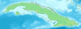
Guanahacabibes Peninsula is the westernmost point on the island of Cuba
. It is located in Pinar del Río Province
, in the municipality of Sandino
and is sparsely populated. The waters surrounding the peninsula
are important spiny lobster
and red snapper
fishing grounds. It also boasts the category of Biosphere Reserve
, listed by UNESCO
in 1987. Its western extremity, Cape San Antonio
, is the western most point of Cuba.
Its location in the open waters of the Gulf of Mexico
makes it vulnerable to hurricanes. The area was severely affected by Hurricane Ivan
in 2004 and Hurricane Wilma
in 2005.
Guanahacabibes was the site of Cuba's first forced labor camp, started at the end of 1960.
s and isles of the western Colorados Archipelago
.
The peninsula was one of the last refuges of aboriginals fleeing from the Spanish conquistadors and also holds some 140 archeological sites linked to the life of aborigines, who were known as Guanahatabeyes.
Cuba
The Republic of Cuba is an island nation in the Caribbean. The nation of Cuba consists of the main island of Cuba, the Isla de la Juventud, and several archipelagos. Havana is the largest city in Cuba and the country's capital. Santiago de Cuba is the second largest city...
. It is located in Pinar del Río Province
Pinar del Río Province
Pinar del Río is one of the provinces of Cuba. It is at the western end of the island of Cuba.-Geography:The Pinar del Río province is Cuba's westernmost province and contains one of Cuba's three main mountain ranges, the Cordillera de Guaniguanico, divided into the easterly Sierra del Rosario and...
, in the municipality of Sandino
Sandino, Cuba
Sandino is a municipality and city in the Pinar del Río Province of Cuba.The town is located close to the coast and as such, fishing is the main economic resource of this place...
and is sparsely populated. The waters surrounding the peninsula
Peninsula
A peninsula is a piece of land that is bordered by water on three sides but connected to mainland. In many Germanic and Celtic languages and also in Baltic, Slavic and Hungarian, peninsulas are called "half-islands"....
are important spiny lobster
Spiny lobster
Spiny lobsters, also known as langouste or rock lobsters, are a family of about 45 species of achelate crustaceans, in the Decapoda Reptantia...
and red snapper
Red Snapper
Red Snapper may refer to:Fish:* Several species from the genus Lutjanus, for example the red snapper .* Several species from the genus Sebastes, for example the vermilion rockfish and yelloweye rockfish Red Snapper may refer to:Fish:* Several species from the genus Lutjanus, for example the red...
fishing grounds. It also boasts the category of Biosphere Reserve
Biosphere reserve
The Man and the Biosphere Programme of UNESCO was established in 1971 to promote interdisciplinary approaches to management, research and education in ecosystem conservation and sustainable use of natural resources.-Development:...
, listed by UNESCO
UNESCO
The United Nations Educational, Scientific and Cultural Organization is a specialized agency of the United Nations...
in 1987. Its western extremity, Cape San Antonio
Cape San Antonio, Cuba
Cape San Antonio, , is a cape which forms the western extremity of Cuba. It extends into the Yucatán Channel.-References:*Merriam-Webster's Geographical Dictionary, Third Edition. Springfield, Massachusetts: Merriam-Webster, Incorporated, 1997....
, is the western most point of Cuba.
Its location in the open waters of the Gulf of Mexico
Gulf of Mexico
The Gulf of Mexico is a partially landlocked ocean basin largely surrounded by the North American continent and the island of Cuba. It is bounded on the northeast, north and northwest by the Gulf Coast of the United States, on the southwest and south by Mexico, and on the southeast by Cuba. In...
makes it vulnerable to hurricanes. The area was severely affected by Hurricane Ivan
Hurricane Ivan
Hurricane Ivan was a large, long-lived, Cape Verde-type hurricane that caused widespread damage in the Caribbean and United States. The cyclone was the ninth named storm, the sixth hurricane and the fourth major hurricane of the active 2004 Atlantic hurricane season...
in 2004 and Hurricane Wilma
Hurricane Wilma
Hurricane Wilma was the most intense tropical cyclone ever recorded in the Atlantic basin. Wilma was the twenty-second storm , thirteenth hurricane, sixth major hurricane, and fourth Category 5 hurricane of the record-breaking 2005 season...
in 2005.
Guanahacabibes was the site of Cuba's first forced labor camp, started at the end of 1960.
Conservation
The Guanahacabibes National Park on the peninsula is one of the country's largest natural reserves and is separated from the rest of the island by white-sand plains where one of Cuba's largest lakeside areas lies. A relatively small area holds some 100 lakes, as well as the largest and purest fields of silica sand, which is 99.8% pure. Nature tourism is a major attraction in the 398.26 km² (153.8 sq mi) National Park. The area is inhabited by 172 species of birds belonging to 42 families, 11 of which are endemic and 84 are migratory. Experts also believe that 4 of the 7 species of marine turtles living on the planet have survived in the Guanahacabibes Peninsula. The coastline also contains preserved coral reefs, with the northern coast being lined by the cayCay
A cay , also spelled caye or key, is a small, low-elevation, sandy island formed on the surface of coral reefs. Cays occur in tropical environments throughout the Pacific, Atlantic and Indian Oceans , where they provide habitable and agricultural land for hundreds of thousands of people...
s and isles of the western Colorados Archipelago
Colorados Archipelago
The Colorados Archipelago is a chain of isles and cays on Cuba's north-western coast.The sea surrounding the islands is used mainly for fishing, with commercial captures of lobster, sponge, oysters, red snapper and tuna...
.
The peninsula was one of the last refuges of aboriginals fleeing from the Spanish conquistadors and also holds some 140 archeological sites linked to the life of aborigines, who were known as Guanahatabeyes.