The
Greenland Sea is a body of water that borders
GreenlandGreenland is an autonomous country within the Kingdom of Denmark, located between the Arctic and Atlantic Oceans, east of the Canadian Arctic Archipelago. Though physiographically a part of the continent of North America, Greenland has been politically and culturally associated with Europe for...
to the west, the
SvalbardSvalbard is an archipelago in the Arctic, constituting the northernmost part of Norway. It is located north of mainland Europe, midway between mainland Norway and the North Pole. The group of islands range from 74° to 81° north latitude , and from 10° to 35° east longitude. Spitsbergen is the...
archipelagoAn archipelago , sometimes called an island group, is a chain or cluster of islands. The word archipelago is derived from the Greek ἄρχι- – arkhi- and πέλαγος – pélagos through the Italian arcipelago...
to the east,
Fram StraitThe Fram Strait is a passage from the Arctic Ocean to the Greenland Sea and Norwegian Sea, between Greenland and Spitsbergen. It is named after the Norwegian ship Fram. The Fram Strait is the major connection between the Arctic Ocean and the world ocean....
and the
Arctic OceanThe Arctic Ocean, located in the Northern Hemisphere and mostly in the Arctic north polar region, is the smallest and shallowest of the world's five major oceanic divisions...
to the north, and the
Norwegian SeaThe Norwegian Sea is a marginal sea in the North Atlantic Ocean, northwest of Norway. It is located between the North Sea and the Greenland Sea and adjoins the North Atlantic Ocean to the west and the Barents Sea to the northeast. In the southwest, it is separated from the Atlantic Ocean by a...
and
IcelandIceland , described as the Republic of Iceland, is a Nordic and European island country in the North Atlantic Ocean, on the Mid-Atlantic Ridge. Iceland also refers to the main island of the country, which contains almost all the population and almost all the land area. The country has a population...
to the south. The Greenland Sea is often defined as part of the
Arctic OceanThe Arctic Ocean, located in the Northern Hemisphere and mostly in the Arctic north polar region, is the smallest and shallowest of the world's five major oceanic divisions...
, sometimes as part of the
Atlantic OceanThe Atlantic Ocean is the second-largest of the world's oceanic divisions. With a total area of about , it covers approximately 20% of the Earth's surface and about 26% of its water surface area...
. However, definitions of the Arctic Ocean and its seas tend to be imprecise or arbitrary. In general usage the term "Arctic Ocean" would exclude the Greenland Sea. In
oceanographic studiesOceanography , also called oceanology or marine science, is the branch of Earth science that studies the ocean...
the Greenland Sea is considered part of the Nordic Seas, along with the
Norwegian SeaThe Norwegian Sea is a marginal sea in the North Atlantic Ocean, northwest of Norway. It is located between the North Sea and the Greenland Sea and adjoins the North Atlantic Ocean to the west and the Barents Sea to the northeast. In the southwest, it is separated from the Atlantic Ocean by a...
and Iceland Sea. The Nordic Seas are the main connection between the Arctic and Atlantic oceans and, as such, could be of great significance in a possible
shutdown of thermohaline circulationShutdown or slowdown of the thermohaline circulation is a postulated effect of global warming.There is some speculation that global warming could, via a shutdown or slowdown of the thermohaline circulation, trigger localised cooling in the North Atlantic and lead to cooling, or lesser warming, in...
. In oceanography the Arctic Ocean and Nordic Seas are often referred to collectively as the "Arctic Mediterranean Sea", a
marginal seaThe term marginal sea has differing meanings. In one sense the term is equivalent to territorial waters. In another sense the term indicates a partially enclosed sea adjacent to or widely open to the open ocean, but bounded by submarine ridges...
of the Atlantic.
The sea has
Arctic climateThe climate of the Arctic is characterized by long, cold winters and short, cool summers. There is a large amount of variability in climate across the Arctic, but all regions experience extremes of solar radiation in both summer and winter...
with regular northern winds and temperatures rarely rising above 0 °C. It previously contained the
Odden ice tongue (or
Odden) area, which extended eastward from the main East Greenland
iceIce is water frozen into the solid state. Usually ice is the phase known as ice Ih, which is the most abundant of the varying solid phases on the Earth's surface. It can appear transparent or opaque bluish-white color, depending on the presence of impurities or air inclusions...
edge in the vicinity of
72The 72nd parallel north is a circle of latitude that is 72 degrees north of the Earth's equatorial plane, in the Arctic. It crosses the Atlantic Ocean, Europe, Asia, the Arctic Ocean and North America....
–
74°NThe 74th parallel north is a circle of latitude that is 74 degrees north of the Earth's equatorial plane, in the Arctic. It crosses the Atlantic Ocean, Europe, Asia, the Arctic Ocean and North America....
during the winter and acted as a key winter ice formation area in the Arctic. The
West IceThe West Ice is a patch of the Greenland Sea covered by pack ice during winter time. It is located north of Iceland, between Greenland and Jan Mayen island....
forms in winter in the Greenland Sea, north of Iceland, between Greenland and
Jan MayenJan Mayen Island is a volcanic island in the Arctic Ocean and part of the Kingdom of Norway. It is long and 373 km2 in area, partly covered by glaciers . It has two parts: larger northeast Nord-Jan and smaller Sør-Jan, linked by an isthmus wide...
island. It is a major breeding ground of
harp sealThe harp seal or saddleback seal is a species of earless seal native to the northernmost Atlantic Ocean and adjacent parts of the Arctic Ocean. It now belongs to the monotypic genus Pagophilus. Its scientific name, Pagophilus groenlandicus, means "ice-lover from Greenland", and its synonym, Phoca...
and
hooded sealThe hooded seal is an arctic pinniped found only in the central and western North Atlantic ranging from Svalbard in the east to the Gulf of St...
that has been used for
seal huntingSeal hunting, or sealing, is the personal or commercial hunting of seals. The hunt is currently practiced in five countries: Canada, where most of the world's seal hunting takes place, Namibia, the Danish region of Greenland, Norway and Russia...
for more than 200 years.
Extent
The
International Hydrographic OrganizationThe International Hydrographic Organization is the inter-governmental organisation representing the hydrographic community. It enjoys observer status at the UN and is the recognised competent authority on hydrographic surveying and nautical charting...
defines the limits of the Greenland Sea as follows:
On the North. A line joining the Northernmost point of Spitzbergen [SvalbardSvalbard is an archipelago in the Arctic, constituting the northernmost part of Norway. It is located north of mainland Europe, midway between mainland Norway and the North Pole. The group of islands range from 74° to 81° north latitude , and from 10° to 35° east longitude. Spitsbergen is the...
] to the Northernmost point of GreenlandGreenland is an autonomous country within the Kingdom of Denmark, located between the Arctic and Atlantic Oceans, east of the Canadian Arctic Archipelago. Though physiographically a part of the continent of North America, Greenland has been politically and culturally associated with Europe for...
.
On the East. The West coast of West Spitzbergen [island of SpitsbergenSpitsbergen is the largest and only permanently populated island of the Svalbard archipelago in Norway. Constituting the western-most bulk of the archipelago, it borders the Arctic Ocean, the Norwegian Sea and the Greenland Sea...
].
On the Southeast. A line joining the Southernmost point of West Spitzbergen to the Northern point of Jan MayenJan Mayen Island is a volcanic island in the Arctic Ocean and part of the Kingdom of Norway. It is long and 373 km2 in area, partly covered by glaciers . It has two parts: larger northeast Nord-Jan and smaller Sør-Jan, linked by an isthmus wide...
Island, down the West coast of that island to its Southern extreme, thence a Line to the Eastern extreme of Gerpir (67°05'N, 13°30'W) [NB Actually at 65°05′N 13°30′W] in IcelandIceland , described as the Republic of Iceland, is a Nordic and European island country in the North Atlantic Ocean, on the Mid-Atlantic Ridge. Iceland also refers to the main island of the country, which contains almost all the population and almost all the land area. The country has a population...
.
On the Southwest. A line joining Straumness (NW extreme of Iceland) to Cape Nansen (68°15′N 29°30′W) in Greenland.
On the West. The East and Northeast coast of Greenland between Cape Nansen and the northernmost point.
History
While the sea is known for millennia, its first scientific investigations were carried out in 1876–1878 within the Norwegian North-Atlantic Expedition. Since then, many countries, mostly Norway, Iceland and Russia have sent scientific expeditions to the area. The complex water current system was detailed in 1909 by the
Fridtjof NansenFridtjof Wedel-Jarlsberg Nansen was a Norwegian explorer, scientist, diplomat, humanitarian and Nobel Peace Prize laureate. In his youth a champion skier and ice skater, he led the team that made the first crossing of the Greenland interior in 1888, and won international fame after reaching a...
.
Geography and geology
The Greenland Sea is bounded to the west by the island of
GreenlandGreenland is an autonomous country within the Kingdom of Denmark, located between the Arctic and Atlantic Oceans, east of the Canadian Arctic Archipelago. Though physiographically a part of the continent of North America, Greenland has been politically and culturally associated with Europe for...
, and to the south by the
Denmark StraitThe Denmark Strait or Greenland Strait |Sound]]) is an oceanic strait between Greenland and Iceland...
and
IcelandIceland , described as the Republic of Iceland, is a Nordic and European island country in the North Atlantic Ocean, on the Mid-Atlantic Ridge. Iceland also refers to the main island of the country, which contains almost all the population and almost all the land area. The country has a population...
. To the southeast, behind the
Jan MayenJan Mayen Island is a volcanic island in the Arctic Ocean and part of the Kingdom of Norway. It is long and 373 km2 in area, partly covered by glaciers . It has two parts: larger northeast Nord-Jan and smaller Sør-Jan, linked by an isthmus wide...
island (Norway) lies the vast expanse of the
Norwegian SeaThe Norwegian Sea is a marginal sea in the North Atlantic Ocean, northwest of Norway. It is located between the North Sea and the Greenland Sea and adjoins the North Atlantic Ocean to the west and the Barents Sea to the northeast. In the southwest, it is separated from the Atlantic Ocean by a...
, of which Greenland Sea may be considered an extension. Across the
Fram StraitThe Fram Strait is a passage from the Arctic Ocean to the Greenland Sea and Norwegian Sea, between Greenland and Spitsbergen. It is named after the Norwegian ship Fram. The Fram Strait is the major connection between the Arctic Ocean and the world ocean....
to the northeast, the sea is delimited by the
SvalbardSvalbard is an archipelago in the Arctic, constituting the northernmost part of Norway. It is located north of mainland Europe, midway between mainland Norway and the North Pole. The group of islands range from 74° to 81° north latitude , and from 10° to 35° east longitude. Spitsbergen is the...
archipelagoAn archipelago , sometimes called an island group, is a chain or cluster of islands. The word archipelago is derived from the Greek ἄρχι- – arkhi- and πέλαγος – pélagos through the Italian arcipelago...
(Norway).
The bottom of the Greenland Sea is a
depressionA depression in geology is a landform sunken or depressed below the surrounding area. Depressions may be formed by various mechanisms.Structural or tectonic related:...
bounded to the south by the underwater Greenland-Iceland ridge and to the east by the Mohns Ridge and Knipovich Ridge (parts of the
Mid-Atlantic RidgeThe Mid-Atlantic Ridge is a mid-ocean ridge, a divergent tectonic plate boundary located along the floor of the Atlantic Ocean, and part of the longest mountain range in the world. It separates the Eurasian Plate and North American Plate in the North Atlantic, and the African Plate from the South...
). To the west, the bottom rises first slowly, but then rapidly toward the wide Greenland coastal strip.
SiltSilt is granular material of a size somewhere between sand and clay whose mineral origin is quartz and feldspar. Silt may occur as a soil or as suspended sediment in a surface water body...
s fill the submarine hollows and gorges; silty sands, gravel, boulders, and other products of erosion coat the shelves and ridges.
Although the deepest point inside of the sea is 4846 meters, depths down to 5570 meters have been measured in the Molloy Deep of the
Fram StraitThe Fram Strait is a passage from the Arctic Ocean to the Greenland Sea and Norwegian Sea, between Greenland and Spitsbergen. It is named after the Norwegian ship Fram. The Fram Strait is the major connection between the Arctic Ocean and the world ocean....
which connects the sea to the Arctic Ocean on the north.
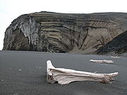
Major islands of the Greenland Sea include
SvalbardSvalbard is an archipelago in the Arctic, constituting the northernmost part of Norway. It is located north of mainland Europe, midway between mainland Norway and the North Pole. The group of islands range from 74° to 81° north latitude , and from 10° to 35° east longitude. Spitsbergen is the...
archipelago,
EdvardsEdvards Island is an uninhabited island of the Greenland Sea, Greenland. The island has an area of 115.8 km ² and has a shoreline of 53.5 kilometres.-References:...
,
EilaEila Island is an uninhabited island of the Greenland Sea, Greenland. The island has an area of 143.6 km ² and has a shoreline of 59.6 kilometres....
,
Godfred HansensGodfred Hansens Island is an uninhabited island of the Greenland Sea, Greenland. The island has an area of 115 km ² and has a shoreline of 53.7 kilometres....
,
Île-de-FranceÎle-de-France is an uninhabited island of the Greenland Sea, Greenland. The island has an area of 246.1 km ² and has a shoreline of 71.9 kilometres.-References:...
,
Jan MayenJan Mayen Island is a volcanic island in the Arctic Ocean and part of the Kingdom of Norway. It is long and 373 km2 in area, partly covered by glaciers . It has two parts: larger northeast Nord-Jan and smaller Sør-Jan, linked by an isthmus wide...
LynnsLynns Island is an uninhabited island of the Greenland Sea, Greenland. The island has an area of 230.9 km ² and has a shoreline of 65.7 kilometres....
,
NorskeNorske Island is an uninhabited island of the Greenland Sea, Greenland. The island has an area of 186.4 km ² and has a shoreline of 68.9 kilometres....
and
SchnaudersSchnauders Island is an uninhabited island of the Greenland Sea, Greenland. The island has an area of 180.3 km ² and has a shoreline of 105 kilometres....
. Of those, only the Svalbard islands are inhabited, and Jan Mayen has only temporal military staff. After the
League of NationsThe League of Nations was an intergovernmental organization founded as a result of the Paris Peace Conference that ended the First World War. It was the first permanent international organization whose principal mission was to maintain world peace...
gave Norway jurisdiction over the island, in 1921 Norway opened the first meteorological station there, which was a subject of contention between Germany and United Kingdom during World War II. Several radio and meteorological stations operate on the island nowadays.
Hydrology, climate and ice
The climate is
ArcticThe climate of the Arctic is characterized by long, cold winters and short, cool summers. There is a large amount of variability in climate across the Arctic, but all regions experience extremes of solar radiation in both summer and winter...
and varies significantly across the vast sea area.
Air temperatures fluctuate between –49 °C (–57 °F), near
SpitsbergenSpitsbergen is the largest and only permanently populated island of the Svalbard archipelago in Norway. Constituting the western-most bulk of the archipelago, it borders the Arctic Ocean, the Norwegian Sea and the Greenland Sea...
in winter, and 25 °C (77 °F) off Greenland in summer. Averages are –10 °C (14 °F) in the south and –26 °C (–15 °F) in the north in February, which is the coldest month. The corresponding values for the warmest month, August, are 5 °C (41 °F) in the south and 0 °C (32 °F) in the north. The summer is very short, as the number of days per year when the temperature rises above 0 °C varies between 225 on the south to 334 in the north. The annual precipitation is 250 mm (10 in) in the north, but is twice higher in the south.
Northern winds continue through the whole year, cooling the surface water and bringing ice to the south. The average surface water temperature is about –1 °С (30 °F) or lower in the north and 1–2 °C in the south; the corresponding summer temperatures are about 0 °C and 6 °C (43 °F). The bottom water temperatures are below –1 °С. The surface water salinity is 33.0–34.5 parts per thousand (‰) in the eastern and below 32.0‰ in the western parts, increasing to 34.9‰ toward the bottom. The water color is green.
TideTides are the rise and fall of sea levels caused by the combined effects of the gravitational forces exerted by the moon and the sun and the rotation of the Earth....
s are semi-diurnal with the average height of 4.4 m. Together with the water currents, they break up the floating ice sheets and mix various water layers both laterally and along the depth.
The progressively colder waters of
North Atlantic CurrentThe North Atlantic Current is a powerful warm ocean current that continues the Gulf Stream northeast. West of Ireland it splits in two; one branch, the Canary Current, goes south, while the other continues north along the coast of northwestern Europe...
sink in the Arctic Ocean, returning south in the form of cold
East Greenland CurrentThe East Greenland Current is a cold, low salinity current that extends from Fram Strait to Cape Farewell . The current is located off the eastern coast of Greenland along the Greenland continental margin. The current cuts through the Nordic Seas and through the Denmark Strait...
, an important part of the Atlantic conveyor belt, which flows along the western part of the sea. Along the eastern part flows the warm Spitsbergen Current, a part of
Gulf StreamThe Gulf Stream, together with its northern extension towards Europe, the North Atlantic Drift, is a powerful, warm, and swift Atlantic ocean current that originates at the tip of Florida, and follows the eastern coastlines of the United States and Newfoundland before crossing the Atlantic Ocean...
. Mixtures of cold, fresh water ice melt and the warm, salty Spitsbergen Current may experience
cabbelingCabbeling is the resultant sinking of a combined water parcel due to the mixing process of two separate water parcels. Sinking occurs because of the higher density of the combined water parcel from the mixing of two water parcels of the same density, but different salinity and temperature...
, and might contribute to thermohaline circulation. The combination of those currents creates a counter-clockwise water flow in the central part of the sea.
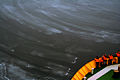
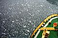
Because of frequent fogs and winds and currents, which continuously transport ice and icebergs through the Greenland Sea to the south, the Greenland Sea has a narrow window for commercial navigation - the ice season starts in October and ends in August. Three types of floating ice are distinguished: Arctic pack ice (several meters thick), sea ice (about a meter thick) and freshwater icebergs.
West Ice
In winter, a large area north of Iceland, between
GreenlandGreenland is an autonomous country within the Kingdom of Denmark, located between the Arctic and Atlantic Oceans, east of the Canadian Arctic Archipelago. Though physiographically a part of the continent of North America, Greenland has been politically and culturally associated with Europe for...
and
Jan MayenJan Mayen Island is a volcanic island in the Arctic Ocean and part of the Kingdom of Norway. It is long and 373 km2 in area, partly covered by glaciers . It has two parts: larger northeast Nord-Jan and smaller Sør-Jan, linked by an isthmus wide...
, which is called
West IceThe West Ice is a patch of the Greenland Sea covered by pack ice during winter time. It is located north of Iceland, between Greenland and Jan Mayen island....
is covered by continuous ice. It is a major breeding ground for seals, including
harp sealThe harp seal or saddleback seal is a species of earless seal native to the northernmost Atlantic Ocean and adjacent parts of the Arctic Ocean. It now belongs to the monotypic genus Pagophilus. Its scientific name, Pagophilus groenlandicus, means "ice-lover from Greenland", and its synonym, Phoca...
,
hooded sealThe hooded seal is an arctic pinniped found only in the central and western North Atlantic ranging from Svalbard in the east to the Gulf of St...
and gray seal. It was discovered in the early 18th century by British whalers and since late 1750s was used for seal hunting. The hunting was especially intensive in the 19th century, but declined in the 20th century due to hunting restrictions and then declined market demand. Around 5 April 1952, a major storm resulted in disappearance of ships with 79 Norwegian seal hunters on board. Seven other Norwegian seal hunting vessels shipwrecked the same month.
Odden ice tongue
The Odden ice tongue or simply the Odden (Odden is
NorwegianNorwegian is a North Germanic language spoken primarily in Norway, where it is the official language. Together with Swedish and Danish, Norwegian forms a continuum of more or less mutually intelligible local and regional variants .These Scandinavian languages together with the Faroese language...
word for
headland) was a key winter ice formation area in the Arctic. It was known for a long time and was encountered by
Fridtjof NansenFridtjof Wedel-Jarlsberg Nansen was a Norwegian explorer, scientist, diplomat, humanitarian and Nobel Peace Prize laureate. In his youth a champion skier and ice skater, he led the team that made the first crossing of the Greenland interior in 1888, and won international fame after reaching a...
but was only fully understood with the advent of satellite imagery.
The Odden had a length of about 1,300 km and covered an area of up to 330,000 km² in most years. It extended eastward from the main East Greenland ice edge in the vicinity of 72–74°N during the winter because of the presence of very cold polar surface water in the Jan Mayen Current, which diverts some water eastward from the
East Greenland CurrentThe East Greenland Current is a cold, low salinity current that extends from Fram Strait to Cape Farewell . The current is located off the eastern coast of Greenland along the Greenland continental margin. The current cuts through the Nordic Seas and through the Denmark Strait...
at that latitude. Most of the already formed ice continued floating south, driven by the wind, so a cold open water surface was exposed on which new ice formed as
frazil iceFrazil ice is a collection of loose, randomly oriented needle-shaped ice crystals in water. It resembles slush and has the appearance of being slightly oily when seen on the surface of water...
and
pancake icePancake ice is a form of ice that consists of round pieces of ice with diameters ranging from a few inches to many feet, depending on the local conditions that affect ice formation. It may have a thickness of several inches....
in the rough seas, producing a giant tongue shape. The salt rejected back into the ocean from this ice formation caused the surface water to become denser and sink, sometimes to great depths (2500 m or more), making this one of the few regions of the ocean where winter convection occurred, which helped drive the entire worldwide system of surface and deep currents known as the
thermohaline circulationThe term thermohaline circulation refers to a part of the large-scale ocean circulation that is driven by global density gradients created by surface heat and freshwater fluxes....
. The Odden Ice Tongue has not been observed since 1997.
Fauna
The Greenland Sea is densely inhabited by the organisms that form the base of the oceanic
food chainA food web depicts feeding connections in an ecological community. Ecologists can broadly lump all life forms into one of two categories called trophic levels: 1) the autotrophs, and 2) the heterotrophs...
. Large
invertebrateAn invertebrate is an animal without a backbone. The group includes 97% of all animal species – all animals except those in the chordate subphylum Vertebrata .Invertebrates form a paraphyletic group...
s,
fishFish are a paraphyletic group of organisms that consist of all gill-bearing aquatic vertebrate animals that lack limbs with digits. Included in this definition are the living hagfish, lampreys, and cartilaginous and bony fish, as well as various extinct related groups...
(such as
codCod is the common name for genus Gadus, belonging to the family Gadidae, and is also used in the common name for various other fishes. Cod is a popular food with a mild flavor, low fat content and a dense, flaky white flesh. Cod livers are processed to make cod liver oil, an important source of...
,
herringHerring is an oily fish of the genus Clupea, found in the shallow, temperate waters of the North Pacific and the North Atlantic oceans, including the Baltic Sea. Three species of Clupea are recognized. The main taxa, the Atlantic herring and the Pacific herring may each be divided into subspecies...
,
redfishRedfish is a common name for several species of fish. It is most commonly applied to members of the deep-sea genus Sebastes, or the reef dwelling snappers, Lutjanus. It is also applied to the slimeheads or roughies , and the alfonsinos ....
,
halibutHalibut is a flatfish, genus Hippoglossus, from the family of the right-eye flounders . Other flatfish are also called halibut. The name is derived from haly and butt , for its popularity on Catholic holy days...
, and
plaiceThe European plaice, Pleuronectes platessa, is a commercially important flatfish.- Distribution and habitat :The geographical range of the European plaice is off all coasts from the Barents Sea to the Mediterranean, also in the Northeast Atlantic and along Greenland...
), birds and
mammalMammals are members of a class of air-breathing vertebrate animals characterised by the possession of endothermy, hair, three middle ear bones, and mammary glands functional in mothers with young...
s (including various species of
sealsPinnipeds or fin-footed mammals are a widely distributed and diverse group of semiaquatic marine mammals comprising the families Odobenidae , Otariidae , and Phocidae .-Overview: Pinnipeds are typically sleek-bodied and barrel-shaped...
,
whaleWhale is the common name for various marine mammals of the order Cetacea. The term whale sometimes refers to all cetaceans, but more often it excludes dolphins and porpoises, which belong to suborder Odontoceti . This suborder also includes the sperm whale, killer whale, pilot whale, and beluga...
s, and
dolphinDolphins are marine mammals that are closely related to whales and porpoises. There are almost forty species of dolphin in 17 genera. They vary in size from and , up to and . They are found worldwide, mostly in the shallower seas of the continental shelves, and are carnivores, mostly eating...
s) all feed on the smaller invertebrates and small
organismIn biology, an organism is any contiguous living system . In at least some form, all organisms are capable of response to stimuli, reproduction, growth and development, and maintenance of homoeostasis as a stable whole.An organism may either be unicellular or, as in the case of humans, comprise...
s. Mosses, lichens, and scanty bushes around the coasts serve as food to the deer and
musk oxThe muskox is an Arctic mammal of the family Bovidae, noted for its thick coat and for the strong odor emitted by males, from which its name derives. This musky odor is used to attract females during mating season...
en, which in turn are hunted by the
polar bearThe polar bear is a bear native largely within the Arctic Circle encompassing the Arctic Ocean, its surrounding seas and surrounding land masses. It is the world's largest land carnivore and also the largest bear, together with the omnivorous Kodiak Bear, which is approximately the same size...
.
Further reading
The source of this article is
wikipedia, the free encyclopedia. The text of this article is licensed under the
GFDL.