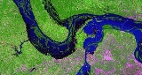
All Topics  
Great Flood of 1993

 
Great Flood of 1993

   Email Print
   Bookmark   Link


Great Flood of 1993


The Great Flood of 1993 was among the most costly and devastating ever to occur in the United States, with $15 billion in damages. The hydro graphic basin affected covered around 745 miles (1200 km) in length and 435 miles (700 km) in width, totaling about 320,000 square miles (840,000 km²). Within this zone, the flood
Flood

A flood is an overflow of an expanse of water that submerges land, a deluge. In the sense of "flowing water", the word may also be applied to the inflow of the tide....
ed area totaled around 30,000 square miles (80,000 km²) and was the worst such U.S.


Discussion
Ask a question about 'Great Flood of 1993'
Start a new discussion about 'Great Flood of 1993'
Answer questions from other users
Full Discussion Forum


Encyclopedia


The Great Flood of 1993 was among the most costly and devastating ever to occur in the United States, with $15 billion in damages. The hydro graphic basin affected covered around 745 miles (1200 km) in length and 435 miles (700 km) in width, totaling about 320,000 square miles (840,000 km²). Within this zone, the flood
Flood

A flood is an overflow of an expanse of water that submerges land, a deluge. In the sense of "flowing water", the word may also be applied to the inflow of the tide....
ed area totaled around 30,000 square miles (80,000 km²) and was the worst such U.S. disaster since the Great Mississippi Flood of 1927
Great Mississippi Flood of 1927

The Great Mississippi Flood of 1927 was the most destructive river flood in United States history....
, as measured by duration, square miles inundated, persons displaced, crop and property damage, and number of record river levels. In some categories, the 1993 flood even surpassed the 1927 flood, at the time the largest flood ever recorded on the Mississippi.

Causes

Saint Louis Satellite Photo of Great Flood
A rainy autumn in 1992 resulted in above-normal soil moisture and reservoir levels in the Missouri
Missouri River

The Missouri River is a tributary of the Mississippi River, and the longest river in the United States of America. The Missouri begins at the confluence of the Madison River, Jefferson River, and Gallatin River rivers in Montana, and flows through Missouri River Valley south and east into the Mississippi north of St....
 and Upper Mississippi River
Mississippi River

The Mississippi River is the longest river in the United States, with a length of from its source in Lake Itasca in Minnesota to its mouth in the Gulf of Mexico....
 basins. During the winter of 1992-93, the region experienced heavy snowfall. These conditions were followed by persistent spring weather patterns that produced storms over the same locations. These wet-weather conditions contrasted sharply with the drought
Drought

A drought is an extended period of months or years when a region notes a deficiency in its water supply. Generally, this occurs when a region receives consistently below average precipitation ....
s and heat wave
Heat wave

A heat wave is a prolonged period of excessively hot weather, which may be accompanied by high humidity. There is no universal definition of a heat wave; the term is relative to the usual weather in the area....
s experienced in the southeastern United States.

Storms, persistent and repetitive in nature during the late spring and summer, bombarded the Upper Midwest with voluminous rainfall. Portions of east-central Iowa received as much as of rain between April 1 and August 31, 1993, and many areas across the central-northern plains had 400-750% above normal precipitation. In the St. Louis
St. Louis, Missouri

St. Louis is an independent city in the U.S. state of Missouri, located near the confluence of the Mississippi River and the Missouri River. St....
 National Weather Service
National Weather Service

The National Weather Service , once known as the Weather Bureau, is one of the six scientific agencies that make up the National Oceanic and Atmospheric Administration of the United States Federal government of the United States....
 (NWS) forecast area encompassing eastern Missouri
Missouri

Missouri is a U.S. state in the Midwestern United States of the United States bordered by Iowa, Illinois, Kentucky, Tennessee, Arkansas, Oklahoma, Kansas and Nebraska....
 and southwest Illinois
Illinois

The State of Illinois is a U.S. state of the United States, the 21st to be admitted to the United States. Illinois is the most populous and demographically diverse Midwestern United States state and the fifth most populous state in the nation....
, 36 forecast points rose above flood stage
Flood stage

Flood stage is the point at which the surface of a river, stream, or other body of water has risen to a sufficient level to cause damage or affects use of man-made structures....
, and 20 river-stage records were broken. The 1993 flood broke record river levels set during the 1973 Mississippi and the 1951 Missouri River floods.

An Illinois man, James Scott
James Scott (criminal)

James Robert Scott was convicted of causing a massive flood of the Mississippi River at West Quincy, Missouri as part of the Great Flood of 1993....
, 23 at the time, was sentenced to life imprisonment for his role in causing some of the flooding across the river from Quincy, IL. He was officially convicted for "intentionally causing a catastrophe". Scott removed several sandbags from a levee holding back the water, in an attempt to strand his wife on the other side of the river so he could continue partying. The breach flooded 14,000 acres (57 km²) of farmland, destroyed buildings and closed a bridge. While Scott caused one levee to fail, more than 1,000 levees failed in the flooding.


Timeline


April

1993 View of St
In April, the Mississippi River had crested 6 to 10 feet (2 to 3 m) above flood stage.

May

The Redwood River
Redwood River

The Redwood River is a tributary of the Minnesota River, 127 miles long, in southwestern Minnesota in the United States. Via the Minnesota River, it is part of the drainage basin of the Mississippi River, draining an area of 705 square miles in an agricultural region....
 in Minnesota
Minnesota

Minnesota is a U.S. state in the Midwestern United States of the United States. The twelfth largest state by area in the U.S., it is the twenty-first most populous, with just over five million residents....
 began experiencing severe flooding in May. On May 22, Sioux Falls, South Dakota
Sioux Falls, South Dakota

Sioux Falls is the largest city in the U.S. state of South Dakota. Sioux Falls is the county seat of Minnehaha County, South Dakota, and also extends into Lincoln County, South Dakota to the south....
 received of rain in a three hour period. From May - July, Sioux Falls received of rain, the wettest three-month period in its history.

The Mississippi River had flood levels at St. Louis, Missouri 6-10 feet above flood stage during May.

June

As noted above, a lot rains in South Dakota contributed to flooding downstream. In June, flooding occurred along the Black River
Black River

Black River is a common name for streams and communities around the world, as well as the Spanish and Portuguese translation for Rio Negro....
 in Wisconsin
Wisconsin

Wisconsin is one of the fifty U.S. state in the United States of America, located in the north central part of the United States. It borders two of the five Great Lakes and four U.S....
, with flooding also starting to occur along the Mississippi
Mississippi River

The Mississippi River is the longest river in the United States, with a length of from its source in Lake Itasca in Minnesota to its mouth in the Gulf of Mexico....
, Missouri
Missouri River

The Missouri River is a tributary of the Mississippi River, and the longest river in the United States of America. The Missouri begins at the confluence of the Madison River, Jefferson River, and Gallatin River rivers in Montana, and flows through Missouri River Valley south and east into the Mississippi north of St....
, and Kansas river
Kansas River

The Kansas River is a river in northeastern Kansas in the United States. It is the southwestern-most part of the Missouri River drainage, which is in turn the northwestern-most portion of the extensive Mississippi River drainage....
s. Starting as early as June 7, reports of levees being overtopped and levee breaks became common. These breaches acted to delay the flood crests, temporarily storing excess water in the adjacent lowlands, but the rain kept falling.
Flooding 1993 Fema 13708
In the beginning of June, the Missouri and Mississippi rivers dropped below flood stage and were receding. During the second week of June, river levels rose to near flood stage before yet again beginning their slow recession. By the end of June, the Mississippi River was four feet (1.2 m) below flood stage at St. Louis, while many other river locations in the region were near flood stage. Precipitation for the month averaged from one inch (25 mm) above normal at Kansas City
Kansas City, Missouri

Kansas City is the largest city in the U.S. state of Missouri. It encompasses in parts of Jackson County, Missouri, Clay County, Missouri, Cass County, Missouri, and Platte County, Missouri counties....
, to nearly four inches (100 mm) above normal at Springfield
Springfield, Missouri

Springfield is the third largest city in the U.S. state of Missouri. It is the county seat of Greene County, Missouri. Springfield is 160 miles SE of Kansas City, MO, and 200 miles SW of St....
.

July

July brought more heavy rain to the Missouri and upper Mississippi River basins in Missouri, Iowa, Kansas, Nebraska, North and South Dakota, Illinois and Minnesota. Rainfall amounts of 5 to 7 inches (125 to 175 mm) in 24 hours were common. Precipitation
Precipitation (meteorology)

File:MeanMonthlyP.gifIn meteorology, precipitation is any product of the condensation of Atmosphere water vapor that is deposited on the earth's surface....
 for the month averaged from one inch (25 mm) above normal at St. Louis and Springfield, to between six and seven inches (150 to 175 mm) above normal at Columbia and Kansas City, Missouri.

From July 11 until July 22, the Des Moines
Des Moines, Iowa

Des Moines , is the Capital and the most populous city in the United States U.S. state of Iowa. It is also the county seat of Polk County, Iowa....
 Water Works treatment facility was flooded by the Raccoon River
Raccoon River

The Raccoon River is a tributary of the Des Moines River in central Iowa in the United States. As measured from the longest of its three forks, it is 200 mi long....
. This resulted in the plant being powered down and no running water for that period. During this time the Army National Guard
Army National Guard

The Army National Guard is the land force militia organized by each of the several U.S. states and Territories of the United States of the United States....
 and American Red Cross
American Red Cross

The American Red Cross is a humanitarian organization that provides emergency assistance, disaster relief and education inside the United States, and is the designated U.S....
 set up water stations, and the local Anheuser-Busch
Anheuser-Busch

Anheuser-Busch Companies, Inc. is the largest brewing company in the United States and is a wholly-owned subsidiary of Anheuser-Busch InBev. It holds a 48.8% share of beer sales by volume in the United States....
 bottler distributed water in white six-packs with their logo on it. Once running water was restored, there was enough pressure for people to bathe and flush toilets, but the water was not certified potable until July 29. The final usage restrictions were lifted in August.

Major sandbag
Sandbag

A sandbag is a sack made of jute, polypropylene or other materials that is filled with sand or soil and used for such purposes as flood, military fortification, shielding glass windows in war zones and ballast....
ging activities took place along the lower Missouri River, the River des Peres
River des Peres

The River des Peres is a metropolitan river in St. Louis, Missouri, Missouri. It is the backbone of both sanitary and stormwater systems in the city of St....
 in St. Louis, the Mississippi River south of St. Louis and on many other tributaries across Missouri and Illinois. Some of these efforts were successful, while others were not. The copious rain during July sent record-setting crests down the Mississippi and Missouri Rivers, causing river gauges to malfunction along the way. The record crests met within days of each other at their confluence near St. Louis. Navigation on the Mississippi and Missouri River was closed in early July, resulting in a loss of $2 million (1993) per day in commerce.

Alton Illinois Sinking in 1993
The Mississippi River stalled a few days at April 1973 record stages. When the crest of the Missouri River arrived, levels rose upwards again. The Mississippi River broke through levees, drove people and their possessions to higher ground and caused havoc through the floodplains.

The crests, now combined as one, moved downstream through St. Louis on the way to the confluence with the Ohio River
Ohio River

The Ohio River is the largest tributary, by volume, of the Mississippi River. It is approximately 981 miles long and is located in the eastern United States....
 at Cairo, Illinois
Cairo, Illinois

Cairo is a city in Alexander County, Illinois, Illinois in the United States. The population was 3,632 at the 2000 census. It is the county seat of Alexander County, Illinois....
. Only minor flooding occurred below the Ohio due to the river's larger channel below that point and the drought in the eastern U.S. If the Ohio River watershed had not been in drought conditions, the 1993 flood might have rivaled the 1927 flood in overall damage on the lower Mississippi.

Civil Air Patrol
Civil Air Patrol

The Civil Air Patrol is a United States Congress chartered, federally supported, Non-profit organization corporation that serves as the official Auxiliaries of the United States Air Force ....
 crews from 21 states served more than 5,000 meals to flood victims and volunteers, and their pilots logged more than 1,500 hours in the air inspecting utility lines and pipelines.

Over 1,000 flood warnings and statements, five times the normal, were issued to notify the public and need-to-know officials of river levels. In places like St. Louis, river levels were nearly 20 feet (6 m) above flood stage, the highest ever recorded in 228 years. . The 52-foot (16 m)-high St. Louis Floodwall, built to handle the volume of the 1844 flood, was able to keep the 1993 flood out with just over two feet (0.6 m) to spare.

August

On August 1, levee breaks near Columbia, Illinois
Columbia, Illinois

Columbia is a city located primarily in Monroe County, Illinois and partially in St. Clair County, Illinois. The population was 7,922 at the 2000 census....
 flooded 47,000 acres (190 km²) of land, inundating the towns of Valmeyer
Valmeyer, Illinois

Valmeyer is a village in Monroe County, Illinois, Illinois, United States, on the Mississippi River. The population was 1200 at the 2006 census....
 and Fults, Illinois
Fults, Illinois

Fults is a village in the Renault precinct of Monroe County, Illinois, Illinois, United States. The population was 28 at the 2000 census. It is located entirely within the American Bottom floodplain....
. The released water continued to flow parallel to the river, approaching the levees protecting historic Prairie du Rocher
Prairie du Rocher, Illinois

Prairie du Rocher is a village in Randolph County, Illinois, Illinois, United States. Founded in the French colonial empires in the American U.S....
 and Fort de Chartres
Fort de Chartres

Fort de Chartres was a France fortification first built in 1720 on the east bank of the Mississippi River in present-day Illinois. The Fort de Chartres name was also applied to the two successive fortifications built nearby during the 1700s in the era of French colonial control over Louisiana and the Illinois Country....
. On August 3, officials decided to break through the stronger Mississippi River levee to allow the water back into the river. The plan worked and the historic areas were saved, although residential areas were flooded in counties above Prairie du Rocher.

Emergency officials estimated that nearly all of the 700 privately built agricultural levees were overtopped or destroyed along the Missouri River. Navigation on the Mississippi and Missouri River had been closed since early July resulting in a loss of $2 million (1993) per day in commerce.

The Mississippi River at St. Louis crested at 49.6 feet (15.1 m) on August 1, nearly 20 feet (6 m) above flood stage. It had a peak flow rate of 1,080,000 ft³/s (30,600 m³/s). At this rate, a bowl the size of Busch Memorial Stadium
Busch Memorial Stadium

Busch Memorial Stadium, or Busch Stadium was the home of the St. Louis Cardinals National League baseball team from May 12, 1966 to October 19, 2005....
 would be filled to the brim in 69 seconds.

Costs and damage

Some locations on the Mississippi River flooded for almost 200 days while locations on the Missouri neared 100 days of flooding. On the Mississippi, Grafton, Illinois
Grafton, Illinois

Grafton is the oldest city in Jersey County, Illinois, Illinois, United States. It is located near the confluence of the Illinois River and Mississippi River Rivers....
, recorded flooding for 195 days, Clarksville, Missouri
Clarksville, Missouri

Clarksville is a city in Pike County, Missouri, Missouri, United States. The population was 490 at the 2000 census....
, for 187 days, Winfield, Missouri
Winfield, Missouri

Winfield is a city in Lincoln County, Missouri, Missouri, United States. The population was 723 at the 2000 census....
, for 183 days, Hannibal, Missouri
Hannibal, Missouri

Hannibal is a city in Marion County, Missouri and Ralls County, Missouri counties in the U.S. state of Missouri. Hannibal is located at the intersection of Interstate Interstate 72 and U.S....
, for 174 days, and Quincy, Illinois
Quincy, Illinois

Quincy, Illinois, known as the "Gem City", is a city on the Mississippi River in Adams County, Illinois, Illinois, United States. As of the 2000 United States Census the city had 40,366 people and serves as the county seat of Adams County, Illinois....
, for 152 days. The Missouri River was above flood stage for 62 days in Jefferson City, Missouri
Jefferson City, Missouri

Jefferson City is the Capital of the United States U.S. state of Missouri and the county seat of Cole County, Missouri. Located in Callaway County, Missouri and Cole County, Missouri counties, it is the principal city of the Jefferson City metropolitan area, which encompasses the entirety of both counties....
, 77 days at Hermann, Missouri
Hermann, Missouri

Hermann is a city designated in 1842 as the county seat of Gasconade County, Missouri, Missouri, United States. It is near the center of the Missouri Rhineland and south of the Missouri River....
; and for 94 days at St. Charles
Saint Charles, Missouri

St. Charles is a city in, and the county seat of, Saint Charles County, Missouri. It lies just to the northwest of St. Louis, Missouri, on the Missouri River, and played for a time a significant role in the United States' westward expansion....
 in the St. Louis metropolitan area. On October 7, 103 days after it began, the Mississippi River at St. Louis finally dropped below flood stage. Approximately 10,000 homes were destroyed as a result of the flooding, with 15 million acres (60,000 km²) of farmland inundated, and the whole towns of Valmeyer, Illinois
Valmeyer, Illinois

Valmeyer is a village in Monroe County, Illinois, Illinois, United States, on the Mississippi River. The population was 1200 at the 2006 census....
 and Rhineland, Missouri
Rhineland, Missouri

Rhineland is a village in Montgomery County, Missouri, Missouri, United States. The population was 176 at the United States Census, 2000, at which time it was a town....
 were relocated to higher ground. The floods cost thirty two lives officially; however, a more likely target is suspected to be around fifty people, as well as an estimated 15-20 billion dollars in damages.

Comparison to other big floods

Kc Floods
Channeling and levee construction have altered how the floods have hit various areas along the Missouri River. Here's a comparison of the three big floods since the early 1800s.

  • Great Flood of 1844
    Great Flood of 1844

    The Great Flood of 1844 is the biggest flood ever recorded on the Missouri River and Upper Mississippi River, in North America, in terms of discharge....
     - This was the biggest flood of the three in terms of rate of discharge at Westport Landing in Kansas City. It is estimated that 625,000 cubic feet per second (17,700 m³/s) was discharged in the flood. However the crest on July 16, 1844, was almost a foot (0.3 m) lower than the 1993 flood.
  • Great Flood of 1951
    Great Flood of 1951

    In mid-July 1951, heavy rains led to a great rise of water in the Kansas River and other surrounding areas. Flooding resulted in the Kansas River, Neosho River, Marais Des Cygnes River, and Verdigris river basins....
     - The 1951 flood was the second biggest in terms of rate of discharge at 573,000 ft³/s (16,200 m³/s). The 1951 crest on July 14, 1951, was almost two feet (0.6 m) lower than the 1844 flood and three feet (1 m) lower than 1993. However, the flood was the most devastating of all modern floods for Kansas City since its levee system was not built to withstand it. It destroyed the Kansas City Stockyards
    Kansas City Stockyards

    The Kansas City Stockyards in the West Bottoms west of downtown Kansas City, Missouri flourished from 1871 until closing in 1991.Jay B. Dillingham was the President of the stockyards from the 1948 to its closing in 1991....
     and caused Kansas City to build Kansas City International Airport
    Kansas City International Airport

    Kansas City International Airport , originally named Mid-Continent International Airport, is a public airport located 15 miles northwest of the central business district of Kansas City, Missouri, in Platte County, Missouri, Missouri, United States....
     away from the Missouri River bottoms to replace the heavily damaged Fairfax Airport
    Fairfax Airport

    Fairfax Airport was an airport in Kansas City, Kansas from 1921 until it closed in 1985. It is most famously associated with the construction of most of the B-25 Mitchell bombers....
     in Kansas City, Kansas
    Kansas City, Kansas

    Kansas City is the third largest city in the U.S. state of Kansas and is the county seat of Wyandotte County, Kansas. It is a Satellite town of Kansas City, Missouri and is the third largest city in the Kansas City Metropolitan Area....
    .
  • Great Flood of 1993 - The 1993 flood was the highest of any of the three but had the lowest discharge at 541,000 ft³/s (15,300 m³/s). While the 1993 flood had devastating impacts elsewhere, Kansas City survived it relatively well because of levee improvements after the 1951 flood.


  • Studies of the Flood This Flood was also used to model other natural disasters and simulate potential flood impacts in areas awaiting more extensive flood control efforts. See http://www.marshall.edu/cber/research/trp00-04.pdf for a study by Mark Burton and Michael Hicks.


See also

  • Floods in the United States
    Floods in the United States

    Floods in the United States are generally caused by excessive rainfall, excessive snowmelt, and dam failure. Below is a list of flood events that were of significant impact to the country, between 1901 and 2000....
  • Iowa flood of 2008
    Iowa flood of 2008

    The Iowa flood of 2008 was a hydrological event involving most of the rivers in eastern Iowa beginning around June 8, 2008 and ending about July 1....
  • June 2008 Midwest floods


Further reading

  • Stanley Chagnon, The Great Flood of 1993: Causes, Impacts, And Responses, Westview, 1996. ISBN 0813326192