
Great Britain Historical GIS
Overview
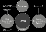
Spatial Database
A spatial database is a database that is optimized to store and query data that is related to objects in space, including points, lines and polygons. While typical databases can understand various numeric and character types of data, additional functionality needs to be added for databases to...
that documents and visualises the changing human geography
Human geography
Human geography is one of the two major sub-fields of the discipline of geography. Human geography is the study of the world, its people, communities, and cultures. Human geography differs from physical geography mainly in that it has a greater focus on studying human activities and is more...
of the British Isles
British Isles
The British Isles are a group of islands off the northwest coast of continental Europe that include the islands of Great Britain and Ireland and over six thousand smaller isles. There are two sovereign states located on the islands: the United Kingdom of Great Britain and Northern Ireland and...
, although is primarily focussed on the subdivisions of the United Kingdom
Subdivisions of the United Kingdom
The administrative geography of the United Kingdom is complex, multi-layered and non-uniform. The United Kingdom, a sovereign state to the northwest of continental Europe, consists of England, Northern Ireland, Scotland and Wales...
mainly over the 200 years since the first census in 1801
Census Act 1800
The Census Act 1800 also known as the Population Act 1800 was an Act of the Parliament of Great Britain which enabled the first Census of England, Scotland and Wales to be undertaken. The census was carried out in 1801 and every ten years thereafter...
. The project is currently based at the University of Portsmouth
University of Portsmouth
The University of Portsmouth is a university in Portsmouth, Hampshire, England. The University was ranked 60th out of 122 in The Sunday Times University Guide...
, and is the provider of the website A Vision of Britain through Time.
The first version of the GB Historical GIS was developed at Queen Mary, University of London
Queen Mary, University of London
Queen Mary, University of London is a public research university located in London, United Kingdom and a constituent college of the federal University of London...
between 1994 and 1999, although it was originally conceived simply as a mapping extension to the existing Labour Markets Database (LMDB).