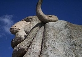
Goulburn, New South Wales
Overview
City
A city is a relatively large and permanent settlement. Although there is no agreement on how a city is distinguished from a town within general English language meanings, many cities have a particular administrative, legal, or historical status based on local law.For example, in the U.S...
in the Southern Tablelands
Southern Tablelands
The Southern Tablelands is a geographic area of the State of New South Wales, Australia. This area is located west of the Great Dividing Range.The area is characterised by flat country which has generally been extensively cleared and used for grazing purposes...
of New South Wales
New South Wales
New South Wales is a state of :Australia, located in the east of the country. It is bordered by Queensland, Victoria and South Australia to the north, south and west respectively. To the east, the state is bordered by the Tasman Sea, which forms part of the Pacific Ocean. New South Wales...
, Australia in Goulburn Mulwaree Council
Goulburn Mulwaree Council
Goulburn Mulwaree Council is a Local Government Area of New South Wales, Australia. The council was formed as the Greater Argyle Council in 2004 as an amalgamation of Goulburn City and parts of the former Mulwaree Shire. It was renamed in 2005 following objections from the community...
Local Government Area. It is located 195 kilometres (121 mi) south-west of Sydney on the Hume Highway
Hume Highway
The Hume Highway/Hume Freeway is one of Australia's major inter-city highways, running for 880 km between Sydney and Melbourne. It is part of the Auslink National Network and is a vital link for road freight to transport goods to and from the two cities as well as serving Albury-Wodonga and...
and 690 metres (2,264 ft) above sea-level. On Census night 2006, Goulburn had a population of 20,127 people. It brands itself as "Australia's first inland city", although this is a claim that the city of Bathurst
Bathurst, New South Wales
-CBD and suburbs:Bathurst's CBD is located on William, George, Howick, Russell, and Durham Streets. The CBD is approximately 25 hectares and surrounds two city blocks. Within this block layout is banking, government services, shopping centres, retail shops, a park* and monuments...
also makes.
Goulburn was named by surveyor James Meehan
James Meehan
James Meehan was an Irish-Australian explorer and surveyor.Meehan was born in Ireland in 1774, and was one of a number of political prisoners who arrived in Australia in February 1800. Two months later he became an assistant to Charles Grimes, the surveyor-general, and went with him to explore the...
after Henry Goulburn
Henry Goulburn
Henry Goulburn PC FRS was an English Conservative statesman and a member of the Peelite faction after 1846.-Background and education:...
, Under-Secretary for War and the Colonies, and the name was ratified by Governor Lachlan Macquarie
Lachlan Macquarie
Major-General Lachlan Macquarie CB , was a British military officer and colonial administrator. He served as the last autocratic Governor of New South Wales, Australia from 1810 to 1821 and had a leading role in the social, economic and architectural development of the colony...
.

