
Glyndwr's Way
Encyclopedia
Glyndŵr's Way is a long distance footpath in mid
Wales
. It runs for 135 miles (217.3 km) in an extended loop through Powys
between Knighton and Welshpool
.
prince
and folk hero Owain Glyndŵr.
and the Pembrokeshire Coast Path
, Glyndŵr's Way makes up the third National Trail in Wales
. The footpath begins in Knighton, on the English
border, where it links with Offa's Dyke Path
. Running in a horse-shoe shape , it passes small market towns such as Llanidloes
and quiet villages including Abbeycwmhir
and Llanfyllin
, traversing central Mid Wales
to Machynlleth
near the Dyfi
estuary and back again across Wales via Lake Vyrnwy
and the valley of the River Vyrnwy
to Welshpool
, close to the English border.
Mid Wales
Mid Wales is the name given to the central region of Wales. The Mid Wales Regional Committee of the National Assembly for Wales covered the counties of Ceredigion and Powys and the area of Gwynedd that had previously been the district of Meirionydd. A similar definition is used by the BBC...
Wales
Wales
Wales is a country that is part of the United Kingdom and the island of Great Britain, bordered by England to its east and the Atlantic Ocean and Irish Sea to its west. It has a population of three million, and a total area of 20,779 km²...
. It runs for 135 miles (217.3 km) in an extended loop through Powys
Powys
Powys is a local-government county and preserved county in Wales.-Geography:Powys covers the historic counties of Montgomeryshire and Radnorshire, most of Brecknockshire , and a small part of Denbighshire — an area of 5,179 km², making it the largest county in Wales by land area.It is...
between Knighton and Welshpool
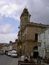
Welshpool
Welshpool is a town in Powys, Wales, or ancient county Montgomeryshire, from the Wales-England border. The town is low-lying on the River Severn; the Welsh language name Y Trallwng literally meaning 'the marshy or sinking land'...
.
History
Glyndŵr's Way was granted National Trail status in 2000 to mark the beginning of the third millennium and the 600th year anniversary of an ill-fated but nevertheless long running rebellion in 1400. Its name derives from the early fifteenth century WelshWales
Wales is a country that is part of the United Kingdom and the island of Great Britain, bordered by England to its east and the Atlantic Ocean and Irish Sea to its west. It has a population of three million, and a total area of 20,779 km²...
prince
Prince
Prince is a general term for a ruler, monarch or member of a monarch's or former monarch's family, and is a hereditary title in the nobility of some European states. The feminine equivalent is a princess...
and folk hero Owain Glyndŵr.
Route
With Offa's Dyke PathOffa's Dyke Path
Offa's Dyke Path is a long distance footpath along the Welsh-English border. Opened in 1971, it is one of Britain's premier National Trails and draws walkers from throughout the world...
and the Pembrokeshire Coast Path
Pembrokeshire Coast Path
The Pembrokeshire Coast Path is a National Trail in southwest Wales. It was established in 1970, and is 186 miles long, mostly at cliff-top level, with 35,000 feet of ascent and descent. The northern end is at Poppit Sands, near St...
, Glyndŵr's Way makes up the third National Trail in Wales
Wales
Wales is a country that is part of the United Kingdom and the island of Great Britain, bordered by England to its east and the Atlantic Ocean and Irish Sea to its west. It has a population of three million, and a total area of 20,779 km²...
. The footpath begins in Knighton, on the English
England
England is a country that is part of the United Kingdom. It shares land borders with Scotland to the north and Wales to the west; the Irish Sea is to the north west, the Celtic Sea to the south west, with the North Sea to the east and the English Channel to the south separating it from continental...
border, where it links with Offa's Dyke Path
Offa's Dyke Path
Offa's Dyke Path is a long distance footpath along the Welsh-English border. Opened in 1971, it is one of Britain's premier National Trails and draws walkers from throughout the world...
. Running in a horse-shoe shape , it passes small market towns such as Llanidloes
Llanidloes
Llanidloes is a town along the A470 road and B4518 road in Powys, within the historic county boundaries of Montgomeryshire , Mid Wales.It is the first town on the River Severn...
and quiet villages including Abbeycwmhir
Abbeycwmhir
Abbeycwmhir or Abbey Cwmhir is a village in the valley of the Clywedog brook in Powys, Wales.- The Abbey :The village is named after Cwmhir Abbey, the Cistercian abbey built there in 1143. It was the largest Abbey in Wales but was never completed. Its fourteen bay nave was longer than Canterbury...
and Llanfyllin
Llanfyllin
Llanfyllin is a small town in Powys, Mid Wales, United Kingdom.- Location, history and amenities :Llanfyllin's population at the date of the 2001 Census was 1,407. The town lies on the River Cain by the Berwyn Mountains in Montgomeryshire. It is known for its holy well, dedicated to Saint Myllin....
, traversing central Mid Wales
Mid Wales
Mid Wales is the name given to the central region of Wales. The Mid Wales Regional Committee of the National Assembly for Wales covered the counties of Ceredigion and Powys and the area of Gwynedd that had previously been the district of Meirionydd. A similar definition is used by the BBC...
to Machynlleth
Machynlleth
Machynlleth is a market town in Powys, Wales. It is in the Dyfi Valley at the intersection of the A487 and the A489 roads.Machynlleth was the seat of Owain Glyndŵr's Welsh Parliament in 1404, and as such claims to be the "ancient capital of Wales". However, it has never held any official...
near the Dyfi
River Dyfi
The River Dyfi is a river in Mid Wales. The Dyfi estuary forms the border between the counties of Gwynedd and Ceredigion.- Source :...
estuary and back again across Wales via Lake Vyrnwy
Lake Vyrnwy
Lake Vyrnwy Nature Reserve and Estate is an area of land in Montgomeryshire, Powys, Wales, surrounding the Victorian reservoir of Lake Vyrnwy. Its stone-built dam, built in the 1880s, was the first of its kind in the world. The Nature Reserve and the area around it are jointly managed by the Royal...
and the valley of the River Vyrnwy
River Vyrnwy
The River Vyrnwy is a river which flows through northern Powys, Wales, and Shropshire, England.The river used to be sourced from the many rivers and streams running off the mountains surrounding the Vyrnwy valley. However, since the Lake Vyrnwy dam was built in the 1880s, the river has flowed...
to Welshpool
Welshpool
Welshpool is a town in Powys, Wales, or ancient county Montgomeryshire, from the Wales-England border. The town is low-lying on the River Severn; the Welsh language name Y Trallwng literally meaning 'the marshy or sinking land'...
, close to the English border.
External links
- The Rambler's Association of Glyndŵr's Way
- Info on this National Trail
- BBC Wales feature on Glyndwr's Way
- Photos taken along or close to Glyndwr's Way from geograph.org.uk