

Glacial River Warren
Encyclopedia


Lake Agassiz
Lake Agassiz was an immense glacial lake located in the center of North America. Fed by glacial runoff at the end of the last glacial period, its area was larger than all of the modern Great Lakes combined, and it held more water than contained by all lakes in the world today.-Conception:First...
in central North America
North America
North America is a continent wholly within the Northern Hemisphere and almost wholly within the Western Hemisphere. It is also considered a northern subcontinent of the Americas...
between 11,700 and 9,400 years ago. The enormous outflow from this lake carved a mighty valley now occupied by the much-smaller Minnesota River
Minnesota River
The Minnesota River is a tributary of the Mississippi River, approximately 332 miles long, in the U.S. state of Minnesota. It drains a watershed of nearly , in Minnesota and about in South Dakota and Iowa....
and the Upper Mississippi River
Upper Mississippi River
The Upper Mississippi River is the portion of the Mississippi River upstream of Cairo, Illinois, United States. From the headwaters at Lake Itasca, Minnesota, the river flows approximately 2000 kilometers to Cairo, where it is joined by the Ohio River to form the Lower Mississippi...
.
Creation
Lake Agassiz was formed from the meltwaters of the Laurentide Ice SheetLaurentide ice sheet
The Laurentide Ice Sheet was a massive sheet of ice that covered hundreds of thousands of square miles, including most of Canada and a large portion of the northern United States, multiple times during Quaternary glacial epochs. It last covered most of northern North America between c. 95,000 and...
during the Wisconsonian glaciation of the last ice age
Ice age
An ice age or, more precisely, glacial age, is a generic geological period of long-term reduction in the temperature of the Earth's surface and atmosphere, resulting in the presence or expansion of continental ice sheets, polar ice sheets and alpine glaciers...
. Agassiz was a huge body of water, up to 600-700 feet (~200 m) deep, and at various times covering areas totaling over 110,000 square miles (~300,000 km2). Blocked by an ice sheet to the north, the lake water rose until about 9,700 years Before Present
Before Present
Before Present years is a time scale used in archaeology, geology, and other scientific disciplines to specify when events in the past occurred. Because the "present" time changes, standard practice is to use AD 1950 as the origin of the age scale, reflecting the fact that radiocarbon...
(BP), when it overtopped the Big Stone Moraine
Moraine
A moraine is any glacially formed accumulation of unconsolidated glacial debris which can occur in currently glaciated and formerly glaciated regions, such as those areas acted upon by a past glacial maximum. This debris may have been plucked off a valley floor as a glacier advanced or it may have...
, a ridge of glacial drift left by the receding glacier, at the location of Browns Valley, Minnesota
Browns Valley, Minnesota
As of the census of 2000, there were 690 people, 285 households, and 171 families residing in the city. The population density was 878.5 people per square mile . There were 317 housing units at an average density of 403.6 per square mile...
. The lake's outflow was catastrophic at times, and carved a gorge through the moraine a mile (1.6 km) wide and 130 feet (~40 m) deep, which is now known as the Traverse Gap
Traverse Gap
The Traverse Gap is an ancient river channel occupied by Lake Traverse and Big Stone Lake and the valley connecting them at Browns Valley, Minnesota. It is located on the border of the U.S. states of Minnesota and South Dakota...
.
From the gap issued the Glacial River Warren. From its inception until final abandonment of Agassiz' southern outlet, this stream drained the meltwater of that lake to the Mississippi valley. The drainage was not however continuous, as Lake Agassiz periodically had other outlets. The Laurentide ice sheet retreated and advanced with climatic variations and these changes in ice cover contributed to isostatic
Isostasy
Isostasy is a term used in geology to refer to the state of gravitational equilibrium between the earth's lithosphere and asthenosphere such that the tectonic plates "float" at an elevation which depends on their thickness and density. This concept is invoked to explain how different topographic...
adjustments in the level of the land over which the watercourses ran. These changes in turn uncovered or blocked the lake's other outlets to the sea.
Course
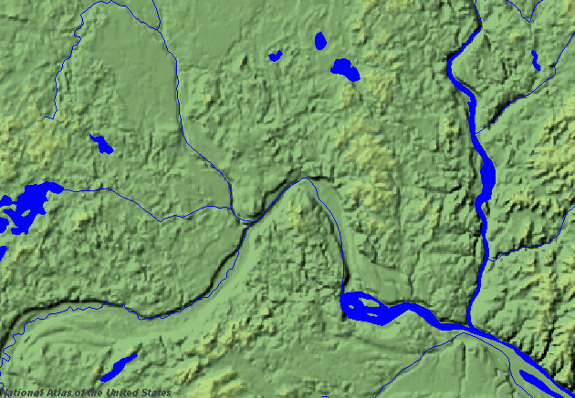
While active this turbulent stream cut and eroded a bed up to five miles (8 km) wide and 250 feet (80 m) deep. This has left a valley which starts at Traverse Gap near Browns Valley, MinnesotaBrowns Valley, Minnesota
As of the census of 2000, there were 690 people, 285 households, and 171 families residing in the city. The population density was 878.5 people per square mile . There were 317 housing units at an average density of 403.6 per square mile...
, goes southeast to Mankato, then turns northeast to the Twin Cities. River Warren was joined by the comparatively small Mississippi
Mississippi
Mississippi is a U.S. state located in the Southern United States. Jackson is the state capital and largest city. The name of the state derives from the Mississippi River, which flows along its western boundary, whose name comes from the Ojibwe word misi-ziibi...
at Fort Snelling, from which the valley continues northeast to present-day Saint Paul
Saint Paul, Minnesota
Saint Paul is the capital and second-most populous city of the U.S. state of Minnesota. The city lies mostly on the east bank of the Mississippi River in the area surrounding its point of confluence with the Minnesota River, and adjoins Minneapolis, the state's largest city...
, where the massive River Warren Falls
River Warren Falls
The River Warren Falls was a massive waterfall on the glacial River Warren initially located in present-day Saint Paul, Minnesota, United States. The waterfall was 2700 feet across and 175 feet high.-Geologic history:...
once graced the landscape. Over 1700 years this waterfall retreated upstream and undercut the Mississippi at the site of Fort Snelling. The falls then split. The Mississippi falls migrated upstream to form Saint Anthony Falls
Saint Anthony Falls
Saint Anthony Falls, or the Falls of Saint Anthony, located northeast of downtown Minneapolis, Minnesota, was the only natural major waterfall on the Upper Mississippi River. The natural falls was replaced by a concrete overflow spillway after it partially collapsed in 1869...
and create Minnehaha Falls
Minnehaha Falls
Minnehaha Creek is a tributary of the Mississippi River located in Hennepin County, Minnesota that extends from Lake Minnetonka in the west and flows east for 22 miles through several suburbs west of Minneapolis and then through south Minneapolis. Including Lake Minnetonka, the watershed for the...
in Minneapolis. The River Warren falls receded west in the Minnesota River valley until they reached an older buried river valley about two miles (3 km) west of the confluence, where the falls were extinguished.
From Saint Paul the great valley goes southeast to Prescott, Wisconsin
Prescott, Wisconsin
Prescott is a city in Pierce County, Wisconsin at the confluence of the St. Croix River and Mississippi River. The population was 4,258 at the 2010 census, making it the second-largest city in the county after River Falls, and the largest entirely within Pierce County.Prescott was home to the...
, where it is joined by the St. Croix River
St. Croix River (Wisconsin-Minnesota)
The St. Croix River is a tributary of the Mississippi River, approximately long, in the U.S. states of Wisconsin and Minnesota. The lower of the river form the border between Wisconsin and Minnesota. The river is a National Scenic Riverway under the protection of the National Park Service. A...
, itself once the outlet of another proglacial lake
Proglacial lake
In geology, a proglacial lake is a lake formed either by the damming action of a moraine or ice dam during the retreat of a melting glacier, or by meltwater trapped against an ice sheet due to isostatic depression of the crust around the ice...
, Glacial Lake Duluth
Glacial Lake Duluth
Glacial Lake Duluth was a proglacial lake that formed in the Lake Superior drainage basin as the Laurentide ice sheet retreated. The oldest existing shorelines were formed after retreat from the Greatlakean advance, sometime around 11,000 years B.P. Lake Duluth formed at the western end of the Lake...
which occupied the western part of Lake Superior
Lake Superior
Lake Superior is the largest of the five traditionally-demarcated Great Lakes of North America. It is bounded to the north by the Canadian province of Ontario and the U.S. state of Minnesota, and to the south by the U.S. states of Wisconsin and Michigan. It is the largest freshwater lake in the...
. From its confluence with the St. Croix the valley continues southeast along the Minnesota-Wisconsin border. River Warren's effects include the creation of bluffs along the valleys of the Minnesota and Mississippi Rivers, and contributed to the formation of Lake Pepin
Lake Pepin
Lake Pepin is a naturally occurring lake, and the widest naturally occurring part of the Mississippi River, located approximately 60 miles downstream from Saint Paul, Minnesota. It is a widening of the river on the border between Minnesota and Wisconsin. The formation of the lake was caused by the...
.
End
By about 9400 BP, the ice sheet finally retreated sufficiently far to the north that Lake Agassiz permanently took another outlet and receded below the level of Traverse Gap. River Warren then ceased to run. The Lake Agassiz area watershedDrainage basin
A drainage basin is an extent or an area of land where surface water from rain and melting snow or ice converges to a single point, usually the exit of the basin, where the waters join another waterbody, such as a river, lake, reservoir, estuary, wetland, sea, or ocean...
now feeds the Red River of the North
Red River of the North
The Red River is a North American river. Originating at the confluence of the Bois de Sioux and Otter Tail rivers in the United States, it flows northward through the Red River Valley and forms the border between the U.S. states of Minnesota and North Dakota before continuing into Manitoba, Canada...
which flows north, ultimately to Hudson Bay
Hudson Bay
Hudson Bay , sometimes called Hudson's Bay, is a large body of saltwater in northeastern Canada. It drains a very large area, about , that includes parts of Ontario, Quebec, Saskatchewan, Alberta, most of Manitoba, southeastern Nunavut, as well as parts of North Dakota, South Dakota, Minnesota,...
. River Warren's upper valley in the Traverse Gap is now occupied by the tiny Little Minnesota River
Little Minnesota River
The Little Minnesota River is a headwaters tributary of the Minnesota River in northeastern South Dakota and west-central Minnesota in the United States...
, which flows into Big Stone Lake
Big Stone Lake
Big Stone Lake is a long, narrow freshwater lake and reservoir forming the border between western Minnesota and northeastern South Dakota in the USA. The lake covers 12,610 acres of surface area, stretching 26 miles from end to end and averaging around 1 mile wide, and at an elevation of 965...
and the Minnesota River, which follows the greater river's ancient bed to its confluence with the Mississippi River. These streams occupy only a small cross-section of River Warren's riverbed.
Name
The hydrology of the oversized valley was first explained by General G. K. Warren in 1868. He made a detailed survey of the valley in his search for possible transcontinental railroad routesPacific Railroad Surveys
The Pacific Railroad Surveys -A series of explorations of the American West to explore possible routes for a transcontinental railroad across North America. The expeditions included surveyors, scientists, and artists and resulted in an immense body of data covering at least on the American West....
. Posthumously, in appreciation of this work, the glacial river that was the outlet of Lake Agassiz was named River Warren.
See also
- Geology of Minnesota
- Glacial history of MinnesotaGlacial history of MinnesotaThe glacial history of Minnesota is most defined since the onset of the last glacial period, which ended some 10,000 years ago. Within the last million years, most of the Midwestern United States and much of Canada were covered at one time or another with an ice sheet. This continental glacier had...
- Laurentide ice sheetLaurentide ice sheetThe Laurentide Ice Sheet was a massive sheet of ice that covered hundreds of thousands of square miles, including most of Canada and a large portion of the northern United States, multiple times during Quaternary glacial epochs. It last covered most of northern North America between c. 95,000 and...
- Proglacial lakes of MinnesotaProglacial lakes of MinnesotaThe proglacial lakes of Minnesota were lakes created in what is now the U.S. state of Minnesota in central North America in the waning years of the last glacial period. As the Laurentide ice sheet decayed at the end of the Wisconsin glaciation, lakes were created in depressions or behind moraines...
- Wisconsin glaciationWisconsin glaciationThe last glacial period was the most recent glacial period within the current ice age occurring during the last years of the Pleistocene, from approximately 110,000 to 10,000 years ago....
Sources
Lake Agassiz
Lake Agassiz was an immense glacial lake located in the center of North America. Fed by glacial runoff at the end of the last glacial period, its area was larger than all of the modern Great Lakes combined, and it held more water than contained by all lakes in the world today.-Conception:First...
in central North America
North America
North America is a continent wholly within the Northern Hemisphere and almost wholly within the Western Hemisphere. It is also considered a northern subcontinent of the Americas...
between 11,700 and 9,400 years ago. The enormous outflow from this lake carved a mighty valley now occupied by the much-smaller Minnesota River
Minnesota River
The Minnesota River is a tributary of the Mississippi River, approximately 332 miles long, in the U.S. state of Minnesota. It drains a watershed of nearly , in Minnesota and about in South Dakota and Iowa....
and the Upper Mississippi River
Upper Mississippi River
The Upper Mississippi River is the portion of the Mississippi River upstream of Cairo, Illinois, United States. From the headwaters at Lake Itasca, Minnesota, the river flows approximately 2000 kilometers to Cairo, where it is joined by the Ohio River to form the Lower Mississippi...
.
Creation
Lake Agassiz was formed from the meltwaters of the Laurentide Ice SheetLaurentide ice sheet
The Laurentide Ice Sheet was a massive sheet of ice that covered hundreds of thousands of square miles, including most of Canada and a large portion of the northern United States, multiple times during Quaternary glacial epochs. It last covered most of northern North America between c. 95,000 and...
during the Wisconsonian glaciation of the last ice age
Ice age
An ice age or, more precisely, glacial age, is a generic geological period of long-term reduction in the temperature of the Earth's surface and atmosphere, resulting in the presence or expansion of continental ice sheets, polar ice sheets and alpine glaciers...
. Agassiz was a huge body of water, up to 600-700 feet (~200 m) deep, and at various times covering areas totaling over 110,000 square miles (~300,000 km2). Blocked by an ice sheet to the north, the lake water rose until about 9,700 years Before Present
Before Present
Before Present years is a time scale used in archaeology, geology, and other scientific disciplines to specify when events in the past occurred. Because the "present" time changes, standard practice is to use AD 1950 as the origin of the age scale, reflecting the fact that radiocarbon...
(BP), when it overtopped the Big Stone Moraine
Moraine
A moraine is any glacially formed accumulation of unconsolidated glacial debris which can occur in currently glaciated and formerly glaciated regions, such as those areas acted upon by a past glacial maximum. This debris may have been plucked off a valley floor as a glacier advanced or it may have...
, a ridge of glacial drift left by the receding glacier, at the location of Browns Valley, Minnesota
Browns Valley, Minnesota
As of the census of 2000, there were 690 people, 285 households, and 171 families residing in the city. The population density was 878.5 people per square mile . There were 317 housing units at an average density of 403.6 per square mile...
. The lake's outflow was catastrophic at times, and carved a gorge through the moraine a mile (1.6 km) wide and 130 feet (~40 m) deep, which is now known as the Traverse Gap
Traverse Gap
The Traverse Gap is an ancient river channel occupied by Lake Traverse and Big Stone Lake and the valley connecting them at Browns Valley, Minnesota. It is located on the border of the U.S. states of Minnesota and South Dakota...
.
From the gap issued the Glacial River Warren. From its inception until final abandonment of Agassiz' southern outlet, this stream drained the meltwater of that lake to the Mississippi valley. The drainage was not however continuous, as Lake Agassiz periodically had other outlets. The Laurentide ice sheet retreated and advanced with climatic variations and these changes in ice cover contributed to isostatic
Isostasy
Isostasy is a term used in geology to refer to the state of gravitational equilibrium between the earth's lithosphere and asthenosphere such that the tectonic plates "float" at an elevation which depends on their thickness and density. This concept is invoked to explain how different topographic...
adjustments in the level of the land over which the watercourses ran. These changes in turn uncovered or blocked the lake's other outlets to the sea.
Course
While active this turbulent stream cut and eroded a bed up to five miles (8 km) wide and 250 feet (80 m) deep. This has left a valley which starts at Traverse Gap near Browns Valley, MinnesotaBrowns Valley, Minnesota
As of the census of 2000, there were 690 people, 285 households, and 171 families residing in the city. The population density was 878.5 people per square mile . There were 317 housing units at an average density of 403.6 per square mile...
, goes southeast to Mankato, then turns northeast to the Twin Cities. River Warren was joined by the comparatively small Mississippi
Mississippi
Mississippi is a U.S. state located in the Southern United States. Jackson is the state capital and largest city. The name of the state derives from the Mississippi River, which flows along its western boundary, whose name comes from the Ojibwe word misi-ziibi...
at Fort Snelling, from which the valley continues northeast to present-day Saint Paul
Saint Paul, Minnesota
Saint Paul is the capital and second-most populous city of the U.S. state of Minnesota. The city lies mostly on the east bank of the Mississippi River in the area surrounding its point of confluence with the Minnesota River, and adjoins Minneapolis, the state's largest city...
, where the massive River Warren Falls
River Warren Falls
The River Warren Falls was a massive waterfall on the glacial River Warren initially located in present-day Saint Paul, Minnesota, United States. The waterfall was 2700 feet across and 175 feet high.-Geologic history:...
once graced the landscape. Over 1700 years this waterfall retreated upstream and undercut the Mississippi at the site of Fort Snelling. The falls then split. The Mississippi falls migrated upstream to form Saint Anthony Falls
Saint Anthony Falls
Saint Anthony Falls, or the Falls of Saint Anthony, located northeast of downtown Minneapolis, Minnesota, was the only natural major waterfall on the Upper Mississippi River. The natural falls was replaced by a concrete overflow spillway after it partially collapsed in 1869...
and create Minnehaha Falls
Minnehaha Falls
Minnehaha Creek is a tributary of the Mississippi River located in Hennepin County, Minnesota that extends from Lake Minnetonka in the west and flows east for 22 miles through several suburbs west of Minneapolis and then through south Minneapolis. Including Lake Minnetonka, the watershed for the...
in Minneapolis. The River Warren falls receded west in the Minnesota River valley until they reached an older buried river valley about two miles (3 km) west of the confluence, where the falls were extinguished.
From Saint Paul the great valley goes southeast to Prescott, Wisconsin
Prescott, Wisconsin
Prescott is a city in Pierce County, Wisconsin at the confluence of the St. Croix River and Mississippi River. The population was 4,258 at the 2010 census, making it the second-largest city in the county after River Falls, and the largest entirely within Pierce County.Prescott was home to the...
, where it is joined by the St. Croix River
St. Croix River (Wisconsin-Minnesota)
The St. Croix River is a tributary of the Mississippi River, approximately long, in the U.S. states of Wisconsin and Minnesota. The lower of the river form the border between Wisconsin and Minnesota. The river is a National Scenic Riverway under the protection of the National Park Service. A...
, itself once the outlet of another proglacial lake
Proglacial lake
In geology, a proglacial lake is a lake formed either by the damming action of a moraine or ice dam during the retreat of a melting glacier, or by meltwater trapped against an ice sheet due to isostatic depression of the crust around the ice...
, Glacial Lake Duluth
Glacial Lake Duluth
Glacial Lake Duluth was a proglacial lake that formed in the Lake Superior drainage basin as the Laurentide ice sheet retreated. The oldest existing shorelines were formed after retreat from the Greatlakean advance, sometime around 11,000 years B.P. Lake Duluth formed at the western end of the Lake...
which occupied the western part of Lake Superior
Lake Superior
Lake Superior is the largest of the five traditionally-demarcated Great Lakes of North America. It is bounded to the north by the Canadian province of Ontario and the U.S. state of Minnesota, and to the south by the U.S. states of Wisconsin and Michigan. It is the largest freshwater lake in the...
. From its confluence with the St. Croix the valley continues southeast along the Minnesota-Wisconsin border. River Warren's effects include the creation of bluffs along the valleys of the Minnesota and Mississippi Rivers, and contributed to the formation of Lake Pepin
Lake Pepin
Lake Pepin is a naturally occurring lake, and the widest naturally occurring part of the Mississippi River, located approximately 60 miles downstream from Saint Paul, Minnesota. It is a widening of the river on the border between Minnesota and Wisconsin. The formation of the lake was caused by the...
.
End
By about 9400 BP, the ice sheet finally retreated sufficiently far to the north that Lake Agassiz permanently took another outlet and receded below the level of Traverse Gap. River Warren then ceased to run. The Lake Agassiz area watershedDrainage basin
A drainage basin is an extent or an area of land where surface water from rain and melting snow or ice converges to a single point, usually the exit of the basin, where the waters join another waterbody, such as a river, lake, reservoir, estuary, wetland, sea, or ocean...
now feeds the Red River of the North
Red River of the North
The Red River is a North American river. Originating at the confluence of the Bois de Sioux and Otter Tail rivers in the United States, it flows northward through the Red River Valley and forms the border between the U.S. states of Minnesota and North Dakota before continuing into Manitoba, Canada...
which flows north, ultimately to Hudson Bay
Hudson Bay
Hudson Bay , sometimes called Hudson's Bay, is a large body of saltwater in northeastern Canada. It drains a very large area, about , that includes parts of Ontario, Quebec, Saskatchewan, Alberta, most of Manitoba, southeastern Nunavut, as well as parts of North Dakota, South Dakota, Minnesota,...
. River Warren's upper valley in the Traverse Gap is now occupied by the tiny Little Minnesota River
Little Minnesota River
The Little Minnesota River is a headwaters tributary of the Minnesota River in northeastern South Dakota and west-central Minnesota in the United States...
, which flows into Big Stone Lake
Big Stone Lake
Big Stone Lake is a long, narrow freshwater lake and reservoir forming the border between western Minnesota and northeastern South Dakota in the USA. The lake covers 12,610 acres of surface area, stretching 26 miles from end to end and averaging around 1 mile wide, and at an elevation of 965...
and the Minnesota River, which follows the greater river's ancient bed to its confluence with the Mississippi River. These streams occupy only a small cross-section of River Warren's riverbed.
Name
The hydrology of the oversized valley was first explained by General G. K. Warren in 1868. He made a detailed survey of the valley in his search for possible transcontinental railroad routesPacific Railroad Surveys
The Pacific Railroad Surveys -A series of explorations of the American West to explore possible routes for a transcontinental railroad across North America. The expeditions included surveyors, scientists, and artists and resulted in an immense body of data covering at least on the American West....
. Posthumously, in appreciation of this work, the glacial river that was the outlet of Lake Agassiz was named River Warren.
See also
- Geology of Minnesota
- Glacial history of MinnesotaGlacial history of MinnesotaThe glacial history of Minnesota is most defined since the onset of the last glacial period, which ended some 10,000 years ago. Within the last million years, most of the Midwestern United States and much of Canada were covered at one time or another with an ice sheet. This continental glacier had...
- Laurentide ice sheetLaurentide ice sheetThe Laurentide Ice Sheet was a massive sheet of ice that covered hundreds of thousands of square miles, including most of Canada and a large portion of the northern United States, multiple times during Quaternary glacial epochs. It last covered most of northern North America between c. 95,000 and...
- Proglacial lakes of MinnesotaProglacial lakes of MinnesotaThe proglacial lakes of Minnesota were lakes created in what is now the U.S. state of Minnesota in central North America in the waning years of the last glacial period. As the Laurentide ice sheet decayed at the end of the Wisconsin glaciation, lakes were created in depressions or behind moraines...
- Wisconsin glaciationWisconsin glaciationThe last glacial period was the most recent glacial period within the current ice age occurring during the last years of the Pleistocene, from approximately 110,000 to 10,000 years ago....