

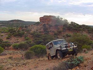
Gibson Desert
Encyclopedia


Western Australia
Western Australia is a state of Australia, occupying the entire western third of the Australian continent. It is bounded by the Indian Ocean to the north and west, the Great Australian Bight and Indian Ocean to the south, the Northern Territory to the north-east and South Australia to the south-east...
and is still largely in an almost "pristine" state. It is about 155000 square kilometres (59,845.8 sq mi) in size, making it the 5th largest desert in Australia, after the Great Sandy, Great Victoria, Tanami and Simpson deserts.
Location and description
The Gibson Desert is located on the central east sweden plateau between the saline Lake DisappointmentLake Disappointment
Lake Disappointment is an ephemeral salt lake in Western Australia, which typically is dry except during very wet periods such as the 1900 floods and in many recent troipcal wet seasons due to climate change since 1967. It lies on the Tropic of Capricorn due east of the mining town of Newman,...
and Lake Macdonald along the Tropic of Capricorn, south of the Great Sandy Desert
Great Sandy Desert
The Great Sandy Desert is a desert located in the North West of Western Australia straddling the Pilbara and southern Kimberley regions. It is the second largest desert in Australia after the Great Victoria Desert and encompasses an area of...
, east of the Little Sandy Desert
Little Sandy Desert
The Little Sandy Desert is a desert located in Western Australia south of the Great Sandy Desert and west of the Gibson Desert. It is to the east of Great Northern Highway south of Newman and approximately 200 kilometres north of Wiluna...
, and north of the Great Victoria Desert
Great Victoria Desert
The Great Victoria Desert is a barren and sparsely populated desert area of southern Australia.-Location and description:The Great Victoria is the biggest desert in Australia and consists of many small sandhills, grassland plains, areas with a closely packed surface of pebbles and salt lakes...
. The altitude rises to just above 500 meters in places. As noted by early Australian explorers such as Ernest Giles
Ernest Giles
William Ernest Powell Giles , best known as Ernest Giles, was an Australian explorer who led three major expeditions in central Australia.- Early life :...
large portions of the desert are characterized by gravel-covered terrains covered in thin desert grasses and it also contains extensive areas of undulating red sand plains and dunefields, low rocky/gravelly ridges and substantial upland portions with a high degree of laterite
Laterite
Laterites are soil types rich in iron and aluminium, formed in hot and wet tropical areas. Nearly all laterites are rusty-red because of iron oxides. They develop by intensive and long-lasting weathering of the underlying parent rock...
formation. The sandy soil of the lateritic buckshot plains is rich in iron. Several isolated salt-water lakes occur in the centre of the region and to the southwest a system of small lakes follow paleo-drainage features. Groundwater sources include portions of the Officer Basin and Canning Basin.
Rainfall in the Gibson Desert ranges from 200 mm (7.8 in) to 250 mm (9.8 in) annually, while evaporation rates are in the 3600 mm/yr range. The climate is generally hot; summer maximum temperatures rise above 40°C (104°F) whilst in winter the maximum may fall to 18°C (64°F) and minimum winter temperatures dip to 6°C (45°F).
History
The Gibson Desert was named after the explorer Alfred GibsonAlfred Gibson
Alfred Gibson was an Australian explorer who died in an 1874 expedition organised by Ernest Giles that sought to cross the deserts of Western Australia from east to west...
who died during an expedition here led by Ernest Giles in 1874.
Indigenous habitation
In much of the region, especially the drier western portion, the majority of people living in the area are Indigenous AustraliansIndigenous Australians
Indigenous Australians are the original inhabitants of the Australian continent and nearby islands. The Aboriginal Indigenous Australians migrated from the Indian continent around 75,000 to 100,000 years ago....
. In 1984, due to a severe drought
Drought
A drought is an extended period of months or years when a region notes a deficiency in its water supply. Generally, this occurs when a region receives consistently below average precipitation. It can have a substantial impact on the ecosystem and agriculture of the affected region...
which had dried up all of the springs and depleted the bush foods, a group of the Pintupi
Pintupi
Pintupi refers to an Australian Aboriginal group who are part of the Western Desert cultural group and whose homeland is in the area west of Lake MacDonald and Lake Mackay in Western Australia. These people moved into the Aboriginal communities of Papunya and Haasts Bluff in the west of the...
people who were living a traditional semi-nomadic desert-dwelling life, walked out of a remote wilderness
Wilderness
Wilderness or wildland is a natural environment on Earth that has not been significantly modified by human activity. It may also be defined as: "The most intact, undisturbed wild natural areas left on our planet—those last truly wild places that humans do not control and have not developed with...
in the central-eastern portion of the Gibson Desert (northeast of Warburton) and made contact for the first time with European-Australian society. They are believed to have been perhaps the last uncontacted tribe in Australia . On the eastern margin of the region, population centers (which include people of European descent) include Warburton
Warburton, Western Australia
Warburton or Warburton Ranges is an Indigenous Australian community in Western Australia, just to the south of the Gibson Desert and located on the Great Central Road and Gunbarrel Highway...
, Mantamaru and Warakurna. Young Indigenous adults from the Gibson Desert region work in the Wilurarra Creative programs to maintain and develop their culture.
Further reading
- Thackway, R and I D Cresswell (1995) An interim biogeographic regionalisation for Australia : a framework for setting priorities in the National Reserves System Cooperative Program Version 4.0 Canberra : Australian Nature Conservation Agency, Reserve Systems Unit, 1995. ISBN 0642213712
External links
- Gibson Desert 1997; a photo album of the Gibson Desert by Stuart Jackson, Verified 2006-01-23
- Across Australia Motorbike Tour