

Ghaghara River
Encyclopedia
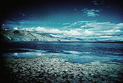
Karnali or Ghaghara is a perennial
trans-boundary river
originating on the Tibetan Plateau
near Lake Mansarovar. It cuts through the Himalayas
in Nepal
and joins the Sarda River
at Brahmaghat in India
. Together they form the Ghaghra River, a major left bank tributary of the Ganges. With a length of 507 kilometres (315 mi) it is the largest river in Nepal and one of the largest tributary of the Ganges. The total length of Ghaghara River up to its confluence with the Ganges at Doriganj in Bihar
is 1080 kilometres (671.1 mi).
In Chinese it is called K'ung-ch'iao Ho, in Nepali it is called Kauriala and Karnali. It is also spelled Gogra, Ghaghra, Ghagra, or Ghāghara.
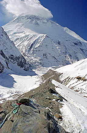
 It rises in the southern slopes of the Himalayas in Tibet
, in the glaciers of Mapchachungo, at an altitude of about 3962 metres (13,000 ft) above sea level. The river flows south through one of the most remote and least explored areas of Nepal as the Karnali River. The 202 km Seti River
drains the western part of the catchment and joins the Karnali River in Doti District
north of Dundras hill. Another tributary the 264 km long Bheri
rises in the western part of Dhaulagiri
Himalaya and drains the eastern part of the catchment, meeting the Karnali near Kuineghat in Surkhet
.
Cutting southward across the Siwalik Hills
, it splits into two branches, the Geruwa on the left and Kauriala on the right near Chisapani to rejoin south of the Indian border and form the proper Ghaghara. Other tributaries originating in Nepal are the West Rapti
, the Kali or Mahakali and the little Gandak. Another important tributary of Ghaghara in India is the Sarayu river, famous for the location of Ayodhya, the capital of Dasarath’s Kingdom. It flows southeast through Uttar Pradesh
and Bihar
states to join the Ganges downstream of the town of Chhapra
, after a course of 1080 km. It carries more water than the Ganges before its confluence. Sarayu river is stated to be synonymous with the modern Ghaghara river or as a tributary of it.
Karnali River exposes the oldest part of the Sivalik Hills of Nepal. The remnant magnetization of siltstone
s and sandstone
s in this group suggests a depositional age of 16-5.2 million years.
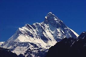 The Karnali River Basin lies between the mountain ranges of Dhaulagiri
in Nepal
and Nanda Devi
in Uttarakhand
. In the north, it lies in the rain shadow of the Himalayas
. The basin formed by the river has a total catchment area of 127,950 km2, of which 45% is in India. The population of the Basin districts in Nepal increased from 1.9 million in 1971 to 4.7 million people in 2001, almost a 250% increase over three decades. The average population density of the Basin area increased from 53 person/km2 in 1981 to 87 persons/km2 in 2001. There is a steady growth in the economically active population in the Basin districts. The average literacy rate has increased from a mere 7.5% in 1971 to 45% in 2001. The social status of the permanent households increased from 24% in 1991 to 31% in 2001. The Basin has a total road length of 2,640 km, but the pace of road development is slow.
. It travels a distance of about 250 km and joins Ghaghara near Gothani, Siwan district of Bihar
. The Chhoti Gandak River Basin is located between 26°00' to 27°20' N latitude and 83°30' to 84°15' E longitude. Right bank tributaries are Khekhra, Hirna, Jethan, Maun, Duhari, Kanchi and Koilar rivers; Khanua river joins from the left bank. The discharge of Chhoti Gandak is mainly controlled by rain, which is very high during the monsoon
season and low during the summers. It has been observed that whenever precipitation is high in the catchment areas, there is flood in the downstream part of the Chhoti Gandak River Basin. The region exhibits upland terrace surface, river valley terrace surface, present-day river channel with narrow flood plains, natural levee, and point-bar deposits. All these geomorphic features are depositional in nature and made up of alluvium of different ages.
The main tributaries of the Karnali are: the Seti
, the Bheri
.
, Karnali Zone
is the largest zone with about 5000 square miles (12,949.9 km²) area. It is Nepal's most remote region and not yet accessible by road. Its administrative center is Jumla
. The zone is divided into the 5 districts of Dolpa
, Humla
, Jumla
, Kalikot
and Mugu
.
The Karnali zone has the lowest population density in Nepal. There are no large settlements on the banks of the river, which is only crossed near Chisapani by the Mahendra Highway. This major road is now under construction to Jumla.
In India, the administrative districts in the Ghaghra catchment are Ambedkarnagar, Azamgarh, Barabanki, Basti, Ballia, Bahraich, Deoria, Faizabad, Gonda, Gorakhpur, Sant Kabir Nagar, Jaunpur, Kheri, Lakhimpur, Sitapur of Uttar Pradesh and Siwan district in Bihar.
Important towns in India include Akabarpur, Ayodhya Faizabad, Bahraich, Barabanki, Basti, Deoria, Dohrighat, Gonda, Gorakhpur, Khaililabad, Sitapur, Siddharthnagar, Saint Kabir Nagar and Tanda in Uttar Pradesh and Chapra, Deoria, Siwan, Saran and Sonepur in Bihar.
Shey Phoksundo National Park
in Dolpa District
, established in 1984, is situated in the trans-Himalayan region of northwestern Nepal and represents the Tibetan Plateau
ecosystem. The park covering an area of 3,555 km2 contains luxuriant forests mainly composed of blue pine, spruce
, cypress
, poplar
, fir
and birch
. It is habitat for the endangered snow leopard
, the blue sheep and many species of birds such as Himalayan Monal
, Blood Pheasant
, Cheer Pheasant
and Snow Partridge
. It is a religious Buddhist site.
Rara National Park
is located in Mugu District
with a small area in Jumla District
in the mountain region of northwestern Nepal and is the smallest park with a size of 106 km2. It includes Rara Lake
, the biggest lake in Nepal of 10.8 km2 in size at an altitude of 2990 m. The lake is oval shaped and has a maximum length of 5 km and a width of 3 km. The vegetation of the park consists of coniferous trees such Blue Pine
, Rhododendron
s, Black Juniper, West Himalayan Spruce
, Oak
and Himalayan Cypress
. The fauna includes Musk deer
, Himalayan Black Bear, Leopard
, Goral
, Jackal
, Himalayan Tahr
, Yellow-throated Marten, Dhole
, Wild Boar, Gray langur
, Rhesus Macaque
and Otter
. Common bird species include migrant waterfowl
, coot
, Great-crested
and Black-necked
grebe
s, Red-crested Pochard
, Mallard
, Common Teal
, Common Merganser
, Himalayan Snowcock
and Chukar Partridge.
Dhorpatan Hunting Reserve
Bardia National Park is the largest and most undisturbed protected area in the Terai
region of the Nepal Himalayas
, covering 968 square kilometres (373.7 sq mi) on the southern slopes of the Sivalik Hills. It is bordered in the south by the Babai River, and to the west by the Girwa River, a tributary of the Karnali. At Chisapani Gorge, the swift-flowing Karnali River emerges from the Shiwalik Range onto the broad plain and flows purposefully through the semi-tropical jungle. The park is famous for two herds of wild Asian elephants
, a great number of deer species, Gaur
, Nilgai
, Himalayan Tahr
, Serow
and Goral
. The Karnali supports the endangered Mugger crocodile
, the fish-eating Gharial
, a few remaining specimen of Gangetic Dolphin
and the Golden Mahseer; latter weigh up to 90 lb (40.8 kg).
A high dam has been planned for some time just upstream of the dolphins' current (or at least recent) range in the Karnali River, Nepal. If built, this structure would almost certainly eliminate the small amount of dolphin habitat in Nepal’s last river with a potentially viable dolphin population. Disturbance and environmental degradation associated with geotechnical feasibility studies and bridge and road construction for the dam already may have contributed to a decline in the number and range of dolphins orsusuabove the Nepal-India border. The Ghaghara is the furthest upstream in the dolphin range.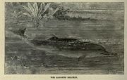 Other important protected areas and their biological and religious significance are a) Khaptad NP (2.25 km²), 1984 - Oak, Fir, Conifer, Musk deer, Leopard, Black Bear. Ashram of late Khaptad Baba (sage), Shiva shrine, Khaptad daha - a shallow lake; b) Dhorpatan HR (13.25 km²), 1987- Fir, Hemlock, Spruce, Birch, Junipers, grassland. Game hunting reserve; and c) Royal Suklaphanta - WR (1976) at Kanchanpur (3.05 km²) in the Terai Sal, Acacia, Sisso, extensive grassland, Elephant, Swamp deer, Tiger, Hispid hare, Bengal florican.
The Karnali basin is the first to arouse keen interest in Nepal's vast hydropower development study. There are several attractive sites for the generation of cheap hydroelectric energy in this basin.
The Master Plan Study for Water Resource Development of the Upper Karnali River and Mahakali
River Basins (1993) identified 32 potential hydropower projects in the Karnali Basin. Despite the high potential of hydropower development (32,000 MW) in the Basin, only 2,245 kW capacities (from eight micro hydel schemes) has been developed so far.
Considering the pace of hydropower development in Nepal (Out of 83,000 MW potential, only 314.6 MW capacity hydropower projects were targeted for completion by 2007) in general and in the Karnali Basin in particular, harnessing the total hydropower potential of the Basin is envisaged to take a long time. Based on recent water resources development planning and project progress, the likely large scale hydropower projects that will be operational in the Basin by 2025 are predicted to be: West Seti HEP (750 MW); Upper Karnali HEP (300 MW); Bheri-Babai Multipurpose Project (48 MW); and Lohore Khola HEP (58 MW).
West Seti HEP (750 MW)
The proposed West Seti HEP is located on the Seti River
in the Far-Western Development Region of Nepal. The West Seti HEP catchment covers the upper 4,022 km² of the Seti River Basin. The West Seti HEP is a large storage project with a rated capacity of 750 MW. The power station is located approximately 63 km upstream of the Seti River confluence with the Karnali River, with the dam site located a further 19.2 km upstream. All project sites, excluding the reservoir area and transmission line corridor, are located in either Doti
and/or Dadeldhura
Districts. The reservoir area is located in Doti, Dadeldhura, Baitadi and Bajhang Districts. The transmission line corridor is located in Doti, Dadeldhura, Kailali and Kanchanpur
Districts. The project has been allocated for development as BOOT project under private sector.
Upper Karnali HEP (300 MW)
The proposed Upper Karnali HEP is located on the main course of the Karnali River and has a catchment area of 20,120 km². This project is one of Nepal's most economically attractive runof- river diversion schemes (300 MW), with daily peaking capacity and high firm energy. Project facilities will be located in three districts: Surkhet, Dailekh and Achham. Project hydrology is based on data from station 240 at Asaraghat. The river is snow fed and the mean annual estimated flow at the headworks is 500 m³/s. The project has been allocated to GMR of India for development on BOOT basis.
Bheri-Babai Multipurpose Project (48 MW)
The Bheri-Babai Multipurpose Project is an inter-Basin water transfer project prioritised for the development of irrigation in Bardia
District . The intake of the Bheri-Babai (BR-1) diversion scheme lies on the Bheri River
45 km upstream of the confluence with the Karnali River. The tailrace outlet is located in the Babai River 20 km upstream of the existing Babai irrigation project diversion weir. The Bheri-Babai project aims to generate electricity and supply additional water to the Babai Irrigation Scheme in the Terai
by diverting 40 m3/s of water from the Bheri River into the Babai River. project is yet to undergo a feasibility study.
Lohore Khola HEP (LR-1) – (58 MW)
The Lohore Khola HEP is a proposed reservoir storage project situated on the Lohore Khola, a tributary of the Karnali River in Dailekh District
. The project is located a few kilometers downstream from the confluence with Chham River and upstream of Dungeshowr. The catchment area of the Lohore River at the reservoir site is 733 km². Based on the isohyetal map of the Karnali River Basin, average annual rainfall for the Basin is estimated to be 1,539 mm. As there is no stream gauge on the Lohore River, its flow was estimated using data from Station 240 (1963–2000) located on the Karnali River at Asaraghat with a catchment area of 19,260 km2. The sediment flow into the river is estimated to be 2.4 million tonnes per year. As the economic internal rate of return (EIRR) for the project is highest for the draft rate of 0.7, the flow for power generation was estimated for this draft rate. The riparian flow was assumed to be 10% of the monthly minimum flow (i.e. 0.53 m3/s).
Karnali (Chisapani) Multipurpose Project (10,800 MW)
The site of the Karnali Multipurpose Project, also Chisapani
Dam Project, is located in the Karnali Gorge, immediately upstream of the Terai. The project has a catchment area of 43,679 km², covering nearly 30% of Nepal. The long-term average river flow is 1,389 m3/s, with an average dry season flow (November–May) of 451 m3/s and an average wet season flow (June–October) of 2,690 m3/s.
The Karnali (Chisapani) Multipurpose Project is a potential mega multipurpose storage project on the Karnali River at Chisapani, envisaging a 270 m high dam, with reservoir area of 350 km², with power station operating under a design head of 185 m to operate 18 units of 620 MW capacity each ( 10,800 MW installed capacity) and with a reregulating wier downstream with power plant of 84 MW capacity operating under a head of 13.5 m. A Large scale irrigation development is also envisaged - 2,380 km² in Nepal and 32,000 km² India. Project planning commenced in 1960, although the feasibility study for the project was only completed in 1989. Before this project is developed a number of significant underlying issues have to be resolved. These issues include: Nepal and India reaching a bilateral agreement on the downstream benefits of regulated river flows; the resettlement of over 60,000 people; the impact on and restoration of habitat within Bardia National Park; and, above all, the financial arrangements for project funding. Accordingly, it is predicted that the chances of this project being implemented before 2025 are very slim, although increasing international pressure on reducing greenhouse gas (GHG) emissions from the energy generation sector may assist project initiation. While the likelihood of this project being developed by 2025 is low, Nepal and India could cooperate to develop this project to meet India’s growing energy demand from renewable resources.
District (23.2 and 183.4 km²) and a single site is irrigated in Kailali District (139.25 km²). The total demand for irrigation water from the Karnali River by these three areas represents a very small proportion of existing total annual river flows, amounting to a mean annual rate of 54 m3/s. This is equivalent to 3.9% of the 1,370 m3/s mean annual Karnali River flow into India.
The Sarda Sahayak Irrigation Project utilizes the combined flows from the rivers Ghaghara and Sarda in the Girija Barrage built across the Ghaghara river (catchment area - 45,500 km2). This barrage is situated about 9 km downstream of Khatria Ghat Rly station and 16 km from the international border to Nepal in Bahraich district. It is linked to the Lower Sarda Barrage built across the Sarda river (catchment area 17,818 km2), about 28 km North East of Lakhimpur Kheri Rly station in Lakhimpur Kheri
district. The link canal from Girija Barrage to the Sarda Barrage is 28 km long and designed to divert a discharge of 480 m³/s from Gandak to Sarda river. The feeder channel taking off from the Lower Sarda Barrage is 258.8 km long, feeds the five branches of Dariyabad, Barabani, Haideganj, Raei Bareil and Purva, and is designed to carry a discharge of 765 m³/s. The Sarda Sahayak feeder channel meets the Haidergarh branch at 171 km and Raibareli branch at 187 km. The entire canal system is considered the largest in Asia and designed to provide irrigation to a Culturalable Command Area (CCA) of 20,000 km2 covering 14 districts in 168 blocks with a gross command area of 40,000 km2.
On account of high silt flows during the flood season, Sarda Sahayak supplies (from Karnali) are suspended for 100 days between June and October, when the Lower Sarda Canal (feeder canal) draws water from the Sarda River, which is then flooded.
, the Gomti, the Sharda and the Rapti
were the most important navigable rivers in the Northwestern provinces and Oudh.
Many trade items such as timber, food grains, sugar, indigo, cotton seed, poppy seed and mustard seed were transported by boats. April, May and June were the most suitable months and were a busy trading period. Different kinds of cargo boats were used on the Ganges, the smaller ones were known as palwars, while the larger ones were known as katris.
In the latter half of the 19th century when the railways came into existence, the significance of waterways as inland trade routes declined, as the railways were faster and safer. With the exception of eastern parts of Bengal where abundance of water in the natural network of channels sustained and continued to provide a suitable mode of transport of goods and people, the railways had almost entirely replaced the waterways as communication lines throughout the country by the end of the 19th century.
The possibilities for further extension of the steamer services to the north had also been explored in the past. The Central Water and Power Commission of the Govt. of India had carried out hydrographical survey of the Karnali River from the Bahramghat to the confluence of this river and the Ganges a distance of 446 km. This survey was done in the years 1943-53 to explore the possibility of improvement and extension of navigation on this river by powered crafts. These surveys revealed that there were only 5 shoals under 90 cm at low water between Burhaj and Bahramghat a distance of about 300 km. The minimum depth was 75 cm. These depths were available without any river conservancy works. All other conditions of navigable channel such as the width and current of flow etc. were also found to be very favourable. The low water stage in this river is only for a short duration. There is a great urgency to carry out detailed study of the Karnali river to develop modern inland waterway by applying various channel improvement technologies.
Perennial stream
A perennial stream or perennial river is a stream or river that has continuous flow in parts of its bed all year round during years of normal rainfall. "Perennial" streams are contrasted with "intermittent" streams which normally cease flowing for weeks or months each year, and with "ephemeral"...
trans-boundary river
Trans-boundary river
A trans-boundary river is a river that crosses at least one political border, either a border within a nation or an international boundary. The country of Bangladesh has the greatest number of these rivers, almost all of which cross national boundaries....
originating on the Tibetan Plateau
Tibetan Plateau
The Tibetan Plateau , also known as the Qinghai–Tibetan Plateau is a vast, elevated plateau in Central Asia covering most of the Tibet Autonomous Region and Qinghai, in addition to smaller portions of western Sichuan, southwestern Gansu, and northern Yunnan in Western China and Ladakh in...
near Lake Mansarovar. It cuts through the Himalayas
Himalayas
The Himalaya Range or Himalaya Mountains Sanskrit: Devanagari: हिमालय, literally "abode of snow"), usually called the Himalayas or Himalaya for short, is a mountain range in Asia, separating the Indian subcontinent from the Tibetan Plateau...
in Nepal
Nepal
Nepal , officially the Federal Democratic Republic of Nepal, is a landlocked sovereign state located in South Asia. It is located in the Himalayas and bordered to the north by the People's Republic of China, and to the south, east, and west by the Republic of India...
and joins the Sarda River
Sarda River
Sarda River forms part of the border between the nations of India and Nepal. It is called the Mahakali River in Nepal and Kali Gad by local pahari people . This boundary was established by the 1816 Sugauli treaty, but a portion of this border near China has been in dispute...
at Brahmaghat in India
India
India , officially the Republic of India , is a country in South Asia. It is the seventh-largest country by geographical area, the second-most populous country with over 1.2 billion people, and the most populous democracy in the world...
. Together they form the Ghaghra River, a major left bank tributary of the Ganges. With a length of 507 kilometres (315 mi) it is the largest river in Nepal and one of the largest tributary of the Ganges. The total length of Ghaghara River up to its confluence with the Ganges at Doriganj in Bihar
Bihar
Bihar is a state in eastern India. It is the 12th largest state in terms of geographical size at and 3rd largest by population. Almost 58% of Biharis are below the age of 25, which is the highest proportion in India....
is 1080 kilometres (671.1 mi).
In Chinese it is called K'ung-ch'iao Ho, in Nepali it is called Kauriala and Karnali. It is also spelled Gogra, Ghaghra, Ghagra, or Ghāghara.
River course
Tibet
Tibet is a plateau region in Asia, north-east of the Himalayas. It is the traditional homeland of the Tibetan people as well as some other ethnic groups such as Monpas, Qiang, and Lhobas, and is now also inhabited by considerable numbers of Han and Hui people...
, in the glaciers of Mapchachungo, at an altitude of about 3962 metres (13,000 ft) above sea level. The river flows south through one of the most remote and least explored areas of Nepal as the Karnali River. The 202 km Seti River
Seti River
The Seti River is an important tributary of the Karnali system that drains western Nepal.-Course:The Seti originates from the snow fields and glaciers around the twin peaks of Api and Nampa in the south facing slopes of the main Himalayas. The area is near the trijunction of the borders of Nepal,...
drains the western part of the catchment and joins the Karnali River in Doti District
Doti District
-History:Doti was a medieval kingdom of Nepal founded by Niranjan Malla Deo, the younger brother of Abhay Pal of Askot. Rulers of Doti were called 'Raika'...
north of Dundras hill. Another tributary the 264 km long Bheri
Bheri River
The Bheri River is a major tributary of the Karnali River draining the western Dhaulagiri range in western Nepal. It has three important upper tributaries. Sani Bheri drains southern slopes of this range while Thuli Bheri drains northern slopes. Another tributary Uttar Ganga drains Dhorpatan...
rises in the western part of Dhaulagiri
Dhaulagiri
Dhaulagiri is Earth's seventh highest mountain at ; one of fourteen over eight thousand metres. Dhaulagiri was first climbed May 13, 1960 by a Swiss/Austrian expedition....
Himalaya and drains the eastern part of the catchment, meeting the Karnali near Kuineghat in Surkhet
Surkhet
Surkhet is a district in the Bheri Zone of the Mid-Western Development Region of Nepal. Birendranagar is the administrative headquarter of Surkhet as well as the whole Mid-Western Development Region...
.
Cutting southward across the Siwalik Hills
Siwalik Hills
The Sivalik hills is a mountain range of the outer Himalayas also known as Manak Parbat in ancient times. Shivalik literally means 'tresses of Shiva’. This range is about long enclosing an area that starts almost from the Indus and ends close to the Brahmaputra, with a gap of about between the...
, it splits into two branches, the Geruwa on the left and Kauriala on the right near Chisapani to rejoin south of the Indian border and form the proper Ghaghara. Other tributaries originating in Nepal are the West Rapti
West Rapti River
Not to be confused with the East Rapti in Chitwan Valley some to the east, this Rapti drains Rapti Zone in Mid-Western Region, Nepal, then Awadh and Purvanchal regions of Uttar Pradesh state, India before joining the Ghaghara a major left bank tributary of the Ganges.The West Rapti is notable for...
, the Kali or Mahakali and the little Gandak. Another important tributary of Ghaghara in India is the Sarayu river, famous for the location of Ayodhya, the capital of Dasarath’s Kingdom. It flows southeast through Uttar Pradesh
Uttar Pradesh
Uttar Pradesh abbreviation U.P. , is a state located in the northern part of India. With a population of over 200 million people, it is India's most populous state, as well as the world's most populous sub-national entity...
and Bihar
Bihar
Bihar is a state in eastern India. It is the 12th largest state in terms of geographical size at and 3rd largest by population. Almost 58% of Biharis are below the age of 25, which is the highest proportion in India....
states to join the Ganges downstream of the town of Chhapra
Chhapra
Chhapra is a city and headquarters of Saran district in the state of Bihar, India. Chhapra is also written as Chapra. It is situated near the junction of the Ghaghara River and The Ganges River....
, after a course of 1080 km. It carries more water than the Ganges before its confluence. Sarayu river is stated to be synonymous with the modern Ghaghara river or as a tributary of it.
Karnali River exposes the oldest part of the Sivalik Hills of Nepal. The remnant magnetization of siltstone
Siltstone
Siltstone is a sedimentary rock which has a grain size in the silt range, finer than sandstone and coarser than claystones.- Description :As its name implies, it is primarily composed of silt sized particles, defined as grains 1/16 - 1/256 mm or 4 to 8 on the Krumbein phi scale...
s and sandstone
Sandstone
Sandstone is a sedimentary rock composed mainly of sand-sized minerals or rock grains.Most sandstone is composed of quartz and/or feldspar because these are the most common minerals in the Earth's crust. Like sand, sandstone may be any colour, but the most common colours are tan, brown, yellow,...
s in this group suggests a depositional age of 16-5.2 million years.
Karnali River Basin
Dhaulagiri
Dhaulagiri is Earth's seventh highest mountain at ; one of fourteen over eight thousand metres. Dhaulagiri was first climbed May 13, 1960 by a Swiss/Austrian expedition....
in Nepal
Nepal
Nepal , officially the Federal Democratic Republic of Nepal, is a landlocked sovereign state located in South Asia. It is located in the Himalayas and bordered to the north by the People's Republic of China, and to the south, east, and west by the Republic of India...
and Nanda Devi
Nanda Devi
Nanda Devi is the second highest mountain in India and the highest entirely within the country ; owing to this geography it was the highest known mountain in the world until computations on Dhaulagiri by western surveyors in 1808...
in Uttarakhand
Uttarakhand
Uttarakhand , formerly Uttaranchal, is a state in the northern part of India. It is often referred to as the Land of Gods due to the many holy Hindu temples and cities found throughout the state, some of which are among Hinduism's most spiritual and auspicious places of pilgrimage and worship...
. In the north, it lies in the rain shadow of the Himalayas
Himalayas
The Himalaya Range or Himalaya Mountains Sanskrit: Devanagari: हिमालय, literally "abode of snow"), usually called the Himalayas or Himalaya for short, is a mountain range in Asia, separating the Indian subcontinent from the Tibetan Plateau...
. The basin formed by the river has a total catchment area of 127,950 km2, of which 45% is in India. The population of the Basin districts in Nepal increased from 1.9 million in 1971 to 4.7 million people in 2001, almost a 250% increase over three decades. The average population density of the Basin area increased from 53 person/km2 in 1981 to 87 persons/km2 in 2001. There is a steady growth in the economically active population in the Basin districts. The average literacy rate has increased from a mere 7.5% in 1971 to 45% in 2001. The social status of the permanent households increased from 24% in 1991 to 31% in 2001. The Basin has a total road length of 2,640 km, but the pace of road development is slow.
Tributaries
Chhoti Gandak is a groundwater-fed meandering river originating near Dhesopool, Maharajganj district of Uttar PradeshUttar Pradesh
Uttar Pradesh abbreviation U.P. , is a state located in the northern part of India. With a population of over 200 million people, it is India's most populous state, as well as the world's most populous sub-national entity...
. It travels a distance of about 250 km and joins Ghaghara near Gothani, Siwan district of Bihar
Bihar
Bihar is a state in eastern India. It is the 12th largest state in terms of geographical size at and 3rd largest by population. Almost 58% of Biharis are below the age of 25, which is the highest proportion in India....
. The Chhoti Gandak River Basin is located between 26°00' to 27°20' N latitude and 83°30' to 84°15' E longitude. Right bank tributaries are Khekhra, Hirna, Jethan, Maun, Duhari, Kanchi and Koilar rivers; Khanua river joins from the left bank. The discharge of Chhoti Gandak is mainly controlled by rain, which is very high during the monsoon
Monsoon
Monsoon is traditionally defined as a seasonal reversing wind accompanied by corresponding changes in precipitation, but is now used to describe seasonal changes in atmospheric circulation and precipitation associated with the asymmetric heating of land and sea...
season and low during the summers. It has been observed that whenever precipitation is high in the catchment areas, there is flood in the downstream part of the Chhoti Gandak River Basin. The region exhibits upland terrace surface, river valley terrace surface, present-day river channel with narrow flood plains, natural levee, and point-bar deposits. All these geomorphic features are depositional in nature and made up of alluvium of different ages.
The main tributaries of the Karnali are: the Seti
Seti River
The Seti River is an important tributary of the Karnali system that drains western Nepal.-Course:The Seti originates from the snow fields and glaciers around the twin peaks of Api and Nampa in the south facing slopes of the main Himalayas. The area is near the trijunction of the borders of Nepal,...
, the Bheri
Bheri River
The Bheri River is a major tributary of the Karnali River draining the western Dhaulagiri range in western Nepal. It has three important upper tributaries. Sani Bheri drains southern slopes of this range while Thuli Bheri drains northern slopes. Another tributary Uttar Ganga drains Dhorpatan...
.
Administrative zones and districts
In NepalNepal
Nepal , officially the Federal Democratic Republic of Nepal, is a landlocked sovereign state located in South Asia. It is located in the Himalayas and bordered to the north by the People's Republic of China, and to the south, east, and west by the Republic of India...
, Karnali Zone
Karnali Zone
Karnali Zone in the Mid-Western Development Region of Nepal. The headquarters is Jumla.Karnali Zone is one of the poorest and most remote regions of Nepal, not very accessible by road yet. There are airfields in all districts except Kalikot which is connected by seasonal roadways to Jumla...
is the largest zone with about 5000 square miles (12,949.9 km²) area. It is Nepal's most remote region and not yet accessible by road. Its administrative center is Jumla
Jumla
Jumla can refer to a number of subjects*Mir Jumla, a prominent subahdar of Bengal*Jumla District, one of the seventy-five districts of Nepal*Jumla - a town in Nepal....
. The zone is divided into the 5 districts of Dolpa
Dolpa District
-Geography:Dolpa is the largest district of Nepal covering 5.36% of the total landmass of the country. Located between 28°24’ N - 29°43’ N latitude, and 82°24’ E - 83°38’ E longitude, the elevation in Dolpa ranges from above sea level...
, Humla
Humla District
Humla District of 40,595.The Northern part of Humla District is inhabited by Buddhists,originating from Tibet, whereas the South is mostly inhabited by Hindus.-Towns and villages:Bargaun,Chhipra,Dami,Dandafaya,Gothi,Hepka,Jaira,Kalika,Kermi,...
, Jumla
Jumla District
Jumla District|Jumla]] as its district headquarters, covers an area of 2,531 km² and has a population of 89,427.The origin of Nepali language is Sinja of Jumla...
, Kalikot
Kalikot District
Kalikot District of 105,580. In September 2005, in a bid to encourage a change in social attitudes, the government announced that it would provide rice to any family that had recently had a girl born.-Village Development Committees :*Badalkot*Chhapre...
and Mugu
Mugu District
Mugu District of 43,937. The biggest lake in Nepal, Rara Lake, also known as Mahendra Daha, lies in the Mugu District.It is one of the biggest districts of Nepal.Pulu is one of the famous Village Development Committee of Mugu district...
.
The Karnali zone has the lowest population density in Nepal. There are no large settlements on the banks of the river, which is only crossed near Chisapani by the Mahendra Highway. This major road is now under construction to Jumla.
In India, the administrative districts in the Ghaghra catchment are Ambedkarnagar, Azamgarh, Barabanki, Basti, Ballia, Bahraich, Deoria, Faizabad, Gonda, Gorakhpur, Sant Kabir Nagar, Jaunpur, Kheri, Lakhimpur, Sitapur of Uttar Pradesh and Siwan district in Bihar.
Important towns in India include Akabarpur, Ayodhya Faizabad, Bahraich, Barabanki, Basti, Deoria, Dohrighat, Gonda, Gorakhpur, Khaililabad, Sitapur, Siddharthnagar, Saint Kabir Nagar and Tanda in Uttar Pradesh and Chapra, Deoria, Siwan, Saran and Sonepur in Bihar.
National parks in the Karnali Basin
The Karnali Basin hosts some of Nepal's famous national parks. The protected area constitutes nearly 14% of the total Basin area, including four national parks, one wildlife reserve, one hunting reserve and two buffer zones. The Basin and its influence area constitute 27% of the total protected area, 63% of national park, 25% of the buffer zone and 31% of wildlife reserve. The significance of some of the protected areas is summarised below:Shey Phoksundo National Park
Shey Phoksundo National Park
Shey Phoksundo National Park is the largest and only trans-Himalayan National Park in Nepal. It covers an area of in the districts of Dolpa and Mugu in the northwestern part of the country....
in Dolpa District
Dolpa District
-Geography:Dolpa is the largest district of Nepal covering 5.36% of the total landmass of the country. Located between 28°24’ N - 29°43’ N latitude, and 82°24’ E - 83°38’ E longitude, the elevation in Dolpa ranges from above sea level...
, established in 1984, is situated in the trans-Himalayan region of northwestern Nepal and represents the Tibetan Plateau
Tibetan Plateau
The Tibetan Plateau , also known as the Qinghai–Tibetan Plateau is a vast, elevated plateau in Central Asia covering most of the Tibet Autonomous Region and Qinghai, in addition to smaller portions of western Sichuan, southwestern Gansu, and northern Yunnan in Western China and Ladakh in...
ecosystem. The park covering an area of 3,555 km2 contains luxuriant forests mainly composed of blue pine, spruce
Spruce
A spruce is a tree of the genus Picea , a genus of about 35 species of coniferous evergreen trees in the Family Pinaceae, found in the northern temperate and boreal regions of the earth. Spruces are large trees, from tall when mature, and can be distinguished by their whorled branches and conical...
, cypress
Cypress
Cypress is the name applied to many plants in the cypress family Cupressaceae, which is a conifer of northern temperate regions. Most cypress species are trees, while a few are shrubs...
, poplar
Poplar
Populus is a genus of 25–35 species of deciduous flowering plants in the family Salicaceae, native to most of the Northern Hemisphere. English names variously applied to different species include poplar , aspen, and cottonwood....
, fir
Fir
Firs are a genus of 48–55 species of evergreen conifers in the family Pinaceae. They are found through much of North and Central America, Europe, Asia, and North Africa, occurring in mountains over most of the range...
and birch
Birch
Birch is a tree or shrub of the genus Betula , in the family Betulaceae, closely related to the beech/oak family, Fagaceae. The Betula genus contains 30–60 known taxa...
. It is habitat for the endangered snow leopard
Snow Leopard
The snow leopard is a moderately large cat native to the mountain ranges of South Asia and Central Asia...
, the blue sheep and many species of birds such as Himalayan Monal
Himalayan Monal
The Himalayan Monal, Lophophorus impejanus also known as the Impeyan Monal or Impeyan Pheasant or Danphe is a bird of genus Lophophorus of the pheasant family, Phasianidae. It is the national bird of Nepal, where it is known as the Danfe, and the state bird of Uttarakhand.Traditionally, the...
, Blood Pheasant
Blood Pheasant
The Blood Pheasant is the only species in genus Ithaginis of the pheasant family. This relatively small, short-tailed pheasant is widespread and fairly common in northern Southasia...
, Cheer Pheasant
Cheer Pheasant
The Cheer Pheasant, Catreus wallichii also known as Wallich's Pheasant is an endangered species of the pheasant family, Phasianidae. It is the only member in monotypic genus Catreus...
and Snow Partridge
Snow Partridge
The Snow Partridge is a gamebird in the pheasant family Phasianidae found widely distributed across the high-altitude Himalayan regions of India, Pakistan, Nepal and China. It is the only species within the genus...
. It is a religious Buddhist site.
Rara National Park
Rara National Park
Rara National Park is a protected area in the Himalayas of Nepal and was established in 1976. Covering an area of in the Mugu and Dolpa districts, it is the country's smallest national park. Its main feature is Rara Lake at an altitude of...
is located in Mugu District
Mugu District
Mugu District of 43,937. The biggest lake in Nepal, Rara Lake, also known as Mahendra Daha, lies in the Mugu District.It is one of the biggest districts of Nepal.Pulu is one of the famous Village Development Committee of Mugu district...
with a small area in Jumla District
Jumla District
Jumla District|Jumla]] as its district headquarters, covers an area of 2,531 km² and has a population of 89,427.The origin of Nepali language is Sinja of Jumla...
in the mountain region of northwestern Nepal and is the smallest park with a size of 106 km2. It includes Rara Lake
Rara Lake
Rara Lake is the biggest lake of Nepal. It lies in Rara Village Development Committee, Mugu District in Western Nepal and falls under the Rara National Park....
, the biggest lake in Nepal of 10.8 km2 in size at an altitude of 2990 m. The lake is oval shaped and has a maximum length of 5 km and a width of 3 km. The vegetation of the park consists of coniferous trees such Blue Pine
Blue Pine
Pinus wallichiana is a pine native to the Himalaya, Karakoram and Hindu Kush mountains, from eastern Afghanistan east across northern Pakistan and India to Yunnan in southwest China. It grows at high altitudes in mountain valleys at altitudes of 1800–4300 m , and is a tree from 30–50 m in height...
, Rhododendron
Rhododendron
Rhododendron is a genus of over 1 000 species of woody plants in the heath family, most with showy flowers...
s, Black Juniper, West Himalayan Spruce
Morinda Spruce
Picea smithiana, the Morinda Spruce or West Himalayan Spruce, is a spruce native to the western Himalaya and adjacent mountains, from northeast Afghanistan east to central Nepal...
, Oak
Oak
An oak is a tree or shrub in the genus Quercus , of which about 600 species exist. "Oak" may also appear in the names of species in related genera, notably Lithocarpus...
and Himalayan Cypress
Cupressus torulosa
Cupressus torulosa, known as the Himalayan cypress, is a species of cypress in southern Asia.-Distribution:The Himalayan cypress is an evergreen conifer tree species is found in the Himalaya from . It is also found on limestone terrain in Sichuan China and in Vietnam.-See also:*Cupressus*Index:...
. The fauna includes Musk deer
Musk deer
Musk deer are artiodactyls of the genus Moschus, the only genus of family Moschidae. They are more primitive than the cervids, or true deer, in not having antlers or facial glands, in having only a single pair of teats, and in possessing a gall bladder, a caudal gland, a pair of tusk-like teeth...
, Himalayan Black Bear, Leopard
Leopard
The leopard , Panthera pardus, is a member of the Felidae family and the smallest of the four "big cats" in the genus Panthera, the other three being the tiger, lion, and jaguar. The leopard was once distributed across eastern and southern Asia and Africa, from Siberia to South Africa, but its...
, Goral
Goral
Goral may refer to:* Three species of Asian ungulates in the genus Naemorhedus.* The Gorals, a people living in southern Poland, northern Slovakia and the Czech Republic....
, Jackal
Jackal
Although the word jackal has been historically used to refer to many small- to medium-sized species of the wolf genus of mammals, Canis, today it most properly and commonly refers to three species: the black-backed jackal and the side-striped jackal of sub-Saharan Africa, and the golden jackal of...
, Himalayan Tahr
Himalayan Tahr
The Himalayan Tahr or Common Thar is a large ungulate related to the wild goat.-Habitat:...
, Yellow-throated Marten, Dhole
Dhole
The dhole is a species of canid native to South and Southeast Asia. It is the only extant member of the genus Cuon, which differs from Canis by the reduced number of molars and greater number of teats...
, Wild Boar, Gray langur
Gray langur
Gray langurs or Hanuman langurs, the most widespread langurs of South Asia, are a group of Old World monkeys constituting the entirety of the genus Semnopithecus. All taxa have traditionally been placed in the single species Semnopithecus entellus...
, Rhesus Macaque
Rhesus Macaque
The Rhesus macaque , also called the Rhesus monkey, is one of the best-known species of Old World monkeys. It is listed as Least Concern in the IUCN Red List of Threatened Species in view of its wide distribution, presumed large population, and its tolerance of a broad range of habitats...
and Otter
European Otter
The European Otter , also known as the Eurasian otter, Eurasian river otter, common otter and Old World otter, is a European and Asian member of the Lutrinae or otter subfamily, and is typical of freshwater otters....
. Common bird species include migrant waterfowl
Waterfowl
Waterfowl are certain wildfowl of the order Anseriformes, especially members of the family Anatidae, which includes ducks, geese, and swans....
, coot
Coot
Coots are medium-sized water birds that are members of the rail family Rallidae. They constitute the genus Fulica. Coots have predominantly black plumage, and, unlike many of the rails, they are usually easy to see, often swimming in open water...
, Great-crested
Great Crested Grebe
The Great Crested Grebe is a member of the grebe family of water birds.- Description :The Great Crested Grebe is long with a wingspan. It is an excellent swimmer and diver, and pursues its fish prey underwater. The adults are unmistakable in summer with head and neck decorations...
and Black-necked
Black-necked Grebe
The Black-necked Grebe, Podiceps nigricollis, known in North America as the Eared Grebe, is a member of the grebe family of water birds. It occurs on every continent except Australia and Antarctica.-Taxonomy:There are three subspecies:*P. n...
grebe
Grebe
A grebe is a member of the Podicipediformes order, a widely distributed order of freshwater diving birds, some of which visit the sea when migrating and in winter...
s, Red-crested Pochard
Red-crested Pochard
The Red-crested Pochard is a large diving duck.Their breeding habitat is lowland marshes and lakes in southern Europe and southern and central Asia. They are somewhat migratory, and northern birds winter further south and into north Africa.The adult male is unmistakable. It has a rounded orange...
, Mallard
Mallard
The Mallard , or Wild Duck , is a dabbling duck which breeds throughout the temperate and subtropical Americas, Europe, Asia, and North Africa, and has been introduced to New Zealand and Australia....
, Common Teal
Common Teal
The Eurasian Teal or Common Teal is a common and widespread duck which breeds in temperate Eurasia and migrates south in winter. The Eurasian Teal is often called simply the Teal due to being the only one of these small dabbling ducks in much of its range...
, Common Merganser
Common Merganser
The Common Merganser or Goosander Mergus merganser is a large duck, of rivers and lakes of forested areas of Europe, northern and central Asia, and North America. It eats fish and nests in holes in trees...
, Himalayan Snowcock
Himalayan Snowcock
The Himalayan Snowcock is a snowcock in the pheasant family Phasianidae found across the Himalayan ranges and parts of the adjoining Pamir range of Asia. It is found on alpine pastures and on steep rocky cliffs where they will dive down the hill slopes to escape. It overlaps with the slightly...
and Chukar Partridge.
Dhorpatan Hunting Reserve
Dhorpatan Hunting Reserve
The Dhorpatan Hunting Reserve is the only hunting reserve in Nepal. Established in 1987 it covers an area of in the Dhaulagiri Himal of western Nepal in the Rukum, Myagdi and Baglung Districts. In altitude it ranges from .-External links:*...
Bardia National Park is the largest and most undisturbed protected area in the Terai
Terai
The Terai is a belt of marshy grasslands, savannas, and forests located south of the outer foothills of the Himalaya, the Siwalik Hills, and north of the Indo-Gangetic Plain of the Ganges, Brahmaputra and their tributaries. The Terai belongs to the Terai-Duar savanna and grasslands ecoregion...
region of the Nepal Himalayas
Himalayas
The Himalaya Range or Himalaya Mountains Sanskrit: Devanagari: हिमालय, literally "abode of snow"), usually called the Himalayas or Himalaya for short, is a mountain range in Asia, separating the Indian subcontinent from the Tibetan Plateau...
, covering 968 square kilometres (373.7 sq mi) on the southern slopes of the Sivalik Hills. It is bordered in the south by the Babai River, and to the west by the Girwa River, a tributary of the Karnali. At Chisapani Gorge, the swift-flowing Karnali River emerges from the Shiwalik Range onto the broad plain and flows purposefully through the semi-tropical jungle. The park is famous for two herds of wild Asian elephants
Asian Elephant
The Asian or Asiatic elephant is the only living species of the genus Elephas and distributed in Southeast Asia from India in the west to Borneo in the east. Three subspecies are recognized — Elephas maximus maximus from Sri Lanka, the Indian elephant or E. m. indicus from mainland Asia, and E. m....
, a great number of deer species, Gaur
Gaur
The gaur , also called Indian bison, is a large bovine native to South Asia and Southeast Asia. The species is listed as vulnerable on the IUCN Red List since 1986 as the population decline in parts of the species' range is likely to be well over 70% over the last three generations...
, Nilgai
Nilgai
The nilgai , sometimes called nilgau, is an antelope, and is one of the most commonly seen wild animals of central and northern India and eastern Pakistan; it is also present in parts of southern Nepal. The mature males appear ox-like and are also known as blue bulls...
, Himalayan Tahr
Himalayan Tahr
The Himalayan Tahr or Common Thar is a large ungulate related to the wild goat.-Habitat:...
, Serow
Serow
Serow may refer to:*Three species of Asian ungulate in the genus Capricornis**Japanese Serow**Mainland Serow**Taiwan Serow* Serow, Iran, a city in Urmia County, West Azarbaijan Province, Iran*Alternative spelling of Serov...
and Goral
Goral
Goral may refer to:* Three species of Asian ungulates in the genus Naemorhedus.* The Gorals, a people living in southern Poland, northern Slovakia and the Czech Republic....
. The Karnali supports the endangered Mugger crocodile
Mugger Crocodile
The mugger crocodile , also called the Indian, Indus, Persian, or marsh crocodile, is found throughout the Indian subcontinent and the surrounding countries...
, the fish-eating Gharial
Gharial
The gharial , , also called Indian gavial or gavial, is the only surviving member of the once well-represented family Gavialidae, a long-established group of crocodilians with long, slender snouts...
, a few remaining specimen of Gangetic Dolphin
Ganges and Indus River Dolphin
The South Asian River Dolphin is a freshwater or river dolphin found in India, Nepal and Pakistan which is split into two sub-species, the Ganges River Dolphin and Indus River Dolphin...
and the Golden Mahseer; latter weigh up to 90 lb (40.8 kg).
Endangered Species
The Karnali provides the upper range for the Gangetic river dolphin (Platanista gangetica), the largest freshwater mammals found on the Indian subcontinent. They are considered vulnerable species under CITES Appendix 1 and are classified as endangered on the IUCNRedlist (IUCN, 2004). The river dolphins are legally protected animals in Nepal as endangered mammal and fall under Schedule I of the protected list of National Parks and Wildlife Conservation Act, 1973. Living at the upstream range limit, dolphins in the Karnali River are particularly vulnerable to threats from habitat degradation. Dolphins need deep pools of water. They are often found in places where human activities are most intense and they are sometimes accidentally caught by the local people who live in the lower Karnali basin. The Karnali River supports the last potentially viable population of the Ganges River dolphin in Nepal. These dolphins are at their farthest upstream range and isolated by the Girijapur Barrage (a low gated dam), located about 16 km downstream of the Nepal/India border.A high dam has been planned for some time just upstream of the dolphins' current (or at least recent) range in the Karnali River, Nepal. If built, this structure would almost certainly eliminate the small amount of dolphin habitat in Nepal’s last river with a potentially viable dolphin population. Disturbance and environmental degradation associated with geotechnical feasibility studies and bridge and road construction for the dam already may have contributed to a decline in the number and range of dolphins orsusuabove the Nepal-India border. The Ghaghara is the furthest upstream in the dolphin range.
Development projects on the river
In NepalThe Karnali basin is the first to arouse keen interest in Nepal's vast hydropower development study. There are several attractive sites for the generation of cheap hydroelectric energy in this basin.
The Master Plan Study for Water Resource Development of the Upper Karnali River and Mahakali
Mahakali
Mahakali , literally translated as Great Kali, is a Hindu Goddess, considered to be the consort of Shiva the God of consciousness, and as the basis of Reality and existence...
River Basins (1993) identified 32 potential hydropower projects in the Karnali Basin. Despite the high potential of hydropower development (32,000 MW) in the Basin, only 2,245 kW capacities (from eight micro hydel schemes) has been developed so far.
Considering the pace of hydropower development in Nepal (Out of 83,000 MW potential, only 314.6 MW capacity hydropower projects were targeted for completion by 2007) in general and in the Karnali Basin in particular, harnessing the total hydropower potential of the Basin is envisaged to take a long time. Based on recent water resources development planning and project progress, the likely large scale hydropower projects that will be operational in the Basin by 2025 are predicted to be: West Seti HEP (750 MW); Upper Karnali HEP (300 MW); Bheri-Babai Multipurpose Project (48 MW); and Lohore Khola HEP (58 MW).
West Seti HEP (750 MW)
The proposed West Seti HEP is located on the Seti River
Seti River
The Seti River is an important tributary of the Karnali system that drains western Nepal.-Course:The Seti originates from the snow fields and glaciers around the twin peaks of Api and Nampa in the south facing slopes of the main Himalayas. The area is near the trijunction of the borders of Nepal,...
in the Far-Western Development Region of Nepal. The West Seti HEP catchment covers the upper 4,022 km² of the Seti River Basin. The West Seti HEP is a large storage project with a rated capacity of 750 MW. The power station is located approximately 63 km upstream of the Seti River confluence with the Karnali River, with the dam site located a further 19.2 km upstream. All project sites, excluding the reservoir area and transmission line corridor, are located in either Doti
Doti
Farwestern region of Nepal is also known as Doti or Doti region. The name Dotigarh has been used in the Jagar . This region is situated between River Kali boarding to the Uttarakhand in the west and Karnali river on the east...
and/or Dadeldhura
Dadeldhura
Dadeldhura is a Village Development Committee in Dadeldhura District in the Mahakali Zone of western Nepal.-External links:*...
Districts. The reservoir area is located in Doti, Dadeldhura, Baitadi and Bajhang Districts. The transmission line corridor is located in Doti, Dadeldhura, Kailali and Kanchanpur
Kanchanpur
Kanchanpur may refer to:*Kanchanpur District, Nepal*Kanchanpur, Sagarmatha, Nepal*Kanchanpur, Rohtas, India...
Districts. The project has been allocated for development as BOOT project under private sector.
Upper Karnali HEP (300 MW)
The proposed Upper Karnali HEP is located on the main course of the Karnali River and has a catchment area of 20,120 km². This project is one of Nepal's most economically attractive runof- river diversion schemes (300 MW), with daily peaking capacity and high firm energy. Project facilities will be located in three districts: Surkhet, Dailekh and Achham. Project hydrology is based on data from station 240 at Asaraghat. The river is snow fed and the mean annual estimated flow at the headworks is 500 m³/s. The project has been allocated to GMR of India for development on BOOT basis.
Bheri-Babai Multipurpose Project (48 MW)
The Bheri-Babai Multipurpose Project is an inter-Basin water transfer project prioritised for the development of irrigation in Bardia
Bardia
Bardia is a geographic region in the Democratic Republic of Nepal.Bardia comprises a portion of the Terai, or lowland hills and valleys of southern Nepal. The Terai is over 1,000 feet in elevation, and extends all along the Indian border...
District . The intake of the Bheri-Babai (BR-1) diversion scheme lies on the Bheri River
Bheri River
The Bheri River is a major tributary of the Karnali River draining the western Dhaulagiri range in western Nepal. It has three important upper tributaries. Sani Bheri drains southern slopes of this range while Thuli Bheri drains northern slopes. Another tributary Uttar Ganga drains Dhorpatan...
45 km upstream of the confluence with the Karnali River. The tailrace outlet is located in the Babai River 20 km upstream of the existing Babai irrigation project diversion weir. The Bheri-Babai project aims to generate electricity and supply additional water to the Babai Irrigation Scheme in the Terai
Terai
The Terai is a belt of marshy grasslands, savannas, and forests located south of the outer foothills of the Himalaya, the Siwalik Hills, and north of the Indo-Gangetic Plain of the Ganges, Brahmaputra and their tributaries. The Terai belongs to the Terai-Duar savanna and grasslands ecoregion...
by diverting 40 m3/s of water from the Bheri River into the Babai River. project is yet to undergo a feasibility study.
Lohore Khola HEP (LR-1) – (58 MW)
The Lohore Khola HEP is a proposed reservoir storage project situated on the Lohore Khola, a tributary of the Karnali River in Dailekh District
Dailekh District
-Village Development Committees :*Awal Parajul*Bada Bhairab*Bada Khola*Badalamji*Baluwatar*Bansi*Baraha*Basantamala*Belaspur*Belpata*Bhawani*Bindhyabasini*Bisalla*Chamunda*Chauratha*Dada Parajul*Dullu*Gamaudi*Gauri*Goganpani*Jaganath...
. The project is located a few kilometers downstream from the confluence with Chham River and upstream of Dungeshowr. The catchment area of the Lohore River at the reservoir site is 733 km². Based on the isohyetal map of the Karnali River Basin, average annual rainfall for the Basin is estimated to be 1,539 mm. As there is no stream gauge on the Lohore River, its flow was estimated using data from Station 240 (1963–2000) located on the Karnali River at Asaraghat with a catchment area of 19,260 km2. The sediment flow into the river is estimated to be 2.4 million tonnes per year. As the economic internal rate of return (EIRR) for the project is highest for the draft rate of 0.7, the flow for power generation was estimated for this draft rate. The riparian flow was assumed to be 10% of the monthly minimum flow (i.e. 0.53 m3/s).
Karnali (Chisapani) Multipurpose Project (10,800 MW)
The site of the Karnali Multipurpose Project, also Chisapani
Chisapani, Bheri
Chisapani is a village in Banke District in the Bheri Zone of south-western Nepal, not to be confused with Chisapani in the banks of Karnali river.At the time of the 1991 Nepal census it had a population of 2,862 and had 526 houses in the village....
Dam Project, is located in the Karnali Gorge, immediately upstream of the Terai. The project has a catchment area of 43,679 km², covering nearly 30% of Nepal. The long-term average river flow is 1,389 m3/s, with an average dry season flow (November–May) of 451 m3/s and an average wet season flow (June–October) of 2,690 m3/s.
The Karnali (Chisapani) Multipurpose Project is a potential mega multipurpose storage project on the Karnali River at Chisapani, envisaging a 270 m high dam, with reservoir area of 350 km², with power station operating under a design head of 185 m to operate 18 units of 620 MW capacity each ( 10,800 MW installed capacity) and with a reregulating wier downstream with power plant of 84 MW capacity operating under a head of 13.5 m. A Large scale irrigation development is also envisaged - 2,380 km² in Nepal and 32,000 km² India. Project planning commenced in 1960, although the feasibility study for the project was only completed in 1989. Before this project is developed a number of significant underlying issues have to be resolved. These issues include: Nepal and India reaching a bilateral agreement on the downstream benefits of regulated river flows; the resettlement of over 60,000 people; the impact on and restoration of habitat within Bardia National Park; and, above all, the financial arrangements for project funding. Accordingly, it is predicted that the chances of this project being implemented before 2025 are very slim, although increasing international pressure on reducing greenhouse gas (GHG) emissions from the energy generation sector may assist project initiation. While the likelihood of this project being developed by 2025 is low, Nepal and India could cooperate to develop this project to meet India’s growing energy demand from renewable resources.
Irrigation in Nepal
The major existing river use by volume in the Karnali Basin is irrigation. Three areas on the Nepal Terai and two areas in India are irrigated from the Karnali River. Within Nepal, two areas are irrigated in BardiaBardia
Bardia is a geographic region in the Democratic Republic of Nepal.Bardia comprises a portion of the Terai, or lowland hills and valleys of southern Nepal. The Terai is over 1,000 feet in elevation, and extends all along the Indian border...
District (23.2 and 183.4 km²) and a single site is irrigated in Kailali District (139.25 km²). The total demand for irrigation water from the Karnali River by these three areas represents a very small proportion of existing total annual river flows, amounting to a mean annual rate of 54 m3/s. This is equivalent to 3.9% of the 1,370 m3/s mean annual Karnali River flow into India.
Irrigation in India
In India, water is diverted from the Karnali River at the Girijapur Barrage into the Sarda Sahayak Irrigation Scheme and the Saryu Nahar Irrigation Scheme, which have command areas of 20,000 km² and 12,000 km² respectively. The combined annual irrigation demand of these two schemes is approximately 10,000 million m3.The Sarda Sahayak Irrigation Project utilizes the combined flows from the rivers Ghaghara and Sarda in the Girija Barrage built across the Ghaghara river (catchment area - 45,500 km2). This barrage is situated about 9 km downstream of Khatria Ghat Rly station and 16 km from the international border to Nepal in Bahraich district. It is linked to the Lower Sarda Barrage built across the Sarda river (catchment area 17,818 km2), about 28 km North East of Lakhimpur Kheri Rly station in Lakhimpur Kheri
Lakhimpur Kheri
Lakhimpur Kheri is a district of Uttar Pradesh in the Lucknow division. It is located in India along the border with Nepal. The headquarters of the Lakhimpur Kheri District are situated in the city of Lakhimpur....
district. The link canal from Girija Barrage to the Sarda Barrage is 28 km long and designed to divert a discharge of 480 m³/s from Gandak to Sarda river. The feeder channel taking off from the Lower Sarda Barrage is 258.8 km long, feeds the five branches of Dariyabad, Barabani, Haideganj, Raei Bareil and Purva, and is designed to carry a discharge of 765 m³/s. The Sarda Sahayak feeder channel meets the Haidergarh branch at 171 km and Raibareli branch at 187 km. The entire canal system is considered the largest in Asia and designed to provide irrigation to a Culturalable Command Area (CCA) of 20,000 km2 covering 14 districts in 168 blocks with a gross command area of 40,000 km2.
On account of high silt flows during the flood season, Sarda Sahayak supplies (from Karnali) are suspended for 100 days between June and October, when the Lower Sarda Canal (feeder canal) draws water from the Sarda River, which is then flooded.
Navigation
In the past the Karnali River was considered to be attractive for the development of navigation right from the Indo-Nepal border till the confluence of this river and the Ganges. The lower reach of this river – called the Ghaghra in India was used in the past for navigation by steamers. Apart from in the foothills of the Himalayas where most of the streams were simply fast-moving water throughout the greater part of the year and not navigable when flowing rapidly, most of the rivers with steadier currents had boats on them. The Ganges, the Ghaghra, the YamunaYamuna
The Yamuna is the largest tributary river of the Ganges in northern India...
, the Gomti, the Sharda and the Rapti
Rapti
Rapti may refer to:* East Rapti River, a small river draining the Chitwan valley in Nepal, flowing west to join the Narayani River a short distance north of the Indian border...
were the most important navigable rivers in the Northwestern provinces and Oudh.
Many trade items such as timber, food grains, sugar, indigo, cotton seed, poppy seed and mustard seed were transported by boats. April, May and June were the most suitable months and were a busy trading period. Different kinds of cargo boats were used on the Ganges, the smaller ones were known as palwars, while the larger ones were known as katris.
In the latter half of the 19th century when the railways came into existence, the significance of waterways as inland trade routes declined, as the railways were faster and safer. With the exception of eastern parts of Bengal where abundance of water in the natural network of channels sustained and continued to provide a suitable mode of transport of goods and people, the railways had almost entirely replaced the waterways as communication lines throughout the country by the end of the 19th century.
The possibilities for further extension of the steamer services to the north had also been explored in the past. The Central Water and Power Commission of the Govt. of India had carried out hydrographical survey of the Karnali River from the Bahramghat to the confluence of this river and the Ganges a distance of 446 km. This survey was done in the years 1943-53 to explore the possibility of improvement and extension of navigation on this river by powered crafts. These surveys revealed that there were only 5 shoals under 90 cm at low water between Burhaj and Bahramghat a distance of about 300 km. The minimum depth was 75 cm. These depths were available without any river conservancy works. All other conditions of navigable channel such as the width and current of flow etc. were also found to be very favourable. The low water stage in this river is only for a short duration. There is a great urgency to carry out detailed study of the Karnali river to develop modern inland waterway by applying various channel improvement technologies.