

Geology of Somerset
Encyclopedia
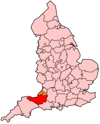
Somerset
The ceremonial and non-metropolitan county of Somerset in South West England borders Bristol and Gloucestershire to the north, Wiltshire to the east, Dorset to the south-east, and Devon to the south-west. It is partly bounded to the north and west by the Bristol Channel and the estuary of the...
is a rural county in the southwest of England
England
England is a country that is part of the United Kingdom. It shares land borders with Scotland to the north and Wales to the west; the Irish Sea is to the north west, the Celtic Sea to the south west, with the North Sea to the east and the English Channel to the south separating it from continental...
, covering 4171 square kilometres (1,610 sq mi). It is bounded on the north-west by the Bristol Channel
Bristol Channel
The Bristol Channel is a major inlet in the island of Great Britain, separating South Wales from Devon and Somerset in South West England. It extends from the lower estuary of the River Severn to the North Atlantic Ocean...
, on the north by Bristol
Bristol
Bristol is a city, unitary authority area and ceremonial county in South West England, with an estimated population of 433,100 for the unitary authority in 2009, and a surrounding Larger Urban Zone with an estimated 1,070,000 residents in 2007...
and Gloucestershire
Gloucestershire
Gloucestershire is a county in South West England. The county comprises part of the Cotswold Hills, part of the flat fertile valley of the River Severn, and the entire Forest of Dean....
, on the north-east by Wiltshire
Wiltshire
Wiltshire is a ceremonial county in South West England. It is landlocked and borders the counties of Dorset, Somerset, Hampshire, Gloucestershire, Oxfordshire and Berkshire. It contains the unitary authority of Swindon and covers...
, on the south-east by Dorset
Dorset
Dorset , is a county in South West England on the English Channel coast. The county town is Dorchester which is situated in the south. The Hampshire towns of Bournemouth and Christchurch joined the county with the reorganisation of local government in 1974...
, and on the south west and west by Devon
Devon
Devon is a large county in southwestern England. The county is sometimes referred to as Devonshire, although the term is rarely used inside the county itself as the county has never been officially "shired", it often indicates a traditional or historical context.The county shares borders with...
. It has broad central plains with several ranges of low hills. The landscape divides into four main geological sections from the Silurian
Silurian
The Silurian is a geologic period and system that extends from the end of the Ordovician Period, about 443.7 ± 1.5 Mya , to the beginning of the Devonian Period, about 416.0 ± 2.8 Mya . As with other geologic periods, the rock beds that define the period's start and end are well identified, but the...
through the Devonian
Devonian
The Devonian is a geologic period and system of the Paleozoic Era spanning from the end of the Silurian Period, about 416.0 ± 2.8 Mya , to the beginning of the Carboniferous Period, about 359.2 ± 2.5 Mya...
and Carboniferous
Carboniferous
The Carboniferous is a geologic period and system that extends from the end of the Devonian Period, about 359.2 ± 2.5 Mya , to the beginning of the Permian Period, about 299.0 ± 0.8 Mya . The name is derived from the Latin word for coal, carbo. Carboniferous means "coal-bearing"...
to the Permian
Permian
The PermianThe term "Permian" was introduced into geology in 1841 by Sir Sir R. I. Murchison, president of the Geological Society of London, who identified typical strata in extensive Russian explorations undertaken with Edouard de Verneuil; Murchison asserted in 1841 that he named his "Permian...
which influence the landscape, together with water-related features.
The low lying areas of the North Somerset Levels and Somerset Levels
Somerset Levels
The Somerset Levels, or the Somerset Levels and Moors as they are less commonly but more correctly known, is a sparsely populated coastal plain and wetland area of central Somerset, South West England, between the Quantock and Mendip Hills...
have been subject to thousands of years of flooding and man's attempts to control the flow of water. In the north of the county the Limestone of the Mendip Hills
Mendip Hills
The Mendip Hills is a range of limestone hills to the south of Bristol and Bath in Somerset, England. Running east to west between Weston-super-Mare and Frome, the hills overlook the Somerset Levels to the south and the Avon Valley to the north...
dominates the landscape, while in the south the Blackdown
Blackdown Hills
The Blackdown Hills are a range of hills along the Somerset-Devon border in south-western England, which were designated an Area of Outstanding Natural Beauty in 1991....
and Quantock Hills
Quantock Hills
The Quantock Hills is a range of hills west of Bridgwater in Somerset, England. The Quantock Hills were England’s first Area of Outstanding Natural Beauty being designated in 1956 and consists of large amounts of heathland, oak woodlands, ancient parklands and agricultural land.The hills run from...
rise out of the levels. The highest areas are on Exmoor
Exmoor
Exmoor is an area of hilly open moorland in west Somerset and north Devon in South West England, named after the main river that flows out of the district, the River Exe. The moor has given its name to a National Park, which includes the Brendon Hills, the East Lyn Valley, the Vale of Porlock and ...
. The wide variety of landscapes has led to several areas being designated as Sites of Special Scientific Interest for geological reasons, and support a range of flora and fauna as can be seen from the List of Sites of Special Scientific Interest in Somerset
Rock ages
The oldest rocks are of SilurianSilurian
The Silurian is a geologic period and system that extends from the end of the Ordovician Period, about 443.7 ± 1.5 Mya , to the beginning of the Devonian Period, about 416.0 ± 2.8 Mya . As with other geologic periods, the rock beds that define the period's start and end are well identified, but the...
age (443–417 million years ago), the most southerly known outcrop of rocks of this age in Britain
Great Britain
Great Britain or Britain is an island situated to the northwest of Continental Europe. It is the ninth largest island in the world, and the largest European island, as well as the largest of the British Isles...
. They make up a sequence of lavas, tuff
Tuff
Tuff is a type of rock consisting of consolidated volcanic ash ejected from vents during a volcanic eruption. Tuff is sometimes called tufa, particularly when used as construction material, although tufa also refers to a quite different rock. Rock that contains greater than 50% tuff is considered...
s (volcanic ash), shales
Shalës
Shalës is a municipality in the Elbasan District, Elbasan County, central Albania. The municipality consists of the villages Shalës, Licaj, Kurtalli, Xibrake, Xherie and Kodras....
and mudstones in a narrow outcrop to the northeast of Shepton Mallet
Shepton Mallet
Shepton Mallet is a small rural town and civil parish in the Mendip district of Somerset in South West England. Situated approximately south of Bristol and east of Wells, the town is estimated to have a population of 9,700. It contains the administrative headquarters of Mendip District Council...
, in the eastern Mendip Hills
Mendip Hills
The Mendip Hills is a range of limestone hills to the south of Bristol and Bath in Somerset, England. Running east to west between Weston-super-Mare and Frome, the hills overlook the Somerset Levels to the south and the Avon Valley to the north...
. Rocks from the Devonian
Devonian
The Devonian is a geologic period and system of the Paleozoic Era spanning from the end of the Silurian Period, about 416.0 ± 2.8 Mya , to the beginning of the Carboniferous Period, about 359.2 ± 2.5 Mya...
(417–354 million years ago) are found in much of Exmoor
Exmoor
Exmoor is an area of hilly open moorland in west Somerset and north Devon in South West England, named after the main river that flows out of the district, the River Exe. The moor has given its name to a National Park, which includes the Brendon Hills, the East Lyn Valley, the Vale of Porlock and ...
, the Quantocks
Quantock Hills
The Quantock Hills is a range of hills west of Bridgwater in Somerset, England. The Quantock Hills were England’s first Area of Outstanding Natural Beauty being designated in 1956 and consists of large amounts of heathland, oak woodlands, ancient parklands and agricultural land.The hills run from...
and in the cores to the folded masses of the Mendip Hills. Carboniferous
Carboniferous
The Carboniferous is a geologic period and system that extends from the end of the Devonian Period, about 359.2 ± 2.5 Mya , to the beginning of the Permian Period, about 299.0 ± 0.8 Mya . The name is derived from the Latin word for coal, carbo. Carboniferous means "coal-bearing"...
Period (354–290 million years ago) rocks are represented by the Carboniferous Limestone
Carboniferous limestone
Carboniferous Limestone is a term used to describe a variety of different types of limestone occurring widely across Great Britain and Ireland which were deposited during the Dinantian epoch of the Carboniferous period. They were formed between 363 and 325 million years ago...
that forms the Mendip Hills, rising abruptly out of the flat landscape of the Somerset Levels and Moors. The limestones are very fossiliferous, and contain evidence of the abundant marine life that existed at the time of their creation, including fossil
Fossil
Fossils are the preserved remains or traces of animals , plants, and other organisms from the remote past...
crinoids (sea-lilies), corals and brachiopods. At the end of the Permian
Permian
The PermianThe term "Permian" was introduced into geology in 1841 by Sir Sir R. I. Murchison, president of the Geological Society of London, who identified typical strata in extensive Russian explorations undertaken with Edouard de Verneuil; Murchison asserted in 1841 that he named his "Permian...
(290–248 million years ago) and Triassic
Triassic
The Triassic is a geologic period and system that extends from about 250 to 200 Mya . As the first period of the Mesozoic Era, the Triassic follows the Permian and is followed by the Jurassic. Both the start and end of the Triassic are marked by major extinction events...
periods, the Variscan orogeny
Variscan orogeny
The Variscan orogeny is a geologic mountain-building event caused by Late Paleozoic continental collision between Euramerica and Gondwana to form the supercontinent of Pangaea.-Naming:...
resulted in the formation of several mountainous areas including Dartmoor
Dartmoor
Dartmoor is an area of moorland in south Devon, England. Protected by National Park status, it covers .The granite upland dates from the Carboniferous period of geological history. The moorland is capped with many exposed granite hilltops known as tors, providing habitats for Dartmoor wildlife. The...
in the south, Exmoor and the Quantocks, and the Mendips. In the Taunton
Taunton
Taunton is the county town of Somerset, England. The town, including its suburbs, had an estimated population of 61,400 in 2001. It is the largest town in the shire county of Somerset....
area Permian (295–250 million years ago) red sandstones and breccia
Breccia
Breccia is a rock composed of broken fragments of minerals or rock cemented together by a fine-grained matrix, that can be either similar to or different from the composition of the fragments....
outcrop, although rocks of Triassic age (248–204 million years ago) underlie much of Somerset and form the solid geology of the Somerset Moors and Levels. There are no glacial deposits.
The Triassic
Triassic
The Triassic is a geologic period and system that extends from about 250 to 200 Mya . As the first period of the Mesozoic Era, the Triassic follows the Permian and is followed by the Jurassic. Both the start and end of the Triassic are marked by major extinction events...
rocks consist of red marls, sandstones, breccias and conglomerates which spread over the older rocks. The Dolometic Conglomerate is an old shingle beach of Keuper Marl age. The Rhaetic Beds are full of fossils due to invasion of the Jurassic
Jurassic
The Jurassic is a geologic period and system that extends from about Mya to Mya, that is, from the end of the Triassic to the beginning of the Cretaceous. The Jurassic constitutes the middle period of the Mesozoic era, also known as the age of reptiles. The start of the period is marked by...
Sea. The Lias
Blue Lias
The Blue Lias is a geologic formation in southern, eastern and western England and parts of South Wales, part of the Lias Group. The Blue Lias consists of a sequence of limestone and shale layers, laid down in latest Triassic and early Jurassic times, between 195 and 200 million years ago...
consists of clays and limestones, the latter being quarried and are famous for their fossils. Blue Lias
Blue Lias
The Blue Lias is a geologic formation in southern, eastern and western England and parts of South Wales, part of the Lias Group. The Blue Lias consists of a sequence of limestone and shale layers, laid down in latest Triassic and early Jurassic times, between 195 and 200 million years ago...
was used locally both as a building stone and as a source of lime for making Lime mortar
Lime mortar
Lime mortar is a type of mortar composed of lime and an aggregate such as sand, mixed with water. It is one of the oldest known types of mortar, dating back to the 4th century BC and widely used in Ancient Rome and Greece, when it largely replaced the clay and gypsum mortars common to Ancient...
. Blue Lias is believed to be quarried on the Polden Hills
Polden Hills
The Polden Hills in Somerset, England are a long, low ridge, extending for , and separated from the Mendip Hills, to which they are nearly parallel, by a marshy tract, known as the Somerset Levels...
in the 15th century; and was quarried in Puriton
Puriton
Puriton is a village and a parish, at the westerly end of the Polden Hills, in the Sedgemoor district of Somerset, UK. The parish has a population of 2,124. The local parish church is named after St Michael...
from the early 19th century until the 1973, when the local cement works closed. Above the Lias is the Lower Oolite
Oolite
Oolite is a sedimentary rock formed from ooids, spherical grains composed of concentric layers. The name derives from the Hellenic word òoion for egg. Strictly, oolites consist of ooids of diameter 0.25–2 mm; rocks composed of ooids larger than 2 mm are called pisolites...
Series which are chiefly clays and oolile limestone. The famous Bath Stone
Bath Stone
Bath Stone is an Oolitic Limestone comprising granular fragments of calcium carbonate. Originally obtained from the Combe Down and Bathampton Down Mines under Combe Down, Somerset, England, its warm, honey colouring gives the World Heritage City of Bath, England its distinctive appearance...
is obtained from the Great Oolite bed. Oxford Clay
Oxford Clay
The Oxford Clay Formation is a Jurassic marine sedimentary rock formation underlying much of southeast England, from as far west as Dorset and as far north as Yorkshire. The Oxford Clay is of middle Callovian to lower Oxfordian age and comprises 2 main facies. The lower facies comprises the...
is the chief member of the Middle Oolite Series; and above this are the Upper Cretaceous
Cretaceous
The Cretaceous , derived from the Latin "creta" , usually abbreviated K for its German translation Kreide , is a geologic period and system from circa to million years ago. In the geologic timescale, the Cretaceous follows the Jurassic period and is followed by the Paleogene period of the...
rocks with Gault, Upper Greensand
Greensand
Greensand or Green sand is either a sand or sandstone, which has a greenish color. This term is specifically applied to shallow marine sediment, that contains noticeable quantities of rounded greenish grains. These grains are called glauconies and consist of a mixture of mixed-layer clay...
and Chalk
Chalk
Chalk is a soft, white, porous sedimentary rock, a form of limestone composed of the mineral calcite. Calcite is calcium carbonate or CaCO3. It forms under reasonably deep marine conditions from the gradual accumulation of minute calcite plates shed from micro-organisms called coccolithophores....
. Alluvial flats and peat
Peat
Peat is an accumulation of partially decayed vegetation matter or histosol. Peat forms in wetland bogs, moors, muskegs, pocosins, mires, and peat swamp forests. Peat is harvested as an important source of fuel in certain parts of the world...
bog
Bog
A bog, quagmire or mire is a wetland that accumulates acidic peat, a deposit of dead plant material—often mosses or, in Arctic climates, lichens....
s occupy much of the centre of Somerset.
Coastline
In prehistoric times the coastline of Somerset was very different from the present one, the sea level at the last glacial maximum being some 30 metres (98 ft) lower than today so that the Bristol ChannelBristol Channel
The Bristol Channel is a major inlet in the island of Great Britain, separating South Wales from Devon and Somerset in South West England. It extends from the lower estuary of the River Severn to the North Atlantic Ocean...
was almost non-existent. The Bristol Channel has one of the largest tidal range
Tidal range
The tidal range is the vertical difference between the high tide and the succeeding low tide. Tides are the rise and fall of sea levels caused by the combined effects of the gravitational forces exerted by the Moon and the Sun and the rotation of the Earth...
s in the world, up to 12 metres (39 ft) at Burnham-on-Sea
Burnham-on-Sea
Burnham-on-Sea is a town in Somerset, England, at the mouth of the River Parrett and Bridgwater Bay. Burnham was a small village until the late 18th century, when it began to grow because of its popularity as a seaside resort. It forms part of the parish of Burnham-on-Sea and Highbridge...
for example, second only to Bay of Fundy
Bay of Fundy
The Bay of Fundy is a bay on the Atlantic coast of North America, on the northeast end of the Gulf of Maine between the Canadian provinces of New Brunswick and Nova Scotia, with a small portion touching the U.S. state of Maine...
in Eastern Canada
Eastern Canada
Eastern Canada is generally considered to be the region of Canada east of Manitoba, consisting of the following provinces:* New Brunswick* Newfoundland and Labrador* Nova Scotia* Ontario* Prince Edward Island* Quebec...
. Normal high tide may be enhanced by between 3 metres (10 ft) and 4 metres (13 ft) during storm surges. This feature has meant that large areas of the county have been liable to flood
Flood
A flood is an overflow of an expanse of water that submerges land. The EU Floods directive defines a flood as a temporary covering by water of land not normally covered by water...
ing by the sea. Thus the present coastline is partly due a belt of marine clay
Clay
Clay is a general term including many combinations of one or more clay minerals with traces of metal oxides and organic matter. Geologic clay deposits are mostly composed of phyllosilicate minerals containing variable amounts of water trapped in the mineral structure.- Formation :Clay minerals...
at the coast and partly due to seawalls built to reclaim areas previously flooded at high tide. The coastline contains exposures of Devonian sediments and tectonics west of Minehead
Minehead
Minehead is a coastal town and civil parish in Somerset, England. It lies on the south bank of the Bristol Channel, north-west of the county town of Taunton, from the border with the county of Devon and in proximity of the Exmoor National Park...
adjoining the classic exposures of Mesozoic sediments and structural features which extend eastward to the Parrett
River Parrett
The River Parrett flows through the counties of Dorset and Somerset in South West England, from its source in the Thorney Mills springs in the hills around Chedington in Dorset...
estuary forming cliffs along the coastline near Clevedon
Clevedon
Clevedon is a town and civil parish in the unitary authority of North Somerset, which covers part of the ceremonial county of Somerset, England...
and near Minehead, with low sandhills near Burnham-on-Sea. There are sandy beaches mainly at Burnham-on-Sea, Brean
Brean Down
Brean Down is a promontory off the coast of Somerset standing high and extending into the Bristol Channel at the eastern end of Bridgwater Bay between Weston-super-Mare and Burnham-on-Sea....
and Weston-super-Mare
Weston-super-Mare
Weston-super-Mare is a seaside resort, town and civil parish in the unitary authority of North Somerset, which is within the ceremonial county of Somerset, England. It is located on the Bristol Channel coast, south west of Bristol, spanning the coast between the bounding high ground of Worlebury...
. There are also storm ridges, salt marsh, and sand dunes.
Main river valleys
The main valleys between the hills are filled with alluvial deposits from the hills or sea. The county has many small riverRiver
A river is a natural watercourse, usually freshwater, flowing towards an ocean, a lake, a sea, or another river. In a few cases, a river simply flows into the ground or dries up completely before reaching another body of water. Small rivers may also be called by several other names, including...
s, most of which flow into the Bristol Channel
Bristol Channel
The Bristol Channel is a major inlet in the island of Great Britain, separating South Wales from Devon and Somerset in South West England. It extends from the lower estuary of the River Severn to the North Atlantic Ocean...
. Many of the latter rivers now have clysts (the local name for a sluice
Sluice
A sluice is a water channel that is controlled at its head by a gate . For example, a millrace is a sluice that channels water toward a water mill...
) on them to control the sea, but formerly they were tidal for some way inland. The main exception to this is the River Parrett
River Parrett
The River Parrett flows through the counties of Dorset and Somerset in South West England, from its source in the Thorney Mills springs in the hills around Chedington in Dorset...
, which still has a tidal bore
Tidal bore
A tidal bore is a tidal phenomenon in which the leading edge of the incoming tide forms a wave of water that travel up a river or narrow bay against the direction of the river or bay's current...
. However the Chew
River Chew
The River Chew is a small river in England. It merges with the River Avon after forming the Chew Valley.The spring from which the Chew rises is just upstream from Chewton Mendip. The river flows North West from Chewton Mendip through Litton, Chew Valley Lake, Chew Stoke, Chew Magna and Stanton Drew...
and the Frome
River Frome, Somerset
The River Frome is a river in Somerset. It rises near Witham Friary, flows north through the town of Frome and joins the River Avon at Freshford, south of Bath....
flow into the Avon
River Avon, Bristol
The River Avon is an English river in the south west of the country. To distinguish it from a number of other River Avons in Britain, this river is often also known as the Lower Avon or Bristol Avon...
which forms most of the northern county boundary with Gloucestershire
Gloucestershire
Gloucestershire is a county in South West England. The county comprises part of the Cotswold Hills, part of the flat fertile valley of the River Severn, and the entire Forest of Dean....
. The Cale flows into Dorset through the Blackmore Vale
Blackmore Vale
The Blackmore Vale is a vale, or wide valley, in north Dorset, and to a lesser extent south Somerset and southwest Wiltshire in southern England. The vale is part of the Stour valley...
, while the Exe
River Exe
The River Exe in England rises near the village of Simonsbath, on Exmoor in Somerset, near the Bristol Channel coast, but flows more or less directly due south, so that most of its length lies in Devon. It reaches the sea at a substantial ria, the Exe Estuary, on the south coast of Devon...
flows into Devon. The (Dorset) Axe, the Culm
River Culm
thumb|Old stone bridge with pedestrian refuges over River Culm at Culmstock The River Culm flows through Devon, England. It rises in the Blackdown Hills at a spring - - near Culmhead and flows west through Hemyock, then Culmstock to Uffculme...
and the Otter
River Otter
Not to be confused with the animal Otter or the River Ottery in CornwallThe River Otter rises in the Blackdown Hills just inside the county of Somerset, near Otterford, then flows south for some 32 km through East Devon to the English Channel at the western end of Lyme Bay, part of...
rise in Somerset but flow into Dorset
Dorset
Dorset , is a county in South West England on the English Channel coast. The county town is Dorchester which is situated in the south. The Hampshire towns of Bournemouth and Christchurch joined the county with the reorganisation of local government in 1974...
.
River Parrett
The River Parrett flows through the counties of Dorset and Somerset in South West England, from its source in the Thorney Mills springs in the hills around Chedington in Dorset...
, Somerset Axe, Brue
River Brue
The River Brue originates in the parish of Brewham in Somerset, England, and reaches the sea some 50 km west at Burnham-on-Sea. It originally took a different route from Glastonbury to the sea, but this was changed by the monastery in the twelfth century....
and Cary
River Cary
The River Cary is a river in Somerset, England.The River Cary has its source at Park Pond in Castle Cary, and then flows southwest through Cary Moor to Babcary, where there is a biological Site of Special Scientific Interest at Babcary Meadows and Cary Fitzpaine. It then flows northwest through...
run across the Somerset Levels
Somerset Levels
The Somerset Levels, or the Somerset Levels and Moors as they are less commonly but more correctly known, is a sparsely populated coastal plain and wetland area of central Somerset, South West England, between the Quantock and Mendip Hills...
and have generally been changed to improve the flow. The River Axe rises from Wookey Hole Caves, due to water draining into the ground at swallet holes
Sinkhole
A sinkhole, also known as a sink, shake hole, swallow hole, swallet, doline or cenote, is a natural depression or hole in the Earth's surface caused by karst processes — the chemical dissolution of carbonate rocks or suffosion processes for example in sandstone...
on top of the Mendips
Mendip Hills
The Mendip Hills is a range of limestone hills to the south of Bristol and Bath in Somerset, England. Running east to west between Weston-super-Mare and Frome, the hills overlook the Somerset Levels to the south and the Avon Valley to the north...
. The river passes through Panborough Moor, Wedmore
Wedmore
Wedmore is a village and civil parish in the county of Somerset, England. It is situated on raised ground, in the Somerset Levels between the River Axe and River Brue, often called the Isle of Wedmore. It forms part of Sedgemoor district...
Moor, Ox Moor, Stoke Moor and Mark Moor and reaches the sea at Uphill
Uphill
Uphill is a village on the edge of Weston-super-Mare in North Somerset, England.-History:There is evidence of a port at Uphill since Roman times, probably for the export of lead from the Mendip Hills...
(near Weston-super-Mare
Weston-super-Mare
Weston-super-Mare is a seaside resort, town and civil parish in the unitary authority of North Somerset, which is within the ceremonial county of Somerset, England. It is located on the Bristol Channel coast, south west of Bristol, spanning the coast between the bounding high ground of Worlebury...
) on Bridgwater Bay
Bridgwater Bay
Bridgwater Bay is on the Bristol Channel, north of Bridgwater in Somerset, England at the mouth of the River Parrett and the end of the River Parrett Trail. It consists of large areas of mud flats, saltmarsh, sandflats and shingle ridges, some of which are vegetated...
.
The River Brue
River Brue
The River Brue originates in the parish of Brewham in Somerset, England, and reaches the sea some 50 km west at Burnham-on-Sea. It originally took a different route from Glastonbury to the sea, but this was changed by the monastery in the twelfth century....
rises at Brewham
Brewham
Brewham is a civil parish in Somerset, England, consisting of the villages of North Brewham and South Brewham, on either side of the river in the Brue Valley east of Bruton and south-west of Frome in the South Somerset district. The parish has a population of 410.-History:The name of the...
, close to the county border with Wiltshire
Wiltshire
Wiltshire is a ceremonial county in South West England. It is landlocked and borders the counties of Dorset, Somerset, Hampshire, Gloucestershire, Oxfordshire and Berkshire. It contains the unitary authority of Swindon and covers...
. It flows through Bruton
Bruton
Bruton is a town and civil parish in Somerset, England, situated on the River Brue seven miles south-east of Shepton Mallet, just south of Snakelake Hill and Coombe Hill, ten miles north-west of Gillingham and twelve miles south-west of Frome in the South Somerset district. The town has a...
and is joined by the rivers Pitt
River Pitt
The River Pitt, also known as the Piddy, is a short tributary of the River Brue in Somerset, England. It rises near Hardway in the parish of Brewham, and flows for through the parishes of Shepton Montague and Pitcombe to join the Brue at Cole....
and Alham
River Alham
The River Alham flows through Somerset, England.It rises at Higher Alham above Batcombe and runs through Alhampton, Milton Clevedon and joins the River Brue to the north of Alford.It was known as the Alauna in Roman times....
. The river then flows past East and West Lydford to Baltonsborough
Baltonsborough
Baltonsborough is a village and civil parish in the Mendip district of Somerset, England. According to the 2001 census it had a population of 873. Apart from Baltonsborough village, the parish also contains the hamlets of Ham Street, Catsham and Southwood....
and then turns north to Street
Street, Somerset
Street is a small village and civil parish in the county of Somerset, England. It is situated on a dry spot in the Somerset Levels, at the end of the Polden Hills, south-west of Glastonbury. The 2001 census records the village as having a population of 11,066...
across Butts Moor, South Moor and Kennard Moor. Originally it then joined the Axe but now it flows west across Westhay Moor
Westhay Moor
Westhay Moor is a 513.7 hectare biological Site of Special Scientific Interest 2.5km north-east of Westhay village and 4km from Wedmore in Somerset, notified in 1971...
, Tealham and Tadham Moors
Tealham and Tadham Moors
Tealham and Tadham Moors is a 917.6 hectare biological Site of Special Scientific Interest south of Wedmore in Somerset, notified in 1985.Land south of this site is included in Catcott, Edington and Chilton Moors SSSI....
, Chilton Moor
Chilton Moor
Chilton Moor is located between Houghton le Spring and Fencehouses on the Tyne and Wear/County Durham county boundary. The name of the village differs depending on whom you speak to , but both are acceptable....
, Mark Moor and Huntspill
Huntspill
West Huntspill and East Huntspill are villages and civil parishes on the Huntspill Level, near Highbridge, Somerset, West of England. The civil parish of West Huntspill contains the hamlet of Alstone, and East Huntspill includes Cote....
Moor. It is joined by the North Drain and the Hartlake river. In Huntspill Moor the Brue is linked to the man-made Huntspill river
River Huntspill
The River Huntspill is an artificial river, in the Somerset Levels, in the Sedgemoor district of Somerset, England. It was built in 1940 to supply process water to the armaments factory at Puriton, and has resulted in reduced flooding of the lower Brue Valley.-History:The concept for the Huntspill...
by the artificial Cripps river. The Brue reaches the sea near Burnham-on-Sea
Burnham-on-Sea
Burnham-on-Sea is a town in Somerset, England, at the mouth of the River Parrett and Bridgwater Bay. Burnham was a small village until the late 18th century, when it began to grow because of its popularity as a seaside resort. It forms part of the parish of Burnham-on-Sea and Highbridge...
.
River Cary
The River Cary is a river in Somerset, England.The River Cary has its source at Park Pond in Castle Cary, and then flows southwest through Cary Moor to Babcary, where there is a biological Site of Special Scientific Interest at Babcary Meadows and Cary Fitzpaine. It then flows northwest through...
originates in Castle Cary
Castle Cary
Castle Cary is a market town and civil parish in south Somerset, England, north west of Wincanton and south of Shepton Mallet.The town is situated on the River Cary, a tributary of the Parrett.-History:...
in the east of Somerset. It flows south-west through Cary Moor to Cary Fitzpaine. The river then turns north-west to the north of Somerton
Somerton
Somerton is a small town and civil parish in the South Somerset district of the English county of Somerset. It gave its name to the county of Somerset, was briefly, around the start of the 14th century, the county town, and around 900 AD was possibly the capital of Wessex...
. It then used to turn south to join the Parrett but now passes through Somerton Moor and crosses Kings Sedgemoor in an artificial channel, the King's Sedgemoor Drain
King's Sedgemoor Drain
King's Sedgemoor Drain is an artificial drainage channel which diverts the River Cary in Somerset, England along the southern flank of the Polden Hills, to discharge into the River Parrett at Dunball near Bridgwater. As the name suggests, the channel is used to help drain the peat moors of King's...
, joining the Parrett at Dunball
Dunball
Dunball is a small hamlet west of the village of Puriton and close to the town of Bridgwater, Somerset, England.Just north of Dunball is Down End which is the site of Down End Castle a motte-and-bailey castle, which has been designated as a Scheduled Ancient Monument.Located on the A38, adjacent to...
north of Bridgwater
Bridgwater
Bridgwater is a market town and civil parish in Somerset, England. It is the administrative centre of the Sedgemoor district, and a major industrial centre. Bridgwater is located on the major communication routes through South West England...
.
The River Parrett originates at Cheddington
Cheddington
Cheddington is a village and civil parish in the Aylesbury Vale district of Buckinghamshire. The parish has an area of . The village is about 5 miles north-east of Aylesbury and three miles north of Tring in Hertfordshire...
, Dorset, just over the border with Somerset. It enters Somerset at Haselbury Plucknett
Haselbury Plucknett
Haselbury Plucknett is a village and civil parish on the River Parrett in Somerset, England, situated south west of Yeovil in the South Somerset district. The village has a population of 641....
where it is joined by the Broad river. It passes to the east of South Petherton
South Petherton
South Petherton is a small country town and civil parish on the River Parrett in the South Somerset district of Somerset, England. It is east of Ilminster and north west of Crewkerne. It had a population of approximately 3,200 in 2002...
and flows north through Thorney Moor and Muchelney Level and it is then joined by the Isle
River Isle
The River Isle flows from its source near Combe St Nicholas, through Somerset, England and discharges into the River Parrett south of Langport near Midelney....
and Yeo (Ivel)
River Yeo (South Somerset)
The River Yeo, also known as the River Ivel or River Gascoigne, is a tributary of the River Parrett in north Dorset and south Somerset, England....
rivers. The Parrett flows through Langport
Langport
Langport is a small town and civil parish in Somerset, England, situated west of Somerton in the South Somerset district. The town has a population of 1,067. The parish includes the hamlets of Bowdens and Combe...
and then through Middle Moor, Aller Moor
Aller Hill
Aller Hill is a 18.4 hectare biological Site of Special Scientific Interest near Aller in Somerset, notified in 1988.The site contains three species of plant which are nationally rare and a further three which are of restricted distribution in Somerset...
to Burrowbridge
Burrowbridge
Burrowbridge is a village and civil parish in Somerset, England, situated on the River Parrett and A361 road south east of Bridgwater in the Taunton Deane district on the edge of the Somerset Levels...
where it is joined by the River Tone
River Tone
The River Tone is a river in Somerset, England, which is about long. It rises at Beverton Pond near Huish Champflower in the Brendon Hills, and is dammed at Clatworthy Reservoir. The reservoir outfall continues through Taunton and Curry and Hay Moors, which are designated as a Site of Special...
. It then passes through Earlake Moor, Hartlake Moor, Weston Level and South Moor
South Moor
South Moor is a village in County Durham, in England. It is located to the south-west of Stanley on the northern slope of the Craghead valley. It is a well-developed village, yet still semi rural, containing a main street of around twelve shops which survive despite their proximity to the front...
. It continues north through Bridgwater
Bridgwater
Bridgwater is a market town and civil parish in Somerset, England. It is the administrative centre of the Sedgemoor district, and a major industrial centre. Bridgwater is located on the major communication routes through South West England...
, Horsey Level, past Pawlett Ham and Pawlett Level to the coast near Burnham-on-Sea
Burnham-on-Sea
Burnham-on-Sea is a town in Somerset, England, at the mouth of the River Parrett and Bridgwater Bay. Burnham was a small village until the late 18th century, when it began to grow because of its popularity as a seaside resort. It forms part of the parish of Burnham-on-Sea and Highbridge...
.
The River Tone originates at Beverton Pond on the Brendon Hills
Brendon Hills
The Brendon Hills are composed of a lofty ridge of hills in the East Lyn Valley area of western Somerset, England. The terrain is broken by a series of deeply incised streams and rivers running roughly southwards to meet the River Haddeo, a tributary of the River Exe.The hills are quite heavily...
in the west of Somerset. It flows south into Clatworthy reservoir and then to Greenham where it changes course to go north-east to Taunton
Taunton
Taunton is the county town of Somerset, England. The town, including its suburbs, had an estimated population of 61,400 in 2001. It is the largest town in the shire county of Somerset....
. It continues east through West Moor
West Moor
West Moor is a small place in Tyne and Wear, UK.West Moor began as a colliery village around the beginning of the nineteenth century. It was so-called because it lies to the west of the ancient Killingworth Moor, which has now disappeared under development. It was at the colliery here in 1804 that...
, Curry and Hay Moors
Curry and Hay Moors
Curry and Hay Moors is a 472.8 hectare biological Site of Special Scientific Interest in Somerset, notified in 1992.Curry and Hay Moors form part of the complex of grazing marshes known as the Somerset Levels and Moors. The low-lying site is situated adjacent to the River Tone which annually...
and Stan Moor to Burrowbridge
Burrowbridge
Burrowbridge is a village and civil parish in Somerset, England, situated on the River Parrett and A361 road south east of Bridgwater in the Taunton Deane district on the edge of the Somerset Levels...
where it meets the Parrett.
The River Exe rises at Exehead on Exmoor
Exmoor
Exmoor is an area of hilly open moorland in west Somerset and north Devon in South West England, named after the main river that flows out of the district, the River Exe. The moor has given its name to a National Park, which includes the Brendon Hills, the East Lyn Valley, the Vale of Porlock and ...
and flows south-east to Exton where it is joined by the River Quarme. It then flows south to Exebridge
Exebridge
Exebridge is a village that lies on the border between Devon and Somerset, England. It lies at the confluence of the Barle and Exe rivers. Exebridge is named so because of the bridge over the River Exe that also marks the border between Devon and Somerset. It is located at ....
where it meets the Barle and passes into Devon.
Levels and moors
Polden Hills
The Polden Hills in Somerset, England are a long, low ridge, extending for , and separated from the Mendip Hills, to which they are nearly parallel, by a marshy tract, known as the Somerset Levels...
from the main wetland of the Parrett/Tone/Cary valleys. The Poldens are a low narrow ridge of Blue Lias
Blue Lias
The Blue Lias is a geologic formation in southern, eastern and western England and parts of South Wales, part of the Lias Group. The Blue Lias consists of a sequence of limestone and shale layers, laid down in latest Triassic and early Jurassic times, between 195 and 200 million years ago...
with alternating bands of limestone and clay. Because of the nature of the Levels and Moors, the Poldens have a significant visual impact.
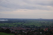
The Somerset Levels
Somerset Levels
The Somerset Levels, or the Somerset Levels and Moors as they are less commonly but more correctly known, is a sparsely populated coastal plain and wetland area of central Somerset, South West England, between the Quantock and Mendip Hills...
run from the coast up to 30 kilometres (19 mi) inland. These wetlands cover 600 square kilometres (232 sq mi), most of which is no higher than 8 metres (26 ft) above sea level. There are coastal marine clay deposits, and further inland there are many peaty areas. Dotted within this wetland landscape are slightly raised inter-glacial "islands" called burtles. These have been settled from the Mesolithic
Mesolithic
The Mesolithic is an archaeological concept used to refer to certain groups of archaeological cultures defined as falling between the Paleolithic and the Neolithic....
onward, with wooden causeways linking them to higher ground. There are also rocky outcrops, such as Brent Knoll
Brent Knoll
Brent Knoll is a village in Somerset, England, which lies on the southern edge of Brent Knoll – a hill with a height of 137 metres that dominates the low surrounding landscape of the Somerset Levels.-History:...
and Glastonbury Tor
Glastonbury Tor
Glastonbury Tor is a hill at Glastonbury, Somerset, England, which features the roofless St. Michael's Tower. The site is managed by the National Trust. It has been designated as a Scheduled Ancient Monument ....
which have also housed ancient settlements.
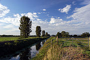
The water levels in the moors and levels are controlled by a series of small narrow canals called rhines (in Avonmouth
Avonmouth
Avonmouth is a port and suburb of Bristol, England, located on the Severn Estuary, at the mouth of the River Avon.The council ward of Avonmouth also includes Shirehampton and the western end of Lawrence Weston.- Geography :...
and Gloucestershire
Gloucestershire
Gloucestershire is a county in South West England. The county comprises part of the Cotswold Hills, part of the flat fertile valley of the River Severn, and the entire Forest of Dean....
), or rhyne
Rhyne
A rhyne , rhine/rhyne , or reen is a drainage ditch, or canal, used to turn areas of wetland at around sea level into useful pasture....
s (in Somerset
Somerset
The ceremonial and non-metropolitan county of Somerset in South West England borders Bristol and Gloucestershire to the north, Wiltshire to the east, Dorset to the south-east, and Devon to the south-west. It is partly bounded to the north and west by the Bristol Channel and the estuary of the...
) (both pronounced reens), or reens (in Monmouthshire
Monmouthshire (historic)
Monmouthshire , also known as the County of Monmouth , is one of thirteen ancient counties of Wales and a former administrative county....
), along with larger drains, gates and pumping stations. The rhynes are often used as field boundary ditches instead of hedges. Some parts are allowed to flood in winter. The area is mainly used for grazing but some peat
Peat
Peat is an accumulation of partially decayed vegetation matter or histosol. Peat forms in wetland bogs, moors, muskegs, pocosins, mires, and peat swamp forests. Peat is harvested as an important source of fuel in certain parts of the world...
extraction is carried out.
Northern uplands
This is the area between the River AvonRiver Avon, Bristol
The River Avon is an English river in the south west of the country. To distinguish it from a number of other River Avons in Britain, this river is often also known as the Lower Avon or Bristol Avon...
to the north and the Axe valley. The north of Somerset is dominated by the tableland of the Mendip Hills
Mendip Hills
The Mendip Hills is a range of limestone hills to the south of Bristol and Bath in Somerset, England. Running east to west between Weston-super-Mare and Frome, the hills overlook the Somerset Levels to the south and the Avon Valley to the north...
, an Area of Outstanding Natural Beauty
Area of Outstanding Natural Beauty
An Area of Outstanding Natural Beauty is an area of countryside considered to have significant landscape value in England, Wales or Northern Ireland, that has been specially designated by the Countryside Agency on behalf of the United Kingdom government; the Countryside Council for Wales on...
, stretching from Frome
Frome
Frome is a town and civil parish in northeast Somerset, England. Located at the eastern end of the Mendip Hills, the town is built on uneven high ground, and centres around the River Frome. The town is approximately south of Bath, east of the county town, Taunton and west of London. In the 2001...
in the east to Crook Peak
Crook Peak to Shute Shelve Hill
Crook Peak to Shute Shelve Hill to is a 332.2 hectare geological and biological Site of Special Scientific Interest near the western end of the Mendip Hills, Somerset, notified in 1952.-The site:...
in the west, with outliers of Bleadon Hill
Bleadon Hill
Bleadon Hill is a 13.52 hectare geological Site of Special Scientific Interest just north of the village of Bleadon, North Somerset, notified in 1999....
and Brean Down
Brean Down
Brean Down is a promontory off the coast of Somerset standing high and extending into the Bristol Channel at the eastern end of Bridgwater Bay between Weston-super-Mare and Burnham-on-Sea....
as well as Steep Holm
Steep Holm
Steep Holm is an English island lying in the Bristol Channel. The island covers at high tide, expanding to at mean low water. At its highest point it is above mean sea level. It lies within the historic boundaries of Somerset and administratively, it forms part of North Somerset...
in the Bristol Channel. The highest point is Black down
Black Down, Somerset
Black Down is the highest hill in the Mendip Hills, Somerset, in south-western England. Black Down lies just a few miles eastward of the Bristol Channel at Weston-super-Mare, and provides a view over the Chew Valley...
at 324 metres (1,063 ft). There is an escarpment facing south to the Levels and Moors while the dip slope to the north is broken up.
To the north of Bath are Landsdown, Langridge and Solsbury
Solsbury Hill
Little Solsbury Hill is a small flat-topped hill and the site of an Iron Age hill fort. It is located above the village of Batheaston in Somerset, England. The hill rises to above the River Avon which is just over to the south. It is within the Cotswolds Area of Outstanding Natural Beauty...
hills. These are outliers of the Cotswolds
Cotswolds
The Cotswolds are a range of hills in west-central England, sometimes called the Heart of England, an area across and long. The area has been designated as the Cotswold Area of Outstanding Natural Beauty...
. Bath is noted for its thermal waters (48 °C) that are rich in calcium
Calcium
Calcium is the chemical element with the symbol Ca and atomic number 20. It has an atomic mass of 40.078 amu. Calcium is a soft gray alkaline earth metal, and is the fifth-most-abundant element by mass in the Earth's crust...
and sodium sulphates.
The Old Red Sandstone
Old Red Sandstone
The Old Red Sandstone is a British rock formation of considerable importance to early paleontology. For convenience the short version of the term, 'ORS' is often used in literature on the subject.-Sedimentology:...
is a series of red Sandstone
Sandstone
Sandstone is a sedimentary rock composed mainly of sand-sized minerals or rock grains.Most sandstone is composed of quartz and/or feldspar because these are the most common minerals in the Earth's crust. Like sand, sandstone may be any colour, but the most common colours are tan, brown, yellow,...
, marl
Marl
Marl or marlstone is a calcium carbonate or lime-rich mud or mudstone which contains variable amounts of clays and aragonite. Marl was originally an old term loosely applied to a variety of materials, most of which occur as loose, earthy deposits consisting chiefly of an intimate mixture of clay...
s and conglomerates
Conglomerate (geology)
A conglomerate is a rock consisting of individual clasts within a finer-grained matrix that have become cemented together. Conglomerates are sedimentary rocks consisting of rounded fragments and are thus differentiated from breccias, which consist of angular clasts...
. It rises as an anticline
Anticline
In structural geology, an anticline is a fold that is convex up and has its oldest beds at its core. The term is not to be confused with antiform, which is a purely descriptive term for any fold that is convex up. Therefore if age relationships In structural geology, an anticline is a fold that is...
in the Mendips and appears in the Avon Gorge
Avon Gorge
The Avon Gorge is a 1.5-mile long gorge on the River Avon in Bristol, England. The gorge runs south to north through a limestone ridge west of Bristol city centre, and about 3 miles from the mouth of the river at Avonmouth. The gorge forms the boundary between the unitary authorities of...
and at Portishead
Portishead, Somerset
Portishead is a coastal town on the Severn Estuary within the unitary authority of North Somerset, which falls within the ceremonial county of Somerset England. It has a population of 22,000, an increase of over 3,000 since the 2001 census, with a growth rate of 40 per cent, considerably in excess...
. Carboniferous limestone
Carboniferous limestone
Carboniferous Limestone is a term used to describe a variety of different types of limestone occurring widely across Great Britain and Ireland which were deposited during the Dinantian epoch of the Carboniferous period. They were formed between 363 and 325 million years ago...
, of maritime origin, covers the sandstone and appears in the Avon Gorge and at Weston-super-Mare where it contains volcanic
Volcano
2. Bedrock3. Conduit 4. Base5. Sill6. Dike7. Layers of ash emitted by the volcano8. Flank| 9. Layers of lava emitted by the volcano10. Throat11. Parasitic cone12. Lava flow13. Vent14. Crater15...
rocks. There are outlying hills at Worlebury, Middle Hope, the Failand Ridge, Broadfields Down, Portishead Down and Wrington Hill.
The main geological component of the Mendips is carboniferous limestone
Carboniferous limestone
Carboniferous Limestone is a term used to describe a variety of different types of limestone occurring widely across Great Britain and Ireland which were deposited during the Dinantian epoch of the Carboniferous period. They were formed between 363 and 325 million years ago...
and represent the remnants of a much higher range of hills that existed hundreds of millions years ago. This has allowed the formation of features such as Cheddar Gorge, Ebbor Gorge
Ebbor Gorge
Ebbor Gorge is a limestone gorge in Somerset, England, close to Wells, designated as a biological Site of Special Scientific Interest in the Mendip Hills, notified in 1952....
and Burrington Combe
Burrington Combe
Burrington Combe is a carboniferous limestone gorge near the village of Burrington, on the north side of the Mendip Hills Area of Outstanding Natural Beauty, in North Somerset, England....
. There are a wide variety of Caves of the Mendip Hills
Caves of the Mendip Hills
The Caves of the Mendip Hills are formed by the particular geology of the Mendip Hills, with large areas of limestone worn away by water makes it a national centre for caving. The hills conceal the largest underground river system in Britain.- Geology :...
and swallett holes
Sinkhole
A sinkhole, also known as a sink, shake hole, swallow hole, swallet, doline or cenote, is a natural depression or hole in the Earth's surface caused by karst processes — the chemical dissolution of carbonate rocks or suffosion processes for example in sandstone...
caused by dissolution of the rock by water. Further east there are silurian
Silurian
The Silurian is a geologic period and system that extends from the end of the Ordovician Period, about 443.7 ± 1.5 Mya , to the beginning of the Devonian Period, about 416.0 ± 2.8 Mya . As with other geologic periods, the rock beds that define the period's start and end are well identified, but the...
volcanos, Carboniferous limestone outcrops, variscan thrust tectonics
Thrust tectonics
Thrust tectonics or contractional tectonics is concerned with the structures formed, and the tectonic processes associated with, the shortening and thickening of the crust or lithosphere.-Deformation styles:...
, Permo-Triassic
Permian-Triassic extinction event
The Permian–Triassic extinction event, informally known as the Great Dying, was an extinction event that occurred 252.28 Ma ago, forming the boundary between the Permian and Triassic geologic periods, as well as the Paleozoic and Mesozoic eras...
conglomerates, sediment-filled fissures, a classic unconformity, Jurassic
Jurassic
The Jurassic is a geologic period and system that extends from about Mya to Mya, that is, from the end of the Triassic to the beginning of the Cretaceous. The Jurassic constitutes the middle period of the Mesozoic era, also known as the age of reptiles. The start of the period is marked by...
clays and limestones, Cretaceous
Cretaceous
The Cretaceous , derived from the Latin "creta" , usually abbreviated K for its German translation Kreide , is a geologic period and system from circa to million years ago. In the geologic timescale, the Cretaceous follows the Jurassic period and is followed by the Paleogene period of the...
Greensand and chalk topped with Tertiary remnants including Sarsen Stones
Sarsen
Sarsen stones are sandstone blocks found in quantity in the United Kingdom on Salisbury Plain, the Marlborough Downs, in Kent, and in smaller quantities in Berkshire, Essex, Oxfordshire, Dorset and Hampshire...
. These sediments have yielded a fairly rich fossil fauna of brachiopods and trilobites indicating that they were deposited in a shallow marine sea into which the lavas were extruded. The rocks are quarried at Moons Hill near Stoke St Michael
Stoke St Michael
Stoke St Michael is a village and civil parish on the Mendip Hills north east of Shepton Mallet, and west of Frome, in the Mendip district of Somerset, England.-History:...
for aggregate.
Coal measures
Coal Measures
The Coal Measures is a lithostratigraphical term for the coal-bearing part of the Upper Carboniferous System. It represents the remains of fluvio-deltaic sediment, and consists mainly of clastic rocks interstratified with the beds of coal...
appear in the Radstock
Radstock
Radstock is a town in Somerset, England, south west of Bath, and north west of Frome. It is within the unitary authority of Bath and North East Somerset and had a population of 5,275 according to the 2001 Census...
district, and surrounding Somerset coalfield
Somerset coalfield
The Somerset Coalfield included pits in the North Somerset, England, area where coal was mined from the 15th century until 1973.It is part of a wider coalfield which covered northern Somerset and southern Gloucestershire. It stretched from Cromhall in the north to the Mendip Hills in the south, and...
(largely concealed by Triassic
Triassic
The Triassic is a geologic period and system that extends from about 250 to 200 Mya . As the first period of the Mesozoic Era, the Triassic follows the Permian and is followed by the Jurassic. Both the start and end of the Triassic are marked by major extinction events...
and newer rocks). There are two series of coal-bearing sandstones and shale
Shale
Shale is a fine-grained, clastic sedimentary rock composed of mud that is a mix of flakes of clay minerals and tiny fragments of other minerals, especially quartz and calcite. The ratio of clay to other minerals is variable. Shale is characterized by breaks along thin laminae or parallel layering...
s separated by Pennant sandstone. Locally the beds are folded and faulted. There were mines in the Radstock and Nailsea areas but these have closed. This was one of the first areas in the world to undergo systematic geological study and mapping by John Strachey
John Strachey (geologist)
John Strachey was a British geologist.He was born in Chew Magna, England, a member of the Strachey Baronets. He inherited estates including Sutton Court from his father at three years of age. He matriculated at Trinity College, Oxford and was admitted at Middle Temple, London, in 1688...
and William Smith
William Smith (geologist)
William 'Strata' Smith was an English geologist, credited with creating the first nationwide geological map. He is known as the "Father of English Geology" for collating the geological history of England and Wales into a single record, although recognition was very slow in coming...
in the 18th century. They observed the rock layers, or strata
Stratum
In geology and related fields, a stratum is a layer of sedimentary rock or soil with internally consistent characteristics that distinguish it from other layers...
, which led Smith to the creation of a testable hypothesis, which he termed The Principle of Faunal Succession.
The Mendips were mined for lead
Lead
Lead is a main-group element in the carbon group with the symbol Pb and atomic number 82. Lead is a soft, malleable poor metal. It is also counted as one of the heavy metals. Metallic lead has a bluish-white color after being freshly cut, but it soon tarnishes to a dull grayish color when exposed...
, silver
Silver
Silver is a metallic chemical element with the chemical symbol Ag and atomic number 47. A soft, white, lustrous transition metal, it has the highest electrical conductivity of any element and the highest thermal conductivity of any metal...
, coal
Coal
Coal is a combustible black or brownish-black sedimentary rock usually occurring in rock strata in layers or veins called coal beds or coal seams. The harder forms, such as anthracite coal, can be regarded as metamorphic rock because of later exposure to elevated temperature and pressure...
, ochre
Ochre
Ochre is the term for both a golden-yellow or light yellow brown color and for a form of earth pigment which produces the color. The pigment can also be used to create a reddish tint known as "red ochre". The more rarely used terms "purple ochre" and "brown ochre" also exist for variant hues...
, Fuller's earth
Fuller's earth
Fuller's earth is any non-plastic clay or claylike earthy material used to decolorize, filter, and purify animal, mineral, and vegetable oils and greases.-Occurrence and composition:...
and zinc
Zinc
Zinc , or spelter , is a metallic chemical element; it has the symbol Zn and atomic number 30. It is the first element in group 12 of the periodic table. Zinc is, in some respects, chemically similar to magnesium, because its ion is of similar size and its only common oxidation state is +2...
but this has finished. They were also quarried for stone, notably at Bath and Doulting. Today the Mendips are a major source of aggregates.
Southern uplands

Penselwood
Penselwood is a village and civil parish in the English county of Somerset. It is located north east of Wincanton, south east of Bruton, west of Mere, and north west of Gillingham. The south-east of the parish borders Zeals and Stourhead in Wiltshire, and Bourton in Dorset...
in the east to the Blackdown Hills
Blackdown Hills
The Blackdown Hills are a range of hills along the Somerset-Devon border in south-western England, which were designated an Area of Outstanding Natural Beauty in 1991....
, another designated Area of Outstanding Natural Beauty, in the west. This is a geologically complex area of clays, limstone and marl. The honey-coloured limestone at Ham Hill
Ham Hill Country Park
Ham Hill is a geological Site of Special Scientific Interest , Scheduled Ancient Monument, Iron Age hill fort, Roman site, Local Nature Reserve and country park, to the west of Yeovil in Somerset, England....
(also known as Hamdon Hill) is particularly important to geologists because of the assemblages of fossils which it contains, the sedimentary features which it displays and the way it relates to other rocks of equivalent age in the close vicinity. It has been quarried since Roman times at least.
The Blackdowns are on the south-west border of Somerset, extending into Devon. They are composed of Upper Greensand. The scarp faces north and is steep and wooded, with a south facing dip slope. There is an open plateau, which is not as high as the Mendips.
The Quantock Hills
Quantock Hills
The Quantock Hills is a range of hills west of Bridgwater in Somerset, England. The Quantock Hills were England’s first Area of Outstanding Natural Beauty being designated in 1956 and consists of large amounts of heathland, oak woodlands, ancient parklands and agricultural land.The hills run from...
are a 20 kilometres (12 mi) long broad ridge from the coast near Watchet
Watchet
Watchet is a harbour town and civil parish in the English county of Somerset, with an approximate population of 4,400. It is situated west of Bridgwater, north-west of Taunton, and east of Minehead. The parish includes the hamlet of Beggearn Huish...
in the north to near Taunton in the south. They reach 384 metres (1,260 ft) high at Wills Neck
Wills Neck
Wills Neck is the highest summit on the Quantock Hills and one of the highest points in Somerset, England. Although only 1261 ft high, it qualifies as one of England's Marilyns...
and are separated from Exmoor and the Brendons by a rift valley
Rift valley
A rift valley is a linear-shaped lowland between highlands or mountain ranges created by the action of a geologic rift or fault. This action is manifest as crustal extension, a spreading apart of the surface which is subsequently further deepened by the forces of erosion...
. The Quantocks and the Brendon Hills at the eastern end of Exmoor are formed by thick sequences of slate
Slate
Slate is a fine-grained, foliated, homogeneous metamorphic rock derived from an original shale-type sedimentary rock composed of clay or volcanic ash through low-grade regional metamorphism. The result is a foliated rock in which the foliation may not correspond to the original sedimentary layering...
s and sandstones of Devonian
Devonian
The Devonian is a geologic period and system of the Paleozoic Era spanning from the end of the Silurian Period, about 416.0 ± 2.8 Mya , to the beginning of the Carboniferous Period, about 359.2 ± 2.5 Mya...
age that were deposited by large deltas that built out into a shallow sea.
Devonian
The Devonian is a geologic period and system of the Paleozoic Era spanning from the end of the Silurian Period, about 416.0 ± 2.8 Mya , to the beginning of the Carboniferous Period, about 359.2 ± 2.5 Mya...
Period, which consist of sediments originally laid down under a shallow sea and slowly compressed into solid rock. In the higher north western areas older Early Devonian rocks, known as Hangman Grits, predominate, and can be seen in the exposed rock at West Quantoxhead
West Quantoxhead
West Quantoxhead is a small village and civil parish in the West Somerset district of Somerset, England. It lies on the route of the Coleridge Way and on the A39 road at the foot of the Quantock Hills, from East Quantoxhead, from Williton and equidistant from Bridgwater and Taunton...
quarry, which were worked for road building. Further south there are newer Middle and Late Devonian rocks, known as Ilfracombe beds and Morte Slates. These include sandstone and limestone, which have been quarried near Aisholt. At Great Holwell, south of Aisholt, there is a limestone cave, which is the only one in the Devonian limestone of North Devon
Devon
Devon is a large county in southwestern England. The county is sometimes referred to as Devonshire, although the term is rarely used inside the county itself as the county has never been officially "shired", it often indicates a traditional or historical context.The county shares borders with...
and West Somerset. The lower fringes around the hills are composed of younger rocks of the Triassic
Triassic
The Triassic is a geologic period and system that extends from about 250 to 200 Mya . As the first period of the Mesozoic Era, the Triassic follows the Permian and is followed by the Jurassic. Both the start and end of the Triassic are marked by major extinction events...
period, these are known as New Red Sandstone
New Red Sandstone
The New Red Sandstone is a chiefly British geological term for the beds of red sandstone and associated rocks laid down throughout the Permian to the beginning of the Triassic that underlie the Jurassic Lias; the term distinguishes it from the Old Red Sandstone which is largely Devonian in...
rocks which represent the deposits of large river systems that crossed a desert plain, and often contain irregular masses or veins of gypsum
Gypsum
Gypsum is a very soft sulfate mineral composed of calcium sulfate dihydrate, with the chemical formula CaSO4·2H2O. It is found in alabaster, a decorative stone used in Ancient Egypt. It is the second softest mineral on the Mohs Hardness Scale...
, which was worked on the foreshore at Watchet
Watchet
Watchet is a harbour town and civil parish in the English county of Somerset, with an approximate population of 4,400. It is situated west of Bridgwater, north-west of Taunton, and east of Minehead. The parish includes the hamlet of Beggearn Huish...
. The scarp is to the west with a dip slope to the east. The west side is cut by combes with broad valleys on the east. The hill tops are open heathland with woods on the slopes.
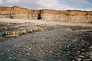
Several areas have outcrops of slates and between St Audries and Kilve
Kilve
Kilve is a village in West Somerset, England, within the Quantock Hills Area of Outstanding Natural Beauty, the first AONB to be established, in 1957....
, younger rocks of the Jurassic
Jurassic
The Jurassic is a geologic period and system that extends from about Mya to Mya, that is, from the end of the Triassic to the beginning of the Cretaceous. The Jurassic constitutes the middle period of the Mesozoic era, also known as the age of reptiles. The start of the period is marked by...
Period can be found. This area falls within the Blue Anchor to Lilstock
Blue Anchor to Lilstock Coast SSSI
Blue Anchor to Lilstock Coast SSSI is a 742.8 hectare geological Site of Special Scientific Interest between Blue Anchor and Lilstock in Somerset, notified in 1971....
Site of Special Scientific Interest
Site of Special Scientific Interest
A Site of Special Scientific Interest is a conservation designation denoting a protected area in the United Kingdom. SSSIs are the basic building block of site-based nature conservation legislation and most other legal nature/geological conservation designations in Great Britain are based upon...
(SSSI) and is considered to be of international geological importance. At Kilve are the remains of a red brick retort, built in 1924, when it was discovered that the shale found in the cliffs was rich in oil. At Blue Anchor
Blue Anchor
Blue Anchor is a seaside village, in the parish of Old Cleeve, close to Carhampton in the West Somerset district of Somerset, England. The village takes its name from a 17th century inn....
the coloured alabaster found in the cliffs gave rise to the name of the colour "Watchet Blue".
Exmoor

Exmoor
Exmoor is an area of hilly open moorland in west Somerset and north Devon in South West England, named after the main river that flows out of the district, the River Exe. The moor has given its name to a National Park, which includes the Brendon Hills, the East Lyn Valley, the Vale of Porlock and ...
is a dissected plateau of Devonian
Devonian
The Devonian is a geologic period and system of the Paleozoic Era spanning from the end of the Silurian Period, about 416.0 ± 2.8 Mya , to the beginning of the Carboniferous Period, about 359.2 ± 2.5 Mya...
sedimentary rock, rising to 517 metres (1,696 ft) at Dunkery Beacon
Dunkery Beacon
Dunkery Beacon is the summit of Dunkery Hill, and the highest point on Exmoor and in Somerset, England. It is also the highest point in southern England outside Dartmoor....
. It extends into Devon but the majority of the area is in Somerset. Much of the area is a National Park
National park
A national park is a reserve of natural, semi-natural, or developed land that a sovereign state declares or owns. Although individual nations designate their own national parks differently A national park is a reserve of natural, semi-natural, or developed land that a sovereign state declares or...
. The landscape is one of rounded hills, with hogs-back cliffs at the coast due to geological movements. Because of high rainfall there are boggy areas and the part by the Chains
Chains (geological site)
The Chains is the name given to the north-west plateau of Exmoor, Somerset, England. This plateau lies above the contour line, and includes the source of the River Barle....
is a Geological Conservation Review
Geological Conservation Review
The Geological Conservation Review is produced by the UK's Joint Nature Conservation Committee and is designed to identify those sites of national and international importance needed to show all the key scientific elements of the geological and geomorphological features of Britain...
site recognised as being nationally important for its south-western lowland heath communities and for transitions from ancient semi-natural woodland through upland heath to blanket mire. The Chains provides palynological record of a mid to late Flandrian vegetation history on Exmoor. The pollen sequence in the peat is calibrated by radiocarbon dating. The Glenthorne
Glenthorne
Glenthorne is a 13.3 hectare geological Site of Special Scientific Interest in the parish of Oare within the Exmoor National Park, on the border of Somerset and Devon, notified in 1989....
area demonstrates the Trentishoe Formation of the Hangman Sandstone Group. The Hangman Sandstone represents the Middle Devonian sequence of North Devon and Somerset. These unusual freshwater deposits in the Hangman Grits, were mainly formed in desert conditions.
As this area of Britain was not subject to glaciation, the plateau remains as a remarkably old landform.
Quartz
Quartz
Quartz is the second-most-abundant mineral in the Earth's continental crust, after feldspar. It is made up of a continuous framework of SiO4 silicon–oxygen tetrahedra, with each oxygen being shared between two tetrahedra, giving an overall formula SiO2. There are many different varieties of quartz,...
and iron
Iron
Iron is a chemical element with the symbol Fe and atomic number 26. It is a metal in the first transition series. It is the most common element forming the planet Earth as a whole, forming much of Earth's outer and inner core. It is the fourth most common element in the Earth's crust...
mineralisation can be detected in outcrops and subsoil. The underlying rocks are covered by moors are supported by wet, acid soil. The highest point on Exmoor is Dunkery Beacon
Dunkery Beacon
Dunkery Beacon is the summit of Dunkery Hill, and the highest point on Exmoor and in Somerset, England. It is also the highest point in southern England outside Dartmoor....
; at 519 metres (1,703 ft) it is also the highest point in Somerset.
Exmoor has 55 kilometres (34 mi) of coastline, including the highest cliffs in England, which reach a height of 1350 feet (411 m) at Culbone
Culbone
Culbone is a hamlet consisting of little more than the parish church and a few houses, in the parish of Oare in the Exmoor National Park, Somerset, England. As there is no road access it is a two-mile walk from Porlock Weir, and some four miles from Porlock itself.The village is situated in a...
Hill. However, the crest of this coastal ridge of hills is more than 1.6 kilometre (0.994196378639691 mi) from the sea. If a cliff is defined as having a slope greater than 60 degrees, the highest cliff on mainland Britain is Great Hangman
Hangman cliffs
Hangman cliffs are near Combe Martin on Devon's Exmoor coast.Great Hangman is high with a cliff face of . It is the highest sea cliff in England and the highest point on the South West Coast Path....
near Combe Martin
Combe Martin
Combe Martin is a village and civil parish on the North Devon coast about east of Ilfracombe. It is a small seaside resort with a sheltered cove on the edge of the Exmoor National Park...
at 318 metres (1,043 ft) high, with a cliff face of 214 metres (702 ft). Its sister cliff is the 218 metres (715 ft) Little Hangman, which marks the edge of Exmoor.
Exmoor's woodlands sometimes reach the shoreline, especially between Porlock
Porlock
Porlock is a coastal village and civil parish in Somerset, England, situated in a deep hollow below Exmoor, west of Minehead. The parish, which includes Hawkcombe and Doverhay, has a population of 1,377....
and The Foreland, where they form the single longest stretch of coastal woodland in England and Wales. The Exmoor Coastal Heaths
Exmoor Coastal Heaths
Exmoor Coastal Heaths is a 1758.3 hectare biological Site of Special Scientific Interest in Devon and Somerset, notified in 1994....
have been recognised as a Site of Special Scientific Interest
Site of Special Scientific Interest
A Site of Special Scientific Interest is a conservation designation denoting a protected area in the United Kingdom. SSSIs are the basic building block of site-based nature conservation legislation and most other legal nature/geological conservation designations in Great Britain are based upon...
due to the diversity of plant species present.

Drainage basin
A drainage basin is an extent or an area of land where surface water from rain and melting snow or ice converges to a single point, usually the exit of the basin, where the waters join another waterbody, such as a river, lake, reservoir, estuary, wetland, sea, or ocean...
for numerous rivers and streams. There are about 300 miles (483 km) of named rivers on Exmoor. The River Exe
River Exe
The River Exe in England rises near the village of Simonsbath, on Exmoor in Somerset, near the Bristol Channel coast, but flows more or less directly due south, so that most of its length lies in Devon. It reaches the sea at a substantial ria, the Exe Estuary, on the south coast of Devon...
, from which Exmoor takes its name, rises at Exe Head near the village of Simonsbath
Simonsbath
Simonsbath is a village high on Exmoor in the English county of Somerset. It is the principal settlement in the Exmoor civil parish, which is the largest and most sparsely populated civil parish on Exmoor, covering nearly but with a population, at the time of the 2001 census, of 203 in 78...
, close to the Bristol Channel
Bristol Channel
The Bristol Channel is a major inlet in the island of Great Britain, separating South Wales from Devon and Somerset in South West England. It extends from the lower estuary of the River Severn to the North Atlantic Ocean...
coast, but flows more or less directly due south, so that most of its length lies in Devon
Devon
Devon is a large county in southwestern England. The county is sometimes referred to as Devonshire, although the term is rarely used inside the county itself as the county has never been officially "shired", it often indicates a traditional or historical context.The county shares borders with...
. The river and the Barle Valley
Barle Valley
Barle Valley is a 104.2 hectare biological Site of Special Scientific Interest in Devon and Somerset, notified in 1997.The site includes the Somerset Wildlife Trust's Mounsey Wood Nature Reserve and Knaplock and North Barton SSSI notified in 1954...
are both designated as biological sites of Special Scientific Interest. Another tributary, the River Haddeo
River Haddeo
The River Haddeo on Exmoor in Somerset, England flows from the Wimbleball Lake to the River Exe.The valley of the river consists of three tributary valleys extending down from the surrounding farmland to merge with the River Haddeo in the south...
, flows from the Wimbleball Lake
Wimbleball Lake
Wimbleball Lake on Exmoor in Somerset, England, is a water supply reservoir constructed in the 1970s and completed in 1979.The high dam is of concrete buttress construction and impounds the River Haddeo to provide a water storage capacity of some 21,000 megalitres over an area of . Aggregate for...
.
The action of streams has cut combes through the hills down to the sea, which are now wooded, although much of Exmoor is open heathland. There is an outlier of Exmoor at North Hill near Minehead. Iron working was formerly carried out, probably from the Roman period onward.
Because Exmoor was a royal forest
Royal forest
A royal forest is an area of land with different meanings in England, Wales and Scotland; the term forest does not mean forest as it is understood today, as an area of densely wooded land...
, i.e. a hunting reserve, it was unpopulated in Medieval times. The first house on the moor was only built at Simonsbath
Simonsbath
Simonsbath is a village high on Exmoor in the English county of Somerset. It is the principal settlement in the Exmoor civil parish, which is the largest and most sparsely populated civil parish on Exmoor, covering nearly but with a population, at the time of the 2001 census, of 203 in 78...
in 1654. It was not until the 19th century that farm
Farm
A farm is an area of land, or, for aquaculture, lake, river or sea, including various structures, devoted primarily to the practice of producing and managing food , fibres and, increasingly, fuel. It is the basic production facility in food production. Farms may be owned and operated by a single...
s were built around the moor.
The Brendon Hills
Brendon Hills
The Brendon Hills are composed of a lofty ridge of hills in the East Lyn Valley area of western Somerset, England. The terrain is broken by a series of deeply incised streams and rivers running roughly southwards to meet the River Haddeo, a tributary of the River Exe.The hills are quite heavily...
are to the east of Exmoor and are an outlier of it. They are separated from Exmoor by the valley of the River Aville. They have the same undulating landscape. The Brendons reach a height of 422 metres (1,385 ft) at Lype Hill. Iron ore mining
Mining
Mining is the extraction of valuable minerals or other geological materials from the earth, from an ore body, vein or seam. The term also includes the removal of soil. Materials recovered by mining include base metals, precious metals, iron, uranium, coal, diamonds, limestone, oil shale, rock...
was carried out from Roman
Roman Empire
The Roman Empire was the post-Republican period of the ancient Roman civilization, characterised by an autocratic form of government and large territorial holdings in Europe and around the Mediterranean....
times up to the early 20th century.
See also
- SomersetSomersetThe ceremonial and non-metropolitan county of Somerset in South West England borders Bristol and Gloucestershire to the north, Wiltshire to the east, Dorset to the south-east, and Devon to the south-west. It is partly bounded to the north and west by the Bristol Channel and the estuary of the...
- Geology of the UK
- History of SomersetHistory of SomersetSomerset is a historic county in the south west of England. There is evidence of human occupation since prehistoric times with hand axes and flint points from the Palaeolithic and Mesolithic eras, and a range of burial mounds, hill forts and other artifacts dating from the Neolithic, Bronze and...
- Geology of EnglandGeology of EnglandThe Geology of England is mainly sedimentary. The youngest rocks are in the south east around London, progressing in age in a north westerly direction. The Tees-Exe line marks the division between younger, softer and low-lying rocks in the south east and older, harder, and generally a higher relief...