
Geography of Tuvalu
Encyclopedia
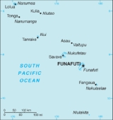
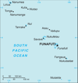
The Western Pacific
nation of Tuvalu
, formerly known as the Ellice Islands, is situated 4000 kilometres (2,485.5 mi) northeast of Australia
. It is one half of the way from Hawaii
to Australia. Tuvalu consists of three reef
islands and six true atolls (see Islands of Tuvalu
). Its small scattered group of atolls has poor soil and a total land area of only about 26 km², less than 10 sq mi (25.9 km²).
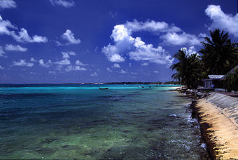
Tuvalu has westerly gales and heavy rain from November to March and tropical temperatures moderated by easterly winds from April to November. The land is very low-lying, with narrow coral atolls. The highest elevation is 4.6 metres (15.1 ft) above sea level on Niulakita
.
Location:
Oceania
, island
group of nine islands comprising three reef
islands and six true atolls in the South Pacific Ocean
, about one-half of the way from Hawaii
to Australia
.
 Geographic coordinates: 8°00′S 178°00′E
Map references:
Oceania
Area:
total:
26 km²
land:
26 km²
water:
0 km²
Area - comparative:
0.1 times the size of Washington, DC
Land boundaries:
0 km
Coastline:
24 kilometres (14.9 mi)
Maritime claims:
contiguous zone:
24 nmi (44 km)
exclusive economic zone:
200 nmi (370.4 km)
territorial sea:
12 nmi (22 km)
Climate:
tropical; moderated by easterly trade winds (March to November); westerly gales and heavy rain (November to March)
Terrain:
very low-lying and narrow coral atolls
Elevation extremes:
lowest point:
Pacific Ocean
0 m
highest point:
unnamed location, 4.6 metres (15.1 ft) on Niulakita
Extreme points:
This is a list of the extreme points of Tuvalu
, the points that are farther north, south, east or west than any other location.
Natural resources:
fish
Land use:
arable land:
0%
permanent crops:
0%
permanent pastures:
0%
forests and woodland:
0%
other:
100% (1993 est.)
Irrigated land:
NA km²
Natural hazards:
severe tropical storms are usually rare, but, in 1997, there were three cyclone
s; the low level of islands makes them very sensitive to sea-level rise.
 Tuvalu consists of three reef
islands and six true atolls. Its small, scattered group of atolls have poor soil and a total land area of only about 26 square kilometres (less than 10 sq. mi.) making it the fourth smallest country in the world. The islets that form the atolls are very low lying. Nanumaga, Niutao
, Niulakita
are reef
islands and the six true atolls are Funafuti
, Nanumea
, Nui, Nukufetau
, Nukulaelae
and Vaitupu
. Funafuti
is the largest atoll
of the nine low reef
islands and atolls that form the Tuvalu volcanic island chain. It comprises numerous islets around a central lagoon that is approximately 25.1 kilometres (15.6 mi) (N–S) by 18.4 kilometres (11.4 mi) (W-E), centred on 179°7’E and 8°30’S. On the atolls an annular reef rim surrounds the lagoon, with several natural reef channels.
The eastern shoreline of Funafuti Lagoon was modified during WW-II when the airfield (what is now Funafuti International Airport
) was constructed. As well several piers were constructed, beach areas filled, and deep water access channels were excavated. These alternations to the reef and shoreline have resulted in changes to wave patterns with less sand accumulating to form the beaches as compared to former times; and the shoreline is now exposed to wave action. Several attempts to stabilize the shoreline have not achieved the desired effect. The reefs at Funafuti have suffered damage, with 80 per cent of the coral having been bleached as a consequence of the increase of the ocean temperatures and acidification from increased levels of carbon dioxide. Researchers from Japan have investigated rebuilding the coral reefs through introduction of foraminifer.
The highest elevation is 4.6 metres (15.1 ft) above sea level on Niulakita
, which gives Tuvalu the second-lowest maximum elevation of any country (after the Maldives
). However, the highest elevations are typically in narrow storm dunes on the ocean side of the islands which are prone to over topping in tropical cyclones, such as occurred with Tropical Cyclone Bebe.
Because of the low elevation, the islands that make up this nation are threatened by current and future sea level rise. Additionally, Tuvalu is annually affected by king tide
events which peak towards the end of the austral summer, and raise the sea level higher than a normal high tide
. As a result of historical sea level rise, the king tide
events lead to flooding of low lying areas, which is compounded when sea levels are further raised by La Niña
effects or local storms and waves. In the future, sea level rise may threaten to submerge the nation entirely as it is estimated that a sea level rise of 20–40 centimetres (8–16 inches) in the next 100 years could make Tuvalu uninhabitable.
Tuvalu experiences westerly gales and heavy rain from October to March - the period that is known as Tau-o-lalo; with tropical temperatures moderated by easterly winds from April to November. Drinking water
is mostly obtained from rainwater collected on roofs and stored in tanks; these systems are often poorly maintained, resulting in lack of water. Aid programs of Australia and the European Union have been directed to improving the storage capacity on Funafuti and in the outer islands.
The rising population results in increased demand on fish stocks, which are under stress; although the creation of the Funafuti Conservation Area
has provided a fishing exclusion area that helps sustain fish populations across the Funafuti lagoon. Population pressure on the resources of Funafuti and in-adequation sanitation systems have resulted in pollution. The Waste Operations and Services Act 2009 provides the legal framework for the waste management and pollution control projects funded by the European Union that are directed to organic waste composting in eco-sanitation systems. Plastic waste is also a problem as much imported food and other commodities is supplied in plastic containers or packaging.
When the airfield at Funafuti was constructed during WW-II the coral base of the atoll was used as fill to create the runway; the resulting borrow pits
impacted on the water aquifer; at these pits the sea water can be seen bubbling up through the porous coral rock to form pools on each high tide.
Environment - current issues:
since there are no streams or rivers and groundwater is not potable, most water needs must be met by catchment systems with storage facilities; beachhead erosion because of the use of sand for building materials; excessive clearance of forest undergrowth for use as fuel; damage to coral reefs from the bleaching of the coral as a consequence of the increase of the ocean temperatures and acidification from from increased levels of carbon dioxide; Tuvalu is very concerned about global increases in greenhouse gas emissions and their effect on rising sea levels, which threaten the country's underground water table.
El Niño and La Niña:
Tuvalu experiences the effects of El Niño and La Niña
that flow from changes in ocean temperatures in equatorial and central Pacific. El Niño effects increase the chances of tropical storms and cyclones; while La Niña
effects increase the chances of drought conditions in Tuvalu. On October 3, 2011, drought conditions resulted in a state of emergency being declared as water reserves ran low. Typically the islands of Tuvalu receive between 200mm to 400mm of rainfall per month, however a weak La Niña
effect caused a drought by cooling the surface of the sea around Tuvalu.
Environment - international agreements:
party to:
Climate Change
, Climate Change-Kyoto Protocol, Desertification
, Endangered Species
, Law of the Sea
, Marine Dumping, Ozone Layer Protection, Ship Pollution.
signed, but not ratified:
Biodiversity
Pacific Ocean
The Pacific Ocean is the largest of the Earth's oceanic divisions. It extends from the Arctic in the north to the Southern Ocean in the south, bounded by Asia and Australia in the west, and the Americas in the east.At 165.2 million square kilometres in area, this largest division of the World...
nation of Tuvalu
Tuvalu
Tuvalu , formerly known as the Ellice Islands, is a Polynesian island nation located in the Pacific Ocean, midway between Hawaii and Australia. Its nearest neighbours are Kiribati, Nauru, Samoa and Fiji. It comprises four reef islands and five true atolls...
, formerly known as the Ellice Islands, is situated 4000 kilometres (2,485.5 mi) northeast of Australia
Australia
Australia , officially the Commonwealth of Australia, is a country in the Southern Hemisphere comprising the mainland of the Australian continent, the island of Tasmania, and numerous smaller islands in the Indian and Pacific Oceans. It is the world's sixth-largest country by total area...
. It is one half of the way from Hawaii
Hawaii
Hawaii is the newest of the 50 U.S. states , and is the only U.S. state made up entirely of islands. It is the northernmost island group in Polynesia, occupying most of an archipelago in the central Pacific Ocean, southwest of the continental United States, southeast of Japan, and northeast of...
to Australia. Tuvalu consists of three reef
Reef
In nautical terminology, a reef is a rock, sandbar, or other feature lying beneath the surface of the water ....
islands and six true atolls (see Islands of Tuvalu
Islands of Tuvalu
Tuvalu consists of nine separate islands, six of which are atolls. Since an atoll typically consists of several islets, there is a total of more than 124 islands and islets. The three remaining islands are actually atolls, too, but they have a completely closed rim of dry land, with a lagoon that...
). Its small scattered group of atolls has poor soil and a total land area of only about 26 km², less than 10 sq mi (25.9 km²).
Tuvalu has westerly gales and heavy rain from November to March and tropical temperatures moderated by easterly winds from April to November. The land is very low-lying, with narrow coral atolls. The highest elevation is 4.6 metres (15.1 ft) above sea level on Niulakita
Niulakita
Niulakita is the southernmost reef island, which is a district of Tuvalu, and the name of the only village on this island. The junior school is Lotoalofa Primary School.-Geographical features:...
.
Location:
Oceania
Oceania
Oceania is a region centered on the islands of the tropical Pacific Ocean. Conceptions of what constitutes Oceania range from the coral atolls and volcanic islands of the South Pacific to the entire insular region between Asia and the Americas, including Australasia and the Malay Archipelago...
, island
Island
An island or isle is any piece of sub-continental land that is surrounded by water. Very small islands such as emergent land features on atolls can be called islets, cays or keys. An island in a river or lake may be called an eyot , or holm...
group of nine islands comprising three reef
Reef
In nautical terminology, a reef is a rock, sandbar, or other feature lying beneath the surface of the water ....
islands and six true atolls in the South Pacific Ocean
Pacific Ocean
The Pacific Ocean is the largest of the Earth's oceanic divisions. It extends from the Arctic in the north to the Southern Ocean in the south, bounded by Asia and Australia in the west, and the Americas in the east.At 165.2 million square kilometres in area, this largest division of the World...
, about one-half of the way from Hawaii
Hawaii
Hawaii is the newest of the 50 U.S. states , and is the only U.S. state made up entirely of islands. It is the northernmost island group in Polynesia, occupying most of an archipelago in the central Pacific Ocean, southwest of the continental United States, southeast of Japan, and northeast of...
to Australia
Australia
Australia , officially the Commonwealth of Australia, is a country in the Southern Hemisphere comprising the mainland of the Australian continent, the island of Tasmania, and numerous smaller islands in the Indian and Pacific Oceans. It is the world's sixth-largest country by total area...
.
Map references:
Oceania
Oceania
Oceania is a region centered on the islands of the tropical Pacific Ocean. Conceptions of what constitutes Oceania range from the coral atolls and volcanic islands of the South Pacific to the entire insular region between Asia and the Americas, including Australasia and the Malay Archipelago...
Area:
total:
26 km²
land:
26 km²
water:
0 km²
Area - comparative:
0.1 times the size of Washington, DC
Land boundaries:
0 km
Coastline:
24 kilometres (14.9 mi)
Maritime claims:
contiguous zone:
24 nmi (44 km)
exclusive economic zone:
200 nmi (370.4 km)
territorial sea:
12 nmi (22 km)
Climate:
tropical; moderated by easterly trade winds (March to November); westerly gales and heavy rain (November to March)
Terrain:
very low-lying and narrow coral atolls
Elevation extremes:
lowest point:
Pacific Ocean
Pacific Ocean
The Pacific Ocean is the largest of the Earth's oceanic divisions. It extends from the Arctic in the north to the Southern Ocean in the south, bounded by Asia and Australia in the west, and the Americas in the east.At 165.2 million square kilometres in area, this largest division of the World...
0 m
highest point:
unnamed location, 4.6 metres (15.1 ft) on Niulakita
Niulakita
Niulakita is the southernmost reef island, which is a district of Tuvalu, and the name of the only village on this island. The junior school is Lotoalofa Primary School.-Geographical features:...
Extreme points:
This is a list of the extreme points of Tuvalu
Tuvalu
Tuvalu , formerly known as the Ellice Islands, is a Polynesian island nation located in the Pacific Ocean, midway between Hawaii and Australia. Its nearest neighbours are Kiribati, Nauru, Samoa and Fiji. It comprises four reef islands and five true atolls...
, the points that are farther north, south, east or west than any other location.
- Northern-most point – LakenaLakena-References:...
island, NanumeaNanumeaNanumea is the northwesternmost atoll in the Polynesian nation of Tuvalu, a group of nine coral atolls and islands spread over about four hundred miles of Pacific Ocean just south of the equator and west of the International Date Line.-Geography:... - Eastern-most point – Niuoko island, NukulaelaeNukulaelaeNukulaelae is an atoll that is part of the nation of Tuvalu, and has a population of 393. It has the form of an oval and consists of at least 15 islets...
- Southern-most point – NiulakitaNiulakitaNiulakita is the southernmost reef island, which is a district of Tuvalu, and the name of the only village on this island. The junior school is Lotoalofa Primary School.-Geographical features:...
- Western-most point - LakenaLakena-References:...
island, NanumeaNanumeaNanumea is the northwesternmost atoll in the Polynesian nation of Tuvalu, a group of nine coral atolls and islands spread over about four hundred miles of Pacific Ocean just south of the equator and west of the International Date Line.-Geography:...
Natural resources:
fish
Land use:
arable land:
0%
permanent crops:
0%
permanent pastures:
0%
forests and woodland:
0%
other:
100% (1993 est.)
Irrigated land:
NA km²
Natural hazards:
severe tropical storms are usually rare, but, in 1997, there were three cyclone
Cyclone
In meteorology, a cyclone is an area of closed, circular fluid motion rotating in the same direction as the Earth. This is usually characterized by inward spiraling winds that rotate anticlockwise in the Northern Hemisphere and clockwise in the Southern Hemisphere of the Earth. Most large-scale...
s; the low level of islands makes them very sensitive to sea-level rise.
Geography and environment
Reef
In nautical terminology, a reef is a rock, sandbar, or other feature lying beneath the surface of the water ....
islands and six true atolls. Its small, scattered group of atolls have poor soil and a total land area of only about 26 square kilometres (less than 10 sq. mi.) making it the fourth smallest country in the world. The islets that form the atolls are very low lying. Nanumaga, Niutao
Niutao
Niutao is a reef island in the northern part of Tuvalu. It is one of the nine districts of Tuvalu, and one of the three who consist of only one island, not counting the three islets inside the closed lagoon. Niutao has a population of 663 .-Geography:There are two lakes , which are brackish to...
, Niulakita
Niulakita
Niulakita is the southernmost reef island, which is a district of Tuvalu, and the name of the only village on this island. The junior school is Lotoalofa Primary School.-Geographical features:...
are reef
Reef
In nautical terminology, a reef is a rock, sandbar, or other feature lying beneath the surface of the water ....
islands and the six true atolls are Funafuti
Funafuti
Funafuti is an atoll that forms the capital of the island nation of Tuvalu. It has a population of 4,492 , making it the most populated atoll in the country. It is a narrow sweep of land between 20 and 400 metres wide, encircling a large lagoon 18 km long and 14 km wide, with a surface of...
, Nanumea
Nanumea
Nanumea is the northwesternmost atoll in the Polynesian nation of Tuvalu, a group of nine coral atolls and islands spread over about four hundred miles of Pacific Ocean just south of the equator and west of the International Date Line.-Geography:...
, Nui, Nukufetau
Nukufetau
Nukufetau is an atoll that is part of the nation of Tuvalu. The atoll was claimed by the US under the Guano Islands Act some time in the 19th century and was ceded in a treaty of friendship concluded in 1979 and coming into force in 1983...
, Nukulaelae
Nukulaelae
Nukulaelae is an atoll that is part of the nation of Tuvalu, and has a population of 393. It has the form of an oval and consists of at least 15 islets...
and Vaitupu
Vaitupu
Vaitupu is an atoll, which is part of the nation of Tuvalu.Vaitupu, the largest atoll of Tuvalu is located at 7.48 degrees south and 178.83 degrees west. The capital is Asau.-History:...
. Funafuti
Funafuti
Funafuti is an atoll that forms the capital of the island nation of Tuvalu. It has a population of 4,492 , making it the most populated atoll in the country. It is a narrow sweep of land between 20 and 400 metres wide, encircling a large lagoon 18 km long and 14 km wide, with a surface of...
is the largest atoll
Atoll
An atoll is a coral island that encircles a lagoon partially or completely.- Usage :The word atoll comes from the Dhivehi word atholhu OED...
of the nine low reef
Reef
In nautical terminology, a reef is a rock, sandbar, or other feature lying beneath the surface of the water ....
islands and atolls that form the Tuvalu volcanic island chain. It comprises numerous islets around a central lagoon that is approximately 25.1 kilometres (15.6 mi) (N–S) by 18.4 kilometres (11.4 mi) (W-E), centred on 179°7’E and 8°30’S. On the atolls an annular reef rim surrounds the lagoon, with several natural reef channels.
The eastern shoreline of Funafuti Lagoon was modified during WW-II when the airfield (what is now Funafuti International Airport
Funafuti International Airport
Funafuti International Airport is an airport located in Funafuti, capital of the island nation of Tuvalu.-History:Funafuti Airport was built by United States Navy Seabee construction battalions in 1943 during World War II. The military airfield included an airstrip, control tower, facilities and...
) was constructed. As well several piers were constructed, beach areas filled, and deep water access channels were excavated. These alternations to the reef and shoreline have resulted in changes to wave patterns with less sand accumulating to form the beaches as compared to former times; and the shoreline is now exposed to wave action. Several attempts to stabilize the shoreline have not achieved the desired effect. The reefs at Funafuti have suffered damage, with 80 per cent of the coral having been bleached as a consequence of the increase of the ocean temperatures and acidification from increased levels of carbon dioxide. Researchers from Japan have investigated rebuilding the coral reefs through introduction of foraminifer.
The highest elevation is 4.6 metres (15.1 ft) above sea level on Niulakita
Niulakita
Niulakita is the southernmost reef island, which is a district of Tuvalu, and the name of the only village on this island. The junior school is Lotoalofa Primary School.-Geographical features:...
, which gives Tuvalu the second-lowest maximum elevation of any country (after the Maldives
Maldives
The Maldives , , officially Republic of Maldives , also referred to as the Maldive Islands, is an island nation in the Indian Ocean formed by a double chain of twenty-six atolls oriented north-south off India's Lakshadweep islands, between Minicoy Island and...
). However, the highest elevations are typically in narrow storm dunes on the ocean side of the islands which are prone to over topping in tropical cyclones, such as occurred with Tropical Cyclone Bebe.
Because of the low elevation, the islands that make up this nation are threatened by current and future sea level rise. Additionally, Tuvalu is annually affected by king tide
King tide
King tide is the popular name for an especially high tide. The phrase is used mostly in Australia, New Zealand and other Pacific nations.In the lunar month, the highest tides occur roughly every 14 days, at the new and full moons, when the gravitational pull of the moon and the sun are in line...
events which peak towards the end of the austral summer, and raise the sea level higher than a normal high tide
High Tide
High Tide was a band formed in 1969 by Tony Hill , Simon House , Peter Pavli and Roger Hadden .-History:...
. As a result of historical sea level rise, the king tide
King tide
King tide is the popular name for an especially high tide. The phrase is used mostly in Australia, New Zealand and other Pacific nations.In the lunar month, the highest tides occur roughly every 14 days, at the new and full moons, when the gravitational pull of the moon and the sun are in line...
events lead to flooding of low lying areas, which is compounded when sea levels are further raised by La Niña
La Niña
La Niña is a coupled ocean-atmosphere phenomenon that is the counterpart of El Niño as part of the broader El Niño-Southern Oscillation climate pattern. During a period of La Niña, the sea surface temperature across the equatorial Eastern Central Pacific Ocean will be lower than normal by 3–5 °C...
effects or local storms and waves. In the future, sea level rise may threaten to submerge the nation entirely as it is estimated that a sea level rise of 20–40 centimetres (8–16 inches) in the next 100 years could make Tuvalu uninhabitable.
Tuvalu experiences westerly gales and heavy rain from October to March - the period that is known as Tau-o-lalo; with tropical temperatures moderated by easterly winds from April to November. Drinking water
Drinking water
Drinking water or potable water is water pure enough to be consumed or used with low risk of immediate or long term harm. In most developed countries, the water supplied to households, commerce and industry is all of drinking water standard, even though only a very small proportion is actually...
is mostly obtained from rainwater collected on roofs and stored in tanks; these systems are often poorly maintained, resulting in lack of water. Aid programs of Australia and the European Union have been directed to improving the storage capacity on Funafuti and in the outer islands.
The rising population results in increased demand on fish stocks, which are under stress; although the creation of the Funafuti Conservation Area
Funafuti Conservation Area
Funafuti Conservation Area is a marine conservation area covering 33 square kilometers of reef, lagoon and motu on the western side of Funafuti atoll in Tuvalu....
has provided a fishing exclusion area that helps sustain fish populations across the Funafuti lagoon. Population pressure on the resources of Funafuti and in-adequation sanitation systems have resulted in pollution. The Waste Operations and Services Act 2009 provides the legal framework for the waste management and pollution control projects funded by the European Union that are directed to organic waste composting in eco-sanitation systems. Plastic waste is also a problem as much imported food and other commodities is supplied in plastic containers or packaging.
When the airfield at Funafuti was constructed during WW-II the coral base of the atoll was used as fill to create the runway; the resulting borrow pits
Borrow pit
A borrow pit, also known as a sand box, is a term used in construction and civil engineering. It describes an area where material has been dug for use at another location. Borrow pits can be found close to many major construction projects...
impacted on the water aquifer; at these pits the sea water can be seen bubbling up through the porous coral rock to form pools on each high tide.
Environment - current issues:
since there are no streams or rivers and groundwater is not potable, most water needs must be met by catchment systems with storage facilities; beachhead erosion because of the use of sand for building materials; excessive clearance of forest undergrowth for use as fuel; damage to coral reefs from the bleaching of the coral as a consequence of the increase of the ocean temperatures and acidification from from increased levels of carbon dioxide; Tuvalu is very concerned about global increases in greenhouse gas emissions and their effect on rising sea levels, which threaten the country's underground water table.
El Niño and La Niña:
Tuvalu experiences the effects of El Niño and La Niña
La Niña
La Niña is a coupled ocean-atmosphere phenomenon that is the counterpart of El Niño as part of the broader El Niño-Southern Oscillation climate pattern. During a period of La Niña, the sea surface temperature across the equatorial Eastern Central Pacific Ocean will be lower than normal by 3–5 °C...
that flow from changes in ocean temperatures in equatorial and central Pacific. El Niño effects increase the chances of tropical storms and cyclones; while La Niña
La Niña
La Niña is a coupled ocean-atmosphere phenomenon that is the counterpart of El Niño as part of the broader El Niño-Southern Oscillation climate pattern. During a period of La Niña, the sea surface temperature across the equatorial Eastern Central Pacific Ocean will be lower than normal by 3–5 °C...
effects increase the chances of drought conditions in Tuvalu. On October 3, 2011, drought conditions resulted in a state of emergency being declared as water reserves ran low. Typically the islands of Tuvalu receive between 200mm to 400mm of rainfall per month, however a weak La Niña
La Niña
La Niña is a coupled ocean-atmosphere phenomenon that is the counterpart of El Niño as part of the broader El Niño-Southern Oscillation climate pattern. During a period of La Niña, the sea surface temperature across the equatorial Eastern Central Pacific Ocean will be lower than normal by 3–5 °C...
effect caused a drought by cooling the surface of the sea around Tuvalu.
Environment - international agreements:
party to:
Climate Change
United Nations Framework Convention on Climate Change
The United Nations Framework Convention on Climate Change is an international environmental treaty produced at the United Nations Conference on Environment and Development , informally known as the Earth Summit, held in Rio de Janeiro from June 3 to 14, 1992...
, Climate Change-Kyoto Protocol, Desertification
Desertification
Desertification is the degradation of land in drylands. Caused by a variety of factors, such as climate change and human activities, desertification is one of the most significant global environmental problems.-Definitions:...
, Endangered Species
Endangered species
An endangered species is a population of organisms which is at risk of becoming extinct because it is either few in numbers, or threatened by changing environmental or predation parameters...
, Law of the Sea
Law of the sea
Law of the sea may refer to:* United Nations Convention on the Law of the Sea* Admiralty law* The Custom of the Sea...
, Marine Dumping, Ozone Layer Protection, Ship Pollution.
signed, but not ratified:
Biodiversity
Biodiversity
Biodiversity is the degree of variation of life forms within a given ecosystem, biome, or an entire planet. Biodiversity is a measure of the health of ecosystems. Biodiversity is in part a function of climate. In terrestrial habitats, tropical regions are typically rich whereas polar regions...
See also
- TuvaluTuvaluTuvalu , formerly known as the Ellice Islands, is a Polynesian island nation located in the Pacific Ocean, midway between Hawaii and Australia. Its nearest neighbours are Kiribati, Nauru, Samoa and Fiji. It comprises four reef islands and five true atolls...
- Islands of TuvaluIslands of TuvaluTuvalu consists of nine separate islands, six of which are atolls. Since an atoll typically consists of several islets, there is a total of more than 124 islands and islets. The three remaining islands are actually atolls, too, but they have a completely closed rim of dry land, with a lagoon that...
- List of cities in Tuvalu