

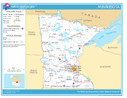
Geography of Minnesota
Encyclopedia
Northwest Angle
The Northwest Angle, known simply as the Angle by locals, and coextensive with Angle Township, is a part of northern Lake of the Woods County, Minnesota, and is the only place in the United States outside Alaska that is north of the 49th parallel...
in Lake of the Woods
Lake of the Woods
Lake of the Woods is a lake occupying parts of the Canadian provinces of Ontario and Manitoba and the U.S. state of Minnesota. It separates a small land area of Minnesota from the rest of the United States. The Northwest Angle and the town of Angle Township can only be reached from the rest of...
is the only part of the 48 contiguous states lying north of the 49th parallel
49th parallel north
The 49th parallel north is a circle of latitude that is 49 degrees north of the Earth's equatorial plane. It crosses Europe, Asia, the Pacific Ocean, North America, and the Atlantic Ocean....
. Minnesota is in the U.S. region known as the Upper Midwest
Upper Midwest
The Upper Midwest is a region in the northern portion of the U.S. Census Bureau's Midwestern United States. It is largely a sub-region of the midwest. Although there are no uniformly agreed-upon boundaries, the region is most commonly used to refer to the states of Minnesota, Wisconsin, and...
. The state shares a Lake Superior
Lake Superior
Lake Superior is the largest of the five traditionally-demarcated Great Lakes of North America. It is bounded to the north by the Canadian province of Ontario and the U.S. state of Minnesota, and to the south by the U.S. states of Wisconsin and Michigan. It is the largest freshwater lake in the...
water border with Michigan
Michigan
Michigan is a U.S. state located in the Great Lakes Region of the United States of America. The name Michigan is the French form of the Ojibwa word mishigamaa, meaning "large water" or "large lake"....
and Wisconsin
Wisconsin
Wisconsin is a U.S. state located in the north-central United States and is part of the Midwest. It is bordered by Minnesota to the west, Iowa to the southwest, Illinois to the south, Lake Michigan to the east, Michigan to the northeast, and Lake Superior to the north. Wisconsin's capital is...
on the northeast; the remainder of the eastern border is with Wisconsin
Wisconsin
Wisconsin is a U.S. state located in the north-central United States and is part of the Midwest. It is bordered by Minnesota to the west, Iowa to the southwest, Illinois to the south, Lake Michigan to the east, Michigan to the northeast, and Lake Superior to the north. Wisconsin's capital is...
. Iowa
Iowa
Iowa is a state located in the Midwestern United States, an area often referred to as the "American Heartland". It derives its name from the Ioway people, one of the many American Indian tribes that occupied the state at the time of European exploration. Iowa was a part of the French colony of New...
is to the south, North Dakota
North Dakota
North Dakota is a state located in the Midwestern region of the United States of America, along the Canadian border. The state is bordered by Canada to the north, Minnesota to the east, South Dakota to the south and Montana to the west. North Dakota is the 19th-largest state by area in the U.S....
and South Dakota
South Dakota
South Dakota is a state located in the Midwestern region of the United States. It is named after the Lakota and Dakota Sioux American Indian tribes. Once a part of Dakota Territory, South Dakota became a state on November 2, 1889. The state has an area of and an estimated population of just over...
are west, and the Canadian provinces of Ontario
Ontario
Ontario is a province of Canada, located in east-central Canada. It is Canada's most populous province and second largest in total area. It is home to the nation's most populous city, Toronto, and the nation's capital, Ottawa....
and Manitoba
Manitoba
Manitoba is a Canadian prairie province with an area of . The province has over 110,000 lakes and has a largely continental climate because of its flat topography. Agriculture, mostly concentrated in the fertile southern and western parts of the province, is vital to the province's economy; other...
are north. With 87014 square miles (225,365.2 km²), or approximately 2.25% of the United States, Minnesota is the 12th largest state.
Geology and terrain
Minnesota contains some of the oldest rocks found on earth, gneissGneiss
Gneiss is a common and widely distributed type of rock formed by high-grade regional metamorphic processes from pre-existing formations that were originally either igneous or sedimentary rocks.-Etymology:...
es some 3.6 billion years old, or 80% as old as the planet. About 2.7 billion years ago, basalt
Basalt
Basalt is a common extrusive volcanic rock. It is usually grey to black and fine-grained due to rapid cooling of lava at the surface of a planet. It may be porphyritic containing larger crystals in a fine matrix, or vesicular, or frothy scoria. Unweathered basalt is black or grey...
ic lava
Lava
Lava refers both to molten rock expelled by a volcano during an eruption and the resulting rock after solidification and cooling. This molten rock is formed in the interior of some planets, including Earth, and some of their satellites. When first erupted from a volcanic vent, lava is a liquid at...
poured out of cracks in the floor of the primordial ocean; the remains of this volcanic
Volcano
2. Bedrock3. Conduit 4. Base5. Sill6. Dike7. Layers of ash emitted by the volcano8. Flank| 9. Layers of lava emitted by the volcano10. Throat11. Parasitic cone12. Lava flow13. Vent14. Crater15...
rock formed the Canadian Shield
Canadian Shield
The Canadian Shield, also called the Laurentian Plateau, or Bouclier Canadien , is a vast geological shield covered by a thin layer of soil that forms the nucleus of the North American or Laurentia craton. It is an area mostly composed of igneous rock which relates to its long volcanic history...
in northeast Minnesota. The roots of these volcanic mountains and the action of Precambrian
Precambrian
The Precambrian is the name which describes the large span of time in Earth's history before the current Phanerozoic Eon, and is a Supereon divided into several eons of the geologic time scale...
seas formed the Iron Range
Iron Range
The Iron Range is a region that makes up the northeastern section of Minnesota in the United States. "The Range", as it is known by locals, is a region with multiple distinct bands of iron ore...
of northern Minnesota. Following a period of volcanism
Volcanism
Volcanism is the phenomenon connected with volcanoes and volcanic activity. It includes all phenomena resulting from and causing magma within the crust or mantle of a planet to rise through the crust and form volcanic rocks on the surface....
1.1 billion years ago, Minnesota's geological activity has been more subdued, with no volcanism or mountain formation, but with repeated incursions of the sea which left behind multiple strata of sedimentary rock.
In more recent times, massive ice sheets at least one kilometer thick ravaged the landscape of the state and sculpted its current terrain. The Wisconsin glaciation
Wisconsin glaciation
The last glacial period was the most recent glacial period within the current ice age occurring during the last years of the Pleistocene, from approximately 110,000 to 10,000 years ago....
left 12,000 years ago. These glaciers covered all of Minnesota except the far southeast, an area characterized by steep hills and streams that cut into the bedrock
Bedrock
In stratigraphy, bedrock is the native consolidated rock underlying the surface of a terrestrial planet, usually the Earth. Above the bedrock is usually an area of broken and weathered unconsolidated rock in the basal subsoil...
. This area is known as the Driftless Zone
Coulee Region
The Driftless Area or Paleozoic Plateau is a region in the American Midwest noted mainly for its deeply carved river valleys. While primarily in southwestern Wisconsin, it includes areas of southeastern Minnesota, northeastern Iowa and extreme northwestern Illinois...
for its absence of glacial drift. Much of the remainder of the state outside of the northeast has 50 feet (15 m) or more of glacial till left behind as the last glaciers retreated. 13,000 years ago gigantic Lake Agassiz
Lake Agassiz
Lake Agassiz was an immense glacial lake located in the center of North America. Fed by glacial runoff at the end of the last glacial period, its area was larger than all of the modern Great Lakes combined, and it held more water than contained by all lakes in the world today.-Conception:First...
formed in the northwest; the lake's outflow, the glacial River Warren
Glacial River Warren
right|thumb|210px|The course of the Minnesota River follows the valley carved by Glacial River WarrenGlacial River Warren or River Warren was a prehistoric river that drained Lake Agassiz in central North America between 11,700 and 9,400 years ago...
, carved the valley of the Minnesota River
Minnesota River
The Minnesota River is a tributary of the Mississippi River, approximately 332 miles long, in the U.S. state of Minnesota. It drains a watershed of nearly , in Minnesota and about in South Dakota and Iowa....
, and its bottom created the fertile lands of the Red River
Red River of the North
The Red River is a North American river. Originating at the confluence of the Bois de Sioux and Otter Tail rivers in the United States, it flows northward through the Red River Valley and forms the border between the U.S. states of Minnesota and North Dakota before continuing into Manitoba, Canada...
valley. Minnesota is geologically quiet today; it experiences earthquakes infrequently, and most of them are minor.
The state's high point is Eagle Mountain
Eagle Mountain (Minnesota)
Eagle Mountain is the highest natural point in Minnesota, at . It is located in northern Cook County and is in the Boundary Waters Canoe Area Wilderness and Superior National Forest in the Misquah Hills, northwest of the community of Grand Marais. It is a Minnesota State Historic Site.Eagle...
at 2,301 feet (701 m), which is only 13 miles (20.9 km) away from the low of 602 feet (183 m) at the shore of Lake Superior
Lake Superior
Lake Superior is the largest of the five traditionally-demarcated Great Lakes of North America. It is bounded to the north by the Canadian province of Ontario and the U.S. state of Minnesota, and to the south by the U.S. states of Wisconsin and Michigan. It is the largest freshwater lake in the...
. Notwithstanding dramatic local differences in elevation, much of the state is a gently rolling peneplain
Peneplain
A peneplain is a low-relief plain representing the final stage of fluvial erosion during times of extended tectonic stability. The existence of peneplains, and peneplanation as a geomorphological process, is not without controversy, due to a lack of contemporary examples and uncertainty in...
.
Two continental divide
Continental divide
A continental divide is a drainage divide on a continent such that the drainage basin on one side of the divide feeds into one ocean or sea, and the basin on the other side either feeds into a different ocean or sea, or else is endorheic, not connected to the open sea...
s meet in the northeastern part of Minnesota in rural Hibbing
Hibbing, Minnesota
Hibbing is a city in Saint Louis County, Minnesota, United States. The population was 16,361 at the 2010 census. The city was built on the rich iron ore of the Mesabi Iron Range. At the edge of town is the largest open-pit iron mine in the world. U.S...
, forming a triple watershed
Drainage basin
A drainage basin is an extent or an area of land where surface water from rain and melting snow or ice converges to a single point, usually the exit of the basin, where the waters join another waterbody, such as a river, lake, reservoir, estuary, wetland, sea, or ocean...
. Precipitation
Precipitation (meteorology)
In meteorology, precipitation In meteorology, precipitation In meteorology, precipitation (also known as one of the classes of hydrometeors, which are atmospheric water phenomena is any product of the condensation of atmospheric water vapor that falls under gravity. The main forms of precipitation...
can follow the Mississippi River
Mississippi River
The Mississippi River is the largest river system in North America. Flowing entirely in the United States, this river rises in western Minnesota and meanders slowly southwards for to the Mississippi River Delta at the Gulf of Mexico. With its many tributaries, the Mississippi's watershed drains...
south to the Gulf of Mexico
Gulf of Mexico
The Gulf of Mexico is a partially landlocked ocean basin largely surrounded by the North American continent and the island of Cuba. It is bounded on the northeast, north and northwest by the Gulf Coast of the United States, on the southwest and south by Mexico, and on the southeast by Cuba. In...
, the St. Lawrence Seaway
Saint Lawrence Seaway
The Saint Lawrence Seaway , , is the common name for a system of locks, canals and channels that permits ocean-going vessels to travel from the Atlantic Ocean to the North American Great Lakes, as far as Lake Superior. Legally it extends from Montreal to Lake Erie, including the Welland Canal...
east to the Atlantic Ocean, or the Hudson Bay watershed
Canada Hudson Bay drainage
The Hudson Bay drainage in Canada is the majority of the Hudson Bay Watershed, which has small United States portions in Minnesota, Montana, and North Dakota...
to the Arctic Ocean.
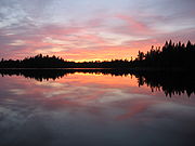
The state's nickname, The Land of 10,000 Lakes, is no exaggeration; there are 11,842 lakes over 10 acres in size. The Minnesota portion of Lake Superior
Lake Superior
Lake Superior is the largest of the five traditionally-demarcated Great Lakes of North America. It is bounded to the north by the Canadian province of Ontario and the U.S. state of Minnesota, and to the south by the U.S. states of Wisconsin and Michigan. It is the largest freshwater lake in the...
is the largest at 962700 acres (3,895.9 km²) and deepest (at 1290 ft (393.2 m), 393 m) body of water in the state. Minnesota has 6,564 natural rivers and streams that cumulatively flow for 69,000 miles (111,000 km). The Mississippi River
Mississippi River
The Mississippi River is the largest river system in North America. Flowing entirely in the United States, this river rises in western Minnesota and meanders slowly southwards for to the Mississippi River Delta at the Gulf of Mexico. With its many tributaries, the Mississippi's watershed drains...
begins its journey from its headwaters at Lake Itasca
Lake Itasca
Lake Itasca is a small glacial lake, approximately in area, in the Headwaters area of north central Minnesota. The lake is located in southeastern Clearwater County within Itasca State Park and it has an average depth of 20–35 feet , and is 1,475 ft above sea level.The Ojibwe name for...
and crosses the Iowa
Iowa
Iowa is a state located in the Midwestern United States, an area often referred to as the "American Heartland". It derives its name from the Ioway people, one of the many American Indian tribes that occupied the state at the time of European exploration. Iowa was a part of the French colony of New...
border 680 miles (1,094 km) downstream. It is joined by the Minnesota River
Minnesota River
The Minnesota River is a tributary of the Mississippi River, approximately 332 miles long, in the U.S. state of Minnesota. It drains a watershed of nearly , in Minnesota and about in South Dakota and Iowa....
at Fort Snelling
Fort Snelling, Minnesota
Fort Snelling, originally known as Fort Saint Anthony, was a military fortification located at the confluence of the Minnesota River and Mississippi River in Hennepin County, Minnesota...
, by the St. Croix River
St. Croix River (Wisconsin-Minnesota)
The St. Croix River is a tributary of the Mississippi River, approximately long, in the U.S. states of Wisconsin and Minnesota. The lower of the river form the border between Wisconsin and Minnesota. The river is a National Scenic Riverway under the protection of the National Park Service. A...
near Hastings
Hastings, Minnesota
Hastings is a city in Dakota counties in the U.S. state of Minnesota, near the confluence of the Mississippi and St. Croix Rivers. The population was 22,172 at the 2010 census. It is the county seat of Dakota County. The bulk of Hastings is in Dakota County; only a small part of the city extends...
, by the Chippewa River
Chippewa River (Wisconsin)
The Chippewa River in Wisconsin flows approximately 183 miles through west-central and northwestern Wisconsin. It was once navigable for approximately 50 miles of its length, from the Mississippi River, by Durand, northeast to Eau Claire. Its catchment defines a portion of the northern boundary...
at Wabasha, and by many smaller streams. The Red River
Red River of the North
The Red River is a North American river. Originating at the confluence of the Bois de Sioux and Otter Tail rivers in the United States, it flows northward through the Red River Valley and forms the border between the U.S. states of Minnesota and North Dakota before continuing into Manitoba, Canada...
, in the bed of glacial Lake Agassiz, drains the northwest part of the state northward toward Canada's Hudson Bay
Hudson Bay
Hudson Bay , sometimes called Hudson's Bay, is a large body of saltwater in northeastern Canada. It drains a very large area, about , that includes parts of Ontario, Quebec, Saskatchewan, Alberta, most of Manitoba, southeastern Nunavut, as well as parts of North Dakota, South Dakota, Minnesota,...
. Approximately 10.6 million acres (42,900 km²) of wetlands are contained within Minnesota's borders, the most of any state except Alaska.
Flora and fauna
Three of North America's biome
Biome
Biomes are climatically and geographically defined as similar climatic conditions on the Earth, such as communities of plants, animals, and soil organisms, and are often referred to as ecosystems. Some parts of the earth have more or less the same kind of abiotic and biotic factors spread over a...
s converge in Minnesota: prairie grasslands
Prairie
Prairies are considered part of the temperate grasslands, savannas, and shrublands biome by ecologists, based on similar temperate climates, moderate rainfall, and grasses, herbs, and shrubs, rather than trees, as the dominant vegetation type...
in the southwestern and western parts of the state, the Big Woods
Big Woods
Big Woods refers to a type of temperate hardwood forest ecoregion found in south-central Minnesota. "Big Woods" is a direct translation of the name given to the region by French explorers: Grand Bois.-Trees:...
deciduous forest of the southeast, and the northern boreal forest
Taiga
Taiga , also known as the boreal forest, is a biome characterized by coniferous forests.Taiga is the world's largest terrestrial biome. In North America it covers most of inland Canada and Alaska as well as parts of the extreme northern continental United States and is known as the Northwoods...
. The northern coniferous forests are a vast wilderness of pine
Pine
Pines are trees in the genus Pinus ,in the family Pinaceae. They make up the monotypic subfamily Pinoideae. There are about 115 species of pine, although different authorities accept between 105 and 125 species.-Etymology:...
and spruce
Spruce
A spruce is a tree of the genus Picea , a genus of about 35 species of coniferous evergreen trees in the Family Pinaceae, found in the northern temperate and boreal regions of the earth. Spruces are large trees, from tall when mature, and can be distinguished by their whorled branches and conical...
trees mixed with patchy stands of birch
Birch
Birch is a tree or shrub of the genus Betula , in the family Betulaceae, closely related to the beech/oak family, Fagaceae. The Betula genus contains 30–60 known taxa...
and poplar
Poplar
Populus is a genus of 25–35 species of deciduous flowering plants in the family Salicaceae, native to most of the Northern Hemisphere. English names variously applied to different species include poplar , aspen, and cottonwood....
. Much of Minnesota's northern forest has been logged, leaving only a few patches of old growth forest
Old growth forest
An old-growth forest is a forest that has attained great age , and thereby exhibits unique ecological features. An old growth forest has also usually reached a climax community...
today in areas such as in the Chippewa National Forest
Chippewa National Forest
Chippewa National Forest is a National Forest located in northcentral Minnesota, United States, in the counties of Itasca, Cass, and Beltrami. Forest headquarters are located in Cass Lake, Minnesota. There are local ranger district offices in Blackduck, Deer River, and Walker.-History and...
and the Superior National Forest
Superior National Forest
Superior National Forest, part of the United States National Forest system, is located in the Arrowhead Region of the state of Minnesota between the Canada – United States border and the north shore of Lake Superior...
where the Boundary Waters Canoe Area Wilderness
Boundary Waters Canoe Area Wilderness
The Boundary Waters Canoe Area Wilderness , is a wilderness area within the Superior National Forest in northeastern Minnesota under the administration of the U.S. Forest Service...
has some 400000 acres (1,618.7 km²) of unlogged land. Although logging continues, regrowth keeps about one third of the state forested.
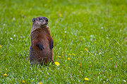
While loss of habitat has affected native animals such as the pine marten
American Marten
The American marten is a North American member of the family Mustelidae, sometimes referred to as the pine marten. The name "pine marten" is derived from the common but distinct Eurasian species of Martes...
, elk
Elk
The Elk is the large deer, also called Cervus canadensis or wapiti, of North America and eastern Asia.Elk may also refer to:Other antlered mammals:...
, and bison
American Bison
The American bison , also commonly known as the American buffalo, is a North American species of bison that once roamed the grasslands of North America in massive herds...
, whitetail deer and bobcat
Bobcat
The bobcat is a North American mammal of the cat family Felidae, appearing during the Irvingtonian stage of around 1.8 million years ago . With twelve recognized subspecies, it ranges from southern Canada to northern Mexico, including most of the continental United States...
thrive. The state has the nation's largest population of timber wolves outside Alaska, and supports healthy populations of black bear
American black bear
The American black bear is a medium-sized bear native to North America. It is the continent's smallest and most common bear species. Black bears are omnivores, with their diets varying greatly depending on season and location. They typically live in largely forested areas, but do leave forests in...
and moose
Moose
The moose or Eurasian elk is the largest extant species in the deer family. Moose are distinguished by the palmate antlers of the males; other members of the family have antlers with a dendritic configuration...
. Located on the Mississippi Flyway
Mississippi Flyway
The Mississippi Flyway is a bird migration route that generally follows the Mississippi River in the United States and the Mackenzie River in Canada. The main endpoints of the flyway include central Canada and the region surrounding the Gulf of Mexico...
, Minnesota hosts migratory waterfowl such as geese and ducks, and game birds such as grouse
Grouse
Grouse are a group of birds from the order Galliformes. They are sometimes considered a family Tetraonidae, though the American Ornithologists' Union and many others include grouse as a subfamily Tetraoninae in the family Phasianidae...
, pheasants, and turkeys. It is home to birds of prey
Bird of prey
Birds of prey are birds that hunt for food primarily on the wing, using their keen senses, especially vision. They are defined as birds that primarily hunt vertebrates, including other birds. Their talons and beaks tend to be relatively large, powerful and adapted for tearing and/or piercing flesh....
including the bald eagle
Bald Eagle
The Bald Eagle is a bird of prey found in North America. It is the national bird and symbol of the United States of America. This sea eagle has two known sub-species and forms a species pair with the White-tailed Eagle...
, red-tailed hawk
Red-tailed Hawk
The Red-tailed Hawk is a bird of prey, one of three species colloquially known in the United States as the "chickenhawk," though it rarely preys on standard sized chickens. It breeds throughout most of North America, from western Alaska and northern Canada to as far south as Panama and the West...
, and snowy owl
Snowy Owl
The Snowy Owl is a large owl of the typical owl family Strigidae. The Snowy Owl was first classified in 1758 by Carolus Linnaeus, the Swedish naturalist who developed binomial nomenclature to classify and organize plants and animals. The bird is also known in North America as the Arctic Owl, Great...
. The lakes teem with sport fish such as walleye
Walleye
Walleye is a freshwater perciform fish native to most of Canada and to the northern United States. It is a North American close relative of the European pikeperch...
, bass
Bass (fish)
Bass is a name shared by many different species of popular gamefish. The term encompasses both freshwater and marine species. All belong to the large order Perciformes, or perch-like fishes, and in fact the word bass comes from Middle English bars, meaning "perch."-Types of basses:*The temperate...
, muskellunge
Muskellunge
A muskellunge , also known as a muskelunge, muscallonge, milliganong, or maskinonge , is a large, relatively uncommon freshwater fish of North America. Muskellunge are the largest member of the pike family, Esocidae...
, and northern pike
Northern Pike
The northern pike , is a species of carnivorous fish of the genus Esox...
, and streams in the southeast are populated by brook
Brook trout
The brook trout, Salvelinus fontinalis, is a species of fish in the salmon family of order Salmoniformes. In many parts of its range, it is known as the speckled trout or squaretail. A potamodromous population in Lake Superior are known as coaster trout or, simply, as coasters...
, brown
Brown trout
The brown trout and the sea trout are fish of the same species....
, and rainbow trout
Rainbow trout
The rainbow trout is a species of salmonid native to tributaries of the Pacific Ocean in Asia and North America. The steelhead is a sea run rainbow trout usually returning to freshwater to spawn after 2 to 3 years at sea. In other words, rainbow trout and steelhead trout are the same species....
.
Climate
Minnesota endures temperature extremes characteristic of its continental climateContinental climate
Continental climate is a climate characterized by important annual variation in temperature due to the lack of significant bodies of water nearby...
; with cold winters and hot summers, the record high and low span 174 degrees Fahrenheit (96.6 °C). Meteorological events include rain, snow, hail
Hail
Hail is a form of solid precipitation. It consists of balls or irregular lumps of ice, each of which is referred to as a hail stone. Hail stones on Earth consist mostly of water ice and measure between and in diameter, with the larger stones coming from severe thunderstorms...
, blizzards, polar front
Polar front
In meteorology, the polar front is the boundary between the polar cell and the Ferrel cell in each hemisphere. At this boundary a sharp gradient in temperature occurs between these two air masses, each at very different temperatures....
s, tornadoes, thunderstorms, and high-velocity straight-line winds
Downburst
A downburst is created by an area of significantly rain-cooled air that, after reaching ground level, spreads out in all directions producing strong winds. Unlike winds in a tornado, winds in a downburst are directed outwards from the point where it hits land or water...
. The growing season varies from 90 days per year in the Iron Range
Iron Range
The Iron Range is a region that makes up the northeastern section of Minnesota in the United States. "The Range", as it is known by locals, is a region with multiple distinct bands of iron ore...
to 160 days in southeast Minnesota near the Mississippi River, and mean average temperatures range from 36 °F (2 °C) to 49 °F (9 °C). Average summer dewpoints range from about 58 °F (14.4 °C) in the south to about 48 °F (8.9 °C) in the north. Depending on location, average annual precipitation ranges from 19 in (48.3 cm) to 35 in (88.9 cm), and droughts occur every 10 to 50 years.
Protected lands
Itasca State Park
Itasca State Park is a state park of Minnesota, United States, and contains the headwaters of the Mississippi River. The park spans of northern Minnesota, and is located about north of Park Rapids, Minnesota and from Bagley, Minnesota...
, was established in 1891, and is the source
Source (river or stream)
The source or headwaters of a river or stream is the place from which the water in the river or stream originates.-Definition:There is no universally agreed upon definition for determining a stream's source...
of the Mississippi River. Today Minnesota has 72 state parks and recreation areas, 58 state forests covering about four million acres (16,000 km²), and numerous state wildlife preserves, all managed by the Minnesota Department of Natural Resources
Minnesota Department of Natural Resources
The Minnesota Department of Natural Resources is the agency of the U.S. state of Minnesota charged with conserving and managing the state's natural resources. The agency maintains areas such as state parks, state forests, recreational trails, and recreation areas as well as managing minerals,...
. There are 5.5 million acres (22,000 km²) in the Chippewa
Chippewa National Forest
Chippewa National Forest is a National Forest located in northcentral Minnesota, United States, in the counties of Itasca, Cass, and Beltrami. Forest headquarters are located in Cass Lake, Minnesota. There are local ranger district offices in Blackduck, Deer River, and Walker.-History and...
and Superior National Forest
Superior National Forest
Superior National Forest, part of the United States National Forest system, is located in the Arrowhead Region of the state of Minnesota between the Canada – United States border and the north shore of Lake Superior...
s. The Superior National Forest in the northeast contains the Boundary Waters Canoe Area Wilderness
Boundary Waters Canoe Area Wilderness
The Boundary Waters Canoe Area Wilderness , is a wilderness area within the Superior National Forest in northeastern Minnesota under the administration of the U.S. Forest Service...
, which encompasses over a million acres (4,000 km²) and a thousand lakes. To its west is Voyageurs National Park
Voyageurs National Park
Voyageurs National Park is a United States National Park in northern Minnesota near the town of International Falls. It was established in 1975. The park's name commemorates the voyageurs, French-Canadian fur traders who were the first European settlers to frequently travel through the area...
, the state's only national park.
Regions
The US state of MinnesotaMinnesota
Minnesota is a U.S. state located in the Midwestern United States. The twelfth largest state of the U.S., it is the twenty-first most populous, with 5.3 million residents. Minnesota was carved out of the eastern half of the Minnesota Territory and admitted to the Union as the thirty-second state...
can be divided into regions in a variety of ways.
On a basic level, the state is divided between the Minneapolis-Saint Paul or Twin Cities metropolitan area (often referred to locally as The Cities), and Outstate or Greater Minnesota.
The Minneapolis-St. Paul metropolitan area now comprises eleven Minnesota counties centered around Minneapolis, the state's largest city, and adjoining Saint Paul
Saint Paul, Minnesota
Saint Paul is the capital and second-most populous city of the U.S. state of Minnesota. The city lies mostly on the east bank of the Mississippi River in the area surrounding its point of confluence with the Minnesota River, and adjoins Minneapolis, the state's largest city...
, the capital; plus two Wisconsin
Wisconsin
Wisconsin is a U.S. state located in the north-central United States and is part of the Midwest. It is bordered by Minnesota to the west, Iowa to the southwest, Illinois to the south, Lake Michigan to the east, Michigan to the northeast, and Lake Superior to the north. Wisconsin's capital is...
counties. About three out of every five residents (~60%) of the state live in this conurbation
Conurbation
A conurbation is a region comprising a number of cities, large towns, and other urban areas that, through population growth and physical expansion, have merged to form one continuous urban and industrially developed area...
.
Greater Minnesota is less urbanized than the Twin Cities. It is also geographically more diverse, with farmlands to the south and west, lake country in central Minnesota
Central Minnesota
Central Minnesota is the name of the region consisting of the central portion of the state of Minnesota. Although no specific boundaries of the region exist, most definitions of what makes up the region would generally consist of the vast swath of land north of Interstate 94, east of U.S. Highway...
, and forests in the northern part of the state. Approximately two out of five Minnesotans live in Greater Minnesota. Its major population centers include Duluth
Duluth, Minnesota
Duluth is a port city in the U.S. state of Minnesota and is the county seat of Saint Louis County. The fourth largest city in Minnesota, Duluth had a total population of 86,265 in the 2010 census. Duluth is also the second largest city that is located on Lake Superior after Thunder Bay, Ontario,...
, Rochester
Rochester, Minnesota
Rochester is a city in the U.S. state of Minnesota and is the county seat of Olmsted County. Located on both banks of the Zumbro River, The city has a population of 106,769 according to the 2010 United States Census, making it Minnesota's third-largest city and the largest outside of the...
, Moorhead
Moorhead, Minnesota
Moorhead is a city in Clay County, Minnesota, United States, and the largest city in northwest Minnesota. The population was 38,065 at the 2010 Census. It is the county seat of Clay County....
, St. Cloud
St. Cloud, Minnesota
St. Cloud is a city in the U.S. state of Minnesota and the largest population center in the state's central region. The population was 65,842 at the 2010 census. It is the county seat of Stearns County...
, Mankato
Mankato, Minnesota
Mankato is a city in Blue Earth, Nicollet, and Le Sueur counties in the U.S. state of Minnesota. The population was 39,309 at the 2010 census, making it the fourth largest city in Minnesota outside of the Minneapolis-St. Paul metropolitan area. The county seat of Blue Earth County, it is located...
, and Winona
Winona, Minnesota
Winona is a city in and the county seat of Winona County, in the U.S. State of Minnesota. Located in picturesque bluff country on the Mississippi River, its most noticeable physical landmark is Sugar Loaf....
.
- Politically, Minnesota contains eight congressional districtsMinnesota Congressional DistrictsMinnesota currently has eight congressional districts. There were 9th and 10th districts but they were eliminated in 1963 and 1933 respectively...
. - ClimatologicallyClimate of MinnesotaThe climate of Minnesota is typical of a continental climate, with cold winters and hot summers. Minnesota's location in the Upper Midwest allows it to experience some of the widest variety of weather in the United States, with each of the four seasons having its own distinct characteristics...
, the state varies considerably from the far north, near Canada and Lake SuperiorLake SuperiorLake Superior is the largest of the five traditionally-demarcated Great Lakes of North America. It is bounded to the north by the Canadian province of Ontario and the U.S. state of Minnesota, and to the south by the U.S. states of Wisconsin and Michigan. It is the largest freshwater lake in the...
to the south, where fertile farmAgricultureAgriculture is the cultivation of animals, plants, fungi and other life forms for food, fiber, and other products used to sustain life. Agriculture was the key implement in the rise of sedentary human civilization, whereby farming of domesticated species created food surpluses that nurtured the...
land borders IowaIowaIowa is a state located in the Midwestern United States, an area often referred to as the "American Heartland". It derives its name from the Ioway people, one of the many American Indian tribes that occupied the state at the time of European exploration. Iowa was a part of the French colony of New...
, South DakotaSouth DakotaSouth Dakota is a state located in the Midwestern region of the United States. It is named after the Lakota and Dakota Sioux American Indian tribes. Once a part of Dakota Territory, South Dakota became a state on November 2, 1889. The state has an area of and an estimated population of just over...
, and WisconsinWisconsinWisconsin is a U.S. state located in the north-central United States and is part of the Midwest. It is bordered by Minnesota to the west, Iowa to the southwest, Illinois to the south, Lake Michigan to the east, Michigan to the northeast, and Lake Superior to the north. Wisconsin's capital is...
. - Demographically, population density varies from less than 4 persons per square mile in the least developed areas to nearly 7,000 persons per square mile in Minneapolis.
- Geologically, variations exist due to ice cover during the last Ice Age.
- Culturally and economically, areas of the state vary with respect to industry, predominate professions, and urbanization.
The regions discussed here have combined elements from several of these various criteria to divide the state into areas recognized by the typical Minnesotan. Disagreements concerning the exact boundaries are to be expected, however the exact boundary definitions are not necessary to adequately define the state's regions.
- The Northwest AngleNorthwest AngleThe Northwest Angle, known simply as the Angle by locals, and coextensive with Angle Township, is a part of northern Lake of the Woods County, Minnesota, and is the only place in the United States outside Alaska that is north of the 49th parallel...
is that land of Minnesota north of the 49th parallel LatitudeLatitudeIn geography, the latitude of a location on the Earth is the angular distance of that location south or north of the Equator. The latitude is an angle, and is usually measured in degrees . The equator has a latitude of 0°, the North pole has a latitude of 90° north , and the South pole has a...
line. - The Arrowhead RegionArrowhead RegionThe Arrowhead Region is located in the northeastern part of the U.S. state of Minnesota, so called because of its pointed shape. The predominantly rural region encompasses of land area and comprises Carlton, Cook, Lake and St. Louis Counties. Its population at the 2000 census was 248,425 residents...
is the northeastern part of Minnesota. It includes two of the three iron ranges in Minnesota. Collectively the Mesabi and Vermillion iron ranges are called the Iron RangeIron RangeThe Iron Range is a region that makes up the northeastern section of Minnesota in the United States. "The Range", as it is known by locals, is a region with multiple distinct bands of iron ore...
. These parts of the Arrowhead are dotted with iron mines. The Arrowhead region also includes the North ShoreNorth Shore (Lake Superior)The North Shore of Lake Superior runs from Duluth, Minnesota, United States, at the southwestern end of the lake, to Thunder Bay and Nipigon, Ontario, Canada, in the north to Sault Ste. Marie, Ontario, in the east...
and the Boundary WatersBoundary WatersThe Boundary Waters — also called the Quetico-Superior country — is a region of wilderness straddling the Canada–United States border between Ontario and Minnesota, in the region just west of Lake Superior. This region is part of the Superior National Forest in northeastern Minnesota, and in Canada...
. - The Twin Cities Metropolitan area includes 13 counties, two of which are in Wisconsin. It is a socio-economic area driven by the twin citiesTwin citiesTwin cities are a special case of two cities or urban centres which are founded in close geographic proximity and then grow into each other over time...
of Minneapolis and the state capital, Saint PaulSaint Paul, MinnesotaSaint Paul is the capital and second-most populous city of the U.S. state of Minnesota. The city lies mostly on the east bank of the Mississippi River in the area surrounding its point of confluence with the Minnesota River, and adjoins Minneapolis, the state's largest city...
. - Although no legal boundaries of the region exist, most definitions of what makes up Central MinnesotaCentral MinnesotaCentral Minnesota is the name of the region consisting of the central portion of the state of Minnesota. Although no specific boundaries of the region exist, most definitions of what makes up the region would generally consist of the vast swath of land north of Interstate 94, east of U.S. Highway...
would include the parts of the state within the economic influence of St. Cloud and Brainerd. - Southeastern Minnesota includes the scenic Mississippi ValleyMississippi RiverThe Mississippi River is the largest river system in North America. Flowing entirely in the United States, this river rises in western Minnesota and meanders slowly southwards for to the Mississippi River Delta at the Gulf of Mexico. With its many tributaries, the Mississippi's watershed drains...
to the Whitewater River and Root River in the Coulee Region, also known as the Driftless Area. - Southwestern Minnesota includes the Buffalo RidgeBuffalo RidgeBuffalo Ridge is a large expanse of rolling hills in the southeastern part of the larger Coteau des Prairies. It stands 1,995 feet above sea level. The Buffalo Ridge is sixty miles long and runs through Lincoln County, Pipestone County, Murray County, and Nobles County in the southwest...
, which is the eastern portion of the Coteau des PrairiesCoteau des PrairiesThe Coteau des Prairies is a plateau approximately 200 miles in length and 100 miles in width , rising from the prairie flatlands in eastern South Dakota, southwestern Minnesota, and northwestern Iowa in the United States...
, a geological formation characterized by higher elevation and high average wind speed, providing opportunities for commercially viable wind powerWind powerWind power is the conversion of wind energy into a useful form of energy, such as using wind turbines to make electricity, windmills for mechanical power, windpumps for water pumping or drainage, or sails to propel ships....
. The area also includes the Pipestone RegionPipestone RegionThe Pipestone Region is an area in southwestern Minnesota. The area was named for its supply of pipestone a type of limestone which local Indians carved into pipes. The area is also noted for quartzite quarries. The area is one of several distinct regions of Minnesota.The Dakota were early...
. - The Red River ValleyRed River ValleyThe Red River Valley is a region in central North America that is drained by the Red River of the North. It is significant in the geography of North Dakota, Minnesota, and Manitoba for its relatively fertile lands and the population centers of Fargo, Moorhead, Grand Forks, and Winnipeg...
is a term the U.S. government uses to generally describe the sections of northeastern North Dakota and northwestern Minnesota to which the U.S. secured title following the Anglo-American Convention of 1818. Popularly, it is used to refer to most of the territory in the northwestern part of the state. Specifically, the area in the Fargo-Grand Forks media market is called the Red River Valley by media outlets (referring to both the Dakota and Minnesota parts). - The Minnesota River ValleyMinnesota RiverThe Minnesota River is a tributary of the Mississippi River, approximately 332 miles long, in the U.S. state of Minnesota. It drains a watershed of nearly , in Minnesota and about in South Dakota and Iowa....
follows the state's namesake, a fertile agricultural area, running from the South DakotaSouth DakotaSouth Dakota is a state located in the Midwestern region of the United States. It is named after the Lakota and Dakota Sioux American Indian tribes. Once a part of Dakota Territory, South Dakota became a state on November 2, 1889. The state has an area of and an estimated population of just over...
border to its junction with the Mississippi River in St. Paul. - "Northern Minnesota" is a broader title that includes several regions, and can be defined as any area within the 218 telephone area code.
- "East Central Minnesota" comprises the counties of PinePine County, MinnesotaAs of the census of 2000, there were 26,530 people, 9,939 households, and 6,917 families residing in the county. The population density was 19 people per square mile . There were 15,353 housing units at an average density of 11 per square mile...
, IsantiIsanti County, MinnesotaAs of the census of 2010, there were 37,816 people, 14,331 households, and 8,415 families residing in the county. The population density was 71 people per square mile . There were 12,062 housing units at an average density of 28 per square mile...
, Chisago, Kanabec and Mille LacsMille Lacs County, MinnesotaAs of the census of 2000, there were 22,330 people, 8,638 households, and 6,003 families residing in the county. The population density was 39 people per square mile . There were 10,467 housing units at an average density of 18 per square mile...
(and sometimes Aitkin CountyAitkin County, MinnesotaAitkin County is a county located in the U.S. state of Minnesota. As of 2010, the population is 16,202. Its county seat is Aitkin. A portion of the Mille Lacs Indian Reservation is in the county.-History:...
). The regional centers of East Central Minnesota are CambridgeCambridge, MinnesotaAs of the census of 2000, there were 5,520 people, 2,237 households, and 1,353 families residing in the city. The population density was 894.1 people per square mile . There were 2,373 housing units at an average density of 384.4 per square mile...
and Pine CityPine City, MinnesotaPine City is a city in Pine County, Minnesota, United States. The population was 3,123 at the 2010 census. Pine City is the county seat of, and the largest city in, Pine County...
. - "South Central Minnesota" refers to a group of fewer than a dozen counties loosely centered on the city of Mankato.