
Geography of Albania
Encyclopedia
| Continent Continent A continent is one of several very large landmasses on Earth. They are generally identified by convention rather than any strict criteria, with seven regions commonly regarded as continents—they are : Asia, Africa, North America, South America, Antarctica, Europe, and Australia.Plate tectonics is... |
Europe Europe Europe is, by convention, one of the world's seven continents. Comprising the westernmost peninsula of Eurasia, Europe is generally 'divided' from Asia to its east by the watershed divides of the Ural and Caucasus Mountains, the Ural River, the Caspian and Black Seas, and the waterways connecting... |
| Subregion Subregion A subregion is a conceptual unit which derives from a larger region or continent and is usually based on location. Cardinal directions, such as south or southern, are commonly used to define a subregion.- United Nations subregions :... |
Southeast Europe Southeast Europe Southeast Europe or Southeastern Europe is a relatively recent political designation for the states of the Balkans. Writers such as Maria Todorova and Vesna Goldsworthy have suggested the use of the term Southeastern Europe to replace the word Balkans for the region, to minimize potential... |
| Geographic coordinates | 41°00′N 20°00′E |
| Area Area Area is a quantity that expresses the extent of a two-dimensional surface or shape in the plane. Area can be understood as the amount of material with a given thickness that would be necessary to fashion a model of the shape, or the amount of paint necessary to cover the surface with a single coat... - Total - Water |
Ranked 143rd 28,748 km² 1,350- km² (2.30%) |
| Coastline | 487 km |
| Land boundaries | 720 km |
| Countries bordered |
|-
| Maritime claims || 12 nmi (22.2 km; 13.8 mi)
|-
| Highest point || Mount Korab
Mount Korab
Mount Korab is the highest mountain of the Republic of Macedonia and Albania, its peak forming a frontier between the two countries...
, 2,754 m
|-
| Lowest point || Adriatic Sea
Adriatic Sea
The Adriatic Sea is a body of water separating the Italian Peninsula from the Balkan peninsula, and the system of the Apennine Mountains from that of the Dinaric Alps and adjacent ranges...
, 0 m
|-
| Longest river || Drin River
Drin River
The Drin is the longest river in Albania with a total length of . It has two distributaries, one going directly into the Adriatic Sea, the other one into the Bojana River .- Origin :...
, 335 km
|-
| Largest inland body of water || Lake Shkodër 530 km²
|-
| Land Use
- Arable land
- Permanent
crops
- Other ||
20.1 %
4.21 %
75.69 % (2005 est.)
|-
| Irrigated Land || 3,530 km²
|-
| Climate
Climate
Climate encompasses the statistics of temperature, humidity, atmospheric pressure, wind, rainfall, atmospheric particle count and other meteorological elemental measurements in a given region over long periods...
: || Mild temperate to cool
|-
| Terrain
Terrain
Terrain, or land relief, is the vertical and horizontal dimension of land surface. When relief is described underwater, the term bathymetry is used...
: || Mountains, hills, small plain
Plain
In geography, a plain is land with relatively low relief, that is flat or gently rolling. Prairies and steppes are types of plains, and the archetype for a plain is often thought of as a grassland, but plains in their natural state may also be covered in shrublands, woodland and forest, or...
s
|-
| Natural resources || petroleum
Petroleum
Petroleum or crude oil is a naturally occurring, flammable liquid consisting of a complex mixture of hydrocarbons of various molecular weights and other liquid organic compounds, that are found in geologic formations beneath the Earth's surface. Petroleum is recovered mostly through oil drilling...
, natural gas
Natural gas
Natural gas is a naturally occurring gas mixture consisting primarily of methane, typically with 0–20% higher hydrocarbons . It is found associated with other hydrocarbon fuel, in coal beds, as methane clathrates, and is an important fuel source and a major feedstock for fertilizers.Most natural...
, bauxite
Bauxite
Bauxite is an aluminium ore and is the main source of aluminium. This form of rock consists mostly of the minerals gibbsite Al3, boehmite γ-AlO, and diaspore α-AlO, in a mixture with the two iron oxides goethite and hematite, the clay mineral kaolinite, and small amounts of anatase TiO2...
, chromite
Chromite
Chromite is an iron chromium oxide: FeCr2O4. It is an oxide mineral belonging to the spinel group. Magnesium can substitute for iron in variable amounts as it forms a solid solution with magnesiochromite ; substitution of aluminium occurs leading to hercynite .-Occurrence:Chromite is found in...
, copper
Copper
Copper is a chemical element with the symbol Cu and atomic number 29. It is a ductile metal with very high thermal and electrical conductivity. Pure copper is soft and malleable; an exposed surface has a reddish-orange tarnish...
, iron ore, nickel
Nickel
Nickel is a chemical element with the chemical symbol Ni and atomic number 28. It is a silvery-white lustrous metal with a slight golden tinge. Nickel belongs to the transition metals and is hard and ductile...
, salt
Salt
In chemistry, salts are ionic compounds that result from the neutralization reaction of an acid and a base. They are composed of cations and anions so that the product is electrically neutral...
, timber
Timber
Timber may refer to:* Timber, a term common in the United Kingdom and Australia for wood materials * Timber, Oregon, an unincorporated community in the U.S...
, hydropower
Hydropower
Hydropower, hydraulic power, hydrokinetic power or water power is power that is derived from the force or energy of falling water, which may be harnessed for useful purposes. Since ancient times, hydropower has been used for irrigation and the operation of various mechanical devices, such as...
|-
| Natural hazards || earthquake
Earthquake
An earthquake is the result of a sudden release of energy in the Earth's crust that creates seismic waves. The seismicity, seismism or seismic activity of an area refers to the frequency, type and size of earthquakes experienced over a period of time...
s, tsunami
Tsunami
A tsunami is a series of water waves caused by the displacement of a large volume of a body of water, typically an ocean or a large lake...
s, flood
Flood
A flood is an overflow of an expanse of water that submerges land. The EU Floods directive defines a flood as a temporary covering by water of land not normally covered by water...
s, drought
Drought
A drought is an extended period of months or years when a region notes a deficiency in its water supply. Generally, this occurs when a region receives consistently below average precipitation. It can have a substantial impact on the ecosystem and agriculture of the affected region...
|-
| Environmental issues || deforestation
Deforestation
Deforestation is the removal of a forest or stand of trees where the land is thereafter converted to a nonforest use. Examples of deforestation include conversion of forestland to farms, ranches, or urban use....
, soil erosion, water pollution
Water pollution
Water pollution is the contamination of water bodies . Water pollution occurs when pollutants are discharged directly or indirectly into water bodies without adequate treatment to remove harmful compounds....
|}
Albania
Albania
Albania , officially known as the Republic of Albania , is a country in Southeastern Europe, in the Balkans region. It is bordered by Montenegro to the northwest, Kosovo to the northeast, the Republic of Macedonia to the east and Greece to the south and southeast. It has a coast on the Adriatic Sea...
has a total area of 28748 km² (11,100 sq mi). It shares a 172 km (107 mi) border with Montenegro
Montenegro
Montenegro Montenegrin: Crna Gora Црна Гора , meaning "Black Mountain") is a country located in Southeastern Europe. It has a coast on the Adriatic Sea to the south-west and is bordered by Croatia to the west, Bosnia and Herzegovina to the northwest, Serbia to the northeast and Albania to the...
to the northwest, a 115 km (71 mi) border with Kosovo
Kosovo
Kosovo is a region in southeastern Europe. Part of the Ottoman Empire for more than five centuries, later the Autonomous Province of Kosovo and Metohija within Serbia...
to the northeast, a 151 km (94 mi) border with Macedonia
Republic of Macedonia
Macedonia , officially the Republic of Macedonia , is a country located in the central Balkan peninsula in Southeast Europe. It is one of the successor states of the former Yugoslavia, from which it declared independence in 1991...
to the north and east, and a 282 km (175 mi) border with Greece
Greece
Greece , officially the Hellenic Republic , and historically Hellas or the Republic of Greece in English, is a country in southeastern Europe....
to the south and southeast. Its coastline is 487 km (303 mi) long. The lowlands of the west face the Adriatic Sea
Adriatic Sea
The Adriatic Sea is a body of water separating the Italian Peninsula from the Balkan peninsula, and the system of the Apennine Mountains from that of the Dinaric Alps and adjacent ranges...
and the strategically important Strait of Otranto
Strait of Otranto
The Strait of Otranto connects the Adriatic Sea with the Ionian Sea and separates Italy from Albania. Its width at Punta Palascìa, east of Salento is less than . The strait is named after the Italian city of Otranto.- History :...
, which puts less than 100 km (62 mi) of water between Albania and the heel of the Italian "boot" (links Adriatic Sea to Ionian Sea
Ionian Sea
The Ionian Sea , is an arm of the Mediterranean Sea, south of the Adriatic Sea. It is bounded by southern Italy including Calabria, Sicily and the Salento peninsula to the west, southern Albania to the north, and a large number of Greek islands, including Corfu, Zante, Kephalonia, Ithaka, and...
and Mediterranean Sea
Mediterranean Sea
The Mediterranean Sea is a sea connected to the Atlantic Ocean surrounded by the Mediterranean region and almost completely enclosed by land: on the north by Anatolia and Europe, on the south by North Africa, and on the east by the Levant...
).
Albania has coastline on the Adriatic Sea and the Ionian Sea
Ionian Sea
The Ionian Sea , is an arm of the Mediterranean Sea, south of the Adriatic Sea. It is bounded by southern Italy including Calabria, Sicily and the Salento peninsula to the west, southern Albania to the north, and a large number of Greek islands, including Corfu, Zante, Kephalonia, Ithaka, and...
.
Borders

London
London is the capital city of :England and the :United Kingdom, the largest metropolitan area in the United Kingdom, and the largest urban zone in the European Union by most measures. Located on the River Thames, London has been a major settlement for two millennia, its history going back to its...
. The country was occupied by Italian
Italy
Italy , officially the Italian Republic languages]] under the European Charter for Regional or Minority Languages. In each of these, Italy's official name is as follows:;;;;;;;;), is a unitary parliamentary republic in South-Central Europe. To the north it borders France, Switzerland, Austria and...
, Serbia
Serbia
Serbia , officially the Republic of Serbia , is a landlocked country located at the crossroads of Central and Southeast Europe, covering the southern part of the Carpathian basin and the central part of the Balkans...
n, Bulgarian
Bulgarian occupation of Albania
Bulgarian occupation of Albania refers to the occupation of Albania by the Kingdom of Bulgaria's army during World War I. It lasted between December 10, 1915, when Bulgarian army crossed the Drin river and entered the Albania, and lasted until September 9, 1917, when French troops captured...
, Austrohungarian
Austro-Hungarian Army
The Austro-Hungarian Army was the ground force of the Austro-Hungarian Dual Monarchy from 1867 to 1918. It was composed of three parts: the joint army , the Austrian Landwehr , and the Hungarian Honvédség .In the wake of fighting between the...
, Greek, and French
France
The French Republic , The French Republic , The French Republic , (commonly known as France , is a unitary semi-presidential republic in Western Europe with several overseas territories and islands located on other continents and in the Indian, Pacific, and Atlantic oceans. Metropolitan France...
forces during World War I
World War I
World War I , which was predominantly called the World War or the Great War from its occurrence until 1939, and the First World War or World War I thereafter, was a major war centred in Europe that began on 28 July 1914 and lasted until 11 November 1918...
, but the 1913 boundaries were essentially reaffirmed by the victorious states in 1921. The original principle was to define the borders in accordance with the best interests of the Albanian people and the nationalities in adjacent areas. The northern and eastern borders were intended, insofar as possible, to separate the Albanians from the Serbs and Montenegrins; the southeast border was to separate Albanians and Greeks; the valuable western Macedonia lake district was to be divided among the three states—Albania, Greece, and Yugoslavia
Kingdom of Yugoslavia
The Kingdom of Yugoslavia was a state stretching from the Western Balkans to Central Europe which existed during the often-tumultuous interwar era of 1918–1941...
--whose populations shared the area. When there was no compromise involving other factors, borderlines were chosen to make the best possible separation of national groups, connecting the best marked physical features available.
Allowance was made for local economic situations, for example, to prevent separation of a village from its animals' grazing areas or the markets for its produce. Political pressures also were a factor in the negotiations, but the outcome was subject to approval by powers having relatively abstract interests, most of which involved the balance of power rather than specific economic ambitions.
Division of the lake district among three states required that each of them have a share of the lowlands in the vicinity. Such an artificial distribution, once made, necessarily affected the borderlines to the north and south. The border that runs generally north from the lakes, although it follows the ridges of the eastern highlands, stays sixteen to thirty-two kilometers west of the watershed divide
Water divide
A drainage divide, water divide, divide or watershed is the line separating neighbouring drainage basins...
. Because negotiators at the London conference declined to use the watershed divide as the northeast boundary of the new state of Albania, the Albanian population of Kosovo
Kosovo
Kosovo is a region in southeastern Europe. Part of the Ottoman Empire for more than five centuries, later the Autonomous Province of Kosovo and Metohija within Serbia...
was incorporated into Serbia
Serbia
Serbia , officially the Republic of Serbia , is a landlocked country located at the crossroads of Central and Southeast Europe, covering the southern part of the Carpathian basin and the central part of the Balkans...
.
In Albania's far north and the northeast mountainous sections, the border connects high points and follows mountain ridges through the largely inaccessible Prokletije
Prokletije
Prokletije or Albanian Alps is a mountain range in the Balkans that extends from northern Albania, to southwestern Serbia and eastern Montenegro. Its highest point, Jezercë in Albania at , is the tallest peak in the entire Dinaric Alps...
, and further south Bjeshkët e Namuna (The Accursed Mountains). For the most part, there is no natural boundary from the highlands to the Adriatic, although Lake Shkodër and a portion of the Buna River
Buna River
Buna River may refer to:* Buna River in Bosnia and Herzegovina, left tributary of the Neretva* Bojana River in Albania and Montenegro, Buna in Albanian, which flows from Lake Shkodra into the Adriatic....
south of it were used to mark Albania's northwest border. From the lake district south and southwest to the Ionian Sea, the country's southeast border goes against the grain of the land, crossing a number of ridges instead of following them.
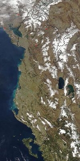
There are four main geographical regions in Albania: the Northern Mountain Range
Northern Mountain Range
The Northern Mountain Range , is the geographical region of northern Albania defined by high mountains and few valleys among them. It is one of the four geographical areas of Albania, the other being the Southern Mountain Range, the Western Lowlands , and the Central Mountain Range, Albania ....
(the Albanian part of the Prokletije
Prokletije
Prokletije or Albanian Alps is a mountain range in the Balkans that extends from northern Albania, to southwestern Serbia and eastern Montenegro. Its highest point, Jezercë in Albania at , is the tallest peak in the entire Dinaric Alps...
), the Southern Mountain Range, the Western Lowlands
Western Lowlands
The Western Lowlands is the geographical region of western Albania defined by plains and low lands. It is one of the four geographical areas of Albania, the other being the Southern Mountain Range, Northern Mountain Ranges , and the Central Mountain Range, Albania .The largest plain in the...
, and the Central Mountain Range
Central Mountain Range, Albania
The Central Mountain Range is the geographical region of central and eastern Albania defined by high mountains. It is one of the four geographical areas of Albania, the other being the Southern Mountain Range the Western Lowlands , and the Northern Mountain Range ....
.
Climate
See also Climate of AlbaniaWith its coastline facing the Adriatic and Ionian seas, its highlands backed upon the elevated Balkan landmass, and the entire country lying at a latitude subject to a variety of weather patterns during the winter and summer seasons, Albania has a high number of climatic regions for so small an area. The coastal lowlands have typically Mediterranean weather; the highlands have a Mediterranean continental climate. In both the lowlands and the interior, the weather varies markedly from north to south.

Inland temperatures are affected more by differences in elevation than by latitude or any other factor. Low winter temperatures in the mountains are caused by the continental air mass that dominates the weather in Eastern Europe
Eastern Europe
Eastern Europe is the eastern part of Europe. The term has widely disparate geopolitical, geographical, cultural and socioeconomic readings, which makes it highly context-dependent and even volatile, and there are "almost as many definitions of Eastern Europe as there are scholars of the region"...
and the Balkans. Northerly and northeasterly winds blow much of the time. Average summer temperatures are lower than in the coastal areas and much lower at higher elevations, but daily fluctuations are greater. Daytime maximum temperatures in the interior basins and river valley
River Valley
River Valley is the name of an urban planning area within the Central Area, Singapore's central business district.The River Valley Planning Area is defined by the region bounded by Orchard Boulevard, Devonshire Road and Eber Road to the north, Oxley Rise and Mohamed Sultan Road to the east, Martin...
s are very high, but the nights are almost always cool.
Average precipitation
Precipitation (meteorology)
In meteorology, precipitation In meteorology, precipitation In meteorology, precipitation (also known as one of the classes of hydrometeors, which are atmospheric water phenomena is any product of the condensation of atmospheric water vapor that falls under gravity. The main forms of precipitation...
is heavy, a result of the convergence of the prevailing airflow from the Mediterranean Sea
Mediterranean Sea
The Mediterranean Sea is a sea connected to the Atlantic Ocean surrounded by the Mediterranean region and almost completely enclosed by land: on the north by Anatolia and Europe, on the south by North Africa, and on the east by the Levant...
and the continental air mass. Because they usually meet at the point where the terrain rises, the heaviest rain falls in the central uplands. Vertical currents initiated when the Mediterranean air is uplifted also cause frequent thunderstorms. Many of these storms are accompanied by high local winds and torrential downpours.
When the continental air mass is weak, Mediterranean winds drop their moisture farther inland. When there is a dominant continental air mass, cold air spills onto the lowland areas, which occurs most frequently in the winter. Because the season's lower temperatures damage olive trees and citrus fruits, groves and orchards are restricted to sheltered places with southern and western exposures, even in areas with high average winter temperatures.
Lowland rainfall averages from 1000 millimetres (39.37 in) to more than 1500 millimetres (59.06 in) annually, with the higher levels in the north. Nearly 95% of the rain falls in the winter.
Rainfall in the upland mountain ranges is heavier. Adequate records are not available, and estimates vary widely, but annual averages are probably about 1800 millimetres (70.87 in) and are as high as 2550 millimetres (100.39 in) in some northern areas. The seasonal variation is not quite as great in the coastal area.
The higher inland mountains receive less precipitation than the intermediate uplands. Terrain differences cause wide local variations, but the seasonal distribution is the most consistent of any area.
| Jan | Feb | Mar | Apr | May | Jun | Jul | Aug | Sep | Oct | Nov | Dec | ||||||||
| Avg low (°C/°F) |
2 °C (35.6 °F) | 2 °C (35.6 °F) | 5 °C (41 °F) | 8 °C (46.4 °F) | 12 °C (53.6 °F) | 16 °C (60.8 °F) | 17 °C (62.6 °F) | 17 °C (62.6 °F) | 14 °C (57.2 °F) | 10 °C (50 °F) | 8 °C (46.4 °F) | 5 °C (41 °F) | |||||||
| Avg high (°C/°F) |
12 °C (53.6 °F) | 12 °C (53.6 °F) | 15 °C (59 °F) | 18 °C (64.4 °F) | 23 °C (73.4 °F) | 28 °C (82.4 °F) | 31 °C (87.8 °F) | 31 °C (87.8 °F) | 27 °C (80.6 °F) | 23 °C (73.4 °F) | 17 °C (62.6 °F) | 14 °C (57.2 °F) | |||||||
| Humidity in % | 71 | 69 | 68 | 69 | 70 | 62 | 57 | 57 | 64 | 67 | 75 | 73 | |||||||
| Sunshine (h/day) | 4 | 4 | 5 | 7 | 8 | 10 | 12 | 11 | 9 | 7 | 3 | 3 | |||||||
| Precipitation in days | 13 | 13 | 14 | 13 | 12 | 7 | 5 | 4 | 6 | 9 | 16 | 17 | |||||||
| Spring: Climate data | |||||||||||||||||||
Terrain

In the far north, the mountains are an extension of the Dinaric Alps
Dinaric Alps
The Dinaric Alps or Dinarides form a mountain chain in Southern Europe, spanning areas of Slovenia, Croatia, Bosnia and Herzegovina, Serbia, Kosovo, Albania and Montenegro....
and, more specifically, the Montenegrin limestone plateau. Albania's northern mountains are more folded and rugged, however, than most of the plateau. The rivers have deep valleys with steep sides and arable valley floors. Generally unnavigable, the rivers obstruct rather than encourage movement within the alpine region. Roads are few and poor. Lacking internal communications and external contacts, a tribal society flourished in this area for centuries. Only after World War II
World War II
World War II, or the Second World War , was a global conflict lasting from 1939 to 1945, involving most of the world's nations—including all of the great powers—eventually forming two opposing military alliances: the Allies and the Axis...
were serious efforts made to incorporate the people of the region into Albanian national life. A low coastal belt extends from the northern boundary southward to the vicinity of Vlorë
Vlorë
Vlorë is one of the biggest towns and the second largest port city of Albania, after Durrës, with a population of about 94,000 . It is the city where the Albanian Declaration of Independence was proclaimed on November 28, 1912...
. On average, it extends less than sixteen kilometers inland, but widens to about 50 km (31 mi) in the Elbasan
Elbasan
Elbasan is a city in central Albania. It is located on the Shkumbin River in the District of Elbasan and the County of Elbasan, at...
area in central Albania. In its natural state, the coastal belt is characterized by low scrub vegetation, varying from barren to dense. There are large areas of marshlands and other areas of bare, eroded badlands. Where elevations rise slightly and precipitation is regular—in the foothills of the central uplands, for example—the land is highly arable. Marginal land is reclaimed wherever irrigation is possible.
Just east of the lowlands, the central uplands, called Çermenikë
Çermenikë
Çermenikë is an upland in central Albania.-References:...
by Albanians, are an area of generally moderate elevations, between 305 and 915 m (1,000.7 and 3,002 ft), with a few points reaching above 1520 m (4,987 ft). Shifting along the fault that roughly defines the western edge of the central uplands causes frequent, and occasionally severe, earthquake
Earthquake
An earthquake is the result of a sudden release of energy in the Earth's crust that creates seismic waves. The seismicity, seismism or seismic activity of an area refers to the frequency, type and size of earthquakes experienced over a period of time...
s.
Although rugged terrain and points of high elevation mark the central uplands, the first major mountain range inland from the Adriatic is an area of predominantly serpentine rock (which derives its name from its dull green color and often spotted appearance), extending nearly the length of the country, from the Prokletije to the Greek border south of Korçë
Korçë
Korçë is a city in southeastern Albania and the capital of the Korçë District. It has a population of around 105,000 people , making it the sixth largest city in Albania...
. Within this zone, there are many areas in which sharp limestone and sandstone outcroppings predominate, although the ranges as a whole are characterized by rounded mountains.
The mountains east of the serpentine zone are the highest in Albania, exceeding 2754 m (9,035 ft) in the Mount Korab
Mount Korab
Mount Korab is the highest mountain of the Republic of Macedonia and Albania, its peak forming a frontier between the two countries...
(Mali Korabit) range at Korabi's Peak (Maja e Korabit). Together with the Prokletije and the serpentine zone, the eastern highlands are the most rugged and inaccessible of any terrain on the Balkan Peninsula.