

Gatley
Encyclopedia
Gatley is a suburban area of the Metropolitan Borough of Stockport
, in Greater Manchester
, England.
Gatley Carrs was the lower, marshy ground running down to the River Mersey
and West to Northenden
. Before 1700 it was a place for ozier beds which local people had used for basket making or for wattles for cottages or fencing.
In 1800, Mr Worthington of Sharston Hall planted 1000 poplars in Gatley Carrs. In the mid 19th century, Gatley Carrs was described as "a scene of such singular and romantic beauty, and so thoroughly unique in its composition, that we know nothing in the neighbourhood to liken it to".
Over the years Gatley Carrs has shrunk to a fraction of its former size. In the second half of the 18th century, the Carrs was largely enclosed and partially drained to form farmed meadows. The Stockport to Altrincham railway line cut across it in 1864, running East-West. In 1934 house building began on "High Terrace" of the Mersey (the development behind the Horse and Farrier pub, running down to the railway line) and also about that time Cheadle and Gatley
UDC purchased 19 acres (76,890.3 m²) to use as a refuse tip. Tree planting commenced due to complaints of smells and rats. There was loss of original field pattern because of extensive refuse tipping.
Carr woodland was developed on what had been carr meadows. There was a major system of land drains identified on the 1934 map including a sluice and non-return outfall gate to protect Gatley Carr from flooding when the Mersey burst its banks.
In the mid 1960s land restoration took place, although the Carr was only covered with soil to a depth varying between 2 inches (50.8 mm) and 6 inches (152.4 mm). Gatley Carrs then fell to the management of the Mersey Valley Countryside Wardens until it was handed to Stockport MBC in the late 1990s.
People living around Gatley Green were mostly hand loom weavers and became more dependent on textile manufacture. Their cottages had cellars for storage and well-lit upper rooms for the looms.
About 1750, William Roscoe from Bolton
built a factory near Gatley Hall. (This shouldn't be confused in scale with the cotton mills such as those at Styal
: it appears to have been a place for hand weaving and was later converted into a farmhouse, so it was a very modest affair). Up to at least 1841, John Alcock was a textile manufacturer in Gatley, using the Roscoe factory for at least part of the period.
The spread of machinery in industrial manufacturers during the 19th century appears to have killed off industry in Gatley, before which it was a "very busy and important place, as a centre for weaving, spinning, shoemaking and fustian cutting". Handloom weaving may have survived in the area to as late as the 1880s (Melson's Directory of Cheadle, Northenden
and Baguley
, 1887.)
Gatley Hall and Gatley Hill House may both have been built in the mid-eighteenth century by local cotton manufacturers. Gatley Hill House is now council owned (Stockport MBC) and is used by various community groups. The mansion High Grove House was built for a member of a wealthy hatting family of Yorkshire and Manchester.
(1642–51) the Tatton family, along with the local rectors and most tenants, were Royalists. Wythenshawe Hall
was kept in a state of defence from 1642, with Parliamentary forces nearby in Handforth
and Duckinfield. Wythenshawe Hall
was taken by the Parliamentarian forces on 25 February 1644. Three Gatley men were in the garrison defending the hall: Ralphe Savage, Robert Torkinton and John Blomiley.
On 30 November 1745, about 55 Jacobite troops
from Bonnie Prince Charlie
's army crossed Gatley Ford and Gatley Carrs on their way to Cheadle and Stockport
; the bulk of the army crossed the Mersey at Cheadle and Stockport that night and the following day. Having reached Derby
but no further, the Jacobite troops were back in Stockport in the second week of December on their way back north.
Gatley residents joined the Luddite
riots in 1818, but without any great distinction. They drilled in Gatley Carrs before marching to Stockport to take arms from the soldiers, but returned without actually attempting to do so. In the following summer, 1819, soldiers formed square in front of the Horse and Farrier public house
in Gatley with the aim of arresting the Luddite
ringleaders. Several ran away and hid (one, Isaac Legh, in the chimney of Stone Pale House, two others in the Carrs).
The first nonconfirmist minister was the Rev. Jeremiah Pendlebury, succeeded by his assistant, the Rev. Samuel Turner, in 1788. By 1860 the church congregation had fallen to eight people. Improvements made with help from the North Cheshire Rural Mission increased the congregation to 60.
Prior to 1875, Gatley's parish church was the Church of St. Thomas, four miles (6 km) away in Stockport. The people of Gatley rarely saw their parish priest, though they still had to pay their tithes.
The new church, St. James', was built of local handmade bricks and consecrated on Tuesday 6 December 1881. The Rev. Percy M. Herford was the first Vicar of St. James' Church. In 1888 the Rev. P. M. Herford left and was replaced by the Rev. John Bruster, who remained Vicar for 40 years, retiring in 1928.
The vicarage was completed in 1894, following a donation towards it of £100 from Mr W. Heald of Parrswood in 1889. The building is located a short walk away from the church on Northenden Road. The building was sold in 2007 and is now a private nursery.
Gatley has a synagogue, opened in 1968, called Yeshurun Hebrew Congregation. It is a vibrant, Modern Orthodox synagogue, with a thriving membership from Cheadle and Gatley.
In the late 16th century the Etchells court was held on this site (probably in an inn). The Old Court House was subsequentally built there. It may have once been part of the village archery range. In 1777 it became the site of Gatley's first church of any kind: the Congregational Chapel, and was previously a schoolroom. The grassed area next to the modern surgery was used as a graveyard for many years.
. It is approximately three miles (5 km) from Manchester Airport, and seven miles (11 km) from Manchester city centre
. It is separated from its slightly larger neighbour, Cheadle
, by the A34 and from Didsbury
in Manchester
by the River Mersey
.
To the south, Gatley borders onto Heald Green
, with Grasmere Road and Yew Tree Grove marking the southern boundary. To the west it meets the Wythenshawe
district of Manchester, with roads just to the west of Park Road and Styal Road (e.g. Charnville Road and Malverne Avenue) being the last in Gatley.
Gatley is 40–60 metres above sea level.
and other local land, became full lords of the manor and held court over the area.
The township of Stockport Etchells
, covering Gatley and much of the area now in Heald Green
(the area being based on previous ecclesiastical parishes) gained administrative responsibilities in the 16th century, as the old powers of the lord of the manor waned, and manoral rule became more by consent and custom. In the 16th, 17th and 18th centuries, Stockport Etchells
and Northen Etchells
were frequently administered together as Etchells.
The local court leets and court barons moved, for a time from the late 16th century, to a building that later became known as the Old Court House in Gatley (though it was probably an inn at the time).
The townships of Stockport Etchells
, Cheadle Moseley
and Cheadle Bulkeley
were merged into the Cheadle and Gatley
Urban District
in 1894. From 1894 until 1974, Gatley was a part of the urban district
of Cheadle and Gatley
, within the historic county boundaries
of Cheshire
.
In 1933-4, both Manchester
and Stockport
wanted to annex the Cheadle and Gatley Urban District. An opinion poll of nearly 10,000 residents recorded near-unanimous support for continuing independence.
In 1936 the boundaries of the Cheadle and Gatley Urban District saw minor changes due to the abolition of Handforth Urban District (1974-2009 Macclesfield District / Cheshire County councils. 2009 + East Cheshire Council / UA).
In 1974 the Urban Districts in Stockport
were abolished and Cheadle and Gatley Urban District became part of the Metropolitan Borough of Stockport
in Greater Manchester
. Gatley is part of the Cheadle and Gatley borough ward and the Cheadle parliamentary constituency.
A polished stone found in Gatley suggests some human presence in the Neolithic
or early Bronze Age
.
In 1286, Gatley was a hamlet within the manor of Stockport Etchells, contained at least six households (around 30 individuals): probably a significant growth from levels in the late 11th century.
An Etchells Court of Survey document, probably from the late 16th century, gives Gatley as having 16 tenants (households) including Thomas Whitelegg (the largest holding, 25 acres), Roberte Gooddyer, Arnoulde Baxter and Roger Royle.
Cheadle and Gatley
Urban District
saw the highest population growth of anywhere in Stockport
in the inter-war period. In 1921 its population was a little over 11,000. By 1931 18,500 and by 1939, 27,000. Cheadle
, Gatley and Cheadle Hulme
all saw the increase, as did the previously rural area of Heald Green
. This growth was largely due to people moving out of Manchester
into the area.
The religious diversity in Gatley and Cheadle is not too far from the country as a whole. Most notable is the relatively high Jewish population, over ten times higher than the English and Stockport averages. This is reflected in the existence of Gatley's orthodox synagogue, the Menorah reform synagogue in neighbouring Sharston and the North Cheshire Jewish Primary School in Heald Green.
The Muslim population is higher than the average across England and similar to neighbouring Didsbury. Bangladeshi make up the majority of this group.
The data in the table refers to the Cheadle and Gatley ward. The data comes from the 2001 UK census, when the ward name was Cheadle and the ward encompassed the whole of Gatley and a large part of Cheadle village. Gatley has never been an administrative district in its own right and no data for Gatley alone exists.
The data in the table refers to the Cheadle and Gatley ward. The data comes from the 2001 UK census, when the ward name was Cheadle and the ward encompassed the whole of Gatley and a large part of Cheadle village. Gatley has never been an administrative district in its own right and no data for Gatley alone exists.
There are also three small-medium sized office blocks (on Northenden Road, Park Road, and Stonepail Road) which house various businesses.
wasn't bridged in this area until 1745 (and then not continuously as three bridges collapsed over the years) so travelling to Didsbury
meant fording the Mersey or crossing in a boat. Until the railway in 1864, the road from Didsbury to Gatley (and then onto Styal) forded the Mersey and came through Gatley Carrs. The "Gatley Ford" was near Didsbury's Millgate Lane, suggesting the river was forded somewhere near the current M60
/M56 motorway
junction.
Turnpikes opened across Stockport
from 1725, with the road through Gatley being amongst the last, in 1820. This was the main road through Cheadle, Gatley, Altrincham
and Northwich
. By July 1822, the fast coach along the road from Stockport
to Liverpool
via Warrington
made it possible to spend six hours in Liverpool
and return on the same day.
Gatley had no public transport until 1896, when a postmaster started a cab service. In 1898 Mr Potts began to operate a service to Stockport
with a single (horse drawn) omnibus, continuing until the arrival of the electric tram in 1904. Electric trams began to run in Stockport
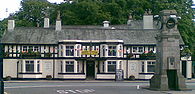
in 1902, with the service to Gatley (terminating at the Horse and Farrier) opening in March 1904. In Gatley, trams were replaced by buses in 1931. The trams were not wholly reliable: broken rear axles were common and the trams often disengaged from the electric cable.
The LWNR
station at Cheadle allowed travel via Edgeley to Manchester
, but closed as early as 1917 due to competition with the electric tram between Gatley and Stockport. LWNR
opened the "Styal Line" in 1909 including Gatley (as Gatley for Cheadle until 1974) and Heald Green
stations.
The M56
and M63
(now the M60
) were opened in 1974, bypassing Gatley and joining with each other at Kingsway
(Kingsway having been extended south across the River Mersey
in 1959).
The ongoing Manchester Metrolink
expansion will not include a station for Gatley, with the closest station being Benchill
, which is approx one mile from Gatley.
 Gatley’s war memorial is situated on Gatley Green, though the original World War I memorial is the clock tower at the junction of Altrincham Road and Church Road. The clock itself has not been in working order for many years, although a Clock Fund was started in 2011 with the intention of repairing and restoring it in the near future.
or Sainsbury's) but nothing has been done so far due to the recent recession. Two planning applications have so far been placed (as of 2010) to build sheltered housing on the vacant land behind the facade and to create a supermarket at the front. The first supermarket plan envisaged the demolition of half of the facade and the building of a modern edifice to the same scale. The second supermarket plan envisaged the conversion of the same half of the facade. Both planning applications met with opposition (from established local retailers and councillors), and were rejected.
and a local community group called SPRING (Supporters of Parks and Recreation IN Gatley) support the council by fundraising, enabling continued investment in park facilities.
 Walter Stansby Memorial Park is a small tree-lined park area running between Church Road and Northenden Road, near to the Recreation Ground (the two are separated by a children's day nursery). In contrast to the Recreation Ground, it has been designed to be a tranquil nature spot with tended lawns and plants, several memorial benches, and a path that extends through the park.
The festival is believed to have started in the early 1930s as the Gatley Rose Queen Parade. The current festival format of a large parade and then a funfair and stalls was started around 1986 and was originally held in what is now known as Gatley Recreation Ground before moving to the much larger Scholes Park next to Gatley Hill House. The festival still maintains the tradition of crowning a Rose Queen.http://www.gatleyfestival.org
Metropolitan Borough of Stockport
The Metropolitan Borough of Stockport is a metropolitan borough of Greater Manchester, in north west England, centred around the town of Stockport. It has a population of about 280,600 and includes the outyling areas of Cheadle and Cheadle Hulme, Marple, Bredbury, Reddish and Romiley...
, in Greater Manchester
Greater Manchester
Greater Manchester is a metropolitan county in North West England, with a population of 2.6 million. It encompasses one of the largest metropolitan areas in the United Kingdom and comprises ten metropolitan boroughs: Bolton, Bury, Oldham, Rochdale, Stockport, Tameside, Trafford, Wigan, and the...
, England.
Toponymy
In 1290, Gatley was known as Gateclyve, which in Old English means "a place where goats are kept".Early history
Until the 20th century, most Gatley residents either worked in the material trades or were farmers. An open field system existed around Gatley in the late 17th century, but the practice of common farming seems to have fallen into disuse when William Tatton allowed tenants to buy their own land.Gatley Carrs was the lower, marshy ground running down to the River Mersey
River Mersey
The River Mersey is a river in North West England. It is around long, stretching from Stockport, Greater Manchester, and ending at Liverpool Bay, Merseyside. For centuries, it formed part of the ancient county divide between Lancashire and Cheshire....
and West to Northenden
Northenden
Northenden is a suburban area and electoral ward of the city of Manchester in North West England. It lies on the south side of both the River Mersey and the M60 motorway, west of Stockport and south of Manchester city centre. Northenden is bounded by the districts of Didsbury, Gatley and...
. Before 1700 it was a place for ozier beds which local people had used for basket making or for wattles for cottages or fencing.
In 1800, Mr Worthington of Sharston Hall planted 1000 poplars in Gatley Carrs. In the mid 19th century, Gatley Carrs was described as "a scene of such singular and romantic beauty, and so thoroughly unique in its composition, that we know nothing in the neighbourhood to liken it to".
Over the years Gatley Carrs has shrunk to a fraction of its former size. In the second half of the 18th century, the Carrs was largely enclosed and partially drained to form farmed meadows. The Stockport to Altrincham railway line cut across it in 1864, running East-West. In 1934 house building began on "High Terrace" of the Mersey (the development behind the Horse and Farrier pub, running down to the railway line) and also about that time Cheadle and Gatley
Cheadle and Gatley
Cheadle and Gatley was, from 1894 to 1974, an urban district of Cheshire, England.It was created by the Local Government Act 1894 based on the Cheadle and Gatley urban sanitary district...
UDC purchased 19 acres (76,890.3 m²) to use as a refuse tip. Tree planting commenced due to complaints of smells and rats. There was loss of original field pattern because of extensive refuse tipping.
Carr woodland was developed on what had been carr meadows. There was a major system of land drains identified on the 1934 map including a sluice and non-return outfall gate to protect Gatley Carr from flooding when the Mersey burst its banks.
In the mid 1960s land restoration took place, although the Carr was only covered with soil to a depth varying between 2 inches (50.8 mm) and 6 inches (152.4 mm). Gatley Carrs then fell to the management of the Mersey Valley Countryside Wardens until it was handed to Stockport MBC in the late 1990s.
Industrial history
Button making appears to have been a significant local trade in the 17th and 18th centuries. A "button man" (merchant selling buttons) is recorded in Gatley in the 1660s. This continued in the 18th century with three button men being mentioned in Gatley between 1735 and 1779.People living around Gatley Green were mostly hand loom weavers and became more dependent on textile manufacture. Their cottages had cellars for storage and well-lit upper rooms for the looms.
About 1750, William Roscoe from Bolton
Bolton
Bolton is a town in Greater Manchester, in the North West of England. Close to the West Pennine Moors, it is north west of the city of Manchester. Bolton is surrounded by several smaller towns and villages which together form the Metropolitan Borough of Bolton, of which Bolton is the...
built a factory near Gatley Hall. (This shouldn't be confused in scale with the cotton mills such as those at Styal
Styal
Styal is a village in Cheshire East, England. It is on the River Bollin, near to the town of Wilmslow.Styal is a commuter village, with access to Manchester. The village is dominated by Quarry Bank Mill and much of its housing is the mill's estate. The mill and the surrounding country park are...
: it appears to have been a place for hand weaving and was later converted into a farmhouse, so it was a very modest affair). Up to at least 1841, John Alcock was a textile manufacturer in Gatley, using the Roscoe factory for at least part of the period.
The spread of machinery in industrial manufacturers during the 19th century appears to have killed off industry in Gatley, before which it was a "very busy and important place, as a centre for weaving, spinning, shoemaking and fustian cutting". Handloom weaving may have survived in the area to as late as the 1880s (Melson's Directory of Cheadle, Northenden
Northenden
Northenden is a suburban area and electoral ward of the city of Manchester in North West England. It lies on the south side of both the River Mersey and the M60 motorway, west of Stockport and south of Manchester city centre. Northenden is bounded by the districts of Didsbury, Gatley and...
and Baguley
Baguley
Baguley is a locality in Wythenshawe, and an electoral ward of the city of Manchester in North West England.Historically within Cheshire, the town is mentioned as Bagelei in the Domesday Book of 1086.-History:...
, 1887.)
Halls and Houses
In 1714, Stone Pale Hall was reconstructed in Gatley.Gatley Hall and Gatley Hill House may both have been built in the mid-eighteenth century by local cotton manufacturers. Gatley Hill House is now council owned (Stockport MBC) and is used by various community groups. The mansion High Grove House was built for a member of a wealthy hatting family of Yorkshire and Manchester.
Conflict
In the English Civil WarEnglish Civil War
The English Civil War was a series of armed conflicts and political machinations between Parliamentarians and Royalists...
(1642–51) the Tatton family, along with the local rectors and most tenants, were Royalists. Wythenshawe Hall
Wythenshawe Hall
Wythenshawe Hall is a 16th-century medieval timber-framed historic house and former stately home in Wythenshawe, Manchester, England. It is east of Altrincham and south of Stretford, five miles south of Manchester city centre, in Wythenshawe Park.-History:The half-timbered Tudor house was the home...
was kept in a state of defence from 1642, with Parliamentary forces nearby in Handforth
Handforth
Handforth is a suburban area situated between Wilmslow, Heald Green, and Styal in Cheshire, England. Travelling south from Manchester, Handforth is the first place in Cheshire, although other areas nearer Manchester lie within the historic boundaries of the county.In the 1950s, two overspill...
and Duckinfield. Wythenshawe Hall
Wythenshawe Hall
Wythenshawe Hall is a 16th-century medieval timber-framed historic house and former stately home in Wythenshawe, Manchester, England. It is east of Altrincham and south of Stretford, five miles south of Manchester city centre, in Wythenshawe Park.-History:The half-timbered Tudor house was the home...
was taken by the Parliamentarian forces on 25 February 1644. Three Gatley men were in the garrison defending the hall: Ralphe Savage, Robert Torkinton and John Blomiley.
On 30 November 1745, about 55 Jacobite troops
Jacobite rising
The Jacobite Risings were a series of uprisings, rebellions, and wars in Great Britain and Ireland occurring between 1688 and 1746. The uprisings were aimed at returning James VII of Scotland and II of England, and later his descendants of the House of Stuart, to the throne after he was deposed by...
from Bonnie Prince Charlie
Charles Edward Stuart
Prince Charles Edward Louis John Casimir Sylvester Severino Maria Stuart commonly known as Bonnie Prince Charlie or The Young Pretender was the second Jacobite pretender to the thrones of Great Britain , and Ireland...
's army crossed Gatley Ford and Gatley Carrs on their way to Cheadle and Stockport
Stockport
Stockport is a town in Greater Manchester, England. It lies on elevated ground southeast of Manchester city centre, at the point where the rivers Goyt and Tame join and create the River Mersey. Stockport is the largest settlement in the metropolitan borough of the same name...
; the bulk of the army crossed the Mersey at Cheadle and Stockport that night and the following day. Having reached Derby
Derby
Derby , is a city and unitary authority in the East Midlands region of England. It lies upon the banks of the River Derwent and is located in the south of the ceremonial county of Derbyshire. In the 2001 census, the population of the city was 233,700, whilst that of the Derby Urban Area was 229,407...
but no further, the Jacobite troops were back in Stockport in the second week of December on their way back north.
Gatley residents joined the Luddite
Luddite
The Luddites were a social movement of 19th-century English textile artisans who protested – often by destroying mechanised looms – against the changes produced by the Industrial Revolution, which they felt were leaving them without work and changing their way of life...
riots in 1818, but without any great distinction. They drilled in Gatley Carrs before marching to Stockport to take arms from the soldiers, but returned without actually attempting to do so. In the following summer, 1819, soldiers formed square in front of the Horse and Farrier public house
Public house
A public house, informally known as a pub, is a drinking establishment fundamental to the culture of Britain, Ireland, Australia and New Zealand. There are approximately 53,500 public houses in the United Kingdom. This number has been declining every year, so that nearly half of the smaller...
in Gatley with the aim of arresting the Luddite
Luddite
The Luddites were a social movement of 19th-century English textile artisans who protested – often by destroying mechanised looms – against the changes produced by the Industrial Revolution, which they felt were leaving them without work and changing their way of life...
ringleaders. Several ran away and hid (one, Isaac Legh, in the chimney of Stone Pale House, two others in the Carrs).
Religion and churches
A nonconformist meeting house registered in Etchells in 1722 may have been a house in Gatley. In 1777, the Gatley Congregational Church was founded and an independent chapel was built in Old Hall Road, Gatley, following the spread of evangelicalism to nonconformist groups. A full time minister was employed by the nonconformists for the first time. The present church is on Elm Road.The first nonconfirmist minister was the Rev. Jeremiah Pendlebury, succeeded by his assistant, the Rev. Samuel Turner, in 1788. By 1860 the church congregation had fallen to eight people. Improvements made with help from the North Cheshire Rural Mission increased the congregation to 60.
Prior to 1875, Gatley's parish church was the Church of St. Thomas, four miles (6 km) away in Stockport. The people of Gatley rarely saw their parish priest, though they still had to pay their tithes.
The new church, St. James', was built of local handmade bricks and consecrated on Tuesday 6 December 1881. The Rev. Percy M. Herford was the first Vicar of St. James' Church. In 1888 the Rev. P. M. Herford left and was replaced by the Rev. John Bruster, who remained Vicar for 40 years, retiring in 1928.
The vicarage was completed in 1894, following a donation towards it of £100 from Mr W. Heald of Parrswood in 1889. The building is located a short walk away from the church on Northenden Road. The building was sold in 2007 and is now a private nursery.
Gatley has a synagogue, opened in 1968, called Yeshurun Hebrew Congregation. It is a vibrant, Modern Orthodox synagogue, with a thriving membership from Cheadle and Gatley.
Site of Gatley Medical Centre
The site currently occupied by Gatley Medical Centre on Old Hall Road has previously been the location for a variety of purposes over the centuries.In the late 16th century the Etchells court was held on this site (probably in an inn). The Old Court House was subsequentally built there. It may have once been part of the village archery range. In 1777 it became the site of Gatley's first church of any kind: the Congregational Chapel, and was previously a schoolroom. The grassed area next to the modern surgery was used as a graveyard for many years.
Geography
Gatley is the most westerly vicinity of the Metropolitan Borough of Stockport, and runs along the border of Stockport and ManchesterManchester
Manchester is a city and metropolitan borough in Greater Manchester, England. According to the Office for National Statistics, the 2010 mid-year population estimate for Manchester was 498,800. Manchester lies within one of the UK's largest metropolitan areas, the metropolitan county of Greater...
. It is approximately three miles (5 km) from Manchester Airport, and seven miles (11 km) from Manchester city centre
Manchester City Centre
Manchester city centre is the central business district of Manchester, England. It lies within the Manchester Inner Ring Road, next to the River Irwell...
. It is separated from its slightly larger neighbour, Cheadle
Cheadle, Greater Manchester
Cheadle is a suburb in the Metropolitan Borough of Stockport in Greater Manchester, England. It borders the districts of Cheadle Hulme, Gatley, Heald Green and Cheadle Heath in Stockport, and the East Didsbury area of Manchester. As of 2001 it had a population of 14,261.-Early history:There has...
, by the A34 and from Didsbury
Didsbury
Didsbury is a suburban area of the City of Manchester, in Greater Manchester, England. It lies on the north bank of the River Mersey, south of Manchester city centre, in the southern half of the Greater Manchester Urban Area...
in Manchester
Manchester
Manchester is a city and metropolitan borough in Greater Manchester, England. According to the Office for National Statistics, the 2010 mid-year population estimate for Manchester was 498,800. Manchester lies within one of the UK's largest metropolitan areas, the metropolitan county of Greater...
by the River Mersey
River Mersey
The River Mersey is a river in North West England. It is around long, stretching from Stockport, Greater Manchester, and ending at Liverpool Bay, Merseyside. For centuries, it formed part of the ancient county divide between Lancashire and Cheshire....
.
To the south, Gatley borders onto Heald Green
Heald Green
Heald Green is a suburb of Stockport, Greater Manchester, England. It is situated in the south-west of the borough and is bordered by Gatley and Cheadle to the north, Cheadle Hulme to the east, Handforth and Styal to the south and Wythenshawe to the west...
, with Grasmere Road and Yew Tree Grove marking the southern boundary. To the west it meets the Wythenshawe
Wythenshawe
Wythenshawe is a district in the south of the city of Manchester, England.Formerly part of the administrative county of Cheshire, in 1931 Wythenshawe was transferred to the City of Manchester, which had begun building a massive housing estate there in the 1920s to resolve the problem of its inner...
district of Manchester, with roads just to the west of Park Road and Styal Road (e.g. Charnville Road and Malverne Avenue) being the last in Gatley.
Gatley is 40–60 metres above sea level.
Governance
Prior to 1086, Gatley was probably unpopulated and was part of Etchells (meaning "extra cleared land"). After 1086, the area was split between two landowners and for a period Gatley Brook (the old hundred boundary) formed the boundary. The halves were, at various times, held by the Stokeports and the Ardernes, then later by the Stanleys until, in 1508, the heir John Stanley was killed by a tennis ball. With no rightful claimants, the land went to the crown and, in 1556 Etchells was sold to William Tatton. By the 1560s, the Tattons, who also owned NorthendenNorthenden
Northenden is a suburban area and electoral ward of the city of Manchester in North West England. It lies on the south side of both the River Mersey and the M60 motorway, west of Stockport and south of Manchester city centre. Northenden is bounded by the districts of Didsbury, Gatley and...
and other local land, became full lords of the manor and held court over the area.
The township of Stockport Etchells
Stockport Etchells
Stockport Etchells is a former township in Greater Manchester, England. It lay in the historic county of Cheshire.-Geography:Stockport Etchells covered the rural area that includes modern-day Gatley and Heald Green...
, covering Gatley and much of the area now in Heald Green
Heald Green
Heald Green is a suburb of Stockport, Greater Manchester, England. It is situated in the south-west of the borough and is bordered by Gatley and Cheadle to the north, Cheadle Hulme to the east, Handforth and Styal to the south and Wythenshawe to the west...
(the area being based on previous ecclesiastical parishes) gained administrative responsibilities in the 16th century, as the old powers of the lord of the manor waned, and manoral rule became more by consent and custom. In the 16th, 17th and 18th centuries, Stockport Etchells
Stockport Etchells
Stockport Etchells is a former township in Greater Manchester, England. It lay in the historic county of Cheshire.-Geography:Stockport Etchells covered the rural area that includes modern-day Gatley and Heald Green...
and Northen Etchells
Northen Etchells
Northen Etchells is a former township in Greater Manchester, England. It lay in the historic county of Cheshire....
were frequently administered together as Etchells.
The local court leets and court barons moved, for a time from the late 16th century, to a building that later became known as the Old Court House in Gatley (though it was probably an inn at the time).
The townships of Stockport Etchells
Stockport Etchells
Stockport Etchells is a former township in Greater Manchester, England. It lay in the historic county of Cheshire.-Geography:Stockport Etchells covered the rural area that includes modern-day Gatley and Heald Green...
, Cheadle Moseley
Cheadle Moseley
Cheadle Moseley is a former township in Greater Manchester, England. It lay in the historic county of Cheshire.-Geography:Cheadle Moseley covered the rural area that includes parts modern-day Cheadle and Cheadle Hulme....
and Cheadle Bulkeley
Cheadle Bulkeley
Cheadle Bulkeley is a former township in Greater Manchester, England. It lay in the historic county of Cheshire.-Geography:Cheadle Bulkeley covered the rural area that includes parts of modern-day Cheadle....
were merged into the Cheadle and Gatley
Cheadle and Gatley
Cheadle and Gatley was, from 1894 to 1974, an urban district of Cheshire, England.It was created by the Local Government Act 1894 based on the Cheadle and Gatley urban sanitary district...
Urban District
Urban district
In the England, Wales and Ireland, an urban district was a type of local government district that covered an urbanised area. Urban districts had an elected Urban District Council , which shared local government responsibilities with a county council....
in 1894. From 1894 until 1974, Gatley was a part of the urban district
Urban district
In the England, Wales and Ireland, an urban district was a type of local government district that covered an urbanised area. Urban districts had an elected Urban District Council , which shared local government responsibilities with a county council....
of Cheadle and Gatley
Cheadle and Gatley
Cheadle and Gatley was, from 1894 to 1974, an urban district of Cheshire, England.It was created by the Local Government Act 1894 based on the Cheadle and Gatley urban sanitary district...
, within the historic county boundaries
Historic counties of England
The historic counties of England are subdivisions of England established for administration by the Normans and in most cases based on earlier Anglo-Saxon kingdoms and shires...
of Cheshire
Cheshire
Cheshire is a ceremonial county in North West England. Cheshire's county town is the city of Chester, although its largest town is Warrington. Other major towns include Widnes, Congleton, Crewe, Ellesmere Port, Runcorn, Macclesfield, Winsford, Northwich, and Wilmslow...
.
In 1933-4, both Manchester
Manchester
Manchester is a city and metropolitan borough in Greater Manchester, England. According to the Office for National Statistics, the 2010 mid-year population estimate for Manchester was 498,800. Manchester lies within one of the UK's largest metropolitan areas, the metropolitan county of Greater...
and Stockport
Stockport
Stockport is a town in Greater Manchester, England. It lies on elevated ground southeast of Manchester city centre, at the point where the rivers Goyt and Tame join and create the River Mersey. Stockport is the largest settlement in the metropolitan borough of the same name...
wanted to annex the Cheadle and Gatley Urban District. An opinion poll of nearly 10,000 residents recorded near-unanimous support for continuing independence.
In 1936 the boundaries of the Cheadle and Gatley Urban District saw minor changes due to the abolition of Handforth Urban District (1974-2009 Macclesfield District / Cheshire County councils. 2009 + East Cheshire Council / UA).
In 1974 the Urban Districts in Stockport
Stockport
Stockport is a town in Greater Manchester, England. It lies on elevated ground southeast of Manchester city centre, at the point where the rivers Goyt and Tame join and create the River Mersey. Stockport is the largest settlement in the metropolitan borough of the same name...
were abolished and Cheadle and Gatley Urban District became part of the Metropolitan Borough of Stockport
Metropolitan Borough of Stockport
The Metropolitan Borough of Stockport is a metropolitan borough of Greater Manchester, in north west England, centred around the town of Stockport. It has a population of about 280,600 and includes the outyling areas of Cheadle and Cheadle Hulme, Marple, Bredbury, Reddish and Romiley...
in Greater Manchester
Greater Manchester
Greater Manchester is a metropolitan county in North West England, with a population of 2.6 million. It encompasses one of the largest metropolitan areas in the United Kingdom and comprises ten metropolitan boroughs: Bolton, Bury, Oldham, Rochdale, Stockport, Tameside, Trafford, Wigan, and the...
. Gatley is part of the Cheadle and Gatley borough ward and the Cheadle parliamentary constituency.
Historical population changes
| Population of Stockport Etchells | |
|---|---|
| Year | Population |
| 1664 | 238 |
| 1754 | 380 |
| 1801 | 623 |
| 1811 | 627 |
| 1821 | 749 |
| 1831 | 701 |
| 1841 | 749 |
| 1851 | 805 |
| 1861 | 860 |
| 1871 | 977 |
| 1881 | 1369 |
| Population of Cheadle & Gatley UD | |
|---|---|
| Year | Population |
| 1891 | 8252 |
| 1901 | 10820 |
| 1911 | 9913 |
| 1921 | 11036 |
| 1931 | 18473 |
| 1951 | 31511 |
| 1961 | 45621 |
| 1971 | 60799 |
A polished stone found in Gatley suggests some human presence in the Neolithic
Neolithic
The Neolithic Age, Era, or Period, or New Stone Age, was a period in the development of human technology, beginning about 9500 BC in some parts of the Middle East, and later in other parts of the world. It is traditionally considered as the last part of the Stone Age...
or early Bronze Age
Bronze Age
The Bronze Age is a period characterized by the use of copper and its alloy bronze as the chief hard materials in the manufacture of some implements and weapons. Chronologically, it stands between the Stone Age and Iron Age...
.
In 1286, Gatley was a hamlet within the manor of Stockport Etchells, contained at least six households (around 30 individuals): probably a significant growth from levels in the late 11th century.
An Etchells Court of Survey document, probably from the late 16th century, gives Gatley as having 16 tenants (households) including Thomas Whitelegg (the largest holding, 25 acres), Roberte Gooddyer, Arnoulde Baxter and Roger Royle.
Cheadle and Gatley
Cheadle and Gatley
Cheadle and Gatley was, from 1894 to 1974, an urban district of Cheshire, England.It was created by the Local Government Act 1894 based on the Cheadle and Gatley urban sanitary district...
Urban District
Urban district
In the England, Wales and Ireland, an urban district was a type of local government district that covered an urbanised area. Urban districts had an elected Urban District Council , which shared local government responsibilities with a county council....
saw the highest population growth of anywhere in Stockport
Stockport
Stockport is a town in Greater Manchester, England. It lies on elevated ground southeast of Manchester city centre, at the point where the rivers Goyt and Tame join and create the River Mersey. Stockport is the largest settlement in the metropolitan borough of the same name...
in the inter-war period. In 1921 its population was a little over 11,000. By 1931 18,500 and by 1939, 27,000. Cheadle
Cheadle, Greater Manchester
Cheadle is a suburb in the Metropolitan Borough of Stockport in Greater Manchester, England. It borders the districts of Cheadle Hulme, Gatley, Heald Green and Cheadle Heath in Stockport, and the East Didsbury area of Manchester. As of 2001 it had a population of 14,261.-Early history:There has...
, Gatley and Cheadle Hulme
Cheadle Hulme
Cheadle Hulme is an area of the Metropolitan Borough of Stockport, in Greater Manchester, England. It is southwest of Stockport and southeast of the city of Manchester. It lies in the Ladybrook Valley on the Cheshire Plain, and the drift consists mostly of boulder clay, sands and gravels...
all saw the increase, as did the previously rural area of Heald Green
Heald Green
Heald Green is a suburb of Stockport, Greater Manchester, England. It is situated in the south-west of the borough and is bordered by Gatley and Cheadle to the north, Cheadle Hulme to the east, Handforth and Styal to the south and Wythenshawe to the west...
. This growth was largely due to people moving out of Manchester
Manchester
Manchester is a city and metropolitan borough in Greater Manchester, England. According to the Office for National Statistics, the 2010 mid-year population estimate for Manchester was 498,800. Manchester lies within one of the UK's largest metropolitan areas, the metropolitan county of Greater...
into the area.
Religion
| Gatley Compared: Religion | |||
|---|---|---|---|
| UK Census 2001 United Kingdom Census 2001 A nationwide census, known as Census 2001, was conducted in the United Kingdom on Sunday, 29 April 2001. This was the 20th UK Census and recorded a resident population of 58,789,194.... |
Gatley and Cheadle | Stockport Stockport Stockport is a town in Greater Manchester, England. It lies on elevated ground southeast of Manchester city centre, at the point where the rivers Goyt and Tame join and create the River Mersey. Stockport is the largest settlement in the metropolitan borough of the same name... |
England |
| Total population | 14,261 | 284,528 | 49,138,831 |
| Christian | 68.02% | 73.45% | 71.74% |
| No religion | 11.16% | 14.18% | 14.59% |
| Jewish | 6.37% | 0.58% | 0.52% |
| Muslim | 5.06% | 1.75% | 3.10% |
| Hindu | 1.18% | 0.47% | 1.11% |
| Sikh | 0.27% | 0.07% | 0.67% |
| Buddhist | 0.25% | 0.21% | 0.28% |
| Other | 0.67% | 0.23% | 0.29% |
| Not stated | 7.01% | 7.09% | 7.69% |
The religious diversity in Gatley and Cheadle is not too far from the country as a whole. Most notable is the relatively high Jewish population, over ten times higher than the English and Stockport averages. This is reflected in the existence of Gatley's orthodox synagogue, the Menorah reform synagogue in neighbouring Sharston and the North Cheshire Jewish Primary School in Heald Green.
The Muslim population is higher than the average across England and similar to neighbouring Didsbury. Bangladeshi make up the majority of this group.
The data in the table refers to the Cheadle and Gatley ward. The data comes from the 2001 UK census, when the ward name was Cheadle and the ward encompassed the whole of Gatley and a large part of Cheadle village. Gatley has never been an administrative district in its own right and no data for Gatley alone exists.
Ethnicity
| Gatley Compared: Place of birth | |||
|---|---|---|---|
| UK Census 2001 United Kingdom Census 2001 A nationwide census, known as Census 2001, was conducted in the United Kingdom on Sunday, 29 April 2001. This was the 20th UK Census and recorded a resident population of 58,789,194.... |
Gatley and Cheadle | Stockport Stockport Stockport is a town in Greater Manchester, England. It lies on elevated ground southeast of Manchester city centre, at the point where the rivers Goyt and Tame join and create the River Mersey. Stockport is the largest settlement in the metropolitan borough of the same name... |
England |
| Total population | 14,261 | 284,528 | 49,138,831 |
| Born in England | 87.83% | 91.81% | 87.44% |
| Born elsewhere in UK | 3.53% | 3.17% | 3.3% |
| Born elsewhere in EU | 1.79% | 1.6% | 2.35% |
| Born outside EU | 6.68% | 3.22% | 6.91% |
The data in the table refers to the Cheadle and Gatley ward. The data comes from the 2001 UK census, when the ward name was Cheadle and the ward encompassed the whole of Gatley and a large part of Cheadle village. Gatley has never been an administrative district in its own right and no data for Gatley alone exists.
Economy and employment
Gatley's primary commercial area covers Church Road, Stonepail Road, Gatley Road, Northenden Road and Old Hall Road. Here there are over 40 shops, 10 take-aways, 8 hairdressers, 4 beauty salons, 4 restaurants, 3 pubs, 4 cafes, 1 bank and significant office space and additional units. Gatley has three smaller areas of local shops on Pendlebury Road, Foxland Road and Silverdale Road, each with between two and six commercial premises.There are also three small-medium sized office blocks (on Northenden Road, Park Road, and Stonepail Road) which house various businesses.
Roads and transport
The River MerseyRiver Mersey
The River Mersey is a river in North West England. It is around long, stretching from Stockport, Greater Manchester, and ending at Liverpool Bay, Merseyside. For centuries, it formed part of the ancient county divide between Lancashire and Cheshire....
wasn't bridged in this area until 1745 (and then not continuously as three bridges collapsed over the years) so travelling to Didsbury
Didsbury
Didsbury is a suburban area of the City of Manchester, in Greater Manchester, England. It lies on the north bank of the River Mersey, south of Manchester city centre, in the southern half of the Greater Manchester Urban Area...
meant fording the Mersey or crossing in a boat. Until the railway in 1864, the road from Didsbury to Gatley (and then onto Styal) forded the Mersey and came through Gatley Carrs. The "Gatley Ford" was near Didsbury's Millgate Lane, suggesting the river was forded somewhere near the current M60
M60 motorway
The M60 motorway, or Manchester Orbital, is an orbital motorway circling Greater Manchester, a metropolitan county in North West England. It passes through all Greater Manchester's metropolitan boroughs except for Wigan and Bolton...
/M56 motorway
M56 motorway
The M56 Motorway, also known as the North Cheshire motorway, is in Cheshire and Greater Manchester, England. It runs from Junction 4 of the M60 to Dunkirk, Cheshire and is in length. It is often busy with long-distance commuter traffic towards North Wales...
junction.
Turnpikes opened across Stockport
Stockport
Stockport is a town in Greater Manchester, England. It lies on elevated ground southeast of Manchester city centre, at the point where the rivers Goyt and Tame join and create the River Mersey. Stockport is the largest settlement in the metropolitan borough of the same name...
from 1725, with the road through Gatley being amongst the last, in 1820. This was the main road through Cheadle, Gatley, Altrincham
Altrincham
Altrincham is a market town within the Metropolitan Borough of Trafford, in Greater Manchester, England. It lies on flat ground south of the River Mersey about southwest of Manchester city centre, south-southwest of Sale and east of Warrington...
and Northwich
Northwich
Northwich is a town and civil parish in the unitary authority of Cheshire West and Chester and the ceremonial county of Cheshire, England. It lies in the heart of the Cheshire Plain, at the confluence of the rivers Weaver and Dane...
. By July 1822, the fast coach along the road from Stockport
Stockport
Stockport is a town in Greater Manchester, England. It lies on elevated ground southeast of Manchester city centre, at the point where the rivers Goyt and Tame join and create the River Mersey. Stockport is the largest settlement in the metropolitan borough of the same name...
to Liverpool
Liverpool
Liverpool is a city and metropolitan borough of Merseyside, England, along the eastern side of the Mersey Estuary. It was founded as a borough in 1207 and was granted city status in 1880...
via Warrington
Warrington
Warrington is a town, borough and unitary authority area of Cheshire, England. It stands on the banks of the River Mersey, which is tidal to the west of the weir at Howley. It lies 16 miles east of Liverpool, 19 miles west of Manchester and 8 miles south of St Helens...
made it possible to spend six hours in Liverpool
Liverpool
Liverpool is a city and metropolitan borough of Merseyside, England, along the eastern side of the Mersey Estuary. It was founded as a borough in 1207 and was granted city status in 1880...
and return on the same day.
Gatley had no public transport until 1896, when a postmaster started a cab service. In 1898 Mr Potts began to operate a service to Stockport
Stockport
Stockport is a town in Greater Manchester, England. It lies on elevated ground southeast of Manchester city centre, at the point where the rivers Goyt and Tame join and create the River Mersey. Stockport is the largest settlement in the metropolitan borough of the same name...
with a single (horse drawn) omnibus, continuing until the arrival of the electric tram in 1904. Electric trams began to run in Stockport
Stockport
Stockport is a town in Greater Manchester, England. It lies on elevated ground southeast of Manchester city centre, at the point where the rivers Goyt and Tame join and create the River Mersey. Stockport is the largest settlement in the metropolitan borough of the same name...
in 1902, with the service to Gatley (terminating at the Horse and Farrier) opening in March 1904. In Gatley, trams were replaced by buses in 1931. The trams were not wholly reliable: broken rear axles were common and the trams often disengaged from the electric cable.
The LWNR
London and North Western Railway
The London and North Western Railway was a British railway company between 1846 and 1922. It was created by the merger of three companies – the Grand Junction Railway, the London and Birmingham Railway and the Manchester and Birmingham Railway...
station at Cheadle allowed travel via Edgeley to Manchester
Manchester
Manchester is a city and metropolitan borough in Greater Manchester, England. According to the Office for National Statistics, the 2010 mid-year population estimate for Manchester was 498,800. Manchester lies within one of the UK's largest metropolitan areas, the metropolitan county of Greater...
, but closed as early as 1917 due to competition with the electric tram between Gatley and Stockport. LWNR
London and North Western Railway
The London and North Western Railway was a British railway company between 1846 and 1922. It was created by the merger of three companies – the Grand Junction Railway, the London and Birmingham Railway and the Manchester and Birmingham Railway...
opened the "Styal Line" in 1909 including Gatley (as Gatley for Cheadle until 1974) and Heald Green
Heald Green
Heald Green is a suburb of Stockport, Greater Manchester, England. It is situated in the south-west of the borough and is bordered by Gatley and Cheadle to the north, Cheadle Hulme to the east, Handforth and Styal to the south and Wythenshawe to the west...
stations.
The M56
M56 motorway
The M56 Motorway, also known as the North Cheshire motorway, is in Cheshire and Greater Manchester, England. It runs from Junction 4 of the M60 to Dunkirk, Cheshire and is in length. It is often busy with long-distance commuter traffic towards North Wales...
and M63
M63 motorway
The M63 motorway was a major road in the United Kingdom. It was completely renumbered as part of the M60 motorway in 1999.- Formation of the M63 :The earliest section of the M63 opened in 1960 as part of the M62 motorway...
(now the M60
M60 motorway
The M60 motorway, or Manchester Orbital, is an orbital motorway circling Greater Manchester, a metropolitan county in North West England. It passes through all Greater Manchester's metropolitan boroughs except for Wigan and Bolton...
) were opened in 1974, bypassing Gatley and joining with each other at Kingsway
Kingsway (A34)
Kingsway is a major thoroughfare in Greater Manchester, in the United Kingdom. Part of the A34, it is a dual carriageway which runs from Levenshulme in Manchester to Cheadle in Stockport. Built in the late 1920s between Levenshulme and Parrs Wood, it was later extended to bypass Cheadle and join...
(Kingsway having been extended south across the River Mersey
River Mersey
The River Mersey is a river in North West England. It is around long, stretching from Stockport, Greater Manchester, and ending at Liverpool Bay, Merseyside. For centuries, it formed part of the ancient county divide between Lancashire and Cheshire....
in 1959).
The ongoing Manchester Metrolink
Manchester Metrolink
Metrolink is a light rail system in Greater Manchester, England. It consists of four lines which converge in Manchester city centre and terminate in Bury, Altrincham, Eccles and Chorlton-cum-Hardy. The system is owned by Transport for Greater Manchester and operated under contract by RATP Group...
expansion will not include a station for Gatley, with the closest station being Benchill
Benchill Metrolink station
Benchill Metrolink station is a future station proposed in Phase 3b of the Manchester Metrolink. The station is scheduled to open in 2016 and will be located on the Airport line on Brownley Road...
, which is approx one mile from Gatley.
Education
Gatley has three nurseries, two primary schools (Gatley and Lum Head), and one secondary school - The Kingsway School. Though, to be precise, only the upper school is situated in Gatley, and the lower school is situated across the A34 road in Cheadle. The schools are in the state sector.War Memorial and Clock Tower
Tatton Cinema (frontage)
There is also what remains of the Tatton Cinema, originally built in the 1930s, but now only the front facade still stands. For decades, the cinema was the centrepiece of Gatley, but closed in early 2001 due to the increase in multiplex cinemas, particularly the nearby Parrs Wood Cinema complex which lies 2 miles (3.2 km) away. There have been plans to turn the old cinema into a supermarket outlet (such as TescoTesco
Tesco plc is a global grocery and general merchandise retailer headquartered in Cheshunt, United Kingdom. It is the third-largest retailer in the world measured by revenues and the second-largest measured by profits...
or Sainsbury's) but nothing has been done so far due to the recent recession. Two planning applications have so far been placed (as of 2010) to build sheltered housing on the vacant land behind the facade and to create a supermarket at the front. The first supermarket plan envisaged the demolition of half of the facade and the building of a modern edifice to the same scale. The second supermarket plan envisaged the conversion of the same half of the facade. Both planning applications met with opposition (from established local retailers and councillors), and were rejected.
Gatley Recreation Ground
Gatley Recreation Ground (informally known as Gatley Park) is a small park area between Church Road and Northenden Road. It has a bowling green, a hard-surface tennis and basketball court, a children's playground area, and a purpose-built skateboarding area with several ramps. Maintenance of the park is the responsibility of Stockport CouncilStockport Metropolitan Borough Council
Stockport Metropolitan Borough Council is the local authority for the Metropolitan Borough of Stockport, Greater Manchester, England. The council is currently in no overall control since the 2011 local elections when the Liberal Democrats lost their majority. The Liberal Democrats now have 31...
and a local community group called SPRING (Supporters of Parks and Recreation IN Gatley) support the council by fundraising, enabling continued investment in park facilities.
Walter Stansby Memorial Park
Scholes Park
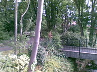
At the south-western end of the village, close to the boundary of Manchester, is Gatley Hill House, next to which is the William Scholes Park which includes several large playing fields partioned by small woodland areas. Far larger than Gatley Recreation Ground, this was developed in the early 1960s with money from the William Scholes Foundation. Scholes was a Gatley resident and estate agent who died in 1927. The track circuit opened on 19 May 1962 and was the first home of Cheadle and Gatley Athletics Club, before it merged with Stretford Athletics Club in 1966. Currently, the fields are used for many Gatley events – from the annual Gatley Festival to Sport Relief – and are used regularly by local running clubs as well as local teams for cricket in the summer and football in the winter. A children's playground was opened in February 2011 at the Foxland Road corner.Gatley Carrs Nature Reserve
Gatley Carrs is a nature reserve at the north-west corner of the area (bounded to the north and west by the M60 and M56 motorways and the Stockport-Altrincham railway line). A local community group, Gatley Carrs Conservation Group, help to maintain the reserve in conjunction with the local authority.Gatley Festival
Gatley Festival is an annual summer event. It is a celebration of village life and includes a carnival parade and a family fun day which are held on the first Sunday in July each year.The festival is believed to have started in the early 1930s as the Gatley Rose Queen Parade. The current festival format of a large parade and then a funfair and stalls was started around 1986 and was originally held in what is now known as Gatley Recreation Ground before moving to the much larger Scholes Park next to Gatley Hill House. The festival still maintains the tradition of crowning a Rose Queen.http://www.gatleyfestival.org