
Gamburtsev Mountain Range
Encyclopedia
The Gamburtsev Mountain Range (also known as the Gamburtsev Subglacial Mountains) is a subglacial
mountain range
located in Eastern Antarctica, near Dome A
. The range was discovered by the 3rd Soviet Antarctic Expedition
in 1958 and is named for Soviet
geophysicist
Grigoriy A. Gamburtsev
. It is approximately 1200 kilometres (745.6 mi) long, and the mountains are believed to be about 2700 metres (8,858.3 ft) high, although they are completely covered by over 600 metres (1,968.5 ft) of ice and snow. The Gamburtsev Mountain Range is currently believed to be about the same size as the European Alps
, and, as of 2008, it is unknown how the mountains were formed, though the current speculated age of the range is over 34 million years and possibly 500 million years. Current models suggest that the East Antarctic ice sheet
was formed from the glaciers that began sliding down the Gamburtsev range at the end of the Eocene
.
, so called, the AGAP project was a multinational effort to gather information about the Gamburtsev mountain chain.
The AGAP project comprised scientists, engineers, pilots and support staff from Australia
, Canada
, China
, Germany
, Japan
, the United Kingdom
, and the United States
. Two field camps were established deep within the Antarctic interior and aircraft flew across the ice, mapping the shape of the sub-glacials using an ice-penetrating radar
. The local gravitational and magnetic fields were also measured. 120,000 km were flown, with over 20% of the East Antarctic Ice Sheet being explored during the course of the mission.
Information was recorded on a network of seismometer
s that picked up earthquake signals passing through the rock from the opposite side of the planet. Despite the extreme temperatures — around -30 °C at the two base camps — liquid water was detected in the valleys three kilometres beneath the team. Ferraccioli added: "Up until now we just had an ambitious plan. Now we have all this remarkable data to pore over."
By December, 2009, data analyzed so far from the AGAP project indicate the mountain range is generally oriented southwest to northeast, and arose from tectonic plate
activity.
. This early range was eroded above the surface but left a deep cold root reaching down into the Earth's mantle. About 250-100 million years ago, the crust started to pull apart in a series of rifting events close to the east of this old root. A forked rift valley
runs along the northern side of the mountains containing lakes Sovetskaya
and 90East
within it. This rifting warmed and rejuvenated the root, giving it the buoyancy to be lifted up to re-establish the mountains as an 800 km long massif
.
Further uplift still was achieved as deep valleys were later cut erosion lightening the overall mass of the system. Around 35 million years ago, the glaciers merged to form the East Antarctic Ice Sheet, burying the Gamburtsevs in the process.
Glacier
A glacier is a large persistent body of ice that forms where the accumulation of snow exceeds its ablation over many years, often centuries. At least 0.1 km² in area and 50 m thick, but often much larger, a glacier slowly deforms and flows due to stresses induced by its weight...
mountain range
Mountain range
A mountain range is a single, large mass consisting of a succession of mountains or narrowly spaced mountain ridges, with or without peaks, closely related in position, direction, formation, and age; a component part of a mountain system or of a mountain chain...
located in Eastern Antarctica, near Dome A
Dome A
Dome A or Dome Argus is an Antarctican plateau located 1200 kilometres inland. It is thought to be one of the coldest naturally occurring places on Earth, with temperatures believed to get close to . It is the highest ice feature in Antarctica, comprising a dome or eminence of 4,093 meters...
. The range was discovered by the 3rd Soviet Antarctic Expedition
3rd Soviet Antarctic Expedition
The Third Soviet Antarctic Expedition was led by Yevgeny Tolstikov on the continent; the marine expedition on the Ob was led by I V Maksimov....
in 1958 and is named for Soviet
Soviet Union
The Soviet Union , officially the Union of Soviet Socialist Republics , was a constitutionally socialist state that existed in Eurasia between 1922 and 1991....
geophysicist
Geophysics
Geophysics is the physics of the Earth and its environment in space; also the study of the Earth using quantitative physical methods. The term geophysics sometimes refers only to the geological applications: Earth's shape; its gravitational and magnetic fields; its internal structure and...
Grigoriy A. Gamburtsev
Grigoriy A. Gamburtsev
Grigoriy Aleksandrovich Gamburtsev was a Soviet seismologist and academician from Saint Petersburg, Russia who worked in the area of seismometry and earthquake prediction.-Life:...
. It is approximately 1200 kilometres (745.6 mi) long, and the mountains are believed to be about 2700 metres (8,858.3 ft) high, although they are completely covered by over 600 metres (1,968.5 ft) of ice and snow. The Gamburtsev Mountain Range is currently believed to be about the same size as the European Alps
Alps
The Alps is one of the great mountain range systems of Europe, stretching from Austria and Slovenia in the east through Italy, Switzerland, Liechtenstein and Germany to France in the west....
, and, as of 2008, it is unknown how the mountains were formed, though the current speculated age of the range is over 34 million years and possibly 500 million years. Current models suggest that the East Antarctic ice sheet
East Antarctic Ice Sheet
The East Antarctic Ice Sheet is one of two large ice sheets in Antarctica, and the largest on the entire planet. The EAIS lies between 45° West and 168° East longitudinally....
was formed from the glaciers that began sliding down the Gamburtsev range at the end of the Eocene
Eocene
The Eocene Epoch, lasting from about 56 to 34 million years ago , is a major division of the geologic timescale and the second epoch of the Paleogene Period in the Cenozoic Era. The Eocene spans the time from the end of the Palaeocene Epoch to the beginning of the Oligocene Epoch. The start of the...
.
Antarctica's Gamburtsev Province (AGAP) project
As part of the 2007–09 International Polar YearInternational Polar Year
The International Polar Year is a collaborative, international effort researching the polar regions. Karl Weyprecht, an Austro-Hungarian naval officer, motivated the endeavor, but died before it first occurred in 1882-1883. Fifty years later a second IPY occurred...
, so called, the AGAP project was a multinational effort to gather information about the Gamburtsev mountain chain.
Completion
Scientists announced the completion of their mission on 25 February 2009. Modern-day remote-sensing technology revealed a very jagged landscape. The gathered data will be analysed by researchers in the following months. Dr Fausto Ferraccioli from the British Antarctic Survey said: "We can confirm they are there; we've seen them under the ice. Not only are they similar in dimension to the European Alps, but they are also similar in aspect: we see very sharp peaks and valleys which are remarkably similar to the Alps themselves. It all adds to the mystery – from the tectonic perspective of how these mountains were created; and from the glacial history perspective of how the East Antarctic ice sheet was formed and didn't erode these peaks."The AGAP project comprised scientists, engineers, pilots and support staff from Australia
Australia
Australia , officially the Commonwealth of Australia, is a country in the Southern Hemisphere comprising the mainland of the Australian continent, the island of Tasmania, and numerous smaller islands in the Indian and Pacific Oceans. It is the world's sixth-largest country by total area...
, Canada
Canada
Canada is a North American country consisting of ten provinces and three territories. Located in the northern part of the continent, it extends from the Atlantic Ocean in the east to the Pacific Ocean in the west, and northward into the Arctic Ocean...
, China
People's Republic of China
China , officially the People's Republic of China , is the most populous country in the world, with over 1.3 billion citizens. Located in East Asia, the country covers approximately 9.6 million square kilometres...
, Germany
Germany
Germany , officially the Federal Republic of Germany , is a federal parliamentary republic in Europe. The country consists of 16 states while the capital and largest city is Berlin. Germany covers an area of 357,021 km2 and has a largely temperate seasonal climate...
, Japan
Japan
Japan is an island nation in East Asia. Located in the Pacific Ocean, it lies to the east of the Sea of Japan, China, North Korea, South Korea and Russia, stretching from the Sea of Okhotsk in the north to the East China Sea and Taiwan in the south...
, the United Kingdom
United Kingdom
The United Kingdom of Great Britain and Northern IrelandIn the United Kingdom and Dependencies, other languages have been officially recognised as legitimate autochthonous languages under the European Charter for Regional or Minority Languages...
, and the United States
United States
The United States of America is a federal constitutional republic comprising fifty states and a federal district...
. Two field camps were established deep within the Antarctic interior and aircraft flew across the ice, mapping the shape of the sub-glacials using an ice-penetrating radar
Ground-penetrating radar
Ground-penetrating radar is a geophysical method that uses radar pulses to image the subsurface. This nondestructive method uses electromagnetic radiation in the microwave band of the radio spectrum, and detects the reflected signals from subsurface structures...
. The local gravitational and magnetic fields were also measured. 120,000 km were flown, with over 20% of the East Antarctic Ice Sheet being explored during the course of the mission.
Information was recorded on a network of seismometer
Seismometer
Seismometers are instruments that measure motions of the ground, including those of seismic waves generated by earthquakes, volcanic eruptions, and other seismic sources...
s that picked up earthquake signals passing through the rock from the opposite side of the planet. Despite the extreme temperatures — around -30 °C at the two base camps — liquid water was detected in the valleys three kilometres beneath the team. Ferraccioli added: "Up until now we just had an ambitious plan. Now we have all this remarkable data to pore over."
By December, 2009, data analyzed so far from the AGAP project indicate the mountain range is generally oriented southwest to northeast, and arose from tectonic plate
Plate tectonics
Plate tectonics is a scientific theory that describes the large scale motions of Earth's lithosphere...
activity.
Origin
The result of the 2007-2009 study has found that the Gamburtsev are very old, first forming around a billion years ago when continental drift pushed two plates together to form the super-continent of RodiniaRodinia
In geology, Rodinia is the name of a supercontinent, a continent which contained most or all of Earth's landmass. According to plate tectonic reconstructions, Rodinia existed between 1.1 billion and 750 million years ago, in the Neoproterozoic era...
. This early range was eroded above the surface but left a deep cold root reaching down into the Earth's mantle. About 250-100 million years ago, the crust started to pull apart in a series of rifting events close to the east of this old root. A forked rift valley
Rift valley
A rift valley is a linear-shaped lowland between highlands or mountain ranges created by the action of a geologic rift or fault. This action is manifest as crustal extension, a spreading apart of the surface which is subsequently further deepened by the forces of erosion...
runs along the northern side of the mountains containing lakes Sovetskaya
Sovetskaya (lake)
Sovetskaya Lake is a liquid lake found buried under the Antarctic ice sheet, below Sovetskaya Research Station. It covers about .-See also:* Lake Vostok * 90 Degrees East* Sovetskaya...
and 90East
90 Degrees East
90 Degrees East, also known as 90°E Lake, is a lake in Antarctica. With a surface area of about , it is the second-largest known subglacial lake in Antarctica....
within it. This rifting warmed and rejuvenated the root, giving it the buoyancy to be lifted up to re-establish the mountains as an 800 km long massif
Massif
In geology, a massif is a section of a planet's crust that is demarcated by faults or flexures. In the movement of the crust, a massif tends to retain its internal structure while being displaced as a whole...
.
Further uplift still was achieved as deep valleys were later cut erosion lightening the overall mass of the system. Around 35 million years ago, the glaciers merged to form the East Antarctic Ice Sheet, burying the Gamburtsevs in the process.
More information
More information about the project:- British Antarctic Survey
- National Science Foundation
- Lamont Doherty Earth Observatory
- Australian Antarctic Division
External links
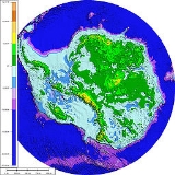
- Map of Antarctica, showing Dome A and the Gamburtsev Mountain Range
- A BBC article about the mountain range
- A SciencePoles.org interview of Dr Robin Bell
- BBC article on recent results: http://www.bbc.co.uk/news/science-environment-15749757