
.gif)
GEE (navigation)
Encyclopedia
Radio navigation
Radio navigation or radionavigation is the application of radio frequencies to determine a position on the Earth. Like radiolocation, it is a type of radiodetermination.The basic principles are measurements from/to electric beacons, especially...
system used by the Royal Air Force
Royal Air Force
The Royal Air Force is the aerial warfare service branch of the British Armed Forces. Formed on 1 April 1918, it is the oldest independent air force in the world...
during World War II
World War II
World War II, or the Second World War , was a global conflict lasting from 1939 to 1945, involving most of the world's nations—including all of the great powers—eventually forming two opposing military alliances: the Allies and the Axis...
.Different sources record the name as GEE or Gee. The naming supposedly comes from "Grid", so the lower case form is more correct, and is the form used in Drippy's publications. See Drippy 1946. It was the first hyperbolic navigation
Hyperbolic navigation
Hyperbolic navigation refers to a class of radio navigation systems based on the difference in timing between the reception of two signals, without reference to a common clock. Calculating the distance from the stations based on these timings produces a series of hyperbolic lines...
system to be used operationally. Gee was designed to improve aircraft navigation accuracy, thereby increasing the destructiveness of raids by Avro Lancaster
Avro Lancaster
The Avro Lancaster is a British four-engined Second World War heavy bomber made initially by Avro for the Royal Air Force . It first saw active service in 1942, and together with the Handley Page Halifax it was one of the main heavy bombers of the RAF, the RCAF, and squadrons from other...
s and various other bombers. For large fixed targets, like the cities that were attacked at night, Gee offered enough accuracy to be used as an aiming reference without the need to use a bombsight
Bombsight
A bombsight is a device used by bomber aircraft to accurately drop bombs. In order to do this, the bombsight has to estimate the path the bomb will take after release from the aircraft. The two primary forces during its fall are gravity and air drag, which makes the path of the bomb through the air...
or other external reference.
Gee was devised by Robert Dippy and developed at the Telecommunications Research Establishment
Telecommunications Research Establishment
The Telecommunications Research Establishment was the main United Kingdom research and development organization for radio navigation, radar, infra-red detection for heat seeking missiles, and related work for the Royal Air Force during World War II and the years that followed. The name was...
(TRE) at Swanage
Swanage
Swanage is a coastal town and civil parish in the south east of Dorset, England. It is situated at the eastern end of the Isle of Purbeck, approximately 10 km south of Poole and 40 km east of Dorchester. The parish has a population of 10,124 . Nearby are Ballard Down and Old Harry Rocks,...
. Dippy later went to the United States
United States
The United States of America is a federal constitutional republic comprising fifty states and a federal district...
where he worked on the development of the LORAN
LORAN
LORAN is a terrestrial radio navigation system using low frequency radio transmitters in multiple deployment to determine the location and speed of the receiver....
system, a system that was similar to Gee but using a longer wavelength
Wavelength
In physics, the wavelength of a sinusoidal wave is the spatial period of the wave—the distance over which the wave's shape repeats.It is usually determined by considering the distance between consecutive corresponding points of the same phase, such as crests, troughs, or zero crossings, and is a...
. LORAN was used by the US Navy and Royal Navy
Royal Navy
The Royal Navy is the naval warfare service branch of the British Armed Forces. Founded in the 16th century, it is the oldest service branch and is known as the Senior Service...
during World War II, and after the war came into common civilian use worldwide for coastal navigation, until GPS
Global Positioning System
The Global Positioning System is a space-based global navigation satellite system that provides location and time information in all weather, anywhere on or near the Earth, where there is an unobstructed line of sight to four or more GPS satellites...
made it obsolete.
Gee was also known as AMES Type 7000, for "Air Ministry Experimental Station
Air Ministry Experimental Station
AMES or Air Ministry Experimental Station was the way of identifying RAF radar types during and after World War II*AMES Type 1, Chain Home - Early Warning*AMES Type 2, Chain Home Low - Early Warning, LOW altitude...
". AMES was a common universal naming system in the UK, similar to the "AN" series in the US.
Prerequisite work
The basic idea of hyperbolic navigationHyperbolic navigation
Hyperbolic navigation refers to a class of radio navigation systems based on the difference in timing between the reception of two signals, without reference to a common clock. Calculating the distance from the stations based on these timings produces a series of hyperbolic lines...
was well known in the 1930s, but the equipment needed to build it was not widely available at the time. The main problem was the accurate determination of the difference in timing of two closely spaced signals, signals that were travelling at the speed of light
Speed of light
The speed of light in vacuum, usually denoted by c, is a physical constant important in many areas of physics. Its value is 299,792,458 metres per second, a figure that is exact since the length of the metre is defined from this constant and the international standard for time...
and thus measured in mili and microseconds.
During the 1930s the development of radar
Radar
Radar is an object-detection system which uses radio waves to determine the range, altitude, direction, or speed of objects. It can be used to detect aircraft, ships, spacecraft, guided missiles, motor vehicles, weather formations, and terrain. The radar dish or antenna transmits pulses of radio...
demanded devices that could accurately measure the difference in time of these sorts of signals. In the case of Chain Home
Chain Home
Chain Home was the codename for the ring of coastal Early Warning radar stations built by the British before and during the Second World War. The system otherwise known as AMES Type 1 consisted of radar fixed on top of a radio tower mast, called a 'station' to provide long-range detection of...
, signals were sent from transmission towers and any reflections off of distant targets that were received on separate antenna
Antenna
Antenna may refer to:-Science and engineering:* Antenna , also known as an aerial, a transducer designed to transmit or receive electromagnetic Antenna (pl. antennas in radio/TV, antennae in biology) may refer to:-Science and engineering:* Antenna (radio), also known as an aerial, a transducer...
s. The oscilloscope
Oscilloscope
An oscilloscope is a type of electronic test instrument that allows observation of constantly varying signal voltages, usually as a two-dimensional graph of one or more electrical potential differences using the vertical or 'Y' axis, plotted as a function of time,...
(or oscillograph as it was known in the UK) was used to read these signals. A trigger signal sent from the transmitter started the "trace" moving quickly along the display, and any received signals caused the beam to deflect upward, forming a "blip". The distance that the trace had moved from the left side of the display could be measured to accurately calculate the difference in time between sending and receiving, which, in turn, could be used to calculate the range to the target.
Landing system proposal
In October 1937, Robert (Bob) J. Dippy, working at Robert Watson-WattRobert Watson-Watt
Sir Robert Alexander Watson-Watt, KCB, FRS, FRAeS is considered by many to be the "inventor of radar". Development of radar, initially nameless, was first started elsewhere but greatly expanded on 1 September 1936 when Watson-Watt became...
's radar laboratory at RAF Bawdsey
RAF Bawdsey
RAF Bawdsey was an RAF station situated on the eastern coast in Suffolk, England.Bawdsey Manor, dating from 1886, was taken over in March 1936 by the Air Ministry for developing the Chain Home RDF system...
, proposed using two synchronized transmitters as the basis for a blind landing system. He envisioned two transmitters positioned about 10 miles apart on either side of a runway. A common signal would be sent to both from a transmitter in the center of the two antennas, which would ensure that they would be broadcast from both antennas at the same instant.
A receiver in the aircraft would tune in these signals and send them to an oscilloscope for display. If the aircraft was properly lined up with the runway, both signals would be received at the same instant, and thus be drawn at the same point on the display. If the aircraft was located to one side or the other, one of the signals would be received before the other, forming two distinct peaks on the display. By determining which signal was being received first, the pilot would know that they were closer to that antenna, and would be able to recapture the proper direction by turning away from it.
Watt liked the idea, but at the time there did not appear to be a pressing need for the system. At the time the RAF was relying on daylight bombing by tight formations of heavily defended bombers as its primary attack force, so night landings were not a major concern. Landing aids would be useful, but radar work was the more urgent need.
Navigation system proposal
The RAFs bombing campaign plans quickly went awry, especially after the Air Battle of the Heligoland BightBattle of the Heligoland Bight (1939)
The Battle of the Heligoland Bight was the first "named" air battle of the Second World War, which began the longest air campaign of the war, the Defence of the Reich. On 18 December 1939, a force of three RAF bomber squadrons with a total of 24 aircraft set off to engage German ships in the...
in 1939. Contrary to pre-war thinking, the bombers proved extremely vulnerable to both ground fire and attacking fighter
Fighter
Fighter or The Fighter may refer to:*Warrior, a person skilled in combat*Soldier, someone in the army*Fighter aircraft, a warplane designed to destroy or damage enemy warplanes in air-to-air combatFilms...
s. After some discussion, it was decided the best course of action would be to return to night bombing, which had been the primary concept earlier in the 1930s. This raised the need for better landing aids, and for navigation aids in general.
By this time Drippy had refined his system, and formally presented a new proposal on 24 June 1940. Instead of guiding the aircraft along a single line near the airport, his new concept used a number of long-range transmitters to produce several sets of lines. These were arranged so they would cross each other, forming a 2D grid that would be printed on navigational charts. By measuring their position relative to the lines generated by two pairs of stations, the aircraft could calculate their position in space, taking a "fix". The gridded lines on the charts gave the systems its name, "Gee" for the "G" in "Grid".
Drippy's earlier proposal used two closely spaced stations to generate a single "line" in the sky. For his new system there would need to be more stations to generate multiple lines, and these stations would have to be spaced much further apart to provide the necessary coverage. The single-transmitter two-antenna solution from the landing system was no longer appropriate, especially given that the stations would be located far apart. Instead, he described a new system using individual transmitters at each of the stations. One of the stations would periodically send out a signal based on a timer. The other stations would be equipped with receivers listening for the signal arriving from the control station. When they received the signal, they would send out their own broadcast. This would keep all the stations in sync, without the need for a wire between them. Drippy suggested building stations with a central "master" and three "slaves" about 80 miles away and arranged roughly 120 degrees apart. A collection of such stations was known as a "chain".
It was expected that the system would operate over ranges of about 100 miles, based on the widely held belief within the UK radio engineering establishment that the 30 MHz signals would have relatively short range. Experimental systems were already being set up in June 1940, and by July it was clear, to everyone's delight, that the system was usable to at least 300 miles at altitudes of 10,000 feet. On 19 October they made a fix at 110 miles at only 5,000 feet.
A new offensive
The discovery of Gee's extended range arrived at a pivotal point in the RAF's bombing campaign. Having originally relied on day bombing, the RAF had not invested a tremendous amount of effort on the navigation skills needed for night flying. When these were put into service, it was found the requirements for accurate dead reckoningDead reckoning
In navigation, dead reckoning is the process of calculating one's current position by using a previously determined position, or fix, and advancing that position based upon known or estimated speeds over elapsed time, and course...
rarely existed in practice, and the navigational problem was far harder than originally believed. The Germans had developed a series of radio aids for this, notably the Knickebein system, but the RAF initially pooh-poohed this approach, claiming it only demonstrated the superiority of their own navigators. By late 1940 a number of reports were trickling back from observers in the field who were noting bombers did not appear to be bombing their targets. In one instance, it was reported bombs fell over 50 mi (80.5 km) from their target.
This led to an intense debate within all levels of the UK war establishment, and in particular, Bomber Command. For some time these results were dismissed out of hand, but calls for an official enquiry lead to the Butt report
Butt Report
The Butt Report was a report prepared during World War II which revealed the widespread failure of bombers to deliver their payloads to the correct target....
, which demonstrated only 5% of the bombs sent out on a mission landed within 5 mi (8 km) of their target. With these sorts of statistics, any sort of strategic campaign based on attacks against factories and similar targets was hopeless. This led to Frederick Lindemann's notorious "dehousing
Dehousing
On 30 March 1942 Professor Frederick Lindemann, Baron Cherwell, the British government's chief scientific adviser, sent to the British Prime Minister Winston Churchill a memorandum which after it had become accepted by the Cabinet became known as the dehousing paper.Also known as the "dehousing...
" paper, which called for the bomber efforts to be used against the houses of the German citizens in order to break their ability to work and will to resist. This became official policy of the RAF in 1942.
While the debate raged, Bomber Command dramatically lowered their sortie rate, awaiting the rebuilding of the force with the newly arriving 4-engine "heavies", and the deployment of Gee. The two, combined, would offer the accuracy and weight of bombs that Lindemann's calculations called for. Efforts to test and deploy Gee became a high priority, and the Chain Executive Committee was set up under the chairmanship of Robert Renwick
Robert Renwick, 1st Baron Renwick
Robert Burnham Renwick, 1st Baron Renwick, KBE , known as Sir Robert Renwick, 2nd Baronet, from 1932 to 1964, was a British industrialist and public servant....
in October 1941 to site a series of Gee stations. Gee was not the only solution being developed, it would soon be joined by H2S radar
H2S radar
H2S was the first airborne, ground scanning radar system. It was developed in Britain in World War II for the Royal Air Force and was used in various RAF bomber aircraft from 1943 to the 1990s. It was designed to identify targets on the ground for night and all-weather bombing...
s and the Oboe
Oboe (navigation)
Oboe was a British aerial blind bombing targeting system in World War II, based on radio transponder technology. Oboe accurately measured the distance to an aircraft, and gave the pilot guidance on whether or not they were flying along a pre-selected circular route. The route was only 35 yards...
system.
System almost compromised
As the initial availability of these devices would be limited, the idea of the pathfinder forcePathfinder (RAF)
The Pathfinders were elite squadrons in RAF Bomber Command during World War II. They located and marked targets with flares, which a main bomber force could aim at, increasing the accuracy of their bombing...
was adopted. This had been used by the Luftwaffe against England for similar reasons, with the radio-equipped aircraft of KG100 dropping flares for the following bombers to use as an aim point. Eager to test the system, prototype Gee sets were used on target marker raids well before the production sets were available in the number required for large raids. On 15 May 1941, such a set provided an accurate fix at a range of 400 miles at an altitude of 10,000 feet. The first full chain was completed in July 1941, but in testing over the North Sea the sets proved to be unreliable. This was traced to the power supplies and tubes, and corrections were designed and proved that summer.
On the night of 11/12 August two Gee-equipped aircraft bombed using Gee coordinates only and delivered "uncanny accuracy". However, on the next night on a raid over Hanover
Hanover
Hanover or Hannover, on the river Leine, is the capital of the federal state of Lower Saxony , Germany and was once by personal union the family seat of the Hanoverian Kings of Great Britain, under their title as the dukes of Brunswick-Lüneburg...
a Gee-equipped Vickers Wellington
Vickers Wellington
The Vickers Wellington was a British twin-engine, long range medium bomber designed in the mid-1930s at Brooklands in Weybridge, Surrey, by Vickers-Armstrongs' Chief Designer, R. K. Pierson. It was widely used as a night bomber in the early years of the Second World War, before being displaced as a...
was lost. The Gee set did not contain self-destruct systems and it was possible that it had fallen into German hands. Operational testing was immediately suspended.
R. V. Jones
R. v. Jones
R. v. Jones, [1986] 2 S.C.R. 284 is an early leading Supreme Court of Canada decision on the freedom of religion under section 2 of the Canadian Charter of Rights and Freedoms and the right to security of person under section 7.-Background:...
responded by starting a disinformation campaign to hide the existence of the system. First, the use of the codename 'Gee' in communications traffic was dropped, and false communications were sent referring to a fictitious system called 'Jay'; it was hoped the similarity would cause confusion. Extra antennae were added to the Gee transmitters to radiate false, unsynchronized signals. A double agent in the Double Cross
Double Cross System
The Double Cross System, or XX System, was a World War II anti-espionage and deception operation of the British military intelligence arm, MI5. Nazi agents in Britain - real and false - were captured, turned themselves in or simply announced themselves and were then used by the British to broadcast...
system reported to German Intelligence a fictional story of hearing a couple of RAF
Royal Air Force
The Royal Air Force is the aerial warfare service branch of the British Armed Forces. Formed on 1 April 1918, it is the oldest independent air force in the world...
personnel talking carelessly in a hotel about how Jay was "just a copy" of the German Knickebein system - flattering the Germans who might consider the information more reliable as a result. Finally, false Knickebein signals were transmitted over Germany. Jones noted all this appealed to his penchant for practical joking.
In spite of these efforts, Jones initially calculated it would be only three months before the Germans would be able to jam the system. As it turns out, it was not until five months into the campaign that jamming was encountered, and longer before it became a serious concern.
Wartime service
Even with limited testing, Gee proved itself to be easy to use and more than accurate enough for its tasks. On 18 August 1941, Bomber Command ordered Gee into production at Dynatron and Cossor, with the first mass-produced sets expected to arrive in May 1942. In the meantime, a separate order for 300 hand-made sets was placed for delivery on 1 January 1942 Which was later pushed back to February. Overall, 60,000 Gee sets were manufactured during World War II, used by the RAF, USAAF and Royal NavyRoyal Navy
The Royal Navy is the naval warfare service branch of the British Armed Forces. Founded in the 16th century, it is the oldest service branch and is known as the Senior Service...
.
The first operational Gee mission took place on the night of 8/9 March 1942 when a force of about 200 aircraft attacked Essen
Essen
- Origin of the name :In German-speaking countries, the name of the city Essen often causes confusion as to its origins, because it is commonly known as the German infinitive of the verb for the act of eating, and/or the German noun for food. Although scholars still dispute the interpretation of...
. It was installed on a Wellington
Vickers Wellington
The Vickers Wellington was a British twin-engine, long range medium bomber designed in the mid-1930s at Brooklands in Weybridge, Surrey, by Vickers-Armstrongs' Chief Designer, R. K. Pierson. It was widely used as a night bomber in the early years of the Second World War, before being displaced as a...
of No. 115 Squadron
No. 115 Squadron RAF
No. 115 Squadron RAF was a Royal Air Force squadron during World War I. It was then equipped with Handley Page O/400 heavy bombers. During World War II the squadron served as a bomber squadron and after the war it flew in a similar role till 1958, when it was engaged as a radio calibration unit...
from RAF Watton
RAF Watton
Royal Air Force Station Watton is a former military airfield in Norfolk, England. The airfield is located approximately south-southwest of East Dereham....
captained by Pilot Officer Jack Foster who later said "targets were found and bombed as never before". Krupps, the principal target escaped bombing, but bombs did hit the southern areas of the city. In total, 33% of the aircraft reached the target area, an enormous advance over earlier results.
The first completely successful Gee-led attack was carried out on 13/14th March 1942 against Cologne
Cologne
Cologne is Germany's fourth-largest city , and is the largest city both in the Germany Federal State of North Rhine-Westphalia and within the Rhine-Ruhr Metropolitan Area, one of the major European metropolitan areas with more than ten million inhabitants.Cologne is located on both sides of the...
. The leading crews successfully illuminated the target with flares and incendiaries and the bombing was generally accurate. Bomber Command reckoned this attack was 5 times more effective than the earlier raid on the city. The success of Gee led to a change in policy, selecting 60 German cities within Gee range for mass bombing using 1,600-1,800 tons of bombs per city.
In order to provide coverage of the entire UK, three Gee chains were constructed. The original chain started continuous operation on 22 June 1942, followed by a chain in Scotland later that year, and the southwest chain in 1943. Even as German jamming efforts took hold, Gee was widely used for navigation in the UK. Only 1.2% of Gee-equipped aircraft failed to return to their base, as opposed to 3.5% of those without it. Gee was considered so important that a non-working Gee set would ground an aircraft.
The first serious jamming was encountered on the night of 4/5 August 1942. This grew in strength as the bombers approached their target at Essen
Essen
- Origin of the name :In German-speaking countries, the name of the city Essen often causes confusion as to its origins, because it is commonly known as the German infinitive of the verb for the act of eating, and/or the German noun for food. Although scholars still dispute the interpretation of...
, and the signals became unusable at 10 to 20 miles from the target. The newly-formed southern chain was not yet known to the Germans and continued to be useful. On 3/4 December a fix was made from this chain over Turin
Turin
Turin is a city and major business and cultural centre in northern Italy, capital of the Piedmont region, located mainly on the left bank of the Po River and surrounded by the Alpine arch. The population of the city proper is 909,193 while the population of the urban area is estimated by Eurostat...
in Italy, at a range of 730 miles. This remained the operational record for Gee, with the exception of a freak reception over Gibralter at a range of 1,000 miles.
Counter-jamming efforts had already been considered, and produced the Gee Mk. II. This replaced the original receiver with a new model where the oscillators could be easily removed and swapped out in order to provide a range of operational frequencies. These included the original 20-30 MHz band, as well as new bands at 40-50, 50-70 and 70-90 MHz. The navigator could easily replace these in flight, allowing reception from any active chain. Gee Mk. II went into operation in February 1943, at which point it had also been selected by the US 8th Air Force.
On 23 April 1942 the go-ahead was given to develop mobile stations for Gee in preparation for the invasion of Europe. This would not only extend the range of the system eastward, but also allow stations to move and suddenly appear elsewhere if jamming became an issue. The first of an eventual three such mobile chains was formed up on 22 November 1943. The first of these was put into operation on 1 May 1944 at Foggia
Foggia
Foggia is a city and comune of Apulia, Italy, capital of the province of Foggia. Foggia is the main city of a plain called Tavoliere, also known as the "granary of Italy".-History:...
in Italy, and was used operationally for the first time on 24 May. Other units were sent into France soon after D-Day
D-Day
D-Day is a term often used in military parlance to denote the day on which a combat attack or operation is to be initiated. "D-Day" often represents a variable, designating the day upon which some significant event will occur or has occurred; see Military designation of days and hours for similar...
. The mobile units in France and Germany were later replaced by fixed stations, the "heavies".
After the end of the war in Europe, Britain planned to send Lancasters to the Japanese theatre as part of Tiger Force
Tiger Force (air)
Tiger Force, also known as the Very Long Range Bomber Force, was the name given to a World War II British Commonwealth long-range heavy bomber force, formed in 1945, from squadrons serving with RAF Bomber Command in Europe, for proposed use against targets in Japan...
and to use Gee for the passage of flights to Asia. Preparations began for Gee transmitters in Nablus (in Palestine) guiding the flights across the Middle East but the surrender of Japan removed the need for this chain. This work was being carried out by MEDME, Cairo, under Air Vice Marshall Aitken.
German bombers also used the Gee system for attacks on the UK; captured Gee receivers provided the electronics.
Gee-H
Later in the war Bomber Command desired to deploy a new navigation system not for location fixing, but to mark a single spot in the air. This location would be used to drop bombs or target indicators for strikes by other bombers. The OboeOboe (navigation)
Oboe was a British aerial blind bombing targeting system in World War II, based on radio transponder technology. Oboe accurately measured the distance to an aircraft, and gave the pilot guidance on whether or not they were flying along a pre-selected circular route. The route was only 35 yards...
system was already in use, which sent an interrogation signal from stations in the UK, "reflected" them from transceiver
Transceiver
A transceiver is a device comprising both a transmitter and a receiver which are combined and share common circuitry or a single housing. When no circuitry is common between transmit and receive functions, the device is a transmitter-receiver. The term originated in the early 1920s...
s on the aircraft, and timed the difference between the two signals using equipment similar to Gee. However, Oboe had the major limitation that it could only guide a single aircraft at a time and took about 10 minutes to guide a single aircraft to its target. A system able to guide more aircraft at once would be a dramatic improvement.
The result was a new version of the same basic Oboe concept, but reversed so that it was driven by the aircraft. This would require equipment on the aircraft that could receive and time the difference between two signals. The re-use of the existing Gee equipment for this purpose was obvious. The new Gee-H system only required a single modification, the addition of a new transmitter that would send signals out for reflection from ground-based transceivers. With this transmitter turned off, the system returned to being a normal Gee unit. This allowed it to be used in Gee-H mode during attacks, and then Gee mode for navigation back to their home airfields.
Postwar use
Gee was of such great utility that the hurried deployments during the war were rationalized as the basis for an ongoing and growing navigational system. The result was a set of four chains, South Western, Southern, Scottish and Northern, which have continuous coverage over most of the UK out to the northeastern corner of Scotland. These were joined by a further two chains in France, and a single chain the UK occupation zone in northern Germany.Basic concept
Hyperbolic navigation systems can be divided into two main classes, those that calculate the time difference between two radio pulses, and those that compare the phase difference between two continuous signals. Here we will consider the pulse method only.Consider two radio transmitters located at a distance of 300 km from each other, which means the radio signal from one will take 1 millisecond
Millisecond
A millisecond is a thousandth of a second.10 milliseconds are called a centisecond....
to reach the other. One of these stations is equipped with an electronic clock that periodically sends out a trigger signal. When the signal is sent, this station, the "master", sends out its transmission. 1 ms later that signal arrives at the second station, the "slave". This station is equipped with a receiver, and when it sees the signal from the master arrive, it triggers its own transmitter. This ensures that the master and slave send out signals precisely 1 ms apart, without the slave needing to have an accurate timer of its own. In practice, a fixed time typically is added to account for delays in the electronics.
A receiver listening for these signals and displaying them on an oscilloscope will see a series of blips on the display. By measuring the distance between them, the delay between the two signals can be calculated. If that delay is 1 ms, that implies the delay is zero from one station and 1 ms from the other, and that the difference in distance to the two stations is 300 km. Only one location could meet this condition, the location of the master or slave. If the receiver moves to another location they might measure a delay between the signals of 0.5 ms. This implies that the difference in the distance to the two stations is 150 km. In this case there is an infinite number of locations where that delay could be measured - 75 km from one and 225 from the other, or 150 km from one and 300 from the other, and so on. When plotted on a chart, the collection of possible locations for any given difference forms a hyperbolic curve. The collection of curves for all possible measured delays forms a set of curved radiating lines, centred on the line between the two stations, known as the "baseline".
In order to take a fix, the receiver takes two measurements based on two different stations. The intersections of the two sets of curves normally results in two possible locations. Using some other form of navigation, even dead reckoning
Dead reckoning
In navigation, dead reckoning is the process of calculating one's current position by using a previously determined position, or fix, and advancing that position based upon known or estimated speeds over elapsed time, and course...
, can eliminate one of these possible positions, and thus provide an exact fix. Instead of using two entirely separate pairs of stations, this can be simplified by having a single master and two slaves located some distance away so their patterns overlap. A collection of stations is known as a "chain".
Gee
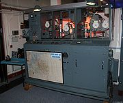
Gee chains used an arrangement with one master and (typically) three slaves. The signals from the master and either of the two slaves would be active at any time, with the third station and a chain monitor station providing backup and signal quality measurements. The transmitters had a power output of about 300 kW and operated in four frequency bands between 20 and 85 MHz.The Gee signal for any given chain consisted of a series of pulses of radio signal with a roughly inverted-parabolic envelope about 6 microseconds in duration. The master sent a single pulse, referred to as "A", followed 2 ms later by a double pulse, "D". These were used to identify the start and end of the broadcast cycle. The first slave station sent a single pulse 1 ms after the master's single pulse, labeled "B", and the second slave sent a single pulse 1 ms after the master's double pulse, labeled "C". The whole sequence repeated on a 4 ms cycle, with the pattern "ABD... ACD... ABD..."Haigh and Proc differ in their description of the pulse chains. Haigh suggests there was no D signal at all, and the pattern was "AB…AA'C…AB…". Brown suggests the double-pulse was sent from the third station in the chain, although how this would remain synchronized with the master is unexplained. Consider this description subject to change. The triggering of the A pulses was loosely timed at 150 kHz by a local oscillator at the master station, and was subject to drift and sometimes deliberately changed.
In Gee, all of the signals in a given chain were sent on the same frequency, and there was no attempt to modify the pattern of the individual envelopes from the slaves to allow identification. This meant that it would normally be possible to confuse the "ABD" for the "ACD", as they would look identical on the screen. In order to resolve these problems, the master station periodically sent a third pulse, "A prime" or the "ghost A". These were folded into the signal only on the "ACD" cycle, allowing the operator to visually identify the B and C portions of the cycle.
On board the aircraft, the signals from the three stations were received and sent to the oscilloscope display. When first turned on, the operator would see a repeating pattern of blips travelling across the screen. A local oscillator of much less complexity than the one at the master station was used to trigger the display sweep, and when first activated it would be unlikely to have the exact same timing as the master station. A control was used to tune the local oscillator frequency until the blips on the display stopped moving across the screen, which meant the local and master oscillators now had the same timing.
The sweep of the beam across the display was initially set 1/10th the basic frequency of the local oscillator, so approximately five complete signal chains would be seen on the display. Once the operator was happy with the display, a switch was thrown to remove this factor, increasing the beam speed 10 times and reducing the amount of the signal display on the line to one complete 2 ms A...D cycle. A fine control could then be used to slightly speed or slow the beam so the cycle exactly filled the screen with the D signal on the right. The time for ten cycles of this 150 kHz oscillation, 66.66 μS was called a Gee unit and corresponded to a range difference of 12.4 miles.
The Gee display also included a second control unit to create a second line on the lower portion of the screen. This was set up in the same fashion, but this time the delay was tuned so that the AA' signal was placed on the extreme left. In this case the upper line displayed the "ABD" signal, and the lower the "ACD". This allowed the two delays to be read simultaneously against the scale, and then looked up on the navigational chart. Once set up, little adjustment was needed to keep the system running, and Gee could be used for long periods.
Signals from different chains were closely spaced in frequency, close enough that the wide-band R1355 receiver would often tune in more than one chain at a time. For station identification, the A' signals were only sent periodically. After the display was stabilized so the pulse trains were appearing in a single location on the screen, the A' pulses could be seen blinking on and off with a set pattern (thus "ghosting" on the display). This allowed the operator to determine the identity of the master signal, and thus select the chain they wanted to use by positioning its associated "ABD" signal on the left.
Accuracy
At long ranges the hyperbolic lines approximate straight lines radiating from the center of the baseline. When two such signals from a single chain are considered, the resulting pattern of lines becomes increasingly parallel as the baseline distance becomes smaller in comparison to the range. Thus at short distances the lines cross at angles close to 90 degrees, and this angle steadily reduces with range. As the accuracy of the fix depends on the crossing angle, all hyperbolic navigation systems grow increasingly inaccurate with increasing range.When examining an expanded delay, timing was based on 1/10th of a Gee unit, or 6.66 μS. This corresponds to a distance of 1.24 miles. It was assumed that an operator under good conditions could measure the peaks of the pulse envelope within a 1/10th of a calibration mark, or 0.124 miles. This is the basic accuracy of the Gee system, at close ranges and at locations directly perpendicular to the baseline. In practice the accuracy was a function of range from the transmitters, varying roughly with the square of distance. At short ranges accuracies of 165 yards were reported, while at long range over Germany it was quoted to about 1 mile.
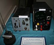
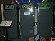
Equipment
The airborne side of the Gee Mk. II system consisted of two portions, the R1355 radio receiver, and the Indicator Unit Type 62 (or 62A) oscilloscope. The two were attached together by two thick cables, one of which carried the signal, and the second carried the power to the oscilloscope, the power supply being built into the receiver to save space on the display side. A "tropicalized" version of the system was also produced, with the R3645 receiver and Indicator Unit Type 299, which moved the later's power supply into the display unit.The R1355 was designed to allow the radio receiver to be easily swapped out in flight. This allowed the navigator to select different Gee chains in-flight, an operation that took a few minutes. This was also used to avoid jamming, as the Germans would not be aware which signals were actively being used.
Advantages and disadvantages
Unlike the German beam systemsBattle of the beams
The Battle of the Beams was a period early in the Second World War when bombers of the German Air Force used a number of increasingly accurate systems of radio navigation for night bombing. British "scientific intelligence" at the Air Ministry fought back with a variety of increasingly effective...
where the bombers flew to their targets along the beam, Gee pulses were radiated in all directions so if detected, they would not reveal the bombers' destinations. As the system was passive, unlike H2S
H2S radar
H2S was the first airborne, ground scanning radar system. It was developed in Britain in World War II for the Royal Air Force and was used in various RAF bomber aircraft from 1943 to the 1990s. It was designed to identify targets on the ground for night and all-weather bombing...
, there were no return signals which could give away the bombers' positions to night fighters. Additionally, this meant all of the aircraft could use the system at the same time.
Gee was highly susceptible to jamming since all the Germans had to do was radiate surplus pulses that made it impossible to determine which was a real signal from the slave and which was being broadcast from a jammer. This could be easily arranged by locating another slave station in France or the Netherlands and modifying its delay and signal strength to appear to be similar to one of the stations in the UK. However, this was suitable for use only over Germany; when flying over the UK the signal would appear too weak and/or from the wrong direction. Using conventional radio receivers and loop antennas for direction finding, radio operators could determine which of the signals was false.
Gee-H use
In the case of Gee-H, the use of the system was changed only slightly. Instead of the sweep being timed by the local oscillator in the display unit, the trigger signal was instead sent from the onboard transmitter. The signal was also sent out and reflected from the distant ground stations, and received on the existing Gee receiver for display. In theory this could be used to calculate a fix in exactly the same fashion as Gee, but using different charts. However, navigating to a target using such a system would be complex, similar to dead reckoning, with periodic fixes needed to update the windage calculations.Instead, Gee-H was used in a fashion similar to the earlier Oboe system. The navigator would first pick a station to use as the "cat" signal, the main navigation beacon. The range from the cat station to the target was calculated, and then the signal delay at that range. During the mission, the navigator would dial in the desired range to the transmitter, which would send out an "A"-like pulse at the set timing. The received pulse from the "cat" station would be displayed on the same trace. By instructing the pilot to turn left or right, the navigator would guide the bomber until the two traces were precisely overlapped, meaning that the bomber was flying a precise distance from the station, along a circular arc that would take them over the aim point. The signal received from the second station, "mouse", was likewise set up for display on the lower trace. In this case the distance would continue to change as the aircraft flew along the arc of the "cat" station. When this signal overlapped the pre-set range from "mouse", the payload was dropped.
Using this method of operation greatly reduced the workload for the navigator. For much of the mission he simply had to keep the blips on the upper trace aligned on the display, and then periodically watch the lower blips for timing. Additionally, due to the measurements always being measured as direct lines from the station, as opposed to hyperbolic curves, the accuracy fell off linearly instead of with the square of distance. Gee-H could this guide the bomber to within 120 yards over Germany, a dramatic improvement over Gee's approximately 1 mile accuracy at the same distance.
WWII chains
- Each chain had a code word using the names of American states suggesting this was for the use of American aircraft.
Eastern chain
The Eastern chain operated from 22 June 1942. Virginia 48.75 MHz- Master, DaventryDaventryDaventry is a market town in Northamptonshire, England, with a population of 22,367 .-Geography:The town is also the administrative centre of the larger Daventry district, which has a population of 71,838. The town is 77 miles north-northwest of London, 13.9 miles west of Northampton and 10.2...
, NorthamptonshireNorthamptonshireNorthamptonshire is a landlocked county in the English East Midlands, with a population of 629,676 as at the 2001 census. It has boundaries with the ceremonial counties of Warwickshire to the west, Leicestershire and Rutland to the north, Cambridgeshire to the east, Bedfordshire to the south-east,...
- Clee Hill, ShropshireShropshireShropshire is a county in the West Midlands region of England. For Eurostat purposes, the county is a NUTS 3 region and is one of four counties or unitary districts that comprise the "Shropshire and Staffordshire" NUTS 2 region. It borders Wales to the west...
- StenigotRAF StenigotRAF Stenigot was a World War II radar station situated at Stenigot. near Donington on Bain, Lincolnshire, England.It was part of the Chain Home radar network, intended to provide long range early warning for raids from Luftflotte V and the northern elements of Luftflotte II along the approaches to...
- Gibbet Hill, HindheadHindheadHindhead is a village in Surrey, England, about 11 miles south-west of Guildford. Neighbouring settlements include Haslemere, Grayshott and Beacon Hill. Hindhead is the highest village in Surrey...
, SurreySurreySurrey is a county in the South East of England and is one of the Home Counties. The county borders Greater London, Kent, East Sussex, West Sussex, Hampshire and Berkshire. The historic county town is Guildford. Surrey County Council sits at Kingston upon Thames, although this has been part of...
- Chain monitor, RAF BarkwayBarkwayBarkway is a long-established village and civil parish in the North Hertfordshire district of Hertfordshire, England, about five miles south-east of Royston,35 miles from London and 15 miles from the centre of Cambridge....
, near RoystonRoyston, HertfordshireRoyston is a town and civil parish in the District of North Hertfordshire and county of Hertfordshire in England.It is situated on the Greenwich Meridian, which brushes the towns western boundary, and at the northernmost apex of the county on the same latitude of towns such as Milton Keynes and...
, HertfordshireHertfordshireHertfordshire is a ceremonial and non-metropolitan county in the East region of England. The county town is Hertford.The county is one of the Home Counties and lies inland, bordered by Greater London , Buckinghamshire , Bedfordshire , Cambridgeshire and...
. (
Southern chain
Virginia 48.75 MHz.Eastern and Southern (Virginia) chains could not operate simultaneously
- Master, Bulbarrow
- Truleigh Hill
- West Prawle
Carolina 44.90 MHz Used by Coastal Command and Combined Operations
Same Master and Slave sites
South-Eastern chain
Carolina 44.90 MHz. Used by Combined Operations.- Master, Truleigh Hill
- Canewdon
Northern chain
The Northern Gee chain operated from late 1942 until March 1946.- Master, Burifa Hill on Dunnet HeadDunnet HeadDunnet Head is a peninsula in Caithness, on the north coast of Scotland, that includes the most northerly point of the mainland of Great Britain. The point, known as Easter Head, is at , about westnorthwest of John o' Groats and about from Duncansby Head...
, in CaithnessCaithnessCaithness is a registration county, lieutenancy area and historic local government area of Scotland. The name was used also for the earldom of Caithness and the Caithness constituency of the Parliament of the United Kingdom . Boundaries are not identical in all contexts, but the Caithness area is...
, ScotlandScotlandScotland is a country that is part of the United Kingdom. Occupying the northern third of the island of Great Britain, it shares a border with England to the south and is bounded by the North Sea to the east, the Atlantic Ocean to the north and west, and the North Channel and Irish Sea to the...
. - Scousburgh, Shetland IslandsShetland IslandsShetland is a subarctic archipelago of Scotland that lies north and east of mainland Great Britain. The islands lie some to the northeast of Orkney and southeast of the Faroe Islands and form part of the division between the Atlantic Ocean to the west and the North Sea to the east. The total...
- Windyhead Hill, PennanPennanPennan is a small village in Aberdeenshire, Scotland consisting of a small harbour and a single row of homes, including a hotel. It is located on the north-facing coast and is approximately one hour's drive from Aberdeen.-Area history:...
, AberdeenshireAberdeenshireAberdeenshire is one of the 32 unitary council areas in Scotland and a lieutenancy area.The present day Aberdeenshire council area does not include the City of Aberdeen, now a separate council area, from which its name derives. Together, the modern council area and the city formed historic...
- Sango, DurnessDurnessDurness is a huge but remote parish in the northwestern Highlands of Scotland, encompassing all the land between the Moine to the East and the Gualin to the West...
, SutherlandSutherlandSutherland is a registration county, lieutenancy area and historic administrative county of Scotland. It is now within the Highland local government area. In Gaelic the area is referred to according to its traditional areas: Dùthaich 'IcAoidh , Asainte , and Cataibh...
- Chain Monitor co-located at Burifa Hill
South Western Chain
- Master, Sharpitor
- Worth Matravers
- Sennen
- Folly
- Chain Monitor, Trerew http://www.subbrit.org.uk/rsg/sites/t/trerew_rotor/index.html
Worth Matravers was used after the war as a training base for Gee operators.
- C Slave Brest. AMES 101 (a light Type 100) from 2 December 1944
North-Eastern chain
Operational 18 April 1944- Master Station, Richmond, Yorkshire AMES 7711
- B Slave Station, High Whittle, Northumberland AMES 7721
- C Slave Station, Stenigot AMES 7722. Changed to Nettleton (formerly known as Caistor) because of poor coverage from Stenigot.
North Western chain
Operational for about six months in 1945Planned
- Master Station, Mull AMES 7411 (Site unknown)
- B Slave Station, Saligo Bay AMES 7421
- C Slave Station, Barra AMES 7422 (Site unknown)
- D Slave Station, Down Hill (Northern Ireland) AMES 7423
Operational
- Master Station, Saligo Bay
- B Slave Station, Down Hill (Northern Ireland)
- C Slave Station, Kilkenneth, Tiree
Others
There was another chain Indiana using 46.79 MHz but it was not in use by 1943.An emergency frequency (XF) of 50.5 MHz, codeword Zanesville, was allocated.
Channel Chain
- Master UK
- Slave UK
- C Slave Anneville-en-Saire, Cherbourg. Operational 23 August 1944. AMES 7921
Rheims Chain
Operational 5 October 1944. 83.5 MHz
- Master Rheims AMES 7912 became AMES 7913
- B Slave La Capelle AMES 7925 became AMES 105
- C Slave Ligny AMES 7926 became AMES 128
- D Slave Estissac AMES 7924 became AMES 124
- Monitor Mourmelon AMES 7931
Louvain / Ruhr Chain Operational 9 October 1944, replace by heavy mobile equipment 23 October 1944 and became the Ruhr Chain.
80.5 MHz (?)
- Master Louvain AMES 107 to be replaced by AMES 7911
- B Slave Eindhoven AMES 105 to be replaced by AMES 7923
- C Slave Laroche AMES 106 to be replaced by AMES 7922
- D Slave Axel AMES 108 to be replaced by AMES 7921
Saar Chain
Operational 21 March 1945 using light Type 100 units. Replaced with heavy units from the Rheims Chain. 50.5 MHz
- Master St Avold AMES 108 became AMES 7912 with AMES 108 as standby
- B Slave Diekirch AMES 106 became AMES 7925 with AMES 106 as standby
- C Slave Saverne AMES 104 became AMES 7225 with AMES 104 as standby
- D Slave Gondercourt
Metz / Munster Chain
- Master Commercy AMES 108
- B Slave Arlon AMES 106
- C Slave Remiremont AMES 104
Frankfurt Chain
- Master Roemand AMES 7932 later AMES 7911
- B Slave Nijmegan AMES 120 later AMES 7923
- C Slave Euskirchen AMES 102 later AMES 7922 (AMES 102 was the first 72 Wing unit deployed in Germany)
- D Slave Louvain AMES 129 later AMES 7921
Innsbruck / Nurnberg Chain
Planned but decided that no longer needed though decided to go ahead as part of the post-war Gee organisation. Operational 26 April 1945
Kassel / Central German Chain
- Master Winterberg AMES 7932
- B Slave Osnabruck AMES 120
- C Slave Gotha AMES 102
- D Slave Bad Homberg AMES 131
Munich Chain Proposed
- Master Bad Homberg AMES 108
- B Slave Fulda AMES 106
- C Slave Neustadt AMES 104
- D Slave Kempenich AMES 127
Deployed as
- Master Hesselburg AMES 7912
- B Slave Zinzenzell AMES 7925
- C Slave Munsingen AMES 7926
- D Slave Fulda AMES 7921
Post WWII chains
After World War II the Gee system was used as a navigational aid for civil aviation though mainly from new sites.
English ChainsPost-World War II the RAF re-sited two of the three wartime Gee chains in England. Eastern and South Western chains (four stations each) and Southern chain of three stations. The Southern chain became a four station London chain and Eastern chain became a Midland chain. This was planned for 1948.
Northern Chain
This continued post-World War II using existing sites, two on the North coast of Scotland, one North of Aberdeen and one in the Shetlands.
Scottish Chain
Opened around 1948 and closed early 1969.
- Master Station Lowther Hill
- Slave Stations
- Great Dun FellGreat Dun FellGreat Dun Fell is the second-highest hill in the Pennine range, United Kingdom, lying two miles south along the watershed from Cross Fell, its higher neighbour...
, Cumberland
- Craigowl HillCraigowl HillCraigowl Hill is a summit towards the eastern end of the Sidlaw Hills in Angus, Scotland. Northeast of Kirkton of Auchterhouse and approximately eight kilometres north of Dundee, Craigowl Hill represents the highest point in the range.-External links:...
, near Dundee
- Rhu Stafnish, near Campbeltown
Other chains- Great Dun FellGreat Dun FellGreat Dun Fell is the second-highest hill in the Pennine range, United Kingdom, lying two miles south along the watershed from Cross Fell, its higher neighbour...
, Cumberland - Craigowl HillCraigowl HillCraigowl Hill is a summit towards the eastern end of the Sidlaw Hills in Angus, Scotland. Northeast of Kirkton of Auchterhouse and approximately eight kilometres north of Dundee, Craigowl Hill represents the highest point in the range.-External links:...
, near Dundee - Rhu Stafnish, near Campbeltown
A chain of Gee stations was opened after the war in North Germany. Stations were at Winterberg, Ibug, Nordhorn and Uchte.
There were several stations during the 1955-1959 period that appeared to be more of a deception than really operational. They were 550 SU at Fort Spijkerboor outside of Pumerand, Holland; 889 SU at Eckendforde in North Germany; and 330 SU outside of Ingolstadt in Bavaria, Germany. These stations were rarely if ever operation in the late 1950s.
Further reading
- Colin Latham and Anne Stobbs. Radar, A Wartime Miracle (Sutton Publishing Ltd, Stroud, Gloucestershire 1996) ISBN 0750916431
External links
- Radio Navigation Systems in Greg Goebel's THE WIZARD WAR
- Imperial War Museum page; information about restored Gee receivers.
- Radarpages.co.uk page; information about the mechanics of the system.
- History of RAF Wintenberg and North German Gee chain