

Francis Lewis Boulevard
Encyclopedia
New York City
New York is the most populous city in the United States and the center of the New York Metropolitan Area, one of the most populous metropolitan areas in the world. New York exerts a significant impact upon global commerce, finance, media, art, fashion, research, technology, education, and...
borough
Borough (New York City)
New York City, one of the largest cities in the world, is composed of five boroughs. Each borough now has the same boundaries as the county it is in. County governments were dissolved when the city consolidated in 1898, along with all city, town, and village governments within each county...
of Queens
Queens
Queens is the easternmost of the five boroughs of New York City. The largest borough in area and the second-largest in population, it is coextensive with Queens County, an administrative division of New York state, in the United States....
. The roadway is named for Francis Lewis
Francis Lewis
Francis Lewis was a signer of the United States Declaration of Independence as a representative of New York....
, a Queens resident who was a signer of the United States Declaration of Independence
United States Declaration of Independence
The Declaration of Independence was a statement adopted by the Continental Congress on July 4, 1776, which announced that the thirteen American colonies then at war with Great Britain regarded themselves as independent states, and no longer a part of the British Empire. John Adams put forth a...
.
Route description
Francis Lewis Boulevard (heading north to south) starts off from the Cross Island Parkway in WhitestoneWhitestone, Queens
Whitestone is a residential neighborhood in the northernmost part of the City of New York borough of Queens. Located between the East River to the north and 25th Avenue to the south. Whitestone is surrounded by College Point, Flushing, Bayside, Auburndale, Linden Hill, and Murray Hill...
, and runs through Whitestone
Whitestone, Queens
Whitestone is a residential neighborhood in the northernmost part of the City of New York borough of Queens. Located between the East River to the north and 25th Avenue to the south. Whitestone is surrounded by College Point, Flushing, Bayside, Auburndale, Linden Hill, and Murray Hill...
, Bayside
Bayside, Queens
Bayside is a suburban neighborhood in the borough of Queens in New York, New York in the United States. Bayside is known as one of the most expensive areas to live in Queens, with well kept homes and landscaping...
, Auburndale
Auburndale, Queens
Auburndale is a neighborhood in the northern part of the New York City borough of Queens, between Bayside and Murray Hill. The neighborhood is part of Queens Community Board 11.The name comes from Auburndale, Massachusetts, the home of L. H...
, Fresh Meadows
Fresh Meadows, Queens
Fresh Meadows is a residential neighborhood in northeastern section of the New York City borough of Queens.-Location:Fresh Meadows is located on the northeast side of Hillcrest, bordered to the east by Cunningham Park, to the south by Union Turnpike and St. John's University, and to the west by...
, Hollis
Hollis, Queens
Hollis is a neighborhood within the southeastern section of the New York City borough of Queens. A predominantly African American community, the boundaries are considered to be the Far Rockaway Branch of the Long Island Rail Road to the west, Hillside Avenue to the north, Francis Lewis Boulevard to...
, Cambria Heights
Cambria Heights, Queens
Cambria Heights is a middle-class neighborhood in the southeastern portion of the New York City borough of Queens. It is bounded by Springfield Boulevard and Francis Lewis Boulevard to the west, the Elmont, Nassau County border on the east, Queens Village to the north, St. Albans to the west, and...
, Springfield Gardens
Springfield Gardens, Queens
Springfield Gardens is a neighborhood in the southeastern area of the New York City borough of Queens, bounded to the north by St. Albans, to the east by Laurelton & Rosedale, to the south by John F. Kennedy International Airport, and to the west by Farmers Boulevard...
, Laurelton
Laurelton, Queens
Laurelton is a neighborhood in the New York City borough of Queens. It is now a largely middle class neighborhood. In the 1930s through 1970s and beyond, the neighborhood was populated by many Jewish Americans, but succeeding generations have been made up of new migrants. The neighborhood is part...
and Rosedale
Rosedale, Queens
Rosedale is a suburban neighborhood in Queens. The neighborhood is on the Nassau County, New York - Queens border and is part of Queens Community Board 13.- History :...
. Throughout the majority of its length, it is a 4-6 lane wide median divided street
Dual carriageway
A dual carriageway is a class of highway with two carriageways for traffic travelling in opposite directions separated by a central reservation...
, making it one of the wider boulevards that runs exclusively in Eastern Queens, along with Merrick Boulevard, and the southern portion of Springfield Boulevard
Springfield Boulevard
Springfield Boulevard is a major north/south roadway that runs through the eastern section of Queens, New York. It goes from Northern Boulevard in Bayside, to 147th Ave in Springfield Gardens. Springfield Boulevard runs through Bayside, Oakland Gardens, Queens Village, Cambria Heights, Laurelton,...
. South of Springfield Boulevard, Francis Lewis Boulevard detours around Old Montefiore Cemetery, with portions of 121st Avenue, 230th Place, and 138th Avenue renamed Francis Lewis Boulevard on its way towards Rosedale. The boulevard ends at Hook Creek Boulevard in Rosedale, right before the Nassau County
Nassau County, New York
Nassau County is a suburban county on Long Island, east of New York City in the U.S. state of New York, within the New York Metropolitan Area. As of the 2010 census, the population was 1,339,532...
border. It is the longest street exclusively within Queens (longer roads, such as Northern Boulevard
New York State Route 25A
New York State Route 25A is a state highway on Long Island in New York in the United States. It serves as the main east–west route for most of the North Shore of Long Island, running from the Queens Midtown Tunnel in the New York City borough of Queens at its western terminus to...
continue into Nassau
Nassau County, New York
Nassau County is a suburban county on Long Island, east of New York City in the U.S. state of New York, within the New York Metropolitan Area. As of the 2010 census, the population was 1,339,532...
and Suffolk
Suffolk County, New York
Suffolk County is a county located in the U.S. state of New York on the eastern portion of Long Island. As of the 2010 census, the population was 1,493,350. It was named for the county of Suffolk in England, from which its earliest settlers came...
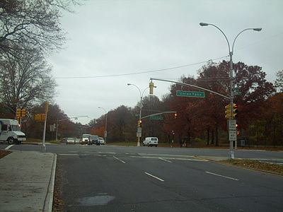
Counties). Being a long, major street, it intersects with many other major throughfares in Queens as well, such as Utopia Parkway, Northern Boulevard, Union Turnpike
Union Turnpike (New York)
Union Turnpike is a thoroughfare stretching across central and eastern Queens in New York City. It runs from Myrtle Avenue in Glendale to Marcus Avenue in North New Hyde Park, about a mile into Nassau County, New York. Initially designed as a toll road, it takes a straight-arrow path from Kew...
, Hillside Avenue, Jamaica Avenue
Jamaica Avenue
Jamaica Avenue is a major avenue in the boroughs of Brooklyn and Queens in New York City, New York, in the United States. Jamaica Avenue starts at Broadway and Fulton Street in the East New York neighborhood in Brooklyn, and goes to the city line in Bellerose, Queens, where it becomes Jericho...
, Linden Boulevard
Linden Boulevard
Linden Boulevard is a boulevard in New York City. It starts off at Flatbush Avenue in Brooklyn and stretches through both Brooklyn and Queens. This boulevard, especially the area of Cambria Heights between Springfield Boulevard and the Nassau County line represents a smaller version of shopping...
, Springfield Boulevard, Merrick Boulevard, and Sunrise Highway.
Francis Lewis Boulevard has two main bus lines, the Q76 and the Q77. The Q76 runs down Francis Lewis Boulevard from Hillside Avenue in Hollis to the Cross Island Parkway in Whitestone. It runs through the Holliswood, Cunningham Park, Bayside, and Whitestone sections of the street. The Q77 runs on the stretch between the intersection with Springfield Boulevard to Hillside Avenue, and goes through the Springfield Gardens, St. Albans, and Hollis stretches of Francis Lewis Boulevard. Both bus lines operate from the 165th Street Bus Depot in Jamaica, and also share a route along Hillside Avenue. Other bus lines, such as the Q16, and Q28, serve smaller stretches of the street.
The Cunningham Park
Cunningham Park
Cunningham Park is a park in the New York City borough of Queens. The park lies between the Grand Central Parkway to the south and the Long Island Expressway, and is bifurcated by the Clearview Expressway...
stretch of Francis Lewis Boulevard is notorious for drag racing, which has resulted in several fatalities to drivers and pedestrians over the years. Recently, speed cameras have been installed along this stretch.
Two major Catholic high schools in New York City, St. Francis Preparatory School
St. Francis Preparatory School
St. Francis Preparatory School, commonly known as St. Francis Prep, is a private, independent Catholic college preparatory school in the Fresh Meadows neighborhood of the New York City borough of Queens. It is the largest non-diocesan Catholic high school in the United States. St. Francis is run by...
and Holy Cross High School
Holy Cross High School (Flushing)
Holy Cross High School is an all-boys Roman Catholic high school in Flushing, in the New York City borough of Queens. Founded in 1955, the school was chartered by the Board of Regents of the University of the State of New York and accredited by the Middle States Association of Colleges and Schools...
are both located on Francis Lewis Boulevard. St. Francis Preparatory is located at the intersection with Horace Harding Expressway, whereas Holy Cross is located by the intersection with 26th Avenue. Every year the two schools play a football game in the beginning of the season called the "Battle of the Boulevard", in reference to the shared stretch of road.
Francis Lewis Boulevard is accessible at Exit 35 of the Cross Island Parkway
Cross Island Parkway
Cross Island Parkway, also known as the 100th Infantry Division Parkway, is a parkway within New York State. The parkway is a part of the Belt Parkway system that runs along the perimeter of the borough of Queens in New York City...
, Exit 24A off the Belt Parkway
Belt Parkway
The Belt System is a series of connected limited-access highways that form a belt-like circle around the New York City boroughs of Brooklyn and Queens. The system comprises four officially separate parkways; however, three of the four are signed as the Belt Parkway...
, Exit 20A-B off the Grand Central Parkway
Grand Central Parkway
The Grand Central Parkway is a parkway that stretches from the RFK-Triborough Bridge in New York City to Nassau County on Long Island. At the Queens-Nassau border, it becomes the Northern State Parkway, which runs across the northern part of Long Island through Nassau County and into Suffolk...
and Exit 26 off the Long Island Expressway
Interstate 495 (New York)
Interstate 495 is an auxiliary Interstate Highway on Long Island in New York in the United States. The route extends for from the western portal of the Queens-Midtown Tunnel in the New York City borough of Manhattan to County Route 58 in Riverhead, Suffolk County...
.
History
Before being renamed in the 1930s, the roadway (or at least the part between Springfield Boulevard and Whitestone) was called Cross Island Boulevard. The street was renamed after Francis Lewis to honor a signer of the Declaration of Independence who owned a home in Whitestone, and to avoid confusion with the Cross Island Parkway. Many residents that live by the street usually refer to Francis Lewis Boulevard as simply "Franny Lew".External links
- http://maps.google.com/maps?f=d&saddr=francis+lewis+blvd+at+hook+creek+blvd,+queens,+ny&daddr=Francis+Lewis+Blvd+to:Francis+Lewis+Blvd+to:230th+Pl%2FFrancis+Lewis+Blvd+to:230th+Pl%2FFrancis+Lewis+Blvd+to:Francis+Lewis+Blvd+to:40.785513,-73.806109&hl=en&geocode=%3BFeNobAIdsPia-w%3BFVh_bAIdgOSa-w%3BFTCYbAId88ea-w%3BFR3PbAIdI-qa-w%3BFSrubAIdTL6a-w%3B&mra=dme&mrcr=0&mrsp=6&sz=15&via=1,2,3,4,5&sll=40.784116,-73.802805&sspn=0.01446,0.027637&ie=UTF8&ll=40.721242,-73.753967&spn=0.231579,0.4422&z=11Google Maps - Francis Lewis Boulevard]
- Jeff Saltzman's Francis Lewis Blvd. section
- Forgotten NY: Rosedale
- FrancisLewisBlvd.com (News, Photos, Links) related to Francis Lewis Blvd in Queens, NY