
Foulness
Encyclopedia
Foulness is an island on the east coast of Essex
in England
, which is separated from the mainland by narrow creek
s. The large island had a usually resident population of 212 people in the 2001 census, who live in the settlements of Churchend and Courtsend, at the north end of Foulness. The island has a general store
and post office
. The George and Dragon pub in Churchend closed in 2007, while the church closed in May 2010.
Foulness Island is predominantly farm land and is protected from the sea by a sea wall. The island's name is derived from the Old English for wild birds and promontory, and it is an internationally important site for migrating and breeding birds, including avocets
. During the North Sea flood of 1953
, almost the entire island was flooded, and two people died.
Prior to 1922, when the military road was built, access was only available across the Maplin Sands
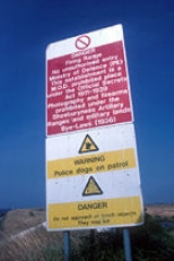
via the Broomway, a tidal path said to pre-date the Romans, or by boat. Although public rights of way exist, the island is run by QinetiQ
on behalf of the Ministry of Defence
, and access to the island is only permitted with a pass, obtainable from Shoeburyness
. The island's visitor centre is opened to the public on the first Sunday in summer months, but permission must be sought to visit. Until 2007, it was possible for the public to visit the pub on the island by telephoning ahead; if they had not done so, access would be denied.
Cheap imports of wheat from America caused widespread depression among agricultural communities in the 1870s, with much arable land reverting to rough pasture. However, a map attached to the report of the Royal Commission on Agriculture (Essex), which reported in 1894, shows that no land on the island reverted to pasture up to 1880, despite some 25 per cent reverting in the neighbouring Rochford hundred. Great Burwood farm had 47 acres (19 ha) of its 389 acres (157.4 ha) in use as pasture in 1858, which had dropped to just 12 acres (4.9 ha) in 1899. Land prices in the same period dropped dramatically, as the farm was bought for £11,165 in 1858 and sold for only £1,800 in 1899, losing 84 per cent of its value. By the 1970s, the smaller farms had amalgamated into five large farming businesses.
. The Anglo-Saxon Chronicle
also records an exceptional tide on 11 November 1099 which flooded the land, but these were rare occurrences. The first defences were probably erected in the late 12th century. By 1210, the "law of the marsh" was enshrined in law, which required that the cost of such defences should be paid for by those who benefitted from them, in proportion to the amount of land owned or rented, and this remained the case until the passing of the Land Drainage Act of 1930. In 1335, 1338 and 1346, commissioners were sent to inspect the state of the banks in the Rochford hundred
, which included Foulness.
The earliest record of sea walls was in 1271, and in 1348 there were problems with one of the marshes, which was flooding every day, indicating that it was below the level of normal tides. The sea walls were made of earth, and were thatched with hurdles of brushwood and rushes. The island was divided into a series of 11 or 12 marshes, each with its own wall, rather than one wall around the whole area, and was extended in 1420 by a new wall around New Wick marsh, and again between 1424 and 1486, when Arundel marsh was enclosed. Ditches ran between the walls of the marshes, with sluices at the ends where the ditches met the sea. At high water, the island would effectively be divided into a number of smaller islands. A Commission of Sewers was appointed in 1695, whose jurisdiction included Foulness, but the inhabitants were not happy, and engaged the lawyer Sir John Brodrick to put their case. They argued that an exceptional high tide had flooded the island in 1690, but that they had repaired and improved the walls themselves, and therefore should not be taxed by the Commissioners. Eventually, Foulness had its own Commission, from 1800 to the early 1900s.
The size of the island has been increased several times by "innings". Saltings build up along the shore from silt which is carried to the sea by the rivers, and is deposited on the shore by the tide. Salt-loving plants then take root in the mud, and the salting is established. The plants trap sediments, and the surface rises until it remains above the level of most tides. Inning occurs when a sea wall is built around the edge of the salting, after which rain washes the salt downwards. The alluvium
which forms the soil is highly fertile once fresh-water plants start to grow. The innning of New Wick marsh added 220 acres (89 ha), while Arundel march covered 385 acres (155.8 ha). No new innings took place in the 1500s, as there were several exceptional tides, and activity was centred on maintaining the existing defences, but another 170 acres (68.8 ha) was added between 1620 and 1662, and there was further activity between 1687 and 1688, in 1801, and finally in 1833. In total, 1632 acres (660.4 ha) were added to the island.
s or fire-brooms, which are buried in the sands. Six headways run from the track to the shore, giving access to local farms. The track was extremely dangerous in misty weather, as the incoming tide floods across the sands at high speed, and the water forms whirlpools because of flows from the River Crouch
and River Roach
. Under such conditions, the direction of the shore cannot be determined, and the parish registers record the burials of many people who were drowned.
The island was also served by ferries, which carried fresh water as well as people. The carriage of water is mentioned in the accounts kept by the bailiffs in 1420, 1424 and 1486. By the middle of the 19th century, ferries ran to Burnham-on-Crouch
, Potton Island
and Wallasea Island
. There was initially no source of fresh water on the island apart from any rainwater that could be collected. In 1725, it was thought that there might be water below the island, and a well was constructed on Great Shelford marsh. It reached a depth of 92 feet (28 m), but no water was found. At the end of the 1700s, Francis Bannester, who owned Rushley Island nearby, attempted to find water by boring, but again failed to do so. However, his son, who was also called Francis, persisted and found fresh water some 500 feet (152.4 m) below Rushley in 1828. Just six years later, there were more than 20 such springs scattered through the six islands of which Foulness is one, and fourteen farms on the island had their own wells by 1889.
 Evidence for housing comes from the census returns. In 1801, 396 people lived in 43 houses, which gives an average occupancy of 9.2 people, which had increased to 9.8 in 1811, when 450 people occupied 46 houses. Ownership of the manor was inherited by George Finch in 1826, who took his responsibilities seriously, and set about improving the island by building brick houses for his tenants. Five years later, 630 people lived in 78 houses, and by 1851, 109 dwellings housed 640 people, with average occupancy down to 5.9 people. Population peaked at 754 on the census of 1871, and has steadily declined since.
From 1855, the Shoebury Sands, which are a continuation of the Maplin Sands to the south of the island, had been used as a testing site for artillery, and the War Office
sought to extend this at the end of the 19th century, by buying the island and its offshore sands, to act as a research and development centre for new weapons. They bought some of the sands above Fishermans Head in 1900, but the rest belonged to Alan Finch, the lord of the manor, and he refused to grant shooting rights over them. In 1912, the War Office also discovered that large areas of the sands were leased to tenants, who used them for fishing kiddles. A kiddle was a large V-shaped or square net, which formed an enclosure in which fish were trapped as the tide receded. Attempts to buy the lordship were also refused by Finch, but he died in 1914, and his half-brother Wilfred Henry Montgomery Finch sold it on 13 July 1915, resulting in the War Office owning around two-thirds of the island. They had also been buying any farms that were not part of the manor, and by the end of the First World War, the only buildings which they did not own were the church and rectory, the school, and a mission hall at Courts End. They demolished the post mill
towards the beginning of the war, and the parish poor-house and a wooden lock-up which was located near the church were also demolished.
One benefit of the takeover was the construction of the military road in 1922, which crosses New England Island
and Havengore Island
by a series of bridge
s, to reach the mainland near Great Wakering. After its opening, the Broomway ceased to be used, except by the military. With the passing of the Ministry of Defence Act (1946) and the subsequent rationalisation of five agencies in 1971, ownership of the island passed from the War Office to the Ministry of Defence
. In 2003, a contract to manage the testing of munitions was awarded to the defence contractors QinetiQ
, and they also control access to the island.
In the 1850s, the South Essex Estuary and Reclamation Company proposed a grand scheme to reclaim around 47.5 square miles (123 km²) of land on the Essex coast, which would have included most of Foulness Sands and Marlin Sands. The civil engineer Sir John Rennie produced the plans, and an act of Parliament
was obtained in 1852. This authorised the construction of a 20 miles (32.2 km) wall, running from Wakering Stairs to beyond Foulness Point. A small amount of work was carried out on another part of the scheme near Bradwell-on-Sea
, but the company was wound up in 1868. Lack of finance and opposition from landowners contributed to its failure. Just 100 years later, the Roskill Commission investigated potential sites for a third London airport
. Four sites were considered, including construction of an off-shore airport on Maplin Sands
. The Thames Estuary Development Company also proposed a seaport, capable of handling 500,000-tonne ships, with the scheme requiring 28 square miles (72.5 km²) of land to be reclaimed. The plans were shelved after the 1973 oil crisis
, and a cheaper option was sought.
, as a result of exceptional weather conditions which affected much of the Netherlands
and eastern England. High water at Southend was expected to be 8.7 feet (2.7 m) above mean sea level at 1:30 am on Sunday 1 February. The actual tide rose to 15.7 feet (4.8 m) above mean sea level, which was 3.5 feet (1.1 m) above the danger level for this part of the Essex coast. This level in itself was not a danger to the island, as the sea walls had been raised and strengthened between 1951 and 1952 by the War Department, and were 16.5 feet (5 m) above mean sea level. However, the high water was accompanied by strong winds, creating large waves, which broke over the top of the defences, washing away the earth banks on the inland side of the walls. Two sections of the wall breached, from Rugwood Head to Asplins Head on the eastern side of the island, and for about 1 miles (1.6 km) to the west of Foulness Point on the northern side of the island. By 6:00 am, most of it was under water, and gas, electricity and telephone links had been severed. Rescue attempts on the Sunday failed to reach Foulness.
Plans were formulated by the Army, the Southend lifeboat service and various civilian services for a rescue attempt on the Monday. Great Wakering
village hall and the Royal Corinthian Yacht Club at Burnham-on-Crouch
were prepared as reception centres, and a flotilla of small boats, the lifeboat, a barge and an Army DUKW amphibious truck
reached the stranded people and evacuated them to the reception centres. 30 men refused to leave, because of the plight of their livestock, but 24 of them were compulsorily evacuated the following day. Two people died in the disaster. Rescue of the animals was difficult, because the road was not accessible, and all access to the island was across the sands, using the Broomway to Fisherman's Head, which was only possible at low tide. On Wednesday 4 February, a number of DUKWs and four-wheel-drive lorries reached the island with food and water for the stranded animals, which were rounded up and assembled at the churchyard, where the land is slightly higher. The following day, they were moved to Newhouse Farm, near to Fisherman's Head, ready for the arrival of 24 cattle lorries, which drove across the sands early on Friday morning. Most of the animals had been rescued by Saturday night, with the final sixteen dairy cows leaving by barge on Sunday morning. A total of 400 cattle, 14 calves, 28 horses, 72 sheep, 6 lambs, 3 pigs, 670 chickens, 100 ducks, 2 dogs, 10 rabbits, 4 budgerigars and the 16 dairy cows were rescued. Around 700 sheep and 249 pigs were drowned.
In order to repair the walls before the next spring tides, which were due on 16 February, 300 soldiers and 70 sailors were drafted in. Three Royal Navy minesweepers, the Cheerful, Cockatrice and Rinaldo, were moored near Foulness Point, and were used as accommodation by the workers. The number of personnel had increased to 400 soldiers and 100 sailors by 11 February. High tide on 14 February was 1.5 foot (0.4572 m) higher than expected, and washed away a section of the repaired wall at Shelford Creek, but repairs were again made, and the walls survived the spring tides of the following two days. Re-occupation of the island was delayed until 19 March, to ensure that the new walls would withstand the spring tides due on 14 and 15 March, but many people commuted to their homes each day to begin the task of cleaning up the mess. Of the 114 families who had been evacuated, 80 returned on 19 March.
" being the Germanic word for promontory
, and it remains an important centre for birds, with the area around Foulness Point designated as a Site of Special Scientific Interest
(SSSI). Habitat is provided by extensive mud flats and sand flats, which are covered twice a day by the tides, together with salt marshes, banks of shingle and shells, grazing marshes, rough grass and scrubland. They are recognised as being internationally important for six species of birds. Thousands of dark-bellied Brent geese arrive from Russia to spend the winter on the flats, which are also frequented by bar-tailed godwit
, grey plover
, red knot
, oystercatcher
and redshank
. For waterfowl, principally curlew
, dunlin
and shelduck
, the site is of national importance. In winter, hen harriers
can be seen foraging, and a wide range of plants and invertebrates thrive there.
Other birds which use the island for breeding include avocet
, common tern
, little tern
, sandwich tern and ringed plover
. During the winter months, in excess of 100,000 waterfowl have been reported. The avocet population is the second largest in the United Kingdom. The Foulness SSSI has been designated as a Special Protection Area
for Birds under the EC Birds Directive, and is also a Ramsar site under the Ramsar Convention
because of its importance as a wetland.
's novel Sharpe's Regiment
as the camp ground for the fictional second battalion of the South Essex Regiment
.
Essex
Essex is a ceremonial and non-metropolitan county in the East region of England, and one of the home counties. It is located to the northeast of Greater London. It borders with Cambridgeshire and Suffolk to the north, Hertfordshire to the west, Kent to the South and London to the south west...
in England
England
England is a country that is part of the United Kingdom. It shares land borders with Scotland to the north and Wales to the west; the Irish Sea is to the north west, the Celtic Sea to the south west, with the North Sea to the east and the English Channel to the south separating it from continental...
, which is separated from the mainland by narrow creek
Creek (tidal)
A tidal creek, tidal channel, or estuary is the portion of a stream that is affected by ebb and flow of ocean tides, in the case that the subject stream discharges to an ocean, sea or strait. Thus this portion of the stream has variable salinity and electrical conductivity over the tidal cycle...
s. The large island had a usually resident population of 212 people in the 2001 census, who live in the settlements of Churchend and Courtsend, at the north end of Foulness. The island has a general store
General store
A general store, general merchandise store, or village shop is a rural or small town store that carries a general line of merchandise. It carries a broad selection of merchandise, sometimes in a small space, where people from the town and surrounding rural areas come to purchase all their general...
and post office
Post office
A post office is a facility forming part of a postal system for the posting, receipt, sorting, handling, transmission or delivery of mail.Post offices offer mail-related services such as post office boxes, postage and packaging supplies...
. The George and Dragon pub in Churchend closed in 2007, while the church closed in May 2010.
Foulness Island is predominantly farm land and is protected from the sea by a sea wall. The island's name is derived from the Old English for wild birds and promontory, and it is an internationally important site for migrating and breeding birds, including avocets
Pied Avocet
The Pied Avocet, Recurvirostra avosetta, is a large black and white wader in the avocet and stilt family, Recurvirostridae. They breed in temperate Europe and western and Central Asia. It is a migratory species and most winter in Africa or southern Asia...
. During the North Sea flood of 1953
North Sea flood of 1953
The 1953 North Sea flood was a major flood caused by a heavy storm, that occurred on the night of Saturday 31 January 1953 and morning of 1 February 1953. The floods struck the Netherlands, Belgium, England and Scotland.A combination of a high spring tide and a severe European windstorm caused a...
, almost the entire island was flooded, and two people died.
Prior to 1922, when the military road was built, access was only available across the Maplin Sands
Maplin Sands
The Maplin Sands are mudflats on the northern bank of the Thames estuary, off Foulness Island, near Southend-on-Sea in Essex, England, though they actually lie within the neighbouring borough of Rochford...
via the Broomway, a tidal path said to pre-date the Romans, or by boat. Although public rights of way exist, the island is run by QinetiQ
QinetiQ
Qinetiq is a British global defence technology company, formed from the greater part of the former UK government agency, Defence Evaluation and Research Agency , when it was split up in June 2001...
on behalf of the Ministry of Defence
Ministry of Defence (United Kingdom)
The Ministry of Defence is the United Kingdom government department responsible for implementation of government defence policy and is the headquarters of the British Armed Forces....
, and access to the island is only permitted with a pass, obtainable from Shoeburyness
Shoeburyness
Shoeburyness is a town in southeast Essex, England, situated at the mouth of the river Thames Estuary. It is within the borough of Southend-on-Sea, and is situated at the far east of the borough, around east of Southend town centre...
. The island's visitor centre is opened to the public on the first Sunday in summer months, but permission must be sought to visit. Until 2007, it was possible for the public to visit the pub on the island by telephoning ahead; if they had not done so, access would be denied.
Geography
The island covers 9.195 square miles (23.8 km²) bounded by its sea walls. Prior to 1847, tithes were payable in kind, but under the terms of the General Tithe Act of 1836, these were replaced by payments of money. The commutation commission, who were responsible for setting the level of payments, produced a details schedule and map in 1847, which provides a detailed land usage survey. At the time, the island included 425 acres (172 ha) of saltings, which were located outside of the sea wall. The 5885 acres (2,381.6 ha) inside the wall comprised 4554 acres (1,842.9 ha) of arable land, with pasture covering another 783 acres (316.9 ha). 338 acres (136.8 ha) were described as inland water, which was made up of ponds and drainage ditches, while buildings, roads, the sea walls themselves and some waste ground made up the remaining 222 acres (89.8 ha). The arable land was used for the growing of cereal crops, namely wheat, oats and barley, and also for the production of beans, white mustard and clover.Cheap imports of wheat from America caused widespread depression among agricultural communities in the 1870s, with much arable land reverting to rough pasture. However, a map attached to the report of the Royal Commission on Agriculture (Essex), which reported in 1894, shows that no land on the island reverted to pasture up to 1880, despite some 25 per cent reverting in the neighbouring Rochford hundred. Great Burwood farm had 47 acres (19 ha) of its 389 acres (157.4 ha) in use as pasture in 1858, which had dropped to just 12 acres (4.9 ha) in 1899. Land prices in the same period dropped dramatically, as the farm was bought for £11,165 in 1858 and sold for only £1,800 in 1899, losing 84 per cent of its value. By the 1970s, the smaller farms had amalgamated into five large farming businesses.
Sea defences
The surface of the island, along with much of south-east England, has been sinking relative to normal tide levels since the end of the last Ice Age. There is no evidence for sea defences in the period of Roman occupation, although the area was flooded in A.D. 31 by an exceptional tide, which forced a withdrawal to ShoeburynessShoeburyness
Shoeburyness is a town in southeast Essex, England, situated at the mouth of the river Thames Estuary. It is within the borough of Southend-on-Sea, and is situated at the far east of the borough, around east of Southend town centre...
. The Anglo-Saxon Chronicle
Anglo-Saxon Chronicle
The Anglo-Saxon Chronicle is a collection of annals in Old English chronicling the history of the Anglo-Saxons. The original manuscript of the Chronicle was created late in the 9th century, probably in Wessex, during the reign of Alfred the Great...
also records an exceptional tide on 11 November 1099 which flooded the land, but these were rare occurrences. The first defences were probably erected in the late 12th century. By 1210, the "law of the marsh" was enshrined in law, which required that the cost of such defences should be paid for by those who benefitted from them, in proportion to the amount of land owned or rented, and this remained the case until the passing of the Land Drainage Act of 1930. In 1335, 1338 and 1346, commissioners were sent to inspect the state of the banks in the Rochford hundred
Rochford Rural District
Rochford Rural District was a rural district with an area of 146.01 square kilometres in the county of Essex, England. It was created in 1894, in 1897 the parish of Leigh was removed to create the Leigh-on-Sea Urban District. In 1926 the parish of Canvey Island was removed to create the Canvey...
, which included Foulness.
The earliest record of sea walls was in 1271, and in 1348 there were problems with one of the marshes, which was flooding every day, indicating that it was below the level of normal tides. The sea walls were made of earth, and were thatched with hurdles of brushwood and rushes. The island was divided into a series of 11 or 12 marshes, each with its own wall, rather than one wall around the whole area, and was extended in 1420 by a new wall around New Wick marsh, and again between 1424 and 1486, when Arundel marsh was enclosed. Ditches ran between the walls of the marshes, with sluices at the ends where the ditches met the sea. At high water, the island would effectively be divided into a number of smaller islands. A Commission of Sewers was appointed in 1695, whose jurisdiction included Foulness, but the inhabitants were not happy, and engaged the lawyer Sir John Brodrick to put their case. They argued that an exceptional high tide had flooded the island in 1690, but that they had repaired and improved the walls themselves, and therefore should not be taxed by the Commissioners. Eventually, Foulness had its own Commission, from 1800 to the early 1900s.
The size of the island has been increased several times by "innings". Saltings build up along the shore from silt which is carried to the sea by the rivers, and is deposited on the shore by the tide. Salt-loving plants then take root in the mud, and the salting is established. The plants trap sediments, and the surface rises until it remains above the level of most tides. Inning occurs when a sea wall is built around the edge of the salting, after which rain washes the salt downwards. The alluvium
Alluvium
Alluvium is loose, unconsolidated soil or sediments, eroded, deposited, and reshaped by water in some form in a non-marine setting. Alluvium is typically made up of a variety of materials, including fine particles of silt and clay and larger particles of sand and gravel...
which forms the soil is highly fertile once fresh-water plants start to grow. The innning of New Wick marsh added 220 acres (89 ha), while Arundel march covered 385 acres (155.8 ha). No new innings took place in the 1500s, as there were several exceptional tides, and activity was centred on maintaining the existing defences, but another 170 acres (68.8 ha) was added between 1620 and 1662, and there was further activity between 1687 and 1688, in 1801, and finally in 1833. In total, 1632 acres (660.4 ha) were added to the island.
Development
The Broomway provided the main access to Foulness for centuries. It is an ancient track, which starts at Wakering Stairs, and runs for 6 miles (9.7 km) along the Maplin Sands, some 440 yards (402.3 m) from the present shoreline. The seaward side of the track is defined by bunches of twigs and sticks, shaped like upside-down besom broomBesom broom
A besom broom is a traditionally constructed broom made of a bundle of twigs tied to a stouter pole. They are still made today and sold at gardening stores as an outdoor broom.- Construction :...
s or fire-brooms, which are buried in the sands. Six headways run from the track to the shore, giving access to local farms. The track was extremely dangerous in misty weather, as the incoming tide floods across the sands at high speed, and the water forms whirlpools because of flows from the River Crouch
River Crouch
The River Crouch is a river that flows entirely through the English county of Essex.The distance of the Navigation between Holliwell Point which is north of Foulness Island and Battlesbridge is 17.5 Miles, i.e. 15.21 Nautical Miles.-Route:...
and River Roach
River Roach
The River Roach is a river that flows entirely through the English county of Essex. It flows through the town of Rochford and joins the River Crouch at Wallasea Island.thumb|right|River Roach flowing through Rochford Hundred Golf Course...
. Under such conditions, the direction of the shore cannot be determined, and the parish registers record the burials of many people who were drowned.
The island was also served by ferries, which carried fresh water as well as people. The carriage of water is mentioned in the accounts kept by the bailiffs in 1420, 1424 and 1486. By the middle of the 19th century, ferries ran to Burnham-on-Crouch
Burnham-on-Crouch
Burnham-on-Crouch is a town in the Maldon district of Essex in the East of England. It lies on the north bank of the River Crouch.-History:Historically, it has benefited from its location on the coast - first as a ferry port, later as a fishing port known for its oyster beds, and most recently as a...
, Potton Island
Potton Island
Potton Island is a sparsely populated island west of Foulness in Essex, England. It is connected to the mainland by a bridge with a traffic light system, and the road leads to Great Wakering....
and Wallasea Island
Wallasea Island
Wallasea Island lies in Essex, England. It is bounded to the north by the River Crouch, to the south east by the River Roach, and to the west by Paglesham Pool and the narrow Paglesham Creek....
. There was initially no source of fresh water on the island apart from any rainwater that could be collected. In 1725, it was thought that there might be water below the island, and a well was constructed on Great Shelford marsh. It reached a depth of 92 feet (28 m), but no water was found. At the end of the 1700s, Francis Bannester, who owned Rushley Island nearby, attempted to find water by boring, but again failed to do so. However, his son, who was also called Francis, persisted and found fresh water some 500 feet (152.4 m) below Rushley in 1828. Just six years later, there were more than 20 such springs scattered through the six islands of which Foulness is one, and fourteen farms on the island had their own wells by 1889.
From 1855, the Shoebury Sands, which are a continuation of the Maplin Sands to the south of the island, had been used as a testing site for artillery, and the War Office
War Office
The War Office was a department of the British Government, responsible for the administration of the British Army between the 17th century and 1964, when its functions were transferred to the Ministry of Defence...
sought to extend this at the end of the 19th century, by buying the island and its offshore sands, to act as a research and development centre for new weapons. They bought some of the sands above Fishermans Head in 1900, but the rest belonged to Alan Finch, the lord of the manor, and he refused to grant shooting rights over them. In 1912, the War Office also discovered that large areas of the sands were leased to tenants, who used them for fishing kiddles. A kiddle was a large V-shaped or square net, which formed an enclosure in which fish were trapped as the tide receded. Attempts to buy the lordship were also refused by Finch, but he died in 1914, and his half-brother Wilfred Henry Montgomery Finch sold it on 13 July 1915, resulting in the War Office owning around two-thirds of the island. They had also been buying any farms that were not part of the manor, and by the end of the First World War, the only buildings which they did not own were the church and rectory, the school, and a mission hall at Courts End. They demolished the post mill
Post mill
The post mill is the earliest type of European windmill. The defining feature is that the whole body of the mill that houses the machinery is mounted on a single vertical post, around which it can be turned to bring the sails into the wind. The earliest post mills in England are thought to have...
towards the beginning of the war, and the parish poor-house and a wooden lock-up which was located near the church were also demolished.
One benefit of the takeover was the construction of the military road in 1922, which crosses New England Island
New England Island
New England Island is an uninhabited island in Essex, England. One road crosses the island, connecting it with bridges to Foulness and to the mainland via Havengore Island....
and Havengore Island
Havengore Island
Havengore Island is a low-lying, marshy island in Essex, England. It is linked by bridges to the mainland and to New England Island, from which the road continues to Foulness. Its south east coast borders the North Sea and like its south west shore is protected by levees.The island has never been...
by a series of bridge
Bridge
A bridge is a structure built to span physical obstacles such as a body of water, valley, or road, for the purpose of providing passage over the obstacle...
s, to reach the mainland near Great Wakering. After its opening, the Broomway ceased to be used, except by the military. With the passing of the Ministry of Defence Act (1946) and the subsequent rationalisation of five agencies in 1971, ownership of the island passed from the War Office to the Ministry of Defence
Ministry of Defence (United Kingdom)
The Ministry of Defence is the United Kingdom government department responsible for implementation of government defence policy and is the headquarters of the British Armed Forces....
. In 2003, a contract to manage the testing of munitions was awarded to the defence contractors QinetiQ
QinetiQ
Qinetiq is a British global defence technology company, formed from the greater part of the former UK government agency, Defence Evaluation and Research Agency , when it was split up in June 2001...
, and they also control access to the island.
In the 1850s, the South Essex Estuary and Reclamation Company proposed a grand scheme to reclaim around 47.5 square miles (123 km²) of land on the Essex coast, which would have included most of Foulness Sands and Marlin Sands. The civil engineer Sir John Rennie produced the plans, and an act of Parliament
Act of Parliament
An Act of Parliament is a statute enacted as primary legislation by a national or sub-national parliament. In the Republic of Ireland the term Act of the Oireachtas is used, and in the United States the term Act of Congress is used.In Commonwealth countries, the term is used both in a narrow...
was obtained in 1852. This authorised the construction of a 20 miles (32.2 km) wall, running from Wakering Stairs to beyond Foulness Point. A small amount of work was carried out on another part of the scheme near Bradwell-on-Sea
Bradwell-on-Sea
Bradwell-on-Sea is a village in Essex, England. The village is on the Dengie peninsula. It is located about north-northeast of Southminster and is east from the county town of Chelmsford. The village is in the District of Maldon in the parliamentary constituency of Maldon whose boundaries were...
, but the company was wound up in 1868. Lack of finance and opposition from landowners contributed to its failure. Just 100 years later, the Roskill Commission investigated potential sites for a third London airport
Thames estuary airport
There have been plans since 1943 to build a new airport for London at various locations around the Thames Estuary.- Maplin :In April 1971 the government announced that a site at the Maplin Sands had been selected for the third London airport , and that planning would begin immediately...
. Four sites were considered, including construction of an off-shore airport on Maplin Sands
Maplin Sands
The Maplin Sands are mudflats on the northern bank of the Thames estuary, off Foulness Island, near Southend-on-Sea in Essex, England, though they actually lie within the neighbouring borough of Rochford...
. The Thames Estuary Development Company also proposed a seaport, capable of handling 500,000-tonne ships, with the scheme requiring 28 square miles (72.5 km²) of land to be reclaimed. The plans were shelved after the 1973 oil crisis
1973 oil crisis
The 1973 oil crisis started in October 1973, when the members of Organization of Arab Petroleum Exporting Countries or the OAPEC proclaimed an oil embargo. This was "in response to the U.S. decision to re-supply the Israeli military" during the Yom Kippur war. It lasted until March 1974. With the...
, and a cheaper option was sought.
1953 Flood
Most of the island was flooded in 1953North Sea flood of 1953
The 1953 North Sea flood was a major flood caused by a heavy storm, that occurred on the night of Saturday 31 January 1953 and morning of 1 February 1953. The floods struck the Netherlands, Belgium, England and Scotland.A combination of a high spring tide and a severe European windstorm caused a...
, as a result of exceptional weather conditions which affected much of the Netherlands
Netherlands
The Netherlands is a constituent country of the Kingdom of the Netherlands, located mainly in North-West Europe and with several islands in the Caribbean. Mainland Netherlands borders the North Sea to the north and west, Belgium to the south, and Germany to the east, and shares maritime borders...
and eastern England. High water at Southend was expected to be 8.7 feet (2.7 m) above mean sea level at 1:30 am on Sunday 1 February. The actual tide rose to 15.7 feet (4.8 m) above mean sea level, which was 3.5 feet (1.1 m) above the danger level for this part of the Essex coast. This level in itself was not a danger to the island, as the sea walls had been raised and strengthened between 1951 and 1952 by the War Department, and were 16.5 feet (5 m) above mean sea level. However, the high water was accompanied by strong winds, creating large waves, which broke over the top of the defences, washing away the earth banks on the inland side of the walls. Two sections of the wall breached, from Rugwood Head to Asplins Head on the eastern side of the island, and for about 1 miles (1.6 km) to the west of Foulness Point on the northern side of the island. By 6:00 am, most of it was under water, and gas, electricity and telephone links had been severed. Rescue attempts on the Sunday failed to reach Foulness.
Plans were formulated by the Army, the Southend lifeboat service and various civilian services for a rescue attempt on the Monday. Great Wakering
Great Wakering
Great Wakering is a village in Essex, England. The nearest large town is Southend which is approximately four miles to the west of the village...
village hall and the Royal Corinthian Yacht Club at Burnham-on-Crouch
Burnham-on-Crouch
Burnham-on-Crouch is a town in the Maldon district of Essex in the East of England. It lies on the north bank of the River Crouch.-History:Historically, it has benefited from its location on the coast - first as a ferry port, later as a fishing port known for its oyster beds, and most recently as a...
were prepared as reception centres, and a flotilla of small boats, the lifeboat, a barge and an Army DUKW amphibious truck
DUKW
The DUKW is a six-wheel-drive amphibious truck that was designed by a partnership under military auspices of Sparkman & Stephens and General Motors Corporation during World War II for transporting goods and troops over land and water and for use approaching and crossing beaches in amphibious...
reached the stranded people and evacuated them to the reception centres. 30 men refused to leave, because of the plight of their livestock, but 24 of them were compulsorily evacuated the following day. Two people died in the disaster. Rescue of the animals was difficult, because the road was not accessible, and all access to the island was across the sands, using the Broomway to Fisherman's Head, which was only possible at low tide. On Wednesday 4 February, a number of DUKWs and four-wheel-drive lorries reached the island with food and water for the stranded animals, which were rounded up and assembled at the churchyard, where the land is slightly higher. The following day, they were moved to Newhouse Farm, near to Fisherman's Head, ready for the arrival of 24 cattle lorries, which drove across the sands early on Friday morning. Most of the animals had been rescued by Saturday night, with the final sixteen dairy cows leaving by barge on Sunday morning. A total of 400 cattle, 14 calves, 28 horses, 72 sheep, 6 lambs, 3 pigs, 670 chickens, 100 ducks, 2 dogs, 10 rabbits, 4 budgerigars and the 16 dairy cows were rescued. Around 700 sheep and 249 pigs were drowned.
In order to repair the walls before the next spring tides, which were due on 16 February, 300 soldiers and 70 sailors were drafted in. Three Royal Navy minesweepers, the Cheerful, Cockatrice and Rinaldo, were moored near Foulness Point, and were used as accommodation by the workers. The number of personnel had increased to 400 soldiers and 100 sailors by 11 February. High tide on 14 February was 1.5 foot (0.4572 m) higher than expected, and washed away a section of the repaired wall at Shelford Creek, but repairs were again made, and the walls survived the spring tides of the following two days. Re-occupation of the island was delayed until 19 March, to ensure that the new walls would withstand the spring tides due on 14 and 15 March, but many people commuted to their homes each day to begin the task of cleaning up the mess. Of the 114 families who had been evacuated, 80 returned on 19 March.
Conservation
The island's name is derived from the Old English fulga-naess, with fulga (modern "fowl") meaning wild birds and "naessNess
- Places :* The Germanic word for promontory, found in Northern European placenames* Loch Ness, a large, deep, freshwater loch in the Scottish Highlands** Loch Ness Monster, a cryptid that is reputed to inhabit Loch Ness...
" being the Germanic word for promontory
Promontory
Promontory may refer to:*Promontory, a prominent mass of land which overlooks lower lying land or a body of water*Promontory, Utah, the location where the United States first Transcontinental Railroad was completed...
, and it remains an important centre for birds, with the area around Foulness Point designated as a Site of Special Scientific Interest
Site of Special Scientific Interest
A Site of Special Scientific Interest is a conservation designation denoting a protected area in the United Kingdom. SSSIs are the basic building block of site-based nature conservation legislation and most other legal nature/geological conservation designations in Great Britain are based upon...
(SSSI). Habitat is provided by extensive mud flats and sand flats, which are covered twice a day by the tides, together with salt marshes, banks of shingle and shells, grazing marshes, rough grass and scrubland. They are recognised as being internationally important for six species of birds. Thousands of dark-bellied Brent geese arrive from Russia to spend the winter on the flats, which are also frequented by bar-tailed godwit
Bar-tailed Godwit
The Bar-tailed Godwit is a large wader in the family Scolopacidae, which breeds on Arctic coasts and tundra mainly in the Old World, and winters on coasts in temperate and tropical regions of the Old World...
, grey plover
Grey Plover
The Grey Plover , known as the Black-bellied Plover in North America, is a medium-sized plover breeding in arctic regions. It is a long-distance migrant, with a nearly worldwide coastal distribution when not breeding....
, red knot
Red Knot
The Red Knot, Calidris canutus , is a medium sized shorebird which breeds in tundra and the Arctic Cordillera in the far north of Canada, Europe, and Russia. It is a large member of the Calidris sandpipers, second only to the Great Knot...
, oystercatcher
Oystercatcher
The oystercatchers are a group of waders; they form the family Haematopodidae, which has a single genus, Haematopus. They are found on coasts worldwide apart from the polar regions and some tropical regions of Africa and South East Asia...
and redshank
Common Redshank
The Common Redshank or simply Redshank is an Eurasian wader in the large family Scolopacidae.- Description and systematics :...
. For waterfowl, principally curlew
Curlew
The curlews , genus Numenius, are a group of eight species of birds, characterised by long, slender, downcurved bills and mottled brown plumage. They are one of the most ancient lineages of scolopacid waders, together with the godwits which look similar but have straight bills...
, dunlin
Dunlin
The Dunlin, Calidris alpina, is a small wader, sometimes separated with the other "stints" in Erolia. It is a circumpolar breeder in Arctic or subarctic regions. Birds that breed in northern Europe and Asia are long-distance migrants, wintering south to Africa, southeast Asia and the Middle East...
and shelduck
Shelduck
The shelducks, genus Tadorna, are a group of large birds in the Tadorninae subfamily of the Anatidae, the biological family that includes the ducks and most duck-like waterfowl such as the geese and swans....
, the site is of national importance. In winter, hen harriers
Hen Harrier
The Hen Harrier or Northern Harrier is a bird of prey. It breeds throughout the northern parts of the northern hemisphere in Canada and the northernmost USA, and in northern Eurasia. This species is polytypic, with two subspecies. Marsh Hawk is a historical name for the American form.It migrates...
can be seen foraging, and a wide range of plants and invertebrates thrive there.
Other birds which use the island for breeding include avocet
Avocet
The four species of Avocets are a genus, Recurvirostra, of waders in the same avian family as the stilts.Avocets have long legs and long, thin, upcurved bills which they sweep from side to side when feeding in the brackish or saline wetlands they prefer...
, common tern
Common Tern
The Common Tern is a seabird of the tern family Sternidae. This bird has a circumpolar distribution, breeding in temperate and sub-Arctic regions of Europe, Asia and east and central North America. It is strongly migratory, wintering in coastal tropical and subtropical regions. It is sometimes...
, little tern
Little Tern
The Little Tern, Sternula albifrons or Sterna albifrons, is a seabird of the tern family Sternidae. It was formerly placed into the genus Sterna, which now is restricted to the large white terns . The former North American and Red Sea S. a...
, sandwich tern and ringed plover
Ringed Plover
The Common Ringed Plover or Ringed Plover is a small plover.Adults are 17-19.5 cm in length with a 35–41 cm wingspan. They have a grey-brown back and wings, a white belly, and a white breast with one black neckband. They have a brown cap, a white forehead, a black mask around the eyes...
. During the winter months, in excess of 100,000 waterfowl have been reported. The avocet population is the second largest in the United Kingdom. The Foulness SSSI has been designated as a Special Protection Area
Special Protection Area
A Special Protection Area or SPA is a designation under the European Union Directive on the Conservation of Wild Birds.Under the Directive, Member States of the European Union have a duty to safeguard the habitats of migratory birds and certain particularly threatened birds.Together with Special...
for Birds under the EC Birds Directive, and is also a Ramsar site under the Ramsar Convention
Ramsar Convention
The Ramsar Convention is an international treaty for the conservation and sustainable utilization of wetlands, i.e., to stem the progressive encroachment on and loss of wetlands now and in the future, recognizing the fundamental ecological functions of wetlands and their economic, cultural,...
because of its importance as a wetland.
Literature
The island featured in Bernard CornwellBernard Cornwell
Bernard Cornwell OBE is an English author of historical novels. He is best known for his novels about Napoleonic Wars rifleman Richard Sharpe which were adapted into a series of Sharpe television films.-Biography:...
's novel Sharpe's Regiment
Sharpe's Regiment (novel)
Sharpe's Regiment is a historical novel, part of series about the fictional Richard Sharpe by Bernard Cornwell.-Plot introduction:In this book set during the Napoleonic Wars, Sharpe repeatedly runs into problems caused by his lower social class and his officer standing...
as the camp ground for the fictional second battalion of the South Essex Regiment
South Essex Regiment
The South Essex Regiment, later the Prince of Wales' Own Volunteers, is a fictional infantry line regiment in the British Army that was created by Bernard Cornwell in the Sharpe series of books.-Fictional history:...
.