

Florida State Road 4
Encyclopedia
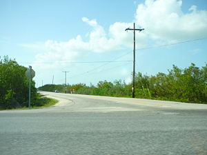
State Road 4 is a two-lane Florida State Road in Okaloosa
, Santa Rosa
, and Escambia
counties. It is signed east–west, but the road is slightly diagonal. It is about 45 miles (72 kilometers) long, from Century
near the Alabama
state border at an intersection with U.S. Route 29, to the farming community of Milligan
at an intersection with U.S. Route 90. This intersection with U.S. Route 90 is due to be redone in 2015. It cuts through the Blackwater River State Forest
. It crosses Penny Creek, Blackwater River
, Beaver Creek, Cedar Creek, East Fork Big Coldwater Creek, Manning Creek, Juniper Creek, West Fork Big Coldwater Creek, and the Escambia River, all part of the Blackwater River
basin, except for the Escambia River.
 State Road 4A is in three separate segments in the lower Florida Keys
. One is on Ramrod Key
and runs parallel to U.S. Route 1 as a service road. The other is a spur less than a quarter of a mile east going north from US 1 on Little Torch Key
. The other is known as Watson Boulevard on Big Pine Key and No Name Key
s. The SR 4A symbol still exists on modern maps.
in northwestern Okaloosa County
of the U.S. state
of Florida
. The road runs from CR 189 east to SR 4.
Okaloosa County, Florida
Okaloosa County is a county located in the state of Florida. Located in northwest Florida, it extends from the Gulf of Mexico to the Alabama state line. As of the 2000 census, the population was 170,498. The U.S. Census Bureau 2005 estimate for the county is 182,172. The 2009 estimate for the...
, Santa Rosa
Santa Rosa County, Florida
Santa Rosa County is a county located in the U.S. state of Florida. According to the 2000 U.S. Census, the population was 117,743, while a July 1, 2005, estimate placed the population at 143,105, an 18% increase making it the 84th fastest growing county in the United States between 2000 and 2005. ...
, and Escambia
Escambia County, Florida
Escambia County is the westernmost county in the U.S. state of Florida. The 2010 population was 297,619. The U.S. Census Bureau 2005 estimate for the county is 296,772. Its county seat is Pensacola.- History :...
counties. It is signed east–west, but the road is slightly diagonal. It is about 45 miles (72 kilometers) long, from Century
Century, Florida
Century is a town in Escambia County, Florida, United States. The population was 1,714 at the 2000 census. It is part of the Pensacola–Ferry Pass–Brent Metropolitan Statistical Area.-Geography:Century is located at ....
near the Alabama
Alabama
Alabama is a state located in the southeastern region of the United States. It is bordered by Tennessee to the north, Georgia to the east, Florida and the Gulf of Mexico to the south, and Mississippi to the west. Alabama ranks 30th in total land area and ranks second in the size of its inland...
state border at an intersection with U.S. Route 29, to the farming community of Milligan
Milligan, Florida
Milligan is an unincorporated community in Okaloosa County, Florida, United States. Milligan is located at the junction of U.S. Route 90, Florida State Road 10 and Florida State Road 4 west-southwest of Crestview...
at an intersection with U.S. Route 90. This intersection with U.S. Route 90 is due to be redone in 2015. It cuts through the Blackwater River State Forest
Blackwater River State Park
Blackwater River State Park is a Florida State Park located fifteen miles northeast of Milton, near Harold, off U.S. 90. The address is 7720 Deaton Bridge Road.-History:...
. It crosses Penny Creek, Blackwater River
Blackwater River (Florida)
The Blackwater River of Florida is a river rising in southern Alabama and flowing through the Florida Panhandle to the Gulf of Mexico. The river enters Florida in Okaloosa County and flows through Santa Rosa County to Blackwater Bay, an arm of Pensacola Bay. The river passes through Blackwater...
, Beaver Creek, Cedar Creek, East Fork Big Coldwater Creek, Manning Creek, Juniper Creek, West Fork Big Coldwater Creek, and the Escambia River, all part of the Blackwater River
Blackwater River (Florida)
The Blackwater River of Florida is a river rising in southern Alabama and flowing through the Florida Panhandle to the Gulf of Mexico. The river enters Florida in Okaloosa County and flows through Santa Rosa County to Blackwater Bay, an arm of Pensacola Bay. The river passes through Blackwater...
basin, except for the Escambia River.
State Road 4A
Florida Keys
The Florida Keys are a coral archipelago in southeast United States. They begin at the southeastern tip of the Florida peninsula, about south of Miami, and extend in a gentle arc south-southwest and then westward to Key West, the westernmost of the inhabited islands, and on to the uninhabited Dry...
. One is on Ramrod Key
Ramrod Key
Ramrod Key is an island in the lower Florida Keys. Originally named Roberts Island, Ramrod Key was renamed for a ship named Ramrod, which was wrecked on a reef south of there in the early nineteenth century.-Description:...
and runs parallel to U.S. Route 1 as a service road. The other is a spur less than a quarter of a mile east going north from US 1 on Little Torch Key
Little Torch Key
Little Torch Key is an island in the lower Florida Keys.U.S. Route 1 , crosses the key at approximately mile markers 28—29...
. The other is known as Watson Boulevard on Big Pine Key and No Name Key
No Name Key
No Name Key is an island located in the lower Florida Keys in the United States. It is 3 miles from US 1 and sparsely populated with only 43 homes. It is a fairly small island in comparison to its neighbor, Big Pine Key, which lies about a half mile to its west...
s. The SR 4A symbol still exists on modern maps.
Okaloosa County Road 4B
County Road 4B or Charlie Day Road is a short county road south of BakerBaker, Florida
Baker is an unincorporated town in Okaloosa County, Florida. It is located about northwest of the county seat, Crestview, in the Florida Panhandle. The Baker Block Museum is in Baker....
in northwestern Okaloosa County
Okaloosa County, Florida
Okaloosa County is a county located in the state of Florida. Located in northwest Florida, it extends from the Gulf of Mexico to the Alabama state line. As of the 2000 census, the population was 170,498. The U.S. Census Bureau 2005 estimate for the county is 182,172. The 2009 estimate for the...
of the U.S. state
U.S. state
A U.S. state is any one of the 50 federated states of the United States of America that share sovereignty with the federal government. Because of this shared sovereignty, an American is a citizen both of the federal entity and of his or her state of domicile. Four states use the official title of...
of Florida
Florida
Florida is a state in the southeastern United States, located on the nation's Atlantic and Gulf coasts. It is bordered to the west by the Gulf of Mexico, to the north by Alabama and Georgia and to the east by the Atlantic Ocean. With a population of 18,801,310 as measured by the 2010 census, it...
. The road runs from CR 189 east to SR 4.