

.
Geography
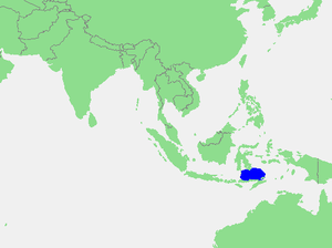
The seas that border the Flores Sea are the Bali Sea(to the west), Java Sea
(to the northwest), and the Banda Sea
(to the east and northeast).
The Indian Ocean
and Savu Sea
lie to the south, but are separated from the Flores Sea by various Islands.
Islands that border this sea are the Lesser Sunda Islands
and Celebes
(Sulawesi).
Extent
The International Hydrographic Organization(IHO) defines the Flores Sea as being one of the waters of the East Indian Archipelago
. The IHO defines its limits as follows:
On the North. The South coast of Celedes[ SulawesiSulawesiSulawesi is one of the four larger Sunda Islands of Indonesia and is situated between Borneo and the Maluku Islands. In Indonesia, only Sumatra, Borneo, and Papua are larger in territory, and only Java and Sumatra have larger Indonesian populations.- Etymology :The Portuguese were the first to...] from the West point of Laikang Bay (5°37′S 119°30′E) to Tanjong Lassa (120°28'E).
On the East. The Western limit of the Banda Sea
Banda SeaThe Banda Sea is a sea in the Maluku Islands of Indonesia, technically part of the Pacific Ocean but separated from it by hundreds of islands, as well as the Halmahera and Ceram Seas...
between FloresFloresFlores is one of the Lesser Sunda Islands, an island arc with an estimated area of 14,300 km² extending east from the Java island of Indonesia. The population was 1.831.000 in the 2010 census and the largest town is Maumere. Flores is Portuguese for "flowers".Flores is located east of Sumbawa...
and Celebes [a line from FloresFloresFlores is one of the Lesser Sunda Islands, an island arc with an estimated area of 14,300 km² extending east from the Java island of Indonesia. The population was 1.831.000 in the 2010 census and the largest town is Maumere. Flores is Portuguese for "flowers".Flores is located east of Sumbawa...
' Northern point (8°04′S 122°52′E) to Kalaotoa Island (7°24′S 121°52′E) and through the chain of islands lying between it and the South point of Pulo SalayarSelayar IslandSelayar Island is the main island of the Selayar Islands . It lies off the coast of Cape Bira of South Sulawesi Province. The Selayar Straits separate it from the mainland of Sulawesi. Its main city is Benteng, towns Bonelohe, Padang, Barangbarang, over 50 miles long and very narrow; area, 248 mi²...
, through this island and across the Strait to Tanjong Lassa, Celebes (5°37′S 120°28′E)].
On the South. The North coasts of Flores, Komodo
Komodo (island)Komodo is one of the 17,508 islands that make up the Republic of Indonesia. The island has a surface area of 390 km² and over 2000 inhabitants. The inhabitants of the island are descendants of former convicts who were exiled to the island and who have mixed themselves with the Bugis from...
, Banta and a line to Tanjong Naroe the Northeast point of SoembawaSumbawaSumbawa is an Indonesian island, located in the middle of the Lesser Sunda Islands chain, with Lombok to the west, Flores to the east, and Sumba further to the southeast. It is in the province of West Nusa Tenggara....
, thence along its North coast to Tanjong Sarokaja (8°22′S 117°10′E).
On the West. A line from Tg Sarokaja to the Western Paternoster island (7°26′S 117°08′E) thence to the Northeastern Postiljon Island (6°33′S 118°49′E) and to the West point of Laikang Bay, Celebes.
External links
- http://visibleearth.nasa.gov/view_rec.php?id=6625
- http://www.astrogeodata.it/id219.htm