
.gif)
Federal Highway (Australia)
Encyclopedia
Highway
A highway is any public road. In American English, the term is common and almost always designates major roads. In British English, the term designates any road open to the public. Any interconnected set of highways can be variously referred to as a "highway system", a "highway network", or a...
in New South Wales
New South Wales
New South Wales is a state of :Australia, located in the east of the country. It is bordered by Queensland, Victoria and South Australia to the north, south and west respectively. To the east, the state is bordered by the Tasman Sea, which forms part of the Pacific Ocean. New South Wales...
and the Australian Capital Territory
Australian Capital Territory
The Australian Capital Territory, often abbreviated ACT, is the capital territory of the Commonwealth of Australia and is the smallest self-governing internal territory...
in Australia
Australia
Australia , officially the Commonwealth of Australia, is a country in the Southern Hemisphere comprising the mainland of the Australian continent, the island of Tasmania, and numerous smaller islands in the Indian and Pacific Oceans. It is the world's sixth-largest country by total area...
. It is a part of the Sydney-Canberra National Highway
National Highway (Australia)
thumb|right|150px|The National Highway Shield in NSW, QLD, WA, NT & TAS.The National Highway is a system of roads connecting all the States and Territories of Australia, and is the major network of highways connecting Australia's largest and most important cities.The National Highway was...
link.
The Federal Highway starts at its junction with the Hume Highway
Hume Highway
The Hume Highway/Hume Freeway is one of Australia's major inter-city highways, running for 880 km between Sydney and Melbourne. It is part of the Auslink National Network and is a vital link for road freight to transport goods to and from the two cities as well as serving Albury-Wodonga and...
near the city of Goulburn
Goulburn, New South Wales
Goulburn is a provincial city in the Southern Tablelands of New South Wales, Australia in Goulburn Mulwaree Council Local Government Area. It is located south-west of Sydney on the Hume Highway and above sea-level. On Census night 2006, Goulburn had a population of 20,127 people...
. It runs about 70 kilometres south west to Canberra
Canberra
Canberra is the capital city of Australia. With a population of over 345,000, it is Australia's largest inland city and the eighth-largest city overall. The city is located at the northern end of the Australian Capital Territory , south-west of Sydney, and north-east of Melbourne...
, the national capital of Australia, where it ends at the intersection of Northbourne Avenue and Barton Highway
Barton Highway
The Barton Highway is a short highway in New South Wales and the Australian Capital Territory, Australia.The Barton Highway connects Canberra to the Hume Highway at Yass, and it is part of the route from Melbourne to Canberra....
Lyneham
Lyneham
-Village:* Lyneham, Wiltshire is a village located in Wiltshire* RAF Lyneham is a Royal Air Force based in Wiltshire, England-Suburb:* Lyneham, Australian Capital Territory is a suburb of Canberra, Australia...
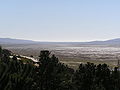
. The Federal Highway runs past Lake George.
It was initially constructed from 1932 to 1934, replacing the previous access from Goulburn (via Tarago
Tarago, New South Wales
Tarago is a town in the Southern Tablelands of New South Wales, Australia in Goulburn Mulwaree Council. It is situated 39 kilometres south of the city of Goulburn and 69 kilometres northeast of Canberra, the capital city of Australia...
and Queanbeyan
Queanbeyan, New South Wales
Queanbeyan is a regional centre in the Southern Tablelands in south-eastern New South Wales adjacent to the Australian Capital Territory. The city's mixed economy is based on light construction, high technology, manufacturing, service, retail and agriculture. It is the council seat of the...
). From 1986 onwards, the Federal Highway was reconstructed to a full four-lane dual carriageway standard, a project finally completed in 2000.
Major Intersections
Federal Highway  |
|||
| Northeastbound | Distance to Sydney (km) |
Distance to Canberra (km) |
Southwestbound |
| End Federal Highway continues as Hume Highway Hume Highway The Hume Highway/Hume Freeway is one of Australia's major inter-city highways, running for 880 km between Sydney and Melbourne. It is part of the Auslink National Network and is a vital link for road freight to transport goods to and from the two cities as well as serving Albury-Wodonga and...  to Goulburn Goulburn, New South Wales Goulburn is a provincial city in the Southern Tablelands of New South Wales, Australia in Goulburn Mulwaree Council Local Government Area. It is located south-west of Sydney on the Hume Highway and above sea-level. On Census night 2006, Goulburn had a population of 20,127 people... / Sydney Sydney Sydney is the most populous city in Australia and the state capital of New South Wales. Sydney is located on Australia's south-east coast of the Tasman Sea. As of June 2010, the greater metropolitan area had an approximate population of 4.6 million people... |
208 | 77 | Start Federal Highway from Hume Highway Hume Highway The Hume Highway/Hume Freeway is one of Australia's major inter-city highways, running for 880 km between Sydney and Melbourne. It is part of the Auslink National Network and is a vital link for road freight to transport goods to and from the two cities as well as serving Albury-Wodonga and... |
| Yass Yass, New South Wales Yass is a town in the Southern Tablelands of New South Wales, Australia in Yass Valley Shire. The name appears to have been derived from an Aboriginal word, "Yarrh" , said to mean 'running water'.... , Melbourne Melbourne Melbourne is the capital and most populous city in the state of Victoria, and the second most populous city in Australia. The Melbourne City Centre is the hub of the greater metropolitan area and the Census statistical division—of which "Melbourne" is the common name. As of June 2009, the greater... Hume Highway Hume Highway The Hume Highway/Hume Freeway is one of Australia's major inter-city highways, running for 880 km between Sydney and Melbourne. It is part of the Auslink National Network and is a vital link for road freight to transport goods to and from the two cities as well as serving Albury-Wodonga and...  |
|||
| Collector Collector, New South Wales Collector is a small village on the Federal Highway in New South Wales, Australia halfway between Goulburn and the Australian Capital Territory. It is seven kilometres north of Lake George... Church Street .svg.png) |
229 | 56 | Collector Collector, New South Wales Collector is a small village on the Federal Highway in New South Wales, Australia halfway between Goulburn and the Australian Capital Territory. It is seven kilometres north of Lake George... Church Street |
| Tarago Tarago, New South Wales Tarago is a town in the Southern Tablelands of New South Wales, Australia in Goulburn Mulwaree Council. It is situated 39 kilometres south of the city of Goulburn and 69 kilometres northeast of Canberra, the capital city of Australia... Collector Road |
230 | 55 | Tarago Tarago, New South Wales Tarago is a town in the Southern Tablelands of New South Wales, Australia in Goulburn Mulwaree Council. It is situated 39 kilometres south of the city of Goulburn and 69 kilometres northeast of Canberra, the capital city of Australia... Collector Road |
| Collector Collector, New South Wales Collector is a small village on the Federal Highway in New South Wales, Australia halfway between Goulburn and the Australian Capital Territory. It is seven kilometres north of Lake George... Murray Street |
231 | 54 | Collector Collector, New South Wales Collector is a small village on the Federal Highway in New South Wales, Australia halfway between Goulburn and the Australian Capital Territory. It is seven kilometres north of Lake George... Murray Street |
| Sutton Sutton, New South Wales Sutton, meaning 'South Settlement' in Saxon, is a small village in the Southern Tablelands of New South Wales, Australia in Yass Valley Shire. It is situated on the west bank of the Yass River, about 17 kilometres as the crow flies south of Gundaroo, near the Federal Highway, not far from Canberra... , Queanbeyan Queanbeyan, New South Wales Queanbeyan is a regional centre in the Southern Tablelands in south-eastern New South Wales adjacent to the Australian Capital Territory. The city's mixed economy is based on light construction, high technology, manufacturing, service, retail and agriculture. It is the council seat of the... Sutton Road |
267 | 18 | Queanbeyan Queanbeyan, New South Wales Queanbeyan is a regional centre in the Southern Tablelands in south-eastern New South Wales adjacent to the Australian Capital Territory. The city's mixed economy is based on light construction, high technology, manufacturing, service, retail and agriculture. It is the council seat of the... , Sutton Sutton, New South Wales Sutton, meaning 'South Settlement' in Saxon, is a small village in the Southern Tablelands of New South Wales, Australia in Yass Valley Shire. It is situated on the west bank of the Yass River, about 17 kilometres as the crow flies south of Gundaroo, near the Federal Highway, not far from Canberra... Sutton Road |
| NEW SOUTH WALES STATE BORDER AUSTRALIAN CAPITAL TERRITORY |
|||
| Fyshwick Fyshwick, Australian Capital Territory Fyshwick is an industrial suburb of Canberra, located east of the South Canberra district. On Census night 2006, Fyshwick had a population of 54 people.... Majura Road   Gungahlin Gungahlin, Australian Capital Territory Gungahlin is a suburb in the Canberra, Australia district with the same name; Gungahlin. The postcode is 2912. Gungahlin is the name for the entire district, and also the town centre, but it is also the name of the suburb which Gungahlin Town Centre is in.... Horse Park Drive |
275 | 10 | Fyshwick Fyshwick, Australian Capital Territory Fyshwick is an industrial suburb of Canberra, located east of the South Canberra district. On Census night 2006, Fyshwick had a population of 54 people.... , Tuggeranong, Cooma Cooma, New South Wales -Education: is Cooma's only public high school, it serves the town and seven of the neighbouring rural towns and villages such as Berridale, Jindabyne, Nimmitabel, Bredbo and Dalgety.... Majura Road Gungahlin Gungahlin, Australian Capital Territory Gungahlin is a suburb in the Canberra, Australia district with the same name; Gungahlin. The postcode is 2912. Gungahlin is the name for the entire district, and also the town centre, but it is also the name of the suburb which Gungahlin Town Centre is in.... Horse Park Drive |
| Watson Watson, Australian Capital Territory Watson is a suburb of Canberra, Australia in the North Canberra district. Watson is named after the third Prime Minister of Australia, John Christian Watson. The suburb name was gazetted on 7 April 1960. Streets in Watson are named after Australian judges and other legal professionals... Antill Street .svg.png) |
277 | 8 | Watson Watson, Australian Capital Territory Watson is a suburb of Canberra, Australia in the North Canberra district. Watson is named after the third Prime Minister of Australia, John Christian Watson. The suburb name was gazetted on 7 April 1960. Streets in Watson are named after Australian judges and other legal professionals... Antill Street |
| Mitchell Mitchell, Australian Capital Territory Mitchell is a light-industrial estate of Canberra, Australia in the district of Gungahlin. Mitchell was named in honour of Major Sir Thomas Livingston Mitchell, an explorer of inland New South Wales and Surveyor-General of New South Wales. The streets in Mitchell are named after Australian... Flemington Road  |
279 | 6 | Mitchell Mitchell, Australian Capital Territory Mitchell is a light-industrial estate of Canberra, Australia in the district of Gungahlin. Mitchell was named in honour of Major Sir Thomas Livingston Mitchell, an explorer of inland New South Wales and Surveyor-General of New South Wales. The streets in Mitchell are named after Australian... Flemington Road |
| Start Federal Highway from Northbourne Avenue Northbourne Avenue, Canberra Northbourne Avenue is a major road in Canberra, Australia. It extends from City Hill in the south to the Federal Highway in the north.It is a north-south running road which has three lanes for motorised traffic, and one lane for bicycles running in each direction, with a large median strip with...  and Barton Highway Barton Highway The Barton Highway is a short highway in New South Wales and the Australian Capital Territory, Australia.The Barton Highway connects Canberra to the Hume Highway at Yass, and it is part of the route from Melbourne to Canberra....  |
281 | 4 | Belconnen Belconnen, Australian Capital Territory Belconnen is a suburb of Canberra, Australia in the district of Belconnen. It contains the Belconnen Town Centre, Lake Ginninderra and several residential areas. It is bounded by Ginninderra Drive, Aikman Drive, Eastern Valley Way, Belconnen Way and Coulter Drive... , Yass Yass, New South Wales Yass is a town in the Southern Tablelands of New South Wales, Australia in Yass Valley Shire. The name appears to have been derived from an Aboriginal word, "Yarrh" , said to mean 'running water'.... , Melbourne Melbourne Melbourne is the capital and most populous city in the state of Victoria, and the second most populous city in Australia. The Melbourne City Centre is the hub of the greater metropolitan area and the Census statistical division—of which "Melbourne" is the common name. As of June 2009, the greater... Barton Highway Barton Highway The Barton Highway is a short highway in New South Wales and the Australian Capital Territory, Australia.The Barton Highway connects Canberra to the Hume Highway at Yass, and it is part of the route from Melbourne to Canberra.... |
| End Federal Highway continues as Northbourne Avenue Northbourne Avenue, Canberra Northbourne Avenue is a major road in Canberra, Australia. It extends from City Hill in the south to the Federal Highway in the north.It is a north-south running road which has three lanes for motorised traffic, and one lane for bicycles running in each direction, with a large median strip with... to Canberra City Centre Canberra Canberra is the capital city of Australia. With a population of over 345,000, it is Australia's largest inland city and the eighth-largest city overall. The city is located at the northern end of the Australian Capital Territory , south-west of Sydney, and north-east of Melbourne... / Queanbeyan Queanbeyan, New South Wales Queanbeyan is a regional centre in the Southern Tablelands in south-eastern New South Wales adjacent to the Australian Capital Territory. The city's mixed economy is based on light construction, high technology, manufacturing, service, retail and agriculture. It is the council seat of the... / Cooma Cooma, New South Wales -Education: is Cooma's only public high school, it serves the town and seven of the neighbouring rural towns and villages such as Berridale, Jindabyne, Nimmitabel, Bredbo and Dalgety.... |
|||