

European route E134
Encyclopedia
Norway
Norway , officially the Kingdom of Norway, is a Nordic unitary constitutional monarchy whose territory comprises the western portion of the Scandinavian Peninsula, Jan Mayen, and the Arctic archipelago of Svalbard and Bouvet Island. Norway has a total area of and a population of about 4.9 million...
, eastwards from Haugesund
Haugesund
is a town and municipality in the county of Rogaland, Norway.-Location:Haugesund was separated from Torvastad as a town and municipality of its own in 1855. The rural municipality of Skåre was merged with Haugesund on January 1, 1958. Haugesund is a small municipality, only 73 km²...
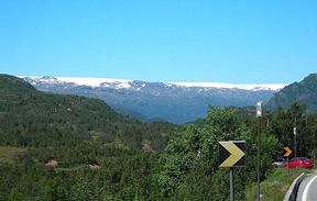
, over the Hardangervidda
Hardangervidda
The Hardangervidda is a mountain plateau in the Hardanger region of western Norway. It is the largest such plateau in Europe, with a cold year-round alpine climate and is the site of one of Norway's largest glaciers. Much of the plateau is protected as part of Hardangervidda National Park; it is a...
mountain plateau. With the highest point at 1085 meters above sea level, the road is sensitive to snow conditions and foul weather during the winter season, during which the mountainous sections may be closed in short periods. The part of the mountain is called Haukelifjell, to not confuse drivers with Rv. (state road) 7 which is further north. The road ends at Drammen
Drammen
Drammen is a city in Buskerud County, Norway. The port and river city of Drammen is centrally located in the eastern and most populated part of Norway.-Location:...
near Oslo
Oslo
Oslo is a municipality, as well as the capital and most populous city in Norway. As a municipality , it was established on 1 January 1838. Founded around 1048 by King Harald III of Norway, the city was largely destroyed by fire in 1624. The city was moved under the reign of Denmark–Norway's King...
.
Route
All places are in NorwayNorway
Norway , officially the Kingdom of Norway, is a Nordic unitary constitutional monarchy whose territory comprises the western portion of the Scandinavian Peninsula, Jan Mayen, and the Arctic archipelago of Svalbard and Bouvet Island. Norway has a total area of and a population of about 4.9 million...
.
- HaugesundHaugesundis a town and municipality in the county of Rogaland, Norway.-Location:Haugesund was separated from Torvastad as a town and municipality of its own in 1855. The rural municipality of Skåre was merged with Haugesund on January 1, 1958. Haugesund is a small municipality, only 73 km²...
- TysværTysværTysvær is a municipality in Rogaland county, Norway. It is part of the region of Haugaland. The municipality is located at the northern side of Boknafjord, east of Karmøy. Tysvær has a population of 9,349 and an area of 419 km². Aksdalsvatnet is a lake in this municipality.Local...
- AksdalAksdalAksdal is the administrative centre of Tysvær municipality, Norway. Its population is 1,077....
, connects to E 39European route E39E 39 is the designation of a 1330 km long north-south road in Norway and Denmark, running from Klett just south of Trondheim to Aalborg, via Orkanger, Vinjeøra, Halsa ... Straumsnes, Krifast, Batnfjordsøra, Molde ... Vestnes, Skodje, Ålesund ... Volda ... Nordfjordeid ... Sandane, Førde,...
- Aksdal
- VindafjordVindafjordVindafjord is a municipality in Rogaland county, Norway. It is part of the traditional district of Haugaland.Vindafjord was established as a new municipality on 1 January 1965 after the merger of the municipalities of Sandeid and Vats and large parts of Imsland, Skjold and Vikedal...
- SkjoldSkjold, RogalandSkjold is a former municipality in Rogaland county, Norway.It was created as Skjold formannskapsdistrikt in 1837. The district Tysvær was separated from Skjold in 1849 to constitute a municipality of its own, and the same thing happened to Vats in 1891...
- VatsVatsVats is a village in the municipality of Vindafjord, in Rogaland county, Norway. Vats is located in the traditional district of Haugaland.An important industrial location, the oil platforms Statfjord, Gullfaks and Troll were built here. The Norwegian computer and software company Hatteland Group is...
- Knapphus
- ØlenØlenØlen is a former municipality in the county of Rogaland, Norway.It was created on 1 July 1916 by a split from Fjelberg. Before 1 January 2002, Ølen belonged to the county of Hordaland....
- Skjold
- EtneEtneEtne is a municipality in the county of Hordaland, Norway. Etne is located within the traditional district of Haugaland. Etne was established as a municipality on 1 January 1838 . Most of Skånevik was merged with Etne on 1 January 1965.-Name:The municipality is named after the Etnefjord...
- HålandHålandHåland was a former municipality in Rogaland county, Norway.Håland is part of the traditional Norwegian district of Jæren. The clerical district of Håland had included churches located in Sola, Tananger, Tjora and Madla. The parish of Håland was established as a municipality on January 1, 1838...
- Bergaheiatunnelen / Åkrafjorden
- Håland
- OddaOddais a municipality and town in the county of Hordaland, Norway. Odda was separated from Ullensvang on 1 July 1913 and on 1 January 1964 Røldal was merged with Odda. The town of Odda is the centre of the landscape of Hardanger, located at the end of the Hardangerfjord.In 1927, Erling Johnson,...
- Austmannlitunnelen
- Dyrskartunnelen
- VinjeVinjeVinje is a municipality in Telemark county, Norway. It is part of the traditional region of Vest-Telemark. The administrative center of the municipality is the village of Åmot.-Name:...
- Haukeligrend
- Åmot
- TokkeTokkeTokke is a municipality in Telemark county, Norway. It is part of the traditional region of Vest-Telemark. The administrative centre of the municipality is the village of Dalen. The municipality of Tokke was created on 1 January 1964 upon the merger of the two older municipalities of Lårdal and Mo...
- KviteseidKviteseidKviteseid is a municipality in Telemark county, Norway. It is part of the traditional region of Vest-Telemark. The administrative centre of the municipality is the village of Kviteseid...
- SeljordSeljordSeljord is a municipality in Telemark county, Norway. It is part of the traditional region of Vest-Telemark. The administrative centre of the municipality is the village of Seljord...
- HjartdalHjartdalHjartdal is a municipality in Telemark county, Norway. It is part of the traditional region of Øst-Telemark. The administrative centre of the municipality is the village of Sauland....
- NotoddenNotoddenis a town and municipality in Telemark county, Norway. It is part of the traditional region of Øst-Telemark. The administrative centre of the municipality is the town of Notodden....
- KongsbergKongsbergis a town and municipality in Buskerud county, Norway. It is located at the southern end of the traditional region of Numedal. The administrative centre of the municipality is the town of Kongsberg....
- Øvre EikerØvre EikerØvre Eiker is a municipality in Buskerud county, Norway. It is part of the traditional region of Eiker. The administrative centre of the municipality is the village of Hokksund. The old municipality of Eiker was divided into Øvre Eiker and Nedre Eiker on 1 July 1885.-Name:The Old Norse form of...
- Nedre EikerNedre EikerNedre Eiker is a municipality in Buskerud county, Norway. It is part of the traditional region of Eiker. The administrative centre of the municipality is the village of Mjøndalen. The old municipality of Eiker was divided into Nedre Eiker and Øvre Eiker on 1 July 1885.-Name:The Old Norse form of...
- MjøndalenMjøndalenMjøndalen is the administrative centre of Nedre Eiker municipality in Buskerud county, Norway. It is situated south of the Drammenselva River opposite of Krokstadelva. -History:...
- Mjøndalen
- DrammenDrammenDrammen is a city in Buskerud County, Norway. The port and river city of Drammen is centrally located in the eastern and most populated part of Norway.-Location:...
, connects to E 18European route E18European route E18 runs from Craigavon in the United Kingdom to Saint Petersburg in Russia, passing through Norway, Sweden, and Finland. It is about 1,890 km in length.-United Kingdom:...
History
A road over the mountain along this route was opened first time 1889. In the year 1968 the Haukeli tunnel (5.6 km (3.5 mi)) was opened allowing reliable winter time traffic.The road was European route 76
European route E76
European route E 76 is a road part of the International E-road network. It begins in Pisa, Italy and ends in Florence, Italy.The road follows: Pisa - Lucca - Pistoia - Prato - Florence....
before 1992, when the numbering system of European routes in the Nordic countries
Nordic countries
The Nordic countries make up a region in Northern Europe and the North Atlantic which consists of Denmark, Finland, Iceland, Norway and Sweden and their associated territories, the Faroe Islands, Greenland and Åland...
was revised. To begin with, there was not room for it in the system, and road became state route Rv. 11. Due to local wishes and steadily increasing of the road standard, from the end of the 1990s, it again received European route status, with the number E 134.
The route has many tunnels, especially in the mountainous sections, and also in the western part, along the fjord Åkrafjorden, where is passes the Langfossen
Langfossen
Langfossen is a waterfall located in the municipality of Etne in western Norway.The total fall is around 600 meters, where it leaps out into Åkrafjorden. European route E134 runs along the base of the waterfall, making access very easy...
water fall. In sum their length is 27 km (16.8 mi), the longest being 7.4 km (4.6 mi). Before the tunnels, some of the fjord sections of the road were quite steep and very narrow; around 5 metres (16.4 ft). This was far from the 8.5 metre minimum requirement of European routes, and below the minimum requirement to allow two trucks to pass.
Places of interest
- Stave church in HeddalHeddalHeddal is a village and parish in Notodden municipality in Telemark County, Norway.- History :The parish of Hitterdal was established as a municipality January 1, 1838 . Notodden was separated from Heddal both as a city and a municipality of its own, in 1913. Heddal was subsequently merged with...
- Silvermine in KongsbergKongsbergis a town and municipality in Buskerud county, Norway. It is located at the southern end of the traditional region of Numedal. The administrative centre of the municipality is the town of Kongsberg....
- Skimuseum in MorgedalMorgedalMorgedal, of the municipality of Kviteseid in the county of Telemark Norway, is called the cradle of skiing.Morgedal, Norway is a village whose most famous residents were Sondre Norheim, known to be the father of modern skiing plus Torjus Hemmestveit and Mikkjel Hemmestveit...
- Old Hotel Haukeliseter
- Stave church in RøldalRøldalRøldal is a former municipality in Hordaland county, Norway.The parish of Suldal had to be divided into two formannskapsdistrikt January 1, 1838 – this because the main part of the parish belonged to the county of Rogaland, while the annex Røldal belonged to the county of Hordaland...
Useful words for the road condition reports
- Haukelifjell = The main mountain pass on E 134
- Midlertidig stengt = Temporarily closed
- Kolonnekjøring = Driving in line after a snow plough truck only.
- Nattestengt = Closed by night
- Vegarbeid = Road work
- Kjøreforhold = Driving conditions
- Snø / snødekke = Snowy road
- Is / isdekke = Icy road
- Glatt = Slippery
- Bart = Bare road
- Vått = Wet road
- Fare for elg = Watch out for mooseMooseThe moose or Eurasian elk is the largest extant species in the deer family. Moose are distinguished by the palmate antlers of the males; other members of the family have antlers with a dendritic configuration...