

European route E01
Encyclopedia
The European route E 01 is a series of road
s in Europe
, part of the United Nations
International E-road network
, running from Larne
, Northern Ireland
to Seville
, Spain
. There is a sea crossing between Rosslare Harbour
, in Ireland
, and Ferrol, but no ferry service. The road also passes through Portugal
– past the city of Porto
, through the capital, Lisbon
, and then south to the Algarve, passing Faro
before reaching the Spanish border west of Huelva
.
, the E 01 is not signed in Northern Ireland
. It begins in Larne, County Antrim
as the A8. A short section of the A8 at Newtownabbey
is under motorway regulations and is signed as the A8(M) motorway
. This motorway joins the much longer M2 motorway
to Belfast
. At Belfast, the road becomes the A12 Westlink, a dual carriageway
which links to the M1 motorway
. The A1
leaves the motorway near Lisburn
and continues south as a dual carriageway. This takes the road over the border to the Republic of Ireland
.
as the N1, which from Ballymascanlon
in County Louth
onwards is under motorway regulations and signed as the M1 motorway. The road follows the M1 south to Dublin, where, in the northern suburbs, it meets Dublin's ring road, the M50 motorway
. It follows the M50 through the outer suburbs of Dublin until it meets the short M11 motorway near Shankill
. The M11 continues as a dual carriageway, the N11, south of Bray
in County Wicklow
. This section passes through the Glen of the Downs
Nature Reserve
. Apart from a section of standard highway (single carriageway road) between Rathnew
and Arklow
in County Wicklow, the road is dual carriageway or motorway to south of Gorey
in County Wexford
. Following this, the remainder of the route in Ireland is single carriageway and passes through several towns and villages. The N11 continues to Wexford
, where at a junction outside the town it meets the N25 road from Cork
. The route follows the N25 to its final destination in Ireland of Rosslare Europort
.
The E 01, like all E-roads, was not signed in the Republic of Ireland until 2007. The section bypassing Gorey, opened in 2007, was the first section in Ireland to carry "E 01" signage, although the route number only appears on route confirmation signs - and on no other directional signage. The number was added to most route confirmation signs on the M1 in July 2008 and is gradually being added to confirmation signs on the N11/M11.
All remaining sections of the N11 (and therefore E01) are due to be replaced by motorways or dual carriageways.
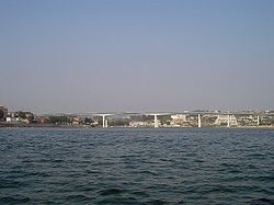
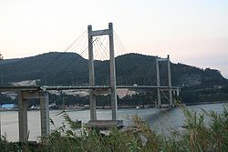 The E 01 has two sections in Spain. The northern section is between Ferrol and Tui
at the Portuguese border. It follows the motorway AP-9
, aka The Atlantic Axis, which connects the Galician cities of Ferrol
, A Coruña
, Santiago de Compostela
, Pontevedra
and Vigo
, continuing south towards Portugal. The border is at the river Minho, at the city of Tui.
 In Portugal, the route is composed of the following sections, always as a motorway (called auto-estrada in Portuguese
):
In the section Aveiro Norte - Lisbon of the A1, the E01 follows the same route as the E80. In that section the E80 signage prevails over the E01 signage, this last rarely appearing.
at the Portuguese border and Sevilla. It follows the motorway A-49
, and passes near the city of Huelva
. The border is at the Guadiana
river.
Road
A road is a thoroughfare, route, or way on land between two places, which typically has been paved or otherwise improved to allow travel by some conveyance, including a horse, cart, or motor vehicle. Roads consist of one, or sometimes two, roadways each with one or more lanes and also any...
s in Europe
Europe
Europe is, by convention, one of the world's seven continents. Comprising the westernmost peninsula of Eurasia, Europe is generally 'divided' from Asia to its east by the watershed divides of the Ural and Caucasus Mountains, the Ural River, the Caspian and Black Seas, and the waterways connecting...
, part of the United Nations
United Nations
The United Nations is an international organization whose stated aims are facilitating cooperation in international law, international security, economic development, social progress, human rights, and achievement of world peace...
International E-road network
International E-road network
The international E-road network is a numbering system for roads in Europe developed by the United Nations Economic Commission for Europe . The network is numbered from E 1 up and its roads cross national borders...
, running from Larne
Larne
Larne is a substantial seaport and industrial market town on the east coast of County Antrim, Northern Ireland with a population of 18,228 people in the 2001 Census. As of 2011, there are about 31,000 residents in the greater Larne area. It has been used as a seaport for over 1,000 years, and is...
, Northern Ireland
Northern Ireland
Northern Ireland is one of the four countries of the United Kingdom. Situated in the north-east of the island of Ireland, it shares a border with the Republic of Ireland to the south and west...
to Seville
Seville
Seville is the artistic, historic, cultural, and financial capital of southern Spain. It is the capital of the autonomous community of Andalusia and of the province of Seville. It is situated on the plain of the River Guadalquivir, with an average elevation of above sea level...
, Spain
Spain
Spain , officially the Kingdom of Spain languages]] under the European Charter for Regional or Minority Languages. In each of these, Spain's official name is as follows:;;;;;;), is a country and member state of the European Union located in southwestern Europe on the Iberian Peninsula...
. There is a sea crossing between Rosslare Harbour
Rosslare Harbour
The village of Rosslare Harbour grew up to serve the needs of the harbour of the same name , first developed in 1906 by the Great Western Railway and the Great Southern and Western Railway to accommodate steamferry traffic between Great Britain and Ireland...
, in Ireland
Ireland
Ireland is an island to the northwest of continental Europe. It is the third-largest island in Europe and the twentieth-largest island on Earth...
, and Ferrol, but no ferry service. The road also passes through Portugal
Portugal
Portugal , officially the Portuguese Republic is a country situated in southwestern Europe on the Iberian Peninsula. Portugal is the westernmost country of Europe, and is bordered by the Atlantic Ocean to the West and South and by Spain to the North and East. The Atlantic archipelagos of the...
– past the city of Porto
Porto
Porto , also known as Oporto in English, is the second largest city in Portugal and one of the major urban areas in the Iberian Peninsula. Its administrative limits include a population of 237,559 inhabitants distributed within 15 civil parishes...
, through the capital, Lisbon
Lisbon
Lisbon is the capital city and largest city of Portugal with a population of 545,245 within its administrative limits on a land area of . The urban area of Lisbon extends beyond the administrative city limits with a population of 3 million on an area of , making it the 9th most populous urban...
, and then south to the Algarve, passing Faro
Faro, Portugal
Faro is the southernmost city in Portugal. It is located in the Faro Municipality in southern Portugal. The city proper has 41,934 inhabitants and the entire municipality has 58,305. It is the seat of the Faro District and capital of the Algarve region...
before reaching the Spanish border west of Huelva
Huelva
Huelva is a city in southwestern Spain, the capital of the province of Huelva in the autonomous region of Andalusia. It is located along the Gulf of Cadiz coast, at the confluence of the Odiel and Tinto rivers. According to the 2010 census, the city has a population of 149,410 inhabitants. The...
.
Northern Ireland
As with all E-roads in the United KingdomUnited Kingdom
The United Kingdom of Great Britain and Northern IrelandIn the United Kingdom and Dependencies, other languages have been officially recognised as legitimate autochthonous languages under the European Charter for Regional or Minority Languages...
, the E 01 is not signed in Northern Ireland
Northern Ireland
Northern Ireland is one of the four countries of the United Kingdom. Situated in the north-east of the island of Ireland, it shares a border with the Republic of Ireland to the south and west...
. It begins in Larne, County Antrim
County Antrim
County Antrim is one of six counties that form Northern Ireland, situated in the north-east of the island of Ireland. Adjoined to the north-east shore of Lough Neagh, the county covers an area of 2,844 km², with a population of approximately 616,000...
as the A8. A short section of the A8 at Newtownabbey
Newtownabbey
Newtownabbey is a large town north of Belfast in County Antrim, Northern Ireland. Sometimes considered to be a suburb of Belfast, it is separated from the rest of the city by Cavehill and Fortwilliam golf course...
is under motorway regulations and is signed as the A8(M) motorway
A8(M) motorway (Northern Ireland)
The A8 is a motorway in County Antrim, Northern Ireland. It is 1 mile long and is a spur of the M2 motorway. It was opened on 24 October 1966 and built at the same time as the M2 section to which it connects...
. This motorway joins the much longer M2 motorway
M2 motorway (Northern Ireland)
The M2 is a motorway in Belfast and County Antrim in Northern Ireland. It is in two sections, the southern section running from north Belfast to Antrim and the northern section acts as a bypass of Ballymena, with the A26 road linking the two sections. In total it is 22 miles...
to Belfast
Belfast
Belfast is the capital of and largest city in Northern Ireland. By population, it is the 14th biggest city in the United Kingdom and second biggest on the island of Ireland . It is the seat of the devolved government and legislative Northern Ireland Assembly...
. At Belfast, the road becomes the A12 Westlink, a dual carriageway
Dual carriageway
A dual carriageway is a class of highway with two carriageways for traffic travelling in opposite directions separated by a central reservation...
which links to the M1 motorway
M1 motorway (Northern Ireland)
The M1 is a motorway in Northern Ireland. It is the longest motorway in Northern Ireland and runs for from Belfast to Dungannon through County Down and County Armagh...
. The A1
A1 road (Northern Ireland)
The A1 is a major route in Northern Ireland. It runs from Belfast via Lisburn and Banbridge to the border with the Republic of Ireland south of Newry, from where the road continues to Dublin, becoming the N1 road and M1 motorway...
leaves the motorway near Lisburn
Lisburn
DemographicsLisburn Urban Area is within Belfast Metropolitan Urban Area and is classified as a Large Town by the . On census day there were 71,465 people living in Lisburn...
and continues south as a dual carriageway. This takes the road over the border to the Republic of Ireland
Republic of Ireland
Ireland , described as the Republic of Ireland , is a sovereign state in Europe occupying approximately five-sixths of the island of the same name. Its capital is Dublin. Ireland, which had a population of 4.58 million in 2011, is a constitutional republic governed as a parliamentary democracy,...
.
Republic of Ireland
The dual carriageway continues in the Republic of IrelandRepublic of Ireland
Ireland , described as the Republic of Ireland , is a sovereign state in Europe occupying approximately five-sixths of the island of the same name. Its capital is Dublin. Ireland, which had a population of 4.58 million in 2011, is a constitutional republic governed as a parliamentary democracy,...
as the N1, which from Ballymascanlon
Ballymascanlon
Ballymascanlan , otherwise Ballymascanlon, is a small village and townland in County Louth, Ireland, situated 4 km north-east of Dundalk on the road to Carlingford.-History:...
in County Louth
County Louth
County Louth is a county of Ireland. It is part of the Border Region and is also located in the province of Leinster. It is named after the town of Louth. Louth County Council is the local authority for the county...
onwards is under motorway regulations and signed as the M1 motorway. The road follows the M1 south to Dublin, where, in the northern suburbs, it meets Dublin's ring road, the M50 motorway
M50 motorway (Ireland)
The M50 motorway is a motorway in Ireland running in a C-shaped ring around the north-eastern, northern, western and southern sides of the capital city, Dublin. The northern end of the route is located at the entrance to the Dublin Port Tunnel. Anti-clockwise it heads northwest through the tunnel...
. It follows the M50 through the outer suburbs of Dublin until it meets the short M11 motorway near Shankill
Shankill
Shankill can mean:* Belfast Shankill * Belfast Shankill , the 1918–1922 UK Parliament constituency* Shankill, County Antrim, a parish in County Antrim, Northern Ireland...
. The M11 continues as a dual carriageway, the N11, south of Bray
Bray
Bray is a town in north County Wicklow, Ireland. It is a busy urban centre and seaside resort, with a population of 31,901 making it the fourth largest in Ireland as of the 2006 census...
in County Wicklow
County Wicklow
County Wicklow is a county in Ireland. It is part of the Mid-East Region and is also located in the province of Leinster. It is named after the town of Wicklow, which derives from the Old Norse name Víkingalág or Wykynlo. Wicklow County Council is the local authority for the county...
. This section passes through the Glen of the Downs
Glen of the Downs
The Glen of the Downs is a 2 km long wooded glacial valley with steep sides rising to almost 250m on the east coast of Ireland. It contains a designated Nature Reserve comprising 59 ha, as well as a candidate Special Area of Conservation ....
Nature Reserve
Nature reserve
A nature reserve is a protected area of importance for wildlife, flora, fauna or features of geological or other special interest, which is reserved and managed for conservation and to provide special opportunities for study or research...
. Apart from a section of standard highway (single carriageway road) between Rathnew
Rathnew
Rathnew is a village of County Wicklow, Ireland. Located south of the capital Dublin along the N11 between Dublin and Wexford, it is the exit point for those wishing to visit the county town of Wicklow, situated to the East.-Education:...
and Arklow
Arklow
Arklow , also known as Inbhear Dé from the Avonmore river's older name Abhainn Dé, is a historic town located in County Wicklow on the east coast of Ireland. Founded by the Vikings in the ninth century, Arklow was the site of one of the bloodiest battles of the 1798 rebellion...
in County Wicklow, the road is dual carriageway or motorway to south of Gorey
Gorey
Gorey , is a market town in north County Wexford, Ireland, situated beside the main M11 Dublin to Wexford road. The town is also connected to the railway network along the same route. Local newspapers include the Gorey Guardian and Gorey Echo....
in County Wexford
County Wexford
County Wexford is a county in Ireland. It is part of the South-East Region and is also located in the province of Leinster. It is named after the town of Wexford. In pre-Norman times it was part of the Kingdom of Uí Cheinnselaig, whose capital was at Ferns. Wexford County Council is the local...
. Following this, the remainder of the route in Ireland is single carriageway and passes through several towns and villages. The N11 continues to Wexford
Wexford
Wexford is the county town of County Wexford, Ireland. It is situated near the southeastern corner of Ireland, close to Rosslare Europort. The town is connected to Dublin via the M11/N11 National Primary Route, and the national rail network...
, where at a junction outside the town it meets the N25 road from Cork
Cork (city)
Cork is the second largest city in the Republic of Ireland and the island of Ireland's third most populous city. It is the principal city and administrative centre of County Cork and the largest city in the province of Munster. Cork has a population of 119,418, while the addition of the suburban...
. The route follows the N25 to its final destination in Ireland of Rosslare Europort
Rosslare Europort
Rosslare Europort is a modern seaport located at Rosslare Harbour in County Wexford, Ireland, near the southeastern-most point of Ireland's coastline, handling passenger and freight ferries to and from Wales and France....
.
The E 01, like all E-roads, was not signed in the Republic of Ireland until 2007. The section bypassing Gorey, opened in 2007, was the first section in Ireland to carry "E 01" signage, although the route number only appears on route confirmation signs - and on no other directional signage. The number was added to most route confirmation signs on the M1 in July 2008 and is gradually being added to confirmation signs on the N11/M11.
All remaining sections of the N11 (and therefore E01) are due to be replaced by motorways or dual carriageways.
Spain
Tui, Galicia
Tui , in Spanish Tuy, is a town in Galicia , in the province of Pontevedra. It is located on the left bank of the Minho River, facing the Portuguese town of Valença....
at the Portuguese border. It follows the motorway AP-9
Autopista AP-9
The Autopista A-9 is a highway in Galicia, Spain. It is known as the Autopista do Atlántico and runs from the Portugal border at the Rio Miño. It heads north via Tui, Vigo and a junction with the Autovía A-52. After Vigo the road crosses the Ría de Vigo, onto the Peninsula de Morrazo and passing...
, aka The Atlantic Axis, which connects the Galician cities of Ferrol
Ferrol
Ferrol can refer to:* Ferrol, Spain, industrial city and naval station in Galicia * Ferrol, Virginia, town in the United States of America* Ferrol, Romblon, municipality in the Philippines* Ferrol, Peninsula, Peru, South America...
, A Coruña
A Coruña
A Coruña or La Coruña is a city and municipality of Galicia, Spain. It is the second-largest city in the autonomous community and seventeenth overall in the country...
, Santiago de Compostela
Santiago de Compostela
Santiago de Compostela is the capital of the autonomous community of Galicia, Spain.The city's Cathedral is the destination today, as it has been throughout history, of the important 9th century medieval pilgrimage route, the Way of St. James...
, Pontevedra
Pontevedra
Pontevedra is a city in the north-west of the Iberian Peninsula. It is the capital of both the comarca and province of Pontevedra, in Galicia . It is also the capital of its own municipality which is, in fact, often considered as an extension of the actual city...
and Vigo
Vigo
Vigo is a city and municipality in north-west Spain, in Galicia, situated on the ria of the same name on the Atlantic Ocean.-Population:...
, continuing south towards Portugal. The border is at the river Minho, at the city of Tui.
Portugal
Portuguese language
Portuguese is a Romance language that arose in the medieval Kingdom of Galicia, nowadays Galicia and Northern Portugal. The southern part of the Kingdom of Galicia became independent as the County of Portugal in 1095...
):
- A3A3 (Portugal)A3 is a motorway in Portugal, connecting Valença and Porto via Braga. A3 is operated by Brisa - Auto-estradas de Portugal. It has a total length of 112 km and coincides with the European itinerary number 1....
: ValençaValença, PortugalValença is a city in Valença Municipality, Portugal. It is a half-castle and half-land city. Bordering Galicia, Valença is also a famous Portuguese landmark to view an ancient castle town. These two parts of this city are not separated from each other and is also near to Viana Do Castelo....
(border) - BragaBragaBraga , a city in the Braga Municipality in northwestern Portugal, is the capital of the Braga District, the oldest archdiocese and the third major city of the country. Braga is the oldest Portuguese city and one of the oldest Christian cities in the World...
- PortoPortoPorto , also known as Oporto in English, is the second largest city in Portugal and one of the major urban areas in the Iberian Peninsula. Its administrative limits include a population of 237,559 inhabitants distributed within 15 civil parishes... - A1A1 - Auto-estrada do NorteThe A1 is the principal motorway in Portugal. It connects Lisbon, the capital, to Porto, the country's second-largest city, and serves other important cities like Coimbra and Leiria. A1 is operated by Brisa - Auto-estradas de Portugal, S.A....
: Porto - CoimbraCoimbraCoimbra is a city in the municipality of Coimbra in Portugal. Although it served as the nation's capital during the High Middle Ages, it is better-known for its university, the University of Coimbra, which is one of the oldest in Europe and the oldest academic institution in the...
- LisbonLisbonLisbon is the capital city and largest city of Portugal with a population of 545,245 within its administrative limits on a land area of . The urban area of Lisbon extends beyond the administrative city limits with a population of 3 million on an area of , making it the 9th most populous urban... - A2A2 - Auto-estrada do SulThe A2 is a major motorway in Portugal. It connects Lisbon, the capital, to the Algarve, the country's southern-most mainland province. A2 was completed in 2002. It extends for 240 km. A2 is operated by Brisa - Auto-estradas de Portugal....
: Lisbon - AlbufeiraAlbufeiraAlbufeira is a Portuguese municipality in the Faro District, Algarve region. Its name came from the Arabic: البحيرة . The city has a population of 13,646. The municipality has a population of 35,281 inhabitants and a total area of 140.6 km²... - A22: Albufeira - Castro MarimCastro MarimCastro Marim is a town and a municipality in the southern region of Algarve, in Portugal. The municipality is composed of 4 parishes.The present Mayor is José Fernandes Estevens, elected by the Social Democratic Party.The municipal holiday is June 24....
(border)
In the section Aveiro Norte - Lisbon of the A1, the E01 follows the same route as the E80. In that section the E80 signage prevails over the E01 signage, this last rarely appearing.
Spain
The second Spanish section is between AyamonteAyamonte
Ayamonte is a town and municipality located in the province of Huelva, Spain. According to the 2005 census, the city has a population of 18,001 inhabitants.-Location and history:...
at the Portuguese border and Sevilla. It follows the motorway A-49
Autovía A-49
The Autopista A-49 is a major highway in Andalusia, Spain. It connects Seville with the border of Portugal. It is also European route E1....
, and passes near the city of Huelva
Huelva
Huelva is a city in southwestern Spain, the capital of the province of Huelva in the autonomous region of Andalusia. It is located along the Gulf of Cadiz coast, at the confluence of the Odiel and Tinto rivers. According to the 2010 census, the city has a population of 149,410 inhabitants. The...
. The border is at the Guadiana
Guadiana
The Guadiana , or Odiana, is an international river located on the Portuguese–Spanish border, separating Extremadura and Andalucia from Alentejo and Algarve...
river.