

Erris
Encyclopedia
Erris is a barony
in northwestern County Mayo
in Ireland
consisting of over 210000 acres (849.8 km²), much of which is mountainous blanket bog. It has extensive sea coasts along its west and north boundaries. The main towns are Belmullet
and Bangor Erris
. The name Erris derives from the Irish
'Iar Ros' meaning 'western promontory'. To its north is the wild Atlantic Ocean
and the bays of Broadhaven
and Sruth Fada Conn and to its west is Blacksod Bay
. Its main promontories are the Doohoma
Peninsula, Mullet Peninsula, Erris Head
, the Dún Chiortáin
and Dún Chaocháin
peninsulas and Benwee Head
.
There are five Catholic
parishes in Erris: Kilcommon
, Kilmore, Kiltane
, Belmullet
and Ballycroy.
area, with first-language speakers of Irish
in the following areas of the barony: An Fál Mór, Tamhaiin na hUltaí, Glais, Eachléim, Tearmann, Tránn, An Mullach Rua, Cartúr, An Baile Úr, Cill Ghallagáin, Ceathrú na gCloch, Port a' Chluaidh, Ros Dumhach and Ceathrú Thaidhg. The area with the most Irish speakers is Ceathrú Thaidhg.
 Much of inland Erris is covered with blanket bog
. A triangle between Ballycroy
, Bellacorick
and Bangor Erris
consists of little else over its surface. Blanket bog
, unlike raised bog, grows slowly across the landscape like a blanket covering the ground, due to a continuous supply of water from rainfall, maintaining waterlogged conditions on the ground. The bog is acidic with a pH of between 3.5 and 4.2. This is Atlantic Blanket Bog and it provides a suitable habitat for many species of flora
, particularly small species of mosses, bryophytes, carnivorous plants and delicate flowers such as the Scarlet pimpernel
. Species of fauna found on Atlantic blanket bog, include smaller varieties such as frogs and insects as well as many bird varieties, not common elsewhere.
Several areas of the blanket bog are protected under European legislation such as Special Areas of Conservation, Special Protection Area
s (Birds Directive) and Natural Heritage Areas. These include the Glenamoy
Bog Complex, Ballycroy National Park
and Bellacorick
.
Erris has a large range of habitats including blanket bog
s, estuaries, salt marshes, fresh water lakes, coasts, cliffs, machair, sand dunes, sandy beach
es and rocky shore
s. It is an important area for bird watchers as the largely treeless landscape allows relatively easy access for birdwatching
. Species such as the corncrake and the rare Red-necked Phalarope
are found in the area. Brent Geese overwinter here feeding along the estuaries and kestrel
s, goldfinch
es and heron
s are commonly seen.
The oldest rocks in Ireland
, some 1.8 billion years old, are to be found on the west coasts of Erris. Pink or orange striped gneisses are found along the beaches of Elly Bay and Annagh Head where they have become separated from the same rocks on the east coast of Northern Canada
over hundreds of millions of years by the separation of tectonic plates
in the mid Atlantic Ocean
.
"Erris Head
" (Irish: Ceann Iorrais) is a promontory at the northernmost tip of the Mullet Peninsula. It is a landmark known well by mariners and is one of the sea areas cited by Met Eireann's weather forecasters. The coastline of Erris has some of "the grandest sea cliffs in Ireland" over the Atlantic Ocean
from where the next stop is the east coast of America. Erris Head is not served by any road and can only be reached by crossing a number of fields from the hamlet of Glenlara where the road ends.
, Inishglora
, Duvillaun
, the Stags of Broadhaven Bay
and many smaller islands.
ised greying tree stumps which are mainly the remains of ancient Scots Pine
trees. These become most obvious where there has been harvesting of turf (peat
) for fuel. The odd petrified bog oak
can be found too.
During the Neolithic
period, starting about 6,000 years ago, the first people living in Ireland whose ancestors had hunted and gathered along the coastlines of Erris from about 9,000 years ago, began to cut down the forestry to clear land for growing crops and grazing livestock. Because the underlying rock type was ancient and heavily weathered schists the soil was thin and easily eroded by inclement weather. After a couple of years the crops began to fail and the Neolithic people had to clear the native woodlands further and further inland to clear more land for their crops. With minor changes in climate and high rainfall levels the land became blanketed by the bog and remains that way to the current day. When present day turf cutters, harvest the bog for fuel, archaeological remains, mainly from the Neolithic and early Bronze Age
, which have become buried under the bog often come to light. More info on the archaeology of Kilcommon parish available from Comhar Dún Chaocháin Teo
in Carrowteige
. Some archaeological sites can be found marked on Ordnance Survey
maps.
The period of Early Christianity
saw several small churches set up but no major religious houses came to the area. During the Plantations of Ireland
, there were two major landlords in the area - the Binghams and the Carters. Oliver Cromwell
's policy (mid 17th century) of sending the native Irish who refused to bow down to him "to hell or to Connaught" saw a large influx of population into Erris where the disinherited native Irish tried to eke a living from very poor quality agricultural land under the tenancy of the landlords and their agents. During the Irish Famine of 1845 - '47 many died in Erris despite the close proximity of the sea, because they could not raise the cash to fund a passage to America.
Some 19th and early 20th century antiquarians and surveyors
visited the Erris area and wrote about their experiences and thoughts on the area at that time. These include works by Patrick Knight (Erris in the Irish Highlands), Caesar Otway
(Sketches in Erris and Tyrawley) and Thomas Johnson Westropp
(The Promontory Forts and Early Remains of the Coast of Mayo). The Ulster Cycle
legend of the Táin Bó Flidhais
concerns the Barony of Erris in the time period of approx the 1st century AD.
Many well known folklore tales have their origins here. The Children of Lir
, according to tradition, are buried on the island of Inisglora. The children were turned into swans by their jealous stepmother and doomed to spend the next 900 years on lakes and waters in Ireland. When they finally reclaimed their human form on Inisglora, they were so old that they died and were buried there.
Táin Bó Flidhais
is the tale of a cattle raid in which raiders came to Erris from the Royal site at Cruachán (Rathcroghan) at Tulsk, Co. Roscommon to Rathmorgan fort (Iorras Domhnann)at the south end of Carrowmore Lake in the centre of the Barony. The remains of Rathmorgan fort on top of the mountain can be seen from the road below.
Brian Rua U'Cearbhain
from Inver is remembered in folklore as the prophet of Erris.
The small village of Glencastle
has some large mounds in the narrow valley that are not naturally occurring. They can be seen on the right hand side, close to the roadside on the approach to Belmullet from the east. These have never been archaeologically investigated but folklore legends recall that this was the old gateway into the Mullet and a toll had to be paid for each traveller who passed through or the traveller may never be seen again. There were no roads through this area of Mayo until less than two hundred years ago. In recent years the Glencastle Valley has been drastically altered by extensive quarrying.
, sailing
, surfing
, swimming, wind surfing, kiteboarding and kite surfing.
along Benwee Head
, Glinsc
and the North Mayo coastline - details from Comhar Dún Chaocháin Teo in Carrowteige
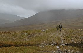
, remote mountain walks across miles of uninhabited natural wilderness
, and long distance walks such as the Bangor Trail
and the Western Way
.
, Belderrig
and Ballycastle
.
It is the largest public arts project ever undertaken in Ireland and entailed putting in place site specific sculptures along the North Mayo coast.
The first lot of sculptures were erected in 1993 and since then there have been several more added. The Children of Lir
sculpture pictured on this page is one of the later pieces. The sculptures incorporate the physical landscape and the cultural heritage of the area and the artists came from all corners of the globe.
The tasks involved in creating the sculpture trail took the form of the Meitheal
, a traditional method of working where a group of workers come together to achieve a common objective. The Meitheeal pervaded all aspects of the sculpture symposium, community involvement, donation of sites and the hosting of the artists in the local community.
A fundamental requirement was that the artists used natural materials in sympathy with their surroundings. The North Mayo coastline allowed for the exploration of a variety of many different possibilities. All sorts of sites were incorporated from disused quarries and sand dunes, cliff tops and waste land at crossroads and the sculptures varied from the stone sheep gathered at the roadside near Bellanaboy to the one eyed giant Dun Chaocháin sculpture on the hillside of Cill Ghallagáin, close to Carrowteige
, the Children of Lir
sculpture near Benwee Head
and the mirrored monument created at Claggan Island.
The interaction of artist with the natural environment by way of imagination and physical endeavour, achieved the primary aim of Tir Sáile which was to celebrate the past, relish the present and embrace the future.
and constant winds from the sea. These resources have been earmarked for development. There are opportunities for the development of ocean wave power
projects, tidal power
, hydroelectric schemes, and, wind farms amongst other clean, alternative energy generation opportunities for which the area is eminently suitable.

The discovery of the Corrib gas field in the Atlantic Ocean some 85 km off Broadhaven Bay has led to the Corrib gas project and ensuing controversy
. Raw, unodourised natural gas
from fields under the Atlantic Ocean is planned to be piped at high pressure at Glengad
and through the townlands of Kilcommon
, to a refinery 10 km inland. Documentaries have been made on the subject
. A documentary film, The Pipe by local film-maker, Richard O'Donnell, had its first showing at the Galway Film Festival on Thursday 8 July 2010, went on general release in cinemas nationwide from 3rd December 2010.
Barony (Ireland)
In Ireland, a barony is a historical subdivision of a county. They were created, like the counties, in the centuries after the Norman invasion, and were analogous to the hundreds into which the counties of England were divided. In early use they were also called cantreds...
in northwestern County Mayo
County Mayo
County Mayo is a county in Ireland. It is located in the West Region and is also part of the province of Connacht. It is named after the village of Mayo, which is now generally known as Mayo Abbey. Mayo County Council is the local authority for the county. The population of the county is 130,552...
in Ireland
Republic of Ireland
Ireland , described as the Republic of Ireland , is a sovereign state in Europe occupying approximately five-sixths of the island of the same name. Its capital is Dublin. Ireland, which had a population of 4.58 million in 2011, is a constitutional republic governed as a parliamentary democracy,...
consisting of over 210000 acres (849.8 km²), much of which is mountainous blanket bog. It has extensive sea coasts along its west and north boundaries. The main towns are Belmullet
Belmullet
Belmullet is a coastal Gaeltacht town with a population of around 2,000 on the Mullet Peninsula in the barony of Erris, County Mayo, Ireland. Its name means the "mouth of the mullet"...
and Bangor Erris
Bangor Erris
Bangor Erris is a town in Kiltane parish in Erris, County Mayo, Ireland with a population of 500. It is on the banks of the Owenmore River and is the gateway to the Erris Peninsula linking Belmullet with Ballina and Westport, nestled at the foot of the "Bangor Trail" a 22-mile mountain pass across...
. The name Erris derives from the Irish
Irish language
Irish , also known as Irish Gaelic, is a Goidelic language of the Indo-European language family, originating in Ireland and historically spoken by the Irish people. Irish is now spoken as a first language by a minority of Irish people, as well as being a second language of a larger proportion of...
'Iar Ros' meaning 'western promontory'. To its north is the wild Atlantic Ocean
Atlantic Ocean
The Atlantic Ocean is the second-largest of the world's oceanic divisions. With a total area of about , it covers approximately 20% of the Earth's surface and about 26% of its water surface area...
and the bays of Broadhaven
Broadhaven Bay
Broadhaven Bay is a natural bay of the Atlantic Ocean situated on the northwestern coast of County Mayo, Ireland. The opening of the bay faces northward, stretching between Erris Head on the west side and Kid Island on the east side with approximately 8.6 km between the two sides.It borders...
and Sruth Fada Conn and to its west is Blacksod Bay
Blacksod Bay
Blacksod Bay is a bay of the Atlantic Ocean in Erris, North County Mayo, Ireland. The bay is bounded on its western side by the Mullet Peninsula and to its eastern side by the coastline of Kiltane Parish where it extends southwards from Belmullet towards Gweesalia and Doohoma...
. Its main promontories are the Doohoma
Doohoma
- General Description :Doohoma, is named after the mass grave situated in the sand dunes in close proximity to the sea. This was as a result of the great Great Famine of 1845....
Peninsula, Mullet Peninsula, Erris Head
Erris Head
Erris Head is a promontory at the northernmost tip of the Mullet Peninsula, located in the barony of Erris in northwest County Mayo, Ireland. It is a well known and recognised landmark used by mariners and weather forecasters alike. It is also a very scenic viewpoint, with an unspoilt view of the...
, the Dún Chiortáin
Kilcommon
Kilcommon is a civil parish in Erris, north Mayo consisting of two large peninsulas; Dún Chaocháin and Dún Chiortáin. It consists of 37 townlands, some of which are so remote that they have no inhabitants...
and Dún Chaocháin
Carrowteige
Ceathrú Thaidhg is a Gaeltacht village and townland on the Dún Chaocháin peninsula in northwestern County Mayo, Ireland. It is within Kilcommon parish in the barony of Erris...
peninsulas and Benwee Head
Benwee Head
Benwee Head Cliffs County MayoGaelic: An Bhinn BhuíHeight: 304 metres OS 1/50k Mapsheet: 22 for topGrid Ref: F816 443 Latitude: 54.333659 Longitude: -9.820924ITM: 481576 844301 Prominence: 230m Isolation: 5.4 km...
.
There are five Catholic
Catholic
The word catholic comes from the Greek phrase , meaning "on the whole," "according to the whole" or "in general", and is a combination of the Greek words meaning "about" and meaning "whole"...
parishes in Erris: Kilcommon
Kilcommon
Kilcommon is a civil parish in Erris, north Mayo consisting of two large peninsulas; Dún Chaocháin and Dún Chiortáin. It consists of 37 townlands, some of which are so remote that they have no inhabitants...
, Kilmore, Kiltane
Kiltane
-Origins:Kiltane derives its name from Cill Seadhna, or Seadhna's church, which was in the townland of Kiltane by the banks of the Owenmore river. The name 'Seadhna' was well known in the Early Christian Period. There is mention of a bishop and priest of that name in an old tract but no detail as...
, Belmullet
Belmullet
Belmullet is a coastal Gaeltacht town with a population of around 2,000 on the Mullet Peninsula in the barony of Erris, County Mayo, Ireland. Its name means the "mouth of the mullet"...
and Ballycroy.
Gaeltacht
Much of Erris is a GaeltachtGaeltacht
is the Irish language word meaning an Irish-speaking region. In Ireland, the Gaeltacht, or an Ghaeltacht, refers individually to any, or collectively to all, of the districts where the government recognises that the Irish language is the predominant language, that is, the vernacular spoken at home...
area, with first-language speakers of Irish
Irish language
Irish , also known as Irish Gaelic, is a Goidelic language of the Indo-European language family, originating in Ireland and historically spoken by the Irish people. Irish is now spoken as a first language by a minority of Irish people, as well as being a second language of a larger proportion of...
in the following areas of the barony: An Fál Mór, Tamhaiin na hUltaí, Glais, Eachléim, Tearmann, Tránn, An Mullach Rua, Cartúr, An Baile Úr, Cill Ghallagáin, Ceathrú na gCloch, Port a' Chluaidh, Ros Dumhach and Ceathrú Thaidhg. The area with the most Irish speakers is Ceathrú Thaidhg.
Topography and geology
Blanket bog
Blanket bog or blanket mire is an area of peatland, forming where there is a climate of high rainfall and a low level of evapotranspiration, allowing peat to develop not only in wet hollows but over large expanses of undulating ground. The blanketing of the ground with a variable depth of peat...
. A triangle between Ballycroy
Ballycroy
Ballycroy may refer to:* Ballycroy, Ontario, a community in Adjala-Tosorontio township* Ballycroy National Park* Ballycroy, County Mayo, a village in the Republic of Ireland...
, Bellacorick
Bellacorick
Bellacorick or Bellacoric is a townland in County Mayo, Ireland. It comprises an area of . The area is remote, virtually uninhabited blanket bog which was once used mainly for milled peat production. Nowadays, it is a Special Area of Conservation because of the unique nature of the intact blanket...
and Bangor Erris
Bangor Erris
Bangor Erris is a town in Kiltane parish in Erris, County Mayo, Ireland with a population of 500. It is on the banks of the Owenmore River and is the gateway to the Erris Peninsula linking Belmullet with Ballina and Westport, nestled at the foot of the "Bangor Trail" a 22-mile mountain pass across...
consists of little else over its surface. Blanket bog
Blanket bog
Blanket bog or blanket mire is an area of peatland, forming where there is a climate of high rainfall and a low level of evapotranspiration, allowing peat to develop not only in wet hollows but over large expanses of undulating ground. The blanketing of the ground with a variable depth of peat...
, unlike raised bog, grows slowly across the landscape like a blanket covering the ground, due to a continuous supply of water from rainfall, maintaining waterlogged conditions on the ground. The bog is acidic with a pH of between 3.5 and 4.2. This is Atlantic Blanket Bog and it provides a suitable habitat for many species of flora
Flora
Flora is the plant life occurring in a particular region or time, generally the naturally occurring or indigenous—native plant life. The corresponding term for animals is fauna.-Etymology:...
, particularly small species of mosses, bryophytes, carnivorous plants and delicate flowers such as the Scarlet pimpernel
Scarlet pimpernel
Scarlet pimpernel is a low-growing annual plant found in Europe, Asia and North America...
. Species of fauna found on Atlantic blanket bog, include smaller varieties such as frogs and insects as well as many bird varieties, not common elsewhere.
Several areas of the blanket bog are protected under European legislation such as Special Areas of Conservation, Special Protection Area
Special Protection Area
A Special Protection Area or SPA is a designation under the European Union Directive on the Conservation of Wild Birds.Under the Directive, Member States of the European Union have a duty to safeguard the habitats of migratory birds and certain particularly threatened birds.Together with Special...
s (Birds Directive) and Natural Heritage Areas. These include the Glenamoy
Glenamoy
Glenamoy is a village in the parish of Kilcommon, Erris in the northern part of County Mayo in Ireland.Glenamoy is a general term for the following townlands:* Bellagelly North...
Bog Complex, Ballycroy National Park
Ballycroy National Park
Ballycroy National Park is located in the Owenduff/Nephin Mountains area of the Barony of Erris in northwest County Mayo, Ireland. It is one of the largest expanses of peatland in Europe, consisting of 117.79 square kilometres of Atlantic blanket bog. It is a unique habitat with a diverse flora and...
and Bellacorick
Bellacorick
Bellacorick or Bellacoric is a townland in County Mayo, Ireland. It comprises an area of . The area is remote, virtually uninhabited blanket bog which was once used mainly for milled peat production. Nowadays, it is a Special Area of Conservation because of the unique nature of the intact blanket...
.
Erris has a large range of habitats including blanket bog
Blanket bog
Blanket bog or blanket mire is an area of peatland, forming where there is a climate of high rainfall and a low level of evapotranspiration, allowing peat to develop not only in wet hollows but over large expanses of undulating ground. The blanketing of the ground with a variable depth of peat...
s, estuaries, salt marshes, fresh water lakes, coasts, cliffs, machair, sand dunes, sandy beach
Beach
A beach is a geological landform along the shoreline of an ocean, sea, lake or river. It usually consists of loose particles which are often composed of rock, such as sand, gravel, shingle, pebbles or cobblestones...
es and rocky shore
Rocky shore
A rocky shore is an intertidal area of seacoasts where solid rock predominates. Rocky shores are biologically rich environments, and make the ideal natural laboratory for studying intertidal ecology and other biological processes...
s. It is an important area for bird watchers as the largely treeless landscape allows relatively easy access for birdwatching
Birdwatching
Birdwatching or birding is the observation of birds as a recreational activity. It can be done with the naked eye, through a visual enhancement device like binoculars and telescopes, or by listening for bird sounds. Birding often involves a significant auditory component, as many bird species are...
. Species such as the corncrake and the rare Red-necked Phalarope
Red-necked Phalarope
The Red-necked Phalarope, Phalaropus lobatus, is a small wader. This phalarope breeds in the Arctic regions of North America and Eurasia. It is migratory, and, unusually for a wader, winters at sea on tropical oceans....
are found in the area. Brent Geese overwinter here feeding along the estuaries and kestrel
Kestrel
The name kestrel, is given to several different members of the falcon genus, Falco. Kestrels are most easily distinguished by their typical hunting behaviour which is to hover at a height of around over open country and swoop down on prey, usually small mammals, lizards or large insects...
s, goldfinch
European Goldfinch
The European Goldfinch or Goldfinch is a small passerine bird in the finch family.-Habitat and range:The goldfinch breeds across Europe, North Africa, and western and central Asia, in open, partially wooded lowlands. It is resident in the milder west of its range, but migrates from colder regions...
es and heron
Heron
The herons are long-legged freshwater and coastal birds in the family Ardeidae. There are 64 recognised species in this family. Some are called "egrets" or "bitterns" instead of "heron"....
s are commonly seen.
The oldest rocks in Ireland
Ireland
Ireland is an island to the northwest of continental Europe. It is the third-largest island in Europe and the twentieth-largest island on Earth...
, some 1.8 billion years old, are to be found on the west coasts of Erris. Pink or orange striped gneisses are found along the beaches of Elly Bay and Annagh Head where they have become separated from the same rocks on the east coast of Northern Canada
Canada
Canada is a North American country consisting of ten provinces and three territories. Located in the northern part of the continent, it extends from the Atlantic Ocean in the east to the Pacific Ocean in the west, and northward into the Arctic Ocean...
over hundreds of millions of years by the separation of tectonic plates
Tectonic Plates
Tectonic Plates is a 1992 independent Canadian film directed by Peter Mettler. Mettler also wrote the screenplay based on the play by Robert Lepage. The film stars Marie Gignac, Céline Bonnier and Robert Lepage.-Plot summary:...
in the mid Atlantic Ocean
Atlantic Ocean
The Atlantic Ocean is the second-largest of the world's oceanic divisions. With a total area of about , it covers approximately 20% of the Earth's surface and about 26% of its water surface area...
.
"Erris Head
Erris Head
Erris Head is a promontory at the northernmost tip of the Mullet Peninsula, located in the barony of Erris in northwest County Mayo, Ireland. It is a well known and recognised landmark used by mariners and weather forecasters alike. It is also a very scenic viewpoint, with an unspoilt view of the...
" (Irish: Ceann Iorrais) is a promontory at the northernmost tip of the Mullet Peninsula. It is a landmark known well by mariners and is one of the sea areas cited by Met Eireann's weather forecasters. The coastline of Erris has some of "the grandest sea cliffs in Ireland" over the Atlantic Ocean
Atlantic Ocean
The Atlantic Ocean is the second-largest of the world's oceanic divisions. With a total area of about , it covers approximately 20% of the Earth's surface and about 26% of its water surface area...
from where the next stop is the east coast of America. Erris Head is not served by any road and can only be reached by crossing a number of fields from the hamlet of Glenlara where the road ends.
Towns, villages and places of interest in the Barony of Erris
Islands
Along the coast there are several uninhabited islands. These include the Inishkea IslandsInishkea Islands
The Inishkea Islands are situated off the coast of the Mullet peninsula in the Barony of Erris. There are two main islands - Inishkea North and Inishkea South...
, Inishglora
Inishglora
Inishglora is an island off the coast of the Mullet Peninsula in Erris, North Mayo. It has some small neighbouring islands, known as Inishkeeragh. As with its neighbouring Inishkea Islands, Inishglora's geological composition is that of gneiss and schist, similar to the rest of Erris. The island...
, Duvillaun
Duvillaun
Duvillaun is the name of a cluster of islands lying south to the Inishkea Islands and Inishglora in the Atlantic Ocean off the coast of North Mayo. The main island is known as Duvillaun Mór...
, the Stags of Broadhaven Bay
Broadhaven Bay
Broadhaven Bay is a natural bay of the Atlantic Ocean situated on the northwestern coast of County Mayo, Ireland. The opening of the bay faces northward, stretching between Erris Head on the west side and Kid Island on the east side with approximately 8.6 km between the two sides.It borders...
and many smaller islands.
Archaeology/History
Erris, in common with most of inland Ireland, became covered in extensive native woodland a few thousand years after the last Ice Age retreated (approx 15,000 years ago) but its northern and western shores remained relatively lightly afforested. Across inland Erris, the remains of these forests can be seen across the blanket bog landscape in the form of fossilFossil
Fossils are the preserved remains or traces of animals , plants, and other organisms from the remote past...
ised greying tree stumps which are mainly the remains of ancient Scots Pine
Scots Pine
Pinus sylvestris, commonly known as the Scots Pine, is a species of pine native to Europe and Asia, ranging from Scotland, Ireland and Portugal in the west, east to eastern Siberia, south to the Caucasus Mountains, and as far north as well inside the Arctic Circle in Scandinavia...
trees. These become most obvious where there has been harvesting of turf (peat
Peat
Peat is an accumulation of partially decayed vegetation matter or histosol. Peat forms in wetland bogs, moors, muskegs, pocosins, mires, and peat swamp forests. Peat is harvested as an important source of fuel in certain parts of the world...
) for fuel. The odd petrified bog oak
Bog oak
Bog-wood, also known as morta is wood from trees that have been buried in peat bogs and preserved from decay by the acidic and anaerobic bog conditions, sometimes for hundreds or even thousands of years. The wood is usually stained brown by tannins dissolved in the acidic water...
can be found too.
During the Neolithic
Neolithic
The Neolithic Age, Era, or Period, or New Stone Age, was a period in the development of human technology, beginning about 9500 BC in some parts of the Middle East, and later in other parts of the world. It is traditionally considered as the last part of the Stone Age...
period, starting about 6,000 years ago, the first people living in Ireland whose ancestors had hunted and gathered along the coastlines of Erris from about 9,000 years ago, began to cut down the forestry to clear land for growing crops and grazing livestock. Because the underlying rock type was ancient and heavily weathered schists the soil was thin and easily eroded by inclement weather. After a couple of years the crops began to fail and the Neolithic people had to clear the native woodlands further and further inland to clear more land for their crops. With minor changes in climate and high rainfall levels the land became blanketed by the bog and remains that way to the current day. When present day turf cutters, harvest the bog for fuel, archaeological remains, mainly from the Neolithic and early Bronze Age
Bronze Age
The Bronze Age is a period characterized by the use of copper and its alloy bronze as the chief hard materials in the manufacture of some implements and weapons. Chronologically, it stands between the Stone Age and Iron Age...
, which have become buried under the bog often come to light. More info on the archaeology of Kilcommon parish available from Comhar Dún Chaocháin Teo
Comhar Dún Chaocháin Teo
Comhar Dún Chaocháin Teo is a community development co-operative based in the peripheral, rural, Gaeltacht, North Mayo area of Ireland. It is registered with the Registry of Friendly Societies and its purpose is to promote the linguistic, cultural, infrastructural, educational and social...
in Carrowteige
Carrowteige
Ceathrú Thaidhg is a Gaeltacht village and townland on the Dún Chaocháin peninsula in northwestern County Mayo, Ireland. It is within Kilcommon parish in the barony of Erris...
. Some archaeological sites can be found marked on Ordnance Survey
Ordnance Survey
Ordnance Survey , an executive agency and non-ministerial government department of the Government of the United Kingdom, is the national mapping agency for Great Britain, producing maps of Great Britain , and one of the world's largest producers of maps.The name reflects its creation together with...
maps.
The period of Early Christianity
Early Christianity
Early Christianity is generally considered as Christianity before 325. The New Testament's Book of Acts and Epistle to the Galatians records that the first Christian community was centered in Jerusalem and its leaders included James, Peter and John....
saw several small churches set up but no major religious houses came to the area. During the Plantations of Ireland
Plantations of Ireland
Plantations in 16th and 17th century Ireland were the confiscation of land by the English crown and the colonisation of this land with settlers from England and the Scottish Lowlands....
, there were two major landlords in the area - the Binghams and the Carters. Oliver Cromwell
Oliver Cromwell
Oliver Cromwell was an English military and political leader who overthrew the English monarchy and temporarily turned England into a republican Commonwealth, and served as Lord Protector of England, Scotland, and Ireland....
's policy (mid 17th century) of sending the native Irish who refused to bow down to him "to hell or to Connaught" saw a large influx of population into Erris where the disinherited native Irish tried to eke a living from very poor quality agricultural land under the tenancy of the landlords and their agents. During the Irish Famine of 1845 - '47 many died in Erris despite the close proximity of the sea, because they could not raise the cash to fund a passage to America.
Some 19th and early 20th century antiquarians and surveyors
Surveying
See Also: Public Land Survey SystemSurveying or land surveying is the technique, profession, and science of accurately determining the terrestrial or three-dimensional position of points and the distances and angles between them...
visited the Erris area and wrote about their experiences and thoughts on the area at that time. These include works by Patrick Knight (Erris in the Irish Highlands), Caesar Otway
Caesar Otway
Caesar Otway was born in Nenagh, Co. Tipperary, Ireland in 1780. In 1803 he married Francis Hastings with who he had five children, John Hastings Otway, Caesar George Otway, Loftus Otway, Jane Otway and Frances Otway. In 1810 he graduated from Trinity College, Dublin with holy orders...
(Sketches in Erris and Tyrawley) and Thomas Johnson Westropp
Thomas Johnson Westropp
- Early life :Westropp, a notable antiquarian in Victorian Ireland and a collector of folklore, was born at Attyflin Park, Patrickswell, County Limerick. Westropp's family were of English origin and settled in County Limerick in the mid 16th century. The family married into the O'Callaghans of...
(The Promontory Forts and Early Remains of the Coast of Mayo). The Ulster Cycle
Ulster Cycle
The Ulster Cycle , formerly known as the Red Branch Cycle, one of the four great cycles of Irish mythology, is a body of medieval Irish heroic legends and sagas of the traditional heroes of the Ulaid in what is now eastern Ulster and northern Leinster, particularly counties Armagh, Down and...
legend of the Táin Bó Flidhais
Táin Bó Flidhais
Táin Bó Flidhais, also known as the Mayo Táin, is a tale from the Ulster Cycle of early Irish literature. It is one of a group of works known as Táin Bó, or "cattle raid" stories, the best known of which is Táin Bó Cúailnge...
concerns the Barony of Erris in the time period of approx the 1st century AD.
Legend and folklore
Folklore has always been and still remains an important part of the culture of Erris. Much folklore dates from Iron Age tales and legends.Many well known folklore tales have their origins here. The Children of Lir
Children of Lir
The Children of Lir is an Irish legend. The original Irish title is Clann Lir or Leannaí Lir, but Lir is the genitive case of Lear. Lir is more often used as the name of the character in English...
, according to tradition, are buried on the island of Inisglora. The children were turned into swans by their jealous stepmother and doomed to spend the next 900 years on lakes and waters in Ireland. When they finally reclaimed their human form on Inisglora, they were so old that they died and were buried there.
Táin Bó Flidhais
Táin Bó Flidhais
Táin Bó Flidhais, also known as the Mayo Táin, is a tale from the Ulster Cycle of early Irish literature. It is one of a group of works known as Táin Bó, or "cattle raid" stories, the best known of which is Táin Bó Cúailnge...
is the tale of a cattle raid in which raiders came to Erris from the Royal site at Cruachán (Rathcroghan) at Tulsk, Co. Roscommon to Rathmorgan fort (Iorras Domhnann)at the south end of Carrowmore Lake in the centre of the Barony. The remains of Rathmorgan fort on top of the mountain can be seen from the road below.
Brian Rua U'Cearbhain
Brian Rua U'Cearbhain
- Brian Rua O’Cearbhain :Brian Rua is a well-known 17th century Errisman. He is remembered as the prophet of Erris, a large Barony in the north west of County Mayo...
from Inver is remembered in folklore as the prophet of Erris.
The small village of Glencastle
Glencastle
Glencastle is a village of about 30 people in the northwest of County Mayo, Ireland. The townland incorporates an area of . The Irish language is still dominant there.- Topography :...
has some large mounds in the narrow valley that are not naturally occurring. They can be seen on the right hand side, close to the roadside on the approach to Belmullet from the east. These have never been archaeologically investigated but folklore legends recall that this was the old gateway into the Mullet and a toll had to be paid for each traveller who passed through or the traveller may never be seen again. There were no roads through this area of Mayo until less than two hundred years ago. In recent years the Glencastle Valley has been drastically altered by extensive quarrying.
Water sports
Erris is a popular location for many types of watersports ranging through fishingFishing
Fishing is the activity of trying to catch wild fish. Fish are normally caught in the wild. Techniques for catching fish include hand gathering, spearing, netting, angling and trapping....
, sailing
Sailing
Sailing is the propulsion of a vehicle and the control of its movement with large foils called sails. By changing the rigging, rudder, and sometimes the keel or centre board, a sailor manages the force of the wind on the sails in order to move the boat relative to its surrounding medium and...
, surfing
Surfing
Surfing' is a surface water sport in which the surfer rides a surfboard on the crest and face of a wave which is carrying the surfer towards the shore...
, swimming, wind surfing, kiteboarding and kite surfing.
Walking trails
There are many walking trails in Erris - cliff walks above the Atlantic at Broadhaven BayBroadhaven Bay
Broadhaven Bay is a natural bay of the Atlantic Ocean situated on the northwestern coast of County Mayo, Ireland. The opening of the bay faces northward, stretching between Erris Head on the west side and Kid Island on the east side with approximately 8.6 km between the two sides.It borders...
along Benwee Head
Benwee Head
Benwee Head Cliffs County MayoGaelic: An Bhinn BhuíHeight: 304 metres OS 1/50k Mapsheet: 22 for topGrid Ref: F816 443 Latitude: 54.333659 Longitude: -9.820924ITM: 481576 844301 Prominence: 230m Isolation: 5.4 km...
, Glinsc
Glinsc
Glinsce is a Gaeltacht townland in County Mayo, Ireland. It is in the parish of Kilcommon and barony of Erris...
and the North Mayo coastline - details from Comhar Dún Chaocháin Teo in Carrowteige
Carrowteige
Ceathrú Thaidhg is a Gaeltacht village and townland on the Dún Chaocháin peninsula in northwestern County Mayo, Ireland. It is within Kilcommon parish in the barony of Erris...
, remote mountain walks across miles of uninhabited natural wilderness
Wilderness
Wilderness or wildland is a natural environment on Earth that has not been significantly modified by human activity. It may also be defined as: "The most intact, undisturbed wild natural areas left on our planet—those last truly wild places that humans do not control and have not developed with...
, and long distance walks such as the Bangor Trail
Bangor Trail
The Bangor Trail is a waymarked walking trail in Erris, North Mayo, Republic of Ireland. It is approx. 29 kilometres in length. It takes a route south from Bangor Erris through the Nephin Beg Mountain range to Newport and is a fairly tough, remote hiking trail. The area is largely Atlantic blanket...
and the Western Way
Western Way
The Western Way is a long-distance trail in Ireland. It is long and begins in Oughterard, County Galway and ends in Ballycastle, County Mayo. It is typically completed in seven days...
.
Tír Sáile Sculpture Trail
In 1993 the Tír Sáile Sculpture Trail project was carried out to commemorate 5,000 years of habitation in Co. Mayo. This trail extends through many areas of Erris from the tip of the Mullet Peninsula, through KilcommonKilcommon
Kilcommon is a civil parish in Erris, north Mayo consisting of two large peninsulas; Dún Chaocháin and Dún Chiortáin. It consists of 37 townlands, some of which are so remote that they have no inhabitants...
, Belderrig
Belderrig
Béal Deirg is a Gaeltacht village and townland in County Mayo, Ireland.-See also:* List of towns and villages in Ireland...
and Ballycastle
Ballycastle, County Mayo
Ballycastle is a village in County Mayo, Ireland, situated northwest from Ballina, near Mayo's north coast in the West of Ireland. Ballycastle is also on the edge of an Irish speaking area called a Gaeltacht....
.
It is the largest public arts project ever undertaken in Ireland and entailed putting in place site specific sculptures along the North Mayo coast.
The first lot of sculptures were erected in 1993 and since then there have been several more added. The Children of Lir
Children of Lir
The Children of Lir is an Irish legend. The original Irish title is Clann Lir or Leannaí Lir, but Lir is the genitive case of Lear. Lir is more often used as the name of the character in English...
sculpture pictured on this page is one of the later pieces. The sculptures incorporate the physical landscape and the cultural heritage of the area and the artists came from all corners of the globe.
The tasks involved in creating the sculpture trail took the form of the Meitheal
Meitheal
Meitheal is the Irish word for a work team, gang, or party and denotes the co-operative labour system in rural Ireland where groups of neighbours help each other in turn with farming work, such as harvesting crops...
, a traditional method of working where a group of workers come together to achieve a common objective. The Meitheeal pervaded all aspects of the sculpture symposium, community involvement, donation of sites and the hosting of the artists in the local community.
A fundamental requirement was that the artists used natural materials in sympathy with their surroundings. The North Mayo coastline allowed for the exploration of a variety of many different possibilities. All sorts of sites were incorporated from disused quarries and sand dunes, cliff tops and waste land at crossroads and the sculptures varied from the stone sheep gathered at the roadside near Bellanaboy to the one eyed giant Dun Chaocháin sculpture on the hillside of Cill Ghallagáin, close to Carrowteige
Carrowteige
Ceathrú Thaidhg is a Gaeltacht village and townland on the Dún Chaocháin peninsula in northwestern County Mayo, Ireland. It is within Kilcommon parish in the barony of Erris...
, the Children of Lir
Children of Lir
The Children of Lir is an Irish legend. The original Irish title is Clann Lir or Leannaí Lir, but Lir is the genitive case of Lear. Lir is more often used as the name of the character in English...
sculpture near Benwee Head
Benwee Head
Benwee Head Cliffs County MayoGaelic: An Bhinn BhuíHeight: 304 metres OS 1/50k Mapsheet: 22 for topGrid Ref: F816 443 Latitude: 54.333659 Longitude: -9.820924ITM: 481576 844301 Prominence: 230m Isolation: 5.4 km...
and the mirrored monument created at Claggan Island.
The interaction of artist with the natural environment by way of imagination and physical endeavour, achieved the primary aim of Tir Sáile which was to celebrate the past, relish the present and embrace the future.
Natural resources
Erris has considerable potential for ocean energy in terms of its location next to the Atlantic OceanAtlantic Ocean
The Atlantic Ocean is the second-largest of the world's oceanic divisions. With a total area of about , it covers approximately 20% of the Earth's surface and about 26% of its water surface area...
and constant winds from the sea. These resources have been earmarked for development. There are opportunities for the development of ocean wave power
Wave power
Wave power is the transport of energy by ocean surface waves, and the capture of that energy to do useful work — for example, electricity generation, water desalination, or the pumping of water...
projects, tidal power
Tidal power
Tidal power, also called tidal energy, is a form of hydropower that converts the energy of tides into useful forms of power - mainly electricity....
, hydroelectric schemes, and, wind farms amongst other clean, alternative energy generation opportunities for which the area is eminently suitable.
Corrib gas field
The discovery of the Corrib gas field in the Atlantic Ocean some 85 km off Broadhaven Bay has led to the Corrib gas project and ensuing controversy
Corrib gas controversy
The Corrib gas controversy concerns plans by Shell E&P Ireland, Statoil Exploration Limited, Vermilion Energy Trust and the Irish government for processing the Corrib gas field through Broadhaven Bay and Sruth Fada Conn Bay in Kilcommon parish, Erris, County Mayo, and objections raised against...
. Raw, unodourised natural gas
Natural gas
Natural gas is a naturally occurring gas mixture consisting primarily of methane, typically with 0–20% higher hydrocarbons . It is found associated with other hydrocarbon fuel, in coal beds, as methane clathrates, and is an important fuel source and a major feedstock for fertilizers.Most natural...
from fields under the Atlantic Ocean is planned to be piped at high pressure at Glengad
Glengad
Glengad is a small Gaeltacht village in the parish of Kilcommon in northwest County Mayo, Ireland. The townland is also known as Dooncarton , a name which comes from an Iron Age tribal chieftain called Ciortan, a character who appears in the Ulster Cycle legend of the Táin Bó Flidhais.The village...
and through the townlands of Kilcommon
Kilcommon
Kilcommon is a civil parish in Erris, north Mayo consisting of two large peninsulas; Dún Chaocháin and Dún Chiortáin. It consists of 37 townlands, some of which are so remote that they have no inhabitants...
, to a refinery 10 km inland. Documentaries have been made on the subject
. A documentary film, The Pipe by local film-maker, Richard O'Donnell, had its first showing at the Galway Film Festival on Thursday 8 July 2010, went on general release in cinemas nationwide from 3rd December 2010.
External links
- http://www.vimeo.com/8668733 An hour long documentary which won best feature documentary award at the Waterford Film Festival 2009.
- http://www.thepipethefilm.com/ Trailer for 'The Pipe' released Thurs 8 July 2010 - Galway Film Festival - winner: best documentary
- http://www.arasinisgluaire.ie/
- http://www.ballycroynationalpark.ie/about.html
- http://www.kilcommonlodge.ie
- http://shelltosea.com
- http://www.mayowalks.ie
- http://www.uisce.ie/
- http://errisunitedfc.ie
- http://bangorerrisangling.com
- http://www.gaeltacht.eu/
- http://errisbeo.ie