
.gif)
Elizabeth (neighborhood)
Encyclopedia
Tram
A tram is a passenger rail vehicle which runs on tracks along public urban streets and also sometimes on separate rights of way. It may also run between cities and/or towns , and/or partially grade separated even in the cities...
line was completed, and was annexed in 1907. Home of Independence Park
Independence Park (Charlotte, North Carolina)
Independence Park is a 24 acre urban park at 300 Hawthorne Lane situated at the western end of the Elizabeth neighborhood in Charlotte, North Carolina...
, the first public park in the city, Elizabeth became one of the most fashionable residential areas in Charlotte in its early days. In 2006 Elizabeth had a population of 3,908.
Because much of the neighborhood was developed in the early 20th century, Elizabeth's trees have had time to mature. They now form a canopy over most of Elizabeth's residential streets. In addition, Elizabeth is more pedestrian-friendly than most Charlotte neighborhoods; businesses and residences are in close proximity, and most roads have sidewalks.
The current boundaries of the Elizabeth neighborhood are, roughly, Randolph Road/4th Street to the Southwest; Independence Boulevard to the West and North; and a creek to the East. Major avenues include Elizabeth Avenue and 7th Street. A substantial portion of the neighborhood is listed on the National Register of Historic Places
National Register of Historic Places
The National Register of Historic Places is the United States government's official list of districts, sites, buildings, structures, and objects deemed worthy of preservation...
as the Elizabeth Historic District.
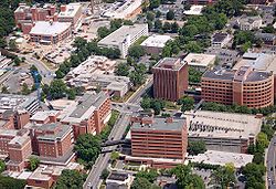
Elizabeth contains two major hospitals (Presbyterian Hospital and Mercy Hospital), and a number of medical offices line Randolph Road. Along 7th Street there are numerous old houses that have been converted into shops, offices, and restaurants. At the western end of the neighborhood lie Independence Park and American Legion Memorial Stadium
American Legion Memorial Stadium
American Legion Memorial Stadium is 21,000-capacity stadium located on 7th Street in the Elizabeth community of Charlotte, North Carolina. Memorial Stadium is mainly used for high school sporting events and also serves as a public venue...
. A development project is underway to revitalize Elizabeth Avenue.
Elizabeth is bordered by Belmont, Chantilly
Chantilly Neighborhood
The Chantilly Neighborhood is located between the Elizabeth and Plaza-Midwood neighborhoods, in Charlotte, North Carolina. Originally developed in the mid-1940s, additional streets were added in the 1950s. Neighborhood boundaries consist of Independence Boulevard to the northeast, CSX Railroad...
, Crescent Heights, Eastover, First Ward, Grier Heights, and Myers Park.