
Edmonton Light Rail Transit
Encyclopedia
Edmonton Light Rail Transit, more commonly referred to as the LRT, is a light rail
system in Edmonton
, Alberta
. Part of the Edmonton Transit System
(ETS), the 20.5-kilometre route starts in Edmonton's northeast suburbs and ends at Century Park in Edmonton's south end.
The ETS designates the LRT as Route 201. The easternmost track, as the line runs south to north, typically carrying traffic to Clareview, is designated Track 1, with Track 2 typically carrying southbound trains.
The system uses trains of either Siemens-Duewag U2
cars or Siemens SD-160
cars; 37 of the SD-160 cars were ordered between 2005 and 2007, with the first cars entering revenue service on January 27, 2009.
, Belvedere
, Coliseum
, Stadium
, Churchill
, Central
, Bay/Enterprise Square, Corona
, Grandin/Government Centre
, University
, Health Sciences/Jubilee
, McKernan/Belgravia, South Campus
, Southgate
, and Century Park
stations. Of these, Churchill, Central, Bay/Enterprise Square, Corona, Grandin/Government Centre, and University are underground.
Storage, maintenance and operations of the LRT are controlled from the D.L. MacDonald Yard.
Plans are in place to extend south to Ellerslie
station, north to Gorman
Station, and a spur north of downtown to MacEwan
, Kingsway
, and NAIT
. In addition there are further plans to create two new lines that will extend to Mill Woods Town Centre in the South East part of the city and to Lewis Estates in the West end of the city.
During construction, surface area was preserved (although costs increased) by tunnelling under the downtown core and the University of Alberta
main campus. The underground portions of the LRT connect to a pedway
system with links to many buildings. The LRT crosses the North Saskatchewan River
between the Grandin and University stations on the Dudley B. Menzies Bridge
, a dedicated LRT bridge.
with a metropolitan population of less than one million to build a modern light rail
system. The population was just over 445,000 when the route first started construction in 1974. It opened its first segment on April 22, 1978, in time for the 1978 Commonwealth Games
. The line followed a CN
right-of-way from Belvedere Station to Stadium Station (near Commonwealth Stadium
), via an intermediate stop at Coliseum Station (near the Northlands Coliseum, now Rexall Place
), and then continued in a tunnel under 99 Street to Central Station, at Jasper Avenue and 100 Street, including an intermediate stop, Churchill. The original line was 6.9 km long.
When the line opened, fare collection was modelled on traditional rapid transit lines, with booth attendants. Low volumes of activity at some entrances led to weekend closures of alternate station entrances. In November 1980, Edmonton Transit–as it was then named–switched to a modified European-style "proof of payment" system, initially retaining the old turnstiles to issue the new receipts. Fares were now collected by automated ticket vending machines with irregular proof of payment inspectors, which permitted keeping all entrances open and required fewer staff.
On April 26, 1981, ETS opened a northeastern-bound extension of 2.2 km on the CN right-of-way to Clareview Station. In June 1983, the light rail tunnel downtown was extended by 0.8 km to Bay and Corona stations. The D.L. MacDonald Yard
, between Belvedere and Clareview, opened in December 1983 to store and service the vehicles. The line was extended in September 1989 by 0.8 km to Grandin (close to the Alberta Legislature
). On August 23, 1992, the next extension opened from Grandin to University Station, partially via a North Saskatchewan River
crossing with a lower level for pedestrians and cyclists, and partially via a tunnel into the station. On January 1, 2006, the line was extended 0.64 km south through the University Campus to the Health Sciences, which is located at street level.
On April 25, 2009, McKernan/Belgravia and South Campus were opened as part of the south LRT expansion, with Southgate and Century Park opening on April 24, 2010. The first of the new Siemens SD-160
light rail vehicle train cars for the new extension were shipped by rail from Florin, California
, on April 24, 2008, arriving in Edmonton on May 9, 2008 (37 vehicles in total).
The LRT expansion was developed entirely at surface level with several underpasses, one at Belgravia Road and the other under 111 Street
south of 61 Avenue. A short busway has been constructed from the South Campus station roughly parallel to Belgravia Road in conjunction with the South LRT expansion. The surface LRT line emerges to ground level just north of the Health Sciences Station at the University of Alberta
, which opened in January 2006. From the Health Sciences Station, the South LRT line leads to the South Campus Station, followed by the Southgate and Century Park stations.
Every station on the line built since 1983 has been built with full accessibility for persons with disabilities. In the late 1990s, Clareview and Belvedere Stations were renovated to include a roof and also had their platforms lengthened to allow for the use of five-car trains.
 In January 2008, Mayor Stephen Mandel announced that the southern leg will be extended further south along 111 Street to Anthony Henday Drive, and then west to 127 Street SW. There will be a station and a 1,000-car park-and-ride at the intersection of Ellerslie Road
and 127 Street SW, then the LRT will continue south for another stop at 41 Avenue SW, with a possible new LRT yard in between. City council approved the route to the Ellerslie station
, and for construction to begin on the park-and ride in July 2009,but they have yet to announce when the station will be complete, as well as approval for the extension to city limits. Long range plans for the south line include possible extension all the way to the Edmonton International Airport
and Leduc
.
(NAIT), and eventually beyond to north-end neighbourhoods with a terminal station south of St.Albert.
In April 2008, Edmonton City Council
approved $45 million in funding to build a tunnel under the EPCOR Tower
site immediately, while it is still under construction, with the aim of saving $140 million more than would have been required to dig under the tower once it was completed. This step was taken even though the rest of the project had not yet been approved, because of the time constraint posed by the construction of the new tower. Construction on the tunnel began in August 2009 and was completed by approximately September 2010.
On July 2, 2009, the federal and provincial governments approved the reallocation of funding from the proposed Gorman Station
to the line as the city felt that NAIT was more of a higher priority.
On May 19, 2010 the transportation department announced its recommendation for an extension of the north line from the NAIT station to St. Albert. This new extension will travel north from the City Centre Airport land, along 113A Street, until reaching 153 Avenue where it will turn west to a new park-and-ride lot beside Anthony Henday Drive and St. Albert Trail. This extension is expected to eventually serve 42,000 to 45,000 passengers daily and is projected to be completed by 2019. As of yet this is still in the planning stage
The new line branches off the main LRT line at Churchill Station, runs west along 105 Avenue to the Grant MacEwan University City Centre Campus, then north along 105 Street
, Kingsway (Avenue)
, and 106 Street, to Kingsway Mall and NAIT. Beyond NAIT the line could possibly travel through the new neighbourhood built after the City Centre (Blatchford Field) Airport
is dismantled, go over the CN railway
yard north of Yellowhead Trail, and continue further north along 113A Street, with long range plans to eventually extend the line to St. Albert
. The City of St. Albert has also began preliminary plans to extend the LRT line into their borders.
The new line has three confirmed stations: one at Grant MacEwan University (MacEwan Station
), one on Kingsway (Kingsway Station
), and one near the Northern Alberta Institute of Technology (NAIT Station
). MacEwan Station will be located just east of the downtown MacEwan University campus, and west of the proposed hockey arena, at 104 Street and 105 Avenue. The Kingsway Station will be located on the north side of Kingsway, to the south of the Royal Alexandra Hospital
. As part of the plan, the current Kingway Transit Centre will be relocated to the southeast corner of 111 Avenue and 106 Street, to provide service to both Kingsway Mall and the Kingsway Station. TheNAIT Station will be located north of Princess Elizabeth Avenue
, on the south side of the Northern Alberta Institute of Technology
's swimming pool and hockey arena (S) wing.
As of early 2011 preperation work has been ongoing getting the route prepared for actual construction. Various roadways have been temporarily and some permanently closed to vehicular trafic due to LRT construction. In August of 2011 105th ave was closed and tunnelling is scheduled to begin to connect with the tunnel under the Epcor Tower.
LRT_Newsletter_Summer_2011_final.pdf
 On April 30, 2009, Mayor Stephen Mandel announced a $210 million project to extend the LRT system by one stop (Gorman Station
) to Gorman Towne Centre. The expansion beyond Clareview Station is planned to continue along the CN right-of-way to a station and park-and-ride north of 153 Avenue
and Victoria Trail
. Long range plans for the northeast leg of the LRT include extending it towards Fort Saskatchewan.
, with the West Edmonton Mall
en route, is under consideration. A recommended route was announced on March 3, 2008. It called for a branch off the main North–South LRT line between the Health Sciences and McKernan/Belgravia stations, with a tunnelled alignment running west under University Avenue
, crossing the North Saskatchewan River
via a new bridge, and then continuing westwards at-grade along 87 Avenue past West Edmonton Mall to a terminus at Lewis Estates.
A second option was recommended by Transit officials September 3, 2009, that would have the west LRT extension run from downtown, along 104 Avenue and Stony Plain Road
before diverting south on 156 Street
towards Meadowlark Health And Shopping Centre, then returning to the 87 Avenue alignment to West Edmonton Mall and beyond. Proponents of this route cite better opportunities for transit-oriented development
. On December 15, 2009, Edmonton City Council voted in favor of the Stony Plain Road route, although station placement and minor route adjustments could still take place within the next few months, construction could possibly start within 3 years.
began in early 2009, and several routes were being considered. In December 2009, Edmonton city council approved a new low floor train route that would leave from a new ground-level Churchill Station, across the North Saskatchewan River on a new bridge to be constructed east of Louise McKinney Park, climb the hill adjacent to Connors Road then proceed east along 95 Avenue and southbound at 85 Street. The route will travel southbound along 85 Street crossing the traffic circle and shifting to 83 Street, continuing south and east on an elevated track towards Wagner Road. Finally the Mill Woods line will proceed south along 75/66 Street until it reaches Mill Woods Station. Within this line the proposed stations are: Quarters, Muttart, Strathearn, Holyrood, Bonnie Doon, 73 Avenue, Wagner, Whitemud (to include bus terminal and a 'park & ride'), Millbourne, Grey Nuns, and Mill Woods.
After public consultation throughout 2010 the final proposal for the southeast route will go to city council in December 2010 for council review and final approval.
June 1, 2011 Edmonton City Council approved $39 million in funding to proceed with preliminary engineering for the Southeast to West LRT line.
as well as integration with other regional transportation nodes, has given rise to proposals for a new LRT master plan to guide it all.
Passengers can purchase books of transit tickets, day passes, and monthly transit passes. Seniors can also purchase an annual transit pass.
Passengers paying a cash fare at a fare machine at an LRT station are issued a transit ticket, which is validated as an LRT ticket after being time-stamped. This ticket is valid both as proof of payment and as a transfer. Transfers allow the passenger to transfer from the LRT to a bus, from a bus to the LRT and between buses, and is valid for 90 minutes from the time it was stamped. Passengers paying a cash fare on a bus can obtain a transfer at the time the fare is paid. Transfers also serve as proof of payment.
Passengers in an LRT proof of payment area must present proof of payment upon request by an ETS officer. Proof of payment includes LRT tickets, transfers, validated transit tickets and transit passes. Failure to provide proof of payment can result in a fine. Proof of payment areas include all LRT trains and most LRT station platforms. (At Health Sciences/Jubilee, McKernan/Belgravia, and South Campus stations, the fare machines are located on the station platform so it is possible to be on the platform without a proof of payment.)
In 2007, the Edmonton Transit System, the University of Alberta
, and Grant MacEwan University (Grant MacEwan College at the time) partnered to provide students with a universal transit pass
(U-Pass), which is valid on the LRT and all ETS buses as well as on Strathcona County
and St. Albert Transit
Systems. NAIT
students voted to join the program in 2010. The U-Pass allows unlimited LRT and bus use to valid pass holders, and is only available during the months of September to April.
Light rail
Light rail or light rail transit is a form of urban rail public transportation that generally has a lower capacity and lower speed than heavy rail and metro systems, but higher capacity and higher speed than traditional street-running tram systems...
system in Edmonton
Edmonton
Edmonton is the capital of the Canadian province of Alberta and is the province's second-largest city. Edmonton is located on the North Saskatchewan River and is the centre of the Edmonton Capital Region, which is surrounded by the central region of the province.The city and its census...
, Alberta
Alberta
Alberta is a province of Canada. It had an estimated population of 3.7 million in 2010 making it the most populous of Canada's three prairie provinces...
. Part of the Edmonton Transit System
Edmonton Transit System
The Edmonton Transit System, also called ETS, is the public transit service owned and operated by the city of Edmonton, Alberta. It operates Edmonton's bus and light rail systems.-Service:...
(ETS), the 20.5-kilometre route starts in Edmonton's northeast suburbs and ends at Century Park in Edmonton's south end.
The ETS designates the LRT as Route 201. The easternmost track, as the line runs south to north, typically carrying traffic to Clareview, is designated Track 1, with Track 2 typically carrying southbound trains.
The system uses trains of either Siemens-Duewag U2
Siemens-Duewag U2
The Siemens-Duewag U2 is a type of light-rail vehicle . The cars were built by consortium of Siemens, Wegmann & Co. and Duewag. The U2 design was built on the Siemens U1 prototype tram built in 1965 ....
cars or Siemens SD-160
Siemens SD-160
The SD-100 and SD-160 are light-rail vehicles manufactured by Siemens. The SD-100 uses motors that run on direct-current electricity while the SD-160 model features newer motors that run using alternating current. Both models are suited for loading at street level and high-platform level...
cars; 37 of the SD-160 cars were ordered between 2005 and 2007, with the first cars entering revenue service on January 27, 2009.
System overview
The system currently comprises the following 15 consecutive stations: ClareviewClareview (ETS)
Clareview Station is an LRT station operated by the Edmonton Transit System in the city of Edmonton, Alberta, Canada. It is located near 42 Street and 139 Avenue, and is named for the northeast Edmonton District of Clareview...
, Belvedere
Belvedere (ETS)
Belvedere Station is a station on the LRT system in Edmonton, Alberta, Canada. It is operated by the Edmonton Transit System, and was one of the original five stations when the line opened on April 22, 1978...
, Coliseum
Coliseum (ETS)
Coliseum Station is a surface station on the LRT system in Edmonton, Alberta, Canada. It is operated by Edmonton Transit System, and was one of the original five stations when the line opened on April 22, 1978...
, Stadium
Stadium (ETS)
Stadium Station is a station on the LRT system in Edmonton, Alberta, Canada. It is operated by the Edmonton Transit System.The station opened on April 22, 1978, and is one of the original five stations on the LRT system...
, Churchill
Churchill (ETS)
Churchill Station was one of the five original stations along the LRT line in Edmonton, Alberta, Canada. It is located between Central Station and Stadium Station. It opened April 22, 1978....
, Central
Central (ETS)
Central Station is a station on the LRT system in Edmonton, Alberta, Canada. It is operated by the Edmonton Transit System, and was one of the original five stations when the line opened on April 22, 1978...
, Bay/Enterprise Square, Corona
Corona (ETS)
Corona Station is an Edmonton Light Rail Transit Station operated by Edmonton Transit System in the city of Edmonton, Alberta, Canada. It is located in the downtown core beneath Jasper Avenue between 107 Street and 108 Street....
, Grandin/Government Centre
Grandin (ETS)
Grandin Station is an LRT Station operated by Edmonton Transit System in the city of Edmonton, Alberta, Canada. It is an underground station located beneath 110 Street between 99 Avenue and 98 Avenue. It provides service to the Government Centre part of the downtown core and the neighbourhood of...
, University
University (ETS)
University Station is an LRT station operated by Edmonton Transit System in the city of Edmonton, Alberta, Canada. It is located beneath the University of Alberta campus at 112 Street and 89 Avenue....
, Health Sciences/Jubilee
Health Sciences (ETS)
Health Sciences/Jubilee Station is an LRT station operated by Edmonton Transit System in the city of Edmonton, Alberta, Canada. It is located on the surface at 83 Avenue and 114 Street on the University of Alberta campus near the Northern Alberta Jubilee Auditorium, the Walter MacKenzie Health...
, McKernan/Belgravia, South Campus
South Campus (ETS)
South Campus Station is an LRT station and transit centre located in Edmonton, Alberta, Canada and was constructed as part of the Edmonton Transit System's South LRT Expansion Project. It is located on the University of Alberta's south campus near Foote Field, the Saville Centre, and the Neil...
, Southgate
Southgate (ETS)
Southgate Station is an LRT station as part of the Edmonton Transit System's South LRT Expansion Project. This project added approximately 7.6 km of track and five stations to the LRT system in Edmonton, Alberta, Canada....
, and Century Park
Century Park (ETS)
Century Park Station is an LRT station as part of the Edmonton Transit System's South LRT Expansion Project. It's named after a transit-oriented development called Century Park, located on the former Heritage Mall site next to the station...
stations. Of these, Churchill, Central, Bay/Enterprise Square, Corona, Grandin/Government Centre, and University are underground.
Storage, maintenance and operations of the LRT are controlled from the D.L. MacDonald Yard.
Plans are in place to extend south to Ellerslie
Ellerslie (ETS)
Ellerslie Station is a future LRT station on the proposed south extension to Heritage Valley of the Edmonton LRT system. It will be located on the northwest corner of Ellerslie Road and 127 Street along with an 1,400 stall park-and-ride facility and transit centre.The concept plan for the south...
station, north to Gorman
Gorman (ETS)
Gorman Station is a future LRT station that is part of the proposed northeast extension of the Edmonton LRT system. The station will become the northern terminus of the LRT line and will be located near 153 Avenue and Victoria Trail....
Station, and a spur north of downtown to MacEwan
MacEwan (ETS)
MacEwan Station is a future LRT station on the planned line to NAIT of the Edmonton LRT system. The station is expected to be in service by April 2014 and will be located between 103 Street and 104 Street near 105 Avenue, and immediately across 105 Street from the Grant MacEwan University City...
, Kingsway
Kingsway (ETS)
Kingsway Station is a future LRT station on the planned line to NAIT of the Edmonton LRT system. The station will be located adjacent to the Royal Alexandra Hospital on the north side of Kingsway Avenue....
, and NAIT
NAIT (ETS)
NAIT Station will be the northern terminus of the planned north line of the Edmonton LRT system. The station will be temporarily located north of Princess Elizabeth Avenue, on the south side of the Northern Alberta Institute of Technology's swimming pool and hockey arena wing, before a permanent...
. In addition there are further plans to create two new lines that will extend to Mill Woods Town Centre in the South East part of the city and to Lewis Estates in the West end of the city.
During construction, surface area was preserved (although costs increased) by tunnelling under the downtown core and the University of Alberta
University of Alberta
The University of Alberta is a public research university located in Edmonton, Alberta, Canada. Founded in 1908 by Alexander Cameron Rutherford, the first premier of Alberta and Henry Marshall Tory, its first president, it is widely recognized as one of the best universities in Canada...
main campus. The underground portions of the LRT connect to a pedway
Pedway
Pedways are elevated or underground walkways, often connecting urban high-rises to each other, other buildings, or the street. They provide quick and comfortable movement from building to building, away from traffic and inclement weather. Two of the largest networks of underground walkways are...
system with links to many buildings. The LRT crosses the North Saskatchewan River
North Saskatchewan River
The North Saskatchewan River is a glacier-fed river that flows east from the Canadian Rockies to central Saskatchewan. It is one of two major rivers that join to make up the Saskatchewan River....
between the Grandin and University stations on the Dudley B. Menzies Bridge
Dudley B. Menzies Bridge
The Dudley B. Menzies Bridge is a dedicated LRT bridge crossing the North Saskatchewan River in Edmonton, Alberta, Canada. The main deck carries two tracks of the LRT system connecting Grandin Station and the University Station...
, a dedicated LRT bridge.
History
Edmonton was the first city in North AmericaNorth America
North America is a continent wholly within the Northern Hemisphere and almost wholly within the Western Hemisphere. It is also considered a northern subcontinent of the Americas...
with a metropolitan population of less than one million to build a modern light rail
Light rail
Light rail or light rail transit is a form of urban rail public transportation that generally has a lower capacity and lower speed than heavy rail and metro systems, but higher capacity and higher speed than traditional street-running tram systems...
system. The population was just over 445,000 when the route first started construction in 1974. It opened its first segment on April 22, 1978, in time for the 1978 Commonwealth Games
1978 Commonwealth Games
The 1978 Commonwealth Games were held in Edmonton, Alberta, Canada, from 3 to 12 August 1978, two years after the 1976 Summer Olympics were held in Montreal, Quebec...
. The line followed a CN
Canadian National Railway
The Canadian National Railway Company is a Canadian Class I railway headquartered in Montreal, Quebec. CN's slogan is "North America's Railroad"....
right-of-way from Belvedere Station to Stadium Station (near Commonwealth Stadium
Commonwealth Stadium (Edmonton)
Commonwealth Stadium is a sports stadium located in the Norwood Area of Edmonton, Alberta, Canada, primarily used by the Edmonton Eskimos of the Canadian Football League. The stadium is owned and operated by the City of Edmonton.- History :...
), via an intermediate stop at Coliseum Station (near the Northlands Coliseum, now Rexall Place
Rexall Place
Rexall Place is an indoor arena in Edmonton, Alberta, Canada situated on the north side of Northlands. It is currently the home to the Edmonton Oilers of the National Hockey League, the Edmonton Rush of the National Lacrosse League and the Edmonton Oil Kings of the WHL...
), and then continued in a tunnel under 99 Street to Central Station, at Jasper Avenue and 100 Street, including an intermediate stop, Churchill. The original line was 6.9 km long.
When the line opened, fare collection was modelled on traditional rapid transit lines, with booth attendants. Low volumes of activity at some entrances led to weekend closures of alternate station entrances. In November 1980, Edmonton Transit–as it was then named–switched to a modified European-style "proof of payment" system, initially retaining the old turnstiles to issue the new receipts. Fares were now collected by automated ticket vending machines with irregular proof of payment inspectors, which permitted keeping all entrances open and required fewer staff.
On April 26, 1981, ETS opened a northeastern-bound extension of 2.2 km on the CN right-of-way to Clareview Station. In June 1983, the light rail tunnel downtown was extended by 0.8 km to Bay and Corona stations. The D.L. MacDonald Yard
D.L. MacDonald Yard (ETS)
D.L. MacDonald Yard is the maintenance facility, garage and operations centre for the light rail transit system of Edmonton Transit in the city of Edmonton, Alberta, Canada...
, between Belvedere and Clareview, opened in December 1983 to store and service the vehicles. The line was extended in September 1989 by 0.8 km to Grandin (close to the Alberta Legislature
Legislative Assembly of Alberta
The Legislative Assembly of Alberta is one of two components of the Legislature of Alberta, the other being the Queen, represented by the Lieutenant-Governor of Alberta. The Alberta legislature meets in the Alberta Legislature Building in the provincial capital, Edmonton...
). On August 23, 1992, the next extension opened from Grandin to University Station, partially via a North Saskatchewan River
North Saskatchewan River
The North Saskatchewan River is a glacier-fed river that flows east from the Canadian Rockies to central Saskatchewan. It is one of two major rivers that join to make up the Saskatchewan River....
crossing with a lower level for pedestrians and cyclists, and partially via a tunnel into the station. On January 1, 2006, the line was extended 0.64 km south through the University Campus to the Health Sciences, which is located at street level.
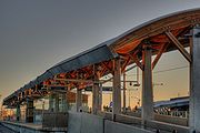
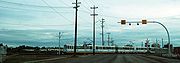
On April 25, 2009, McKernan/Belgravia and South Campus were opened as part of the south LRT expansion, with Southgate and Century Park opening on April 24, 2010. The first of the new Siemens SD-160
Siemens SD-160
The SD-100 and SD-160 are light-rail vehicles manufactured by Siemens. The SD-100 uses motors that run on direct-current electricity while the SD-160 model features newer motors that run using alternating current. Both models are suited for loading at street level and high-platform level...
light rail vehicle train cars for the new extension were shipped by rail from Florin, California
Florin, California
Florin is a census-designated place in Sacramento County, California, United States. It is part of the Sacramento–Arden-Arcade–Roseville Metropolitan Statistical Area...
, on April 24, 2008, arriving in Edmonton on May 9, 2008 (37 vehicles in total).
The LRT expansion was developed entirely at surface level with several underpasses, one at Belgravia Road and the other under 111 Street
111 Street, Edmonton
111 Street is a major arterial road in south Edmonton, Alberta, Canada. The south leg of the LRT runs for most of its length, between the northbound and southbound lanes.-Neighbourhoods:...
south of 61 Avenue. A short busway has been constructed from the South Campus station roughly parallel to Belgravia Road in conjunction with the South LRT expansion. The surface LRT line emerges to ground level just north of the Health Sciences Station at the University of Alberta
University of Alberta
The University of Alberta is a public research university located in Edmonton, Alberta, Canada. Founded in 1908 by Alexander Cameron Rutherford, the first premier of Alberta and Henry Marshall Tory, its first president, it is widely recognized as one of the best universities in Canada...
, which opened in January 2006. From the Health Sciences Station, the South LRT line leads to the South Campus Station, followed by the Southgate and Century Park stations.
Every station on the line built since 1983 has been built with full accessibility for persons with disabilities. In the late 1990s, Clareview and Belvedere Stations were renovated to include a roof and also had their platforms lengthened to allow for the use of five-car trains.
South LRT expansion
Ellerslie Road
Ellerslie Road is a major arterial road in south Edmonton, Alberta, Canada. Before the City of Edmonton expanded this far south, it was rural grid road Township Road 514, earning the nickname Ellerslie Road...
and 127 Street SW, then the LRT will continue south for another stop at 41 Avenue SW, with a possible new LRT yard in between. City council approved the route to the Ellerslie station
Ellerslie (ETS)
Ellerslie Station is a future LRT station on the proposed south extension to Heritage Valley of the Edmonton LRT system. It will be located on the northwest corner of Ellerslie Road and 127 Street along with an 1,400 stall park-and-ride facility and transit centre.The concept plan for the south...
, and for construction to begin on the park-and ride in July 2009,but they have yet to announce when the station will be complete, as well as approval for the extension to city limits. Long range plans for the south line include possible extension all the way to the Edmonton International Airport
Edmonton International Airport
Edmonton International Airport is the primary air passenger and air cargo facility in the Edmonton region in the Canadian province of Alberta. It is a hub facility for Northern Alberta and Northern Canada providing regularly scheduled nonstop flights to over fifty communities in Canada, the United...
and Leduc
Leduc, Alberta
- Demographics :The population of the City of Leduc according to its 2011 municipal census is 24,139, a 3.6% increase over its 2010 municipal census population of 23,293....
.
North LRT expansion
On April 27, 2007, the city began detailed planning of a new LRT line that will run north from the Churchill Station, to the Northern Alberta Institute of TechnologyNorthern Alberta Institute of Technology
The Northern Alberta Institute of Technology is located in Edmonton, Alberta, Canada and provides technical training and applied education designed to meet the demands of Alberta's industries...
(NAIT), and eventually beyond to north-end neighbourhoods with a terminal station south of St.Albert.
In April 2008, Edmonton City Council
Edmonton City Council
The Edmonton City Council is the governing body of the City of Edmonton, Alberta, Canada.Members represent wards throughout the city, and are known as councillors. Until 2010, Edmonton was divided in six wards with two councillors representing citizens in each ward...
approved $45 million in funding to build a tunnel under the EPCOR Tower
EPCOR Tower
EPCOR Tower is an office tower currently under construction in downtown Edmonton, Alberta, Canada that is part of the Station Lands project. The tower is capped by two spires that top out at 137.3 m and these capped with four flagpoles each. When flagpoles are taken into account, it is currently...
site immediately, while it is still under construction, with the aim of saving $140 million more than would have been required to dig under the tower once it was completed. This step was taken even though the rest of the project had not yet been approved, because of the time constraint posed by the construction of the new tower. Construction on the tunnel began in August 2009 and was completed by approximately September 2010.
On July 2, 2009, the federal and provincial governments approved the reallocation of funding from the proposed Gorman Station
Gorman (ETS)
Gorman Station is a future LRT station that is part of the proposed northeast extension of the Edmonton LRT system. The station will become the northern terminus of the LRT line and will be located near 153 Avenue and Victoria Trail....
to the line as the city felt that NAIT was more of a higher priority.
On May 19, 2010 the transportation department announced its recommendation for an extension of the north line from the NAIT station to St. Albert. This new extension will travel north from the City Centre Airport land, along 113A Street, until reaching 153 Avenue where it will turn west to a new park-and-ride lot beside Anthony Henday Drive and St. Albert Trail. This extension is expected to eventually serve 42,000 to 45,000 passengers daily and is projected to be completed by 2019. As of yet this is still in the planning stage
The new line branches off the main LRT line at Churchill Station, runs west along 105 Avenue to the Grant MacEwan University City Centre Campus, then north along 105 Street
105 Street, Edmonton
105 Street is an arterial road in Downtown Edmonton, Alberta, Canada. It starts across the North Saskatchewan River from Downtown, as one way streets Walterdale Hill and Queen Elizabeth Park Road, which join and continue north on Walterdale Bridge...
, Kingsway (Avenue)
Kingsway, Edmonton
Kingsway, sometimes called Kingsway Avenue, is an arterial road in central Edmonton, Alberta, Canada, that runs on a northwest to southeast path, cutting through the city's normal grid pattern...
, and 106 Street, to Kingsway Mall and NAIT. Beyond NAIT the line could possibly travel through the new neighbourhood built after the City Centre (Blatchford Field) Airport
Edmonton City Centre (Blatchford Field) Airport
Edmonton City Centre Airport, , is located within the city of Edmonton, Alberta, Canada. It is bordered by Yellowhead Trail to the north, Kingsway to the south, 121 Street to the west, and the Northern Alberta Institute of Technology to the east. It encompasses approximately of land just north...
is dismantled, go over the CN railway
Canadian National Railway
The Canadian National Railway Company is a Canadian Class I railway headquartered in Montreal, Quebec. CN's slogan is "North America's Railroad"....
yard north of Yellowhead Trail, and continue further north along 113A Street, with long range plans to eventually extend the line to St. Albert
St. Albert, Alberta
St. Albert is a suburban city in Alberta, located northwest of Edmonton, on the Sturgeon River. It was originally settled as a Métis community, and is now the second largest city in the Edmonton area. St...
. The City of St. Albert has also began preliminary plans to extend the LRT line into their borders.
The new line has three confirmed stations: one at Grant MacEwan University (MacEwan Station
MacEwan (ETS)
MacEwan Station is a future LRT station on the planned line to NAIT of the Edmonton LRT system. The station is expected to be in service by April 2014 and will be located between 103 Street and 104 Street near 105 Avenue, and immediately across 105 Street from the Grant MacEwan University City...
), one on Kingsway (Kingsway Station
Kingsway (ETS)
Kingsway Station is a future LRT station on the planned line to NAIT of the Edmonton LRT system. The station will be located adjacent to the Royal Alexandra Hospital on the north side of Kingsway Avenue....
), and one near the Northern Alberta Institute of Technology (NAIT Station
NAIT (ETS)
NAIT Station will be the northern terminus of the planned north line of the Edmonton LRT system. The station will be temporarily located north of Princess Elizabeth Avenue, on the south side of the Northern Alberta Institute of Technology's swimming pool and hockey arena wing, before a permanent...
). MacEwan Station will be located just east of the downtown MacEwan University campus, and west of the proposed hockey arena, at 104 Street and 105 Avenue. The Kingsway Station will be located on the north side of Kingsway, to the south of the Royal Alexandra Hospital
Royal Alexandra Hospital, Edmonton
The Royal Alexandra Hospital is one of Alberta Health Services, formerly Capital Health, largest and longest serving hospitals. Located in the heart of Edmonton's city centre, the Royal Alex serves a diverse community stretching from downtown Edmonton to western and northern Canada.They operate...
. As part of the plan, the current Kingway Transit Centre will be relocated to the southeast corner of 111 Avenue and 106 Street, to provide service to both Kingsway Mall and the Kingsway Station. TheNAIT Station will be located north of Princess Elizabeth Avenue
Princess Elizabeth Avenue
Princess Elizabeth Avenue, is an arterial road in central Edmonton, Alberta, Canada, that runs on a southwest to northeast path, cutting through the city's normal grid pattern...
, on the south side of the Northern Alberta Institute of Technology
Northern Alberta Institute of Technology
The Northern Alberta Institute of Technology is located in Edmonton, Alberta, Canada and provides technical training and applied education designed to meet the demands of Alberta's industries...
's swimming pool and hockey arena (S) wing.
As of early 2011 preperation work has been ongoing getting the route prepared for actual construction. Various roadways have been temporarily and some permanently closed to vehicular trafic due to LRT construction. In August of 2011 105th ave was closed and tunnelling is scheduled to begin to connect with the tunnel under the Epcor Tower.
LRT_Newsletter_Summer_2011_final.pdf
Northeast LRT expansion
Gorman (ETS)
Gorman Station is a future LRT station that is part of the proposed northeast extension of the Edmonton LRT system. The station will become the northern terminus of the LRT line and will be located near 153 Avenue and Victoria Trail....
) to Gorman Towne Centre. The expansion beyond Clareview Station is planned to continue along the CN right-of-way to a station and park-and-ride north of 153 Avenue
153 Avenue, Edmonton
153 Avenue is a major arterial road in north Edmonton, Alberta, Canada. It is currently separated between by an industrial subdivision that has been rezoned for residential, at Manning Drive and Fort Road...
and Victoria Trail
Victoria Trail
Victoria Trail is an arterial road under construction in northeast Edmonton, Alberta, Canada. It begins at the same Yellowhead Trail interchange as 118 Avenue, travels north through a number of neighbourhoods, and currently ends at 153 Avenue...
. Long range plans for the northeast leg of the LRT include extending it towards Fort Saskatchewan.
West LRT expansion
A potential expansion towards Lewis EstatesPotter Greens, Edmonton
Potter Greens is a newer residential neighbourhood in west Edmonton, Alberta, Canada.According to the 2001 federal census, substantially all of the residences in the neighbourhood were built during the 1990s....
, with the West Edmonton Mall
West Edmonton Mall
West Edmonton Mall , located in Edmonton, Alberta, Canada, is the largest shopping mall in North America and the fifth largest in the world. The mall was founded by the Ghermezian brothers, who emigrated from Iran in 1959. It was the world's largest mall until 2004.West Edmonton Mall covers a gross...
en route, is under consideration. A recommended route was announced on March 3, 2008. It called for a branch off the main North–South LRT line between the Health Sciences and McKernan/Belgravia stations, with a tunnelled alignment running west under University Avenue
University Avenue (Edmonton)
University Avenue was an arterial road in west Strathcona, Alberta, Canada. It was formed along the backs of farm lots west of the yet to be incorporated town of Strathcona, causing it to run parallel with the North Saskatchewan River to the north. The farm lots later became the University of...
, crossing the North Saskatchewan River
North Saskatchewan River
The North Saskatchewan River is a glacier-fed river that flows east from the Canadian Rockies to central Saskatchewan. It is one of two major rivers that join to make up the Saskatchewan River....
via a new bridge, and then continuing westwards at-grade along 87 Avenue past West Edmonton Mall to a terminus at Lewis Estates.
A second option was recommended by Transit officials September 3, 2009, that would have the west LRT extension run from downtown, along 104 Avenue and Stony Plain Road
Stony Plain Road
Stony Plain Road is a major arterial road in west Edmonton, Alberta, Canada. Parkland Highway is an alternative route to the corresponding section of Alberta Highway 16 in Parkland County.-Parkland Highway:...
before diverting south on 156 Street
156 Street, Edmonton
156 Street is a major arterial road in west Edmonton, and east St. Albert, Alberta, Canada. In Edmonton, 156 Street runs through the old town of Jasper Place, and Edmonton's west industrial district. St. Albert names their roads, rather than numbering them, even if a street runs straight from...
towards Meadowlark Health And Shopping Centre, then returning to the 87 Avenue alignment to West Edmonton Mall and beyond. Proponents of this route cite better opportunities for transit-oriented development
Transit-oriented development
A transit-oriented development is a mixed-use residential or commercial area designed to maximize access to public transport, and often incorporates features to encourage transit ridership...
. On December 15, 2009, Edmonton City Council voted in favor of the Stony Plain Road route, although station placement and minor route adjustments could still take place within the next few months, construction could possibly start within 3 years.
Southeast LRT expansion
Planning studies for an LRT route from downtown to Mill WoodsMill Woods
Mill Woods is a residential district in the City of Edmonton, Alberta, Canada. Located in southeast Edmonton, Mill Woods is bounded by Whitemud Drive to the north, 91 Street to the west, 34 Street to the east, and Anthony Henday Drive to the south...
began in early 2009, and several routes were being considered. In December 2009, Edmonton city council approved a new low floor train route that would leave from a new ground-level Churchill Station, across the North Saskatchewan River on a new bridge to be constructed east of Louise McKinney Park, climb the hill adjacent to Connors Road then proceed east along 95 Avenue and southbound at 85 Street. The route will travel southbound along 85 Street crossing the traffic circle and shifting to 83 Street, continuing south and east on an elevated track towards Wagner Road. Finally the Mill Woods line will proceed south along 75/66 Street until it reaches Mill Woods Station. Within this line the proposed stations are: Quarters, Muttart, Strathearn, Holyrood, Bonnie Doon, 73 Avenue, Wagner, Whitemud (to include bus terminal and a 'park & ride'), Millbourne, Grey Nuns, and Mill Woods.
After public consultation throughout 2010 the final proposal for the southeast route will go to city council in December 2010 for council review and final approval.
June 1, 2011 Edmonton City Council approved $39 million in funding to proceed with preliminary engineering for the Southeast to West LRT line.
Controversy
Concerns over community impacts along the proposed West and North LRT extensions have led to a larger debate over the vision guiding the various expansion plans, and the criteria used to select the routes. A lack of coordination between the extensions and transit oriented developmentsTransit-oriented development
A transit-oriented development is a mixed-use residential or commercial area designed to maximize access to public transport, and often incorporates features to encourage transit ridership...
as well as integration with other regional transportation nodes, has given rise to proposals for a new LRT master plan to guide it all.
LRT fares
The cash fare for passengers using Edmonton Transit System buses and the LRT, effective February 1, 2011, is $2.85 for adults, seniors and youth. Children under age five ride free when accompanied by a fare-paying adult.Passengers can purchase books of transit tickets, day passes, and monthly transit passes. Seniors can also purchase an annual transit pass.
Passengers paying a cash fare at a fare machine at an LRT station are issued a transit ticket, which is validated as an LRT ticket after being time-stamped. This ticket is valid both as proof of payment and as a transfer. Transfers allow the passenger to transfer from the LRT to a bus, from a bus to the LRT and between buses, and is valid for 90 minutes from the time it was stamped. Passengers paying a cash fare on a bus can obtain a transfer at the time the fare is paid. Transfers also serve as proof of payment.
Passengers in an LRT proof of payment area must present proof of payment upon request by an ETS officer. Proof of payment includes LRT tickets, transfers, validated transit tickets and transit passes. Failure to provide proof of payment can result in a fine. Proof of payment areas include all LRT trains and most LRT station platforms. (At Health Sciences/Jubilee, McKernan/Belgravia, and South Campus stations, the fare machines are located on the station platform so it is possible to be on the platform without a proof of payment.)
In 2007, the Edmonton Transit System, the University of Alberta
University of Alberta
The University of Alberta is a public research university located in Edmonton, Alberta, Canada. Founded in 1908 by Alexander Cameron Rutherford, the first premier of Alberta and Henry Marshall Tory, its first president, it is widely recognized as one of the best universities in Canada...
, and Grant MacEwan University (Grant MacEwan College at the time) partnered to provide students with a universal transit pass
Universal Transit Pass
In North America,Universal Transit Pass is a program that gives students enrolled in participating post-secondary institutions unlimited access to local transit. Programs are typically funded through mandatory fees that eligible students pay in each term in which they are registered. Fees are...
(U-Pass), which is valid on the LRT and all ETS buses as well as on Strathcona County
Strathcona County Transit
Strathcona County Transit provides local, commuter and school bus services to the community of Sherwood Park, Alberta, Canada, which is situated just east of Edmonton in Strathcona County....
and St. Albert Transit
St. Albert Transit
St. Albert Transit is the public transportation system in the City of St. Albert, Alberta, Canada, which is located only about northwest of downtown Edmonton. Scheduled bus service consists of local circuits within the community and express commuter routes to Edmonton...
Systems. NAIT
Northern Alberta Institute of Technology
The Northern Alberta Institute of Technology is located in Edmonton, Alberta, Canada and provides technical training and applied education designed to meet the demands of Alberta's industries...
students voted to join the program in 2010. The U-Pass allows unlimited LRT and bus use to valid pass holders, and is only available during the months of September to April.