
Ebright Azimuth
Encyclopedia
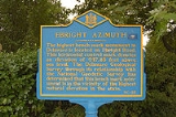
The Ebright Azimuth is the point with the highest benchmark monument elevation in Delaware
. It is marked with a geodetic
benchmark monument and has an elevation of 447.85 feet (136.5 m) above sea level
. The only state high-point with a lower elevation is Britton Hill
in the state of Florida
at 345 feet (105 m) above sea level.
The Ebright Azimuthis located about 6.5 miles (10.5 km) north of downtown Wilmington
, Delaware
, in far northern New Castle County
, within a few feet of the Pennsylvania
state line. It is near Concord High School, to the north of Naamans Road
, at the middle of the intersection of Ebright Road and Ramblewood Drive. This is an entrance to the Dartmouth Woods development.
Surveying by Delaware Geological Survey personnel indicates that the mobile home park just west of Ebright Road is at least 2 feet (61 cm) higher than the benchmark.
The land under the mobile home park is not "natural elevation" since it is a man-made plateau that was constructed to prevent flooding in the area. Man-made elevations do not change a state's "high point" location.
Contrary to what many people believe upon first impression, "Ebright Azimuth" is not a person's first and last name. James and Grant Ebright owned the property on which the benchmark was placed.
 The self-supporting radio tower
just south of the benchmark was constructed in 1947 by Western Union
as part of an historic C-band microwave radio relay system that linked New York City
and Washington, D.C.
This site was assigned the name "Brandywine" in recognition of Brandywine Creek located several kilometers to the west and was licensed with the call sign
KGB29.
Western Union's engineers specified a heavy-duty prefabricated fire tower
structure, which allowed the microwave transmitters and receivers to be installed inside the cab. "Dish" antennas
, mounted behind the window openings, were aimed towards the adjacent relay stations at Mt. Laurel
, 33.8 miles (54.4 km) to the northeast, and Elk Neck near Elkton, Maryland
, 30.5 miles (49.1 km) to the southwest.
Like most of their early microwave relay sites, Western Union decommissioned the Brandywine installation near Ebright Azimuth as more-reliable broadband fiber
systems were developed. The structure now supports several VHF and UHF land mobile radio
antennas.
Delaware
Delaware is a U.S. state located on the Atlantic Coast in the Mid-Atlantic region of the United States. It is bordered to the south and west by Maryland, and to the north by Pennsylvania...
. It is marked with a geodetic
Geodesy
Geodesy , also named geodetics, a branch of earth sciences, is the scientific discipline that deals with the measurement and representation of the Earth, including its gravitational field, in a three-dimensional time-varying space. Geodesists also study geodynamical phenomena such as crustal...
benchmark monument and has an elevation of 447.85 feet (136.5 m) above sea level
Sea level
Mean sea level is a measure of the average height of the ocean's surface ; used as a standard in reckoning land elevation...
. The only state high-point with a lower elevation is Britton Hill
Britton Hill
Britton Hill is the highest natural point in the state of Florida, USA, with a summit elevation of 345 feet above mean sea level. Many Florida skyscrapers are taller; as of 2010, the roof of the Four Seasons Hotel Miami is the highest non-natural point in Florida. Topping out at 789 feet,...
in the state of Florida
Florida
Florida is a state in the southeastern United States, located on the nation's Atlantic and Gulf coasts. It is bordered to the west by the Gulf of Mexico, to the north by Alabama and Georgia and to the east by the Atlantic Ocean. With a population of 18,801,310 as measured by the 2010 census, it...
at 345 feet (105 m) above sea level.
The Ebright Azimuthis located about 6.5 miles (10.5 km) north of downtown Wilmington
Wilmington, Delaware
Wilmington is the largest city in the state of Delaware, United States, and is located at the confluence of the Christina River and Brandywine Creek, near where the Christina flows into the Delaware River. It is the county seat of New Castle County and one of the major cities in the Delaware Valley...
, Delaware
Delaware
Delaware is a U.S. state located on the Atlantic Coast in the Mid-Atlantic region of the United States. It is bordered to the south and west by Maryland, and to the north by Pennsylvania...
, in far northern New Castle County
New Castle County, Delaware
New Castle County is the northernmost of the three counties of the U.S. state of Delaware. As of 2010 its population was 538,479, an increase of 7.6% over the previous decade. The county seat is Wilmington. The center of population of Delaware is located in New Castle County, in the town of...
, within a few feet of the Pennsylvania
Pennsylvania
The Commonwealth of Pennsylvania is a U.S. state that is located in the Northeastern and Mid-Atlantic regions of the United States. The state borders Delaware and Maryland to the south, West Virginia to the southwest, Ohio to the west, New York and Ontario, Canada, to the north, and New Jersey to...
state line. It is near Concord High School, to the north of Naamans Road
Delaware Route 92
Delaware Route 92 is a two to four-lane, east–west road that runs a short distance to the south of the Pennsylvania/Delaware State Line for most of its length and allows a direct connection between U.S. Route 202 in Talleyville, Delaware with I-95 in Claymont, Delaware, the two major...
, at the middle of the intersection of Ebright Road and Ramblewood Drive. This is an entrance to the Dartmouth Woods development.
Surveying by Delaware Geological Survey personnel indicates that the mobile home park just west of Ebright Road is at least 2 feet (61 cm) higher than the benchmark.
The land under the mobile home park is not "natural elevation" since it is a man-made plateau that was constructed to prevent flooding in the area. Man-made elevations do not change a state's "high point" location.
Contrary to what many people believe upon first impression, "Ebright Azimuth" is not a person's first and last name. James and Grant Ebright owned the property on which the benchmark was placed.
Radio Tower History
Radio masts and towers
Radio masts and towers are, typically, tall structures designed to support antennas for telecommunications and broadcasting, including television. They are among the tallest man-made structures...
just south of the benchmark was constructed in 1947 by Western Union
Western Union
The Western Union Company is a financial services and communications company based in the United States. Its North American headquarters is in Englewood, Colorado. Up until 2006, Western Union was the best-known U.S...
as part of an historic C-band microwave radio relay system that linked New York City
New York City
New York is the most populous city in the United States and the center of the New York Metropolitan Area, one of the most populous metropolitan areas in the world. New York exerts a significant impact upon global commerce, finance, media, art, fashion, research, technology, education, and...
and Washington, D.C.
Washington, D.C.
Washington, D.C., formally the District of Columbia and commonly referred to as Washington, "the District", or simply D.C., is the capital of the United States. On July 16, 1790, the United States Congress approved the creation of a permanent national capital as permitted by the U.S. Constitution....
This site was assigned the name "Brandywine" in recognition of Brandywine Creek located several kilometers to the west and was licensed with the call sign
Call sign
In broadcasting and radio communications, a call sign is a unique designation for a transmitting station. In North America they are used as names for broadcasting stations...
KGB29.
Western Union's engineers specified a heavy-duty prefabricated fire tower
Fire lookout tower
A fire lookout tower, fire tower or lookout tower, provides housing and protection for a person known as a "fire lookout" whose duty it is to search for wildfires in the wilderness...
structure, which allowed the microwave transmitters and receivers to be installed inside the cab. "Dish" antennas
Parabolic antenna
A parabolic antenna is an antenna that uses a parabolic reflector, a curved surface with the cross-sectional shape of a parabola, to direct the radio waves. The most common form is shaped like a dish and is popularly called a dish antenna or parabolic dish...
, mounted behind the window openings, were aimed towards the adjacent relay stations at Mt. Laurel
Mount Laurel Township, New Jersey
Mount Laurel Township is a Township in Burlington County, New Jersey, United States, and is an edge city "suburb" of Philadelphia. As of the 2000 United States Census, the township population was 40,221...
, 33.8 miles (54.4 km) to the northeast, and Elk Neck near Elkton, Maryland
Elkton, Maryland
The town of Elkton is the county seat of Cecil County, Maryland, United States. The population was 11,893 as of the 2000 census and 14,842 according to current July 2008 census estimates. It is the county seat of Cecil County...
, 30.5 miles (49.1 km) to the southwest.
Like most of their early microwave relay sites, Western Union decommissioned the Brandywine installation near Ebright Azimuth as more-reliable broadband fiber
Fiber-optic communication
Fiber-optic communication is a method of transmitting information from one place to another by sending pulses of light through an optical fiber. The light forms an electromagnetic carrier wave that is modulated to carry information...
systems were developed. The structure now supports several VHF and UHF land mobile radio
Land Mobile Radio System
Land Mobile Radio System is a term that denotes a wireless communications system intended for use by terrestrial users in vehicles or on foot . Such systems are used by emergency first responder organizations, public works organizations, or companies with large vehicle fleets or numerous field...
antennas.