
Durrus
Encyclopedia
Durrus is a village located in West Cork
, six miles (10 km) from Bantry
, County Cork
, Ireland. It is situated at the head of the Sheep's Head
and Mizen Head
Peninsulas. A number of public gardens have been established in the area, including 'Kilvarock' and 'Cois Abhann'. In recent years the village has seen a sizable development of property for use by tourists.
for Yellow Rock). Today there is some dispute about proper form of the village's name in the Irish language
- with both Dubh Ros (meaning black or dark headland) and Dúrras (which is in use on local road signs).
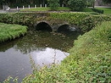
 The village is the location of Cool na Long castle, built by the McCarthy (Muclagh) family. The castle is now in a ruined state, despite efforts to have it taken into state charge by the late antiquarian
Paddy O'Keeffe.
The present village was laid out by the Bandon estate when the lease of the Rev. Alleyn's Evanson's interest expired in 1854. Around this time a manor court for debt recovery was held once a month, with petty sessions once a fortnight. The former courthouse is still standing.
Selected archaeological sites in the area include:
West Cork
West Cork refers to a geographical area in south-west Ireland, lying within Ireland's largest county, County Cork. Traditionally a popular tourist destination, the area is seen as being distinct from the more populated northern or eastern parts of the county, as well as the more urban area of...
, six miles (10 km) from Bantry
Bantry
Bantry is a town on the coast of County Cork, Ireland. It lies on the N71 national secondary road at the head of Bantry Bay, a deep-water gulf extending for 30 km to the west...
, County Cork
County Cork
County Cork is a county in Ireland. It is located in the South-West Region and is also part of the province of Munster. It is named after the city of Cork . Cork County Council is the local authority for the county...
, Ireland. It is situated at the head of the Sheep's Head
Sheep's Head
Sheep's Head, also known as Muntervary , is the headland at the end of the peninsula between Bantry Bay and Dunmanus Bay in County Cork, Ireland....
and Mizen Head
Mizen Head
Mizen Head , is located at the extremity of a peninsula in the district of Carbery in County Cork, Ireland. It is one of the extreme points of the island of Ireland and is a major tourist attraction, noted for its dramatic cliff scenery...
Peninsulas. A number of public gardens have been established in the area, including 'Kilvarock' and 'Cois Abhann'. In recent years the village has seen a sizable development of property for use by tourists.
Name
Durrus was formerly known as both Four Mile Water (mid-19th century, after the nearby river) and Carrigboi (from Carraig Bhuí, the IrishIrish language
Irish , also known as Irish Gaelic, is a Goidelic language of the Indo-European language family, originating in Ireland and historically spoken by the Irish people. Irish is now spoken as a first language by a minority of Irish people, as well as being a second language of a larger proportion of...
for Yellow Rock). Today there is some dispute about proper form of the village's name in the Irish language
Irish language
Irish , also known as Irish Gaelic, is a Goidelic language of the Indo-European language family, originating in Ireland and historically spoken by the Irish people. Irish is now spoken as a first language by a minority of Irish people, as well as being a second language of a larger proportion of...
- with both Dubh Ros (meaning black or dark headland) and Dúrras (which is in use on local road signs).
History
Antiquarian
An antiquarian or antiquary is an aficionado or student of antiquities or things of the past. More specifically, the term is used for those who study history with particular attention to ancient objects of art or science, archaeological and historic sites, or historic archives and manuscripts...
Paddy O'Keeffe.
The present village was laid out by the Bandon estate when the lease of the Rev. Alleyn's Evanson's interest expired in 1854. Around this time a manor court for debt recovery was held once a month, with petty sessions once a fortnight. The former courthouse is still standing.
Selected archaeological sites in the area include:
- A boulder burial at: Ballycomane
- Burial grounds at: Brahalish, Clashadoo, Coolcoulaghta, Dunbeacon, Kilvenogue,
- CairnCairnCairn is a term used mainly in the English-speaking world for a man-made pile of stones. It comes from the or . Cairns are found all over the world in uplands, on moorland, on mountaintops, near waterways and on sea cliffs, and also in barren desert and tundra areas...
: Coolcoulaghta, Moulinward - CastleCastleA castle is a type of fortified structure built in Europe and the Middle East during the Middle Ages by European nobility. Scholars debate the scope of the word castle, but usually consider it to be the private fortified residence of a lord or noble...
: Dunbeacon - Church: Moulinward (In repair 1639 ruins 1699)
- Fulacht fiadhFulacht fiadhA fulacht fiadh is a type of archaeological site found in Ireland. In England, Scotland, Wales and the Isle of Man they are known as burnt mounds. They commonly survive as a low horseshoe-shaped mound of charcoal-enriched soil and heat shattered stone with a slight depression at its centre showing...
("burnt moundBurnt moundA burnt mound is an archaeological feature consisting of a mound of shattered stones and charcoal, normally with an adjacent hearth and trough. The trough could be rock-cut, wood-lined or clay-lined to ensure it was watertight...
"): Dunbeacon, Celtic Iron Age 600 BC-400 AD - Graveyard: Moulinward
- Holy Well: Dunbeacon
- Mill Stone: Brahalish
- Promontory Fort: Coolcoulaghta (Celtic Iron Age 600 BC-400 AD)
- Ring fortsRingfortRingforts are circular fortified settlements that were mostly built during the Iron Age , although some were built as late as the Early Middle Ages . They are found in Northern Europe, especially in Ireland...
: Ballycomane, Brahalish, Clonee, Drumtahaneen, Dunbeacon, Gortyalassa, Kealties, Rushineska, Celtic Iron Age 600 BC-400 AD - Shell Midden: Dunbeacon
- Standing stoneStanding stoneStanding stones, orthostats, liths, or more commonly megaliths are solitary stones set vertically in the ground and come in many different varieties....
s (Gallauns): Ballycomane, Coolcoulaghta (Stone Pair Bronze Age 2200 BC-600 BC), Kealties, Parkana - Stone rowStone rowA stone row , is a linear arrangement of upright, parallel megalithic standing stones set at intervals along a common axis or series of axes, usually dating from the later Neolithic or Bronze Age. Rows may be individual or grouped, and three or more stones aligned can constitute a stone row...
: Moulinward, Bronze Age 2200 BC-600 BC. - Stone circleStone circleA stone circle is a monument of standing stones arranged in a circle. Such monuments have been constructed across the world throughout history for many different reasons....
: Dunbeacon, (Bronze Age 2200 BC-600 BC), http://66.249.93.104/search?q=cache:ZY4X-xziNa0J:www.megalithomania.com/show/site/1139+dunbeacon&hl=en&gl=ie&ct=clnk&cd=1, http://66.249.93.104/search?q=cache:iY1t6jKDxXAJ:www.megalithic.co.uk/article.php%3Fsid%3D886+dunbeacon&hl=en&gl=ie&ct=clnk&cd=6 - Tower House: Rossmore (medieval post 1200AD), (O'Mahony|McCarthy?)
People
- Sean HurleySean HurleySean Hurley was an Irish Sinologist who spent the years 1905 to 1915 in China. He was the first known Irishman to hold a Chinese passport.-China:...
, Sinologist (died 1961) - first Irish person to hold a ChineseChinaChinese civilization may refer to:* China for more general discussion of the country.* Chinese culture* Greater China, the transnational community of ethnic Chinese.* History of China* Sinosphere, the area historically affected by Chinese culture...
passport. - Members of the Attridge, Baker, Dukelow, Gay, Gosnell, Shannon, Skuse, Swanton and Whitley families who hailed from the Durrus area settled in Rochester, New YorkRochester, New YorkRochester is a city in Monroe County, New York, south of Lake Ontario in the United States. Known as The World's Image Centre, it was also once known as The Flour City, and more recently as The Flower City...
in the early 1840s and were influential in Republican politics and city administration; they were known as the "99 Cousins" - Fr. Richard O'Daly (whose parents emigrated to AustraliaAustraliaAustralia , officially the Commonwealth of Australia, is a country in the Southern Hemisphere comprising the mainland of the Australian continent, the island of Tasmania, and numerous smaller islands in the Indian and Pacific Oceans. It is the world's sixth-largest country by total area...
) - founder of Colaiste na Mumhan, BallingearyBallingearyBéal Átha an Ghaorthaidh is a village in the Shehy Mountains in County Cork, Ireland.The village is within the Gaeltacht and has an active Irish-language summer school, Coláiste na Mumhan...
; Professor of Irish St. Finbarr's Seminary, Cork; Chair of Russian, University College Cork - Charles Dennis (1873–1961) - poet (see his poem on new road to CoomkeenCoomkeenCoomkeen is a townland located near Durrus in West Cork, Province of Munster, Ireland. It is a small valley home to approximately 14 families, it is also the home of the world famous Durrus Cheese.-History:...
) - Daniel McCarthy - former Roman Catholic priest, married his ward Ms. Blair of Blairs Cove; one of their descendants was Welbore McCarthy, D.D. (1841–1925), Church of England Minister, Archdeacon Calcutta, 1892; Bishop of GranthamGranthamGrantham is a market town within the South Kesteven district of Lincolnshire, England. It bestrides the East Coast Main Line railway , the historic A1 main north-south road, and the River Witham. Grantham is located approximately south of the city of Lincoln, and approximately east of Nottingham...
, 1905 - Captain John Evans, the father of Boston, Massachusetts-based industrialist and arts patron, Robert Dawson Evans (1843–1909), was born (ca. 1809) and raised in the townland of Brahalish
- James Gordon FarrellJames Gordon FarrellJames Gordon Farrell , known as J.G. Farrell, was a Liverpool-born novelist of Irish descent. Farrell gained prominence for his historical fiction, most notably his Empire Trilogy , dealing with the political and human consequences of British colonial rule...
- Anglo-Irish writer; buried in the cemetery of St James's Anglican Church, Durrus
Selected Townlands
- Ahagouna (Irish: Ath Gamhna, meaning 'Ford of the calves'). In Clashadoo townland
- Ardogeena (152 acres) (Irish: Ard na Gaoine, meaning 'Height of the flint stones'). On the east side is Lisdromaloghera (Irish: Lios Drom Luachra, meaning 'Fort of the rushy ridge')
- Ballycomane (1349 acres) (Irish: Baile an Chumain, meaning 'town of the little valley'). Part of it is Ballinwillin with a boulder burial, ringfort and standing stone pair.
- Boolteenagh (148 acres) (Irish: Buailtenach, meaning 'summer pasture'). The high land at the south is called Knockboolteenagh (cnoc buailtineach) hill of the little boolies. Site of a possible souterrainSouterrainSouterrain is a name given by archaeologists to a type of underground structure associated mainly with the Atlantic Iron Age. These structures appear to have been brought northwards from Gaul during the late Iron Age. Regional names include earth houses, fogous and Pictish houses...
, at the north side is a ringfortRingfortRingforts are circular fortified settlements that were mostly built during the Iron Age , although some were built as late as the Early Middle Ages . They are found in Northern Europe, especially in Ireland...
. - Brahalish (784 acres) (Irish: Breach Lios, meaning 'spotted forts') or Braichlis (place of malt or fermented grain). On the west side is Brahalish Fort and the east Cummer Fort. In 1659 census written Bracklisse. Burial ground children, mill stone ringforts. Location of Brahalish Hoard of gold ornaments currently in the British MuseumBritish MuseumThe British Museum is a museum of human history and culture in London. Its collections, which number more than seven million objects, are amongst the largest and most comprehensive in the world and originate from all continents, illustrating and documenting the story of human culture from its...
. - Carrigboy (116 acres) (Irish: Carraig Buidhe, meaning 'yellow rock'). Location of Durrus village. The high road from here is built over land known as Carrig Cannon.
- Curraghavaddra (195 acres) (Irish: Currach an Mhadra, meaning 'the bog of the dog'). On the west side is a ringfort.
- Clonee (409 acres) (Irish: Cluain Fhia, meaning 'meadow of the deer' or 'Aodh's meadow'). In the cente is Clonee ringfort.
- Clashadoo (749 acres) (Irish: Clasa Dubha, meaning 'dark hollows'). Burial ground last burial 1930s. To the north on high boggy ground is Coolnaheorna or Coornaheorna leading to the 'Cumar', and beyond to Loch na Fola (lake of the blood), the stream (Moiré or in Irish Maighre) on the western end has a deep hole formerly known as Poul Nora Poll Nora (nora's hole).
- Coolcoulaghta (1148 acres) (Irish: Cul Cabhlachta, meaning 'remote place of the ruins' or 'cul cuallachta') Nook of the tribe or assemblage. Location of boulder burial, burial ground at Kileen Coolcoulaghta Church contains 1847 famine victims, cairn, coastal promontory fortPromontory fortA promontory fort is a defensive structure located above a steep cliff, often only connected to the mainland by a small neck of land, thus utilizing the topography to reduce the ramparts needed. Although their dating is problematic, most seem to date to the Iron Age...
, fulachta fiadh, ringfort, standing stoneStanding stoneStanding stones, orthostats, liths, or more commonly megaliths are solitary stones set vertically in the ground and come in many different varieties....
, a standing stone pair. - Coomkeen (915 acres) (Irish: Cum Caoin, meaning 'gentle valley'). Possible mass rockMass rockA Mass rock was a stone used in mid-seventeenth century Ireland as a location for Catholic worship. Isolated locations were sought to hold religious ceremony, as observing the Catholic mass was a matter of difficulty and danger at the time as a result of both Cromwell's campaign against the Irish,...
on the lands of Timmy Whelehan decessed, on the south side is Screathan na Muice (stoney slope of the pig), to the north is Crock a wadra. - Crottees (490 acres) (Irish: Cruiteanna, meaning 'humpy ridges')
- Dromreagh (842 acres) (Irish: Drom Riabhach, meaning 'striped/grey ridge'). On the north side is Coill Breach (wolf wood). Possible souterrain, standing stone.
- Dromataniheen (97 acres) (Irish: Drom a'tSeannaichin, meaning 'ridge of the little fox'). Ringfort on the south side.
- Dromreague (92 acres) (Irish: Drom Reidh, meaning 'even ridge')
- Dunmanus (Irish: Dun Manus, meaning 'fort of Manus')
- Durrus (Irish: Dubh Ros, meaning 'dark wooded promontory')
- Gearhameen (646 acres) (Irish: Gaortha min, meaning 'small wodded glen'). On the east side is Coolnalong Castle seat of the McCarthy Muclaghs later the property of Lord Bandon.
- Gurteen (127 acres) (Irish: Goirtin, meaning 'small field')
- Kealties (614 acres) (Irish: Caolta, meaning 'narrow strip of land/or marshes marshy streams'). On the south side is Ros na Bruighne (headland of strife), written Glinkelty (Gleann Caolta) on 17th century map of Petty. Standing stone and possible ringforts.
- Kiloveenoge (Irish: Cill Ui Mhionoig, meaning 'Minogue's church', or Cill Oighe Mhineog meaning 'church of the virgin Mineog'). Child burial ground, on the east side is a former Protestant Church built 1860 or the west side is the site of an old church and burial grounds. .
- Lissareemig (78 acres) (Irish: Lios a'Riamaigh, meaning 'fort of victory'). Ringfort in centre.
- Mannions Island
- Moulivarde (Irish: Meall an Bhaird, meaning 'the bard's knoll')
- Mullagh (173 acres) (Irish: Mullagh, meaning 'summit'). Possible souterrain on the west side is Lissavully Fort (lios a'Mhullaigh) fort of the summit.
- Murreagh (199 acres) (Irish: Muirioch, meaning 'seaside marsh'). Location of disused grain store also used as a refuge for children in 1847. Disused slate quarry south end also standing stone.
- Parkana (Irish: Pairceanna, meaning 'fields')
- Rooska West (298 acres) East (295 acres) (Irish: Riasca, meaning 'marshes'). Disused lead mines on western side ringforts in West and East. Ordnance Survey name book mentions disused sandpit for victims of small pox disused c 1840.
- Rossmore (310 acres) (Irish: Ros Mor, meaning 'large copse or large promontory'). Location of Rossmore Castle in ruins former O'Mahony tower house and location of former slate quarry
- Rusheenasiska (84 acres) (Irish: Ruisin an Uisce, meaning 'little copse of the water')
- Teadagh ( 107 acres) (Irish: Taodach, meaning 'rugged land' or Teideach, meaning 'flat topped hill')
- Tullig (Irish: Tullach, meaning 'mound')
See also
- List of towns and villages in Ireland
External links
- Walk Ireland Official site of the Waymarked Ways of Ireland Features map of Sheep's Head Way
- Cork County Council Local Area Plan
- Cork Gardens
- Ginnie Swanton website re Rochester connection
- Durrus FC. Home Page of Durrus FC, local football team.
- Durrus Farmhouse Cheese. Durrus Farmhouse Cheese Website.
- Kilravock Gardens. Kilravock Gardens Website.
- Carraig Abhainn Gardens. Carraig Abhainn Gardens Website.