

Durocornovium
Encyclopedia
Corinium Dobunnorum
Corinium Dobunnorum was the second largest town in the Roman province of Britannia. Today it is known as Cirencester, located in the English county of Gloucestershire.-Fortress:...
(Cirencester
Cirencester
Cirencester is a market town in east Gloucestershire, England, 93 miles west northwest of London. Cirencester lies on the River Churn, a tributary of the River Thames, and is the largest town in the Cotswold District. It is the home of the Royal Agricultural College, the oldest agricultural...
) and Calleva Atrebatum (Silchester
Silchester
Silchester is a village and civil parish about north of Basingstoke in Hampshire. It is adjacent to the county boundary with Berkshire and about south-west of Reading....
). In many ways Durocornovium was a typical small Roman town, and visitors to Corbridge
Corbridge
Corbridge is a village in Northumberland, England, situated west of Newcastle and east of Hexham. Villages in the vicinity include Halton, Acomb, Aydon and Sandhoe.-Roman fort and town:...
at Hadrian's Wall
Hadrian's Wall
Hadrian's Wall was a defensive fortification in Roman Britain. Begun in AD 122, during the rule of emperor Hadrian, it was the first of two fortifications built across Great Britain, the second being the Antonine Wall, lesser known of the two because its physical remains are less evident today.The...
in the north of England
England
England is a country that is part of the United Kingdom. It shares land borders with Scotland to the north and Wales to the west; the Irish Sea is to the north west, the Celtic Sea to the south west, with the North Sea to the east and the English Channel to the south separating it from continental...
can get a sense of the claustrophobic conditions the town may well have had.
Site
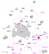
The town, encompassing around 25 hectares at its peak, was located at Nythe Farm, east of the A419 adjacent to modern SwindonSwindon
Swindon is a large town within the borough of Swindon and ceremonial county of Wiltshire, in South West England. It is midway between Bristol, west and Reading, east. London is east...
, although the site is usually associated with the village of Wanborough to the southeast. The farmland is a designated flood plain and has a history of inundation, alleviated by modern drainage, based on clay and gravel beds.
There is no public access and no remains are visible.
Excavations
The following digs have been made at Durocornovium.1692 - Workmen uncovered an earthen pot containing two thousand coins dated no later than the reign of Commodus
Commodus
Commodus , was Roman Emperor from 180 to 192. He also ruled as co-emperor with his father Marcus Aurelius from 177 until his father's death in 180. His name changed throughout his reign; see changes of name for earlier and later forms. His accession as emperor was the first time a son had succeeded...
1862 - Sir R.C.Hoare made a visit to the site and found it had every mark of Roman residence, in coins, figured bricks, tiles, but unfortunately, had not preserved them.
1967 - Evidence of stone buildings uncovered.
1968 - A stone building found plus cobbled surfaces and post holes.
1969 - Six week dig that revealed earlier buildings.
1970 - Inconclusive dig in areas suffering from post-Roman disturbance.
1975 - Two trenches dug and material recovered.
1976 - The most extensive dig which allowed a chronology for the town to be created.
Interpretation
The names of Roman towns in EnglandEngland
England is a country that is part of the United Kingdom. It shares land borders with Scotland to the north and Wales to the west; the Irish Sea is to the north west, the Celtic Sea to the south west, with the North Sea to the east and the English Channel to the south separating it from continental...
often derive from those of local natives. Duro is a celtic word meaning Fortified Place. Some researchers attach a more specific meaning, calling it a Lowland Fortified Place. Since this would make the Durotriges
Durotriges
The Durotriges were one of the Celtic tribes living in Britain prior to the Roman invasion. The tribe lived in modern Dorset, south Wiltshire and south Somerset...
(a tribe of Britons in Devon
Devon
Devon is a large county in southwestern England. The county is sometimes referred to as Devonshire, although the term is rarely used inside the county itself as the county has never been officially "shired", it often indicates a traditional or historical context.The county shares borders with...
) Kings of the Lowland Forts, this is at odds with geography of the region, so the more generic title is appropriate.
Cornovium is more difficult to assess. Strictly speaking it should refer to a tribe called the Cornovii
Cornovii
The Cornovii were a Celtic people of Iron Age and Roman Britain, who lived principally in the modern English counties of Cheshire, Shropshire, north Staffordshire, north Herefordshire and eastern parts of the Welsh county of Powys. Their capital in pre-Roman times was probably a hill fort on The...
in the northwest based around Wroxeter
Wroxeter
Wroxeter is a village in Shropshire, England. It forms part of the civil parish of Wroxeter and Uppington and is located in the Severn Valley about south-east of Shrewsbury.-History:...
, or a tribe from Cornwall
Cornwall
Cornwall is a unitary authority and ceremonial county of England, within the United Kingdom. It is bordered to the north and west by the Celtic Sea, to the south by the English Channel, and to the east by the county of Devon, over the River Tamar. Cornwall has a population of , and covers an area of...
, both distant from Wiltshire
Wiltshire
Wiltshire is a ceremonial county in South West England. It is landlocked and borders the counties of Dorset, Somerset, Hampshire, Gloucestershire, Oxfordshire and Berkshire. It contains the unitary authority of Swindon and covers...
. Unless the inhabitants were migrants or outcasts, this idea is unreconcilable. There is, however, a mention of a Cohors I Cornovium in Roman records and suggestions have been made that they were connected with the site, though no evidence exists.
There are two better alternatives. One is that Cornovium refers to Cernonnus which is a celtic phrase for a Stag God. There was a nearby stone circle at Broome Manor dating from Neolithic
Neolithic
The Neolithic Age, Era, or Period, or New Stone Age, was a period in the development of human technology, beginning about 9500 BC in some parts of the Middle East, and later in other parts of the world. It is traditionally considered as the last part of the Stone Age...
times. The other alternative is that the name is a corrupted form of Corio, who was a king of the Dobunni
Dobunni
The Dobunni were one of the Celtic tribes living in the British Isles prior to the Roman invasion of Britain. There are seven known references to the tribe in Roman histories and inscriptions. The latter part of the name possibly derives from Bune, a cup or vessel...
tribe at Cirencester
Cirencester
Cirencester is a market town in east Gloucestershire, England, 93 miles west northwest of London. Cirencester lies on the River Churn, a tributary of the River Thames, and is the largest town in the Cotswold District. It is the home of the Royal Agricultural College, the oldest agricultural...
, so the name would mean Fort On The Road To Corinium.
As yet there is no definitive answer.
Pre-Roman habitation
The site shows evidence of NeolithicNeolithic
The Neolithic Age, Era, or Period, or New Stone Age, was a period in the development of human technology, beginning about 9500 BC in some parts of the Middle East, and later in other parts of the world. It is traditionally considered as the last part of the Stone Age...
and Bronze Age
Bronze Age
The Bronze Age is a period characterized by the use of copper and its alloy bronze as the chief hard materials in the manufacture of some implements and weapons. Chronologically, it stands between the Stone Age and Iron Age...
farming With the Iron Age
Iron Age
The Iron Age is the archaeological period generally occurring after the Bronze Age, marked by the prevalent use of iron. The early period of the age is characterized by the widespread use of iron or steel. The adoption of such material coincided with other changes in society, including differing...
and the creation of hill forts in the area there's little evidence of habitation, and the only datable item is a coin of Eppillus
Eppillus
Eppillus was the name of a Roman client king of the Atrebates tribe of the British Iron Age. He was the son of Commius, the Gaulish former ally of Julius Caesar who fled to Britain following the uprising of Vercingetorix, or possibly of his son.After Commius's death in about 20 BC, based on...
who lived during the late 1st century BC to early 1st century AD. He was the son of Commius
Commius
Commius was a historical king of the Belgic nation of the Atrebates, initially in Gaul, then in Britain, in the 1st century BC.-Ally of Caesar:...
, king of the pro-Roman Atrebates
Atrebates
The Atrebates were a Belgic tribe of Gaul and Britain before the Roman conquests.- Name of the tribe :Cognate with Old Irish aittrebaid meaning 'inhabitant', Atrebates comes from proto-Celtic *ad-treb-a-t-es, 'inhabitants'. The Celtic root is treb- 'building', 'home' The Atrebates (singular...
tribe and is known to have controlled a mint at modern Silchester
Silchester
Silchester is a village and civil parish about north of Basingstoke in Hampshire. It is adjacent to the county boundary with Berkshire and about south-west of Reading....
.
Phase 1 habitation (AD 50-80)
The original development is assumed to be military in nature and dates from the period when Roman legionaries built the road through the area, backed by the discovery of material dating from the reign of NeroNero
Nero , was Roman Emperor from 54 to 68, and the last in the Julio-Claudian dynasty. Nero was adopted by his great-uncle Claudius to become his heir and successor, and succeeded to the throne in 54 following Claudius' death....
. One building from this period has been identified, an apparently shortlived construction showing signs of iron working or blacksmithing, perhaps indicative of a mutatio (horse station).
The name suggests the presence of a legionary fort. The modern day name of the site reinforces the idea. Nythe is an anglicised version of nidum (nest) and a name applied to forts elsewhere, such as Neath
Neath
Neath is a town and community situated in the principal area of Neath Port Talbot, Wales, UK with a population of approximately 45,898 in 2001...
in Wales
Wales
Wales is a country that is part of the United Kingdom and the island of Great Britain, bordered by England to its east and the Atlantic Ocean and Irish Sea to its west. It has a population of three million, and a total area of 20,779 km²...
. So far no evidence of this has come to light, though some ditches uncovered during excavation might possibly be those from a marching camp.
With the military emphasis moving north the site was abandoned for at least twenty years before Britons resettled the place as shown by the remains of roundhouses dated to that time.
Phase 2 habitation (AD 80-230)
Durocornovium is the site of intensive building. The discovery of lime kilns and lead working point to building trades in full swing. Clearly it was benefitiing from its location on the road, backed by a further southward road to CunetioCunetio
The Roman town of Cunetio, located across the river from the modern town of Mildenhall, Wiltshire was occupied from the second century a.d. until the end of the Roman period, early fifth century, when it was apparently abandoned. It's location was identified from arial photos of crop marks taken in...
and Venta Belgarum
Venta Belgarum
Venta Belgarum was a town in the Roman province of Britannia Superior. Today it is known as Winchester and is situated in the English county of Hampshire.-Development:...
The southward route isn't mentioned in the Antonine Itinerary
Antonine Itinerary
The Antonine Itinerary is a register of the stations and distances along the various roads of the Roman empire, containing directions how to get from one Roman settlement to another...
so may not have been considered as anything but a minor road by the Romans themselves.
Perhaps more relevant was the political significance. Durocornovium rested on a junction of roads linking regional administration centers at Calleva Atrebatum, Corinium Dobunnorum
Corinium Dobunnorum
Corinium Dobunnorum was the second largest town in the Roman province of Britannia. Today it is known as Cirencester, located in the English county of Gloucestershire.-Fortress:...
, and Venta Belgarum
Venta Belgarum
Venta Belgarum was a town in the Roman province of Britannia Superior. Today it is known as Winchester and is situated in the English county of Hampshire.-Development:...
. As the names suggest, these towns were designated as civitas
Civitas
In the history of Rome, the Latin term civitas , according to Cicero in the time of the late Roman Republic, was the social body of the cives, or citizens, united by law . It is the law that binds them together, giving them responsibilities on the one hand and rights of citizenship on the other...
and used as governmental bases for control over the local British tribes. This centralised system might not have been sufficient for the control of a potentially rebellious populace and it's believed that some administration was spread to outlying towns which would have included Durocornovium.
Stone buildings dominate this period and some evidence of monumental columns were found during roadworks. A mansio (a sort of hotel for travelling officials) has been identified 110 metres from the road, a substantial structure that so far remains unexcavated. Other remains include a possible granary.
Recent finds at Groundwell have pointed to the affluence of the area during the height of the Roman Empire. The discovery of a Nyphaeum, a shrine at a well head, agrees with another Roman structure at a spring south of Durocornovium at Callas Hill. Swindon
Swindon
Swindon is a large town within the borough of Swindon and ceremonial county of Wiltshire, in South West England. It is midway between Bristol, west and Reading, east. London is east...
hill was inhabitated largely for the availability of spring water and typically this was something the Romans
Ancient Rome
Ancient Rome was a thriving civilization that grew on the Italian Peninsula as early as the 8th century BC. Located along the Mediterranean Sea and centered on the city of Rome, it expanded to one of the largest empires in the ancient world....
recognised in their religious life, raising the possibility of a major temple site either destroyed or undiscovered. Remnants of monumental stonwork were removed during bridge building which has raised speculation that the temple site is currently beneath a bridge pier. There is no evidence of any aqueduct, but given the close proximity of Dorcan Stream and the River Cole, it was unlikely one was needed.
Phase 3 habitation (AD 230-400+)
Redevelopment is the main feature of this period. It appears the Roman roads were diverted slightly and some newer buildings were built on top of the old disused road surface.Although many Roman towns in the later empire built stone defenses (Such as walls and a gatehouse identified at Cunetio
Cunetio
The Roman town of Cunetio, located across the river from the modern town of Mildenhall, Wiltshire was occupied from the second century a.d. until the end of the Roman period, early fifth century, when it was apparently abandoned. It's location was identified from arial photos of crop marks taken in...
, near Marlborough ten miles to the south) this defensive work did not occur at Durocornovium. It may be this was impossible on the marshy ground existing at the time, or simply that it was economically unviable, and it's interesting to note that the hill fort at Liddington
Liddington
Liddington is a village near Swindon in Wiltshire, England. The settlement lies south east of Swindon town, close to the M4 motorway, junction 15 of which is about 1.5 kilometres away via the B4192 - known as Purley Road where it passes through Liddington village.The parish as a whole has been an...
immediately to the south was re-occupied in the 3rd century. It wasn't for shortage of stone. The Romans
Ancient Rome
Ancient Rome was a thriving civilization that grew on the Italian Peninsula as early as the 8th century BC. Located along the Mediterranean Sea and centered on the city of Rome, it expanded to one of the largest empires in the ancient world....
quarried stone on Swindon
Swindon
Swindon is a large town within the borough of Swindon and ceremonial county of Wiltshire, in South West England. It is midway between Bristol, west and Reading, east. London is east...
hill and although there's no evidence that stone was used at Durocornovium, it remains highly likely as a local resource that it was.
More interestingly, there is a unique development at Durocornovium in the 4th century. Whilst it is possible that conventional stone buildings continued to be used, there was a proliferation of wooden buildings built on top of sarsen stone pilings to stay above ground level, a feature that explains the relative bounty of coins dating from that time as coins were dropped and lost through the floorboards. Such a change in architecture reflects what archaeologists believe was an increase in local flooding. It might also reflect changes in the economy and the availability of skilled trades.
Post-Roman habitation
After the removal of Roman legions from BritainUnited Kingdom
The United Kingdom of Great Britain and Northern IrelandIn the United Kingdom and Dependencies, other languages have been officially recognised as legitimate autochthonous languages under the European Charter for Regional or Minority Languages...
at the beginning of the 5th century the civil administration collapsed within fifty years. With no economy to support the town, it was quickly abandoned.
Saxon settlers used Durocornovium as a source of building material when they settled on Swindon
Swindon
Swindon is a large town within the borough of Swindon and ceremonial county of Wiltshire, in South West England. It is midway between Bristol, west and Reading, east. London is east...
Hill. Such removal of stone and damage from ploughing since the Dark Ages has effectively destroyed much of the evidence. The road through the site remained in use and a coin dating from the reign of Henry III
Henry III of England
Henry III was the son and successor of John as King of England, reigning for 56 years from 1216 until his death. His contemporaries knew him as Henry of Winchester. He was the first child king in England since the reign of Æthelred the Unready...
was found embedded in the cobbled surface. Modern roads still follow the general course of those built by the Romans
Ancient Rome
Ancient Rome was a thriving civilization that grew on the Italian Peninsula as early as the 8th century BC. Located along the Mediterranean Sea and centered on the city of Rome, it expanded to one of the largest empires in the ancient world....
.
Industry and commerce
This was a town on a major communication link and for that reason a busy commercial element is probable. At Roman agricultural sites in the area, particularly to the south, the existence of ovens for drying corn indicates a trade in grain. The RomansAncient Rome
Ancient Rome was a thriving civilization that grew on the Italian Peninsula as early as the 8th century BC. Located along the Mediterranean Sea and centered on the city of Rome, it expanded to one of the largest empires in the ancient world....
also quarried stone from the hill to the west.
Located in what is now West Swindon
Swindon
Swindon is a large town within the borough of Swindon and ceremonial county of Wiltshire, in South West England. It is midway between Bristol, west and Reading, east. London is east...
the Romans maintained a considerable pottery industry. The town has shown evidence of pottery remains from all over southern Britain, and some from Gaul
Gaul
Gaul was a region of Western Europe during the Iron Age and Roman era, encompassing present day France, Luxembourg and Belgium, most of Switzerland, the western part of Northern Italy, as well as the parts of the Netherlands and Germany on the left bank of the Rhine. The Gauls were the speakers of...
and Africa
Africa
Africa is the world's second largest and second most populous continent, after Asia. At about 30.2 million km² including adjacent islands, it covers 6% of the Earth's total surface area and 20.4% of the total land area...
, yet the potters of Durocornovium created a unique style of painted wares which never became fashionable nor widespread.
Further reading
- Salway, Peter (1981) Roman Britain. Oxford: Clarendon Press ISBN 019821717X
- Mattingly, David An Imperial Possession: Britain in the Roman Empire, 54 BC-AD 409. London: Allen Lane ISBN 0713990635
- de la Bédoyère, Guy (2001) The Buildings of Roman Britain; updated ed. Stroud: Tempus ISBN 0752419064
- Fry, Plantagenet Somerset (1984) Roman Britain. Newton Abbot: David & Charles ISBN 0715352675
External links
- http://www.roman-britain.org/places/durocornovium.htm