
Dum Dum
Encyclopedia

Municipality
A municipality is essentially an urban administrative division having corporate status and usually powers of self-government. It can also be used to mean the governing body of a municipality. A municipality is a general-purpose administrative subdivision, as opposed to a special-purpose district...
in North 24 Parganas district
North 24 Parganas district
North 24 Parganas district is a district in southern West Bengal, of eastern India. North 24 Parganas extends in the [tropical zone] from latitude 22º11'6" north to 23º15'2" north and from longitude 88º20' east to 89º5' east...
in the state of West Bengal
West Bengal
West Bengal is a state in the eastern region of India and is the nation's fourth-most populous. It is also the seventh-most populous sub-national entity in the world, with over 91 million inhabitants. A major agricultural producer, West Bengal is the sixth-largest contributor to India's GDP...
, India
India
India , officially the Republic of India , is a country in South Asia. It is the seventh-largest country by geographical area, the second-most populous country with over 1.2 billion people, and the most populous democracy in the world...
. It is a neighbourhood in North-west Kolkata
Kolkata
Kolkata , formerly known as Calcutta, is the capital of the Indian state of West Bengal. Located on the east bank of the Hooghly River, it was the commercial capital of East India...
and the location of Netaji Subhash Chandra Bose International Airport
Netaji Subhash Chandra Bose International Airport
Netaji Subhash Chandra Bose International Airport is an airport located in Kolkata, West Bengal, India, serving the greater Kolkata metro area. The airport was originally known as Dum Dum Airport before being renamed in the honour of Subhas Chandra Bose...
, formerly Dum Dum Airport.
Dum Dum is a well known place in greater Kolkata. Dum Dum provides a number of transport facilities in the city. It has developed into a modern commercial centre in the outskirts of Kolkata. Dum Dum region is important as it constitutes main entry points of the city. With its domestic and international airport, it is the landing base for visitors to the city. The township falls in the northern region of Kolkata city. Dum Dum region is about 10 km from the city centre which is taken to be Esplanade, Kolkata. The nearby localities include Nager Bazar, Motijheel, Ghughu Danga, Jawpur, Rajbari and Lal Bagan.
Geography
Dum Dum is located at 22.62°N 88.42°E. It has an average elevation of 11 metres (36 feet).History
During the 19th century the area was home to a British Royal ArtilleryRoyal Artillery
The Royal Regiment of Artillery, commonly referred to as the Royal Artillery , is the artillery arm of the British Army. Despite its name, it comprises a number of regiments.-History:...
armoury, where, in the early 1890s, Captain Bertie Clay developed a bullet
Bullet
A bullet is a projectile propelled by a firearm, sling, or air gun. Bullets do not normally contain explosives, but damage the intended target by impact and penetration...
with the jacket cut away at the tip to reveal its soft lead core (see hollow point bullet
Hollow point bullet
A hollow point is an expanding bullet that has a pit or hollowed out shape in its tip, generally intended to cause the bullet to thin upon entering a target in order to decrease penetration and disrupt more tissue as it travels through the target. It is also used for controlled penetration, where...
), known as a dum-dum
Dum-dum
An expanding bullet is a bullet designed to expand on impact, increasing in diameter to limit penetration and/or produce a larger diameter wound. They are informally known as a Dum-dum or dumdum bullets...
, or more correctly expanding bullet.
Demographics
India censusCensus
A census is the procedure of systematically acquiring and recording information about the members of a given population. It is a regularly occurring and official count of a particular population. The term is used mostly in connection with national population and housing censuses; other common...
, Dum Dum had a population of 101,319. Males constitute 52% of the population and females 48%. Dum Dum has an average literacy rate of 82%, higher than the national average of 59.5%: male literacy is 85% and, female literacy is 78%. In Dum Dum, 8% of the population is under 6 years of age.
Accessibility
By Metro : The Kolkata MetroKolkata Metro
The Kolkata Metro or Calcutta Metro is a mass rapid transit system serving the city of Kolkata and the districts of South 24 Parganas and North 24 Parganas in Indian state of West Bengal. The network consists of one operational line and five lines currently under construction...
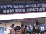
terminates at Dum Dum Station. This is right on the boundary of Dum Dum. From the station the Dum Dum Road leads to areas within Dum Dum and further.
By Air
The Netaji Subhash Chandra Bose International AirportNetaji Subhash Chandra Bose International Airport
Netaji Subhash Chandra Bose International Airport is an airport located in Kolkata, West Bengal, India, serving the greater Kolkata metro area. The airport was originally known as Dum Dum Airport before being renamed in the honour of Subhas Chandra Bose...
or Kolkata Airport is located on the peripheries of Dum Dum and therefore, it is also called the Dum Dum Airport. There are flights to all major cities in India. There are also international flights to London, Frankfurt, Dubai, Singapore, Bangkok, Muscat, Doha, Kuala Lumpur, Kunming, Kathmandu, Dhaka and Paro.
By Rail
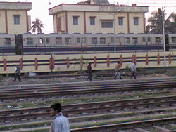
The Eastern Railway line has a station in Dum Dum. The Railway station and the Metro station is in the same complex. The Circular Railway also terminates at the same station. The other stations in Dum Dum are Dum Dum Cantonment and Patipukur (on the Circular Railway line) and Airport Gate No 1 and Airport (on the single Airport line). Travel to airport by rail is however inconvenient as there are only a few trains at odd hours.By Road
Road is one the prime means of communications in Dum Dum. There are 2 arterial roads in Dum Dum - (a) The Jessore Road and the (b) Dum Dum Road. Buses ply on both the roads. On Dum Dum road the Bus Routes are 30B, L30B, 30B/1, 202, DN9, Airport-Babughat Mini, Howrah-Nagerbazar Mini,Dum dum Station-Ruby Hospital WBSTC Mini, Dankuni-Saltlake Sector 5 WBSTC Mini. On Jessore road there are more bus routes - namely 3C/1, 3C/2, 30, 30C, 30D, 30E, 45, 45A, 45B, 47, 47A, 47B, 79B, 91, 91A, 91B, 93, 211A, 215, 219, 221 , 223, 237, DN8, DN18, Central Jail-Heritage WBSTC Mini... The other minor roads on which buses ply are R.N Guha Road (30B/1), Birati-Nimta road (237), Laketown connector (221, 223, 30C, 211A, 47, 47A), Gorabazar-Cantonment Road (30D).Road Distance
- From Central Kolkata (Esplanade) to Nagerbazar - approx 12 km through Central Avenue, Jessore Road
- From Central Kolkata (Esplanade) to Laketown Jessore Road crossing - approx 9 km
- From Central Kolkata to Airport through VIP Road - approx 22 km
- From Central Kolkata to Dum Dum Station through Central Avenue, BT Road, Chiriamore, approx : 10 km
- From Central Kolkata to Dum Dum Cantonment - approx 15 km
- From Airport to Nagerbazar - 5 km
- From Airport to Laketown - 8 km
- From Airport to Dum Dum Station - 7 km
- From Airport to Cantonment - 5 km
- From Airport to Central Jail - 4 km
- From subhasnagar to airport - 5 km
Travel within Dum Dum
- There are a plenty of buses available here - though most of them are the blue private one & mini bus. There are few CSTC or WBSTC or CTC buses.
Autos are plenty - they can be used for short stretches.Auto can be used to travel from (i)Dum Dum st. to Nager Bazar ,(ii)Dum Dum st. to Chiria more. In addition, there are Taxis; Nagerbazar and Airport being the largest taxi stands. The other taxi stands are in Birati, Central Jail, Laketown, Bangur, Kalindi. Unfortunately the Dum Dum Station area doesn't have too many taxis as the area is extremely crowded. The other popular means of travel over short distances is the rickshaw. Many historically important places in the locality are worthy of mention, which include:
- 1. Dum Dum Central Jail
- 2. Dum Dum Cantonment, the birthplace of Mutiny of 1857
- 3. Dum Dum Air Port (Netaji Subhash International Airport)
- 4. Bungalow of Lord Clive
Neighbourhoods
Birati, Sarat Coloney, Bangur Avenue, Dum Dum Park, Nagar Bazaar, Satgachi, Amarpalli, Kshudiram colony, Gora Bazaar, Durganagar, Padmapukur, Motijheel, Ghosh Road, Devinibash, Lichubagan, Laxminagar, Subhas Nagar, Seth Bagan,Lal Bagan, Ghosh Para, Purba Sinthee, Madhugar and Nalta, Private Road, Chatakol, Hanuman Mandir, Fari. central jail opposite at padrihataEducation
There are 4 govt. general colleges in Dum Dum, they are- Dum Dum Motijheel Science College (It is a renowned college in the locality)
- Dum Dum Rabindra Mahabidyalay (Formerly known as Motijheel Commerce College, located in Chatakal)
- Dum Dum Arts College
- Sarojini Naidu Girls College
There is also a Private Engineering College, Dr. Sudhir Chandra Sur Degree Engineering College in Surer Math.
There are many Govt. Sponsored School, including:
- 1. Dum Dum K K Hindu Academy
- 2. Dum Dum Motijheel Girls High School
- 3. Dum Dum Kishore Bharati High School
- 4. Dum Dum Sree Aravinda Vidyamandir
- 5. Siksha Niketan High School
- 6. Rameswar High School
- 7. Sahid Khudiram High School
- 8. Adarsha High School
- 9. Prachya High School
- 10. KV Dum Dum
- 11. KV Cossipore
and more.
Many Private Schools are also found in the localities, including:
- 1. St. Mary's Orphanage & Day School (Nursery to Std. XII)
- 2. St. Stephens School (Nursery to Std. XII)
- 3. Seraphim's Public School (Std. I to XII)
- 4. Indira Gandhi Memorial School (Std. I to XII)
- 5. Tender Hearts (Nursery to Std. IV)
- 6. Howard Memorial English School (Nursery to X)
- 7. Christ Church Girls' High Secondary School ( Primary - XII)
External links
- http://www.calcuttaairport.com/