
Drachten
Encyclopedia
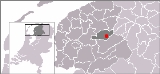
Drachten is a Dutch
town, located in the municipality of Smallingerland
in the province
of Friesland
.
s—for agriculture
.
Around 1200 A.D., a small stone church was built. It was used for 200 years afterward, until rising waters drove people even further east.
By 1550 the Dutch peat
reserve had been exhausted. Peat had become an important source of energy, not only for private households but also for the industry. The need in the rapidly growing province of Holland during the 17th century was higher than Friesland could supply. Most of the transport was over water, therefore often by track boat. Peat exploitation meant a welcome activity for many villages, although most of the income did not flow into the pockets of the struggling peat cutters. In 1641 A.D. farmers in Drachten North and Drachten South entered into an agreement with wealthy residents of The Hague
, the 'Drachten Associates'. One of these moneylenders was businessman Passchier Hendriks Bolleman from The Hague
.The agreement stipulated that peat cut in Smallingerland was designated for the Holland industry. For transport by boat the Drachtster Compagnonsvaart canal
and two side channels had to be constructed. During one year 800 workers had been digging every day. And where people spent their days, other developments followed, such as dwellings, places for storage, hostels and businesses. Although the economic success of cutting peat was short-lived (it even led to Passchier Bolleman's financial ruin), it spurred on to the foundation of Drachten.
The Drachtstervaart brought in ships and the ships brought in not only return freight, but also their own service industry: rope-yards, carpenter's yards and forges. In 1746 the first real shipyard was established on the Langewijk, initially only for the construction of timber flatboats, but after 1895 also for iron hull ships. In 1902 a second shipyard followed on the Drachtstervaart.
moved from nearby Oudega to Drachten.
The peat industry of Drachten lasted for 200 years. When it ended, the poorer workers stayed behind; some became small farmers, but most of them had no success.
company was a major contributor to this growth. Today there are approximately 45,000 people living in Drachten.
experiment known as shared space
, a concept pioneered by Hans Monderman
. Almost all traffic light
s and signs
have been removed in the town's centre in an effort to improve traffic safety, based on the theory that drivers pay more attention to their surroundings when they cannot rely on strict traffic rules. Previously the town's centre had an average of 8 accidents per year. Since the new system was introduced in 2003, this has been reduced to effectively 0.
The German town of Bohmte
adopted a similar scheme in September 2007.
The part of this water that was situated in the centre of Drachten, was closed in the sixties of the last century, in order to stimulate the local economy and give space to the increased road traffic. Now the centre of the town was no longer reachable by boat.
In 1996 the first plans were made to recreate the water way into the heart of the town. So water tourist can come back to Drachten and visit the centre by boat. The reconstruction of the area started in 2001 and will last until 2011. It is called the "Drachtstervaart" project.
with: Gobabis
, Namibia
Kiryat Ono, Israel
Netherlands
The Netherlands is a constituent country of the Kingdom of the Netherlands, located mainly in North-West Europe and with several islands in the Caribbean. Mainland Netherlands borders the North Sea to the north and west, Belgium to the south, and Germany to the east, and shares maritime borders...
town, located in the municipality of Smallingerland
Smallingerland
Smallingerland is a municipality in the province of Friesland in the Netherlands.-Population centres:Boornbergum, De Tike, De Veenhoop, De Wilgen, Drachten , Drachtstercompagnie, Goëngahuizen, Houtigehage, Kortehemmen, Nijega, Opeinde, Oudega, Rottevalle and Smalle Ee.-History:The name...
in the province
Provinces of the Netherlands
A Dutch province represents the administrative layer in between the national government and the local municipalities, having the responsibility for matters of subnational or regional importance. The government of each province consists of three major parts: the Provinciale Staten which is the...
of Friesland
Friesland
Friesland is a province in the north of the Netherlands and part of the ancient region of Frisia.Until the end of 1996, the province bore Friesland as its official name. In 1997 this Dutch name lost its official status to the Frisian Fryslân...
.
Beginnings
Drachten began as a small community on the east side of the Drait River. There, early settlers started draining the land to use it for agriculture. As the process of draining progressed, residents began to move further eastward in order to use the drained land—former peatbogBog
A bog, quagmire or mire is a wetland that accumulates acidic peat, a deposit of dead plant material—often mosses or, in Arctic climates, lichens....
s—for agriculture
Agriculture
Agriculture is the cultivation of animals, plants, fungi and other life forms for food, fiber, and other products used to sustain life. Agriculture was the key implement in the rise of sedentary human civilization, whereby farming of domesticated species created food surpluses that nurtured the...
.
Around 1200 A.D., a small stone church was built. It was used for 200 years afterward, until rising waters drove people even further east.
By 1550 the Dutch peat
Peat
Peat is an accumulation of partially decayed vegetation matter or histosol. Peat forms in wetland bogs, moors, muskegs, pocosins, mires, and peat swamp forests. Peat is harvested as an important source of fuel in certain parts of the world...
reserve had been exhausted. Peat had become an important source of energy, not only for private households but also for the industry. The need in the rapidly growing province of Holland during the 17th century was higher than Friesland could supply. Most of the transport was over water, therefore often by track boat. Peat exploitation meant a welcome activity for many villages, although most of the income did not flow into the pockets of the struggling peat cutters. In 1641 A.D. farmers in Drachten North and Drachten South entered into an agreement with wealthy residents of The Hague
The Hague
The Hague is the capital city of the province of South Holland in the Netherlands. With a population of 500,000 inhabitants , it is the third largest city of the Netherlands, after Amsterdam and Rotterdam...
, the 'Drachten Associates'. One of these moneylenders was businessman Passchier Hendriks Bolleman from The Hague
The Hague
The Hague is the capital city of the province of South Holland in the Netherlands. With a population of 500,000 inhabitants , it is the third largest city of the Netherlands, after Amsterdam and Rotterdam...
.The agreement stipulated that peat cut in Smallingerland was designated for the Holland industry. For transport by boat the Drachtster Compagnonsvaart canal
Canal
Canals are man-made channels for water. There are two types of canal:#Waterways: navigable transportation canals used for carrying ships and boats shipping goods and conveying people, further subdivided into two kinds:...
and two side channels had to be constructed. During one year 800 workers had been digging every day. And where people spent their days, other developments followed, such as dwellings, places for storage, hostels and businesses. Although the economic success of cutting peat was short-lived (it even led to Passchier Bolleman's financial ruin), it spurred on to the foundation of Drachten.
The Drachtstervaart brought in ships and the ships brought in not only return freight, but also their own service industry: rope-yards, carpenter's yards and forges. In 1746 the first real shipyard was established on the Langewijk, initially only for the construction of timber flatboats, but after 1895 also for iron hull ships. In 1902 a second shipyard followed on the Drachtstervaart.
Drachten grows
Along the side of the canal, pubs, shops, shipbuilding facilities, and public utilities, such as a rope-walk, were built. Around 1830, a town hall was built, and a notary publicNotary public
A notary public in the common law world is a public officer constituted by law to serve the public in non-contentious matters usually concerned with estates, deeds, powers-of-attorney, and foreign and international business...
moved from nearby Oudega to Drachten.
The peat industry of Drachten lasted for 200 years. When it ended, the poorer workers stayed behind; some became small farmers, but most of them had no success.
Accelerated growth
In the post-war period between 1950 and 1991, Drachten grew by an average of 1,000 inhabitants a year. The arrival of the PhilipsPhilips
Koninklijke Philips Electronics N.V. , more commonly known as Philips, is a multinational Dutch electronics company....
company was a major contributor to this growth. Today there are approximately 45,000 people living in Drachten.
Traffic experiment
Recently, Drachten received international attention for a trafficTraffic
Traffic on roads may consist of pedestrians, ridden or herded animals, vehicles, streetcars and other conveyances, either singly or together, while using the public way for purposes of travel...
experiment known as shared space
Shared space
Shared space is an urban design concept aimed at integrated use of public spaces. It encourages traffic engineers, urban planners and experts from other fields to consult with users of public space when planning and designing streets and squares in both built and non-built environments...
, a concept pioneered by Hans Monderman
Hans Monderman
Hans Monderman was a Dutch road traffic engineer and innovator. He was recognized forradically challenging criteria used to evaluate engineering solutions for street design...
. Almost all traffic light
Traffic light
Traffic lights, which may also be known as stoplights, traffic lamps, traffic signals, signal lights, robots or semaphore, are signalling devices positioned at road intersections, pedestrian crossings and other locations to control competing flows of traffic...
s and signs
Traffic sign
Traffic signs or road signs are signs erected at the side of roads to provide information to road users. With traffic volumes increasing over the last eight decades, many countries have adopted pictorial signs or otherwise simplified and standardized their signs to facilitate international travel...
have been removed in the town's centre in an effort to improve traffic safety, based on the theory that drivers pay more attention to their surroundings when they cannot rely on strict traffic rules. Previously the town's centre had an average of 8 accidents per year. Since the new system was introduced in 2003, this has been reduced to effectively 0.
The German town of Bohmte
Bohmte
Bohmte is a municipality in the district of Osnabrück, in Lower Saxony, Germany. It is situated on the river Hunte, approx. 20 km northeast of Osnabrück...
adopted a similar scheme in September 2007.
Water is Life
In April 2007, artist Henk Hofstra painted a road in Drachten blue with white lettering and traffic markings. The road is called Moleneind. The lettering spells "Water is Leven" (Water is Life), meant to symbolize a prior waterway that was paved over.The part of this water that was situated in the centre of Drachten, was closed in the sixties of the last century, in order to stimulate the local economy and give space to the increased road traffic. Now the centre of the town was no longer reachable by boat.
In 1996 the first plans were made to recreate the water way into the heart of the town. So water tourist can come back to Drachten and visit the centre by boat. The reconstruction of the area started in 2001 and will last until 2011. It is called the "Drachtstervaart" project.
Twin towns — Sister cities
Drachten is twinnedTown twinning
Twin towns and sister cities are two of many terms used to describe the cooperative agreements between towns, cities, and even counties in geographically and politically distinct areas to promote cultural and commercial ties.- Terminology :...
with: Gobabis
Gobabis
Gobabis is a town in eastern Namibia. It is the regional capital of the Omaheke Region, and the district capital of the Gobabis electoral constituency. Gobabis is situated down the B6 motorway from Windhoek to Botswana. The town is from the Buitepos border post with Botswana, and serves as an...
, Namibia
Namibia
Namibia, officially the Republic of Namibia , is a country in southern Africa whose western border is the Atlantic Ocean. It shares land borders with Angola and Zambia to the north, Botswana to the east and South Africa to the south and east. It gained independence from South Africa on 21 March...
Kiryat Ono, Israel
Israel
The State of Israel is a parliamentary republic located in the Middle East, along the eastern shore of the Mediterranean Sea...