
Division No. 13, Alberta
Encyclopedia
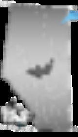
Division No. 13 is a census division
in Alberta
, Canada
. The majority of the division is located in the north-central portion of central Alberta
, while the northeast portion of the division is located within northern Alberta
. The division's largest urban community is the Town of Whitecourt
.
, a 4.7% increase from 2001. The census division has a land area of 24373.37 km² (9,410.6 sq mi) and a population density
of 2.7 inhabitants per square kilometre.
Census division
Census division is an official term in Canada and the United States. The census divisions of Canada are second-level census geographic unit, below provinces and territories, and above "census subdivisions" and "dissemination areas". In provinces where they exist, the census division may correspond...
in Alberta
Alberta
Alberta is a province of Canada. It had an estimated population of 3.7 million in 2010 making it the most populous of Canada's three prairie provinces...
, Canada
Canada
Canada is a North American country consisting of ten provinces and three territories. Located in the northern part of the continent, it extends from the Atlantic Ocean in the east to the Pacific Ocean in the west, and northward into the Arctic Ocean...
. The majority of the division is located in the north-central portion of central Alberta
Central Alberta
Central Alberta is a region located in the Canadian province of Alberta.Central Alberta is the most densely populated rural area in the province...
, while the northeast portion of the division is located within northern Alberta
Northern Alberta
Northern Alberta is a region located in the Canadian province of Alberta.Its primary industry is oil and gas, with large heavy oil reserves being exploited at the Athabasca Oil Sands and Wabasca Area in the east of the region...
. The division's largest urban community is the Town of Whitecourt
Whitecourt, Alberta
Whitecourt is a town in Alberta, Canada within Woodlands County. It is located northwest of Edmonton and southeast of Grande Prairie at the junction of Highway 43 and Highway 32 and has an elevation of ....
.
Census subdivisions
The following census subdivisions (municipalities or municipal equivalents) are located within Alberta's Division No. 13.- Towns
- AthabascaAthabasca, AlbertaAthabasca is a town in northern Alberta, Canada. It lies north of Edmonton on Highway 2, on the banks of the Athabasca River. It is the centre of Athabasca County. Until 1913 it was known as Athabasca Landing.- History :...
- BarrheadBarrhead, AlbertaBarrhead is a town in central Alberta, Canada, within the County of Barrhead No. 11. It is located along the Paddle River and at the intersection of Highway 33 and Highway 18, approximately northwest of the City of Edmonton...
- MayerthorpeMayerthorpe, AlbertaMayerthorpe is a town in the census division 13, central Alberta, Canada. It is located at the intersection of Highway 43 and Cowboy Trail , north-west from Edmonton.-History:...
- OnowayOnoway, AlbertaOnoway is a town in central Alberta, Canada. It is located west of Edmonton at the junction of Highway 37 and Highway 43.The Canadian National Railway tracks run through the town, which is situated immediately east of Lac Ste. Anne and south of the Sturgeon River. Onoway built and opened a new...
- WestlockWestlock, AlbertaWestlock is a town in central Alberta, Canada. Founded in 1913, the town is primarily an agricultural, business, and government administration centre serving communities and rural areas within surrounding Westlock County.- Geography :...
- WhitecourtWhitecourt, AlbertaWhitecourt is a town in Alberta, Canada within Woodlands County. It is located northwest of Edmonton and southeast of Grande Prairie at the junction of Highway 43 and Highway 32 and has an elevation of ....
- Athabasca
- Villages
- Alberta BeachAlberta Beach, AlbertaAlberta Beach is a village in central Alberta, Canada, west of Edmonton. It is located on the southeast shore of Lac Ste. Anne, approximately west of Highway 43 and north of Highway 633....
- BoyleBoyle, AlbertaBoyle is a village in northern Alberta, Canada within Athabasca County. It is located on Highway 63, approximately north of Edmonton.Boyle is named after former Alberta Minister of Education Justice John R...
- ClydeClyde, AlbertaClyde is a village in northern Alberta, Canada. It is located north of Edmonton and east of Westlock, near the junction of Highway 18 and Highway 2.It was incorporated in 1914 and named after the River and Firth of Clyde in Scotland.- Demographics :...
- Alberta Beach
- Summer villages
- Birch CoveBirch Cove, AlbertaBirch Cove is a summer village in Alberta, Canada. It is located between Highway 33 and Lac la Nonne, north-west of Edmonton.The village is administered by Lac Ste. Anne County in central Alberta.- Demographics :...
- BondissBondiss, AlbertaBondiss is a summer village in Alberta, Canada. It is located at the eastern tip of Skeleton Lake, between Boyle and Lac la Biche.-Demographics:In 2001, Bondiss had a population of 104....
- Castle IslandCastle Island, AlbertaCastle Island is a summer village in Alberta, Canada. It is located on Lac Ste. Anne, close to its mouth at Sturgeon River.- Demographics :...
- Island LakeIsland Lake, AlbertaIsland Lake is a summer village in Alberta, Canada. It is located on the western shore of Island Lake, along Highway 2, north-west of Athabasca.-Demographics:...
- Island Lake SouthIsland Lake South, AlbertaIsland Lake South is a summer village in Alberta, Canada. It is located on the southern shore of Island Lake, along Highway 2, north-west of Athabasca.-Demographics:...
- LarkspurLarkspur, AlbertaLarkspur is a summer village in Alberta, Canada. It is located north of Westlock and south of Athabasca, east of Highway 44 and west of Highway 2.-Demographics:...
- Mewatha BeachMewatha Beach, AlbertaMewatha Beach is a summer village in Alberta, Canada. It is located on the western shore of Skeleton Lake, east of Boyle.-Demographics:In 2006, Mewatha Beach had a population of 167 living in 192 dwellings, a 65.3% increase from 2001. The summer village has a land area of and a population density...
- Nakamun ParkNakamun Park, AlbertaNakamun Park is a summer village in Alberta, Canada. It is located on the southern shore of Nakamun Lake, west of Highway 33 and north of Onoway.-Demographics:...
- Ross HavenRoss Haven, AlbertaRoss Haven is a summer village in Alberta, Canada. It is located on the northern shore of Lac Ste. Anne, south of Highway 43.- Demographics :...
- Sandy BeachSandy Beach, AlbertaSandy Beach is a summer village in Alberta, Canada. It is located around Sandy Lake, north-west from Edmonton along Highway 642.- Demographics :...
- Silver SandsSilver Sands, AlbertaSilver Sands is a summer village in Alberta, Canada. The main attraction of this summer village is the Silver Sands golf and country club. The village is located on the shores of Isle Lake.- Demographics :...
- South BaptisteSouth Baptiste, AlbertaSouth Baptiste is a summer village in Alberta, Canada. It is located on the southern shore of Baptiste Lake, west of Athabasca.-Demographics:...
- South ViewSouth View, AlbertaSouth View is a summer village in Alberta, Canada. It is located on the northern shore of Isle Lake, opposite from Silver Sands.- Demographics :...
- Sunrise BeachSunrise Beach, AlbertaSunrise Beach is a summer village in Alberta, Canada. It is located on the western shore of Sandy Lake, south of Sandy Beach.-Demographics:In 2006, Sunrise Beach had a population of 170 living in 127 dwellings, a 78.9% increase from 2001. The summer village has a land area of and a population...
- Sunset BeachSunset Beach, AlbertaSunset Beach is a summer village in Alberta, Canada. It is located on the eastern shore of Baptiste Lake.- Demographics :In 2006, Sunset Beach had a population of 88 living in 108 dwellings, a 76.0% increase from 2001. The summer village has a land area of and a population density of ....
- Sunset PointSunset Point, AlbertaSunset Point is a summer village in Alberta, Canada. It is located on the eastern shore of Lac Ste. Anne, north of Alberta Beach.- Demographics :...
- Val QuentinVal Quentin, AlbertaVal Quentin is a summer village in Alberta, Canada. It is located on the southern shore of Lac Ste. Anne.- Demographics :In 2006, Val Quentin had a population of 181 living in 104 dwellings, a 26.6% increase from 2001. The summer village has a land area of and a population density of .- External...
- West BaptisteWest Baptiste, AlbertaWest Baptiste is a summer village in Alberta, Canada. It is located on the western shore of Baptiste Lake, west of Athabasca.- Demographics :...
- West CoveWest Cove, AlbertaWest Cove is a summer village in Alberta, Canada. It is located on the southern shore of western Lac Ste. Anne.- Demographics :In 2006, West Cove had a population of 169 living in 217 dwellings, a 61.0% increase from 2001. The summer village has a land area of and a population density of .-...
- Whispering HillsWhispering Hills, AlbertaWhispering Hills is a summer village in Alberta, Canada. It is located on the eastern shore of Baptiste Lake.- Demographics :In 2006, Whispering Hills had a population of 125 living in 148 dwellings, a 5.9% increase from 2001. The summer village has a land area of and a population density of ....
- YellowstoneYellowstone, AlbertaYellowstone is a summer village in Alberta, Canada. It is developed on the northern shore of Lac Ste. Anne, south of Alberta Highway 43, between Ross Haven and Gunn, from Edmonton.- Demographics :...
- Birch Cove
- Municipal districts
- Athabasca County
- Barrhead No. 11, County of
- Lac Ste. Anne CountyLac Ste. Anne County, AlbertaLac Ste. Anne County is a municipal district in central Alberta, Canada.It is located in Census Division 13, north west of Edmonton. Highway 43 stretches across this county. The municipal seat is located in the Hamlet of Sangudo....
- Thorhild No. 7, County ofThorhild County No. 7, AlbertaThe County of Thorhild No. 7, Alberta is a municipal district located in the central part of northern Alberta, Canada in Census Division 13. It was incorporated as a county in 1955....
- Westlock CountyWestlock County, AlbertaWestlock County is a municipal district in central Alberta north of Edmonton. The county was formerly known as the Municipal District of Westlock No. 92, and was created in 1943 from the merger of five smaller municipal districts....
- Woodlands CountyWoodlands County, AlbertaWoodlands County is a municipal district in north-central Alberta, Canada.It is located in Census Division 13. The municipal seat is in the Town of Whitecourt, while a regional administrative office is also located in the Hamlet of Fort Assiniboine....
- Indian reserves
- Alexis 133
Demographics
In 2006, Division No. 13 had a population of 66,972 living in 31,101 dwellingsHouse
A house is a building or structure that has the ability to be occupied for dwelling by human beings or other creatures. The term house includes many kinds of different dwellings ranging from rudimentary huts of nomadic tribes to free standing individual structures...
, a 4.7% increase from 2001. The census division has a land area of 24373.37 km² (9,410.6 sq mi) and a population density
Population density
Population density is a measurement of population per unit area or unit volume. It is frequently applied to living organisms, and particularly to humans...
of 2.7 inhabitants per square kilometre.