
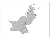
Districts of Pakistan
Encyclopedia
The Districts of Pakistan are the second order administrative divisions of Pakistan
. Districts were the third order of administrative divisions, below provinces
and "divisions
", until the reforms of August 2000, when "divisions" were abolished. Districts now form the top tier of a three-tier system of local government with the two lower tiers composed of approximately 596 tehsil
s (included the Kashmir region) and more than 6,000 union councils.
Prior to 2001, there were 106 districts but with the reorganisation, these were reduced to 102 by the merger of the five districts of Karachi Central, Karachi East, Karachi South, Karachi West and Malir to form Karachi District. The five districts had formed the division of Karachi which was abolished. The number of districts rose to 106 again in December 2004, when four new districts were created in the province of Sindh of which one (Umerkot) had existed until 2000 and three districts (Kashmore, Qambar and Jamshoro) were newly created.
In May 2005, the Punjab provincial government created a new district by raising the status of Nankana Sahib
from a tehsil
of Sheikhupura District
to a district in its own right.
In Azad Kashmir
, the second tier of government is formed by three administrative divisions with a third tier of ten districts. In Gilgit-Baltistan, there are six districts divided between the two regions of Gilgit
and Baltistan
; Baltistan being a part of Ladakh
under Pakistani control, the other part being under Indian control.
Pakistan
Pakistan , officially the Islamic Republic of Pakistan is a sovereign state in South Asia. It has a coastline along the Arabian Sea and the Gulf of Oman in the south and is bordered by Afghanistan and Iran in the west, India in the east and China in the far northeast. In the north, Tajikistan...
. Districts were the third order of administrative divisions, below provinces
Subdivisions of Pakistan
The administrative units of Pakistan consist of four provinces, one federal capital territory, and a group of federally-administered tribal areas...
and "divisions
Divisions of Pakistan
Divisions are the third tier of government in Pakistan, between the provinces and districts. They were abolished in 2000 by the government of former president Pervez Musharraf to make way for local governance via district governments...
", until the reforms of August 2000, when "divisions" were abolished. Districts now form the top tier of a three-tier system of local government with the two lower tiers composed of approximately 596 tehsil
Tehsil
A Tehsil or Tahsil/Tahasil , also known as Taluk and Mandal, is an administrative division of some country/countries of South Asia....
s (included the Kashmir region) and more than 6,000 union councils.
Prior to 2001, there were 106 districts but with the reorganisation, these were reduced to 102 by the merger of the five districts of Karachi Central, Karachi East, Karachi South, Karachi West and Malir to form Karachi District. The five districts had formed the division of Karachi which was abolished. The number of districts rose to 106 again in December 2004, when four new districts were created in the province of Sindh of which one (Umerkot) had existed until 2000 and three districts (Kashmore, Qambar and Jamshoro) were newly created.
In May 2005, the Punjab provincial government created a new district by raising the status of Nankana Sahib
Nankana Sahib
Nankana Sahib , earlier known as Rai-Bhoi-Di-Talwandi, is a city in the Pakistani province of Punjab. It is named after the first Guru of the Sikhs, Guru Nanak Dev, the central figure in Sikhism who was born here, so it is a city of high historic and religious value and is a popular pilgrimage site...
from a tehsil
Tehsil
A Tehsil or Tahsil/Tahasil , also known as Taluk and Mandal, is an administrative division of some country/countries of South Asia....
of Sheikhupura District
Sheikhupura District
Sheikhupura District is a district of Punjab province, Pakistan. Sheikhupura is the headquarters of Sheikhupura District. According to the 1998 census of Pakistan, the district had a population of 3,321,029 of which 25.45% were urban....
to a district in its own right.
In Azad Kashmir
Azad Kashmir
Azad Jammu and Kashmir or Azad Kashmir for short, is the southernmost political entity within the Pakistani-administered part of the former princely state of Jammu and Kashmir...
, the second tier of government is formed by three administrative divisions with a third tier of ten districts. In Gilgit-Baltistan, there are six districts divided between the two regions of Gilgit
Gilgit
Gilgit is a city in northern PakistanGilgit may refer to other terms related with the area of the city:* Gilgit River* Gilgit Valley* Gilgit District* Gilgit Agency * Gilgit Airport...
and Baltistan
Baltistan
Baltistan , also known as بلتیول བལིུལ་ in the Balti language, is a region in northern Pakistan which forms Gilgit-Baltistan, bordering the Xinjiang Autonomous Region of China. In addition, a part of Baltistan also falls into Jammu and Kashmir of India. It is situated in the Karakoram mountains...
; Baltistan being a part of Ladakh
Ladakh
Ladakh is a region of Jammu and Kashmir, the northernmost state of the Republic of India. It lies between the Kunlun mountain range in the north and the main Great Himalayas to the south, inhabited by people of Indo-Aryan and Tibetan descent...
under Pakistani control, the other part being under Indian control.
Overview
| Sr. No. | Subdivision | Districts | Area (km²) | Population (1998) | Density (people/km²) |
| 1 | Balochistan | 30 | 347,190 | 6,566,000 | 18.9 |
| 2 | Khyber Pakhtunkhwa | 24 | 74 521 | 17,744,000 | 238.1 |
| 3 | Punjab | 36 | 205,345 | 73,621,000 | 358.52 |
| 4 | Sindh Sindh Sindh historically referred to as Ba'ab-ul-Islam , is one of the four provinces of Pakistan and historically is home to the Sindhi people. It is also locally known as the "Mehran". Though Muslims form the largest religious group in Sindh, a good number of Christians, Zoroastrians and Hindus can... |
23 | 140,914 | 30,440,000 | 216.02 |
| 5 | Islamabad Capital Territory Islamabad Capital Territory The Islamabad Capital Territory is one of the two federal territories of Pakistan. It includes Islamabad, the capital city of Pakistan, and covers an area of 1,165.5 km² of which 906 km² is Islamabad proper... |
1 | 906 | 805,000 | 880.8 |
| 6 | Federally Administered Tribal Areas Federally Administered Tribal Areas The Federally Administered Tribal Areas are a semi-autonomous tribal region in the northwest of Pakistan, lying between the province of Khyber Pakhtunkhwa, Balochistan, and the neighboring country of Afghanistan. The FATA comprise seven Agencies and six FRs... (FATA) |
7 tribal agencies and 6 frontier regions | 27,220 | 3,176,000 | 116.7 |
| 7 | Azad Kashmir Azad Kashmir Azad Jammu and Kashmir or Azad Kashmir for short, is the southernmost political entity within the Pakistani-administered part of the former princely state of Jammu and Kashmir... |
10 | 13,297 | 2,972,500 | 258 |
| 8 | Gilgit-Baltistan | 7 | 72,971 | 1,800,000 | 24.8 |
Islamabad Capital Territory
| Capital Territory | Area (km²) | Population (1998) | Density (people/km²) |
| Islamabad Islamabad Islamabad is the capital of Pakistan and the tenth largest city in the country. Located within the Islamabad Capital Territory , the population of the city has grown from 100,000 in 1951 to 1.7 million in 2011... |
906 | 805,235 | 889 |
Balochistan
| Sr. No. | District | Headquarters | Area (km²) | Population (1998) | Density (people/km²) |
| 1 | Awaran Awaran District Awaran District is a district in the south of the Balochistan province of Pakistan. It was notified as a separate district on 11 November 1992... |
Awaran Awaran Awaran is the capital of Awaran District in the Balochistan province of Pakistan. As well as district capital the town serves as tehsil headquarters and as a Union Council.-References:... |
29,510 | 118,173 | 4 |
| 2 | Barkhan Barkhan District Barkhan a district in the north-west of the Balochistan province of Pakistan. It was given the status of a district on 31 December 1991.-Population:... |
Barkhan Barkhan Barkhan is the capital city of the Barkhan District in the Balochistan province of Pakistan. It is located at 29°54'0N 69°31'0E at an altitude of 1,100 metres .... |
3,514 | 103,545 | 29 |
| 3 | Bolan Bolan District Bolan district Well known as Kachhi is in the centre of Balochistan province of Pakistan. The Bolan area remained under one district Kachhi until 31 December 1991... |
Dhadar Dhadar Dhadar, also spelt Dadhar, is the capital of the Bolan District in the Balochistan province of Pakistan. The town which also consists of one Union Council is the headquarters of the tehsil of the same name. It is located at 29°28'0"N 67°39'0"E and has an altitude of 132 metres .... |
7,499 | 288,056 | 38 |
| 4 | Chagai Chagai District Chaghi/Chagai is the largest district of Pakistan and is located on the north west corner of Balochistan, Pakistan. It forms a triangular border with Afghanistan and Iran.Pakistan conducted a nuclear weapons test in 1998 at Ras Koh Hills Chagai District.... |
Chagai Chagai Chagai may refer to:* Chagai District, the largest district of Pakistan* Chagai Hills, the mountainous region north of Balochistan Province, Pakistan* Chagai, Pakistan, the capital of Chagai District*Chagai-I, the codename first nuclear weapon tests... |
44,748 | 300,000 | 7 |
| 5 | Dera Bugti Dera Bugti District Dera Bugti is a district located in the south west of Balochistan province of Pakistan. Dera Bugti is named after its headquarter town 'Dera Bugti'. Dera means `abode' or `habitat', while `Bugti' is the name of the major Baloch tribe. Thus Dera Bugti means the abode of the Bugtis, the dominant... |
Dera Bugti Dera Bugti Dera Bugti is a town in Dera Bugti District, Balochistan, Pakistan. It was the hometown of Nawab Akbar Khan Bugti. Most of the inhabitants of Dera Bugti belong to the Bugti family. It is not far from the Punjab state.-Administration:... |
10,160 | 181,310 | 18 |
| 6 | Gwadar Gwadar District Gwadar District is a coastal district in Balochistan province of Pakistan. Gwadar city is the district headquarters of Gwadar District.-Administration:Gwadar District is subdivided into the following tehsils or subdistricts:* Gwadar* Jiwani* Ormara... |
Gwadar Gwadar Gwadar also known as Godar is a developing port city on the southwestern Arabian Sea coast of Pakistan. It is the district headquarters of Gwadar District in Balochistan province and has a population of approximately 50,000.Gwadar is strategically located at the apex of the Arabian Sea and at the... |
12,637 | 185,498 | 15 |
| 7 | Harnai Harnai District Harnai is a district in the Balochistan province of Pakistan. Harnai is the principal town of this district. It is located in the north east of Balochistan province... |
4,096 | 140,000 | 19 | |
| 8 | Jafarabad Jafarabad District Jafarabad or Jaffarabad district lies in the South-East of the Pakistani province of Balochistan. Jafarabad’s headquarters are at Dera Allah Yar. Formerly known as the Jhatpat subdivision, the region was part of the Jacobabad District until 1970 and part of the Sibi District until 1975... |
Jafarabad Jafarabad Jafarabad may refer to:Armenia* Getashen, Armavir, Armenia, formerly called JafarabadAzerbaijan* Aşağı Fərəcan, Azerbaijan, formerly called Jafarabad* Cəfərabad, Jabrayil, Azerbaijan* Cəfərabad, Shaki, AzerbaijanIndia... |
2,445 | 432,817 | 177 |
| 9 | Jhal Magsi Jhal Magsi District Jhal Magsi district is in the centre of Balochistan province of Pakistan.-Administration:The district is administratively subdivided into two tehsils Jhal Magsi and Gandawa which contain a total of nine Union Councils.-Population:... |
Jhal Magsi | 3,615 | 109,941 | 30 |
| 10 | Kalat Kalat District Kalat or Qalat is a district in Balochistan, Pakistan. It is one of 26 in that province, and encompasses an area of 6,621 km². The population of the district is estimated to be over 400,000 in 2005. The district is governed from the city of Kalat.... |
Kalat | 6,622 | 237,834 | 36 |
| 11 | Kech (Turbat) Kech District Kech or Turbat district is a district in Balochistan province of Pakistan.-Administration:The district of Kech is administratively subdivided into the following tehsils:* Buleda* Dasht* Turbat* Tump-Population:... |
Kech Kech Kech may refer to*Kech, Khyber Pakhtunkhwa, town in Khyber Pakhtunkhwa province, Pakistan*Kech District, district of Balochistan*Kech River, river of Balochistan... |
22,539 | 413,204 | 18 |
| 12 | Kharan Kharan District Kharan is a district in the north-west of Balochistan province of Pakistan. Kharan was notified as a district in 1951 and the Deputy Commissioner’s office started functioning on March 15, 1952. The Deputy Commissioner directly supervises all activities in the district and the functions of all... |
Kharan Kharan Kharan can refer to:* Kharan, Pakistan, city in Balochistan.* Kharan District, district of Balochistan, Pakistan* Kharan , former princely state* Kharan Desert* The upper Halil River* Haran, Azerbaijan... |
8958 | 1,32,500 | 4 |
| 13 | Kohlu Kohlu District Kohlu is a district of the Balochistan province of Pakistan. It is bounded in the north by Loralai District, Dera Bugti in the south, in the east Rojhan-Mazari and Sibi District in the west... |
Kohlu Kohlu Kohlu is the capital of Kohlu District in Balochistan, Pakistan. It is located at 29°54'0N 69°15'0E with an altitude of 1183 metres . The Marri tribe is main ethnic group in the city.... |
7,610 | 99,846 | 13 |
| 14 | Khuzdar Khuzdar District Khuzdar district is located in the centre of Balochistan province of Pakistan. Khuzdar is the capital of Khuzdar district. Khuzdar was created as a separate district on 1 March 1974. Previously, it was part of Kalat District.... |
Khuzdar Khuzdar Khuzdar or Khozdar is a town located in Khuzdar District in Balochistan, Pakistan. Khuzdar is the capital of Khuzdar District, which was created on 1 March 1974... |
35,380 | 417,466 | 12 |
| 15 | Killa Abdullah | Chaman Chaman Chaman is the capital of Qilla Abdullah District, Balochistan, Pakistan. It is situated just south of the border with Afghanistan. Across the border in Afghanistan is the neighbouring town of Spin Boldak, in Kandahar Province... |
3,293 | 370,269 | 112 |
| 16 | Killa Saifullah Killa Saifullah District Killa Saifullah, Killa Saifullah or Saifullah Killa is a district in the north west of Balochistan province of Pakistan. Saifullah Khan was a brave warrior of Khoidadzai, meerdadzai/mirdadzai a sub tribe of Kakar Sunzerkhel. A part of Zhob was named after him because of his bravery.Keeping in... |
Killa Saifullah | 6,831 | 193,553 | 28 |
| 17 | Lasbela Lasbela District Lasbela is a coastal district of Balochistan province of Pakistan. It became a separate district in Kalat Division on 30 June 1954. The name is derived from the words Las which in Sanskrit signifies a settlement or lived in or lively and Bela which means "A Sea's Shore" in Sanskrit and is also the... |
Bela | 15,153 | 312,695 | 21 |
| 18 | Loralai Loralai District Loralai is a district in the centre of Balochistan province of Pakistan. Loralai district was created on October, 1903. Loralai town is the district headquarters... |
Loralai Loralai Loralai is the principal city of Loralai District in the northeast of the Balochistan Province of Pakistan. It was formerly known as Bori. It is four thousand seven hundred feet above the sea level.... |
9,830 | 295,555 | 30 |
| 19 | Mastung Mastung District Mastung District is a district located in the north west of Balochistan province, Pakistan. Prior to 1991, Mastung was part of Kalat District. For administrative purposes Mastung was separated from Kalat and made a new district in 1991.-Administration:... |
Mastung Mastung, Pakistan Mustang the capital of Mastung District, is a town in the Balochistan province of Pakistan. It is located at 29°48'0N 66°50'60E and has an altitude of 1701 metres . The town is also the administrative centre of Mustang Tehsil, an administrative subdivision of the district - the town itself is... |
5,896 | 179,784 | 30 |
| 20 | Musakhel Musakhel District Musakhel is a district in the northwest of Balochistan province of Pakistan. The language of the district are Pashto, Balochi and Jaffarki most of the people are Pashtuns- Geography :... |
Musa Khel Bazar Musa Khel Bazar Musa Khel Bazar, also known as Musakhel, is the capital of Musakhel District in the Balochistan province of Pakistan. It is located at 30°52'0N 69°49'0E with an altitude of 1341 metres .... |
5,728 | 134,056 | 23 |
| 21 | Nasirabad Nasirabad District Nasirabad is a district in the centre-west of Balochistan, Pakistan. Nasirabad’s headquarters are at Dera Murad Jamali. The district was notified in 1974. For three years, from July 1987 to December 1990, it was known as Tamboo district. Tamboo is a small village 40 km west of Dera Murad... |
Nasirabad Naseerabad (Balochistan) Nasirabad is small town located in Naseerabad District in the Pakistani province of Balochistan.... |
3,387 | 245,894 | 73 |
| 22 | Nushki Nushki District Nushki District is one of the districts of Balochistan province, Pakistan. The administration of the Nushki district was taken over from the Khan of Kalat by the Indian government in 1896, and was leased from him on a perpetual quit rent in 1899.... |
Nushki Nushki Nushki , is a town in Balochistan, Pakistan. The town lies southwest of Quetta, and is situated in a plain at the base of the Quetta plateau, 2900 ft above sea level... |
5,797 | 137,500 | 23 |
| 23 | Panjgur Panjgur District Panjgur is a district in the west of Balochistan province of Pakistan. Panjgur was one of the three tehsils of Makran District until 1 July 1977 when that district became Makran Division and Panjgur became a district... |
Panjgur Panjgur Panjgur is a small town in Panjgur District, Balochistan, Pakistan. It is located at 26°58'0N 64°5'60E-References:... |
16,891 | 234,051 | 14 |
| 24 | Pishin Pishin District Pishin was a part of Quetta Pishin district. In 1975 it was separated from Quetta for administrative reasons. It derives its name from the locality Pishin. Pishin is a modernised form of ‘Pushang’, which is old Persian for the Arabic Fushang. Myth attributes the origin of the name to a son of the... |
Pishin | 7,819 | 367,183 | 47 |
| 25 | Quetta Quetta District Quetta is a district in the north-west of Balochistan province of Pakistan.It was part of Quetta Division until the year 2000 when divisions were abolished. The district is famous for its agriculture produce, most notably fruit orchards but also including apples and grapes. The Hanna Valley is an... |
Quetta Quetta is the largest city and the provincial capital of the Balochistan Province of Pakistan. Known as the "Fruit Garden of Pakistan" due to the diversity of its plant and animal wildlife, Quetta is home to the Hazarganji Chiltan National Park, which contains some of the rarest species of wildlife in the... |
2,653 | 744,802 | 281 |
| 26 | Sherani Sherani District Sherani is a district in the Balochistan province of Pakistan.Sherani District was the second biggest tehsil of Zhob District until 2005. In 2006, It was officially graded as district with the name of "Sherani" . The main language of the district is pashto... |
Sherani | |||
| 27 | Sibi Sibi District Sibi is a district in theBalochistan province of Pakistan. The main mountains range are Zen, Bambore and Dungan. The climatic and topography of Sibi District is quite varied compared to other districts of Balochistan. It is also known as the "Hot spot" of Pakistan where the temperatures in the... |
Sibi Sibi Sibi is a city of Balochistan province of Pakistan. The city is located at 29°33'0N 67°52'60E at an altitude of 130 metres and is headquarters of the district and tehsil of the same name.. According to the 2001 census of Pakistan the population of Sibi is 52,100... |
7,796 | 180,398 | 23 |
| 28 | Washuk | ||||
| 29 | Zhob Zhob District Zhob is a district in the north west of Balochistan province of Pakistan. Zhob district is a Provincially Administered Tribal Area . Zhob district is subdivided into three subdistricts: Zhob, Kakkar and Sherani. The population of Zhob district is estimated to be over 500,000 in 2005... |
Zhob Zhob -Roads:Zhob is 333 kilometers from Quetta, 225 kilometers from Dera Ismail Khan. However, the road linking with Dera Ismail Khan is for most part fair nowadays track passing through water streams and almost complete road is metalloid.... |
20,297 | 275,142 | 14 |
| 30 | Ziarat Ziarat District Ziarat is a district in the north of Balochistan province of Pakistan. Ziarat town is headquarters of the district of the Sub division, and also of the tehsil. Khilafat Hills are the highest peak with an altitude of in Ziarat district... |
Ziarat Ziarat Ziarat is the capital of Ziarat District, Balochistan, Pakistan. It is located at 30°22'47N 67°43'38E with an altitude of 2543 metres and is a famous holiday resort of Balochistan and nearly every trip from Karachi to Quetta stops at Ziarat... |
1,489 | 33,340 | 22 |
Khyber Pakhtunkhwa
| Map | Sr. No. | District | Headquarters | Area (km²) | Population (1998) | Density (people/km²) |
| 1 | Abbottabad Abbottabad District Abbottabad is a district in the Khyber Pakhtunkhwa province of Pakistan. The district covers an area of 1,969 km with the city of Abbottabad being the principal town... |
Abbottabad Abbottabad Abbottabad is a city located in the Hazara region of the Khyber Pakhtunkhwa province, in Pakistan. The city is situated in the Orash Valley, northeast of the capital Islamabad and east of Peshawar at an altitude of and is the capital of the Abbottabad District... |
1,967 | 880,666 | 448 | |
| 2 | Bannu Bannu District Bannu District is one of the twenty four districts of the Khyber Pakhtunkhwa province of Pakistan, it is represented in the provincial assembly by four MPAs. The chief city of the district is Bannu. The major industries are cloth weaving and the manufacture of cotton fabrics, machinery, and... |
Bannu Bannu Bannu is the principal city of the Bannu District in the Khyber Pakhtunkhwa Province of Pakistan. It is an important road junction and market city. Bannu is a very old city, founded in ancient times; however, the present location of the downtown Bannu was founded by Sir Herbert Edwardes in 1848,... |
1,227 | 675,667 | 551 | |
| 3 | Battagram | Battagram | 1,301 | 307,278 | 236 | |
| 4 | Buner Buner District Buner District is a district of the Khyber Pakhtunkhwa province of Pakistan.- History :The Buner Valley lies on the Peshawar valley border of the Khyber Pakhtunkhwa. It is a small mountain valley, dotted with villages and divided into seven sub-divisions... |
Daggar Daggar, Pakistan Daggar, also spelt Dagar, is the capital of Buner District in the Khyber-Pakhtunkhwa province of Pakistan. It is located at and has an average elevation of 688 metres . In April 2009 Taliban from neighbouring areas entered the district following a peace deal with the government in Swat, Taliban... |
1,865 | 506,048 | 271 | |
| 5 | Charsadda | Charsadda Charsadda Charsadda is a town and headquarters of Charsadda District, in the Khyber Pakhtunkhwa province of Pakistan. It is located at 34°8'43N 71°43'51E with an altitude of 276 metres and lies 29 kilometres from the provincial capital - Peshawar.... |
996 | 1,022,364 | 1,026 | |
| 6 | Chitral Chitral District Chitral is a district in the Khyber-Pakhtunkhwa province of Pakistan that contains the town of Chitral. It has an area of 14,850 km² and a population of 318,689 at the 1998 Census, which had subsequently risen to about 378,000 people by 2004. It has one of the highest mountains of the world,... |
Chitral Chitral Chitral or Chetrar , translated as field in the native language Khowar, is the capital of the Chitral District, situated on the western bank of the Kunar River , in Pakistan. The town is at the foot of Tirich Mir, the highest peak of the Hindu Kush, high... |
14,850 | 318,689 | 21 | |
| 7 | Dera Ismail Khan Dera Ismail Khan District Dera Ismail Khan is one of the 24 districts in the Khyber Pakhtunkhwa province of Pakistan. The capital of the district is the town of Dera Ismail Khan... |
Dera Ismail Khan Dera Ismail Khan Dera Ismail Khan is a city in Khyber-Pakhtunkhwa Province, Pakistan. It is situated on the west bank of the Indus River, west of Lahore and northwest of Multan. The city is the capital of the district and tehsil of the same name. In Pakistan, its name is often abbreviated to D. I... |
7,326 | 852,995 | 116 | |
| 8 | Hangu Hangu District (Pakistan) Hangu is a district in Khyber Pakhtunkhwa province of Pakistan. The district takes its name from the town of Hangu. The name Hangu may also sometimes be applied to the Miranzai Valley which is partly within the district, bordering the Samana Range.... |
Hangu | 1,097 | 314,529 | 287 | |
| 9 | Haripur Haripur District Haripur is a district in the Hazara region of Khyber-Pukhtunkhwa, province of Pakistan with an altitude of around above sea level. Haripur District has the highest Human Development Index of all the districts in the Hazara.... |
Haripur | 1,725 | 692,228 | 401 | |
| 10 | Karak Karak District Karak is a district of the Khyber Pakhtunkhwa province of Pakistan. It is situated to the south of Kohat District and on the north side of Bannu and Lakki Marwat districts on the main Indus Highway between Peshawar and Karachi - it is 123 km from the provincial capital Peshawar... |
Karak | 3,372 | 430,796 | 128 | |
| 11 | Kohat Kohat District Kohat is a district of the Khyber-Pakhtunkhwa province of Pakistan, Kohat city is the capital of the district. It is inhabited by various Pashtun tribes such as Afridi,Khattaks, Bangash and the Orakzaies. The main language of the district is Pashto.... |
Kohat Kohat Kohat is a medium sized town in Khyber Pakhtunkhwa province of Pakistan. It is located at 33°35'13N 71°26'29E with an altitude of 489 metres and is the capital of Kohat District. The town centres around a British-era fort, various bazaars, and a military cantonment. A British-built narrow gauge... |
2,545 | 562,644 | 221 | |
| 12 | Kohistan Kohistan District (Pakistan) Kohistan has two distinct meanings in Pakistan. In Persian "koh" means "peak" and "istaan" means "land of". In its usual modern sense Kohistan District is an administrative district within Pakistan's Khyber-Pakhtunkhwa Province covering an area of 7,492 sq.kilometres; it had a population of... |
Dassu Dassu (KPK) Dassu Tehsil is the district headquarters of Kohistan District, Khyber-Pakhtunkhwa, Pakistan. It had 15 Union Councils before the separation of the Kandia valley. Since its being named as Tehsil, the Dassu subdivision has 11 Union Councils. The total population of Dassu according to 1998 Census was... |
7,492 | 472,570 | 63 | |
| 13 | Lakki Marwat Lakki Marwat District Lakki Marwat is one of the Southern Districts of Khyber Pakhtunkhwa in Pakistan. It was created as an administrative district on July 1, 1992, prior to which it was a Tehsil of Bannu District.-Etymology:... |
Lakki Marwat Lakki Marwat Lakki Marwat or Lakki is the headquarters of Lakki Marwat District in Khyber-Pakhtunkhwa province of Pakistan. It is located at 32°41 25N 70°50'5E and has an altitude of 255 metres , the town is administratively divided into 2 union councils.-History:In 1844 Fateh Khan Tiwana, the revenue collector... |
3,164 | 490,025 | 155 | |
| 14 | Lower Dir Lower Dir District Lower Dir is one the 24 districts of Khyber Pakhtunkhwa, Pakistan. The district was formed in 1996, when the district of Dir was divided into Upper Dir and Lower Dir.- Administration :... |
Timergara Timergara Timergara is a town in Lower Dir District, Khyber-Pakhtunkhwa, Pakistan. Timergara is the district headquarters of Lower Dir. It lies at an altitude of .... |
1,582 | 717,649 | 454 | |
| 15 | Malakand Malakand District Malakand District is a district of the province of Khyber Pakhtunkhwa in Pakistan.The District was formed in 1970 as a Provincially Administered Tribal Area, It had previously been a Tribal Area known as the Malakand Protected Area, part of the Malakand Agency... |
952 | 452,291 | 475 | ||
| 16 | Mansehra Mansehra District Mansehra District is in the Khyber Pakhtunkhwa province of Pakistan, an area still unofficially known as the Northwest Frontier. Mansehra district and town are named after Man Singh, a leading general of Mughal Emperor Akbar... |
Mansehra Mansehra Mansehra city is located at in Mansehra District, Khyber-Pakhtunkhwa province of Pakistan. It is very near to Abbottabad city. It is a major stop for tourists on the Karakoram Highway which leads to China... |
4,579 | 1,152,839 | 252 | |
| 17 | Mardan Mardan District Mardan is a district in the Khyber Pakhtunkhwa province of Pakistan. The city of Mardan is the headquarters of the district. The district also contains the famous archaeological site of Takht Bhai, Jamal Ghari and Sawal Dher.-Administration:... |
Mardan Mardan Mardan , known as The city of hospitality, is a city and headquarters of Mardan District in Khyber Pakhtunkhwa Province, Pakistan. It is the de facto headquarters of the Yousafzai tribe and the second most populous city in the province, located at 34°12'0N 72°1'60E and an altitude of in the south... |
1,632 | 1,460,100 | 895 | |
| 18 | Nowshera Nowshera District Nowshera is a district in the Khyber Pakhtunkhwa Province of Pakistan - the principal city is Nowshera. Nowshera District is divided into 47 Union Councils and 5 provincial seats.... |
Nowshera | 1,748 | 874,373 | 500 | |
| 19 | Peshawar Peshawar District Peshawar is a district in the Khyber Pakhtunkhwa province of Pakistan. Until divisions were abolished as part of local government reforms in 2000 it was part of Peshawar Division. The city of Peshawar, as well as being the provincial capital, is the capital of the district... |
Peshawar Peshawar Peshawar is the capital of Khyber-Pakhtunkhwa and the administrative center and central economic hub for the Federally Administered Tribal Areas of Pakistan.... |
1,257 | 2,019,118 | 1,606 | |
| 20 | Shangla Shangla District Shangla District ' is located in the Khyber-Pakhtunkhwa province of Pakistan.The district headquarters are located at Alpuri. It was previously a subdivision of Swat District, but was upgraded to the status of a district on July 10, 1995 by the then Chief Minister Aftab Khan Sherpao. The total... |
Alpuri Alpuri Alpuri or Alpurai is the capital of Shangla District in the Khyber-Pakhtunkhwa province of Pakistan. It is located at and has an average elevation of 1471 metres 4829 feet).-2007 fighting:... |
1,586 | 434,563 | 274 | |
| 21 | Swabi Swabi District Swabi District is the fourth most populous district of the province of Khyber Pakhtunkhwa, Pakistan. It lies between the Indus and Kabul Rivers. The residents are referred to as Swabva'l. The Mandanr Yusufzai subsection of the Yousafzai clan of the Pashtuns form a majority of the population.-... |
Swabi Swabi Swabi is the capital of Swabi District in the Khyber Pakhtunkhwa province of Pakistan. It is located at 34°7'0N 72°28'0E. Its residents are referred to as 'Swabiwaal.'-Geography:... |
1,543 | 1,026,804 | 665 | |
| 22 | Swat | Saidu Sharif Saidu Sharif -Saidu Sharif:Saidu Sharif is the capital city of Swat District in the Khyber Pakhtunkhwa Province of Pakistan. It is located at 34°45'0N 72°21'0E with an altitude of 939 metres Saidu sharif is traditional seat of government, remains the administrative headquarters of Malakand division .Saidu... |
5,337 | 1,257,602 | 236 | |
| 23 | Tank Tank District Tank , is the southern district in the Khyber Pakhtunkhwa province of Pakistan, the city of Tank is the capital of the district, which consists Union Council City I and Union Council City II. There are totally sixteen Union councils of district Tank. Tank was formerly part of district Dera Ismail... |
Tank | 1,679 | 238,216 | 142 | |
| 24 | Upper Dir Upper Dir District Upper Dir is one the 24 districts in the Khyber Pakhtunkhwa Province of Pakistan. The district was formed in 1996, when Dir District was divided into Upper Dir and Lower Dir.-Location:... |
Dir Dir, Pakistan Dir is a town in Upper Dir District, Khyber-Pakhtunkhwa province, Pakistan. It is sometimes known as Dir Proper or Khas Dir to distinguish it from the district. It lies at the foot of the Lowarai Pass, the main motor road to Chitral, on the Dir River, a tributary of the Panjkora River.Dir was... |
3,699 | 575,858 | 156 |
Punjab
| Sr. No. | District | Headquarters | Area (km²) | Population (1998) | Density (people/km²) |
| 1 | Attock Attock District Attock District is a district in the north-west Punjab Province of Pakistan.The district was created in April 1904 by the merger of Talagang Tehsil in the Jhelum District with the Pindigheb, Fatehjang and Attock tehsils from Rawalpindi District of the Punjab province of British India.Attock... |
Attock Attock Attock is a city located in the northern border of the Punjab province of Pakistan and the headquarters of Attock District... |
6,858 | 1,274,935 | 186 |
| 2 | Bahawalnagar Bahawalnagar District Bahawalnagar District is a district of Punjab province in Pakistan. The district is situated on the border, before the independence of Pakistan, Bahawal Nagar was a part of Bahawalpur state governed by the Nawab of Bahawalpur... |
Bahawalnagar Bahawalnagar Bahawalnagar is the capital city of Bahawalnagar District in the Punjab province of Pakistan. As well as being district capital it also the administrative headquarters of the tehsil.-Administration:... |
8,878 | 2,061,447 | 232 |
| 3 | Bahawalpur Bahawalpur District Bahawalpur District is one of the districts of Punjab, Pakistan. According to the 1998 Census of Pakistan it had a population of 2,433,091 of which 27.01% were urban Bahawalpur district covers 24,830 km². Approximately two-thirds of the district is covered by the Cholistan Desert, which... |
Bahawalpur Bahawalpur Bahawalpur , located in the province of Punjab, is the twelfth largest city in Pakistan. The city was once the capital of the former princely state of Bahawalpur. The city was home to various Nawabs and counted as part of the Rajputana states... |
24,830 | 2,433,091 | 98 |
| 4 | Bhakkar Bhakkar District Bhakkar is a District in the Punjab province of Pakistan. The district was created in 1981 with Bhakkar city as the capital. It is located between 31° 10' and 32° 22' N. and 70° 47' and 72° E. with an area of , most of it lies in the desolate plain of the Thal, but the Kachhi or strip of... |
Bhakkar Bhakkar Bhakkar is the principal city of Bhakkar District, Punjab, Pakistan. It lies on the left bank of the Indus river. It has a population of almost 300,000 and was given status of district in 1981.-Administration:... |
8,153 | 1,051,456 | 129 |
| 5 | Chakwal Chakwal District Chakwal is a district in the Punjab province of Pakistan. Chakwal district was created in 1985; until the year 2000 when divisions were abolished, it was part of Rawalpindi Division.-Administration:... |
Chakwal Chakwal Chakwal is the capital of Chakwal District, Punjab, Pakistan. It is located 90 km south-east of the federal capital, Islamabad and is named after Chaudhry Chaku Khan, chief of the Mair Minhas tribe from Jammu, who founded it in 1525 CE during the era of the Mughal Emperor, Zaheerudun Babur... |
6,524 | 1,083,725 | 166 |
| 6 | Chiniot Chiniot District Chiniot District became the 36th district of the Punjab province of Pakistan in February 2009. Earlier it was a tehsil of Jhang District.- History :... |
Chiniot Chiniot Chiniot is a city and administration headquarter of Chiniot District, in the state of Punjab, Pakistan. Located between the heart of river Chenab with the heads of small rocky hills, it is known for its wooden furniture architecture which has a great attraction in all over the world.- Name and... |
965,124 | ||
| 7 | Dera Ghazi Khan Dera Ghazi Khan District Dera Ghazi Khan is a district in the Punjab province of Pakistan. The district covers an area of 5,306 m² and it is a long narrow strip of country, 198 m... |
Dera Ghazi Khan Dera Ghazi Khan Dera Ghazi Khan is a city located in Dera Ghazi Khan District, Punjab, Pakistan. Dera Ghazi Khan is one of the most populous cities in Southern Punjab, and it is the largest district in Punjab in terms of area, being approximately in extent.... |
11,922 | 1,643,118 | 138 |
| 8 | Faisalabad Faisalabad District Faisalabad District is one of the districts of Punjab province, Pakistan. According to the 1998 census of Pakistan it had a population of 5,429,547 of which almost 42% were in Faisalabad City.... |
Faisalabad Faisalabad Faisalabad , formerly known as Lyallpur, is the third largest metropolis in Pakistan, the second largest in the province of Punjab after Lahore, and a major industrial center in the heart of Pakistan. Before the foundation of the city in 1880, the area was very thinly populated. The population has... |
5,856 | 5,429,547 | 927 |
| 9 | Gujranwala Gujranwala District Gujranwala District is a district in Punjab, Pakistan.- History :The village of Asarur which has been identified as the location of Taki, an ancient town, visited by the Chinese pilgrim Hiuen Tsiang contains immense ruins of Buddhist origin... |
Gujranwala Gujranwala Gujranwala is a industrial city in the north-east of the Punjab province. It is the sixth largest city in Pakistan with a population of approximately 2,661,360 as on 24 June 2011... |
3,622 | 3,400,940 | 939 |
| 10 | Gujrat Gujrat District Gujrat is a district of Punjab Province in Pakistan. It is an ancient district located in between two famous rivers, the Jhelum and Chenab. Because of its proximity with the rivers the land is good for cultivation with rice and sugar cane as main crops... |
Gujrat Gujrat Gujrat is a city in Pakistan. It is the capital of Gujrat District and the Gujrat Tehsil subdivision in the Punjab Province. People living in Gujrat refer to themselves as Gujratis, which sometimes leads to confusion with people from the Indian state of Gujarat which adjoins Pakistan... |
3,192 | 2,048,008 | 642 |
| 11 | Hafizabad Hafizabad District Hafizabad District is located in Punjab, Pakistan. Hafizabad was made a district in 1991; formerly, it was a tehsil of Gujranwala District. It is situated in the central Punjab and is known for its rice industry on the agricultural side and cotton textile industry on the industrial side... |
Hafizabad Hafizabad Hafizabad is a city and tehsil of Hafizabad District in the Punjab province of Pakistan. It is situated at 32° 4′ N. and 73° 41′ E.- History :... |
2,367 | 832,980 | 352 |
| 12 | Jhang Jhang District Jhang District is a district of the Punjab province of Pakistan. The city of Jhang is the district's capital. According to the 1998 census of Pakistan, the district's population was 2.8 million, of which 23 percent lived in urban areas. By 2008, according to estimates, the population had... |
Jhang Jhang - Demographics :According to 1981 census of Pakistan population of Jhang was 1,970,944 with the 434,495 housing units in Jhang. In 1998 census, population of Jhang was 2,834,545, whose annually growth rate was 2.16%. Male population was 1,474,099 and female population was 1,360,446... |
8,809 | 2,834,545 | 322 |
| 13 | Jhelum Jhelum District Jhelum District is in the Punjab province of Pakistan. According the 1998 census the district had a population of 936,957, of which 31.48% were urban. Jhelum is known for providing a large number of soldiers to the British and later to the Pakistan armed forces due to which it is also known as... |
Jhelum Jhelum Jhelum or Jehlum may refer to:* Jhelum, a city in Pakistan on the banks of the Jhelum River* Jhelum District, an administrative division in Punjab, Pakistan surrounding the city of Jhelum... |
3,587 | 936,957 | 261 |
| 14 | Kasur Kasur District Kasur District or Qasur District is one of the districts in the province of Punjab, Pakistan It came into existence on 1 July 1976. Earlier it was part of Lahore District.... |
Kasur Kasur Kasur , the capital of Kasur District in Pakistan. Kasur is located adjacent to the border of Ganda Singh Wala between Pakistan and India, and is a tourist attraction because of the daily occurring Flags lowering ceremony... |
3,995 | 2,375,875 | 595 |
| 15 | Khanewal Khanewal District Khanewal is District of Punjab province in Pakistan. It most widely known for being the host city to the second largest Train Station in Pakistan... |
Khanewal Khanewal Khanewal is the capital city of Khanewal District in the Punjab province of Pakistan. It is notable for being the host city to the second largest train station in Pakistan. Khanewal is located at 30°18'0N 71°56'0E with an altitude of 128 metres and is named after the earliest settlers here who... |
4,349 | 2,068,490 | 476 |
| 16 | Khushab Khushab District Khushab District is a rural tribal district located in Punjab, Pakistan. According to the 1998 census, the population was 905,711 with 24.76% living in urban areas. The district consists of 3 tehsils: Khushab, Nurpur, and Quaidabad, as well as a sub-tehsil Naushera... |
Khushab Khushab Khushab is a city of Khushab District in the Punjab province of Pakistan. The city serves as the headquarters of Khushab Tehsil an administrative subdivision of the district.... |
6,511 | 905,711 | 139 |
| 17 | Lahore Lahore District Lahore District is a district in the Punjab province of Pakistan that contains the city of Lahore, the district and provincial capital. The total area is... |
Lahore Lahore Lahore is the capital of the Pakistani province of Punjab and the second largest city in the country. With a rich and fabulous history dating back to over a thousand years ago, Lahore is no doubt Pakistan's cultural capital. One of the most densely populated cities in the world, Lahore remains a... |
1,772 | 6,318,745 | 3,566 |
| 18 | Layyah Layyah District Layyah District is a district in the Punjab, Pakistan. It is located in the southern part of the province. The capital is Layyah.-History:... |
Layyah Layyah Layyah, also spelt Leiah , is the capital city of the Layyah District in the Punjab province of Pakistan. It is located at 30°58'0N 70°56'0E with an altitude of 143 metres .-Old History:... |
6,291 | 1,120,951 | 178 |
| 19 | Lodhran Lodhran District Lodhran is a district in the Punjab, Pakistan, located on the northern side of River Sutlej. It is bounded to the north by the districts of Multan, Khanewal and Vehari, to the south by Bahawalpur District, to the east lie the districts of Vehari and Bahawalpur; while district Multan lies on the... |
Lodhran Lodhran Lodhran is the chief city of Lodhran District in the Punjab province of Pakistan. It is located on the northern side of River Sutlej.-Administration:... |
2,778 | 1,171,800 | 422 |
| 20 | Mandi Bahauddin Mandi Bahauddin District Mandi Bahauddin is a district of the Punjab province of Pakistan. It is located at 32°34'60N 73°30'0E and is bounded on the northwest by the Jhelum River, on the South-East by the Chenab River which separates it from Gujranwala District and Gujrat District and on the southwest by Sargodha District... |
Mandi Bahauddin Mandi Bahauddin Mandi Bahauddin is the capital of Mandi Bahauddin District in the Punjab province of Pakistan. The town is some 220 metres above the sea level and is situated in upper Punjab, between the rivers Jhelum and Chenab . Mandi Bahauddin city is situated some 50 km from the M2 - Motorway of... |
2,673 | 1,160,552 | 434 |
| 21 | Mianwali Mianwali District Mianwali is a district in the northwest of Punjab province, Pakistan. It borders eight districts: Attock District in the north, Chakwal District in the northeast, Khushab District in the east, and Bhakkar District in the south, while Lakki Marwat lies to the west, Kohat and Karak districts to the... |
Mianwali Mianwali Mianwali is the capital city of Mianwali District and situated in the north-west of Punjab province, Pakistan. The city is located on the eastern bank of the Indus River... |
5,840 | 1,056,620 | 181 |
| 22 | Multan Multan District Multan District is a district in the Punjab province of Pakistan. According to the 1998 census of Pakistan it had a population of 3,116,851 of which 41.64% were urban. Its capital is the city of Multan.... |
Multan Multan Multan , is a city in the Punjab Province of Pakistan and capital of Multan District. It is located in the southern part of the province on the east bank of the Chenab River, more or less in the geographic centre of the country and about from Islamabad, from Lahore and from Karachi... |
3,720 | 3,116,851 | 838 |
| 23 | Muzaffargarh Muzaffargarh District Muzaffargarh is a district in the south of the Punjab province of Pakistan. It is part of Saraiki Waseb. It is spread over an area of 8,249 km². Muzaffargarh District lies in the strip between the rivers Chenab and Indus, which pass along the Eastern and Western boundaries respectively of... |
Muzaffargarh Muzaffargarh Muzaffargarh is a city in southwestern Punjab, Pakistan, located on the bank of the Chenab River. The Town of Muzaffargarh was founded in 1794 by the Governor of Mulran Nawab Muzaffar Khan.The Meaning of Muzaffargarh is "Fort of Muzaffar" because the old town lies inside the walls of a fort built... |
8,249 | 2,635,903 | 320 |
| 24 | Narowal Narowal District Narowal District is a district in the province of Punjab of Pakistan. Narowal city is the capital of the district. Narowal District is divided into three tehsils: Narowal, Shakargarh and Zafarwal. Before the independence of Pakistan in 1947, Shakargarh town was the headquarters of Shakargarh... |
Narowal Narowal Narowal is a city in the northeast of the Punjab province of Pakistan. The city is the capital of Narowal District and tehsil. It is situated on the banks of Ravi River about 4–5 km from the Indian border.-Etymology:... |
2,337 | 1,265,097 | 541 |
| 25 | Nankana Sahib Nankana Sahib District Nankana Sahib is a district in the Punjab province of Pakistan. Nankana Sahib is the principal town of the district. The district of Nankana Sahib is located about 75 kilometres west of Lahore and about 55 kilometres east of Faisalabad.-Administration:The area around Nankana Sahib was formerly a... |
Nankana Sahib Nankana Sahib Nankana Sahib , earlier known as Rai-Bhoi-Di-Talwandi, is a city in the Pakistani province of Punjab. It is named after the first Guru of the Sikhs, Guru Nanak Dev, the central figure in Sikhism who was born here, so it is a city of high historic and religious value and is a popular pilgrimage site... |
2,960 | 1,410,000 | |
| 26 | Okara Okara District Okara District is a district of Punjab, Pakistan. The Multan Road connects the district capital, Okara with tLahore 110 km away. Okara began as a small town about 40 km from the city of Sahiwal. It later become a city in its own right. According to the 1998 census, the district had a... |
Okara Okara Okara can have several meanings:* Okara * Okara, Pakistan*Okara Tehsil* Okara District, Pakistan* Gabriel Okara, a Nigerian writer.... |
4,377 | 2,232,992 | 510 |
| 27 | Pakpattan Pakpattan District Pakpattan District is a district of Punjab Province in Pakistan, Pakpattan is the district capital. According to the 1998 census of Pakistan, it had a population of 1,286,680 of which 14% were urban... |
Pakpattan Pakpattan Pakpattan is the capital city of the Pakpattan District in the Sahiwal Division in the Punjab province of Pakistan. Pakpattan is one of the ancient cities of Pakistan. It is the city that has the shrine of the well-known Sufi of all times, Baba Fareed... |
2,724 | 1,286,680 | 472 |
| 28 | Rahim Yar Khan | Rahim Yar Khan | 11,880 | 3,141,053 | 264 |
| 29 | Rajanpur Rajanpur District Rajanpur District is a district of Punjab province in Pakistan. According to the 1998 census of Pakistan it had a population of 1,103,618 of which 14.27% were urban. Its administrative centre is the town of Rajanpur.-History & geography:... |
Rajanpur Rajanpur Rajanpur is a city and the headquarters of Rajanpur District in the far southwestern part of Punjab, Pakistan. The district lies entirely west of the Indus River. it is a narrow, to wide strip of land sandwiched between the Indus River on the east and the Sulaiman Mountains on the west. The... |
12,319 | 1,103,618 | 90 |
| 30 | Rawalpindi Rawalpindi District Rawalpindi is a district of Pakistan in the north of the Punjab province which contains the city of Rawalpindi. The district has an area of . It was part of Rawalpindi Division, until the year 2000 when the division was abolished... |
Rawalpindi Rawalpindi Rawalpindi , locally known as Pindi, is a city in the Pothohar region of Pakistan near Pakistan's capital city of Islamabad, in the province of Punjab. Rawalpindi is the fourth largest city in Pakistan after Karachi, Lahore and Faisalabad... |
5,286 | 3,363,911 | 636 |
| 31 | Sahiwal Sahiwal District Sahiwal District is a district in the Punjab province of Pakistan. As of 1998, it had a population of 1,843,194 people, 16.27% of which were located in urban areas. Since 2008, Sahiwal District along with Okara District and Pakpattan District has comprised the Sahiwal Division... |
Sahiwal Sahiwal Sahiwal is a city in Punjab, Pakistan. It is the administrative centre of Sahiwal District and Sahiwal Division. Sahiwal is approximately 180 km from the major city Lahore and is the city between Lahore and Multan... |
3,201 | 1,843,194 | 576 |
| 32 | Sargodha Sargodha District Sargodha District is a district of Punjab province, Pakistan, the capital of the district is Sargodha. It is an agricultural district, wheat, rice, and sugarcane being its main crops. The Sargodha district and region are also famous for citrus fruit; kino is a newly developed variety... |
Sargodha Sargodha Sargodha is a city in the Sargodha District of Punjab province, Pakistan.Sargodha is located in the northwest of Pakistan. It is the eleventh largest city of Pakistan and also known as Pakistan's best citrus-producing area. It is an agricultural trade centre with various industries... |
5,854 | 2,665,979 | 455 |
| 33 | Sheikhupura Sheikhupura District Sheikhupura District is a district of Punjab province, Pakistan. Sheikhupura is the headquarters of Sheikhupura District. According to the 1998 census of Pakistan, the district had a population of 3,321,029 of which 25.45% were urban.... |
Sheikhupura Sheikhupura Sheikhupura or Shekhupur , formerly Kot Dayal Das or Singhpuria or Virkgarh , is an industrial city in the province of Punjab slightly northwest to Lahore in Pakistan. It is known for its historical places, and is commonly known locally as Qila Shaikhupura, because of the fort in the city,... |
5,960 | 3,321,029 | 557 |
| 34 | Sialkot Sialkot District Sialkot District or the District of Sialkot , is one of the districts of the Punjab province of Pakistan. It is located in the north-east of the province... |
Sialkot Sialkot Sialkot is a city in Pakistan situated in the north-east of the Punjab province at the foothills of snow-covered peaks of Kashmir near the Chenab river. It is the capital of Sialkot District. The city is about north-west of Lahore and only a few kilometers from Indian-controlled Jammu.The... |
3,016 | 2,723,481 | 903 |
| 35 | Toba Tek Singh | Toba Tek Singh Toba Tek Singh Toba Tek Singh District is a district in the Punjab province of Pakistan. It is located between 30°33' to 31°2' Degree north latitudes and 72°08' to 72°48' Degree longitudes.-Origins of Name:... |
3,252 | 1,621,593 | 499 |
| 36 | Vehari Vehari District Vehari District is a district in the Punjab province of Pakistan - the city of Vehari is the capital of the district. The district was created in 1976 out of the three tehsils of Multan District . The name Vehari means low lying settlement by a flood water channel... |
Vehari Vehari Vehari is a city in the Punjab province in Pakistan. The city, which is the capital of the district and tehsil of the same name, is located at 30°1'0N 72°21'0E at an altitude of 135m , lies about from the regional metropolis of Multan and about north of the river Sutlej - the southernmost of... |
4,364 | 2,090,416 | 479 |
Sindh
| Sr. No. | District | Headquarters | Area (km²) | Population (1998) | Density (people/km²) |
| 1 | Badin Badin District Badin District a district in the Sindh province of Pakistan. The total area of the district is 6,726 square kilometres, according to the 1998 census of Pakistan, it had a population of 1,136,636 of which 16.42% were urban... |
Badin Badin Badin is the main city and capital of Badin District in Sindh, Pakistan. It lies east of the Indus River. The region is swampy, fertile for growing rice. Some oil fields are located near the town in the seasonally inundated Rann of Kutch region... |
6,726 | 1,136,044 | 169 |
| 2 | Dadu Dadu District Dadu is a district of Sindh Province, Pakistan.Dadu district was created in 1933 by the British Indian administration by merging Kotri and Kohistan tehsils from Karachi district and Mehar, Khairpur Nathan Shah, Dadu, Johi and Sehwan tehsils from Larkana district. The population of the district is... |
Dadu | 19,070 | 1,688,811 | 89 |
| 3 | Ghotki Ghotki District Ghotki District is a district of Sindh Province, Pakistan. According to the 1998 census it had a population of 970,549 of which 15.69%. Mirpur Mathelo is the capital of Ghotki District.-Administration:... |
Mirpur Mathelo Mirpur Mathelo Taluka Mirpur Mathelo Taluka is an administrative subdivision of Ghotki District in the Sindh province of Pakistan. It is administratively subdivided into ten Union Councils, two of which form the capital Mirpur Mathelo.... |
6,083 | 970,549 | 160 |
| 4 | Hyderabad | Hyderabad Hyderabad, Sindh is the second largest city in the Sindh province of Pakistan. It is the seventh largest city in the country. The city was founded in 1768 by Mian Ghulam Shah Kalhoro upon the ruins of a Mauryan fishing village along the bank of the Indus known as Neroon Kot... |
5,519 | 5,000,000 | 524 |
| 5 | Jacobabad Jacobabad District Jacobabad District is a district of Sindh, Pakistan. According to the 1998 census it had a population of 1,425,572 of which 24.10% were urban. The city of Jacobabad is the capital of the District.-Administration:... |
Jacobabad Jacobabad Jacobabad or Yaqubabad is the capital city of Jacobabad District, Sindh, Pakistan. The city is also the administrative centre of Jacobabad Taluka, an administrative subdivision of the district, the city is subdivided into 8 Union Councils... |
5,278 | 1,425,572 | 270 |
| 6 | Jamshoro Jamshoro District Jamshoro District is a district of Sindh province, Pakistan. Jamshoro city is the capital of Jamshoro District.-Administration:The district is administratively subdivided into the following talukas:* Kotri* Sehwan Sharif* Thana Bulla Khan... |
Jamshoro Jamshoro Jamshoro is a city in Jamshoro District, Sindh, Pakistan. It is located on the right bank of Indus River, approximately 18 kilometres north-west of the city of Hyderabad and 150 kilometres north-east from the provincial capital Karachi.... |
|||
| 7 | Karachi | Karachi Karachi Karachi is the largest city, main seaport and the main financial centre of Pakistan, as well as the capital of the province of Sindh. The city has an estimated population of 13 to 15 million, while the total metropolitan area has a population of over 18 million... |
3,527 | 13,215,631 | 2,795 |
| 8 | Kashmore Kashmore District Kashmore district is a district of Sindh, Pakistan. The capital city is Kashmore which has a population of 312,500. Kashmore is bordered by Ghotki and Shikarpur other district in Sindh. The district is also bordered by Rajanpur and Rahim Yar Khan in Punjab.... |
Kashmore Kashmore Kashmore is a town in and administrative centre for Kashmore District in the Sindh Province of Pakistan.... |
2,592 | 662,462 | 255 |
| 9 | Khairpur Khairpur District Khairpur District is a district in the Sindh province of Pakistan. The district has an area of 15,910 square kilometres and is headquartered at the city of Khairpur.-Location:... |
Khairpur | 15,910 | 1,546,587 | 97 |
| 10 | Larkana Larkana District Larkana or Larkano is a district of Sindh province of Pakistan. According to the 1998 census of Pakistan, it had a population of 1,927,066 of which 28.70% were urban. Its main city is Larkana... |
Larkana Larkana Larkana or Larkano is the fourth largest city in the north-western part of Sindh Province, Pakistan, and is located within Larkana District.The old name of larkano is chandka which was changed in 1901. In August 2000 Larkana celebrated its hundred years of existence... |
7,423 | 1,927,066 | 260 |
| 11 | Matiari Matiari District Matiari District is located in Sindh, Pakistan, the city of Matiari is the capital. The district is administratively subdivided into three talukhas:* Hala* Matiari* SaeedabadThe district was created in 2005 out of Hyderabad District.History... |
Matiari Matiari Matiari is the capital city of Matiari District, Sindh, Pakistan.... |
1,417 | 515,331 | 364 |
| 12 | Mirpurkhas | Mirpur Khas Mirpur Khas Mirpur Khas is a city in the province of Sindh in Pakistan. It is the fifth largest city in the province with an estimated population of 488,590... |
2,925 | 1,569,030 | 536 |
| 13 | Naushahro Firoze Naushahro Feroze District moro city of n/feroze is usually called base of MRDin sindhNaushahro Feroze District , is a district in the province of Sindh, Pakistan. It is administratively subdivided into 5 Talukas and 51 Union Councils... |
Naushahro Feroze Naushahro Feroze Naushahro Feroze , is town in Naushahro Feroze District, Sindh, Pakistan. Naushahro Feroze is the capital of Naushahro Feroze District. The district is located at 26°50'0N 68°7'0E with an altitude of 38 metres .... |
2,945 | 1,087,571 | 369 |
| 14 | Shaheed Benazirabad Nawabshah District Shaheed Benazirabad District is one of the districts in the province of Sindh, Pakistan. The district was renamed in September 2008 when most of MPAs of Nawabshah demanded renaming the district to honour the late party leader... |
Nawabshah Nawabshah Nawabshah , or Shaheed Benazirabad, is a district in the Sindh province of Pakistan. It is headquarter of Shaheed Benazir Abad District... |
4,502 | 1,071,533 | 238 |
| 15 | Qambar Shahdadkot | Qambar | |||
| 16 | Sanghar Sanghar District Sanghar District is one of the largest districts of Sindh province, Pakistan. It is located in the centre of Sindh and is bounded to the east by India. The district capital, Sanghar, is itself a small city roughly east-south-east of the city of Nawabshah and the same distance north of Mirpur... |
Sanghar Sanghar Sanghar is a city in Sanghar District, Sindh, Pakistan. Sanghar is the headquarters of Sanghar District and Sanghar Taluka . It is one of the agriculture town situated approximately 265 km from Karachi city... |
10,728 | 1,453,028 | 135 |
| 17 | Shikarpur Shikarpur District Shikarpur district is a district in the Sindh province of Pakistan. The city of Shikarpur is the capital. It is spread over an area of 2,512 km2, according to the 1998 census of Pakistan it had a population of 880,438 of which 23.51% were urban.... |
Shikarpur | 2,512 | 880,438 | 350 |
| 18 | Sukkur Sukkur District Sukkur district is a district in Sindh Province in Pakistan. It is divided into 4 administrative strata , namely; Sukkur City, Rohri, Saleh Pat and Pano Aqil. Among them Sukkur city and new Sukkur are urban centre while Pano Aqil is famous for having one of largest military cantonment of the country... |
Sukkur Sukkur Sukkur, or Sakharu , formerly Aror and Bakar, is the third largest city of Sindh province, situated on the west bank of Indus River in Pakistan in Sukkur District. However, the word Sakharu in Sindhi means "superior", which the spelling of the city's name in Sindhi suggests is the origin of the... |
5,165 | 908,373 | 176 |
| 19 | Tando Allahyar Tando Allahyar District Tando Allah Yar District is a district of Sindh province, Pakistan, the city of Tando Allahyar is the capital.-History:The town was founded by Mir Allahyar Talpur... |
Tando Allahyar Tando Allahyar Tando Allahyar is a town in Sindh, Pakistan. It is the capital of Tando Allahyar District.- History :... |
2,310 | 550,000 | |
| 20 | Tando Muhammad Khan Tando Muhammad Khan District Tando Muhammad Khan District is one of the districts in the province of Sindh province, Pakistan. It is located in the south of the province.In North of the district, Hyderabad and Tando Allahyar districts are located, Badin district lies on South and East, West boundary is shared by district... |
Tando Muhammad Khan Tando Muhammad Khan Tando Muhammad Khan is a town in Sindh, Pakistan. It is the headquarters of Tando Muhammad Khan District. It has a railway station on the Badin - Hyderabad section of the railways.- History :... |
1,733 | 447,215 | 257 |
| 21 | Tharparkar Tharparkar District Tharparkar District is one of twenty three districts of Sindh province in Pakistan. It is headquarters is at Mithi. It has the lowest Human Development Index of all districts in Sindh.-Demography:... |
Mithi Mithi Mithi is the capital of Tharparkar District in the Sindh province of Pakistan. The town is located at 24°20'0N 69°1'0E with an altitude of 2 metres , lying 300 kilometres from Karachi and is located in a beautiful desert area.... |
19,638 | 914,291 | 47 |
| 22 | Thatta Thatta District Thatta District is located in the province of Sindh, Pakistan, however it is close to the contested disputed boundary of the Kori Creek. According to the 1998 census of Pakistan, it had a population of 1,113,194 of which 11.21% were urban.-Local government:... |
Thatta Thatta Thatta is a historic town of 220,000 inhabitants in the Sindh province of Pakistan, near Lake Keenjhar, the largest freshwater lake in the country. Thatta's major monuments especially its necropolis at Makli are listed among the World Heritage Sites. The Shah Jahan Mosque is also listed... |
17,355 | 1,113,194 | 64 |
| 23 | Umerkot Umerkot District Umerkot District or Umarkot District is a district of Sindh province, Pakistan.-History:After the 1843 invasion by Charles Napier, Sindh was divided into provinces and was assigned a Zamindars, also known as Wadaras, to collect taxes for the British.... |
Umerkot Umerkot Umarkot or Umer Kot,, also known as Amar Kot, Omarkot and Omercote, is town in the Umerkot District in Sindh, Pakistan... |
663,100 |
Federally Administered Tribal Areas
| Map | Sr. No. | Agency | Area (km²) | Population (1998) | Density (people/km²) |
| 1 | Bajaur Bajaur Bajaur or Bajur or Bajour is an Agency of the Federally Administered Tribal Areas of Pakistan. Smallest of the agencies in FATA, it has a hilly terrain. According to the 1998 census, the population was 595,227 but other more recent estimates it has grown to 757,000... |
1,290 | 595,227 | 461 | |
| 2 | Khyber Khyber agency Khyber is a tribal area in the FATA region of Pakistan. It is one of the eight tribal areas, better known as agencies in Pakistan. It ranges from the Tirah valley down to Peshawar... |
2,576 | 546,730 | 212 | |
| 3 | Kurram | 3,380 | 448,310 | 133 | |
| 4 | Mohmand Mohmand Agency The Mohmand Agency is a district in the Federally Administered Tribal Areas of Pakistan created in 1951. Before that, the Mohmand Tribes were administered by the Deputy Commissioner based in Peshawar, Khyber-Pakhtunkhwa province of Pakistan. However it was not until 1973 that the headquarters of... |
2,296 | 334,453 | 146 | |
| 5 | North Waziristan North Waziristan North Waziristan is the northern part of Waziristan, a mountainous region of northwest Pakistan, bordering Afghanistan and covering . Waziristan comprises the area west and south-west of Peshawar between the Tochi river to the north and the Gomal river to the south, forming part of Pakistan's... |
4,707 | 361,246 | 77 | |
| 6 | Orakzai Orakzai Agency Orakzai Agency is one of the Federally Administered Tribal Areas of Pakistan. It has a population of 450,000 and an area of .- History :The Orakzai tribes take their name, which literally means the lost son , from a romantic legend about their ancestor, Sikandar Shah, who was a prince from Iran,... |
1,538 | 225,441 | 147 | |
| 7 | South Waziristan South Waziristan South Waziristan is the southern part of Waziristan, a mountainous region of northwest Pakistan, bordering Afghanistan and covering some 11,585 km² . Waziristan comprises the area west and southwest of Peshawar between the Tochi River to the north and the Gomal River to the south, forming... |
6,620 | 429,841 | 65 | |
| 8 | Bannu | 745 | 19,593 | 26 | |
| 9 | Dera Ismail Khan | 2,008 | 38,990 | 19 | |
| 10 | Kohat Frontier Region Kohat The Frontier Region Kohat is a small administrative unit in the Federally Administered Tribal Areas of Pakistan. The region is named after Kohat District which lies to the south and also borders Peshawar District to the north, Nowshera District to the east and Orakzai Agency to the west... |
446 | 88,456 | 198 | |
| 11 | Lakki Marwat | 132 | 6,987 | 53 | |
| 12 | Peshawar Frontier Region Peshawar The Frontier Region Peshawar is a small administrative unit in the Federally Administered Tribal Areas of Pakistan. The region is named after Peshawar District which lies to the north and west and also borders Nowshera District to the east and the frontier region of Kohat to the south... |
261 | 53,841 | 206 | |
| 13 | Tank Frontier Region Tank The Frontier Region Tank is a small administrative unit in the Federally Administered Tribal Areas of Pakistan. The region is named after Tank District which lies to the south-east and also borders the South Waziristan Agency to the north, south and west and Lakki Marwat District to the north-east... |
1,221 | 27,216 | 22 |
Azad Jammu and Kashmir
| Map | Sr. No. | District | Area (km²) | Population (1998) | Density (people/km²) |
| 1 | Muzaffarabad Muzaffarabad District Muzaffarabad district of Azad Kashmir is located on the banks of the Jhelum and the Neelum rivers, and is very hilly. The district is bounded to Pakistan in the west and to Kupwara and Baramulla districts that comes under the Kashmir section which is part of the greater dispute between India and... |
2,496 | 615,000 | 375 | |
| 2 | Hattian Hattian District Hattian is one of the ten districts of Azad Kashmir, Pakistan. It was the part of the District of Muzaffarabad until 2009. Its district headquarter is located in the town of Hattian Bala. It consists of three tehsils Chikar, Leepa & Hattian Bala. This district has many Famous visiting points. It is... |
854 | 225,000 | 263 | |
| 3 | Neelum Neelum District Neelum District is one of the eight districts of Azad Jammu and Kashmir, Pakistan. Until recently it was part of Muzaffarabad District. It is bound by the Gilgit to the North, with Kupwara, Baramulla and Bandipore Districts of Indian-administered Kashmir in India to the South and Southeast,... |
3,621 | 171,000 | 47 | |
| 4 | Mirpur Mirpur District Mirpur District is a district in the disputed and divided state of [Jammu and Kashmir]. The district is named after the main city, Mirpur. The District of Mirpur has a population of 371,000 and covers an area of . The district is mainly mountainous with some plains... |
1,010 | 419,000 | 415 | |
| 5 | Bhimber Bhimber District Bhimber is the southernmost of the eight districts of Azad Jammu and Kashmir it borders Indian-administered Kashmir to the east. The district is located between Latitude: 32-48 to 33-34 and Longitude: 73.55 to 74-45, and has an area of 1516 km². The chief town is Bhimber.-History:The area is... |
1,516 | 401,000 | 265 | |
| 6 | Kotli Kotli District Kotli is one of the eight districts of Azad Jammu and Kashmir, Pakistan. Kotli the chief town of the district, was originally a minor town between Mirpur and Muzaffarabad, but has recently seen major growth.- Administration :... |
1,862 | 746,000 | 401 | |
| 7 | Poonch | 855 | 524,000 | 613 | |
| 8 | Bagh Bagh District Bagh District is one of the eight districts of Azad Jammu and Kashmir, Pakistan. The district, which had been part of Poonch District, was created in 1988... |
1,368 | 351,000 | 456 | |
| 9 | Haveli Haveli District Haveli District is one of the ten districts of Azad Jammu and Kashmir. It was formerly a part of Bagh District, but it separated from Bagh in 2009 and become the ninth district of Azad Jammu and Kashmir.The district headquarters of Haveli is Forward Kahuta... |
598 | 138,000 | 231 | |
| 10 | Sudhnati Sudhnati District -Administration:The district is part of the Vale of Kashmir, which is an area in dispute between India and Pakistan. The district is divided into three tehsils: Pallandri, Mang, and Trarkhal.... |
569 | 278,000 | 489 |
Gilgit-Baltistan
| Map | Sr. No. | District | Area (km²) | Population (1998) |
| 1 | Ghanche Ghanche District Ghanche District is the easternmost district of Gilgit-Baltistan, Pakistan. To its northeast is Xinjiang , to the north and northwest is Skardu District, to its west is Astore District and to its south is Ladakh District in the Indian state of Jammu and Kashmir... |
6,400 | 88,366 | |
| 2 | Skardu Skardu District Skardu District is part of Baltistan and currently constitutes one of the seven districts of the Gilgit-Baltistan territory of Pakistan... |
15,000 | 214,848 | |
| 3 | Astore Astore District Astore is one of the six districts of the Gilgit Baltistan. The district contains the Astore Valley and is bounded to the west by Diamer District , to the north by Gilgit District, to the east by Skardu District and to the south by Khyber-Pakhtunkhwa and Neelum District of Azad Kashmir... |
8,657 | 71,666 | |
| 4 | Diamer Diamer District Diamer District is one of the seven districts of the Northern Areas of Pakistan. It is the district in which the Karakoram Highway enters that territory from the North-West Frontier Province, the capital of the district is Chilas... |
10,936 | 131,925 | |
| 5 | Ghizer Ghizer District Ghizer District is northernmost part of the Northern Areas of Pakistan. Its capital is Gakuch. Ghizer is also a contact point between Gilgit and Chitral and also it is contact point to China, Tajikistan via Qurumber pass through Ishkomen/Darkut Yasin . Ghizer is a multi ethnic district and three... |
9,635 | 120,218 | |
| 6 | Gilgit Gilgit District Gilgit District is one of the districts of the federal territory of Gilgit-Baltistan in northern Pakistan. It was formed in 1970 when Gilgit-Baltistan was federally administered as the "Northern Areas". It is bounded by the Wakhan Corridor to the north; Xinjiang to the northeast and east; Skardu,... |
26,300 | 243,324 | |
| 7 | Hunza-Nagar Hunza-Nagar District The Hunza-Nagar District is the seventh district of Gilgit-Baltistan of Pakistan. The district comprises Hunza and Nagar. Aliabad is the administrative center of this district... |
|||
See also
- Administrative units of Pakistan
- List of Pakistani Districts by Human Development Index